
The automobile arrives in the Equality State.
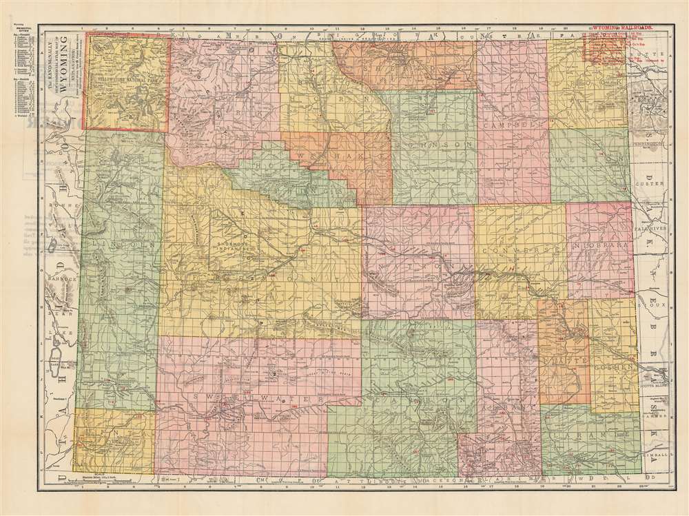
Rand-McNally Indexed Pocket Map and Auto Road Guide, Wyoming.
sold
- Digital Map Information
- Suitable for large format printing
- Full resolution TIFF file
- ICC color profile embedded
- Delivered instantly via download link
This is a c. 1917 Rand-McNally pocket map of Wyoming. It shows the state’s administrative divisions, infrastructure, and geographic features along with a grid, index, and accompanying auto map on the verso (back). (more details)
Flawless example of one of the earliest modern maps of the East Indies.
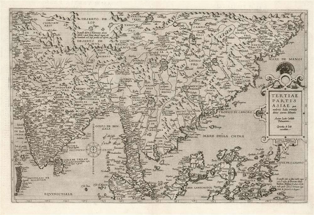
Tertiae Partis Asiae quae modernis India orientalis dicitur acurata delineatio Autore Iacobo Castaldo Pedemontano. Gerardus de Iode excudebat.
sold
- Digital Map Information
- Suitable for large format printing
- Full resolution TIFF file
- ICC color profile embedded
- Delivered instantly via download link
This is a flawless example of the rare 1578 first edition of Gerard De Jode's map of India, the East Indies, and the Philippines. It is broad in scope, including all of India, most of China, the Philippine Islands, and the Malay Peninsula. Singapore appears under the name 'Cingatola.' (more details)
First map of a Philippine Province - printed in Manila!
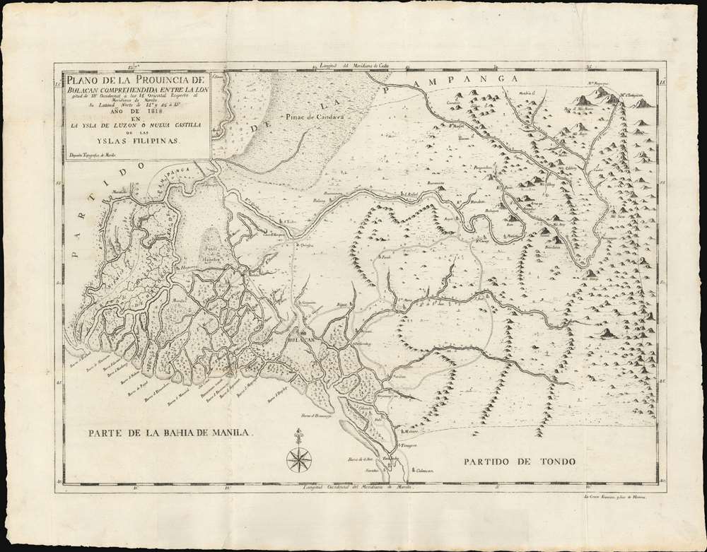
Plano de la Prouincia de Bulacan Comprehendida Entra La Lon gitud de 18' Occidental à los 14' Oriental Respecto al Meridiano de Manila Su Latiud Norte de 14° y 42' à 15° Año de 1818 en La Ysla de Luzon ò Nueua Castilla de la Yslas Filipinas.
sold
- Digital Map Information
- Suitable for large format printing
- DPI: 600
- File Size: 459.07 MB
- File Type: ZIP / TIFF
- ICC color profile embedded
- Delivered instantly via download link
An outstanding example of the 1818 Deposito Topografico / Ildefonso de Aragón map of the province of Bulacan, Philippines, accompanied by the 21-page text Provicia de Bulacan. This is the first specific map of a Philippine province, compiled as part of Ildefonso, and the Deposito's flagship effort to bring structured modern survey techniques to the archipelago. (more details)
A superb, untrimmed example.
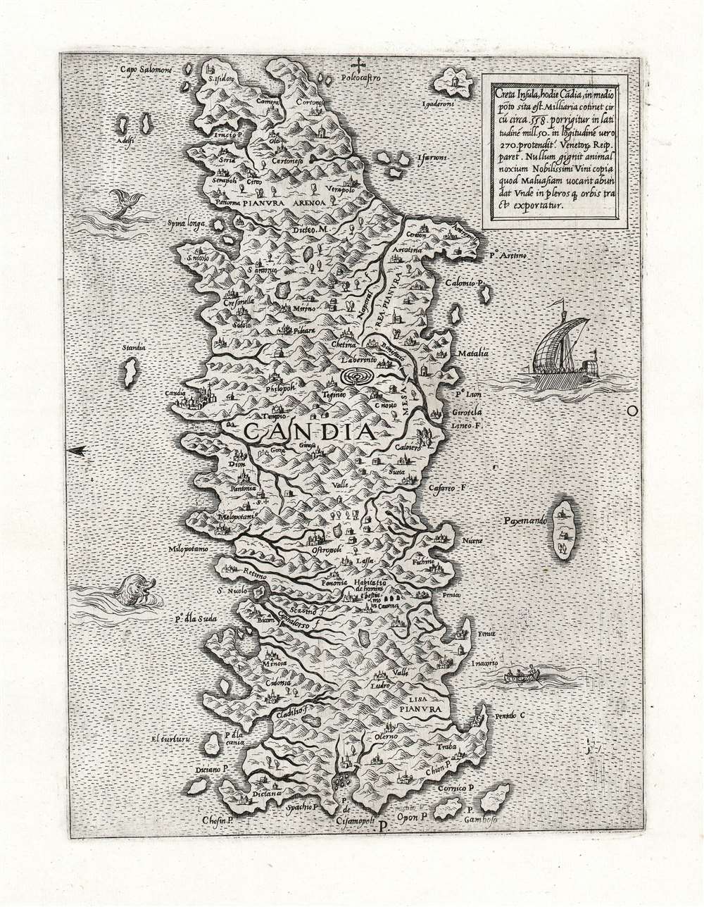
Creta Insula, hodie Cādia, in medio pōto sita est.
sold
- Digital Map Information
- Suitable for large format printing
- Full resolution TIFF file
- ICC color profile embedded
- Delivered instantly via download link
This is an immaculate example of a rare map of the Island of Crete, attributed to Antonio Lafreri. The east-oriented map illustrates the island's topography based on the late model exhibited first in the 1513 Waldseemuller map, and introduced to Venice via Matteo Pagano's 1538 map. (more details)
Exceptional Spanish comparative mountains wall map.

[Mountains and Waterfalls].
sold
- Digital Map Information
- Suitable for large format printing
- File Size: 88.13 MB
- File Type: ZIP / TIFF
- ICC color profile embedded
- Delivered instantly via download link
A most impressive and unusual c. 1875 Spanish comparative chart of the world's tallest mountains and waterfalls. Such charts became popular in the 19th century, largely in response to the natural history innovations of Alexander von Humboldt (1769 - 1859). Naturalists and armchair explorers were fascinated by the extremes of nature - and the ability of humans to penetrate those realms (note the ballooning feats). (more details)
An early 18th century summary of East Asian astronomy and cosmology.

唐土訓蒙圖彙, 一 天文 / [Enlightening Illustrations of China, Vol. 1 'Astronomy'].
sold
- Digital Map Information
- Suitable for large format printing
- Full resolution TIFF file
- ICC color profile embedded
- Delivered instantly via download link
This is an 1719 astronomical work by Hirazumi Sen'an (平住專菴) and Tachibana Morikuni (橘守國). It reflects the intellectual environment of 18th century East Asia, including the synthesis of Western and Chinese astronomical knowledge following the arrival of the Jesuits in China, as well as the diffusion of that knowledge to Japan and throughout East Asia. (more details)
First edition of Rummell's view of Yale.

Yale University.
sold
- Digital Map Information
- Suitable for large format printing
- File Size: 75.19 MB
- File Type: ZIP / TIFF
- ICC color profile embedded
- Delivered instantly via download link
A scarce 1906 first-edition bird's-eye view of Yale University drawn by Richard Rummell and published by F. D. Nichols of Boston. This is not only Rummell's first university view, it is the first edition of such - copyrighted to Nichols and printed by Elson, thus predating Rummell's contract with Littig. (more details)
Illustrates the Russo-Japanese War on a local, regional, and global scale.
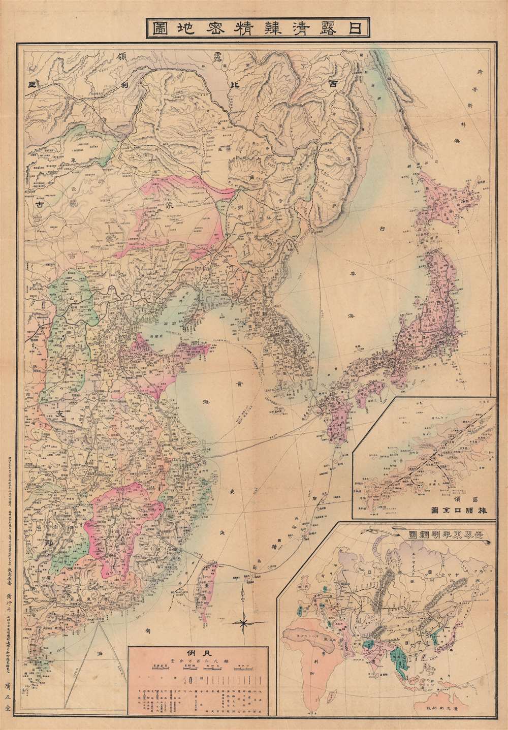
日露清韓精密地圖 / [Precise Map of Japan, Russia, China, and Korea].
$850.00
Acquire
- Digital Map Information
- Suitable for large format printing
- File Size: 100.83 MB
- File Type: ZIP / TIFF
- ICC color profile embedded
- Delivered instantly via download link
This is a visually impressive 1904 Kashima Nagatoshi (鹿島長壽) map of East Asia, made in the opening months of the Russo-Japanese War. Although it clearly alludes to the ongoing conflict, this map is somewhat unusual for also placing the convlict in Northeast Asia in a much wider regional and global context. (more details)
An Alliance of Non-White Peoples.
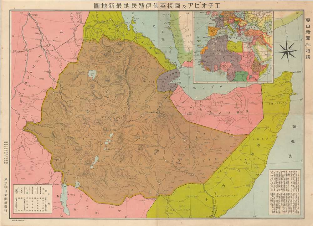
Latest Map of Ethiopia and neighboring British, French and Italian colonies. / エチオピア及隣接英佛伊殖民地最新地圖
sold
- Digital Map Information
- Suitable for large format printing
- File Size: 22.05 MB
- File Type: ZIP / TIFF
- ICC color profile embedded
- Delivered instantly via download link
An intriguing September 1935 Japanese map of Ethiopia at the outbreak of the Second Italo-Ethiopian War (1835 - 1837). Illustrating a little-known episode in pre-WWII history wherein Japan was attempting to create an 'Alliance of Non-White Peoples.' The map covers all of modern-day Ethiopia, as well as parts of Eretria, Somalia, Djibouti, Sudan, and Kenya. An inset in the upper right situates Ethiopia in the context of North Africa, and a text block in the lower right descripts the people and geography. (more details)
Fisherman's guide to America.

The Game Fish Cyclopedia.
sold
- Digital Map Information
- Suitable for large format printing
- File Size: 290.39 MB
- File Type: ZIP / TIFF
- ICC color profile embedded
- Delivered instantly via download link
This is a 1947 Waldo Bemis pictorial fishing or angling map of the United States. Depicting the entire continental United States, Bemis uses shading to indicate the distribution of warm-water fish, cold-water fish, and areas where one could potentially find either warm- or cold-water fish. Red circles and stars with white numbers appear throughout, although the vast majority are along the coastlines. These indicate locations where record fish were caught of each of the fifty-three fish species illustrated in the border. All these notations are explained in a key situated in the lower right quadrant. Vignettes of fishermen are included across the United States, all of whom are experiencing a different degree of success. Vignettes of fishing animals, such as otters, brown bears, seals, and wading birds, also add to this map's appeal. (more details)
A scenic view from the heart of Japan.

琵琶湖遊覽御案内 / [Lake Biwa Round Trip].
sold
- Digital Map Information
- Suitable for large format printing
- Full resolution TIFF file
- ICC color profile embedded
- Delivered instantly via download link
This is a scarce and beautiful 1926 bird's-eye view of Lake Biwa by Yoshida Hatsusaburō, the greatest master of his day in the genre. More specifically, it belongs to the category of sketchbook mailers (書簡圖繪), brochure-like folding views of famous sites in Japan that were very popular in the 1920s–1940s. (more details)
Patriotic map of the Korean War.

Pacific Stars and Stripes Map of the War.
sold
- Digital Map Information
- Suitable for large format printing
- File Size: 29.66 MB
- File Type: ZIP / TIFF
- ICC color profile embedded
- Delivered instantly via download link
This is a 1953 Pacific Stars and Stripes map of the Korean War. The map depicts the Korean peninsula from the Yalu River and the Tumen River to the Korea Strait and from the Yellow Sea to the Sea of Japan. Twenty-five different events in the history of the Korean War are numerically identified, with explanations appearing along the left border. Several silhouettes of aircraft are depicted, including what appears to be the Grumman F9F Panther, a squadron of large four-engine bombers over the Sea of Japan, and a MiG-15 illustrated in red. An inset map, situated below the central map of the Korean peninsula, details the area in the box in the larger map, along the 38th parallel from Yonan and P'anmunjom to Kansong. Several different hills and ridges that played major roles in battles are labeled, including the area of the Punchbowl, Bloody Ridge, Heartbreak Ridge, and Christmas Hill, along with the Iron Triangle. The map is bordered on three sides by the flags of the United Nations and the insignia of numerous American combat units are included along the bottom border. (more details)
The 'Coffee Republic'.
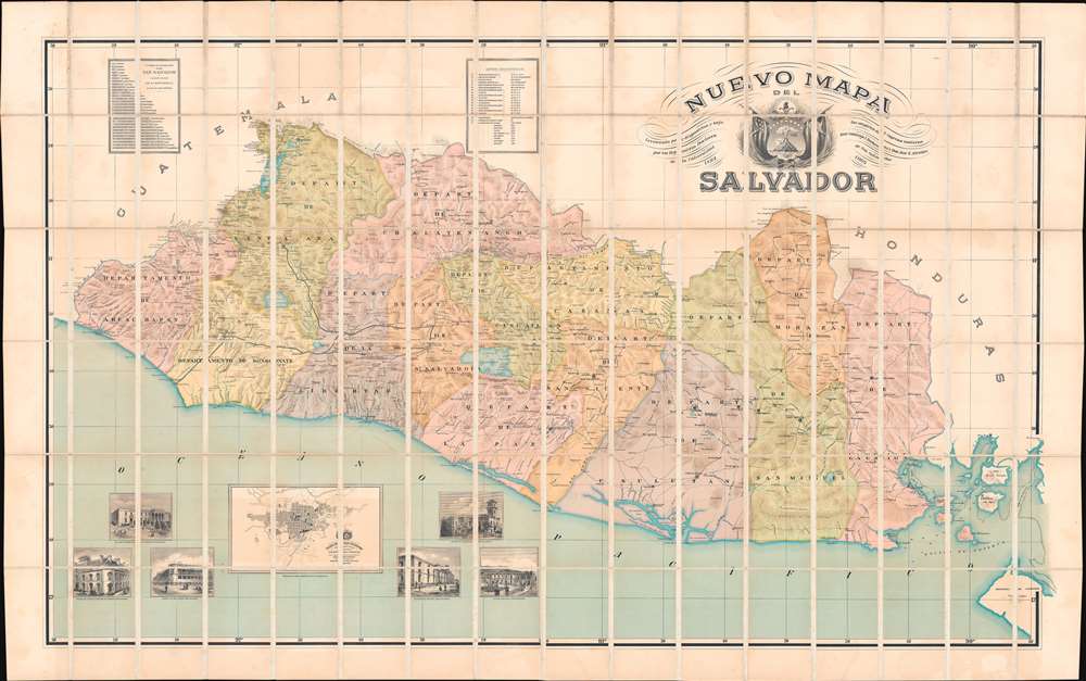
Nuevo Mapa Del Salvador Levantado por disposicion y bajo los auspicios del Supremo Gobierno por los Ingenieros Doctores Don Santiago I Barberena y Don Jose E. Alcaine de la Universidad de San Salvador 1892 - 1905.
sold
- Digital Map Information
- Suitable for large format printing
- File Size: 347.2 MB
- File Type: ZIP / TIFF
- ICC color profile embedded
- Delivered instantly via download link
This is the rare large scale national map of El Salvador, the 'Coffee Republic', composed by Santiago I. Barberena and Jose E. Alcaine. The map, as the title suggests is a 'nuevo' national map, expanding upon and superseding the 1859 Maximillian von Sonnenstern Mapa General. It appeared during a period of political and economic optimism for El Salvador. On May 1892, the year work on this map began, El Salvador, Guatemala, Honduras, and Nicaragua signed a peace treaty strengthen relations and open the path for a future Central American Union (1896 - 1898). While the union did not last to see the map's publication, there can be little doubt that it originated from optimism associated with these efforts. (more details)
The Franco-Prussian War and the Paris Commune.
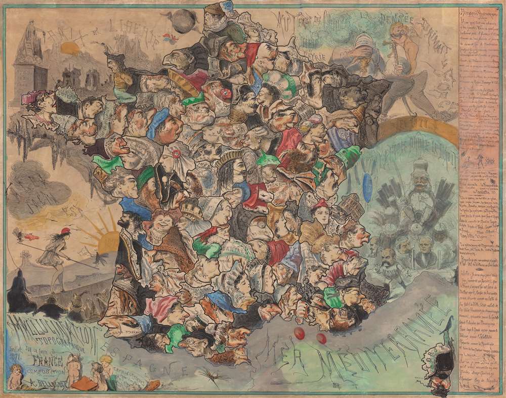
Hallucination topographique sur la carte de France.
sold
- Digital Map Information
- Suitable for large format printing
- File Size: 77.6 MB
- File Type: ZIP / TIFF
- ICC color profile embedded
- Delivered instantly via download link
Published in July 1871, this is satirist André Belloguet's extremely rare caricature map of France. The map emerged at one of the most fraught periods in French history - following closely on the French defeat in the Franco-Prussian War (1870 - 1871), the consequent loss of Alsace and Lorraine, and the chaos of the Paris Commune (1871). (more details)
The 'upside down map' of Elizabethtown.

Map of Elizabethtown, Essex County N.J.
sold
- Digital Map Information
- Suitable for large format printing
- DPI: 600
- File Size: 130.17 MB
- File Type: ZIP / TIFF
- ICC color profile embedded
- Delivered instantly via download link
This is a c. 1851 John Bevan wall city plan or map of Elizabethtown, Essex County, New Jersey. Sometimes called the 'upside down map' because it is oriented with south at the top, Bevan's map captures a moment in Elizabethtown's history, identifying many of its residents and buildings. Churches, schools, the post office, and the town's two hotels are labeled. Dry goods stores, groceries, the fish market, and a boot store are marked as well. Carpenters, tailors, butchers, bakers, and cabinet makers are identified by name. More specialty shops, such as a watch maker, the coach factory, and the oil cloth carpet factory enhance the understanding of life in Elizabethtown at this point in time. (more details)
Original old color example of the first acquirable map of Portugal.
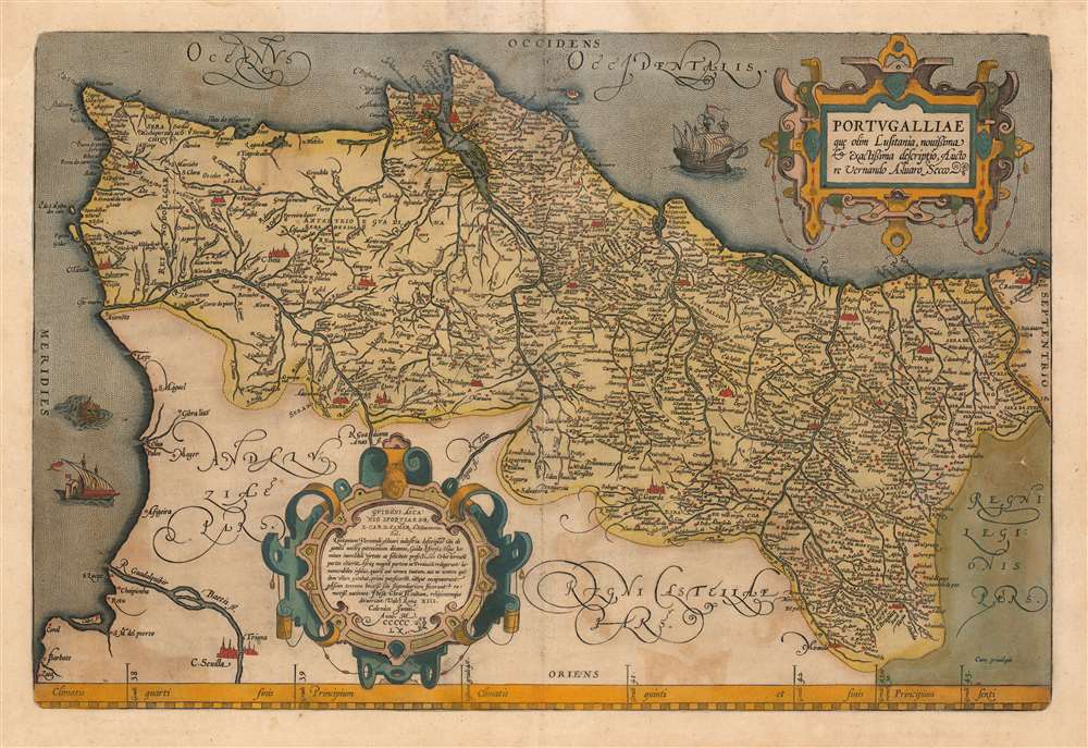
Portugalliae que olim Lusitania, novissima et exactissima descriptio.
sold
- Digital Map Information
- Suitable for large format printing
- DPI: 600
- File Size: 60.34 MB
- File Type: ZIP / TIFF
- ICC color profile embedded
- Delivered instantly via download link
This is an original old color example of Abraham Ortelius' 1570 map of the Kingdom of Portugal, in a Latin edition of 1612. In its first issue it is the earliest acquirable map of that kingdom. The map is oriented to the west, and its composition is balanced and artistic. Ships sail the stippled oceans, and a hirsute monster lurks off the southern coast. The map includes two handsome strapwork cartouches: the title cartouche in the upper right, and at the bottom just left of center, the map's effusive dedication. (more details)
'The Conquest of the Desert.'
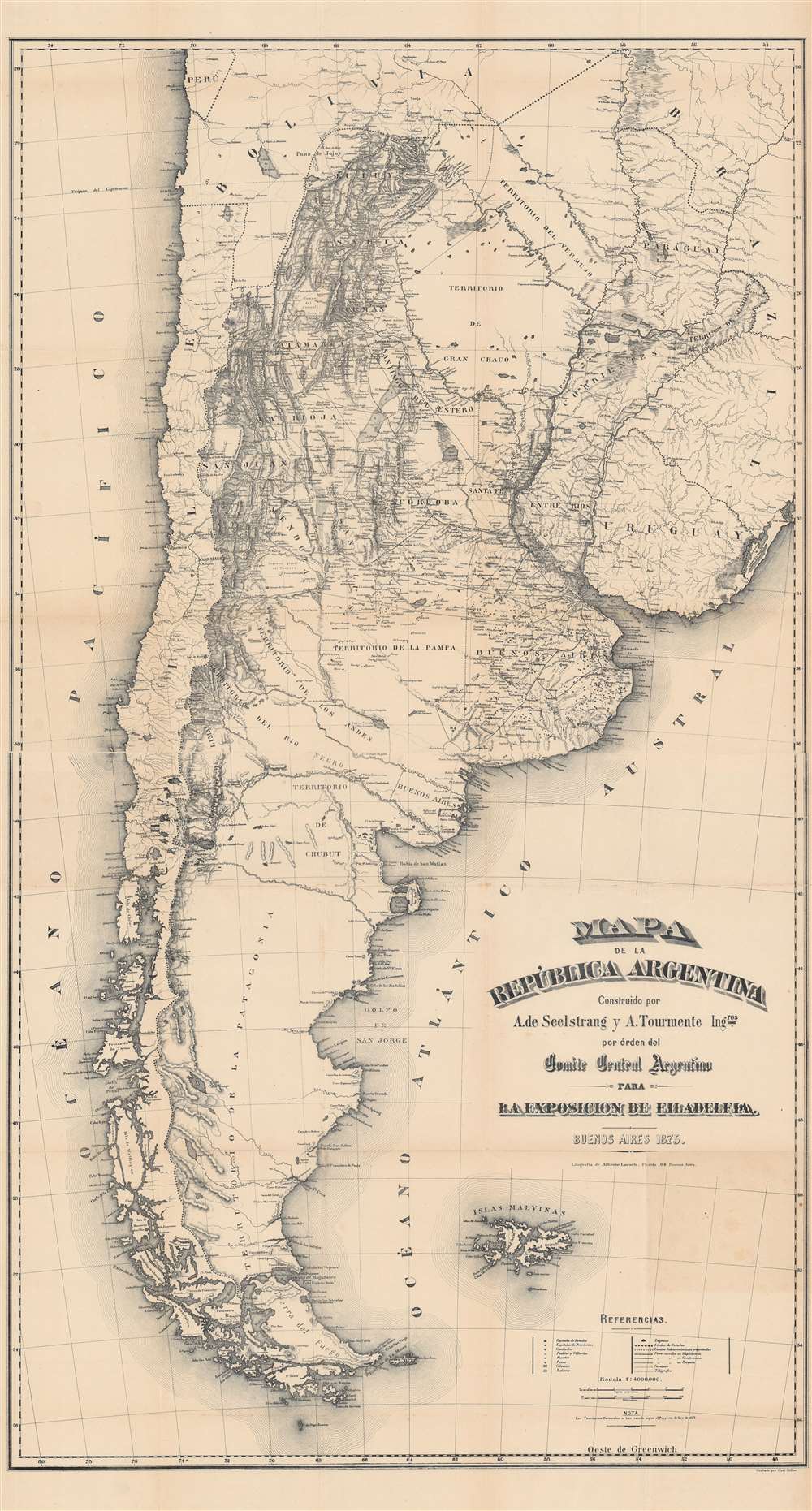
Mapa de la Republica Argentina.
sold
- Digital Map Information
- Suitable for large format printing
- File Size: 142.66 MB
- File Type: ZIP / TIFF
- ICC color profile embedded
- Delivered instantly via download link
This is an important 1876 map of Argentina by Arturo Seelstrang and A. Tourmente produced for the Philadelphia Centennial Exposition to highlight the development and modernization of Argentina. Due to its comprehensiveness and accuracy, it became one of the most influential maps of Argentina in the late 19th century. (more details)
France recognizes the Republic of Texas.

Carte Des États-Unis du Méxique.
sold
- Digital Map Information
- Suitable for large format printing
- DPI: 600
- File Size: 67.59 MB
- File Type: ZIP / TIFF
- ICC color profile embedded
- Delivered instantly via download link
This is an 1842 Pierre and Alexandre Lapie map of Mexico and the southwestern United States, one of the earliest non-American maps to include the Republic of Texas. The map depicts the region from the Pacific Ocean to the Mississippi River and from the Oregon Territory to the Yucatan Peninsula and the Pacific Ocean. The Republic of Texas is bordered in yellow, highlighting its existence. The map’s Texas detail is not limited to this superficial change, however: the whole Texas portion of the copperplate has been entirely reworked over earlier editions. Not only have the borders of the erstwhile nation been added, but also the whole area has updated nomenclature, including Austin, Houston, and Nashville. (more details)
Relief of he Panama Canal as it neared completion.
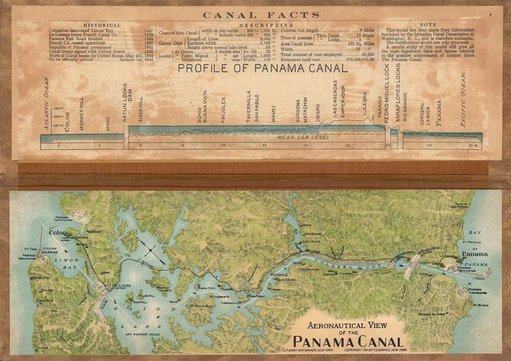
Aeronautical View of the Panama Canal.
sold
- Digital Map Information
- Suitable for large format printing
- Full resolution TIFF file
- ICC color profile embedded
- Delivered instantly via download link
This is a curious 1911 raised relief view of the Panama Canal by C.P. Gray and F.D. Graves. It demonstrates some of the incredible challenges facing canal engineers as well as the enthusiasm for the canal among the public as it neared completion. (more details)
Argentina's subjugation of the frontier.
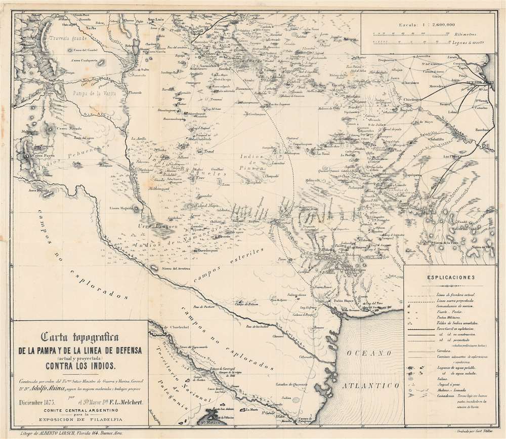
Carta topografica de la pampa y de la linea de defensa (actual y proyectada) contra los Indios.
sold
- Digital Map Information
- Suitable for large format printing
- File Size: 30.74 MB
- File Type: ZIP / TIFF
- ICC color profile embedded
- Delivered instantly via download link
Produced to introduce Argentina to a global audience at the 1876 Philadelphia Centennial Exposition, this map by military engineer F.L. Melchert is also a record of the Argentinian state's campaign to control and ultimately expel indigenous people from Patagonia and the Pampas. (more details)