
Mussolini's Mark on Rome.

Carta di Roma e suburbio.
sold
- Digital Map Information
- Suitable for large format printing
- Full resolution TIFF file
- ICC color profile embedded
- Delivered instantly via download link
A colorful, large-format 1935 Vincenzo Visceglia city map or plan of Rome, Italy - publication at the height of Italy's fascist era. Among other features, it highlights the monumental architecture and urban planning favored by Italy's fascist leader, Benito Mussolini. (more details)
Magnificent Brittany.
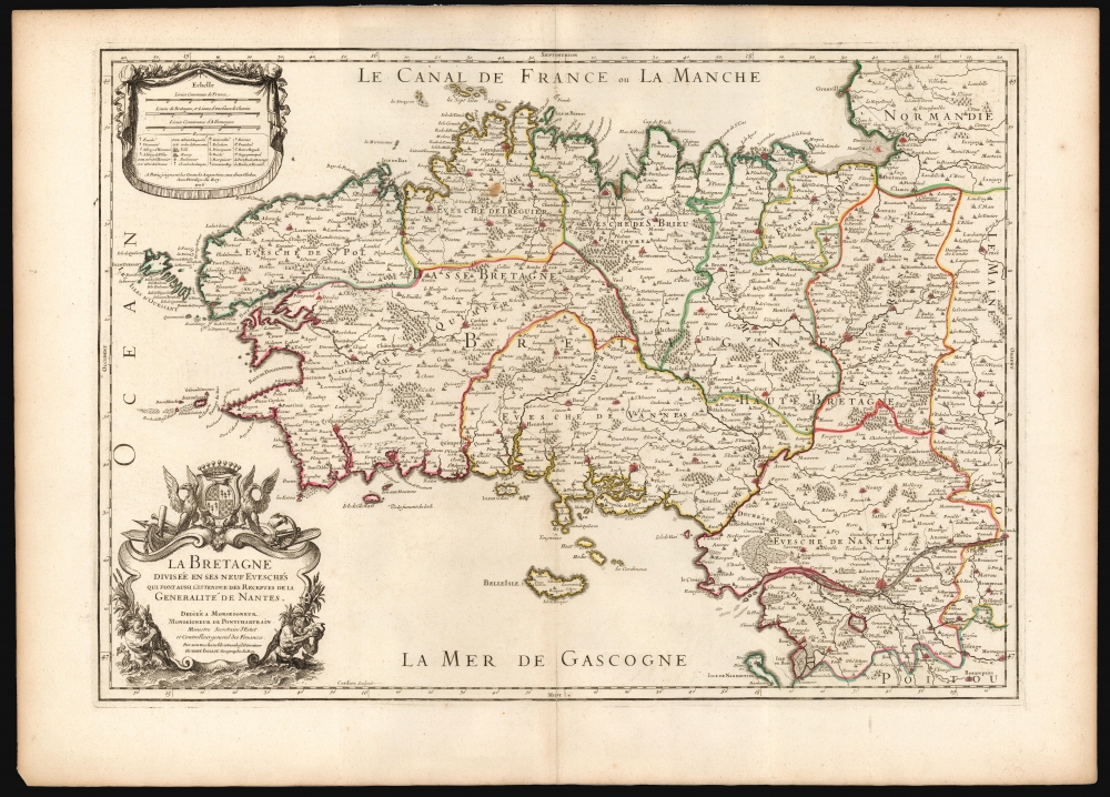
La Bretagne Divisée en ses neuf Eveschés qui font aussi l'estendue des Receptes de la Generalité de Nantes.
sold
- Digital Map Information
- Suitable for large format printing
- DPI: 600
- File Size: 82.82 MB
- File Type: ZIP / TIFF
- ICC color profile embedded
- Delivered instantly via download link
This is Alexis-Hubert Jaillot's map of Brittany, France, in its 1706 edition. It is among the largest atlas maps of the region, here in a superb example with bright original outline color. (more details)
House of Saud's modernization of Mecca.

المملكة العربية السعودية (الأقطار الحجازية) مدينة مكة المكرمة / [The Kingdom of Saudi Arabia (Hejaz Territories) the Holy City of Mecca].
sold
- Digital Map Information
- Suitable for large format printing
- File Size: 35.37 MB
- File Type: ZIP / TIFF
- ICC color profile embedded
- Delivered instantly via download link
A remarkable find, this scarce, large-format Arabic-language map of the holy city of Mecca was prepared in 1948 by the Survey of Egypt. This map reflects an effort by the House of Saud to mark their rule over the Hejaz and the holy sites therein by making Mecca more accessible to Muslims. (more details)
Fascinating Allegorical Asia.
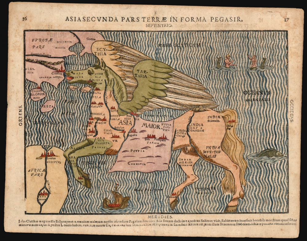
Asia Secunda Pars Terrae In Forma Pegasir.
sold
- Digital Map Information
- Suitable for large format printing
- Full resolution TIFF file
- ICC color profile embedded
- Delivered instantly via download link
This is one of the most famous cartographic curiosities: Heinrich Bünting's 1587 map of Asia in the form of the mythological winged horse, Pegasus. The horse's head is Asia Minor; its front legs form the Arabian Peninsula. Persia resembles a horse blanket. The hind legs represent the Indian and Malay peninsulas, while the spreading wings cover the northern steppe of Scythia and Tartaria. This beautiful woodcut appeared in Bünting's Itinerarium Sacrae, the first and, for many years, the only complete work of biblical geography. (more details)
First Printed Dutch Chart of the Pacific.

Mar del Zur Hispanis Mare Pacificum.
sold
- Digital Map Information
- Suitable for large format printing
- Full resolution TIFF file
- ICC color profile embedded
- Delivered instantly via download link
This is a superb example of Jan Jansson's 1650 map of the Pacific Ocean. It appeared in the 5th volume of Jansson's Atlas Novus, which focused on the world's oceans and can be construed as the first sea atlas intended for a general audience. It is the first chart of the Pacific to appear in a Dutch atlas and the first printed chart of the Pacific to depict California as an island. Striking, speculative cartography appears throughout, including an insular California and an insular Korea. It also includes a mysterious but expansive South Sea archipelago associated with the elusive Spanish explorer Hernán Gallego. (more details)
Contributions of Vermont and New Hampshire to American Independence.
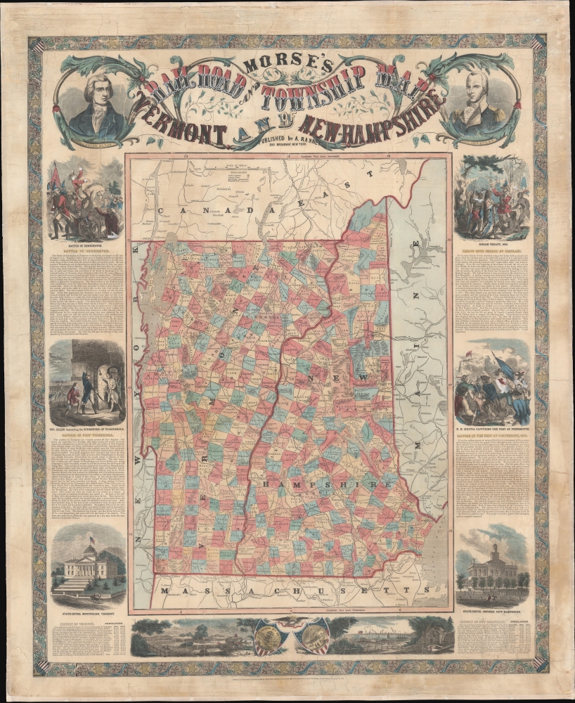
Morse's Railroad and Township Map of Vermont and New Hampshire.
sold
- Digital Map Information
- Suitable for large format printing
- Full resolution TIFF file
- ICC color profile embedded
- Delivered instantly via download link
This is a decorative and educational 1856 Adolphus Ranney broadside wall map of Vermont and New Hampshire celebrating those states' contributions to United States history. (more details)
Magnificent Seventeenth-Century Asia.
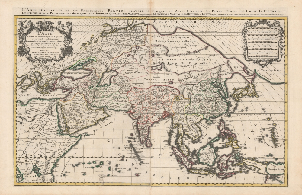
L'Asie diviseé en ses Principales Regions, et ou se peut voir l'estendue Des Empires, Monarchies, Royaumes et Estats qui partagent présentement L'Asie.
$1,500.00
Acquire
- Digital Map Information
- Suitable for large format printing
- DPI: 600
- File Size: 112.68 MB
- File Type: ZIP / TIFF
- ICC color profile embedded
- Delivered instantly via download link
This is a beautiful example of Hubert Jaillot's two-sheet map of Asia in its 1696 Mortier issue. While fundamentally based on Nicolas Sanson's mapping of the continent, the map has been updated to reflect advances in European knowledge of the Far East. Moreover, Jaillot's background as a sculptor has resulted in the artfully engraved cartouches which grace this work. (more details)
...nearly everywhere extremely wild and desolate...
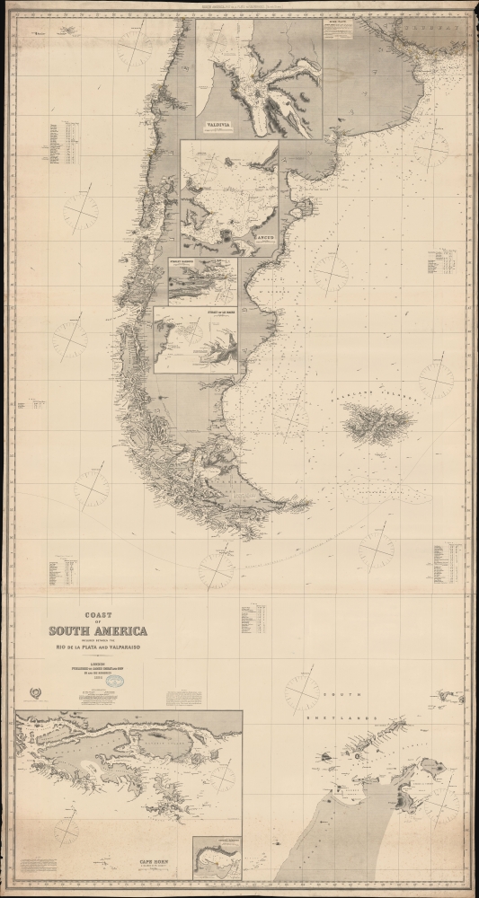
Coast of South America included between the Rio de la Plata and Valparaiso.
sold
- Digital Map Information
- Suitable for large format printing
- File Size: 130.66 MB
- File Type: ZIP / TIFF
- ICC color profile embedded
- Delivered instantly via download link
A massive 1886 Imray nautical map illustrating the coasts of southern South America, including Argentina, Chile, the Falkland Islands (Malvinas), Tierra del Fuego, and the northernmost parts of Antarctica. The map was designed for mariners navigating the treacherous waters of Drake's Passage south of Cape Horn - or navigating to the South Shetlands. (more details)
Australian wildlife - including koalas! Plus a Lockheed Constellation.
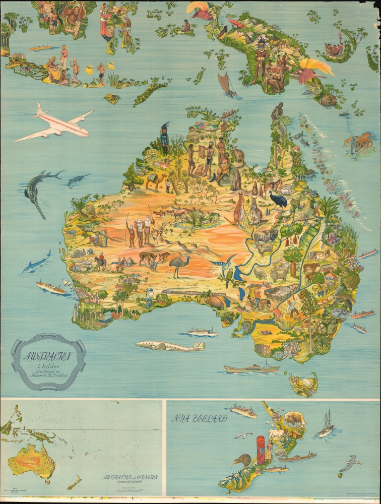
Australien i bilder.
sold
- Digital Map Information
- Suitable for large format printing
- File Size: 225.93 MB
- File Type: ZIP / TIFF
- ICC color profile embedded
- Delivered instantly via download link
This is a c. 1947 B. Lindblad pictorial map of Australia, New Zealand, and Indonesia. (more details)
First map of Homann - premier German cartographer of the 18th century.
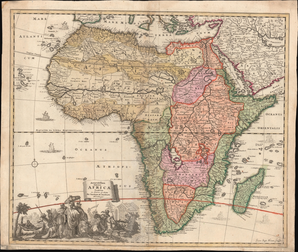
Accuratissima Totius Africae Tabula in Lucem producta per Iacobum de Sandrart Norimbergae.
sold
- Digital Map Information
- Suitable for large format printing
- DPI: 600
- File Size: 31.93 MB
- File Type: ZIP / TIFF
- ICC color profile embedded
- Delivered instantly via download link
This is Jacob Sandrart's scarce, separately published 1697 map of Africa. While cartographically derived from Frederic de Wit's influential 1670 Totius Africae Accuratissima Tabula, this map is notable for being the first or second signed engraving by Johann Baptist Homann, the most important German map publisher of the 18th-century. This map's production in 1697 just preceded the opening of Homann's Nuremberg publishing house in 1702. (more details)
Miguel Gómez Medina's finest and rarest pictorial map!
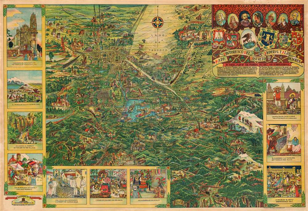
Mapa Pintoresco del Distrito Federal y Alrededores. Pictorial Map of the Federal District and Surroundings.
sold
- Digital Map Information
- Suitable for large format printing
- File Size: 92.75 MB
- File Type: ZIP / TIFF
- ICC color profile embedded
- Delivered instantly via download link
Issued during the Golden Age of Pictorial Maps (c. 1920 - 1960), this is a whimsical map of the Valley of Mexico City (DF, Distrito Federal) by Mexican artist Miguel Gómez Medina. (more details)
Best 20th century map of Acadia National Park.
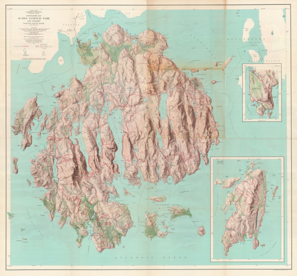
Topographic Map of Acadia National Park and Vicinity Hancock County, Maine.
sold
An extraordinary large-scale 1966 U.S. Geological Survey wall map of Acadia National Park, Mount Desert Island, Maine. This is the best map of the island published in the mid-20th century. The map is unrepresented in the private market as it was produced exclusively for internal administrative use. (more details)
Celebration of American WWII Aviation.
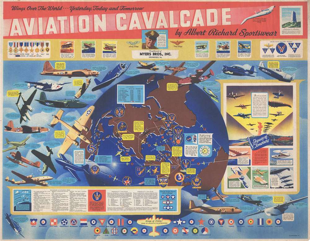
Aviation Cavalcade. Wings Over the World…Yesterday, Today and Tomorrow.
sold
- Digital Map Information
- Suitable for large format printing
- Full resolution TIFF file
- ICC color profile embedded
- Delivered instantly via download link
This is a 1944 World War II era F. E. Cheeseman and Albert Richard pictorial propaganda map celebrating U.S. military aviation. (more details)
Rise of the Houston Freeway Era.

Houston and Vicinity.
sold
This is a huge 1957 U.S. Geological Survey city map of Houston, Texas. It is one of the largest and best mid-century maps of the city. It chronicles the development of Houston's epic freeway system as well as the post-war population boom. (more details)
Traces the 1877 expedition of British Army officer William John Gill.

Route Map of Captain W. J. Gill's Journey in Western China and Eastern Tibet.
$850.00
Acquire
- Digital Map Information
- Suitable for large format printing
- File Size: 16.95 MB
- File Type: ZIP / TIFF
- ICC color profile embedded
- Delivered instantly via download link
This is a scarce and important 1878 William John Turner map of western China and eastern Tibet tracing Captain William John Gill's 1877 expedition through the region. (more details)
First accurate mapping of the Indus River and western and central India.
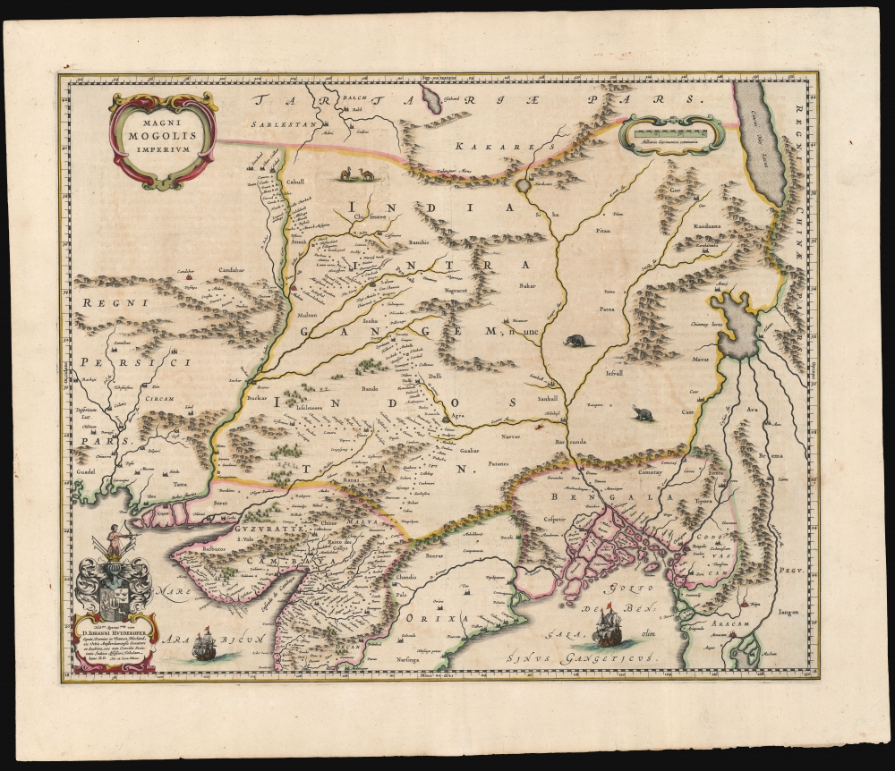
Magni Mogolis Imperium.
sold
- Digital Map Information
- Suitable for large format printing
- Full resolution TIFF file
- ICC color profile embedded
- Delivered instantly via download link
This is an attractive, original color example of Joan and Cornelis Blaeu's 1640 map of the Mughal Empire of Northern India. It is among the most attractively engraved of the 17th-century maps derived from the unacquirable Baffin/Roe map. The map features the first accurate mapping of the Indus River and western and central India. At its heart, the map reveals the vital trade routes between the chief cities of Gujarat, Agra, and Jaisalmer and their linkage to the Silk Road center of Kabul. (more details)
Tutti siamo pellegrini, noi che cerchiamo Italia.

Italia salve, magna parens frugum, Saturnia tellus, magna virum: tibi res antiquae laudis et artis ingredior... / Carta Ideografica d'Italia. Ideographic Map of Italy. Carte Ideographique d'Italie. Ideographische Karte von Italien. Mapa Ideografico de Italia.
sold
An imposing pictorial map of Italy drawn by Otto M. Müller and E. V. Clementi, published in 1965 by the Istituto Cartografico Italiano. The map's colorful illustrations celebrate Italian culture from the Alps to Sicily. Aside from its clear celebration of Italy's diversity, the map also reflects collective relief after the tumultuous years of fascism and war. It might also represent a fear of cultural homogenization amid Italy's postwar economic miracle, as mass media, consumerism, and other forces of modernity began to erode the distinctiveness of the country's regions. (more details)
Birthplace of Surfing.

Father of the Israelites.

Constellatio XLV. [Sancti Israelis Sive Jacobi Patriarchæ].
$500.00
Acquire
- Digital Map Information
- Suitable for large format printing
- Full resolution TIFF file
- ICC color profile embedded
- Delivered instantly via download link
A hand-colored example of Julius Schiller's 1627 depiction of the Lupus Constellation, represented by the Biblical figure Jacob. It appeared in Schiller's rare star atlas Coelum Stellatum Christianum, which aimed but failed to have fellow astronomers exchange the classical zodiac and Greco-Roman figures for Christian icons. (more details)
Capturing the Crescent City.

Bouches du Mississippi et Nouvelle Orleans.
sold
- Digital Map Information
- Suitable for large format printing
- File Size: 13.43 MB
- File Type: ZIP / TIFF
- ICC color profile embedded
- Delivered instantly via download link
A remarkable map of the Mississippi River Delta, New Orleans, and environs, prepared in 1890 by Ernest Dumas-Vorzet. It appeared in the scarce 1890 atlas volume of the French edition of Philippe d'Orléans' Histoire de la Guerre Civile en Amérique. (more details)