
A tourist and propaganda map of Kashmir, soon after its incorporation into India.
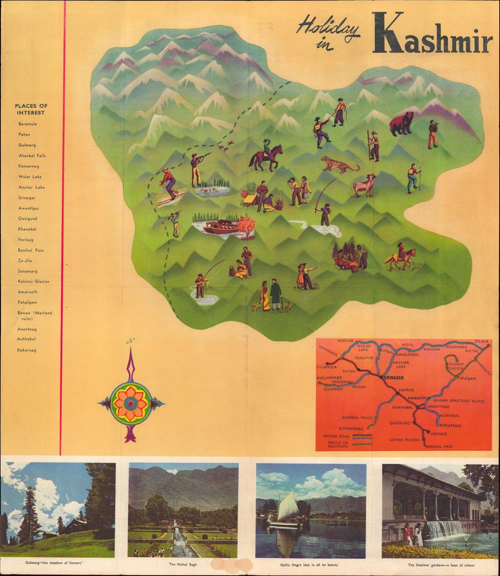
Holiday in Kashmir.
sold
This is a beautiful c. 1960 tourist folding map of Kashmir produced by the Indian government. Although primarily meant to entice domestic and foreign tourists to the region, it is laden with political meaning as the region was only recently and tenuously made part of the Indian Republic. (more details)
Heroes and villains of the Wild West.
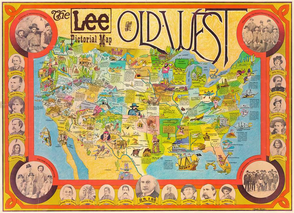
The Lee Pictorial Map of the Old West.
sold
This is a c. 1970 Charles Varner Lee Pictorial Map of the Old West. Depicting the entire United States, the piece is apparently an advertisement for the Lee Corporation. The whole is framed by photographs and sketches of the most famous heroes and villains of the Old West and intends for the viewer to draw a connection between them and Henry David Lee, founder of Lee Jeans. H.D. Lee is pictured at bottom center, flanked by Doc Holiday and Bat Masterson. Other portraits feature Jesse James, Annie Oakley, Gen. George Custer, Sitting Bull, Wyatt Earp, Buffalo Bill, Geronimo, Calamity Jane, and Billy the Kid. Larger portraits in the corners capture the Hole in the Wall Gang, led by Butch Cassidy and The Sundance Kid, and the Dodge City Peace-Keeping Committee. Some cities are identified, along with rivers and the Great Lakes, but the rest of the map is filled with events, facts, and comically drawn animals. Most are related to the Old West, such as the 'Shootout at the O.K. Corral,' the completion of the transcontinental railroad at Promontory Point, and, of course, the founding of the H.D. Lee Company. Other captions reference Old Faithful, Lincoln's log cabin, and the Springfield Colt revolver. (more details)
First printing of one of the most significant and desirable views of San Francisco.

Bird's Eye View of the City and County of San Francisco, 1868.
sold
- Digital Map Information
- Suitable for large format printing
- Full resolution TIFF file
- ICC color profile embedded
- Delivered instantly via download link
An extraordinary Charles Braddock Gifford and William Vallance Gray 3-color chromolithograph bird's-eye view of San Francisco, California, in 1868 - one of the most desirable and influential views of San Francisco ever produced. The view looks southwest on San Francisco Peninsula from an imaginary highpoint to the northeast. The city and bustling harbor are prominent in the foreground while the peninsula's hills and lakes are in the background. The Golden Gate appears at the upper right, and Telegraph Hill at bottom center. (more details)
Earliest Acquirable, Separate Issue.
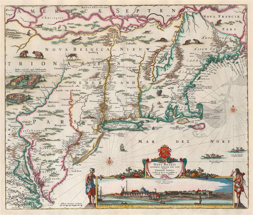
Novi Belgii Novaeque Angliae nec non Partis Virginiae Tabula multis in locis emendata a Nicolao Joannis Visschero.
sold
- Digital Map Information
- Suitable for large format printing
- Full resolution TIFF file
- ICC color profile embedded
- Delivered instantly via download link
This is the rare, c. 1656 second state of the Jansson/ Visscher map of the New Netherlands and New England. It is the earliest acquirable state of this work: the first, 'proof state', of this masterwork is an unobtainable rarity, known in only four examples in institutional and private collections. (more details)
One of the rarest and most beautiful Ortelius maps.
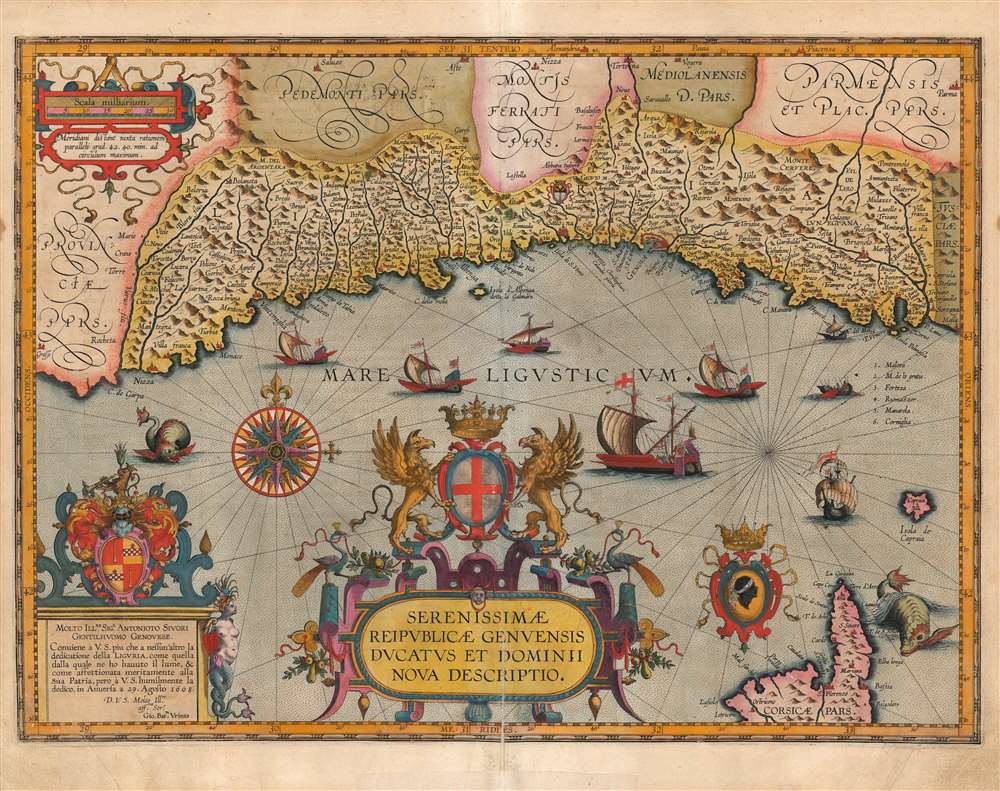
Serenissimae Reipublicae Genuensis Ducatus Et Dominii Nova Descriptio.
sold
- Digital Map Information
- Suitable for large format printing
- Full resolution TIFF file
- ICC color profile embedded
- Delivered instantly via download link
This is a beautiful example of Jan Baptista Vrients' map of the Republic of Genoa, added to Ortelius' Theatrum Orbis Terrarum in 1608. It is among the scarcest of the maps appearing in the Ortelius opus, having appeared in only the four final editions of the work. Typical of the maps thus included by Vrients, it is a tour de force of decorative cartography and stands among the most sumptuously engraved of the maps to appear in Ortelius' opus. Also, Ortelius atlases printed by Vrients enjoyed hand coloring of a very high quality, and the present map exemplifies this: the coloration on the cartouches, compass roses and ships is particularly rich. (more details)
Extremely rare bird's-eye view of Manhattan.
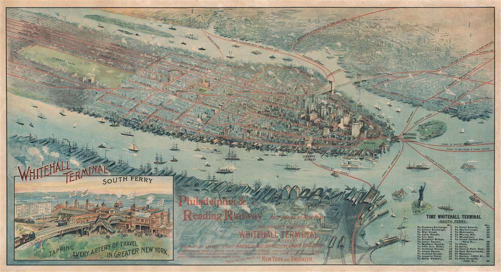
Whitehall Terminal.
sold
- Digital Map Information
- Suitable for large format printing
- File Size: 40.35 MB
- File Type: ZIP / TIFF
- ICC color profile embedded
- Delivered instantly via download link
This is a striking and rare 1897 Gray Lithographing Company chromolithograph bird's-eye view map of Manhattan, New York City, focusing on ferry and rail lines. Red lines mark ferry routes between Whitehall Terminal (South Ferry) and Jersey City and several locations in Brooklyn. Each route is labeled by its destination. In Manhattan and in Brooklyn, similar red lines highlight elevated railway lines. Ships of all kinds appear in the Hudson and East Rivers, underscoring the importance of New York as a major seaport. An inset in the lower left contains an illustration of Whitehall Terminal, with several elevated rail lines. New York Harbor is busy with maritime traffic. (more details)
Engraver's Proof map of the epicenter of the Nevada Silver Boom.
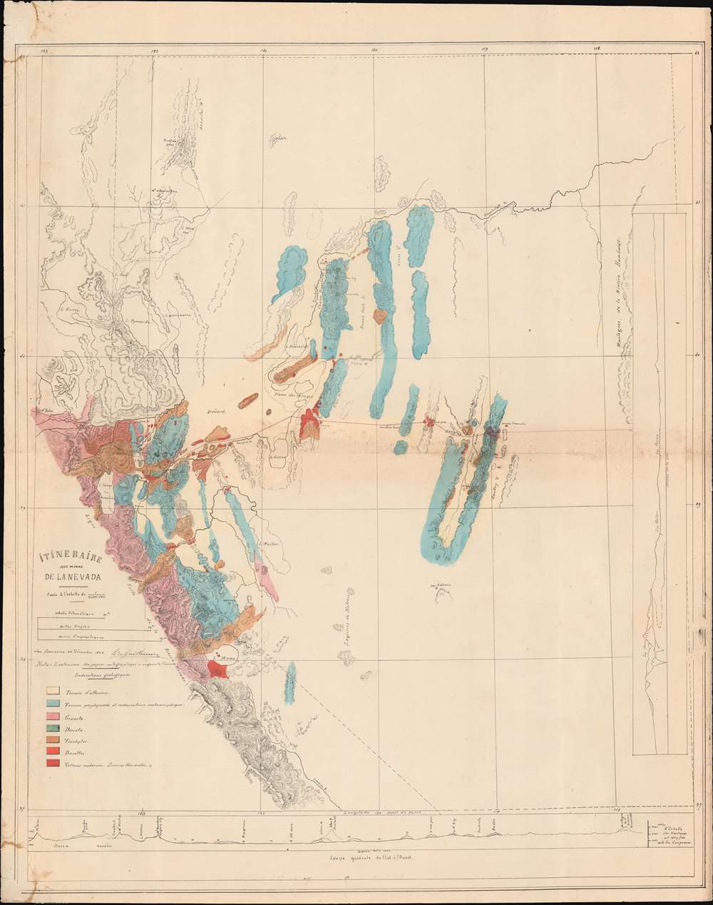
Itineraire aux Mines de La Nevada.
sold
- Digital Map Information
- Suitable for large format printing
- File Size: 20.13 MB
- File Type: ZIP / TIFF
- ICC color profile embedded
- Delivered instantly via download link
An exceptional, likely unique discovery, this is a c. 1868 proof of the French geologist's Edmond Guillemin-Tarayre meticulous survey map of the Sierra Nevada Mountains at the height of the Nevada Silver Boom. The map focuses on epicenter of the silver boom around the Comstock Lode, Virginia City, Carson, and Dayton. It is a product of the Second French Intervention in Mexico and the accompanying Commission Scientifique. (more details)
Reference an audience eager to learn about the world.

重訂萬國地圖 / [Revised World Map].
sold
- Digital Map Information
- Suitable for large format printing
- Full resolution TIFF file
- ICC color profile embedded
- Delivered instantly via download link
This is a scarce 1876 (Meiji 9) Ichikawa Raijirō world map. A distinctive product of the early Meiji period, the map scrupulously includes not only geographic information but also reference material from a range of related sciences. (more details)
Vrients color.
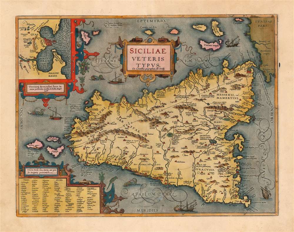
Siciliae Veteris Typus ex Conatibus geographicis Ab. Ortelij.
sold
- Digital Map Information
- Suitable for large format printing
- Full resolution TIFF file
- ICC color profile embedded
- Delivered instantly via download link
This is a superb example of Ortelius' map of Sicily as it was known in antiquity. The map is noteworthy for highlighting Ortelius' scholarship as a historian, as well as for denoting the locations of many sites from classical antiquity and mythology. This example is noteworthy as being from the Jan Bapatista Vrients (1552 - 1612) edition, which are known for exceptionally rich original colorwork. (more details)
Recalls a time when Afghanistan was considered one of the most beautiful and welcoming countries in Asia.
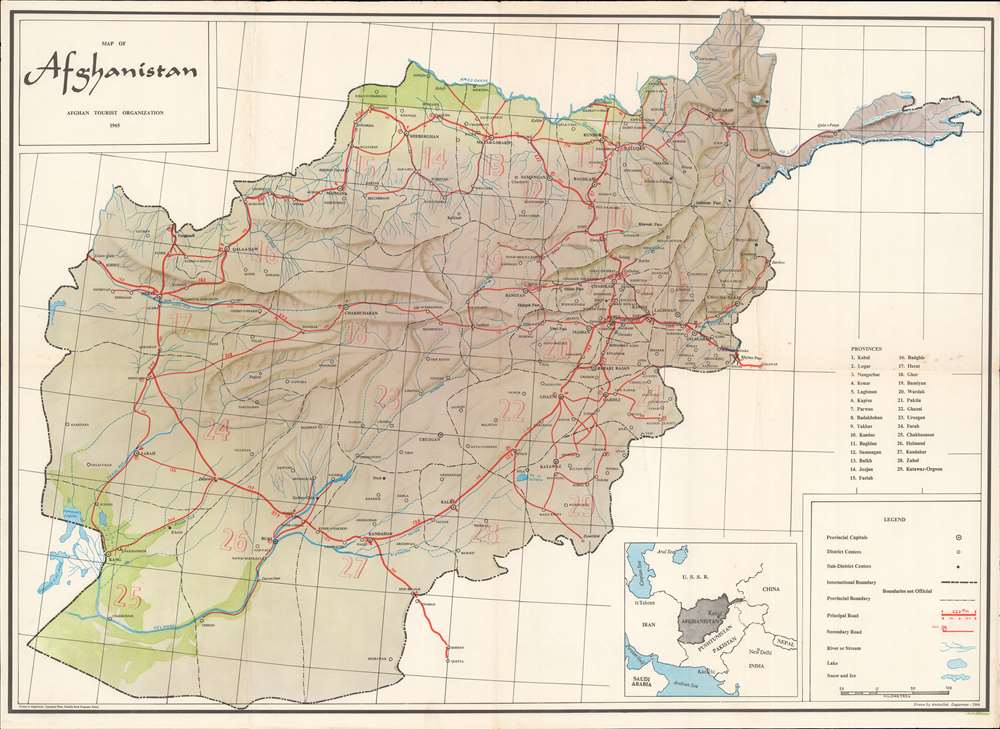
Map of Afghanistan.
sold
Recalling a time when Afghanistan was considered one of the most beautiful and welcoming countries in Central Asia, this is a 1965 Aminullah Dagarman and Afghan Tourist Organization map of Afghanistan. This map of Afghanistan depicts the entire country, then known as the 'Garden of Asia'. Thick red lines trace the principal roads, which connect major cities, including Kabul, Ghazni, Kandahar, and Herat. Distances between cities (in kilometers) appear as well. Towns and villages of all sizes are labeled throughout, along with mountain passes, rivers, and lakes. Afghanistan's twenty-nine provinces are labeled numerically and correspond with a table situated along the right border. Subtle artistic designs evoke Afghanistan's incredible terrain, and two green areas hint at the importance of the Helmand and Amoo Darya rivers for Afghanistan's agricultural industry. (more details)
Lights on the Balearics.
Provincia de Palma.
sold
- Digital Map Information
- Suitable for large format printing
- File Size: 12.6 MB
- File Type: ZIP / TIFF
- ICC color profile embedded
- Delivered instantly via download link
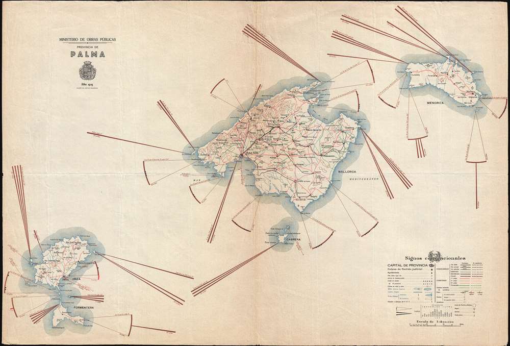
This is a 1935 Instituto Geografico map of the Balearic Islands. The map depicts the archipelago, which is made up of the islands of Majorca, Minorca, and Ibiza, along with the smaller islands Formentera and Cabrera. A beautiful piece, its most compelling feature is the illustration of the lighthouses and beacons installed on the coasts of the islands. The distance out in the Mediterranean each light can be seen is eye-catching, and details, such as the color of each light and frequency of flashes of different colors, are also given. Numerous cities, towns, and villages are labeled throughout the islands. Roads and railroads are also illustrated, and different lines are used to denote variations in grade for both. A key is situated in the lower right corner that provides the viewer with an explanation of all the notations used. (more details)
Rare Civil War map of the Battle of Vicksburgh from Spangenberg manuscript.

Map of the Siege of Vicksburg, Miss. By the U.S. Forces Under the Command of Genl. U.S. Grant, U.S. Vls. Maj. F.E. Prime, Chief Engr. Surveyed and constructed under the direction of Capt. C.B. Comstock, U.S. Engr.s and Lt. Col. Js. H. Wilson . . . Drawn by Chs. Spangenberg.
sold
- Digital Map Information
- Suitable for large format printing
- File Size: 67.43 MB
- File Type: ZIP / TIFF
- ICC color profile embedded
- Delivered instantly via download link
This is a rare c. 1863 separate issue Charles Spangenberg Civil War map of the Siege of Vicksburg (May 18, 1863 - July 4, 1863). This map, considered one of the most attractive Civil War maps, is based upon a manuscript map drawn by military engineer Charles Spangenberg shortly after the siege. It covers Vicksburg and the surrounding hills as well as the full bend of the Mississippi River. To the right of the map there are various cross sections illustrating the Confederate and Union fortifications. (more details)
Recife printed in Recife!
Planta da Cidade do Recife.
sold
- Digital Map Information
- Suitable for large format printing
- Full resolution TIFF file
- ICC color profile embedded
- Delivered instantly via download link
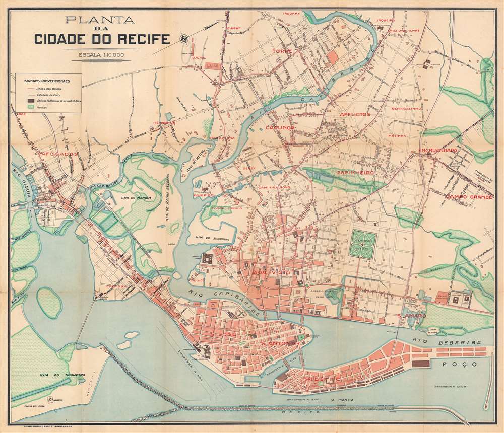
This is a 1914 Simonek e Cia city plan or map of Recife, Brazil. Oriented toward the west, bold red block lettering identifies many of the city's neighborhoods, including Recife, Boa Vista, and Santo Antonio. Locations within these neighborhoods are numerically identified by small red numbers and correspond with an index in the accompanying booklet. The small blue numbers mark government buildings. Islands are labeled throughout the region, along with major streets and a handful of buildings. Among these are the Portuguese Hospital, the powerplant, the central train station, and the Forte das Cinco Pontas, which houses the Recife City Museum today. (more details)
Brilliant, data rich depiction of mid-century New York.

The City of New York.
sold
- Digital Map Information
- Suitable for large format printing
- File Size: 77.21 MB
- File Type: ZIP / TIFF
- ICC color profile embedded
- Delivered instantly via download link
This 1939 Richard Edes Harrison map of New York City - published in conjunction with the New York World’s Fair – represents a triumph of the visual display of quantitative information. Its aesthetic impact is all the more impressive in its clear expression of municipal and demographic data, making this a map of the people of New York City, as much as of the physical city itself. All five boroughs are represented in the primary map. On it, Harrison’s masterful use of vivid color to distinguish between residential, commercial, industrial, and federal use of land is clear yet supple, able to make distinction (for example) of low-income housing projects using the same palette. Parks and cemeteries both appear as green spaces, with white spots - evoking headstones - indicating the difference between the two. The two major airports (Floyd Bennett Field and North Beach Airport) are given their own color as well. The city’s industrial areas, shown in black, dominate the East River and Hudson coastlines, a reminder of the centrality of trade to the city’s development and history. (more details)
Missionaries in China and social upheaval.
Originalkarte der Provinz Kwang Tung (Canton) zur Übersicht der Deutschen Missions-Stationen von J. Nacken / [Original map overview of the German mission stations of the province of Kwang Tung (Canton)].
$450.00
Acquire
- Digital Map Information
- Suitable for large format printing
- File Size: 7.92 MB
- File Type: ZIP / TIFF
- ICC color profile embedded
- Delivered instantly via download link
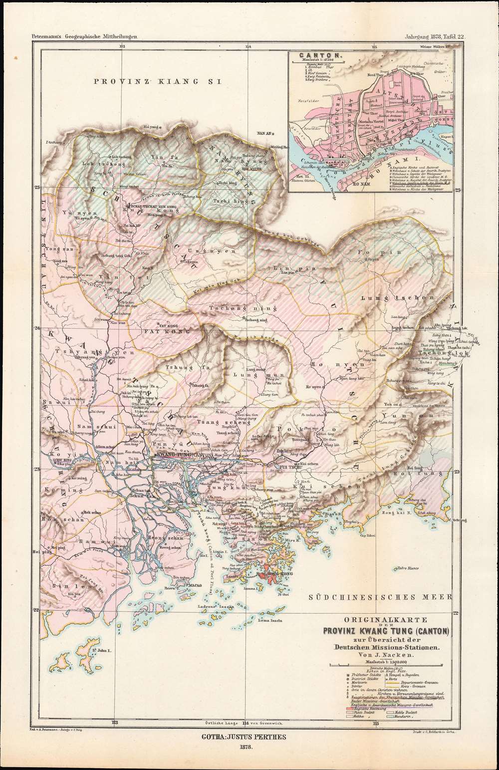
This is an 1878 Rev. Johannes Nacken map of the German mission stations in Guangdong Province, China, originally published in the geography journal Petermann's Geographische Mitteilungen. The map is indicative of the level of geographic and cultural knowledge about China in Europe at the time. (more details)
The evolution of Mississippi during the Indian Removal Act.
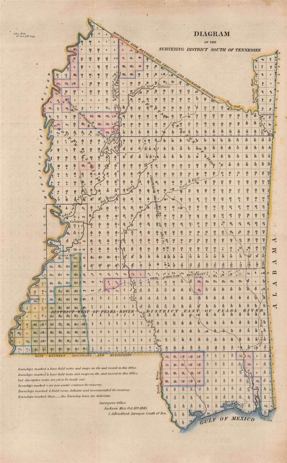
Diagram of the Surveying District South of Tennessee.
sold
- Digital Map Information
- Suitable for large format printing
- Full resolution TIFF file
- ICC color profile embedded
- Delivered instantly via download link
This is an 1845 Charles A. Bradford map of Mississippi or the Surveying District South of Tennessee with references to the Indian Removal Act and the Trail of Tears. Townships throughout Mississippi are illustrated, with letters marking the current state of surveys. The map notes townships with maps and field notes on file in the Surveyor General's Office, townships that were currently being resurveyed, and townships that were recommended for resurveying. The state's rivers are illustrated and labeled, along with a handful of cities, including Vicksburg and Jackson. (more details)
Pundits on the 'roof of the world'.
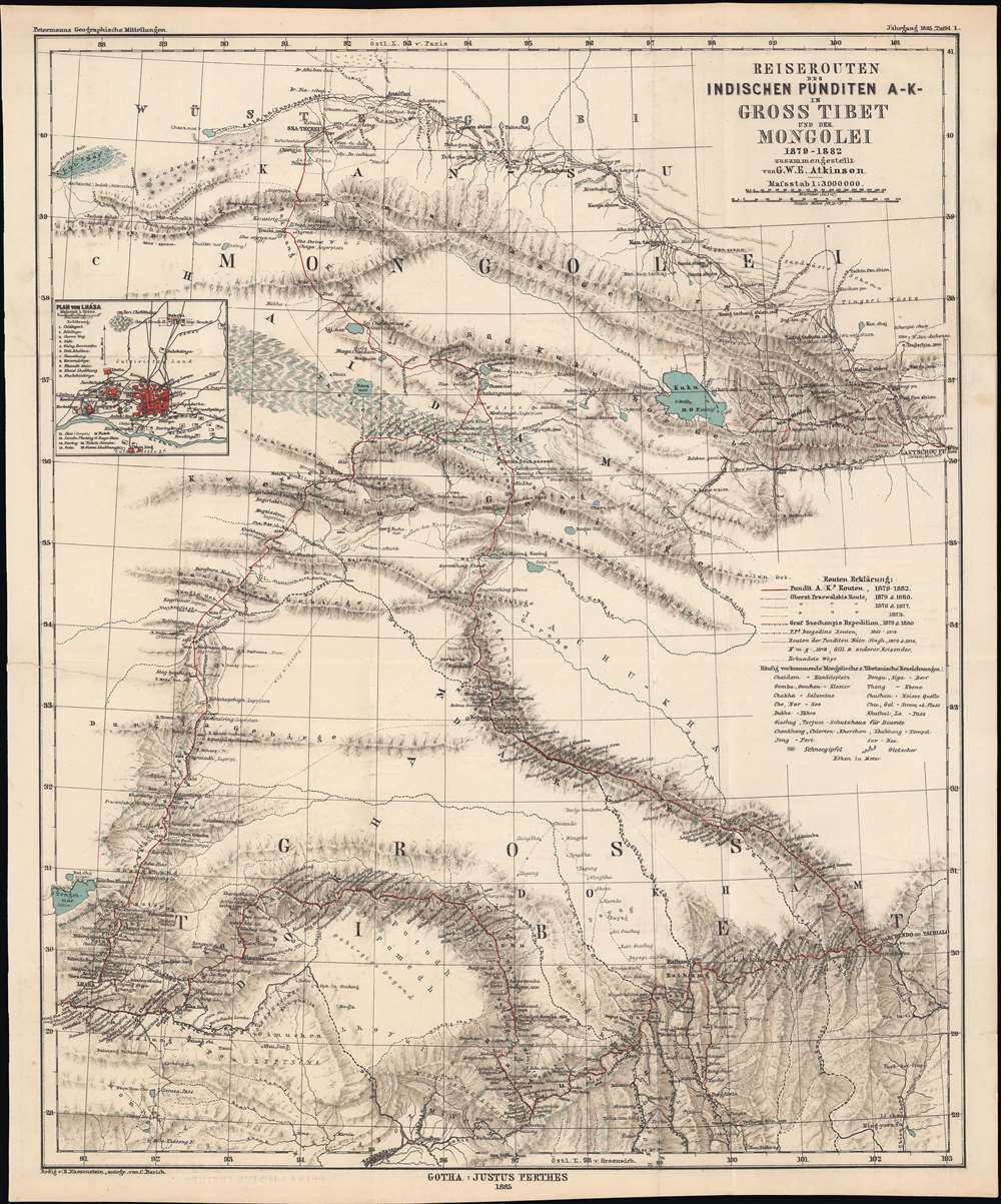
Reiserouten des Indischen Punditen A - K - in Gross Tibet und der Mongolei 1879 - 1882.
$400.00
Acquire
- Digital Map Information
- Suitable for large format printing
- File Size: 22.03 MB
- File Type: ZIP / TIFF
- ICC color profile embedded
- Delivered instantly via download link
This is an 1885 map of expeditions in western China compiled by G.W.E. Atkinson. The map depicts much of today's Qinghai Province and Tibetan Autonomous Region. The map is based not only upon European expeditions, but also those of the Pundits, or Pandits - Indian and / or Tibetan explorers working secretly for the British. (more details)
The Canadian Rocky Mountains by rail!

Canadian Rockies Showing Main Line of Canadian Pacific Ry. with Branch Lines and Steamship Connections.
sold
- Digital Map Information
- Suitable for large format printing
- File Size: 54.97 MB
- File Type: ZIP / TIFF
- ICC color profile embedded
- Delivered instantly via download link
This is a 1923 Canadian Pacific Railway bird's-eye view map of the Canadian Rocky Mountains. With Vancouver in the foreground and Edmonton in the background, red lines trace the railroads connecting the coast with points inland. Cities, towns, and villages along the railroad's routes are labeled, along with those connected by roads, which are marked by thin black lines. Dotted and dashed lines illustrate steamship routes, which leave Vancouver through the Strait of Georgia and the Juan de Fuca Strait, and others that operate on the region's larger lakes. Yoho Park, Glacier Park, and Rocky Mountains Park are within the view's scope. Pictorial profiles illustrate the Banff Springs Hotel in Rocky Mountains Park, Glacier House in Glacier Park, and the Sicamous Hotel in Sicamous, along with several others. An inset in the upper left depicts the Canadian Pacific coast from Skagway south to Seattle, with steamship lines, roads, and railways illustrated. (more details)
Visit California's national forests!
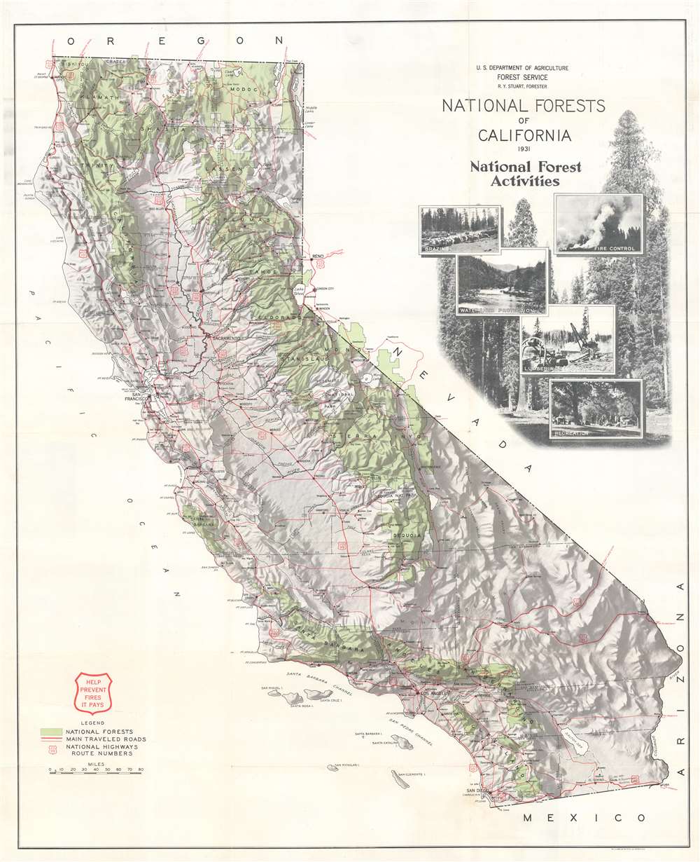
National Forests of California.
sold
- Digital Map Information
- Suitable for large format printing
- Full resolution TIFF file
- ICC color profile embedded
- Delivered instantly via download link
This is a 1932 U.S. Forest Service map of California national forests. The national forests, including Shasta National Forest, Stanislas National Forest, and Sequoia National Forest, are shaded green and labeled with big block letters. Red highlights the state's highways and other major roads. A wonderful pictorial cartouche appears just below the title. Photographs focusing on land use within the forests, including fire control, grazing, watershed protection, and recreation, superimposed over a stunning photograph of trees. (more details)
Boston and Maine Railroad's routes around Cape Ann.

Cape Ann Mass.
sold
- Digital Map Information
- Suitable for large format printing
- File Size: 9.18 MB
- File Type: ZIP / TIFF
- ICC color profile embedded
- Delivered instantly via download link
This is an 1889 Rand Avery Supply Company map of Cape Ann, Massachusetts. Issued by the Passenger Department of the Boston and Maine Railroad, thick black lines trace the Boston and Maine Railroad's network through the region, including the Eastern Division spurs to Marblehead and Rockport. The only cities and towns labeled are those serviced by the Boston and Maine. However, the region's counties, rivers, ponds, and lakes are all illustrated and labeled. The coastline is also depicted in detail, with Salem Harbor and Beverly Harbor identified, along with innumerable points and coves. (more details)