
Sailing map of Western Long Island Sound's Sailing Grounds by a Sail Lover.

A Map of Western Long Island Sound: Showing Yacht Clubs, Aids to Navigation and Principal Larchmont Race Courses.
sold
- Digital Map Information
- Suitable for large format printing
- File Size: 20.11 MB
- File Type: ZIP / TIFF
- ICC color profile embedded
- Delivered instantly via download link
This is a delightful 1939 Rolf Klep pictorial map of western Long Island Sound. It covers the waters off Westchester County, Fairfield County, and the ‘Gold Coast’ of Long Island, specifically those frequented by the members of the Larchmont Yacht Club. A note on the verso describes this as ‘a Yachting Paradise’ and ‘the most populous yachting center in the world, with about fifty clubs lining some seventeen miles of Long Island Sound.’ The locations of indeed fifty yachting clubs are marked with flags on the map, as are lighthouses, buoys, and radio beacons. The routes of seven Larchmont Regatta race courses are shown in white overlapping triangles throughout the Sound. Though soundings are not numbered, depths are indicated by varying shades, the darkest showing the deepest water, over 120 feet. Ebb and flood tides are marked on the map with arrows, as are key landmarks used by yachtsmen to take compass bearings - chimneys, domes, water towers, and even specific houses. Despite the map’s richness of detail, the author of the article it accompanied was at pains to explain that ‘though accurate, this map should not be used for navigation’ directing the reader instead to consult the U.S. Coast and Geodetic Survey and Texaco cruising charts from which the map’s data was drawn. (more details)
Miami's Greatest Achievement? The first printed map of Coral Gables.

Coral Gables - Miami's Greatest Achievement and Most Profitable Investment. / Coral Gables. Miami's Master Suburb.
sold
- Digital Map Information
- Suitable for large format printing
- Full resolution TIFF file
- ICC color profile embedded
- Delivered instantly via download link
This 1922 double-sided broadside, likely the first printed map of Coral Gables, Miami, Florida, was issued to promote investment and development in the emerging suburb. The broadside, touting Coral Gables as 'Miami's Greatest Achievement', features a large map of the planned community, dated 1922 - an updated and revised version of the unpublished Bliss/Button masterplan drawn in 1921. The verso features illustrations of the just-built country club walls, as well Spanish colonial style model homes. Other than the manuscript masterplans preserved at History Miami, this is the earliest map of Coral Gables known and the first published map. (more details)
The Twelve Tribes of Israel, with vignettes of the Exodus.
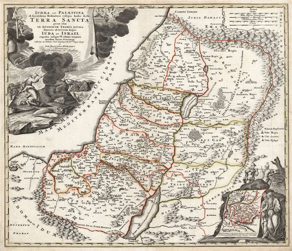
Judæa seu Palæstina ob sacratissima Redemtoris vestigia hodie dicta Terra Sancta prout olim in duodecim tribus divisa, seperatis ab invicem Regnis Iuda et Israel expressis in super VI. ultimi temporis ejusdem Terræ Provinciis.
sold
- Digital Map Information
- Suitable for large format printing
- Full resolution TIFF file
- ICC color profile embedded
- Delivered instantly via download link
This is a beautiful example of J. B. Homann's 1707 map of the Holy Land. As Homann noted in the map's title, it is derived from the work of the French mapmaker Guillaume Sanson (1633 - 1703). The map combines modern geographical information with place names drawn from Biblical history: specifically, the Exodus, and the settlement of the Twelve Tribes of Israel. It depicts the Mediterranean coast from Sidon (in modern-day Lebanon) to Alexandria (not named, but marked with Pompey's Pillar). The territories of the Tribes of Israel are marked, appearing on both sides of the Jordan. Mountains and forest regions are illustrated pictorially. Intriguingly, the Dead Sea contains the ruins of Sodom, Gomorrah, Adama, and Seboim - all destroyed for their sins. (more details)
Blown away by a hurricane...

Fourth Unit Fleetwood Section of Daytona Shores.
sold
- Digital Map Information
- Suitable for large format printing
- Full resolution TIFF file
- ICC color profile embedded
- Delivered instantly via download link
This is a c. 1926 J. Perry Stoltz map of the Fleetwood Section of Daytona Shores, Florida. Situated on a peninsula between the Tomoka River and the Halifax River, this planned neighborhood was never actually built: Tomoka State Park north of Daytona Beach now occupies the land. At the tip of the peninsula, the proposed Fleetwood Hotel, illustrated in profile, towers above the point. The rest of the area is divided into lots, zoned for homes, apartments, and businesses. Streets are labeled, including the Dixie Highway to St. Augustine and Jacksonville. (more details)
Connecting Burma and China by rail - bold but hopeless...
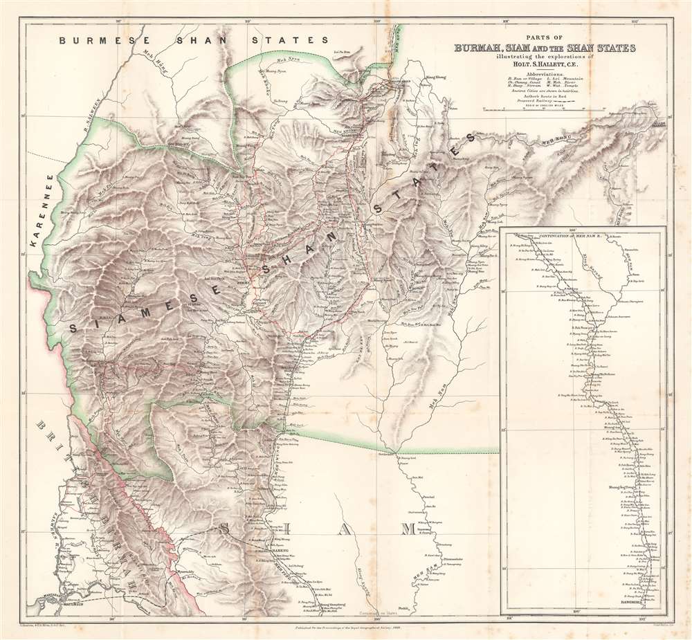
Parts of Burmah, Siam and the Shan States illustrating the explorations of Holt S. Hallett, C.E.
$400.00
Acquire
- Digital Map Information
- Suitable for large format printing
- File Size: 33.9 MB
- File Type: ZIP / TIFF
- ICC color profile embedded
- Delivered instantly via download link
This is an 1886 Henry Sharbau and H. A. Milne map of Burma (Myanmar) and Thailand. The map focuses on northern Thailand (Siam) and the railroad proposed by civil engineer Holt S. Hallett (1841 - 1911) and his associate Archibald Colquhoun (pronounced kuhl-HOON.) It was created to accompany a paper Hallett presented to the Royal Geographical Society. Red lines trace Hallett's explorations,
scouting and surveying the best railroad route. A dashed black and white line illustrated the proposed railway, running south from Kiang Hsen to the map's lower border. An inset along the right illustrates the route's continuation to Bangkok. (more details)
Tolkien's Middle-Earth!
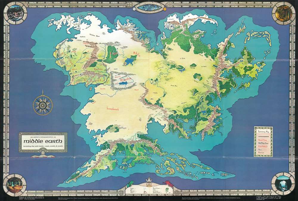
An Artist's Interpretation of Middle Earth including the Wild Lands - east, south, and north.
sold
This is a 1982 map of J. R. R. Tolkien's fantasy world 'Middle-Earth' by Peter C. Fenlon. Fans of Tolkien will be quick to recognize the northeastern part of the map, generally known as the Westlands, encompassing the main theater of both the Hobbit and The Lord of the Rings. The cartography for these areas, from Forodwaith to Umbar and from the western ocean (Belegaer) to the Sea of Rhûn, is drawn directly from the iconic map that accompanied the The Lord of the Rings. Unlike the maps published in Tolkien's famous books, the present map extends south and west to embrace the entire continent of Endor. Cartographically, Endor roughly mirrors Europe (Westlands), Africa (Haradwraith), and Asia (east of Rhûn). Although Tolkien's Legendarium does in fact give some hints regarding the lands and topography to the east of Mordor and Rhûn, much of the cartography here seems to have been imagined by Fenlon. Nonetheless, this map proved popular in the 1980s and was distributed to complement Iron Crown Enterprises successful LOTR-based role-playing game series. Although the map has no scale, we extrapolated a scale of 1:19000000 based on Tolkien's statement that Mirkwood was 300 miles wide. (more details)
Distributed by the Way's Auto Inn from Orlando.

Florida.
sold
- Digital Map Information
- Suitable for large format printing
- Full resolution TIFF file
- ICC color profile embedded
- Delivered instantly via download link
This is a 1915 C. S. Hammond map of Florida, for distribution by Way's Auto Inn in Orlando. Major roads are illustrated and cities, towns, and villages throughout the state are labeled. An inset in the lower-left focuses on the Florida Panhandle from Alabama to West Bay. An index along the left presents the most recent population data for fifty-five Florida cities, given in alphabetical order. (more details)
Come visit Massachusetts after seeing the New York World's Fair!
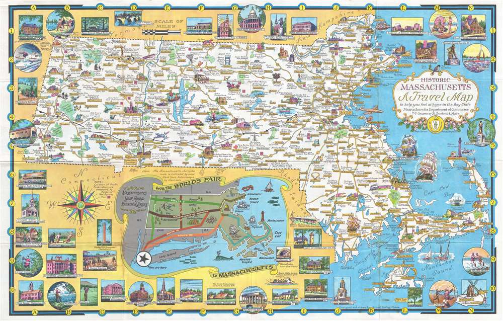
Historic Massachusetts: A Travel Map to help you feel at home in the Bay State.
sold
One of Ernest Dudley Chase's less common pictorial maps, this map of Massachusetts was created for the Massachusetts Pavilion at the 1964 New York World's Fair. Charmingly illustrated with eye-catching color, the map highlights the sightseeing opportunities of the Bay State. Historic buildings throughout are illustrated in profile and in the vignettes that frame the map. Historic ships, such as the Mayflower and Old Ironsides, ply the waters off the Massachusetts coast. An inset along the bottom border illustrates routes to tempt travelers into a side trip to Massachusetts after visiting the World's Fair, highlighting Boston, Plymouth, and in particular the New Bedford Whaling Museum, which had lent a 175-foot section of the famous 1,295-foot-long Whaling Panorama to the New England Pavilion restaurant. Numerous vignettes highlight activities available to the visitor, such as fishing, golfing, horseback riding, and boating. Historic sites from around the state, including Springfield Armory, Faneuil Hall in Boston, and the Bunker Hill Monument in Charlestown are noted for the less sporty tourist. (more details)
Highlights events in Illinois history - including several in the life of Abraham Lincoln.

Know Your Illinois.
sold
- Digital Map Information
- Suitable for large format printing
- Full resolution TIFF file
- ICC color profile embedded
- Delivered instantly via download link
This is a 1931 Illinois Terminal Railroad System pictorial map of Illinois. Vignettes illustrate events throughout the state's history, including the first Lincoln-Douglas debate, European exploration, battles fought between Native Americans and settlers, and other historical events. Universities and colleges, such as Northwestern and the University of Chicago, are identified. A text box on the left promotes Illinois's history, while a text box on the right extolls the virtues of the Illinois Terminal Railroad System. (more details)
Manuscript Map of the Battle of Shiloh. - drawn by a participant.

[Battle of Shiloh].
sold
- Digital Map Information
- Suitable for large format printing
- File Size: 39.14 MB
- File Type: ZIP / TIFF
- ICC color profile embedded
- Delivered instantly via download link
This is a c. 1865 manuscript map of the American Civil War Battle of Shiloh (April 6 - 7, 1862) drawn by Jehiel D. Lyon, a solider who participated in the battle with the 1st Ohio Infantry Regiment. (more details)
The most important map of Florida, issued 1 year after statehood at the end of the Second Seminole War.

The State of Florida.
sold
- Digital Map Information
- Suitable for large format printing
- Full resolution TIFF file
- ICC color profile embedded
- Delivered instantly via download link
The first official map of the State of Florida, this spectacular production was issued in 1846, on year after statehood and at the end of the Second Seminole War, by the Army Bureau of Topographical Engineers. The map was drawn by Joseph Goldsborough Bruff, an adventurer, playboy, and civilian contractor working with the Topographical Engineers. It illustrates the state of the Florida survey as of 1846, as well as major events, routes, and settlements associated with the First and Second Seminole Wars. Moreover, the map includes holdover grants from the Spanish era, including Arredondo's Grant and Forbes' Purchase. With unsurpassed detail and scale, this map became the foundational map for most subsequent maps of Florida through the end of the 19th century. (more details)
Earliest map of Europe based on contemporaneous knowledge.

Description Novelle D'Europe.
sold
- Digital Map Information
- Suitable for large format printing
- Full resolution TIFF file
- ICC color profile embedded
- Delivered instantly via download link
This is a handsome example of Sebastian Münster's southern-oriented map of Europe: an early French edition of the first acquirable map of Europe based on contemporary geographical information, and the only generally acquirable derivative of Martin Waldseemüller's unobtainable 1511 map of Europe. Münster's Geographia and Cosmographia provided for many years the literate European's only glimpses of the world, and these two works contained a number of maps with previously unseen contemporaneous knowledge of the areas they depicted. For Münster's readership, this map was almost certainly the first depiction of their home continent not based upon the 2nd century work of Claudius Ptolemy. (more details)
Cedar Key at the height of its prosperity.

Bird's Eye View of Cedar-Key, Fla. Levy Co.
sold
- Digital Map Information
- Suitable for large format printing
- File Size: 5.42 MB
- File Type: ZIP / TIFF
- ICC color profile embedded
- Delivered instantly via download link
This is an 1884 Joseph John Stoner bird's-eye view of Cedar Key, Florida. Depicting the city at its height, when Cedar Key was a boomtown and thriving port servicing Florida's lumber industry. Thirty-three locations are numerically identified and correspond with an index on either side of the view's title. Churches, hotels, sawmills, cedar mills, and general stores, rank among these locations. The Florida Transit and Peninsular Railroad curves through the view, its depot in the foreground on the right. Steamships, ferries, and sailing ships ply the waters around Cedar Key, reinforcing its economic importance and prosperity. Just two years after this view was published, Henry Plant's 'Plant System' railroad reached Tampa. This move took shipping away from Cedar Key and began the region's economic decline. (more details)
Inspiration for the animated series 'Disenchantment'. - Matt Groening
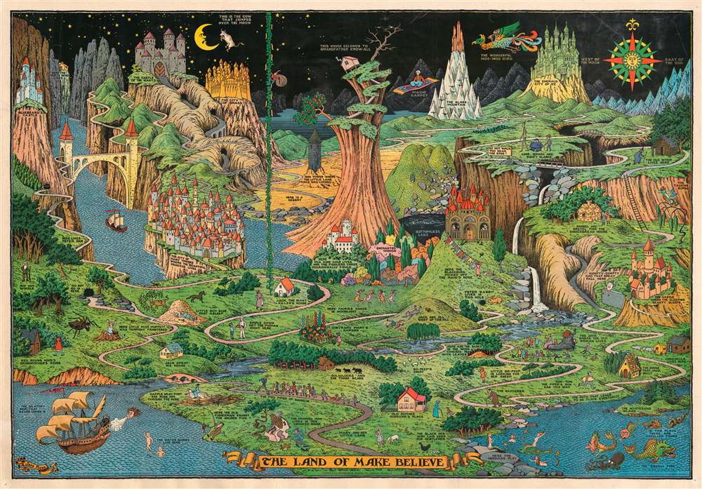
The Land of Make Believe.
sold
This is a 1958 Jaro Hess pictorial map of the Land of Make Believe. The map is derived from over 60 nursery rhymes, fairy tales, and children's stories with creative, entertaining, and attractive illustrations. The map emerged at the height of the Great Depression (1929 - 1933) and offered much needed escapism during those brutal times. Among the stories referenced are Little Red Riding Hood, Little Miss Muffet, Little Boy Blue, Jack and the Beanstalk, Old King Cole, Peter Rabbit, The Old Woman Who Lived in a Shoe, Cinderella, Sleeping Beauty, Hansel and Gretel, the Wizard of Oz, One Thousand and One Nights, Rip Van Winkle, and Peter Pan. Each story has its own illustration and caption. Hess claims that the in a 1972 interview, that the original painting was shown at Chicago's 1933 Century of World Progress children's literature area - but this is unverified by any evidence from the exhibition. The American cartoonist and humorist Matt Groening, famed inventor of The Simpsons, claims the 'Land of Make Believe' was a primary inspiration for his most recent animated series, Disenchantment. (more details)
South Africa tourism.
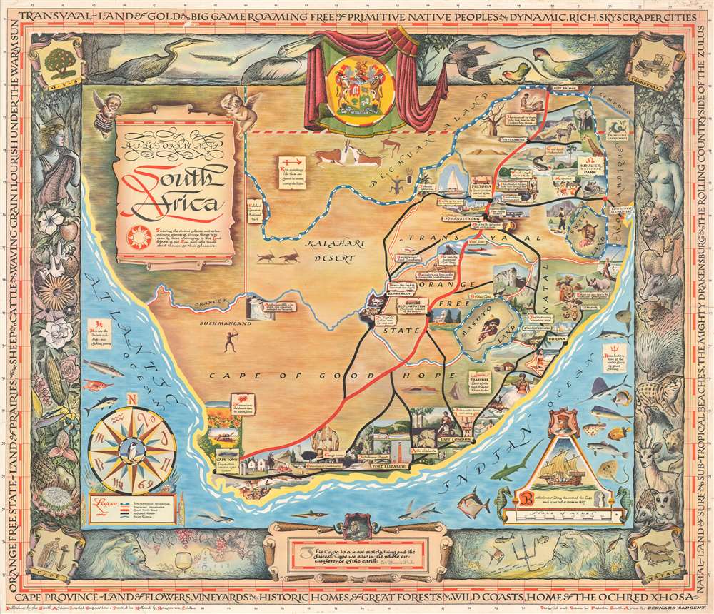
A Pictorial Map: South Africa.
sold
This is a 1954 Bernard Sargent pictorial map of South Africa created for the South African Tourist Corporation. Illustrated vignettes highlight tourism destinations throughout the country but largely focus on South Africa's extraordinary wildlife. Pretoria, Cape Town, and Johannesburg are all labeled, as are the Orange Free State, the Transvaal, and the Cape of Good Hope. Neighboring nations are identified as well, including Swaziland, Basutoland, Bechuanaland, and Mozambique. The whole is surrounded by a stunning pictorial border illustrating South Africa's flora and fauna. (more details)
Important early edition of Garnier's popular map of the Paris Monuments.
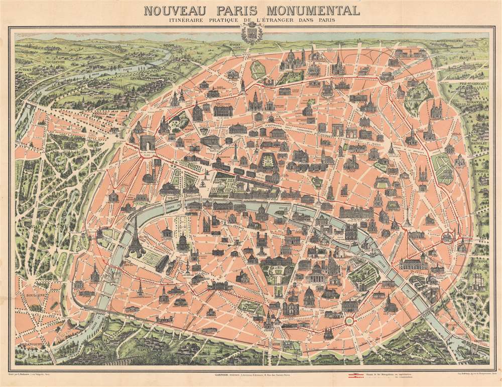
Nouveau Paris Monumental Itinéraire Pratique de l'Étranger dans Paris.
sold
- Digital Map Information
- Suitable for large format printing
- File Size: 45.71 MB
- File Type: ZIP / TIFF
- ICC color profile embedded
- Delivered instantly via download link
This is an extremely attractive 1903 Garnier Frères tourist pictorial pocket map of Paris, France. The map depicts the walled city of Paris and the immediate vicinity from Billancourt to Aubervilliers and from Puteau to Charenton. Celebrated tourist sites are shown in profile, including the Eiffel Tower, the Arc de Triomphe, Sacre-Coeur, the Pantheon, and several more. Paris's many train stations are illustrated along with the railroad lines. Both the Bois de Boulogne and the Bois de Vincennes are depicted in stunning detail. (more details)
Orlando get's its second wind...
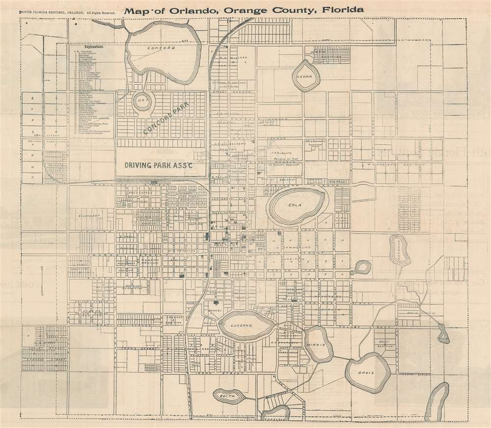
Map of Orlando, Orange County, Florida.
sold
- Digital Map Information
- Suitable for large format printing
- Full resolution TIFF file
- ICC color profile embedded
- Delivered instantly via download link
This is a 1910 South Florida Sentinel city plan or map of Orlando, Florida at the beginning of the Florida Land Boom. Depicting from Concord Lake to Copeland Lake and from just west of Reel Street to Sink Lake, the map provides a detailed look at Orlando at the beginning of the 20th century. Forty-three locations are numerically identified and correspond with an index (labeled 'Explanations') situated in the upper left. Housing additions are illustrated and labeled with the developer's name. In some cases, individual blocks are also labeled. (more details)
Tampa and Vicinity.
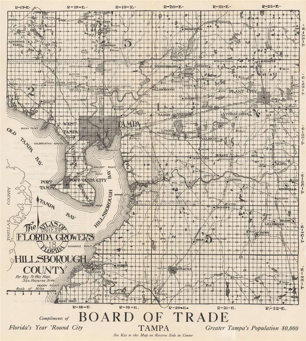
The Florida Grower's Atlas of Florida. Sheet 18 Hillsborough County.
sold
- Digital Map Information
- Suitable for large format printing
- Full resolution TIFF file
- ICC color profile embedded
- Delivered instantly via download link
This is a c. 1920 Tampa Board of Trade map of Hillsborough County, Florida. Tampa, situated at the top of Hillsborough Bay, is shaded. The rest of the county is divided into the township grid with all sections numbered. A key appears on the verso, along with an index of agricultural texts published by the State of Florida. (more details)
The turning point of the American Civil War.

The Battle of Gettysburg, Pa. July 3, 1863.
sold
- Digital Map Information
- Suitable for large format printing
- File Size: 16.73 MB
- File Type: ZIP / TIFF
- ICC color profile embedded
- Delivered instantly via download link
This is an 1863 Currier and Ives view of the Battle of Gettysburg. Union troops, carrying the stars and stripes, determinedly charge Confederate lines in the face of point-blank enemy fire. Two Confederate canons appear in the foreground, and three Confederate casualties lie on the ground in front of the advancing Union force. (more details)
Labels Mecca, Medina, and Jerusalem.
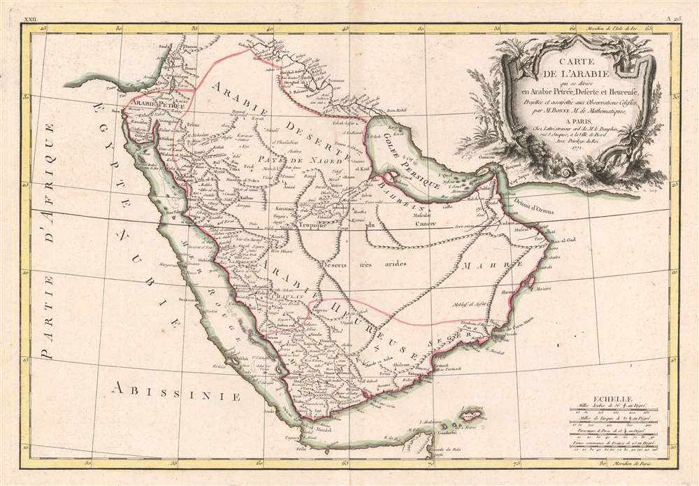
Carte de l'Arabie qui se divise en Arabie Pétrée, Deserte et Heureuse, Projettée et assujettie aux Observations Celestes.
sold
- Digital Map Information
- Suitable for large format printing
- Full resolution TIFF file
- ICC color profile embedded
- Delivered instantly via download link
This is a 1771 Rigobert Bonne map of the Arabian Peninsula. Beautifully engraved and detailed, the map includes the modern-day countries of Saudi Arabia, Israel, Jordan, Kuwait, Iraq, Yemen, Oman, the United Arab Emirates, and Bahrain. Mt. Sinai, Mecca, Medina, and Jerusalem are noted, as well as countless other cities and desert oases. Numerous shoals, reefs, and other dangers in the Red Sea and the Persian Gulf are also identified. A large decorative title cartouche is situated in the upper right. (more details)