
Beautiful pictorial map of the Grand Canyon by one of the great masters of the genra.

Grand Canyon.
sold
A beautiful c. 1931 / 1957 pictorial map of the Grand Canyon by Jo Mora. Roughly following the Colorado River, the map covers the most visited parts of the Grand Canyon. Many of the Canyon's unique formations, which are named after a variety of figures form mythology, fairly takes, and folklore, are noted with pictorial representations of their namesakes. The borders of the map features numerous inset images that range from historical notes, to cultural illustrations, to humorous cartoon anecdotes. (more details)
Extremely Rare, Attractively Engraved Map of Europe, Africa and Asia.
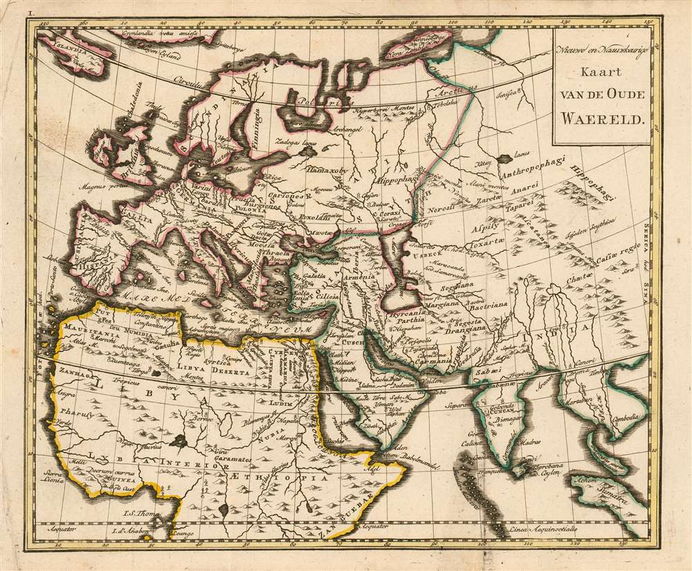
Nieuwe en naauwkeurige kaart van de Oude Waereld.
sold
- Digital Map Information
- Suitable for large format printing
- DPI: 600
- File Size: 6.28 MB
- File Type: ZIP / TIFF
- ICC color profile embedded
- Delivered instantly via download link
This rare 1780 map of Europe, Northern Africa and Western Asia presents - with some notable exceptions - the parts of the world known to the Roman Empire during the Biblical period. Most of the place names are those which would have been familiar to Ptolemy, Pliny and Josephus. The geography shown is not ancient, however. Rather than being modeled after Ptolemy's mapping of the world known during the Roman era, the map reflects the geographical knowledge of the 18th century. Neither Nova Zemla nor Iceland, both shown here, were known to ancient geographers; and although distorted, both the Indian and Malay peninsulae are shown as they were understood after the discovery era. The mapmaker follows many of the early translators of Ptolemy in identifying the island of Taprobana as Sri Lanka. Similarly, Goa and Cambodia are marked and named on the map. Central Asia is labeled (libeled?) as the domain of cannibals and horse-eaters. The map was intended to accompany a book of Biblical geography, and to help the reader place the events of religious antiquity in the context of a modern, expanding world. (more details)
The Fertile Crescent of the Biblcal Era
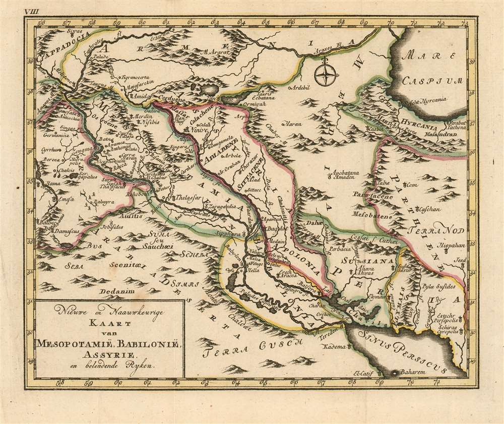
Nieuwe en Naauwkeurige Kaart van Mesopotamië, Babilonië, Assyrie en belendende Ryken.
sold
- Digital Map Information
- Suitable for large format printing
- DPI: 600
- File Size: 5.39 MB
- File Type: ZIP / TIFF
- ICC color profile embedded
- Delivered instantly via download link
This rare 1780 map of Mesopotamia presents the region of modern-day Syria, Iraq and western Iran. the map is centered on the courses of the Tigris and Euphrates, spanning north and south from the Caspian Sea to the Persian Gulf and west to east from Baalbek in Lebanon to Shiraz in Iran. The map's topography is based on contemporary cartographic data, but it was not intended to depict the 18th century Near East: rather, the place names are drawn from Biblical sources, reinforced with geographical data of ancient geographers - primarily referencing the period of the Bablylonian Captivity. Other features include Mount Ararat, reputed to be the mountain where Noah's ark came to rest after The Flood. (more details)
1st map to show the results of the Bering Expedition; 1st map to show any part of Alaska, 1st map of the Russian Empire printed in Russia.
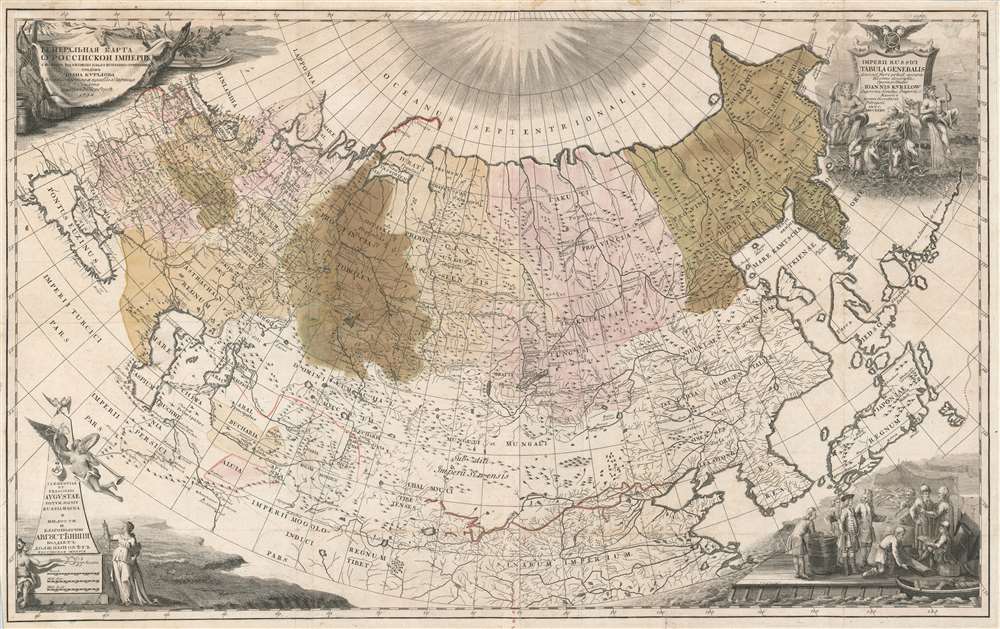
Imperii Russici tabula generalis quo ad fieri potuit accuratissime descripta opera et studio Ioannis Kyrilow.
sold
- Digital Map Information
- Suitable for large format printing
- DPI: 600
- File Size: 70.85 MB
- File Type: ZIP / TIFF
- ICC color profile embedded
- Delivered instantly via download link
An incredibly rare and important map, this is Ivan Kirilov's 1734 large format map of the Russian Empire. Printed in Petropoli, Russia, this is the first scientifically accurate map of the Russian Empire printed in Russia. It is also the first printed map to show the cartographic results if Vutys Bering's First Kamchatka Expedition (1727 - 1730) AND the first appearance of any part of Alaska (St. Lawrence Island) on a printed map. The map's coverage extends from the Black Sea to the Bering Strait, and from the north pole to the Persia, Korea, Japan, and the Yangze River. Decorative cartouche work adorns all four comers and underscores the Tzardom's wealth and power. (more details)
Spectacular dissected wall map of the Untied State revealing a remarkable and ephemeral deportment of the Plains States.
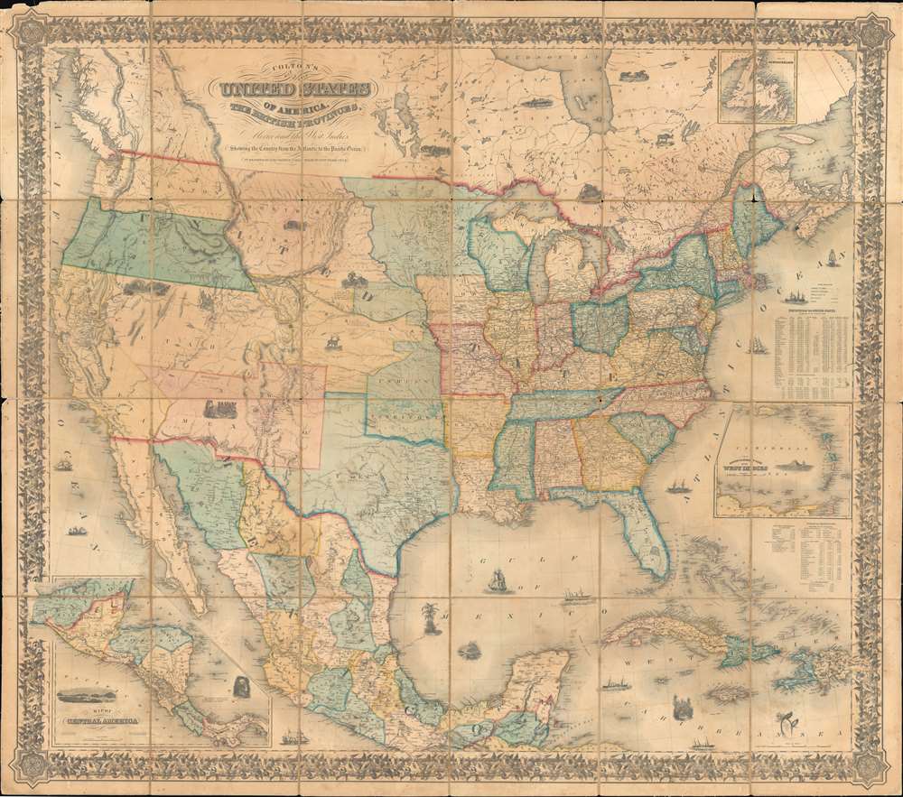
Colton's map of the United States of America, the British provinces, Mexico and the West Indies. Showing the country from the Atlantic to the Pacific Ocean.
sold
- Digital Map Information
- Suitable for large format printing
- DPI: 600
- File Size: 272.72 MB
- File Type: ZIP / TIFF
- ICC color profile embedded
- Delivered instantly via download link
This is a large 1853/54 J. H. Colton dissected wall map of the United States with significant Trans-Mississippi and Great Plains content. This is the largest and most significant of the three separate issue maps of the United States Colton issued in the 1850s. It covers the entire United States as well as most of Mexico, parts of southern Canada, and the Greater Antilles. Central America and the lower Antilles appear in insets. There are numerous ethnographical, geographical, and historical vignettes throughout including a wagon train, American Indians hunting, ships, palm trees, volcanoes, and more. (more details)
First bilingual map of Hong Kong!
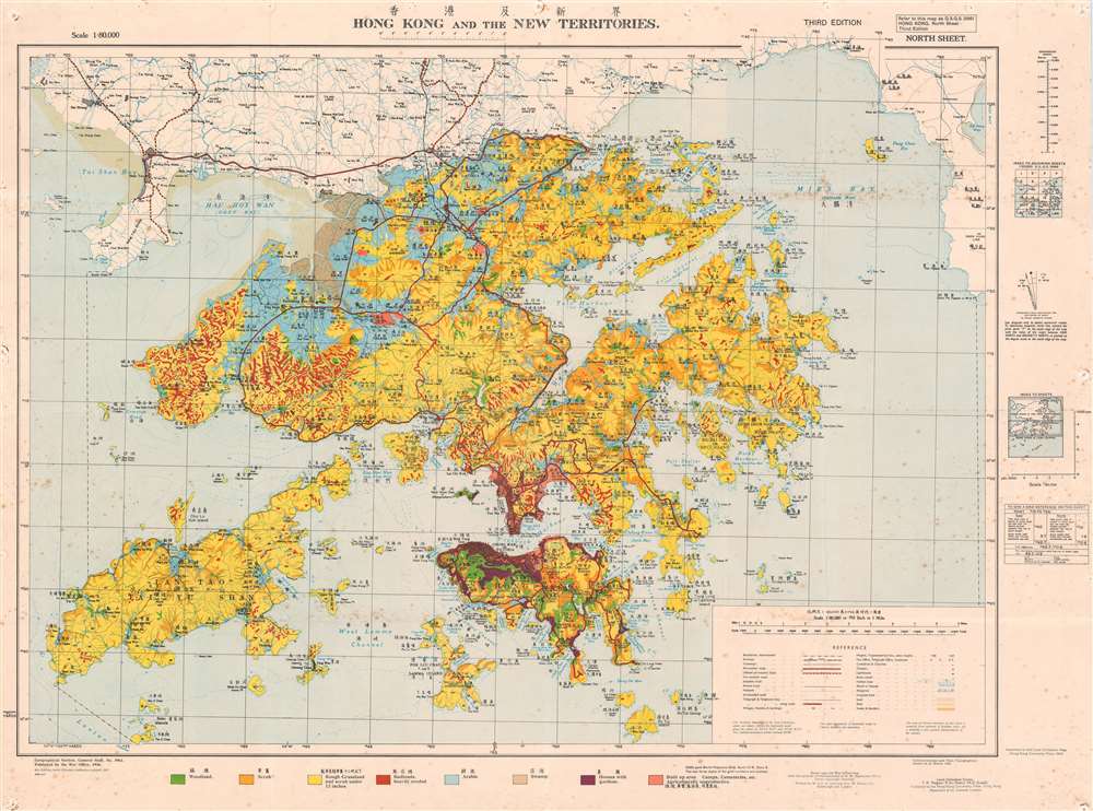
Hong Kong and the New Territories. / 香港及新界.
sold
- Digital Map Information
- Suitable for large format printing
- File Size: 92.6 MB
- File Type: ZIP / TIFF
- ICC color profile embedded
- Delivered instantly via download link
An extremely rare 1957 Geographical Section General Staff map of Hong Kong. Based upon a 1936 map published by the War Office, this is the first bilingual edition of this important. This map is further updated to represent agricultural variance, distinguishing between scrub, roughly grassland, badlands, arable lands, swamp and developed properties. (more details)
Considered to be the most important map of New Zealand, it was created by Captain Cook in the 1770s and consulted into the twentieth century.
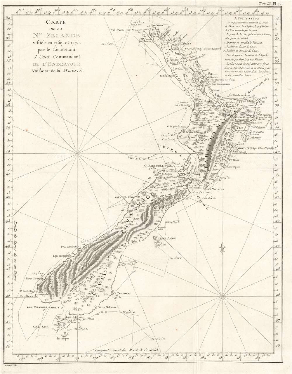
Carte de la Nle. Zelande visitée en 1769 et 1770 par le Lieutenant J. Cook Commandant de l'Endeavour vasseau de sa Majesté.
sold
- Digital Map Information
- Suitable for large format printing
- DPI: 600
- File Size: 12.72 MB
- File Type: ZIP / TIFF
- ICC color profile embedded
- Delivered instantly via download link
Recognized as the most important map in the history of New Zealand, this is the first French edition of Captain James Cook's landmark map of New Zealand. The first map to prove that New Zealand is composed of two islands, Cook's course through what is still known as Cook's Strait separating the two islands, is depicted as well. (more details)
World War II predicted in detail!

Japan's Aim to Dominate the Far East and the Pacific Islands. / A Plan of Japan's Proposed Military and Naval Conquest As Revealed in the Strategic Map.
sold
- Digital Map Information
- Suitable for large format printing
- File Size: 24.31 MB
- File Type: ZIP / TIFF
- ICC color profile embedded
- Delivered instantly via download link
An intriguing c. 1933 anti-Japanese propaganda map pamphlet published in San Francisco prior to the outbreak of World War II. The map, and the text on the verso, claim to reveal Japan's imperialist plans for domination of the Asia-Pacific region, including the seizure of Hawaii, eight years before the attack on Pearl Harbor. The map is strikingly prescient, outlining Japanese plans in detail, including the upcoming bombing of Pearl Harbor, the attack on the Philippines, and the seizure of Singapore. (more details)
Shanghai just before the Shanghai Incident of 1932.

Panorama of Shanghai (1) / (一)圖景風海上
sold
- Digital Map Information
- Suitable for large format printing
- File Size: 51.49 MB
- File Type: ZIP / TIFF
- ICC color profile embedded
- Delivered instantly via download link
A scarce c. 1930 art Deco Era panorama of Shanghai by Guo Chan (果禅). The panorama illustrates the Bund from across the Huangpu River. The port is busy with French, British, and American ships - dating this map to the pre-war period c. 1930. Single and bi-wing planes fill the dramatically shaded skies. The view is centered on the Sassoon Mansion, with its distinctly pyramidal roof, which housed the Cathay Hotel, now the Fairmont Peace Hotel. (more details)
Superbly Detailed Map of Louisville, Kentucky
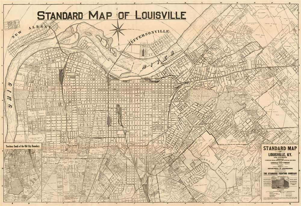
Standard Map of Louisville, Ky. And Environs Originally Compiled from Sureveys and Official Records by the Louisville Title Company.
sold
- Digital Map Information
- Suitable for large format printing
- File Size: 42.45 MB
- File Type: ZIP / TIFF
- ICC color profile embedded
- Delivered instantly via download link
This is the 1921 edition of William Bridges Hunter’s map of Louisville, Kentucky. This plan, printed in Louisville by the Standard Printing Company, is one of the most detailed early maps of the city we have encountered, far outstripping the atlas maps available from the 19th century and rivaled only by the Mendenhall map of 1906. (more details)
A Richly Detailed Map of the Grand Duchy of Lithuania
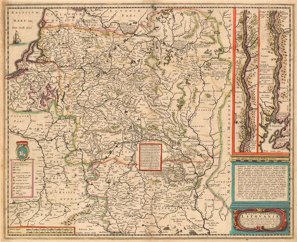
Magni Dvcatvs Lithvaniae caeterarumq ; regionum illi adjacentium exacta descrip./ Illss.mi ac Excell.mi Principis ac Dñi D. Nicolai Christophori Radziwil D.G. Olycae ac in Nieswies Ducis, S. Rom. Imp. Principis in Szylowiec ac Mir comitis, et S. Sepulchri Hirosolimitani Militis etc. opera et cura in lucem edita
sold
- Digital Map Information
- Suitable for large format printing
- DPI: 600
- File Size: 24.13 MB
- File Type: ZIP / TIFF
- ICC color profile embedded
- Delivered instantly via download link
This is Henry Hondius' 1636 map of the Grand Duchy of Lithuania, with inset maps of the course of the Dniepr River. The map encompasses Riga and Smolensk to the north, and Krakow to Kiev in the south. As such it includes parts of modern day Latvia, Lithuania, Poland, Belarus, Ukraine and Russia. The Dniepr insets continue mapping the river from Cherkasy to the river's opening in the Black Sea. The map is based on Willem Blaeu's 1613 wall map of the same title, derived from the 'Radvilas' map of the Grand Duchy of Lithuania. In 1586, the Lithuanian Prince Michael Radziwill commissioned the Polish royal cartographer Maciej Strubicz to produce a map which improved on his earlier map of Poland, Lithuania and Livonia; the resulting map would form the basis of most seventeenth century mapping of this part of the world. Using keys both in the main map and the insets, the cities are marked to indicate their religious (and hence their political) affiliations. The Dniepr maps indicate those forts and cities held by Christians and those held by Muslim 'Tatars;' the main map differentiates between cities of the Palatinates, Catholic bishoprics and Greek Orthodox bishoprics. The map reveals its 16th century naissance in its copious historical notes (with accompanying pictorial battle scenes) of important engagements, alliances and victories in the Polish-Lithuanian Commonwealth's 1579-1581 war with Muscovy. (more details)
Published shortly before Stalin's Great Purge commenced.

ПЛАН ЛЕНИНГРАДА. (Plan of Leningrad).
sold
- Digital Map Information
- Suitable for large format printing
- File Size: 52.55 MB
- File Type: ZIP / TIFF
- ICC color profile embedded
- Delivered instantly via download link
This is a 1935 I. F. Filippov city map or plan of Leningrad (St. Petersburg), Russia. Focused on the city center, districts throughout the city, including Petrogradsky, Vasileostrovsky, Moskovsky, and Vyborg are shaded different colors to allow for easy differentiation. Tram lines are illustrated by solid red lines running along the streets, while bus lines are indicated by dashed lines, all of which are identified with numbers inscribed in circles. Railroads are marked by solid black lines. Some important buildings, including the Peter and Paul Fortress, are noted. (more details)
Richly Decorative County Map with an Early Depiction of Stonehenge

Wilshire.
sold
- Digital Map Information
- Suitable for large format printing
- DPI: 600
- File Size: 18.56 MB
- File Type: ZIP / TIFF
- ICC color profile embedded
- Delivered instantly via download link
This is John Speed's map of the county of Wiltshire in southwestern England. It was included in Speed's The Theatre of the Empire of Great Britaine, which was the first collection of maps of the counties of the British Isles. The map is richly detailed, showing towns, abbeys, castles, forests and parklands. The countryside's hilly terrain is shown pictorially. An inset plan in the upper left details the cathedral city of Salisbury: a key labels the important streets, locations of the town hall, cathedral and other important churches, and the town market. Below the inset are fourteen coats-of-arms, belonging to the Earls of Wilshire and Salisbury. (more details)
A Sumptuous Example of the Classic Dutch Map of Oxfordshire, with the University's College Arms

Oxonium Comitatus, Vulgo Oxfordshire.
sold
- Digital Map Information
- Suitable for large format printing
- DPI: 600
- File Size: 18.56 MB
- File Type: ZIP / TIFF
- ICC color profile embedded
- Delivered instantly via download link
This is a 1662 Johannes Blaeu map of Oxfordshire, one of the most decorative maps of Oxfordshire and the most desirable Dutch map of a British county. The geography is derived from Speed's map, with the map centered on the city of Oxford, dividing the county into its Hundreds and showing its parks and towns. Blaeu's map shines in its decorative elements: The cartouche, which incorporates both the title and the scales, is flanked by two English scholars in formal garb. The British Royal arms are displayed front and center, but the map is cornered with the arms of King Alfred (with the dubious claim that the king founded Oxford,) the arms of the County, and the insignia of the University itself. The map is bordered with sixteen coats of arms belonging to the University's Colleges. The map is embellished with rich contemporary color. (more details)
Issued at the outset of the WWII campaign to retake the Philippines.

Philippine Islands. / フィリッピン群島.
sold
- Digital Map Information
- Suitable for large format printing
- File Size: 24.3 MB
- File Type: ZIP / TIFF
- ICC color profile embedded
- Delivered instantly via download link
An uncommon Showa 19 or 1944 Japanese World War II map of the Philippines. This map was issued in Japan during WWII at the outset of the Philippine Campaign, the Allied invasion that retook the Philippines. There is an inset of Manila in the upper right corner. (more details)
The First Separate, Modern Map of India
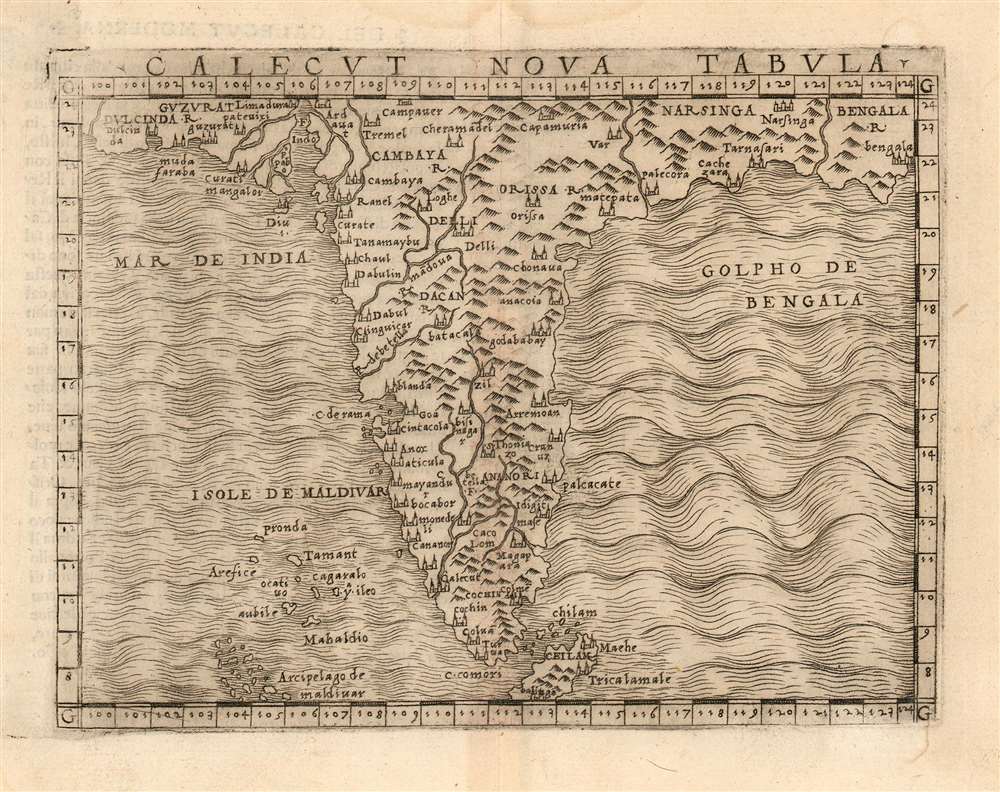
Calecut Nova Tabula.
sold
- Digital Map Information
- Suitable for large format printing
- DPI: 600
- File Size: 2.92 MB
- File Type: ZIP / TIFF
- ICC color profile embedded
- Delivered instantly via download link
This is Giacomo Gastaldi's 1548 map of the Indian Peninsula. It is the earliest printed, modern map of India - all earlier maps of the region being iterations of Claudius Ptolemy's geographical information of the 2nd century. Though a Venetian, Gastaldi's information shows knowledge of the depth of Portuguese penetration of the subcontinent. Guzarat, Goa, Calecut, Delhi and many other place names appear on the map. Sri Lanka (Ceilam) is shown in its correct location and is not conflated with Sumatra, as many of the Ptolemaic maps appeared to do. The archaic term 'Taprobana' does not appear. The Maldives are shown with some exaggeration. (more details)
Traces the rail network in Florida in the early 20th century.
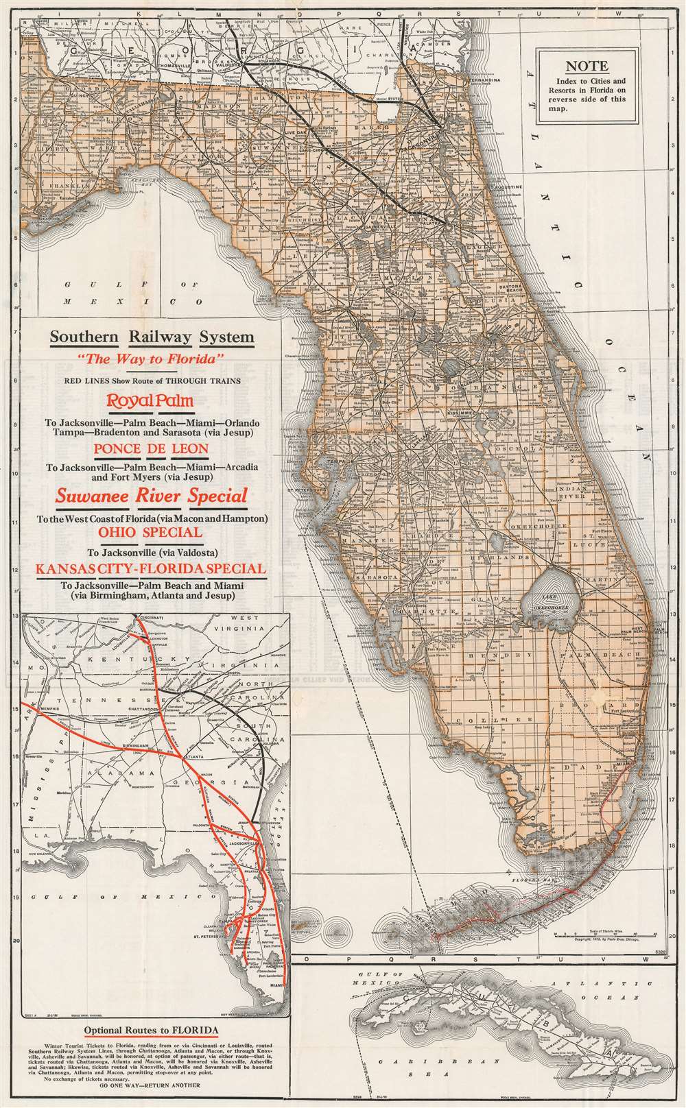
Southern Railway System 'The Way to Florida'.
sold
- Digital Map Information
- Suitable for large format printing
- File Size: 32.57 MB
- File Type: ZIP / TIFF
- ICC color profile embedded
- Delivered instantly via download link
This is a 1926 Poole Brothers railroad map of Florida published by the Southern Railway System. Routes owned by Southern Railway and its subsidiaries in northern Florida are emphasized by illustrating them with thick black lines. The rest of the railroad network in Florida is depicted using thin place lines to mark the routes, all of which are labeled with block lettering, including the Atlantic Coast Line and the Seaboard Air Line, and the Florida East Coast Line from Miami to Key West is traced in red manuscript. The Peninsular and Occidental Steamship Company, which connected Tampa with Key West and Havana, Cuba, is marked by a dotted line running through the Gulf of Mexico. An inset map along the left border highlights the Southern Railway System from Cincinnati and Memphis to Miami, along with other rail lines in the American Southeast. A second inset map of Cuba is situated in the lower right corner that illustrates Cuban railways as well. (more details)
Highlights a very popular tourist rail route in Nova Scotia popularized by a love for Longfellow's epic poem Evangeline, A Tale of Acadie.
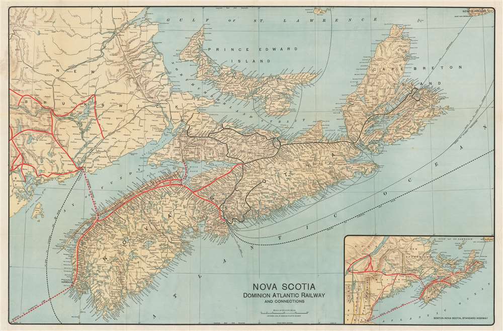
Nova Scotia Dominion Atlantic Railway and Connections.
sold
- Digital Map Information
- Suitable for large format printing
- File Size: 53.48 MB
- File Type: ZIP / TIFF
- ICC color profile embedded
- Delivered instantly via download link
This is a 1918 Poole Brothers map of Nova Scotia and the routes of the regional railroads. Depicting the region from New Brunswick to Cape Breton Island, the Dominion Atlantic Railway and the Canadian Pacific Railway (which owned the Dominion Atlantic) are highlighted by thick red lines, while Canadian government railways are illustrated by black lines. Every stop along the rail lines in Nova Scotia are labeled, with the major stations, such as Yarmouth, Digby, and Halifax, identified using bold block letters. Steamship routes, including those connecting different parts of Nova Scotia, and Nova Scotia and New Brunswick, are marked by dashed lines. Steamship routes to England, the United States, and the West Indies are also illustrated and labeled. (more details)
Chile's political stability is questioned while the military junta in Argentina is supported since it was an ally of the United States.
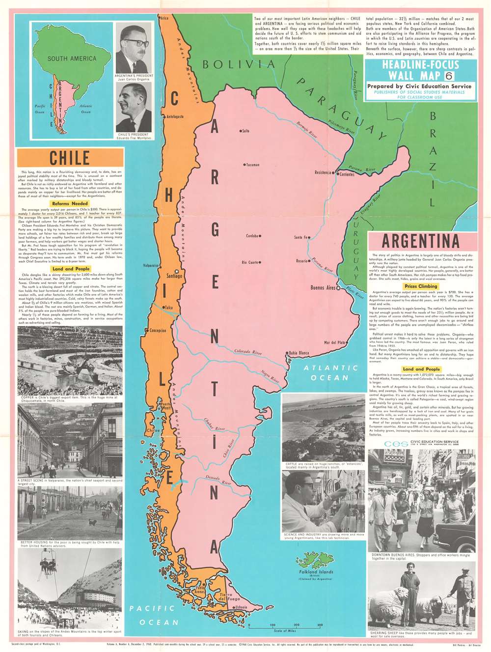
Chile. Argentina. Headline-Focus Wall Map 6.
sold
- Digital Map Information
- Suitable for large format printing
- File Size: 81.7 MB
- File Type: ZIP / TIFF
- ICC color profile embedded
- Delivered instantly via download link
This is a 1968 Civic Education Service map of Argentina and Chile. This map focuses less on the geography of the region and more on its political, social, and economic realities. Cities are labeled throughout both countries, as are rivers and the Andes Mountains, which make up most of the border separating them. A text in the upper right corner summarizes the similarities between the two countries, while text boxes on the left and right sides focus on Chile and Argentina, respectively, shed light on the differences between the two nations. (more details)
A Delicate and Accurately Rendered View of Two Great Mexican Volcanos
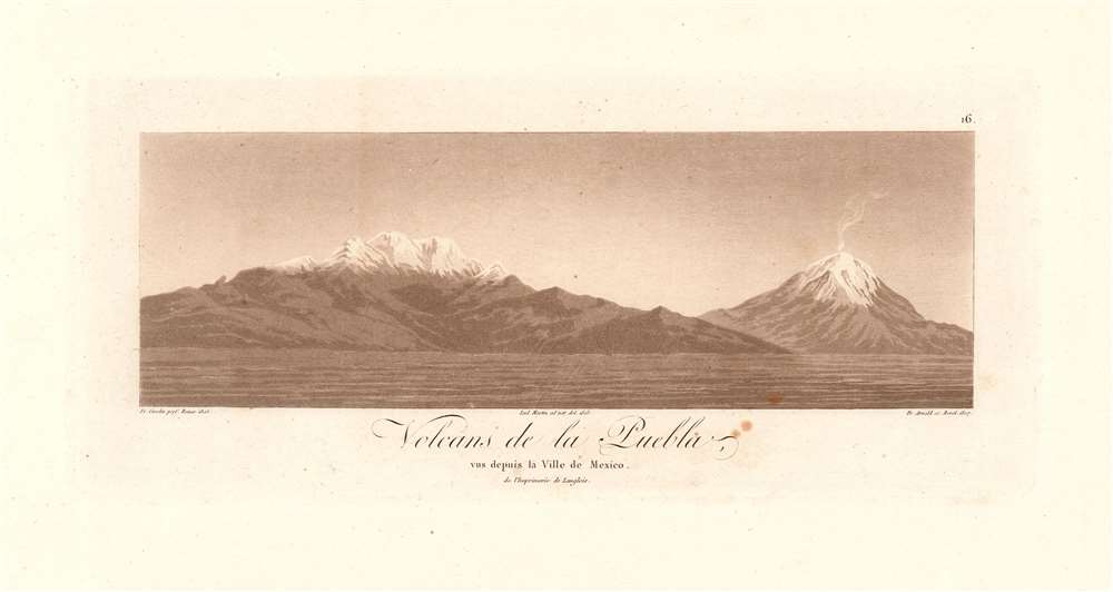
Volcans de la Puebla, vus depuis la Ville de Mexico de l'Imprimerie de Langlois.
sold
- Digital Map Information
- Suitable for large format printing
- DPI: 600
- File Size: 4.58 MB
- File Type: ZIP / TIFF
- ICC color profile embedded
- Delivered instantly via download link
This scarce 1811 aquatint presents an attractive and quite recognizable view of the mountains of Iztaccihuatl and Popocatepetl, the enormous Mexican volcanoes between Mexico City and Puebla, seen here from the north. The view would have been one the great scientist and explorer would have seen during his 1804 journey between Mexico and Veracruz. The aquatint was based on a drawing by Lud Martin in 1803; the engraving credits the artist as having drawn it from life, and it shows every sign of having been so executed: including the wisps of smoke rising from Popocatepetl's summit. Sadly, about the artist Martin - likely, Don Louis Martin, credited for work on several of Humboldt's maps - the historical record is silent. (more details)