
Features a detailed depiction of the Persian Gulf coast, including Bahrain, Qatar, and the U.A.E.
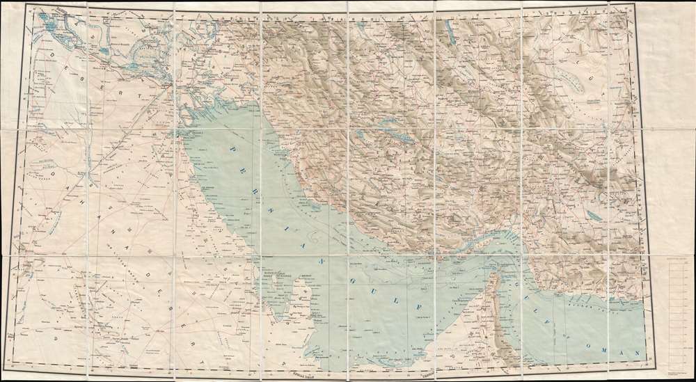
Persia, Arabia, and Turkey in Asia.
sold
- Digital Map Information
- Suitable for large format printing
- File Size: 13.69 MB
- File Type: ZIP / TIFF
- ICC color profile embedded
- Delivered instantly via download link
This is a 1930 Survey of India map of the Middle East on a conic projection. Featuring a highly detailed depiction of the coast of the Persian Gulf, the map illustrates the region from Saudi Arabia and Iraq to eastern Iran and from Yazid in Iran to United Arab ... (more details)
Rare Lee Corporation advertisement featuring heroes and villians of the American Old West.

The Lee Pictorial Map of the Old West.
sold
- Digital Map Information
- Suitable for large format printing
- File Size: 34.63 MB
- File Type: ZIP / TIFF
- ICC color profile embedded
- Delivered instantly via download link
This c. 1970 Lee Pictorial Map of the Old West depicts the entire United States. This map is apparently an advertisement for the Lee Corporation drawn by graphic artist Charles Varner. The map of the United States is framed by photographs and sketches of the ... (more details)
Depicts the 'Great Circle' - verso covered in military aviation information.

Global Map for Global War and Global Peace.
sold
- Digital Map Information
- Suitable for large format printing
- File Size: 22.66 MB
- File Type: ZIP / TIFF
- ICC color profile embedded
- Delivered instantly via download link
This is a 1943 Antonio Petruccelli and Aluminum Company of America map of the world. The map utilizes the Azimuthal Equidistant Projection, or the North Pole Projection. Created with the purpose of illustrating true distances traveled by air, this projection ... (more details)
Features a large inset map of San Francisco.
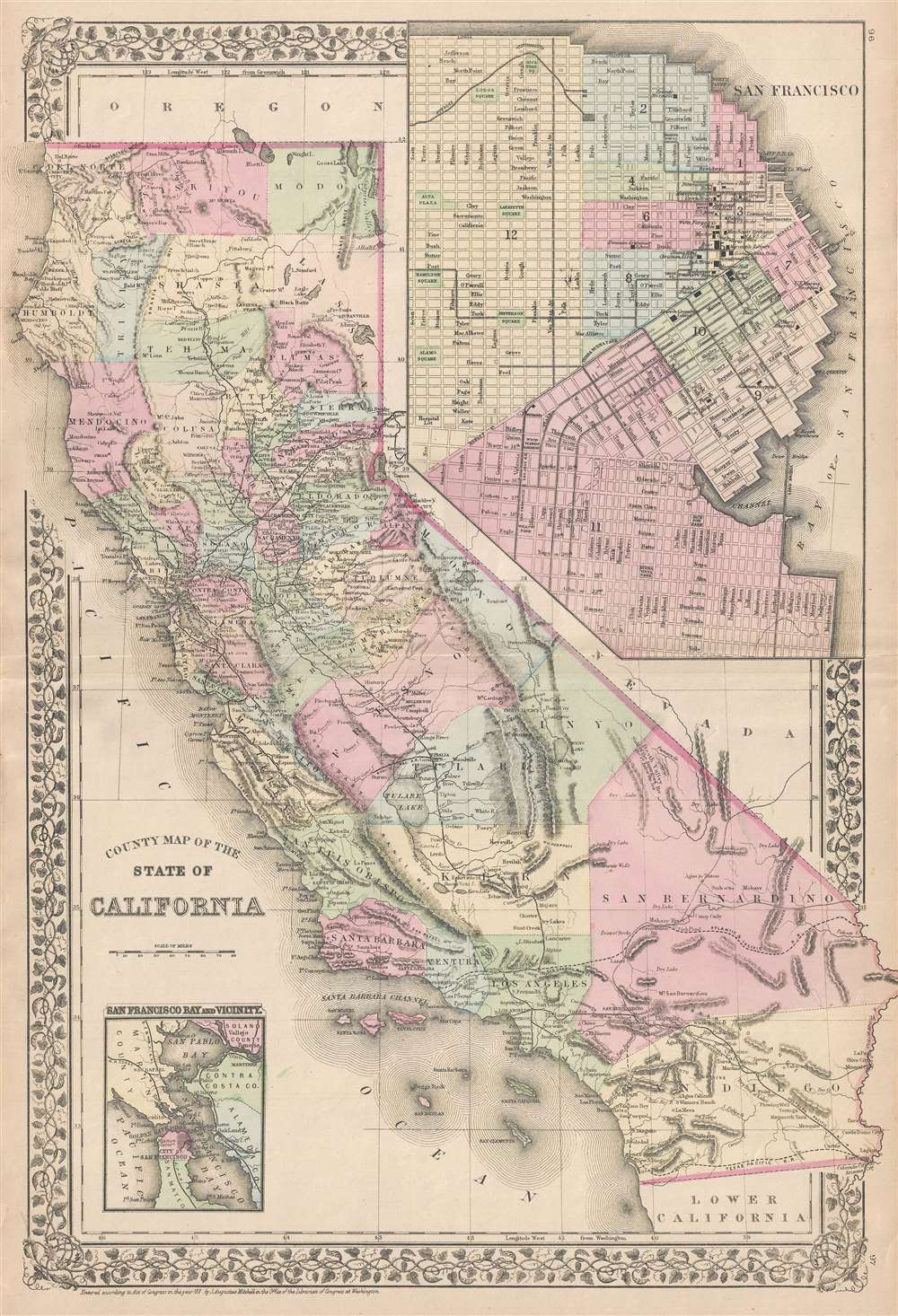
County Map of the State of California.
sold
- Digital Map Information
- Suitable for large format printing
- File Size: 8.34 MB
- File Type: ZIP / TIFF
- ICC color profile embedded
- Delivered instantly via download link
This is an 1881 S.A. Mitchell, Jr. map of California. The map depicts the state from the Pacific Ocean to Nevada and from Oregon to Baja California. Highly detailed, myriad cities and towns are labeled throughout the state. Counties are illustrated, labeled, ... (more details)
One of the most attractive American atlas maps of Washington D.C. to appear in the mid-19th century.
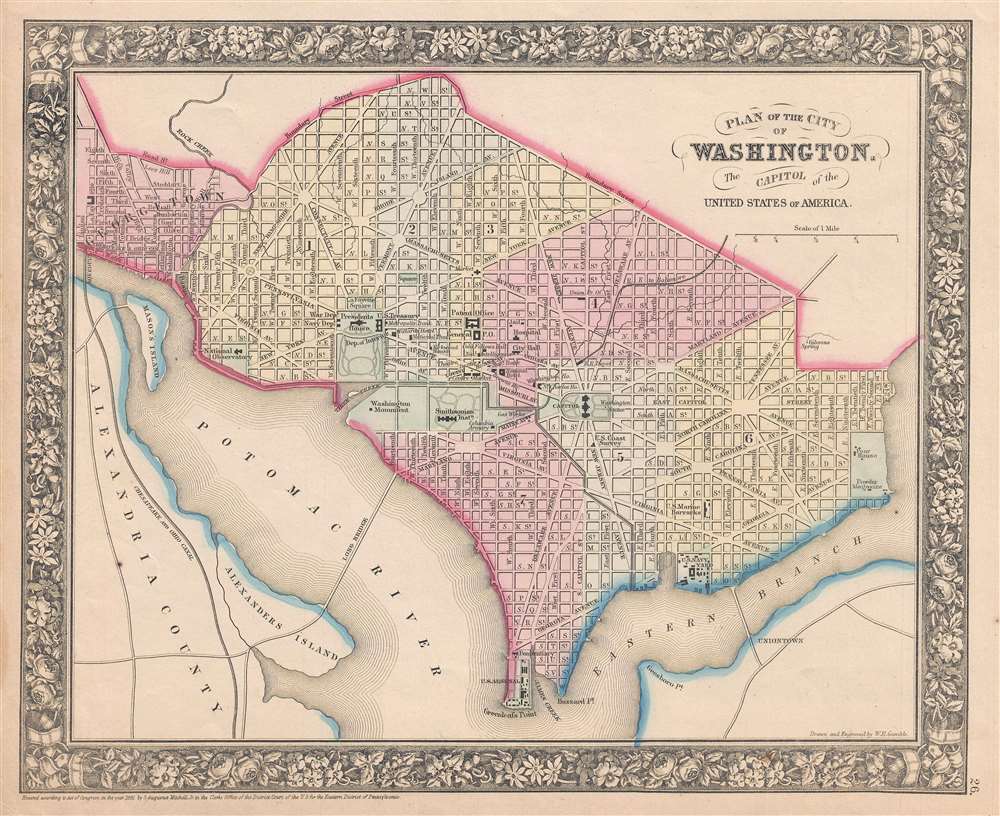
Plan of the City of Washington, The Capitol of the United States of America.
sold
- Digital Map Information
- Suitable for large format printing
- File Size: 4.24 MB
- File Type: ZIP / TIFF
- ICC color profile embedded
- Delivered instantly via download link
This is an 1861 S.A. Mitchell, Jr. city map or plan of Washington, D.C. The map depicts the city from Georgetown to the Anacostia River (Eastern Branch) and from Boundary Street to Greenleafs Point and the confluence of the Anacostia and Potomac Rivers. ... (more details)
A detailed city map of Berlin featuring a profile sketch of the Brandenburg Gate.
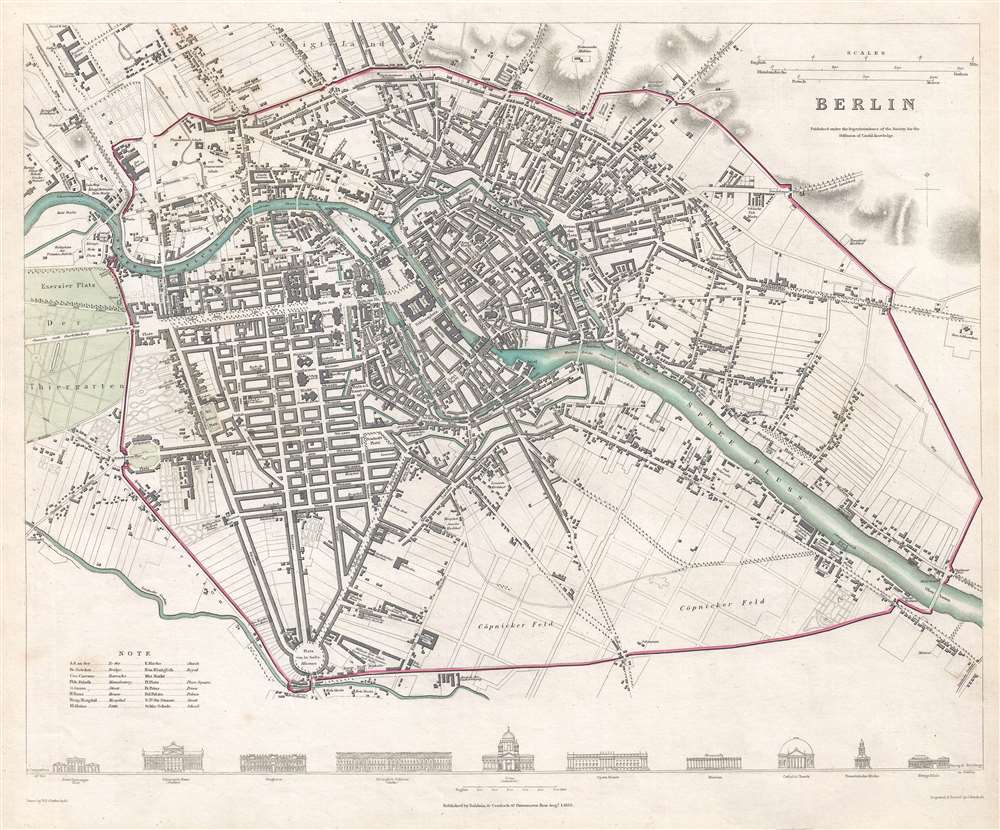
Berlin.
sold
- Digital Map Information
- Suitable for large format printing
- Full resolution TIFF file
- ICC color profile embedded
- Delivered instantly via download link
This is an 1833 Society for the Diffusion of Useful Knowledge city map or plan of Berlin, Germany. Centered on the island in the middle of the Spree River, the map depicts the city from the Voigtland district of Berlin to Mehringplatz (labeled here as ... (more details)
Important separate issue map of Chelsea, Manhattan.
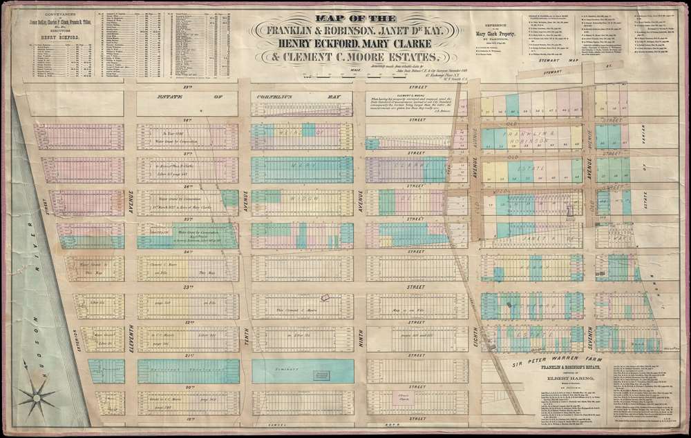
Map of the Franklin and Robinson, Janet De Kay, Henry Eckford, Mary Clarke and Clement C. Moore Estates.
sold
- Digital Map Information
- Suitable for large format printing
- File Size: 20.6 MB
- File Type: ZIP / TIFF
- ICC color profile embedded
- Delivered instantly via download link
A rare and highly detailed separate issue 1869 John Bute Holmes map of the Chelsea neighborhood of Manhattan, New York City. The map covers from the Hudson River to 7th Avenue and from 19th to 29th street. Like all of Holmes' important neighborhood maps, the present map focuses on the mid-19th century breakup of the great Manhattan estates into property lots. In the present example the focuses on the estates of Franklin, Robinson, heiress Janet de Kay (1802 - 1854), shipbuilder Henry Eckford (1775 - 1832), heiress Mary Clarke, and the academic and heir Clement Clarke Moore (1779 - 1863). (more details)
A wonderfully engraved map of the East Indies.
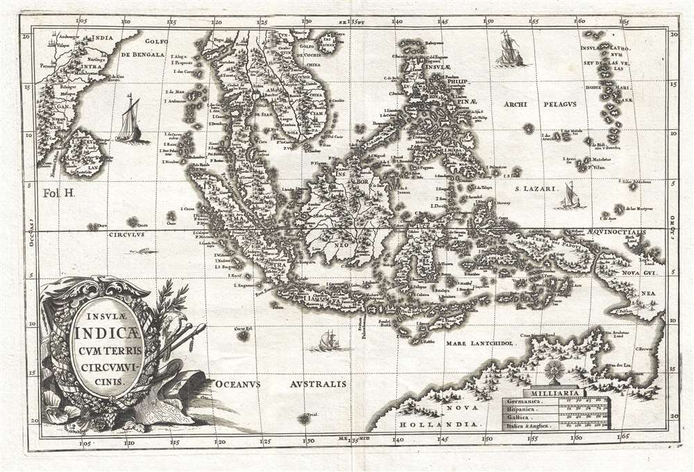
Insulae Indicae Cum Terris Circumvicinis.
sold
- Digital Map Information
- Suitable for large format printing
- DPI: 300
- File Size: 4.83 MB
- File Type: ZIP / TIFF
- ICC color profile embedded
- Delivered instantly via download link
This is a c. 1703 Heinrich Scherer map of Southeast Asia and the East Indies. The map depicts the region from India and Sri Lanka to the Marianas and New Guinea and from Hainan to northern Australia. Islands throughout the region are labeled, ... (more details)
Remarkable political satire ridiculing Davy Crockett!
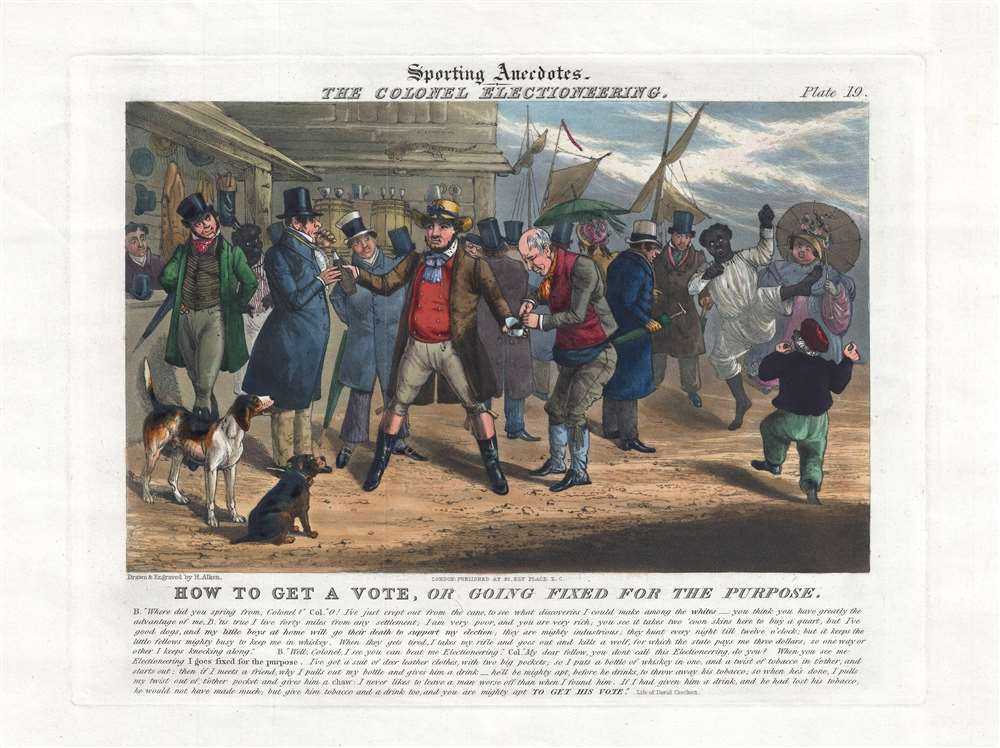
The Colonel Electioneering. How to Get a Vote, or Going Fixed for the Purpose.
sold
- Digital Map Information
- Suitable for large format printing
- DPI: 300
- File Size: 5.35 MB
- File Type: ZIP / TIFF
- ICC color profile embedded
- Delivered instantly via download link
This rare and finely executed c. 1830 - 1835 satirical print illustrates the British perspective on American campaigning or 'Electioneering'. The focus of the print is David 'Davy' Crockett (August 17, 1786 – March 6, 1836), by then already a legendary American figure for his often-exaggerated frontier adventures. Here, Crockett embodies the British perspective on the American politician as an uneducated, tobacco chewing, corrupt drunkard - as well as propagates general British misconceptions about the Americas themselves. (more details)
Homorous pictorial map of San Diego.
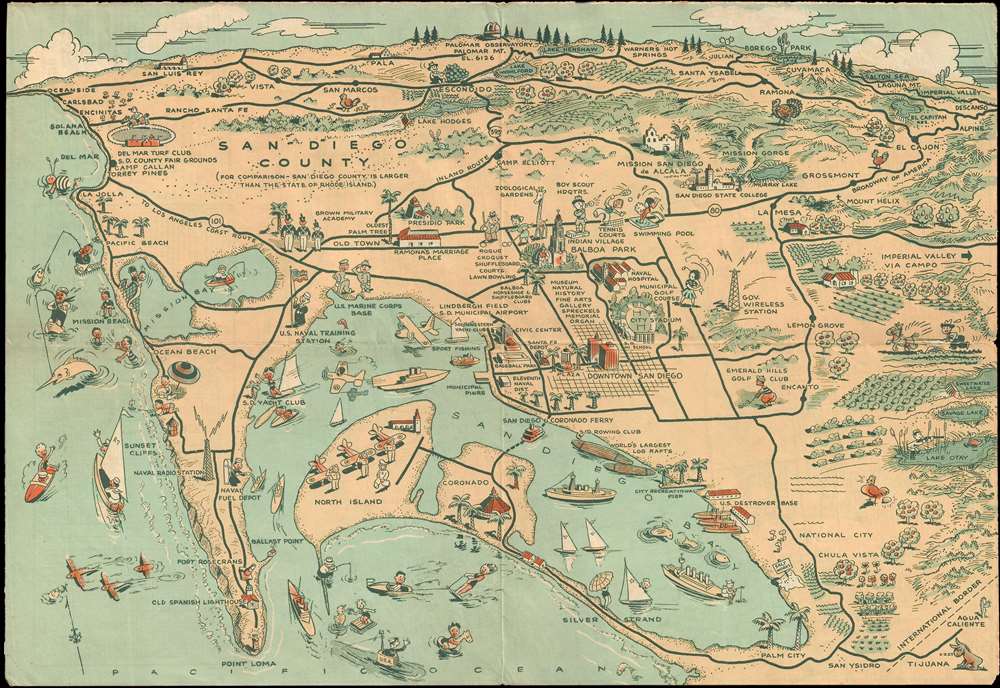
Map of San Diego California Citiy and County.
sold
- Digital Map Information
- Suitable for large format printing
- File Size: 3.9 MB
- File Type: ZIP / TIFF
- ICC color profile embedded
- Delivered instantly via download link
This humorous pictorial map of San Diego was prepared for Lowell E. Jones in 1935. The map covers San Diego county, from Oceanside to Descanso and from Palomar Observatory to Palm City and Point Loma. The map features numerus pictorial ... (more details)
A highly detailed map of the Pacific Northwest that predates the establishment of the Oregon Territory.
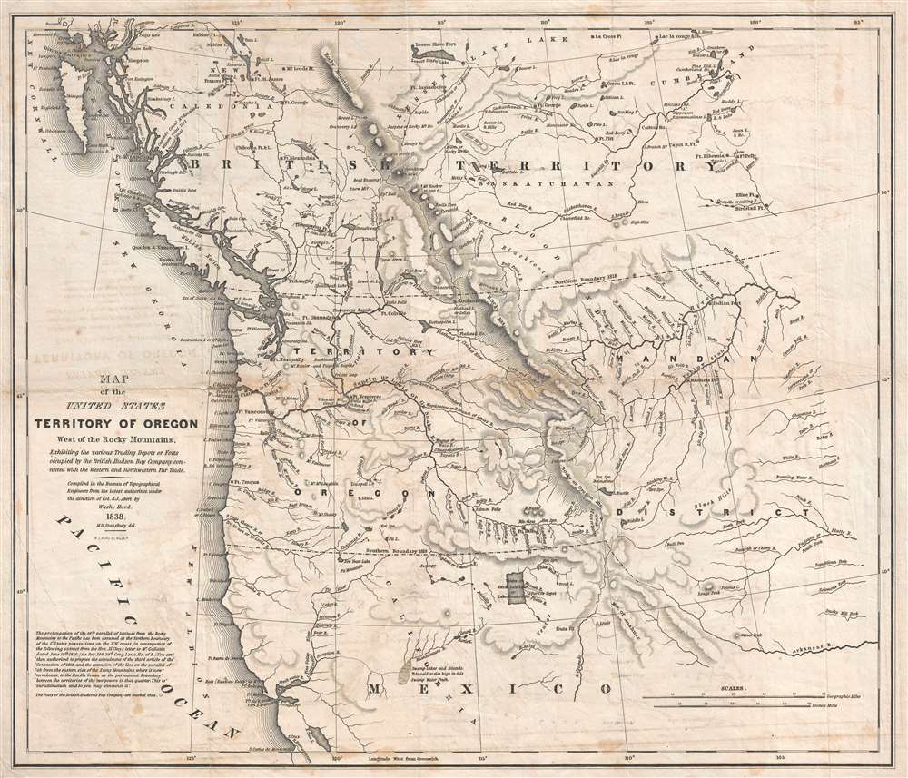
Map of the United States Territory of Oregon West of the Rocky Mountains, Exhibiting the various Trading Depots or Forts occupied by the British Hudson Bay Company, connected with the Western and northwestern Fur Trade.
sold
- Digital Map Information
- Suitable for large format printing
- DPI: 300
- File Size: 10.56 MB
- File Type: ZIP / TIFF
- ICC color profile embedded
- Delivered instantly via download link
This is an important and scarce 1838 map of the Oregon Territory by Captain Washington Hood. Prepared to 'illustrate the report of Senator Linn on a Bill to authorize the President to occupy the Oregon Territory', this map covers ... (more details)
Unusual early 19th century attempt to reconcile De Fonte with Cook and Vancouver
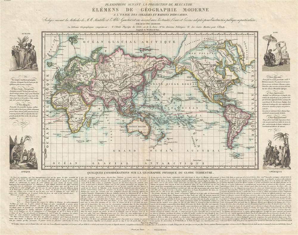
Planisphère suivant la projection de Mercator, Élémens de Géographie Moderne a l'usage des Collèges et Maisons d'Éducation, Redigés suivant la Methodes de MM Mentelle et l'Abbé Gautier; et en accord avec les traités, Cours et Leçons adoptés pour l'instruction publique ou particulière.
sold
- Digital Map Information
- Suitable for large format printing
- DPI: 300
- File Size: 8.58 MB
- File Type: ZIP / TIFF
- ICC color profile embedded
- Delivered instantly via download link
An uncommon and attractive c. 1830 map of the world by the French map and atlas publisher Augustin Legrand illustrating several speculative northwest passages and submarine topography. Set on a Mercator Projection, the map is centered on the Pacific and includes the entire world with the exception of the extreme Arctic and Antarctic regions. The map proper is surrounded by allegorical imagery and extensive textual annotation. (more details)
A milestone in the history of cartography marking a transition to the more `rational' 18th century approach.

Diversa Orbis Terrae. Visu Incedente per Coluros Tropicorum, Ambos Ejus Polos, Et Particularis Sphaerae Zenithm In Planum Orthographica Projectio. / Pla Ontwer van verschey de Aert-Klooten…
sold
- Digital Map Information
- Suitable for large format printing
- DPI: 300
- File Size: 15.44 MB
- File Type: ZIP / TIFF
- ICC color profile embedded
- Delivered instantly via download link
This is a 1706 Pieter Schenk map of the world in a double hemisphere projection, with the western hemisphere on the left and the eastern hemisphere on the right. Based on Carel Allard's map of 1696, this map, along with the Allard map, represent a noteworthy shift away from the traditional decorative margins populated by mythological figures and references toward a much more scientific appearance. Here we find only two small groups of cherubs placed in between the two largest hemispheres, with the decorative border replaced by eight smaller projections depicting the world from different angles and four even smaller diagrams.
Several intriguing aspects of cartography are present here, including California as an island and Terra Esonis, a vestige from the previous century believed to be a continuous land bridge from the semi-mythical Strait of Anian to Asia. It is also important to note the presence of the mythical Laguna de Xarayes and the fact that Australia, depicted in the lower right portion of the Eastern Hemisphere, is not complete. This incomplete depiction of Australia also appears in the smaller map in the upper left corner, and the map in the middle of series of five maps along the bottom border. In the latter two, New Zealand is illustrated and labeled, though only partially. It is also of note that no Great Southern Continent is included, as it was believed that the existence of a large southern continent was necessitated by Asia to balance the globe. (more details)
Several intriguing aspects of cartography are present here, including California as an island and Terra Esonis, a vestige from the previous century believed to be a continuous land bridge from the semi-mythical Strait of Anian to Asia. It is also important to note the presence of the mythical Laguna de Xarayes and the fact that Australia, depicted in the lower right portion of the Eastern Hemisphere, is not complete. This incomplete depiction of Australia also appears in the smaller map in the upper left corner, and the map in the middle of series of five maps along the bottom border. In the latter two, New Zealand is illustrated and labeled, though only partially. It is also of note that no Great Southern Continent is included, as it was believed that the existence of a large southern continent was necessitated by Asia to balance the globe. (more details)
Rare 19th century nautical chart of Northern Malaysia and the Strait of Malacca.
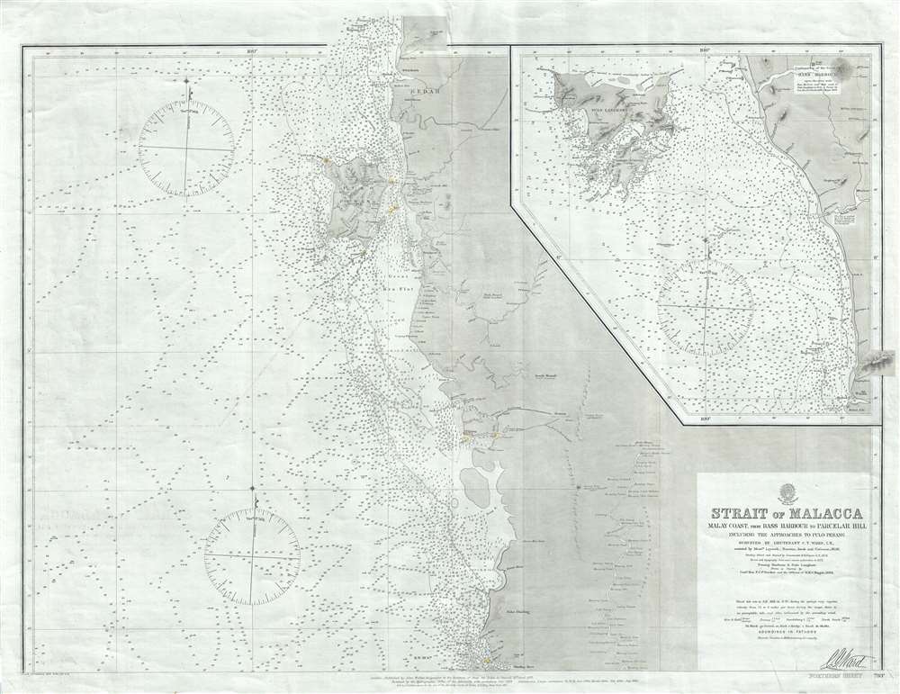
Strait of Malacca Malay Coast, from Bass Harbour to Parcelar Hill Including the Approaches to Pulo Penang.
sold
- Digital Map Information
- Suitable for large format printing
- File Size: 95.53 MB
- File Type: ZIP / TIFF
- ICC color profile embedded
- Delivered instantly via download link
A rare 1889 British Admiralty nautical chart or maritime map of the northern part of the Strait of Malacca, including the island of Penang (Georgetown). The map covers the western shore of the Malay Peninsula from Kedah to the mouth of the Dinding River, in modern day Perak. An inset on the upper right continues along the coast northward to include the Andaman Sea archipelago of Langkawi, known as the Jewel of Kedah. Pulo Penang, Malaysia's modern cay culinary capital, features prominently in the northern quadrants of the map. There is minimal inland detail in general, but he course of the Perak river is detailed as far north as Kuala Kangsar, Perak's royal town. (more details)
Singapore is criiously attached to the Malay Peninsula.
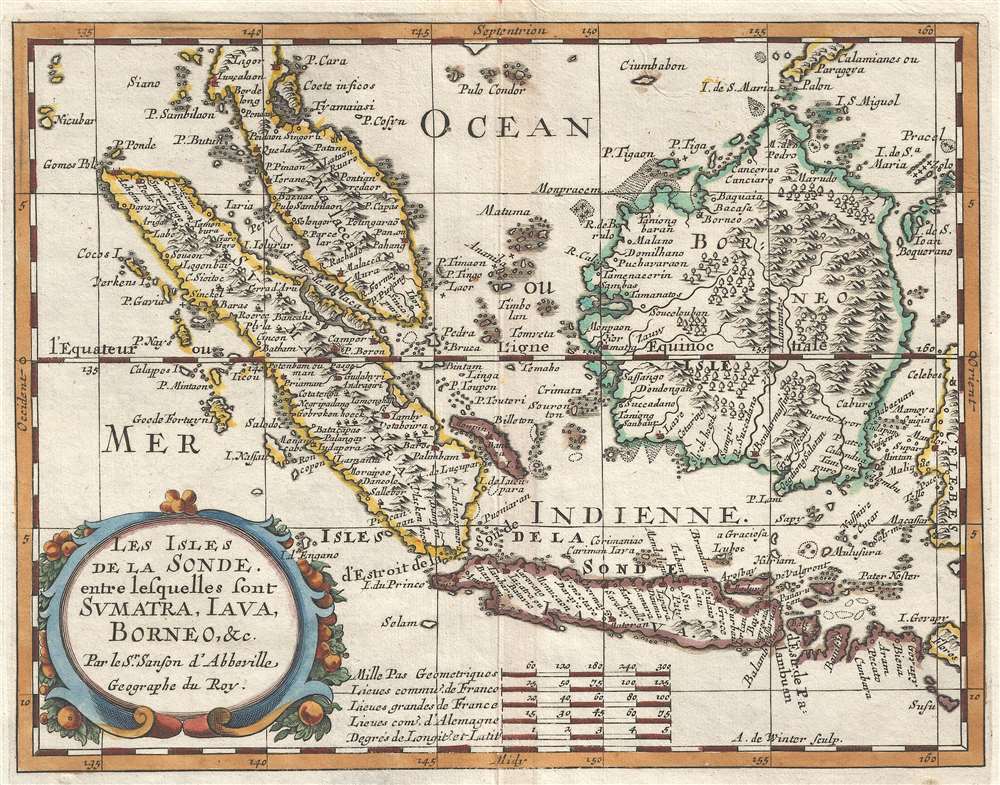
Les Isles de la Sonde entre lesquelles sont Sumatra, Java, Borneo, etc.
sold
- Digital Map Information
- Suitable for large format printing
- DPI: 300
- File Size: 2.03 MB
- File Type: ZIP / TIFF
- ICC color profile embedded
- Delivered instantly via download link
This is a 1657 Nicolas Sanson D'Abbeville map of the East Indies. The map depicts the region from the Indian Ocean to Celebes and from Malay Peninsula to Java. Highly detailed, myriad locations throughout the region are labeled, ... (more details)
A 360-degree view from the top of the Großer Inselsberg in the Thuringian Forest in Germany.
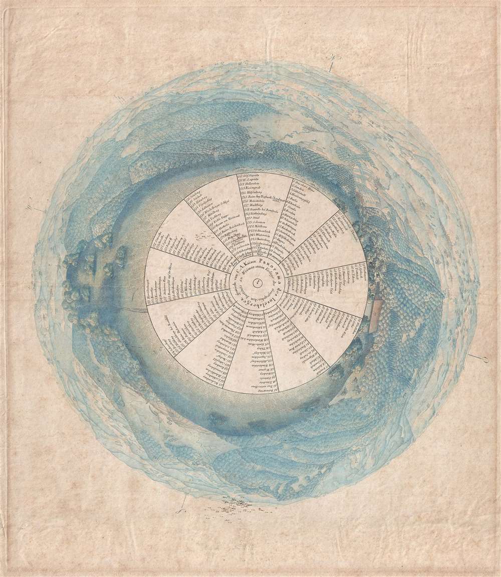
Panorama des Inselsberges.
sold
- Digital Map Information
- Suitable for large format printing
- DPI: 300
- File Size: 10.96 MB
- File Type: ZIP / TIFF
- ICC color profile embedded
- Delivered instantly via download link
This is an 1823 C.A. Kaiser panorama view from the top of the Grosser Inselsberg, the highest mountain in German's Thuringian Forest. A fully 360-degree view colored a brilliant blue, 228 different locations are numerically ... (more details)
Thematic map of the world's ocean currents and wind patterns.
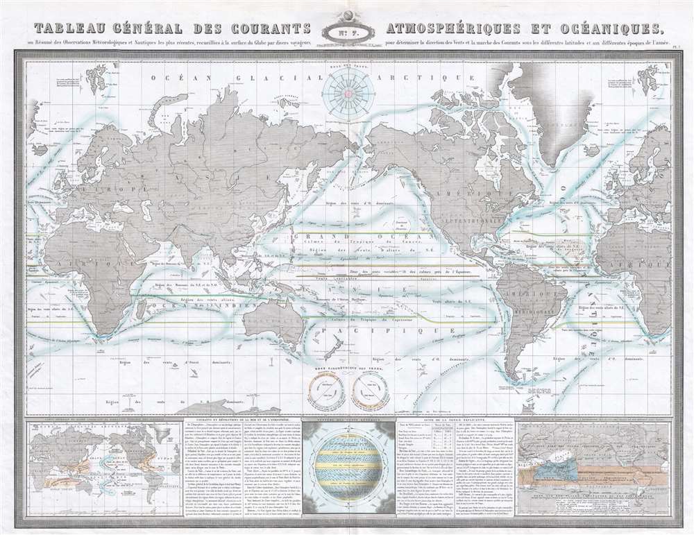
Tableau Général des Courants Atmosphériques et Océaniques, ou Résumé des Observations Meteorologiques et Nautique les plus récentes, recueillies à la surface du Globe par divers voyageurs, pour déterminer la direction des Vents et la marche des Courants sous les différentes latitudes et aux différentes époques de l'année.
sold
- Digital Map Information
- Suitable for large format printing
- File Size: 21.01 MB
- File Type: ZIP / TIFF
- ICC color profile embedded
- Delivered instantly via download link
This is an 1860 F.A. Garnier thematic map of the world's winds and ocean currents. The map depicts the world from Greenland across Europe and Asia to the Pacific Ocean and the Americas and then across the Atlantic Ocean to ... (more details)
Historically intriguing map overlaying French and English land grants along Lake Champlain.
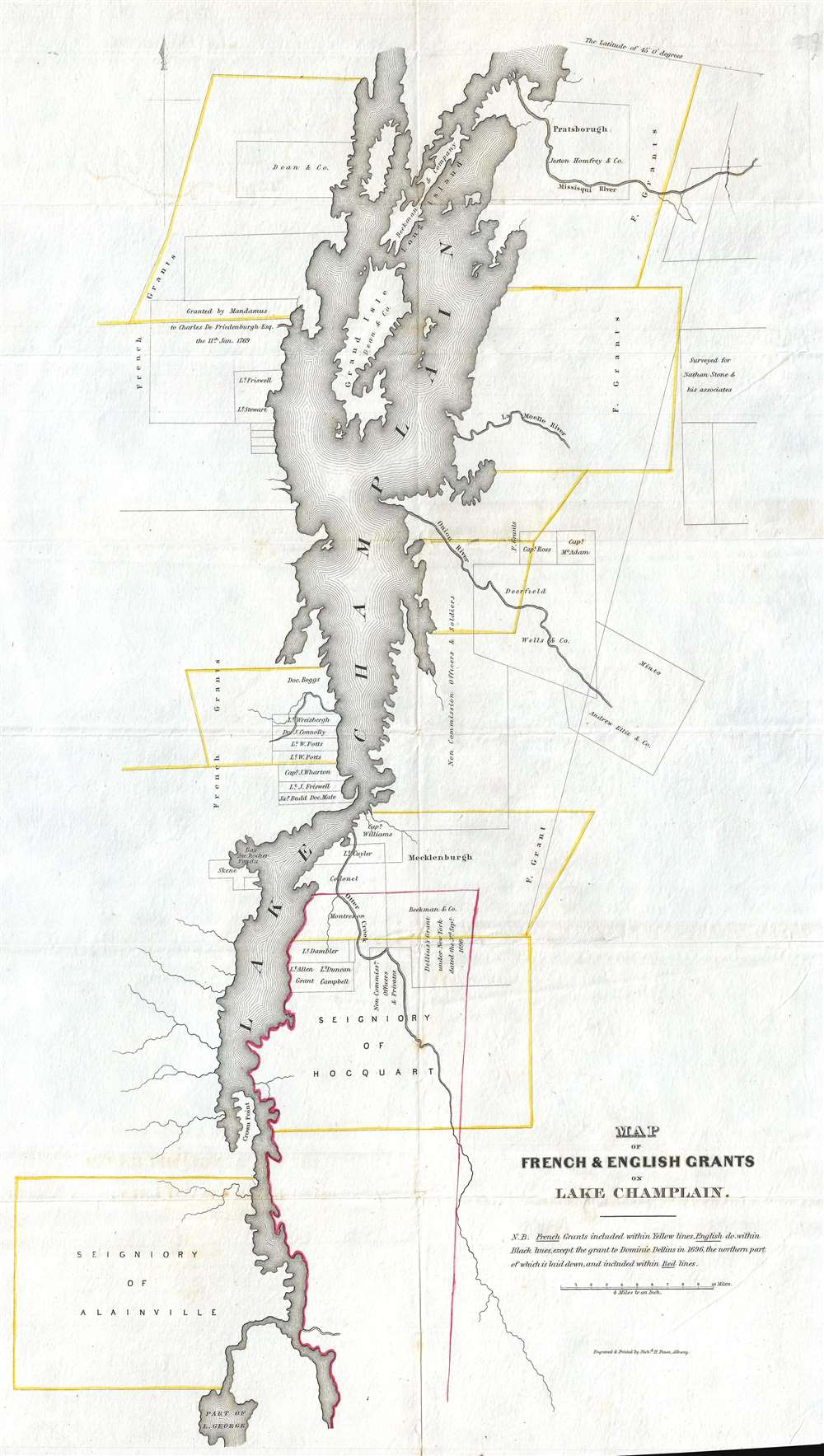
Map of French and English Grants on Lake Champlain.
sold
- Digital Map Information
- Suitable for large format printing
- DPI: 300
- File Size: 3.78 MB
- File Type: ZIP / TIFF
- ICC color profile embedded
- Delivered instantly via download link
This is an 1851 Richard H. Pease map of Lake Champlain. The map depicts Lake Champlain from the extreme northern end of Lake George to 45° 0' latitude and a certain amount of land on either side of the lake. French and ... (more details)
Features an advertisement for Cape Cod's first theatre - the Idle Hour.

[Cape Cod.]
sold
- Digital Map Information
- Suitable for large format printing
- File Size: 8 MB
- File Type: ZIP / TIFF
- ICC color profile embedded
- Delivered instantly via download link
This is a c. 1925 map of Cape Cod framed by local advertisements. The map depicts the region from New Bedford to the Atlantic Ocean and from Race Point to Martha's Vineyard and Nantucket. Placed at the center of this broadside, towns throughout Cape Cod and further west into Massachusetts are labeled, including Plymouth, Falmouth, Hyannis, Chatham, Woods Hole, and Provincetown. Major roads are illustrated in red. The highlight of the broadside is the local advertising framing the central map. Promotions for pharmacies, real estate agents, hotels, inns, banks, the Sears dry goods store, gift shops, and antique dealers are all included, along with many more. (more details)
Dates from just after the Mexican-American War and just before the California Gold Rush and illustrates Texas at its fullest.
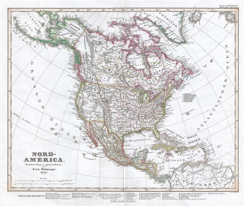
Nord-America. Entworfen u. gezeichnet von F. von Stulpnagel. 1848.
sold
- Digital Map Information
- Suitable for large format printing
- DPI: 300
- File Size: 5.66 MB
- File Type: ZIP / TIFF
- ICC color profile embedded
- Delivered instantly via download link
This is an 1848 Adolf Stieler map of North America just after the Mexican-American War and near the beginning of the California Gold Rush. It also features a depiction of Texas at its largest, with boundaries extending ... (more details)