
Asian Cities (sold)
Extraordinary manuscript map collection of Taiwan and Fujian relating to the 1874 Punitive Expedition and the cartography of Le Gendre.
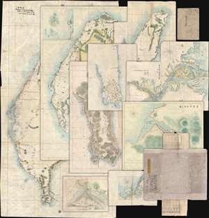
[Taiwan Manuscript Map Collection relating to 1874 Taiwan Punitive Expedition.]
sold
- Digital Map Information
- Suitable for large format printing
- Full resolution TIFF file
- ICC color profile embedded
- Delivered instantly via download link
An extraordinary collection of nine 1874 manuscript maps detailing Taiwan and part of Fujian province, China. The maps were compiled and drafted by one, Sudo Katsuzō (湏藤 or 湏藤勝三) of Tochigi Prefecture, Japan, on an official or semi-official 1874 mission to Taiwan and thence to mainland China. Most of the maps in this set were compiled between March of and June of 1874 and are related to the 1871 Mundan Incident and the subsequent 1874 Taiwan Punitive Expedition. The Taiwan maps are primarily derived from maps drawn by the American Consul to Qing Taiwan Charles William (Guillaum) Joseph Émile Le Gendre's (August 26, 1830 - September 1, 1899) between 1867 and 1873. Others, particularly those of mainland china and Tamsui, are derived from British Admiralty Hydrographic Charts. In addition to the manuscript maps, the collection also contains its original binder and Sudo's application booklet requesting permission to travel from Taiwan to Fujian and Shanghai. (more details)
Earliest view of Tsingtao or Qingdao - drawn shortly after the German takeover.
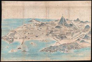
[Tsingtao]
sold
- Digital Map Information
- Suitable for large format printing
- File Size: 78.87 MB
- File Type: ZIP / TIFF
- ICC color profile embedded
- Delivered instantly via download link
This is an outstanding c. 1899 Chinese manuscript view of the city of Qingdao (Tsingtao), China, as it appeared early in the German colonial period. It is hand-painted by an unknown Chinese artist on silk and represents the earliest known image of Qingdao. (more details)
One of the earliest printed maps of Shanghai and the first Japanese map of Shanghai.
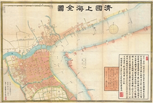
清國上海全圖 / Shinkoku shanhai zenzu. / Qīng guó shànghǎi quán tú. / Qing Shanghai Full Map.
sold
- Digital Map Information
- Suitable for large format printing
- File Size: 29.06 MB
- File Type: ZIP / TIFF
- ICC color profile embedded
- Delivered instantly via download link
An extraordinary discovery, this is the first Japanese map of Shanghai, China, and one of the earliest printed maps of Shanghai. Published in 1873, or Meiji 6, this large format map covers Qing Shanghai's old foreign district. From the conflux of the Huangpu ... (more details)
Center of Qing Power on Taiwan.
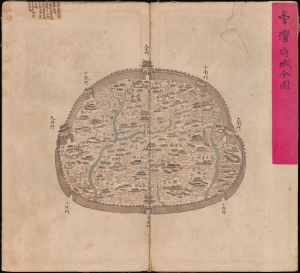
台灣府城全圖 / [Complete Map of the Walled City of Taiwan-fu].
sold
- Digital Map Information
- Suitable for large format printing
- Full resolution TIFF file
- ICC color profile embedded
- Delivered instantly via download link
A remarkable find, this unrecorded c. 1830 manuscript map presents a detailed catalog of Tainan, Taiwan, when the city served as the Qing administrative capital of the island, known as Taiwan-fu. (more details)
Belcher's influential chart is considered the first British Map of Hong Kong.
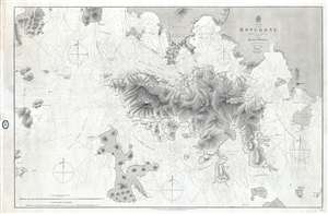
China Hong Kong Surveyed by Captn. Sir Edward Belcher in H.M.S. Sulphur 1841.
sold
- Digital Map Information
- Suitable for large format printing
- File Size: 25.14 MB
- File Type: ZIP / TIFF
- ICC color profile embedded
- Delivered instantly via download link
An iconic map of the utmost importance and rarity, this is the 1864 issue of Edward Belcher's 1843 nautical map of Hong Kong (香港) and vicinity. Belcher's 1841 study is the first detailed British survey of Hong Kong and played a significant role in the ... (more details)
One of a kind manuscript map illustrating Tongyeong, an important South Korean city and former naval fort.
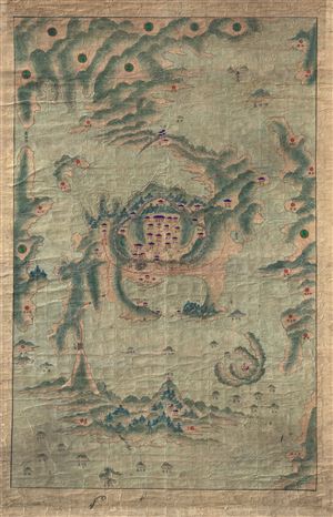
[Tongyeong]
sold
- Digital Map Information
- Suitable for large format printing
- DPI: 300
- File Size: 40.7 MB
- File Type: ZIP / TIFF
- ICC color profile embedded
- Delivered instantly via download link
A scarce early 19th century Korean map of the famous naval base at Tongyeong. The map covers the old naval base, at center, as well as many of the surrounding islands and seas. As with many East Asian maps of this period there is no defined scale. More ... (more details)
The best, largest, and most important map of Beijing made before World War II.
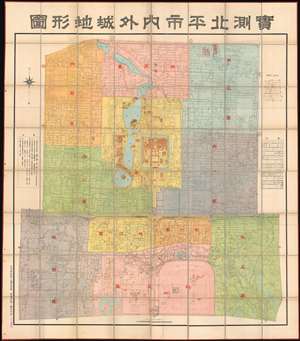
Surveyed Map of Inner City and Outer City, Beijing. /實測北平市内外城地形圖
sold
- Digital Map Information
- Suitable for large format printing
- Full resolution TIFF file
- ICC color profile embedded
- Delivered instantly via download link
The best, largest, and most important map of Beijing made before World War II. This is an astounding wall-sized Republic of China era administrative map of Beijing (Beiping) dating to January 1937 (Mingou 26). This map was issued just months before the Marco Polo Bridge Incident, the Battle of Beiping-Tianjin, the opening of the Second Sino Japanese War, and the subsequent Japanese occupation of Beijing. Measuring 85.5 x 79.5 in (217.17 x 201.93 cm), this enormous work is the largest and most detailed map of Beijing (or Beiping) yet produced. When commissioned by 21st Beijing mayor Yuan Liang (袁良, 1882–1953), more than 10 years had passed since the last major map of Beijing was issued - which was both on a smaller scale and inaccurate. (more details)
The first printing of the most authoritative and influential map of the siege of the British Legation in Peking (Beijing) during the Boxer Rebellion. Printed in Beijing!
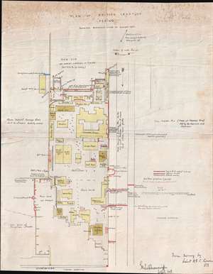
Plan of British Legation Peking shewing defences June to August 1900.
sold
- Digital Map Information
- Suitable for large format printing
- File Size: 6.79 MB
- File Type: ZIP / TIFF
- ICC color profile embedded
- Delivered instantly via download link
An otherwise unobtainable rarity of the utmost historical importance produced in Beijing in the aftermath of the 1900 Boxer Rebellion (Yihetuan Movement, 義和團運動). This is the first, largest, and best official map Beijing's British Legation to illustrate the events of the Boxer Rebellion (1899 - 1901) and the siege of the Legation Quarter.
The map is the product of meticulous on-site surveys and post-siege interviews conducted by British Engineer Henry Edward Colvin Cowie. When the Boxer Rebellion laid siege to the Beijing Legation Quarter, Cowie was drafted from his civilian position with the Indian Public Works Department and sent to Beijing as part of the Bombay Sappers and Miners contingent of the China Relief Expedition. The map was printed on site and bears the Bo. S. and M. (Bombay Sapper's and Miners) imprint, suggesting it was printed with field lithography equipment carried with the Relief Expedition. This is thus the first printing of Cowie's important map and is the source of several subsequent editions which appeared in various influential books and articles on the Boxer Rebellion.
Lithograph signatures of both Lieut. H.E.C. Cowie, and his superior, Lieutenant Colonel George Kenneth Scott-Moncrieff, appear in the lower right. It is also signed in manuscript by Captain Francis Garden Poole (1870 - 1950), an important figure in the defense of the British Legation, this providing the map with an excellent provenance. (more details)
The map is the product of meticulous on-site surveys and post-siege interviews conducted by British Engineer Henry Edward Colvin Cowie. When the Boxer Rebellion laid siege to the Beijing Legation Quarter, Cowie was drafted from his civilian position with the Indian Public Works Department and sent to Beijing as part of the Bombay Sappers and Miners contingent of the China Relief Expedition. The map was printed on site and bears the Bo. S. and M. (Bombay Sapper's and Miners) imprint, suggesting it was printed with field lithography equipment carried with the Relief Expedition. This is thus the first printing of Cowie's important map and is the source of several subsequent editions which appeared in various influential books and articles on the Boxer Rebellion.
Lithograph signatures of both Lieut. H.E.C. Cowie, and his superior, Lieutenant Colonel George Kenneth Scott-Moncrieff, appear in the lower right. It is also signed in manuscript by Captain Francis Garden Poole (1870 - 1950), an important figure in the defense of the British Legation, this providing the map with an excellent provenance. (more details)
The first, best, and earliest map of the Defense of the Legation Quarter during the Boxer Rebellion - original Cyanotype printed in Beijing shortly after the events described.
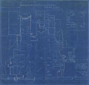
Defence of Foreign Legations, Peking, China, June 20th to Aug. 14th, 1900.
sold
- Digital Map Information
- Suitable for large format printing
- File Size: 26.9 MB
- File Type: ZIP / TIFF
- ICC color profile embedded
- Delivered instantly via download link
A rarity of the utmost historical importance produced in Beijing in the aftermath of the 1900 Boxer Rebellion (Yihetuan Movement, 義和團運動). This is the first, largest, and best official map Beijing's Legation Quarter (Dong Jiaomin Xiang / 東交民巷) to illustrate the events of the Boxer Rebellion (1899 - 1901) and the siege of the Foreign Legations. The map was prepared by the American military engineer Harley Bascom 'Fergie' Ferguson, who was sent to Beijing in 1900 as part of the China Relief Expedition, a multinational emergency force mustered to liberate the besieged legations and suppress the Boxer Rebellion. Produced in cyanotype (blueprint) with Ferguson's own manuscript annotations, this map was issued in miniscule quantities intended only for distribution among military and civilian officials in Beijing – there are only three surviving examples known. Due to the meticulousness and accuracy in illustrating daily progression of the battle, Ferguson's map is today the basis for all subsequent maps of the Legation Quarter's defense. (more details)
The finest British chart of Hong Kong available during the first Opium War.
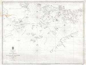
Entrance to the Chou-Kiang or Canton River from the Ouer Islands to Linten.
sold
- Digital Map Information
- Suitable for large format printing
- DPI: 300
- File Size: 6.55 MB
- File Type: ZIP / TIFF
- ICC color profile embedded
- Delivered instantly via download link
A rare and remarkable nautical chart of the utmost significance. This 1840 maritime map of Hong Kong and vicinity is attributed to Captain Daniel Ross, Bombay Marine. During the first Opium War (1839 – 1842), this was the finest and most detailed chart ... (more details)
Remarkable photographic archive illustrating Pre-War China from the perspective of an American navy man. Includes historically unknown images of graphic war events, General Chiang Kai-shek, and Chinese life.
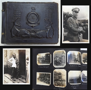
A unique photographic archive covering China and the Philippines in the years of 1927 – 1931, just prior to World War II. The photo archive contains hundreds of photos, loosely arranged thematically and chronologically, following the oriental tour of ... (more details)
A previously unknown early manuscript map of the early vicinity of Saigon or Ho Chi Minh City, Vietnam.
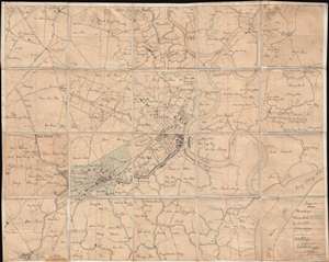
[Saigon and Cholon]
sold
- Digital Map Information
- Suitable for large format printing
- File Size: 40.34 MB
- File Type: ZIP / TIFF
- ICC color profile embedded
- Delivered instantly via download link
The finest and most detailed manuscript map yet discovered illustrating Saigon or Ho Chi Minh City, Vietnam. The map is centered on the center of Saigon City, west of the Song Sai Gon River between the Nhiêu Lộc River and the Bến Nghé River. It ... (more details)
Belcher's influential chart is considered the first British Map of Hong Kong.
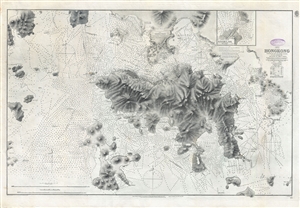
China Hong Kong Surveyed by Captn. Sir Edward Belcher in H.M.S. Sulphur 1841.
sold
- Digital Map Information
- Suitable for large format printing
- File Size: 31.4 MB
- File Type: ZIP / TIFF
- ICC color profile embedded
- Delivered instantly via download link
An iconic map of the utmost importance and rarity, this is the 1890 issue of Edward Belcher's nautical map of Hong Kong (香港) and vicinity. Belcher's 1841 study is considered to be the first British survey of Hong Kong and played a significant role ... (more details)
Remarkable log book of the China Station flagship during and after the Boxer Rebellion.
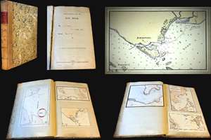
Logbook for use of Junior Officers Afloat. C. V. L. N. / Log Book. Mr. C. V. L. Norcock / H.M.S. Hannibal Glory.
sold
An exceptional and important 1900 – 1902 British naval logbook penned by Charles Vernon Lowcay Norcock (1884 - 1963), an officer in the Royal Navy, recording his experience as a Midshipman on the HMS Glory, flagship of the China Station, in the years of and immediately following the Boxer Rebellion (1899 - 1901). The full logbook covers three ships, recording the voyages of the HMS Hannibal from May to November of 1900; Norcock's subsequent service on the HMS Glory, flagship of the China Station from October of 1900 to January of 1902; and his return voyage to England on the HMS Aurora, from January to February of 1902 - thus covering Norcock's full tour of duty. The content of this volume is exceptionally rich, surpassing most other logbooks, with numerous original manuscript maps of important East Asian ports including Hong Kong, Shanghai, Singapore, Kowloon, Nagasaki, Suez, Valetta, Wusong (Shanghai), Nagasaki, and more. (more details)
Abu Dhabi on the Cusp of Independence and Modernization.
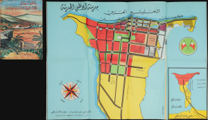
مَدِينَةُ أَبُو ظَبِي الحَدِيثَة [Modern Abu Dhabi City]. / عَامَانِ زَاهِيَان فِي تَارِيخِ إِمَارَةِ أَبُو ظَبِي [Two Glorious Years in the History of the Emirate of Abu Dhabi].
sold
This is a rare 1968 folding map of Abu Dhabi, appearing in the scarce Arabic edition of the Two Glorious Years in the History of the Emirate of Abu Dhabi. The map and book were published in a period of rapid transformation for the emirate, which was preparing for independence and implementing the early phase of a radical modern urban plan. (more details)
Unabashed Japanese ambitions in WWI.
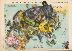
The Illustration of the Graet European War. No. 16. A Humoros Atlas of the World. / 歐洲大戰亂畫報(其十六)滑稽欧亜外交地図.
sold
- Digital Map Information
- Suitable for large format printing
- File Size: 28.45 MB
- File Type: ZIP / TIFF
- ICC color profile embedded
- Delivered instantly via download link
An exceptional September 13, 1914, Japanese serio-comic map of Asia and Europe at the outbreak of World War I. The masterfully drawn chromolithograph map unabashedly illustrates Japanese aspirations to exploit the war in Europe, with underpinning elements of cultural supremacy, imperial ambitions towards China, concern over but contempt for Russia, and grudging respect towards the United States. (more details)
The third episode in the 18th century British mapping of Bombay!
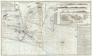
A Plan of Bombay-Harbour on th Coast of Malabar.
sold
- Digital Map Information
- Suitable for large format printing
- Full resolution TIFF file
- ICC color profile embedded
- Delivered instantly via download link
This is a fine example of Laurie and Whittle's 1794 nautical chart or maritime map of Bombay (Mumbai) Island, city, and harbor, India. This map is significant as the third major episode in the mapping of Bombay. The map covers from Salsette Island to ... (more details)
One of the earliest examples of western style Chinese commercial cartography.
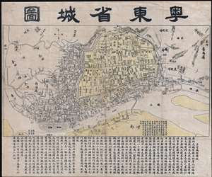
粵東省城圖 / East Guangdong Province City Map. / Yue Dong Sheng Cheng Tu.
sold
- Digital Map Information
- Suitable for large format printing
- Full resolution TIFF file
- ICC color profile embedded
- Delivered instantly via download link
This is a rare Qing Dynasty era Guangxu 26 or 1900 Chinese map of Guangzhou or Canton printed in Guangzhou by the Yangcheng Bookstore (澄天阁点石 / 澄天閣點石書局). It is one of the earliest known examples of Chinese commercial cartography. The map is oriented to the north, looking at the city of Guangzhou from the south side of the Pearl River. The city walls and low mountains are apparent in the distance. Dotted lines on the Pearl Liver indicate river crossings and routes to Haudi (花地). At the base of the map, extensive textual annotation in Chinese describes the development of the city. (more details)
1861 Battle of Shanghai.
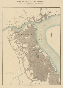
Plan de la Ville de Shanghai avec Les Concessions Étrangères 31, Octobre, 1861.
sold
- Digital Map Information
- Suitable for large format printing
- File Size: 32.6 MB
- File Type: ZIP / TIFF
- ICC color profile embedded
- Delivered instantly via download link
A rare French-language map of Shanghai, China, published in 1861 in the wake of the Battle of Shanghai, the Second Opium War, and the Taiping Rebellion. (more details)
Rare city planning map of Shanghai with mansucript additions of prospective new streets.
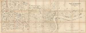
Plan of Shanghai Published under Authority of the Municipal Council. 1923
sold
- Digital Map Information
- Suitable for large format printing
- File Size: 46.17 MB
- File Type: ZIP / TIFF
- ICC color profile embedded
- Delivered instantly via download link
An extremely rare and important 1923 large format map of Shanghai issued by the Shanghai Municipal Council. The map is enormous and extends from the Huangpu River westward as far as the Tianshan Road Residential District. It is in this area that ... (more details)
One of only two known examples outside of China, this rare map illustrates the foreign occupation of Beijing following the Boxer Rebellion.
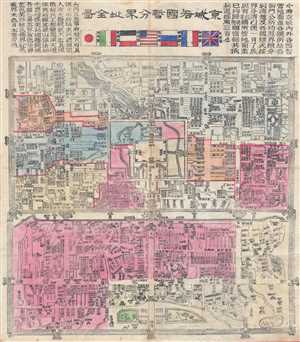
Jīng Chéng Gè Guó Zàn Fēn Jiè Zhǐ Quán Tú / Full Map of Various Foreign Countries' Temporarily Divided Territory Boundaries within the City of Beijing / 京城各國暂分界址全图
sold
- Digital Map Information
- Suitable for large format printing
- File Size: 25.74 MB
- File Type: ZIP / TIFF
- ICC color profile embedded
- Delivered instantly via download link
A map of considerable importance and rarity, this is a 1900 Chinese issue woodcut map illustrating the yearlong occupation of Beijing (Peking) following the suppression of the Boxer Rebellion / Uprising. The title, roughly translated is, 'Full ... (more details)
Guide for White Russian refugees fleeing to Shanghai.
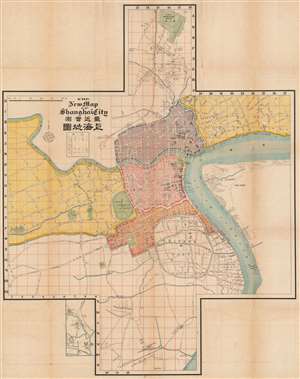
The New Map of Shanghai City / 最新實測上海地圖.
sold
- Digital Map Information
- Suitable for large format printing
- File Size: 153.36 MB
- File Type: ZIP / TIFF
- ICC color profile embedded
- Delivered instantly via download link
This is a rare and intriguing c. 1920 guide and map of Shanghai published by the Russian firm Churin and Co. (Чурин и Ко) to accompany their Russian-language Guide to Shanghai (Путеводитель по Шанхаю). The map is exceptional in several respects, most obviously in its cross-shaped layout. Moreover, although the travel guide is in Russian, the map itself is a combination of Japanese, Chinese, English, and French, reflecting both the cosmopolitan nature of treaty port and this map's ad hoc production process. (more details)
One-of-a-kind map documenting the buildup to the May Thirtieth Movement, the birth of organized labor in modern China, and the beginning-of-the-end of the Unequal Treaties!
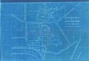
General Plan of No.n 5-7-8-12-15 Mill N.W.K. Shanghai.
sold
- Digital Map Information
- Suitable for large format printing
- File Size: 25.08 MB
- File Type: ZIP / TIFF
- ICC color profile embedded
- Delivered instantly via download link
Recording the beginnings of the May Thirtieth Movement, a pivotal moment in the rise of labor unions and communism, as well as the end of the Unequal Treaties, in pre-war China, this is a striking 1925 cyanotype map of the Nagai Wata Kaisha Cotton Mills (NWK) in Shanghai, just south of Suzhou Creek (or Soochow Creek). Dating to May of 1925, the map focuses on those NWK Mills attached to a series of historic labor strikes against Japanese operated textile mills operating in Shanghai. In specific, manuscript annotations refer to the May 15th event, an armed engagement between workers and Japanese management in which a young Chinese worker, Ku Cheng-hung (顧正紅), was mortally injured. The partially successful strikes led to only marginally improved labor conditions, but can be considered to represent the first stirrings of Communism in Shanghai. The fact that this map is a cyanotype underscores its role as a highly ephemeral production, likely produced to deal with the violence of the strikes. Given the limitations of the cyanotype technique, only about 10 -15 of these were likely made - representing an ephemeral but fundamental moment in Shanghai history. (more details)
Extremely scarce nautical chart of Singapore and Malacca - the most desirable of Horsburgh's influential nautical charts.

To the Honourable The Court of Directors of the United East India Company This Chart of Malacca Strait Singapore Strait and the Southernmost Promontory of Asia Is Inscribed by Their Faithful and Obedient Servant James Horsburgh.
sold
- Digital Map Information
- Suitable for large format printing
- DPI: 300
- File Size: 31.46 MB
- File Type: ZIP / TIFF
- ICC color profile embedded
- Delivered instantly via download link
An extremely scarce 1844 James Horsburgh nautical chart of southern Malaysia, Singapore, and the straits of Malacca and ... (more details)
Rare mid-19th century Qing Map of Beijing printed in China for Chinese government use. Basis for many subsequent maps issued after the Boxer Rebellion.

Jīngchéng nèiwài shǒu shàn quán tú / Premier Full Map of the Capital City's Interior and Exterior / 京城內外首善全圖
sold
- Digital Map Information
- Suitable for large format printing
- DPI: 300
- File Size: 13.93 MB
- File Type: ZIP / TIFF
- ICC color profile embedded
- Delivered instantly via download link
An exceptional c. 1850 Chinese issue Qing Dynasty map of Beijing or Peking, China. This map details the Qing Dynasty ... (more details)
First guidebook to Hong Kong, w/ Maps.
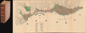
The Treaty Ports of China and Japan. A Complete guide to the Open Ports of Those Countries, Together with Peking, Yedo, Hong Kong and Macao.
sold
- Digital Map Information
- Suitable for large format printing
- Full resolution TIFF file
- ICC color profile embedded
- Delivered instantly via download link
This is the 1867 first edition of Nicholas Belfield Dennys' (c. 1813 - 1899) detailed guide to the Treaty Ports of China and Japan, including a dramatic large map of Victoria, Hong Kong. Intended both for new residents and travelers, it is the first commercially distributed handbook to the post-Opium War Treaty Ports. There are an impressive 29 excellent maps, most fold out, all engraved in Hong Kong. Like the maps, the book was typeset in China, where place names and other content could be set in both English and Chinese. (more details)
Earliest serious British attempt to map the area around Shanghai, China. Surveyed by 'Chinese Gordon' during the Taiping Rebellion.
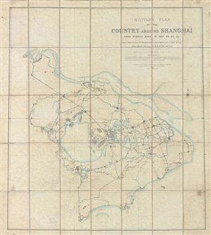
Military Plan of the Country Around Shanghai from Surveys Made in 1862, 63, 64, 65.
sold
- Digital Map Information
- Suitable for large format printing
- File Size: 63.93 MB
- File Type: ZIP / TIFF
- ICC color profile embedded
- Delivered instantly via download link
An extremely scarce 1865 case map illustrating the country around Shanghai, China. This map, by British military ... (more details)
Rare mid-19th Qing Map of Beijing printed in China for Chinese government use. Basis for many subsequent maps issued after the Boxer Rebellion.
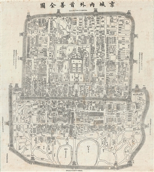
Jīngchéng nèiwài shǒu shàn quán tú / Premier Full Map of the Capital City's Interior and Exterior / 京城內外首善全圖
sold
- Digital Map Information
- Suitable for large format printing
- Full resolution TIFF file
- ICC color profile embedded
- Delivered instantly via download link
An exceptional c. 1867 Chinese issue Qing Dynasty Map of Beijing or Peking, China. This map details the Qing ... (more details)
Rare Chinese Government collection of 45 highly detailed topographical maps of Beijing or Peking, China.

This is an extraordinarily rare set of 45 post-Liberation topographical maps Beijing or Peking, China. They ... (more details)
Opening of Yokohama.
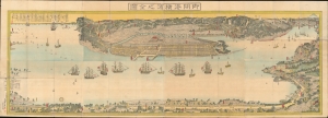
御開港横濱之全圖 / [Complete Map of the Open Port of Yokohama].
sold
- Digital Map Information
- Suitable for large format printing
- File Size: 125.22 MB
- File Type: ZIP / TIFF
- ICC color profile embedded
- Delivered instantly via download link
An epic work by one of Japan's master woodblock printers of the era, this is Utagawa Sadahide's 1859 very large panorama of the port of Yokohama - considered the first and finest early map of Yokohama. Packed with fascinating details, it depicts the city during a period of frenetic development, soon after opening as a treaty port, after which it quickly became the locus of trade and intellectual exchange with the outside world. (more details)
The author's personal copy of an iconic Shanghai hunting map.
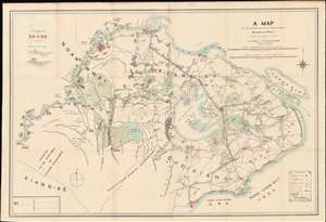
A Map of the Shooting Districts Lying Between Shanghai and Wuhu.
sold
- Digital Map Information
- Suitable for large format printing
- Full resolution TIFF file
- ICC color profile embedded
- Delivered instantly via download link
This Robert Alexis de Villard's own copy of his important 1893 hunting map of Shanghai and its environs. The map was created by de Villard in partnership the renowned sportsman Henling Thomas Wade, for use by expatriate hunting clubs in Shanghai. The map's coverage is expansive, bounded on the north and west by the main course of the Yangtze River, and on the east by Hangchow Bay. It includes from Nanjing (Nanking) and Zhenjiang (Chin-Kiang) to Hangzhou. Most locations are identified in English with Romanized Chinese. Some larger cities and towns, such as Nanjing (Nanking), Zhenjiang (Chin-Kiang), and Hangzhou (Hang-Chow), are also noted in Chinese. (more details)
Remarkable early French map of Singapore representing the forefront of scientific mapping of the region I the 1840s.
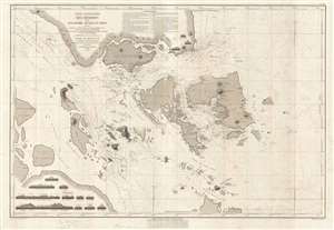
Carte Particulière des Détroits de Singapore, Durian et Rhio.
sold
- Digital Map Information
- Suitable for large format printing
- DPI: 300
- File Size: 22 MB
- File Type: ZIP / TIFF
- ICC color profile embedded
- Delivered instantly via download link
An exceptionally rare nautical chart of Singapore and vicinity issued by Urban Dortet de Tessan, under the ... (more details)