
Asian Cities
First scientific survey of the Islamic holy city of Madinah.

حرم شريف ايله سائر اماكين مباركه وعسكريه وباشلوجه اسواقى كوسترر مدينه منوره شهرينك طپوغرافياى منظمه اصوليله اخذ اولنان خريطه سيدر. / [Map of the Prophet’s Mosque (Haram Sharif) with All Sacred Places, Military Buildings and Main Squares Showing Topography of the City of Medina Al-Munawwarah with a Legend]
$85,000.00
Acquire
- Digital Map Information
- Suitable for large format printing
- File Size: 35.58 MB
- File Type: ZIP / TIFF
- ICC color profile embedded
- Delivered instantly via download link
A seminal map. This large-scale Arabic manuscript map is the first scientific survey of the Islamic holy city of Medina (المدينة المنورة / Madinah), in modern-day Saudi Arabia. The map was compiled for Abd al-Mutalib ibn Ghalib, Emir and Grand Sharif of Mecca, known for his pro-slavery anti-Ottoman positions, as well as for his modernization of infrastructure in both Mecca and Medina. (more details)
First Municipal Council Maps - the origins of modern Shanghai.
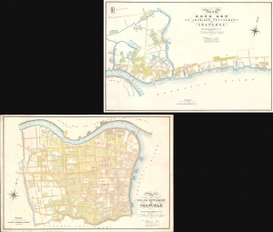
Plan of the English Settlement at Shanghae. / Plan of the Hong Kew (Hong Que.) or American Settlement, at Shanghae.
$45,000.00
Acquire
- Digital Map Information
- Suitable for large format printing
- Full resolution TIFF file
- ICC color profile embedded
- Delivered instantly via download link
The holy grail of Shanghai cartography, this 1866 map set is the most important, largest scale, and most beautiful early presentation of Shanghai. These are the first maps issued by the Shanghai Municipal Council, resulting from a landmark 1864-66 survey that followed the consolidation of the British Concession with the American Settlement. Their issue ended two decades of development lethargy and launched major urbanization and modernization projects that established Shanghai as the major gateway to China. As such, these maps, more than any other, represent the birth of Shanghai as a modern city. (more details)
Foundational manuscript plan of colonial Saigon.
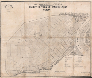
Batiments Civils Projet de Ville de 500,000 Ames Saîgon.
$35,000.00
Acquire
- Digital Map Information
- Suitable for large format printing
- File Size: 36.53 MB
- File Type: ZIP / TIFF
- ICC color profile embedded
- Delivered instantly via download link
This is Lucien Florent Paul Coffyn's 1862 manuscript masterplan of Saigon - the first and most significant map of Saigon (Ho Chi Minh City). Coffyn was the French military engineer tasked with transforming a war-torn fort into a model colonial capital. Following the 1861 French occupation of Saigon, authorities resolved to build a new city on the wartorn site at a monumental scale, reflecting boundless imperial ambition. Coffyn, driven by an unwavering belief in the colony's promise, envisioned a grand, European-style metropolis designed to accommodate half a million residents across 25 square kilometers. The present map - exquisitely drafted and signed by both Coffyn and Vice Admiral Louis Bonard, Governor of Cochinchina - is the likely original manuscript submitted for formal approval. Over the subseqeunt decades, Coffyn's street layout and placement of major sites were implemented with fidelity, though not comprehensively, marking this as the foundational document of colonial Saigon. It stands as a unique testament to French imperial planning and an unparalleled artifact of Asian colonial urbanism. (more details)
First map of the American Concession in Shanghai?
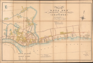
Plan of the Hong Kew (Hong Que.) or American Settlement, at Shanghae.
$19,000.00
Acquire
- Digital Map Information
- Suitable for large format printing
- File Size: 142.69 MB
- File Type: ZIP / TIFF
- ICC color profile embedded
- Delivered instantly via download link
A remarkable, rare, and highly detailed 1866 map of Hong Kew (Hongkou, 虹口区), or the American Concession in Shanghai - possibly the earliest known map to specifically illustrate the American Settlement. The map follows shortly after the formal establishment of the Concession and subsequent International Settlement in 1863 and details in manuscript the construction of subterranean drainage lines by the Shanghai Municipal Council. (more details)
Shanghai at the height of the 'Concession Period.'
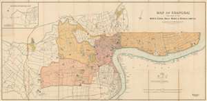
Map of Shanghai Published by the North-China Daily News and Herald, Limited.
$17,500.00
Acquire
- Digital Map Information
- Suitable for large format printing
- File Size: 62.63 MB
- File Type: ZIP / TIFF
- ICC color profile embedded
- Delivered instantly via download link
An extremely rare 1918 North-China Daily News and Herald map of Shanghai, China. Focusing on the Bund and the International Settlement, the map extends from the Shanghai Hangchow Ningpo Railroad in the west to Post Garden and the Standard Oil facility in the east. Derived roughly from the Municipal Council Map of the same year, this map is intensely detailed, with streets, businesses, clubs, parks, government offices, and civic institutions noted. Just outside the International Settlement boundary the Shanghai Jewish Club is noted. (more details)
First printed map of Tabriz.
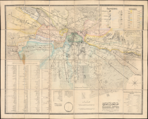
نقشه دارالسلطنه تبریز / [Map of Dār al-Salṭana (the Royal City) Tabriz].
$17,000.00
Acquire
- Digital Map Information
- Suitable for large format printing
- Full resolution TIFF file
- ICC color profile embedded
- Delivered instantly via download link
This rare 1880 Persian-language map of Tabriz, Iran, was prepared by engineer Mohammad Reza and military officer Colonel Qarajadāghī at the pioneering Tabriz Darulfunun (Tabriz State School). It is notable not only as one of the few surviving Persian-language maps from the 19th century and as the most detailed map of Tabriz at the time, but also for reflecting the situation of Tabriz and Qajar Iran. Located in the far northwest of Iran, Tabriz was on the front lines of a decades-long imperial tug-of-war between Qajar Iran, Tsarist Russia, and the Ottoman Empire. The city's proximity to Europe also supported a flourishing commercial economy and the early introduction of new technologies and practices, including recent developments in lithographic printing and scientific surveying. (more details)
Issued in the final days of Old Shangai just after the January 28 Incident or Shanghai Incident.
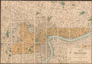
Map of Shanghai.
$9,000.00
Acquire
- Digital Map Information
- Suitable for large format printing
- File Size: 66.6 MB
- File Type: ZIP / TIFF
- ICC color profile embedded
- Delivered instantly via download link
An extremely rare 1933 North-China Daily News and Herald map of Shanghai. Focusing on the Bund and the International Settlement, the map extends from the Shanghai Hangchow Railroad in the west to the Shanghai Baptist College (now the University of Shanghai) in the east. Derived roughly from the Municipal Council Map of the same year, this map is in intensely detailed, with streets, businesses, clubs, parks, government offices, and civic institutions noted. This map was issued shortly after the 1932 Shanghai Incident in the final days of Shanghai's pre-war boomtime. (more details)
Legendary 'Lost' Cook Chart.
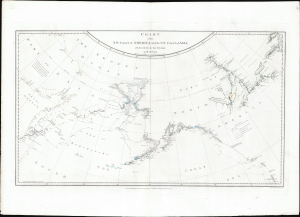
Chart of the N.W. Coast of America and the N.E. Coast of Asia, Explored in the Years 1778 and 1779.
$8,500.00
Acquire
- Digital Map Information
- Suitable for large format printing
- File Size: 17.45 MB
- File Type: ZIP / TIFF
- ICC color profile embedded
- Delivered instantly via download link
This is the suppressed 1784 first edition of Henry Roberts and Captain James Cook's legendary 'Lost Map', issued separately by London publisher William Faden. This is the first map to illustrate the discoveries of Samuel Herne on the Coppermine River. The chart was censured due to the political machinations of the powerful Hudson Bay Company, which had a sustained interest in keeping Herne's voyage secret as it disproved the notion that an inland water route might connect the Hudson Bay with the Pacific, thus threatening the HBC's stock value. (more details)
Early urbanization of Phnom Penh.
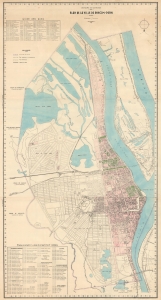
Royaume du Cambodge Plan de la Ville de Phnom-Penh.
$6,500.00
Acquire
- Digital Map Information
- Suitable for large format printing
- File Size: 56.26 MB
- File Type: ZIP / TIFF
- ICC color profile embedded
- Delivered instantly via download link
This is the only known surviving example of an exceptional c. 1935 wall map of Phnom-Penh, capital of Cambodia - the largest and best map of Phnom-Penh during the peak of its colonial era urbanization and development, thus recording a host of ambitious projects, including canals, parks, new neighborhoods, markets, railroads, and dredging efforts that transformed the swampy flood plain to a national capital. (more details)
Japan's first train.
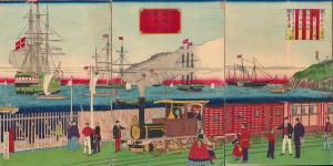
橫濱往返鐵道蒸氣車海上之圖 / [View of Steam Engine on the Seaside Yokohama Line].
$4,500.00
Acquire
- Digital Map Information
- Suitable for large format printing
- Full resolution TIFF file
- ICC color profile embedded
- Delivered instantly via download link
A fascinating 1874 ukiyo-e triptych by Utagawa Hiroshige III celebrating Japan's first passenger railway and the astonishing modernization of Yokohama under the Meiji. Opened between Yokohama and Tokyo in 1872, the steam railway became one of the most potent symbols of a country transforming itself at extraordinary speed, linking Japan's leading international treaty port with the imperial capital. Published two years after the railway's inauguration, the triptych captures not simply a train, but a defining moment in the Meiji Restoration, when foreign technology was being rapidly absorbed and transformed into the infrastructure of modern Japan. (more details)
Tokyo's Foreign Quarter in the Early Meiji Period.
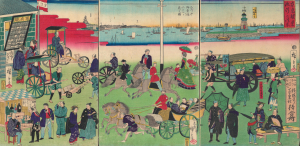
東京繁榮流行の往来 / [The Comings and Goings of Prosperity and Fashions in Tokyo].
$4,500.00
Acquire
- Digital Map Information
- Suitable for large format printing
- Full resolution TIFF file
- ICC color profile embedded
- Delivered instantly via download link
This is an 1870 ukiyo-e depiction of the Tsukiji neighborhood of Tokyo, drawn by Utagawa Hiroshige III and published by Masadaya Heikichi. It displays the neighborhood just months after it was designated as the foreign residence quarter of Tokyo following the Meiji Restoration, emphasizing the rapid importation of foreign technologies, fashion, and manners. (more details)
Rare, separately-issued Biblical Jerusalem.
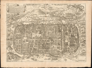
Jerusalem comme elle estoit du temps que Nostre Sauveur Jesus Christ souffrit mort et passion pour nous.
$4,500.00
Acquire
- Digital Map Information
- Suitable for large format printing
- File Size: 26.38 MB
- File Type: ZIP / TIFF
- ICC color profile embedded
- Delivered instantly via download link
This is a rare, separately-issued c. 1670 Gerard Jollain the Elder broadsheet map of Biblical Jerusalem, after Christian van Adrichem: an allegorical depiction of Jerusalem during Christ's lifetime. This work was instrumental in codifying elements of Christian veneration of the Holy City, in particular the Stations of the Cross. (more details)
Manuscript map of Saigon made for an artillery officer.
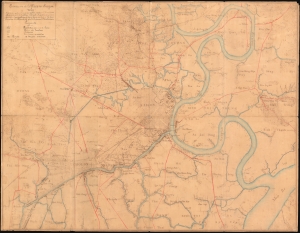
Environs de la Place de Saigon.
$4,500.00
Acquire
- Digital Map Information
- Suitable for large format printing
- File Size: 30.79 MB
- File Type: ZIP / TIFF
- ICC color profile embedded
- Delivered instantly via download link
An exceptional, highly detailed combination ferro-gallic and manuscript map of Saigon (Ho Chi Minh City), Vietnam, prepared in 1904 for Lieutenant Chantereau, an officer serving with the Artillerie Coloniale. The map captures Saigon at its peak as a colonial capital. (more details)
First modern Chinese map of Beijing.
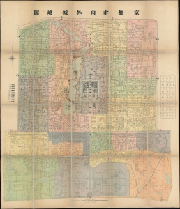
Capital City Inside and Out. / 京都市內外城地圖 / Jing dushi neiwaicheng ditu.
$4,500.00
Acquire
- Digital Map Information
- Suitable for large format printing
- Full resolution TIFF file
- ICC color profile embedded
- Delivered instantly via download link
This is an important ROC (Republic of China) 5 (民國五年), or 1916 map of Beijing, prepared by the municipal government for administrative purposes. This map, the first truly sophisticated Chinese map of Beijing, was the definitive city plan for roughly 20 years until it was superseded in 1936. The map covers the old walled center of Beijing, including the Imperial City, Forbidden City, Tartar City, and Chinese City. (more details)
Yokohama emerging as an international port.
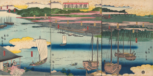
橫濱海岸圖會 / [View of the Coast at Yokohama.]
$4,000.00
Acquire
- Digital Map Information
- Suitable for large format printing
- Full resolution TIFF file
- ICC color profile embedded
- Delivered instantly via download link
An early 1860 ukiyo-e triptych by Utagawa Hiroshige II, capturing Yokohama, Japan, as it emerged as an international treaty port. Published just months after Yokohama opened to foreign trade in 1859, this panoramic view presents a city poised between the insular world of Tokugawa Japan and the profound transformations that would soon accompany sustained contact with the West. Among the earliest printed views of Yokohama, it offers a Japanese vision of the nascent port: cherry blossoms, temples, teahouses, theaters, and the notorious Miyozaki pleasure quarter occupy a landscape only beginning to accommodate global commerce. Most evocative is a woman seated in a waterfront teahouse, telescope in hand, gazing across the harbor - an image that seems to encapsulate Japan itself, watching with fascination as an unfamiliar world approaches. (more details)
Japan's First True Railway.
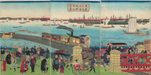
東京高輪海岸蒸氣車鐵道圖 / [Steam Train on the Railway along the Tokyo-Takanawa Coastline].
$4,000.00
Acquire
- Digital Map Information
- Suitable for large format printing
- Full resolution TIFF file
- ICC color profile embedded
- Delivered instantly via download link
A remarkable view of Japan's first modern railway, this ukiyo-e woodblock triptych was drawn by Utagawa Hiroshige III and published by Tsunajima Kamekichi in 1871. (more details)
The Rapid Expansion of Yokohama.
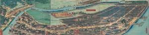
再改橫濱風景 / [Up-to-date View of Yokohama].
$4,000.00
Acquire
- Digital Map Information
- Suitable for large format printing
- Full resolution TIFF file
- ICC color profile embedded
- Delivered instantly via download link
This is a stunning 1861 panoramic set of six ukiyo-e (nishiki-e) Utagawa Sadahide woodblock prints depicting the port of Yokohama. The port opened to foreign trade in 1859, just two years earlier, becoming Japan's primary point of contact with the West. Sadahide was the most prolific among a school of woodblock artists chronicling these momentous changes. (more details)
Yokohama's Yoshiwara.
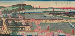
横浜港崎町大門橋真景 / [An Accurate View of the Miyozaki Great Gate and Bridge in Yokohama].
$3,500.00
Acquire
- Digital Map Information
- Suitable for large format printing
- Full resolution TIFF file
- ICC color profile embedded
- Delivered instantly via download link
This is a ukiyo-e triptych of Yokohama, prepared in 1860 by Sadahide, the master of the Yokohama-e subgenre of ukiyo-e woodblock prints. It depicts a view from the Miyozaki pleasure quarter, one of the main sites of cultural contact and mutual curiosity between foreigners and Japanese in Yokohama. (more details)
Baghdad in Transition from Ottoman to British Rule.
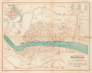
بغداد شهری / [City of Baghdad].
$3,500.00
Acquire
- Digital Map Information
- Suitable for large format printing
- File Size: 18.69 MB
- File Type: ZIP / TIFF
- ICC color profile embedded
- Delivered instantly via download link
This is a rare c. 1925 Ottoman Turkish map of Baghdad, originally prepared by Rashid (Reşid) Bey and updated by the Erkân-ı Harbiye-i Umûmiye Matbaasından, the Printing House of the General Staff of the Turkish military. Although published after the city's capture by British forces, the map presents the city at the end of the Ottoman period, with references to its earlier history. (more details)
Building and Rebuilding Yokohama.
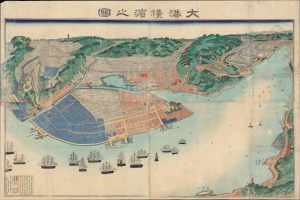
大港橫濱之圖 / [View of the Great Port of Yokohama].
$3,500.00
Acquire
- Digital Map Information
- Suitable for large format printing
- File Size: 53.59 MB
- File Type: ZIP / TIFF
- ICC color profile embedded
- Delivered instantly via download link
A scarce large-format c. 1868 view of Yokohama, prepared by Sadahide, master of the Yokohama-e genre of ukiyo-e woodblocks. It presents the extent of the port and hinterland a decade after it was opened to foreign trade, already expanding far beyond the small fishing village that had hitherto existed there. (more details)
American - Chinese - Japanese exchange in Yokohama.
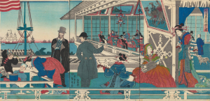
橫濱異人商館之圖 / [View of Foreign Merchant House in Yokohama].
$3,000.00
Acquire
- Digital Map Information
- Suitable for large format printing
- Full resolution TIFF file
- ICC color profile embedded
- Delivered instantly via download link
An absorbing 1861 depiction of Japanese-foreign interactions in Yokohama, this ukiyo-e triptych was prepared by Sadahide, the great chronicler of the treaty port in its early years, and published by Sanoya Kihei. It is notable, among other features, for revealing the three-way exchange between Westerners, Chinese, and Japanese in Yokohama. (more details)
Earliest and most desirable printed map of Taiwan / Formosa.
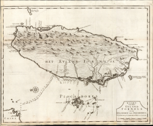
Kaart van het Eyland Formosa en de Eylanden van Piscadores.
$3,000.00
Acquire
- Digital Map Information
- Suitable for large format printing
- File Size: 22.09 MB
- File Type: ZIP / TIFF
- ICC color profile embedded
- Delivered instantly via download link
Printed in 1726 by Francois Valentijn, this is the earliest and most desirable printed map of Formosa (Taiwan). It is considered the first specific printed map of Formosa. (more details)
An Early View of Yokohama's Red-Light District.
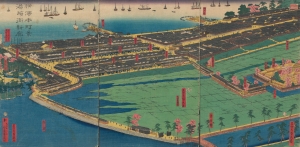
橫濱本町景港崎街新廓 / [View of Yokohama Honmachi and the New Miyozaki Quarter].
$3,000.00
Acquire
- Digital Map Information
- Suitable for large format printing
- Full resolution TIFF file
- ICC color profile embedded
- Delivered instantly via download link
This is a c. 1860 ukiyo-e triptych of Yokohama highlighting, among other elements, the Miyozaki Pleasure Quarter, prepared by Sadahide and published by Yamaguchiya Tōbei. The city, hitherto a small fishing village, rapidly developed after being opened to foreign traders and residents in 1859, building new districts, including Miyozaki, in a handful of months. (more details)
Origins of Modern Japan's Banking System.
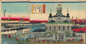
東京海運橋第一國立銀行の全圖并近圓の市中一覽の圖/ [Complete View of the First National Bank at the Tokyo Kaiun Bridge, with a View of the Nearby Cityscape].
$3,000.00
Acquire
- Digital Map Information
- Suitable for large format printing
- Full resolution TIFF file
- ICC color profile embedded
- Delivered instantly via download link
This stunning 1876 Ukiyo-e triptych, depicting the Dai-Ichi Bank Building in Tokyo, was drawn by the artist Yoshitora and published by Takekawa Seikichi. Both the bank and its building, along with several other financial institutions in the same area, were key signifiers of Japan's modernization in the early Meiji period. (more details)
French-Printed Carte á Figures.
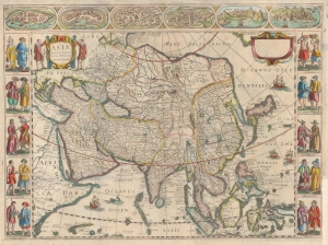
Asia recens summa cura delineata Auct: Iud Hondio.
$2,950.00
Acquire
- Digital Map Information
- Suitable for large format printing
- DPI: 600
- File Size: 54.48 MB
- File Type: ZIP / TIFF
- ICC color profile embedded
- Delivered instantly via download link
This is a beautiful Nicolas Picart edition of the Hondius carte-á-figures map of Asia. It was composed by Jodocus Hondius as early as 1623 and first appeared in the 1630 Hondius atlas. In this case, the map is an entirely new plate engraved in Paris in 1644 by Nicolas Picart. These French editions are beautiful and desirable rarities. (more details)
Keeping Time in Yokohama.
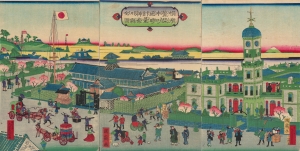
橫濱繁榮本町通時計臺神奈川縣全圖 / [Complete View of the Clock Tower in Yokohama's Flourishing Neighborhood of Honcho, Kanagawa Prefecture].
$2,500.00
Acquire
- Digital Map Information
- Suitable for large format printing
- Full resolution TIFF file
- ICC color profile embedded
- Delivered instantly via download link
A scarce and brightly-colored ukiyo-e 1874 woodblock triptych by Utagawa Kunitsuru depicting Yokohama's town hall (横浜町会所), constructed in 1874 (Meiji 7), one of many new marvels depicted in Yokohama-e prints of the era. Bridging past and present, Kunitsuru employed established nishiki-e conventions but added relatively new, vibrant pink, yellow, and purple aniline inks, most imported from Europe, that eventually became distinctive of Meiji-era woodblock prints. (more details)
How a wood and paper city burns.
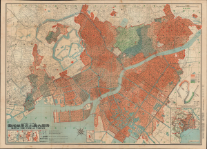
帝都大震火災系統地圖 / Map of the Fire of Tokyo.
$2,500.00
Acquire
- Digital Map Information
- Suitable for large format printing
- Full resolution TIFF file
- ICC color profile embedded
- Delivered instantly via download link
An exceptional example of an infographic masterpiece detailing the ignition and development of the Great Fire of Tokyo following the 1923 Great Kanto Earthquake. This partially bilingual 1923 map of the Great Tokyo Fire was issued by the Relief Information Bureau of Tokyo Imperial University just four months after the disaster. It focuses on ignition points and on the strong winds that coincided with the earthquake, which caused fire to spread rapidly and eventually burn down much of the dense wooden city. This example includes the original index, which we have never seen before, as well as its paper sleeve. (more details)
Working manuscript draft for a Kelly and Wash map later published.
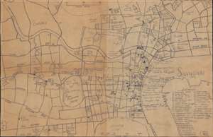
Shanghai (1919).
$2,500.00
Acquire
- Digital Map Information
- Suitable for large format printing
- File Size: 9.08 MB
- File Type: ZIP / TIFF
- ICC color profile embedded
- Delivered instantly via download link
This is a unique 1919 Kelly and Walsh manuscript map of Shanghai - most likely the original working draft for Shanghai map included in Charles Ewart Darwent's Shanghai: a handbook for travellers and residents…. It dates from the height of the treaty port era, when Shanghai was home to dozens of nationalities inhabiting three distinct administrative zones: the International Settlement, the French Concession, and the Chinese-administered areas of the city. (more details)
Rare, Early Cadastral Map of New Zealand's Largest City, w/ Manuscript Annotations.
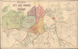
Upton and Co.'s New Map of the City and Suburbs of Auckland.
$2,400.00
Acquire
- Digital Map Information
- Suitable for large format printing
- File Size: 32.19 MB
- File Type: ZIP / TIFF
- ICC color profile embedded
- Delivered instantly via download link
This is Upton's scarce 1884 folding city plan and cadastral map of Auckland, New Zealand, printed by Wilson and Horton. It provides a fascinating glimpse into the early history and evolution of the fast-growing port city. (more details)
The Tokugawa Scheme to Control Daimyo.
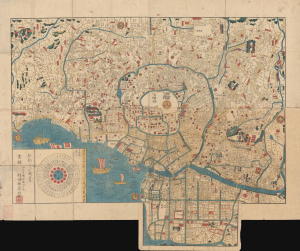
[Edo].
$2,200.00
Acquire
- Digital Map Information
- Suitable for large format printing
- Full resolution TIFF file
- ICC color profile embedded
- Delivered instantly via download link
This is a 1845 Murataya Hikobē map of Edo (Tokyo), Japan, the capital of the Tokugawa Shogunate. It is particularly notable for recording the residences, often multiple residences, and family crests of daimyo from throughout Japan in Edo, a critical piece of the Tokugawa's measures to control them and ensure national unification. (more details)
50 photogravures of Old Shanghai.
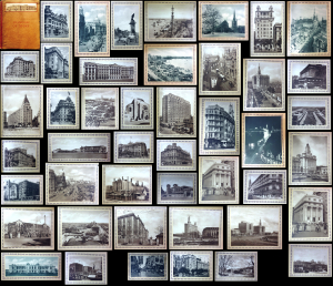
Shanghai of To-day. A Souvenir Album of Fifty Vandyke Gravure Prints of the 'Model Settlement'.
$2,200.00
Acquire
- Digital Map Information
- Suitable for large format printing
- Full resolution TIFF file
- ICC color profile embedded
- Delivered instantly via download link
This is the expanded 1930 third edition of Kelly and Walsh's Shanghai of To-day. A Souvenir Album of Fifty Vandyke Prints of the 'Model Settlement'. The volume of large-format photos captures evocative images of Shanghai's pre-war golden age, when it was a center of global commerce, art, political intrigue, and international cosmopolitanism. (more details)
First published view of Singapore.
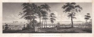
View of the Town and Roads of Singapore from the Government Hill.
$2,200.00
Acquire
- Digital Map Information
- Suitable for large format printing
- DPI: 600
- File Size: 14.72 MB
- File Type: ZIP / TIFF
- ICC color profile embedded
- Delivered instantly via download link
The first printed view of Singapore, issued less than ten years after it was founded by Sir Thomas Stamford Raffles (1781 - 1826). This aquatint view was published in 1828 after a painting by Royal Navy Captain Robert James Elliot. It looks on Singapore from Government Hill, covering the Plain, Singapore River, and Chinatown. Even at this early stage, the view presents a bustling city with numerous buildings and a lively port. We have not been able to trace Elliot's original painting. (more details)