
Holland - Belgium
Among the Earliest Commercially Produced Relief Maps
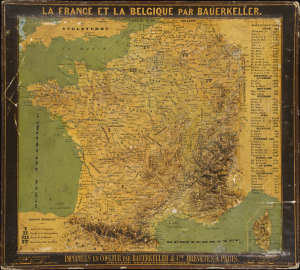
La France et la Belgique par Bauerkeller.
$4,500.00
Acquire
- Digital Map Information
- Suitable for large format printing
- Full resolution TIFF file
- ICC color profile embedded
- Delivered instantly via download link
This is an exceptionally rare c. 1844 raised relief map of France and Belgium, produced by the revolutionary German-born Parisian mapmaker Georg Michael Bauerkeller. Like Bauerkeller's other early works, this was one of the earliest commercially-available relief maps, produced in small numbers in a meticulous patented process. (more details)
Germany's View of Britain during World War I.
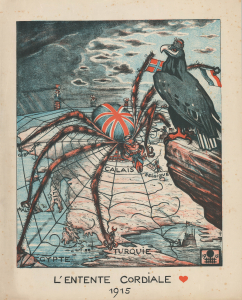
L'Entente Cordiale 1915.
$3,500.00
Acquire
- Digital Map Information
- Suitable for large format printing
- File Size: 26.44 MB
- File Type: ZIP / TIFF
- ICC color profile embedded
- Delivered instantly via download link
This is a powerful 1915 pictorial zoomorphic serio-comic map of Europe, prepared by German illustrator Eugen von Baumgarten as propaganda during World War I (1914 - 1918). It depicts Great Britain as a spider ensnaring and eating its allies, who, unwittingly, have been caught in its web. (more details)
Leige as a Renaissance Cathedral Town.
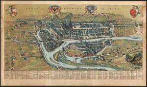
Legia, Sive Leodium; vulgo, Liege.
$2,000.00
Acquire
- Digital Map Information
- Suitable for large format printing
- File Size: 52.24 MB
- File Type: ZIP / TIFF
- ICC color profile embedded
- Delivered instantly via download link
This large, detailed, and ornate bird's-eye view style map of Liege, Belgium, was produced by Joan Blaeu in 1649 for inclusion in his city atlas of the Netherlands. (more details)
Magnificent, updated plan of Amsterdam.
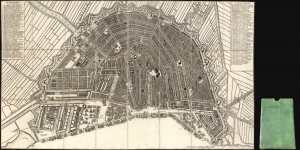
[Plan de la Grande et Fameuse Ville Marchande d'Amsterdam. / Plan van de Wyd Vermaarde en Beroemde Koop Stad Amsterdam.]
$2,000.00
Acquire
- Digital Map Information
- Suitable for large format printing
- Full resolution TIFF file
- ICC color profile embedded
- Delivered instantly via download link
This is the final 1814 Covens and Mortier issue of this large, beautifully engraved Nicolas Visscher II map of Amsterdam. It was originally entitled Plan de la Grande et Fameuse Ville Marchande d'Amsterdam / Plan van de Wyd Vermaarde en Beroemde Koop Stad Amsterdam, but in this state of the plan, the increasingly unfashionable cartouche has been removed, along with the title the plan had borne for a near a century. Architect Daniel Stalpaert initially compiled the plan. It was printed by Nicolas Visscher and was notable as one of the earliest depictions of the iconic ring canals, which were added to the city in the first half of the seventeenth century. The plan is oriented to the south-southwest to display the vibrant port, teeming with ships. It is a magnificently detailed work, with nearly three hundred streets named and numbered. Particularly famous or important structures are illustrated pictorially, as are the windmills built around the city to operate the canal system. (more details)
Large format map of Luxembourg.
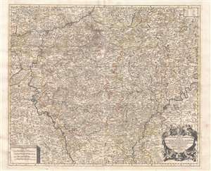
Le duché de Luxembourg divisé en quartier Wallon, et allemand dans chacun desquels sont diviséz les seigneuries, prevostés et comtés, le duché de Bouillon, le comté de Namur, etc.
$1,500.00
Acquire
- Digital Map Information
- Suitable for large format printing
- Full resolution TIFF file
- ICC color profile embedded
- Delivered instantly via download link
This is a large, impressive 1692 Alexis-Hubert Jaillot map of Luxembourg and parts of Belgium. Focused on the region between the Meuse and Moselle Rivers, the map depicts in minute detail from Rocroy in the west to Virnenbourg in the east and from Liege in the north to Thionville in the south. An elaborate allegorical cartouche appears in the lower right quadrant. Additional, less decorative, cartouches in the upper right and lower left feature a key and distance scale, respectively. Map names major and minor towns, rivers, counties, some topographical features, and political districts. (more details)
One of the few route maps published during rather than after WWII.
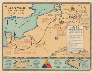
'Hell on Wheels' 1942 - 1943 - 1944. Second United States Armored Division.
$1,200.00
Acquire
- Digital Map Information
- Suitable for large format printing
- File Size: 35.09 MB
- File Type: ZIP / TIFF
- ICC color profile embedded
- Delivered instantly via download link
This is the 1944/45 Marion E. Baker World War II Second Armored Division Pictorial Route Map of Europe. Unlike most WWII Route Maps, the present map was published during the war, making it part of the war experience rather than a post-war summary. One is also struck by the extent of the Second Armored Division's campaigning, stretching to include North Africa, Sicily, and western Europe. (more details)
Ephemeral WWII mimeograph Route Map following the 318th Infantry Regiment.
Map Route CT 318.
$1,000.00
Acquire
- Digital Map Information
- Suitable for large format printing
- Full resolution TIFF file
- ICC color profile embedded
- Delivered instantly via download link
This is a 1945 mimeographed World War II unit route map of the 318th Infantry Regiment in Europe. It records the regiment's fight across Europe, noting milestones, and includes an operational report of the last days of combat in the European theatre, May 6-7, 1945, on the verso. As a mimeograph, this route map is unusual for the genre and limited by the medium, making it exceptionally ephemeral. (more details)
Evacuation hospital during World War II.
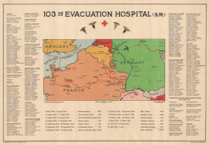
103rd Evacuation Hospital (SM).
$1,000.00
Acquire
- Digital Map Information
- Suitable for large format printing
- File Size: 22.07 MB
- File Type: ZIP / TIFF
- ICC color profile embedded
- Delivered instantly via download link
This is a rare 1945 World War II route map of the 103rd Evacuation Hospital in the European Theater of Operations - the only map was are aware of to detail a medical unit. One of only two known examples, this map provides an overview of the medical unit's wartime activities. We have been unable to locate a corresponding unit history for the 103rd Evacuation Hospital, making this map a critical piece of the broader history of World War II. (more details)
Unique insights into WWII Route Maps.
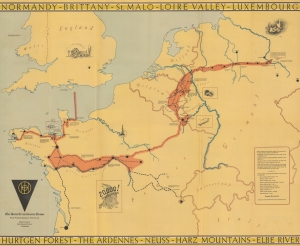
83d United States Infantry Division. The Thunderbolt Division. The Thunderbolt Across Europe.
$1,000.00
Acquire
- Digital Map Information
- Suitable for large format printing
- Full resolution TIFF file
- ICC color profile embedded
- Delivered instantly via download link
This is a 1945 83rd Infantry Division Information-Education Section World War II pictorial route map of Western Europe accompanied by a letter from General Robert Macon, the commanding officer of the 83rd Infantry Division. The letter offers unique insight into the production of this, and other, similar WWII route maps. (more details)
WWII Propaganda: Bombing Britain.
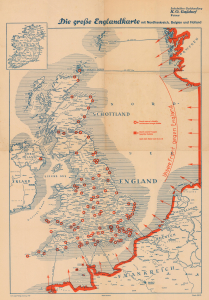
Die Grosse Englandkarte mit Nordfrankreich, Belgien und Holland.
$900.00
Acquire
- Digital Map Information
- Suitable for large format printing
- Full resolution TIFF file
- ICC color profile embedded
- Delivered instantly via download link
This is a 1941 German propaganda map of Great Britain published by Carl Lange Verlag during World War II (1939 - 1945). The map emphasizes British cities bombed by the Luftwaffe and reinforces the powerful German occupation of the entire coast of continental Europe. (more details)
Attractive map of the Flemish regions of Belgium.
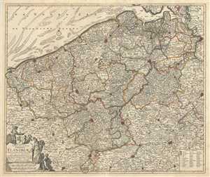
Novissima et Accuratissima Comitatus Flandriae Tabula, in qua Novae Lineae, et omnes Urbes, cum suis veris Munitionibus quae Gallis, Hispanis, Batavisqe parent.
$900.00
Acquire
- Digital Map Information
- Suitable for large format printing
- Full resolution TIFF file
- ICC color profile embedded
- Delivered instantly via download link
This is an attractive c.1721 map of Flanders by Frederik De Wit. The map depicts western portions of modern day Belgium and northern France along with parts of Holland, a region commonly known as Flanders at the time. Extends from Zeeland south to Arras in France ... (more details)
Heart of the Dutch Revolt.
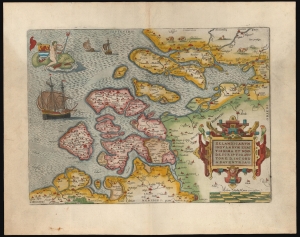
Zelandicarum Insularum Exactissima et Nova Descriptio, Auctore D. Iacobo A Daventria.
$850.00
Acquire
- Digital Map Information
- Suitable for large format printing
- Full resolution TIFF file
- ICC color profile embedded
- Delivered instantly via download link
This is a beautiful example of Abraham Ortelius' 1570 map of the Zeeland province of the Netherlands. The province was inclusive of Antwerp, where Ortelius lived and worked, thus presenting the mapmaker's homeland. It is, moreover, the best map of the lands at the heart of the Dutch Revolt and Eighty Years’ War (1568 - 1648). (more details)
Only Homann Map to name New York City.
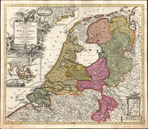
Belgii Pars Septentrionalis communi nomine Vulgo Hollandia nuncupata Continens Statum Potentissime Batavorum Reipublicae seu Provincias VII Foederatas.
$850.00
Acquire
- Digital Map Information
- Suitable for large format printing
- File Size: 25.71 MB
- File Type: ZIP / TIFF
- ICC color profile embedded
- Delivered instantly via download link
A beautiful, original color example of Johann Baptist Homann's 1702 map of the Netherlands, featuring inset maps and city views celebrating the 17th-century global empire of the Dutch. It is the only Homann map to name New York City. (more details)
Tank Destroyers during World War II.
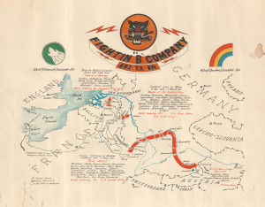
Fightin' 'B' Company 692 T.D. Bn.
$800.00
Acquire
- Digital Map Information
- Suitable for large format printing
- File Size: 16.83 MB
- File Type: ZIP / TIFF
- ICC color profile embedded
- Delivered instantly via download link
This is a c. 1945 World War II unit route map of Company B, 692nd Tank Destroyer Battalion, in Europe. The map follows Company B from its September 26, 1944, debarkation in Europe through France, Belgium, and Germany until May 8, 1945, V-E Day, the end of the war in Europe. (more details)
Ortelius' Map of His Home Region.
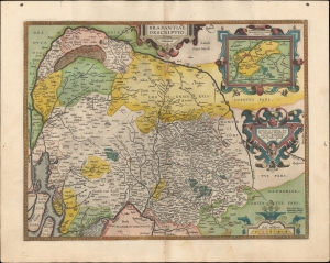
Brabantiae Descriptio.
$800.00
Acquire
- Digital Map Information
- Suitable for large format printing
- Full resolution TIFF file
- ICC color profile embedded
- Delivered instantly via download link
A beautiful original color example of Abraham Ortelius' 1595 map of Brabant, his home region, which contains the cities of Brussels and Antwerp. It appeared in his magisterial Theatrum Orbis Terrarum, the first modern atlas, first printed in Antwerp 1570. (more details)
Halting the German Advance into Belgium.
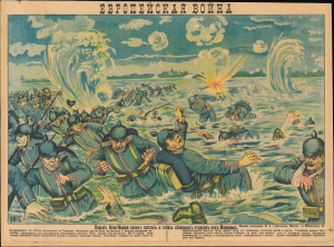
Европейская война Взрыв бельгийцами своих плотин и гибель немецких отрядов под Малином / [European War The Belgians exploding their dams and the death of German troops near Malines.]
$750.00
Acquire
- Digital Map Information
- Suitable for large format printing
- Full resolution TIFF file
- ICC color profile embedded
- Delivered instantly via download link
A dramatic piece of wartime propaganda, this c. 1914 Russian-language lubok illustration celebrates a rare Belgian victory in the opening phase of World War I (1914 - 1818). It was printed by M. A. Streltsova and was the 7th in a series of such propaganda broadsides titled 'European War.' (more details)
Opening moves in the War or the Spanish Succession.
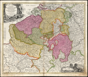
Arena Martis in Belgio Qua Provinciae X Catholicae Inferioris Germaniae cum vicinis Episcopatibus, Coloniensi et Leodiensi.
$750.00
Acquire
- Digital Map Information
- Suitable for large format printing
- File Size: 28.88 MB
- File Type: ZIP / TIFF
- ICC color profile embedded
- Delivered instantly via download link
This is a scarce, early plate of Johann Baptist Homann's 1702 map of Belgium and Luxembourg, then the ten Catholic provinces of the Low Countries, as well as the Bishoprics of Cologne and Liège. As the title states, this is the theater for the opening stages of the War of Spanish Succession (1701 - 1714). (more details)
Airborne troops on D-Day.
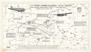
72nd Troop Carrier Squadron (434th Group) Combat Paratroop Missions, Resupply Sorties and Other Operations October 1943 to June 1945.
$750.00
Acquire
This is a 1960 folding road map of Iran, prepared by Abbas Sahab, Iran's This is a c. 1972 Victor Rigotti map of the 72nd Troop Carrier Squadron over Europe during World War II. The map highlights the squadron's most important missions (including its three missions on D-Day) as well as the thousands of resupply and freight missions flown. (more details)
692nd Take Destroyers in WWII.
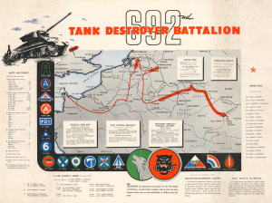
692nd Tank Destroyer Battalion.
$600.00
Acquire
- Digital Map Information
- Suitable for large format printing
- Full resolution TIFF file
- ICC color profile embedded
- Delivered instantly via download link
This is a rare c. 1945 World War II campaign route map of the 692nd Tank Destroyer Battalion in Europe prepared by 1st Lieutenant Francis L. Yost. This map highlights the battalion's movements across the continent, details its campaigns, and remembers the members of the battalion who were killed in action. (more details)
Bulgarian manuscript map of WWI Western Front.
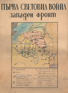
ПЪРВА СВЕТОВНА ВОЙНА западен Фронт. / World War I Western Front.
$600.00
Acquire
- Digital Map Information
- Suitable for large format printing
- Full resolution TIFF file
- ICC color profile embedded
- Delivered instantly via download link
This is a c. 1914 Bulgarian-language broadsheet manuscript map of the Western Front during World War I (1914 - 1918), including coverage of Belgium, France, Germany, and the Netherlands. The map reflects intense Bulgarian interest in the conflict despite its official policy of neutrality. Then aggressively courted by both the Allied (Entente) and Central powers as a strategic pathway to the Balkans and the Ottoman Empire, Bulgaria understood that retaining neutrality was merely a pipe dream. Bulgaria joined the war on the side of the Central Powers in October 1915. (more details)
Commemorating America's Great War Dead.
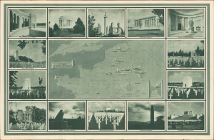
Cemeteries and Memorials in Europe Constructed and Maintained by the United States of America / American War Memorials 1917 1918.
$500.00
Acquire
- Digital Map Information
- Suitable for large format printing
- Full resolution TIFF file
- ICC color profile embedded
- Delivered instantly via download link
This is a c. 1937 pictorial map of Western Europe issued by the American Battle Monuments Commission (ABMC). It denotes the locations of cemeteries of American servicemembers who died during the World War I (1914 - 1918) that were under the management of the ABMC. (more details)
Follow the 186th from Omaha Beach to Czechoslovakia.
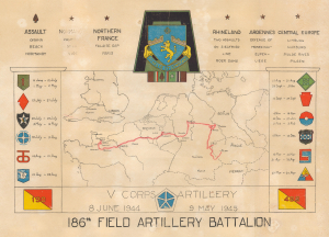
V Corps Artillery. 8 June 1944 - 9 May 1945. 186th Field Artillery Battalion.
$500.00
Acquire
- Digital Map Information
- Suitable for large format printing
- File Size: 11.14 MB
- File Type: ZIP / TIFF
- ICC color profile embedded
- Delivered instantly via download link
This is a 1945 World War II route map of the 186th Field Artillery Battalion in Europe. A striking visual summary of the battalion's war in Europe, this map follows the 186th from landing on Omaha Beach to Pilsen, Czechoslovakia, where they were when the war ended. It also chronicles the battalion's support of 12 divisions while fighting across Europe and notes its five battle stars. (more details)
Advancing the map of Germany.
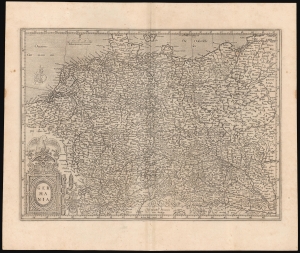
Germania.
$500.00
Acquire
- Digital Map Information
- Suitable for large format printing
- Full resolution TIFF file
- ICC color profile embedded
- Delivered instantly via download link
This is Gerard Mercator's 1585 map of Germany. It marks a significant transition in the mapping of German lands and is far advanced over earlier maps, such as those of Munster. Moreover, it is one of Mercator's earliest obtainable maps. (more details)
Ons Gelderland.
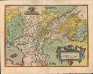
Gelriae, Cliviae, Finitimorumque Locorum Verissima Descriptio.
$450.00
Acquire
- Digital Map Information
- Suitable for large format printing
- Full resolution TIFF file
- ICC color profile embedded
- Delivered instantly via download link
A very fine old color example of Abraham Ortelius' 1595 map of Gelderland (also known as Geulders, or as Geldria or Gelriae in Latin) in the central part of the Netherlands. (more details)
87th Infantry Division during World War II.
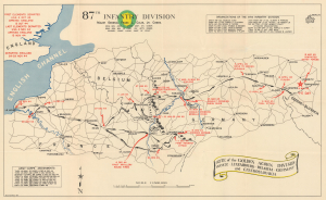
87th Infantry Division. Route of the Golden Acorn Division France, Luxembourg, Belgium, Germany, and Czechoslovakia.
$425.00
Acquire
- Digital Map Information
- Suitable for large format printing
- Full resolution TIFF file
- ICC color profile embedded
- Delivered instantly via download link
This is a 1945 campaign route map for the 87th Infantry Division in western and central Europe during World War II. The map was issued as a souvenir campaign map in the immediate wake of WWII to chronicle the Division's movements and battles from its arrival at Le Havre, France, until V-E Day near the Czechoslovak border. (more details)
Game Map from Belgium's Early Automotive Age.
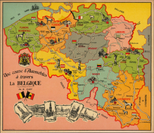
Une Course d'Automobiles à travers la Belgique Jeu de société.
$400.00
Acquire
- Digital Map Information
- Suitable for large format printing
- Full resolution TIFF file
- ICC color profile embedded
- Delivered instantly via download link
This is a c. 1910 uncirculated board game map of Belgium prepared by the Parisian game maker Saussine. It reflects the curiosity and enthusiasm of the early automobile age, as well as Belgium's prominent role in the burgeoning industry. (more details)
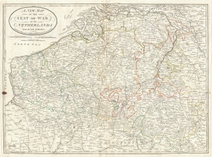
A New Map of the Seat of War, in the Netherlands, from the best Authorities.
$400.00
Acquire
- Digital Map Information
- Suitable for large format printing
- DPI: 300
- File Size: 18.2 MB
- File Type: ZIP / TIFF
- ICC color profile embedded
- Delivered instantly via download link
An very attractive 1794 map of what is today Belgium by Laurie and Whittle. Covers from Zeeland southwards as far as the Picardy (France), and eastwards to Luxembourg. Includes the modern day nation Belgium as well as adjacent parts of Germany, Luxembourg and ... (more details)
Beautiful City of French Flanders.
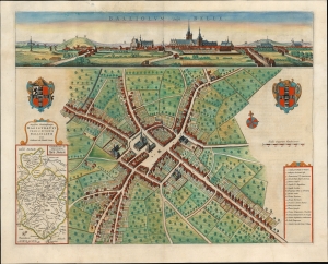
Balliolum vulgo Belle.
$350.00
Acquire
- Digital Map Information
- Suitable for large format printing
- File Size: 23.06 MB
- File Type: ZIP / TIFF
- ICC color profile embedded
- Delivered instantly via download link
This is Joan Blaeu's 1649 bird's-eye plan and panorama, of Bailleul, France. This city, now in the Département Nord, was then part of the Netherlands; consequently, it was one of the cities featured in Blaeu's rare atlas of the cities of the Netherlands. (more details)
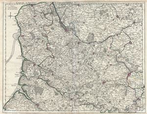
Carte d'Artois et des environs, ou lon voit le Ressort du Conseil Provincial d'Artois.
$350.00
Acquire
- Digital Map Information
- Suitable for large format printing
- DPI: 300
- File Size: 22.74 MB
- File Type: ZIP / TIFF
- ICC color profile embedded
- Delivered instantly via download link
This is a beautiful 1711 Guillaume De L'isle map of Artois region and its environs in northern France. It covers from Calais to Bouchain and from Abbeville north as far as Gravelines. Includes the southwestern parts of modern day Belgium. The map renders the ... (more details)
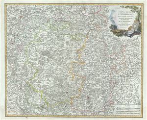
Carte du Duche de Luxembourg, dans laquelle on trouve la partie Meridionale et limitrophe de la Seigneurie de Lyege.
$350.00
Acquire
- Digital Map Information
- Suitable for large format printing
- Full resolution TIFF file
- ICC color profile embedded
- Delivered instantly via download link
This is a beautiful 1753 map of the Duchy of Luxembourg and part of southern Belgium by Robert de Vaugondy. It covers Luxembourg along with parts of neighboring Belgium and Germany and extends from Liege south to Beaumont in France and from Namur in Belgium ... (more details)
Antwerp pictured prior to the Spanish Fury.
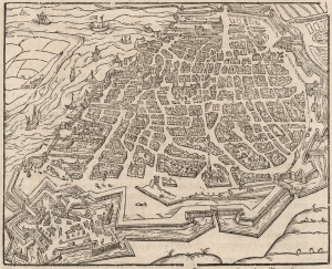
[Bird's-Eye View of Antwerp.]
$300.00
Acquire
- Digital Map Information
- Suitable for large format printing
- DPI: 600
- File Size: 16.38 MB
- File Type: ZIP / TIFF
- ICC color profile embedded
- Delivered instantly via download link
This detailed bird's-eye view of Antwerp is among the earliest printed images of the city. This woodcut first appeared in the 1574 German edition of Sebastian Münster's Cosmographia. It is a careful miniature of the 1572 view printed in Cologne by Braun and Hogenberg, the first of two views of that city appearing in their Civitates Orbis Terrarum. Both were drawn by Joris Hoefnagel, who was a native of the city, here shown on the River Schelde as it stood in the first part of the Eighty Years’ War (1568 - 1648). While it was at the heart of the Dutch Revolt, it was also the seat of Spanish power in the Low Countries. This is evidenced by the fort, built by the Grand Duke of Alba, commanding the southern approaches to the city. Within Antwerp's city walls are the Cathedral, town hall, Grote Markt, and fish market. The portrait below the view is Fernando Álvarez de Toledo y Pimentel, 3rd Duke of Alba (1507 – 1582), known as the Grand Duke of Alba whose bloody but ultimately futile repression failed to suppress the Dutch Revolt. (In 1576, two years after the first appearance of this view, Spanish forces visited the Spanish Fury on the city in the infamous Sack of Antwerp, then the greatest massacre in the history of the Low Countries.) The text describes the great statue of himself that the Grand Duke had erected in his new fortress, including the text of the statue's plaque, both in Latin and German. The spear-carrying statue can be seen in the middle of the fort. Following the sack of the city by the Spanish in 1576, Antwerp's citizens destroyed the statue. (It is conspicuously absent in Hoefnagel's 1596 view). (more details)
Beautiful Covens and Mortier edition of the De Wit map of Brabant.
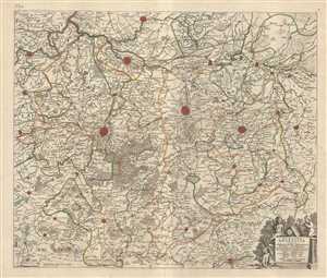
Pars Meridionalis Brabantiae continens Dominium Merchliniense Ducatum Arschotanum.
$300.00
Acquire
- Digital Map Information
- Suitable for large format printing
- Full resolution TIFF file
- ICC color profile embedded
- Delivered instantly via download link
This is an attractive c.1721 map of the southern part of the Duchy of Brabant by Frederik De Wit. The map depicts part of modern day Belgium, which was at the time this map was made, part of the Duchy of Brabant. It covers the vicinity of Brussels and ... (more details)