
Holland - Belgium (sold)
Leiden as Rembrandt Knew It.
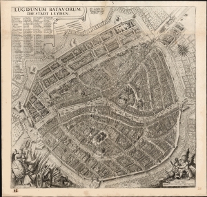
Lugdunum Batavorum. Die Stadt Leyden.
sold
- Digital Map Information
- Suitable for large format printing
- File Size: 29.02 MB
- File Type: ZIP / TIFF
- ICC color profile embedded
- Delivered instantly via download link
This is a rare, beautifully engraved, and influential c. 1630 Frans Huys and Peter Bast map of Leiden, The Netherlands, at the time of Rembrandt. It is one of just two known examples of the map, in this state, and is unrecorded in institutional collections. (more details)
The first Printed Chart of the English Channel.
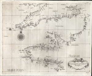
Carta quinta Generale di Europa.
sold
- Digital Map Information
- Suitable for large format printing
- File Size: 13.85 MB
- File Type: ZIP / TIFF
- ICC color profile embedded
- Delivered instantly via download link
This is a beautiful example of Robert Dudley's 1646 chart of the English Channel. It is the first printed chart specifically of this body of water and its coasts. (more details)
Leo Belgicus, in a desirable edition.
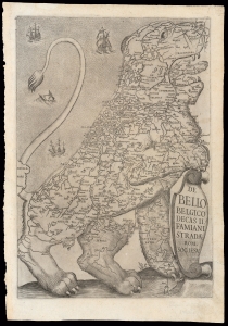
De Bello Belgico Decas II Famiani Stradae Rom. Soc. Iesu
sold
- Digital Map Information
- Suitable for large format printing
- DPI: 600
- File Size: 20.56 MB
- File Type: ZIP / TIFF
- ICC color profile embedded
- Delivered instantly via download link
This 1632/1647 map of the Netherlands is an exemplar of one of the most distinctive heraldic geographical motifs: the famous Leo Belgicus. This depiction of the Low Countries in the form of a lion rampant appeared as the title page in the first, Rome edition of Famiano Strada's 1632 history of the Dutch Revolt. While later editions of Strada featured a Leo in their frontispieces, the plate employed in the 1632 first volume and the 1647 second volume of the first edition was the largest and most beautifully engraved, and among the most desirable. This image's appearance during the course of the Eighty Years' War (c. 1566/1568 - 1648) has led to it being hailed as a cartographic expression of national pride - in spite of its origin being firmly rooted in histories of the war produced predominantly from a Spanish perspective. (more details)
One of the few route maps published during the war. An example with special provenance.
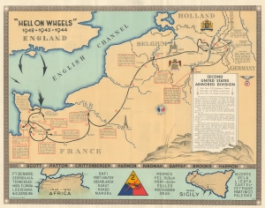
'Hell on Wheels' 1942 - 1943 - 1944. Second United States Armored Division.
sold
- Digital Map Information
- Suitable for large format printing
- Full resolution TIFF file
- ICC color profile embedded
- Delivered instantly via download link
A rarity in an underappreciated genre, this is the 1944/45 Marion E. Baker World War II Second Armored Division Pictorial Route Map of Europe. Two elements stand out from most World War II (1939 - 1945) route maps. One is the scope of the Second Armored Division campaign, including North Africa, Sicily, and Western Europe. The second is that, unlike most route maps, the present map was published during the war, making it a part of the war experience, instead of a post-war summary. (more details)
Getting reinforcements to the front line during World War II.
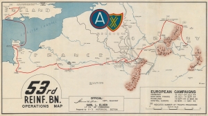
53rd Reinf. Bn. Operations Map.
sold
- Digital Map Information
- Suitable for large format printing
- File Size: 27.43 MB
- File Type: ZIP / TIFF
- ICC color profile embedded
- Delivered instantly via download link
This is an extremely rare c. 1945 World War II 53rd Reinforcement Battalion route map of Europe. This map follows the 53rd Reinforcement Battalion from Chard, England, to Bamberg, Germany, from January 13, 1944, through July 13, 1945. It also informs on the numbers of reinforcements it processed, illustrating the important role this battalion played in winning World War II. (more details)
A decisive but largely forgotten British naval victory.
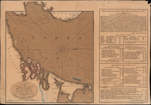
A chart of the coast of Holland exhibiting the situation of the Dutch fleet...
sold
- Digital Map Information
- Suitable for large format printing
- DPI: 600
- File Size: 10.32 MB
- File Type: ZIP / TIFF
- ICC color profile embedded
- Delivered instantly via download link
An ephemeral 1797 John Fairburn broadside map celebrating the British naval victory at the 1797 Battle of Camperdown during the French Revolutionary Wars (1792 - 1802), one of the most significant naval engagements of the era. (more details)
Stunning two part map of Holland.
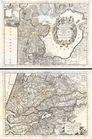
Contado d'Ollanda Parte Settentrionale. - Contado d'Ollanda Parte Meridionale.
sold
- Digital Map Information
- Suitable for large format printing
- Full resolution TIFF file
- ICC color profile embedded
- Delivered instantly via download link
A spectacular example of Coronelli's two part map of Holland or the Netherlands. The upper sheet covers from Friesland to Amsterdam including all of the Zuyder Zee. The southern map covers from the Haarlem Meer south to Breeda and east to Batenborg. Identifies ... (more details)
Superb Plan of 'The Gibraltar of the North'.

Luxembourg, une Fortresse tres celebre de la Duché de cette Nom dans Pais-bas. Grave par M. Seutter, S.C.M. Geogr.
sold
- Digital Map Information
- Suitable for large format printing
- Full resolution TIFF file
- ICC color profile embedded
- Delivered instantly via download link
This is as beautiful, rare, separately issued plan and view of the city of Luxembourg by Matthias Seutter, c. 1734. It illustrates the situation of the fortified city during the renovation of its defenses in the 1730s. (more details)
Old color first edition of Braun and Hogenberg's Dutch Golden Age view of Amsterdam.
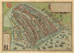
Amstelredamvm, nobile inferioris Germaniae oppidum ad recipiendos ex omnib. mundi partibus, mercatores, recenter natum genus hominum incolit mercimonijs deditum quae quidem, tum blanda populi comitate, ac sedula diligentiqu[ue] industria : tum portus comoditate permagna, vsq[ue]adeo incrementa sumpserunt vt vix vllum mercaturae genus excogitari possit quod heic non exerceatur : hinc fit vt opum lucrique cupiditas, ex remotissimis etiam terris, negotiatores, in hanc ciuitate inuitet qui varia hinc bona et maximè rem frumentaria in Brabantiam caeteraq[ue] longè dissita totius vniuersi loca, transferentes : ingentes ex eiuscemodi commertio opes consequuntur.
sold
- Digital Map Information
- Suitable for large format printing
- DPI: 600
- File Size: 25.26 MB
- File Type: ZIP / TIFF
- ICC color profile embedded
- Delivered instantly via download link
An attractive first edition old color example of George Braun and Franz Hogenberg's 1572 city view and map of Amsterdam. The map, presented in bird's-eye view form, looks on Dutch Golden Age Amsterdam from the northeast. On the left side the map illustrates the elaborate damming and redirection of the Amstel River into Amsterdam's famous canal network. Ships line the canals and fill the Zuiderzee both on the inside and outside of Amsterdam's defensive seawall - suggestive of Amsterdam's enormous commercial prosperity. At center, the old town hall (Stadhuis, 21) and the neighboring Nieue Kerk (23), are recognizable. In the lower right, at the edge of the map, is the gallows field with a total of 11 unfortunates. (more details)
Between the great powers.
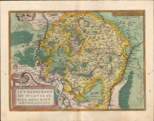
Lutzenburgensis Ducatus Veriss Descript.
sold
- Digital Map Information
- Suitable for large format printing
- Full resolution TIFF file
- ICC color profile embedded
- Delivered instantly via download link
A beautiful example, in superb original color, of Abraham Ortelius' map of Luxembourg. It is considered the first map of those areas presented in an atlas. While the book's first edition was released in 1570, Ortelius continually improved the work - both by adding new maps, and by refining the production of the book. Maps appearing in editions of the Theatrum in the 1580s and 1590s generally display, as here, a finer quality of color than those in the earlier issues of the work. (more details)
Predicting the Allied advance to plan logistics.
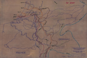
Principal Rail Lines to Berlin - E.T.O.
sold
- Digital Map Information
- Suitable for large format printing
- File Size: 64.69 MB
- File Type: ZIP / TIFF
- ICC color profile embedded
- Delivered instantly via download link
A unique piece, this is a 1944 World War II (1939 - 1945) Second Military Railway Service railroad diazotype map of Europe with extensive predicative manuscript annotation relating to managing logistics behind the battle lines in the face of rapid frontline advancement. The fascinating annotation predicts the Allied advance across Europe in stages from November 1944 through May 1945. The map thus underscores a critical but often overlooked aspect of World War II - logistics. (more details)
One of the few route maps published during the war.
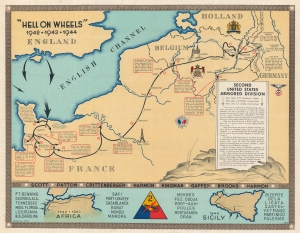
'Hell on Wheels' 1942 - 1943 - 1944. Second United States Armored Division.
sold
- Digital Map Information
- Suitable for large format printing
- File Size: 78.4 MB
- File Type: ZIP / TIFF
- ICC color profile embedded
- Delivered instantly via download link
A rarity in an underappreciated genre, this is the 1944/45 Marion E. Baker World War II Second Armored Division Pictorial Route Map of Europe. Two elements stand out from most World War II (1939 - 1945) route maps. One is the scope of the Second Armored Division campaigning, stretching to including North Africa, Sicily, and western Europe. The second is that, unlike most route maps, the present map was published during the war, making it a part of the war experience, instead of a post-war summary. (more details)
Restoring civilian governments in occupied and liberated Europe.
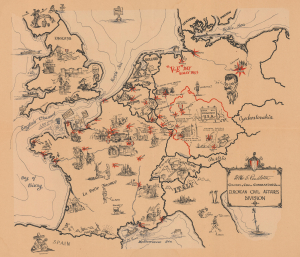
European Civil Affairs Division.
sold
- Digital Map Information
- Suitable for large format printing
- File Size: 22.76 MB
- File Type: ZIP / TIFF
- ICC color profile embedded
- Delivered instantly via download link
This is a 1945 Larry Furman World War II pictorial route map of western and central Europe highlighting the European Civil Affairs Division (ECAD). ECAD was responsible for reestablishing civilian governments in liberated and occupied territories. This map is true WWII scarcity, recorded only at the Library of Congress. (more details)
Commemorating the Allied victory in World War I.
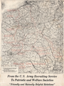
From the U.S. Army Recruiting Service to Patriotic and Welfare Societies.
sold
- Digital Map Information
- Suitable for large format printing
- File Size: 48.68 MB
- File Type: ZIP / TIFF
- ICC color profile embedded
- Delivered instantly via download link
A striking 1920 map of the Western Front of World War I (1914 - 1918), noting the locations of campaigns and battles in which American forces fought. It was produced by the U.S. Army's Engineer Reproduction Plant as a guide for distributing medals and clasps to veterans. (more details)
Ephemeral WWII mimeograph Route Map following the 318th Infantry Regiment.
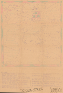
Map Route CT 318.
sold
- Digital Map Information
- Suitable for large format printing
- Full resolution TIFF file
- ICC color profile embedded
- Delivered instantly via download link
This is a 1945 mimeographed World War II unit route map of the 318th Infantry Regiment in Europe. It records the regiment's fight across Europe, noting milestones, and includes an operational report of the last days of combat in the European theatre, May 6-7, 1945, on the verso. As a mimeograph, this route map is unusual for the genre and limited by the medium, making it exceptionally ephemeral. (more details)
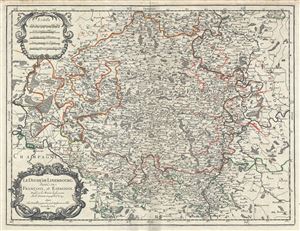
Le Duche de Luxembourg, divise en Francois, et Espagnol.
sold
- Digital Map Information
- Suitable for large format printing
- DPI: 300
- File Size: 17.83 MB
- File Type: ZIP / TIFF
- ICC color profile embedded
- Delivered instantly via download link
This is a scarce 1674 map of the Duchy of Luxembourg by Alexis-Hubert Jaillot. It covers Luxembourg along with parts of neighboring Belgium, France and Germany from Revin in France east to Blankenheim in Germany and from Spa in Belgium, south as far as ... (more details)
Planning an Allied operation across the River Maas.
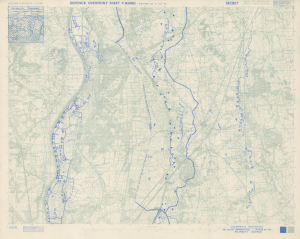
Holland and Germany 1: 25,000 Defence Overprint Sheet F (Rhine) Edition of 31 Oct 44.
sold
- Digital Map Information
- Suitable for large format printing
- Full resolution TIFF file
- ICC color profile embedded
- Delivered instantly via download link
This is an October 1944 World War II Defence Overprint map of the southeastern Netherlands and eastern Germany. The map was compiled from aerial photography during the planning stages of an Allied offensive across the River Maas. (more details)
Follow the 748th Field Artillery Battalion through the European Theater of Operations.
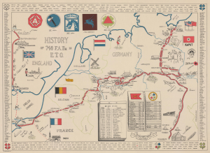
History of 748 F. A. Bn. in E.T.O.
sold
- Digital Map Information
- Suitable for large format printing
- File Size: 28.5 MB
- File Type: ZIP / TIFF
- ICC color profile embedded
- Delivered instantly via download link
This is a rare 1945 World War II pictorial route map of the 748th Field Artillery Battalion in the European Theater of Operations. The map follows the battalion from Liverpool, England, to Weissenburg, Germany, and marks its battles and alongside illustrations of landmarks and 'cultural moments' experienced by the soldiers. (more details)
Bombing Britain and a possible German invasion.
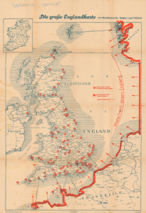
Die Grosse Englandkarte mit Nordfrankreich, Belgien und Holland.
sold
- Digital Map Information
- Suitable for large format printing
- File Size: 37.96 MB
- File Type: ZIP / TIFF
- ICC color profile embedded
- Delivered instantly via download link
This is a 1942 German propaganda map of Great Britain published by Carl Lange Verlag during World War II (1939 - 1945). The map highlights cities throughout Britain that the Luftwaffe had bombed and reinforces the fact that Germany occupied the entire coast of continental Europe. (more details)
Preparing to continue fighting east toward Germany.
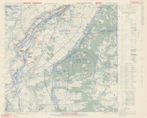
Germany 1:25000. Defence Overprint Sheet 4702 Edition of 7 Feb. 45.
sold
- Digital Map Information
- Suitable for large format printing
- Full resolution TIFF file
- ICC color profile embedded
- Delivered instantly via download link
This is a February 1945 World War II (1939 - 1945) Defence Overprint map of the southeastern Netherlands. Created for British and Canadian forces advancing as part of Operation Veritable, the map highlights German defensive positions along the Meuse River, including a network of trenches and machine gun emplacements that run along the riverbank. (more details)
Roads and Shipping in the Holy Roman Empire.
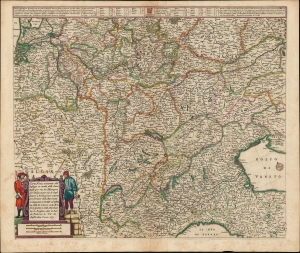
Carta Noua accurata del Passagio et strada dalli Paesi Bassi per via de Allemagna per Italia et per via di Paesi svizeri à Geneva, Lione et Roma per servizio delli Marchanti et viagianti in Genāle ad instanza delli Ss. scherer et sdi Momforti speditori delli Marchantie in Bregens. Dato in luce da Frederico de Wit di Amsterdam l'anno 1671.
sold
- Digital Map Information
- Suitable for large format printing
- DPI: 600
- File Size: 57.46 MB
- File Type: ZIP / TIFF
- ICC color profile embedded
- Delivered instantly via download link
This is a scarce road map engraved by Cornelis Danckerts in 1651, embellished and completed by Frederic De Wit for its most attractive edition, printed in 1671. It illustrates the land routes throughout the Holy Roman Empire connecting the Netherlands, France, Germany, Italy, Switzerland, Austria and Bohemia. It is a remarkable instance of a map commissioned by a specific mercantile concern, in this case the shippers Scherer and Montefort of Bregenz, on the Boden Zee in modern-day Austria. Maps depicting roads, particularly at this level of detail and at this scale, are unusual for this period; this one provides a unique glimpse on the business of transporting goods, and of travel in general, in the seventeenth century. (more details)
Rewards players for resisting the Occupation and punishes them for activities that aid the Occupier.

Laf en Flink Tijdens Hinkepink. [Laf and Flink During Hinkepink].
sold
- Digital Map Information
- Suitable for large format printing
- File Size: 35.45 MB
- File Type: ZIP / TIFF
- ICC color profile embedded
- Delivered instantly via download link
This is a 1945 Handelsonderneming Omnium Dutch pictorial gameboard of life under the Nazi occupation of the Netherlands during World War II. Played by between two and twelve players, each player starts with four chips. Using two dice, the players move along the game board moving the number of spaces rolled. Whichever player reaches the 100th space at the center of the board, the 'Tree of Liberty' with the seals of the eleven provinces of the Netherlands, is the winner. (more details)
Tank Destroyers during World War II.
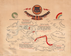
Fightin' 'B' Company 692 T.D. Bn.
sold
- Digital Map Information
- Suitable for large format printing
- File Size: 22.74 MB
- File Type: ZIP / TIFF
- ICC color profile embedded
- Delivered instantly via download link
This is a c. 1945 World War II unit route map of Company B, 692nd Tank Destroyer Battalion, in Europe. The map follows Company B from its September 26, 1944 debarkation in Europe through France, Belgium, and Germany until May 8, 1945, V-E Day, the end of the war in Europe. (more details)
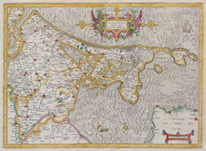
Hollandt comitatus Vtricht episcope
sold
- Digital Map Information
- Suitable for large format printing
- Full resolution TIFF file
- ICC color profile embedded
- Delivered instantly via download link
A rare and beautiful 1606 map of Holland ( Netherlands ) by Gerard Mercator. Amsterdam appears at the center and the map extends south as far as Harderwyck and west as far as Rhenen and Rotterdam. The Zunder Zee, now a damned inland waterway, ... (more details)
Follow the 32nd Armored Regiment across Europe during World War II.
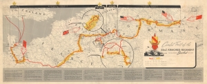
Combat Trail of the 32nd Armored Regiment Third Armored Spearhead Division.
sold
- Digital Map Information
- Suitable for large format printing
- File Size: 18.96 MB
- File Type: ZIP / TIFF
- ICC color profile embedded
- Delivered instantly via download link
This is a 1945 World War II pictorial unit route map of the 32nd Armored Regiment in Europe. The map illustrates the Regiment's movements from its departure from England until it was taken off the line for the final time in late April 1944. (more details)
Follow an ammunition supply battalion across Europe.
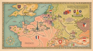
262 Ordnance Battalion (AM) in the European Theatre of Operations. Lt. Col. H.C. Holman Commanding.
sold
- Digital Map Information
- Suitable for large format printing
- Full resolution TIFF file
- ICC color profile embedded
- Delivered instantly via download link
This is an artistic World War II pictorial route map highlighting the campaign of the 262nd Ordnance Ammunition Battalion drawn by Walter Leonard. (more details)
World War II as experienced by the soldiers of the III Corps.
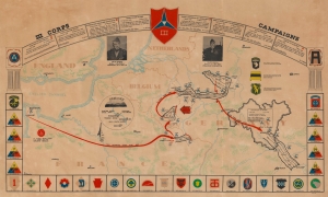
III Corps Campaigns.
sold
- Digital Map Information
- Suitable for large format printing
- File Size: 31.26 MB
- File Type: ZIP / TIFF
- ICC color profile embedded
- Delivered instantly via download link
This is a 1945 Al Beaudry III Corps World War II pictorial route map of Europe. Highlighting the corps' movements, its successes, and its assigned divisions, this map details wartime events experienced by thousands of soldiers. (more details)
Meet me at the Zuiderzee.
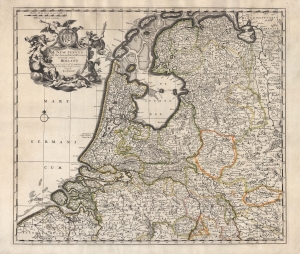
A New Survey of the Seaven United Provinces Commonly Called Holland.
sold
- Digital Map Information
- Suitable for large format printing
- Full resolution TIFF file
- ICC color profile embedded
- Delivered instantly via download link
An unrecorded c. 1740 John Overton map of the Netherlands, based on the 1721 map of the same by John Senex, published in the latter's A New General Atlas of the World. Adopting the convention of the time, 'Holland' is used synonymously with the entire United Provinces. (more details)
The World War I Western Front in June 1918.
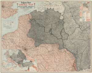
The Literary Digest Liberty Map of the Western Front of the Great World War Showing the Battle Line of Liberty as it Stood June 5, 1918.
sold
- Digital Map Information
- Suitable for large format printing
- Full resolution TIFF file
- ICC color profile embedded
- Delivered instantly via download link
This is a 1918 Matthews-Northrup wall map of northern France, Belgium, Germany, and the surrounding region highlighting the World War I Western Front as of June 5, 1918. A tricolor blue, white, and red line (reminiscent of the French flag) traces the front from the North Sea to Switzerland through parts of western Belgium and northern France. Entente Powers (Britain and France) are shaded pink, while hues of gray fill in members of the 'Teutonic Allies' (Germany) or territory occupied by them (Belgium, Luxembourg, and northeastern France). A blue dashed line marks Germany's farthest advance, while a red dashed line illustrates the advancement of French forces. An accompanying index identifies over 11,000 place names. An inset in the upper right highlights coal and iron regions in occupied territory and Germany and a table just below it quantifies the production. An inset in the lower left corner depicts everywhere fighting was happening around the world. Red lines reinforce these disparate regions: northern France, Russia, Romania, northeastern Italy, Greece, Palestine, and modern-day Iraq. (more details)
Detailed map of southern Netherlands dating to the early 18th century.
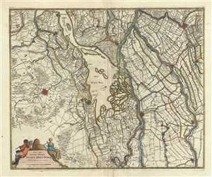
Nova atque emendata descriptio Suydt Hollandiae.
sold
- Digital Map Information
- Suitable for large format printing
- Full resolution TIFF file
- ICC color profile embedded
- Delivered instantly via download link
This is a beautiful c.1721 map of southern Holland or the Netherlands by Frederik De Wit. Oriented with north facing northwest, it extends from Gouda south to Breda and from Willemstad east as far as Culemborg. Important cities of Dordrecht, ... (more details)
Attractive, southern-oriented map of Germany.
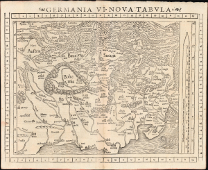
Germania VI. Nova Tabula.
sold
- Digital Map Information
- Suitable for large format printing
- Full resolution TIFF file
- ICC color profile embedded
- Delivered instantly via download link
This is a superb example of Sebastian Münster's modern map of Germany and Central Europe, in a desirable 1552 Geographia edition. It is one of the earliest acquirable modern maps of the heart of Europe. (more details)
This WWII unit built bridges, operated hospitals, and delivered supplies.

This is a 1945 John Ciofalo and Clifford Helstrom World War II pictorial map of ADSEC (Advance Section of the Communications Zone), the forward supply unit of the American army. This unit built bridges, operated hospitals, evacuated wounded, and delivered supplies. (more details)