
Paris (sold)
The Finest Engraved Plan of Paris in its Sole Original Edition.
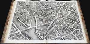
Plan de Paris Commence l’Annee 1734.... Leve et Desine par Louis Bretez Grave par Claude Lucas / Et Ecrit par Aubin.
sold
This is Louis Bretez and Michel-Etienne Turgot's monumental 1739 map of Paris, in a beautiful, bound example. Turgot's map of Paris - possibly the most ambitious urban mapping ever undertaken - shows the whole of 18th century Paris, offering an unparalleled view of the city prior to the 19th century redesign by Baron Georges Eugène Haussmann: every structure within the city at the time is here depicted. Turgot, who held the mayor-like office of Prevôt des Marchands de Paris , commissioned Louis Bretez and Claude Lucas to produce this map. Oriented to the east on an axonometric projection, this map is best understood as an aerial view in which every building, window, tree, shadow, and park are shown from an equidistant aerial perspective. In order to produce the thousands of sketches and surveys required to complete this map, Bretez was issued a permit to enter every building in Paris. It took the team nearly five years of exhaustive sketching and surveying to assemble this masterpiece. (more details)
Lost treasure of Parisian Cartography.
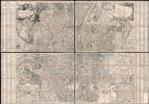
Plan de la Ville de Paris et de ses Faubourgs dédié au Roi.
sold
- Digital Map Information
- Suitable for large format printing
- Full resolution TIFF file
- ICC color profile embedded
- Delivered instantly via download link
The only known example, in this edition, of Bernard-Antoine Jaillot's 1748/1767 large-scale map of Paris. The map is centered on the Île de la Cité and is oriented to the southeast, with the Seine running vertically through the center of the map - a convention established in 1713 by the author's father Bernard-Jean-Hyacinthe Jaillot and followed in 1736-8 by Louis Bretez, and again, here. Coverage extends from the Faubourg Saint-Antoine to the Île des Cygnes that (attached to the Champ de Mars in the late 18th century), and from the Faubourg de Glories to the modern-day 14th arrondissement. Elaborate allegorical cartouches by Pierre-Alexandre Aveline appear in the upper left and right and feature titling and a legend, respectively. In the lower-left and right, inset maps detail the environs of Paris and France in general. The main map is flanked on either side by an exhaustive index of streets and important civic, military, government, mercantile, and ecclesiastical centers. (more details)
Published during the French Revolution.
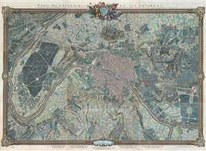
Paris, ses Fauxbourgs, et ses Environs.
sold
- Digital Map Information
- Suitable for large format printing
- DPI: 600
- File Size: 260.28 MB
- File Type: ZIP / TIFF
- ICC color profile embedded
- Delivered instantly via download link
This is a striking 1795 - 1796 Roussel wall-sized city plan or map of Paris, France, and its environs - one of the few large-scale maps of Paris issued during the French Revolution (1789 - 1799). Within Paris, buildings, squares, and parks are illustrated, with the Palais des Tuileries, the Louvre, the Hotel Royal des Invalides, and Notre Dame, among many other famous buildings recognizable. Churches are highlighted in blue, while Paris's many gardens, including the Champs-Elysées, the Champs de Mars, the Jardin des Tuileries, and the Jardin du Luxembourg, appear in green. Some of the most important buildings are illustrated pictorially, including the Abbaye St. Victor, the menagerie in today's Jardin des Plantes, and the factories across the Seine from the Jardin des Plantes. Outside Paris proper, spectacular illustrations of Montmarte and the Butte Chaumont appear. Paris's suburbs are illustrated and labeled as well, many of which are modern-day neighborhoods. (more details)
Unique constructed manuscript plan to renovate Paris by the architect of the Odéon.
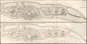
Plan du Quartier de la Cité. / Plan due Quartier de la Cité, de sa Reunion avec L'Isle St. Louis, d'une Garre et d'une Place Consacre a, Louis XVI.
sold
- Digital Map Information
- Suitable for large format printing
- File Size: 14.15 MB
- File Type: ZIP / TIFF
- ICC color profile embedded
- Delivered instantly via download link
A most unique and intriguing 1789 map of the Cité quarter, Paris, with copious manuscript, illustrating the bold plan of French 'Architecte du Roi' and designer of the Odéon, Charles de Wailly, to unite Paris's Île de la Cité with neighboring Île Saint-Louis. The plan, though greeted at the 1789 Paris Salon with much enthusiasm, floundered due to unfortunate timing: it was proposed at the outbreak of the French Revolution (1789 - 1799). It is an epic 'could-have-been' by one of Paris's most famous and influential architects. (more details)
Planning the Thiers Wall - Original Manuscript!
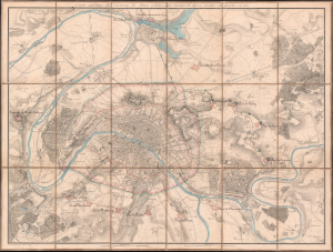
Carte Militaire des Environs de Paris relative aux traveaux de défense éxécutés ou projetés en 1815.
sold
- Digital Map Information
- Suitable for large format printing
- Full resolution TIFF file
- ICC color profile embedded
- Delivered instantly via download link
This is a unique c. 1815 Charles-Étienne Collin map of Paris, France, with unique c. 1841 manuscript updates by General Louis Doguereau illustrating the planned fortification of Paris or, as it became known, the Thiers Wall (Enceinte de Thiers), one of the greatest follies of military engineering ever conceived. As head of the École d'Application de l'Artillerie et du Génie, Doguereau was part of the 8-man Commission des Fortifications organized to design the wall in 1840-41. (more details)
Considered one of the best bird's-eye views of Paris.
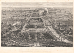
Le Nouveau Paris Panorama de Tous Ses Monuments, Jardins, Promenades; Pris sous un Aspect Nouveau.
sold
- Digital Map Information
- Suitable for large format printing
- File Size: 57.13 MB
- File Type: ZIP / TIFF
- ICC color profile embedded
- Delivered instantly via download link
This is the extremely rare 1865 Guesnu / Chardon bird's-eye view of Paris, France. This is the 'new' Paris, transformed by the Haussmann renovations - celebrated by many, cursed by others. This view stunningly captures the changes by exaggerating the perspective of the new avenues and grand new buildings. (more details)
Considered one of the best Bird's-eye views of Paris.
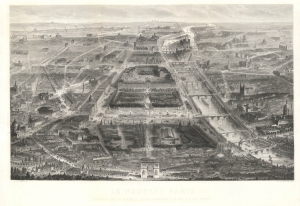
Le Nouveau Paris Panorama de Tous Ses Monuments, Jardins, Promenades; Pris sous un Aspect Nouveau.
sold
- Digital Map Information
- Suitable for large format printing
- File Size: 126.58 MB
- File Type: ZIP / TIFF
- ICC color profile embedded
- Delivered instantly via download link
This is the extremely rare 1865 Guesnu / Chardon bird's-eye view of Paris, France. This is the 'new' Paris, transformed by the Haussmann renovations - celebrated by many, cursed by others. This view stunningly captures the changes by exaggerating the perspective of the new avenues and grand new buildings. (more details)
On the cusp of Imperial glory.
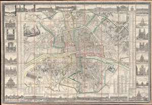
Nouveau Plan Routier de la Ville et Faubourgs de Paris Avec ses Principaux Edifices et Nouvelles Barrieres.
sold
- Digital Map Information
- Suitable for large format printing
- Full resolution TIFF file
- ICC color profile embedded
- Delivered instantly via download link
This is a striking 1804 Pichon and Esnault city plan or map of Paris, France, published during the last (13th) year of the French First Republic. This map marks a critical moment in Parisian history, when under Napoleon Bonaparte (1769 - 1821), the city transformed from a national into an imperial capital. Napoleon crowned himself Emperor of France on December 2, 1804, and immediately embarked upon a series of ambitious civic and urban developments intended to transform Paris into an imperial capital on the model of ancient Rome. (more details)
Magnificent, iconic, and highly detailed twenty page wall map of Paris, France.
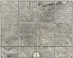
This is the c. 1900 Taride edition of Louis Bretez and Michel-Etienne Turgot's monumental 1739 map of Paris. Turgot's map of Paris is possibly the most ambitious urban mapping ever undertaken. This map shows the whole of 18th century Paris and offers a wonderful perspective on the city before Baron Georges Eugène Haussmann's 19th-century redesign. Turgot, who held the mayor-like office of Prevôt des Marchands de Paris , commissioned Louis Bretez and Claude Lucas to produce this map in 1734. Oriented to the east on an axonometric projection, this map is best understood as an aerial view where in every building, window, tree, shadow, and park are shown. It took the team nearly five years of exhaustive sketching and surveying to assemble this masterpiece. In order to produce the thousands of sketches and surveys required to complete this map, Bretez was issued a permit to enter every building in Paris. (more details)
Important and monumental 20 panel map of Paris.
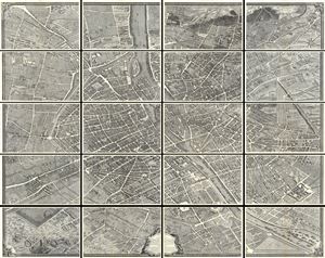
Plan de Paris.
sold
- Digital Map Information
- Suitable for large format printing
- File Size: 32.16 MB
- File Type: ZIP / TIFF
- ICC color profile embedded
- Delivered instantly via download link
This is the c. 1900 Taride edition of Louis Bretez and Michel-Etienne Turgot's monumental 1739 map of Paris. Turgot's map of Paris is possibly the most ambitious urban mapping ever undertaken. This map shows the whole of 18th century Paris and offers a wonderful perspective on the city before Baron Georges Eugène Haussmann's 19th-century redesign. Turgot, who held the mayor-like office of Prevôt des Marchands de Paris , commissioned Louis Bretez and Claude Lucas to produce this map in 1734. Oriented to the east on an axonometric projection, this map is best understood as an aerial view where in every building, window, tree, shadow, and park are shown. It took the team nearly five years of exhaustive sketching and surveying to assemble this masterpiece. In order to produce the thousands of sketches and surveys required to complete this map, Bretez was issued a permit to enter every building in Paris. (more details)
Iconic and early view of Paris.
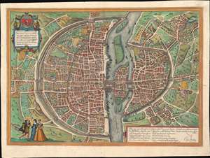
Lutetia vulgari Nomine Paris, Urbs Galliae Maxima, Sequana Navigabili Flumine Irrigatur ...
sold
- Digital Map Information
- Suitable for large format printing
- Full resolution TIFF file
- ICC color profile embedded
- Delivered instantly via download link
A fine full-color example of the Braun and Hogenberg's 1572 map and view of Paris, France. With the Seine flowing at center around the Île de la Cité, this view looks on Paris from the northwest, with the top of the map oriented to the southeast. The city is presented on from equidistant bird's-eye perspective wherein all structures are rendered in view form but from a uniform height and angle relative to all individual points. Fertile fields surround the city, and the rivers bustles with boats, suggesting richness and prosperity. In the bottom left corner, a man greets two women, all are wearing clothing corresponding to the Spanish influenced fashion norms of 1560 - 1570. The Bastille, an infamous as a prison prior to the French Revolution, appears here at top center, surrounded by a mat. The 1550 bastion, appearing to the left of the main structure of the Bastille is also evident. The map's title 'Lutetia' refers to the roman name for Paris which, by the 16th century, had largely been phased out. (more details)
Monumental twelve panel map of Paris.
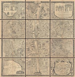
Plan De Paris, Leve Par Les Ordres Du Roy Et Par Les Soins De Messieurs Les Prevost Des Marchands Et Eschevins.
sold
This majestic twelve panel map or plan of Paris is the c. 1900 Taride reissue of an important map originally prepared by Pierre Bullet, Francois Blonde, A. Bonnardt, and Bernard J. H. Jaillot. Like many early maps of Paris, the present example is oriented to the ... (more details)
Important and monumental 20 panel map of Paris, France.
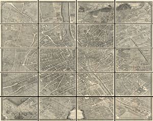
Plan de Paris.
sold
- Digital Map Information
- Suitable for large format printing
- File Size: 17.85 MB
- File Type: ZIP / TIFF
- ICC color profile embedded
- Delivered instantly via download link
This is the c. 1900 Taride edition of Louis Bretez and Michel-Etienne Turgot's monumental 1739 map of Paris. Turgot's map of Paris is possibly the most ambitious urban mapping ever undertaken. Shows the whole of 18th century Paris and offers a wonderful ... (more details)
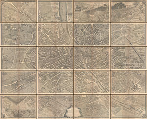
Plan de Paris.
sold
- Digital Map Information
- Suitable for large format printing
- File Size: 39.19 MB
- File Type: ZIP / TIFF
- ICC color profile embedded
- Delivered instantly via download link
This is the c. 1900 Taride edition of Louis Bretez and Michel-Etienne Turgot's monumental 1739 map of Paris. Turgot's map of Paris is possibly the most ambitious urban mapping ever undertaken. Shows the whole of 18th century Paris and offers a wonderful ... (more details)
Important and monumental 20 panel map of Paris.
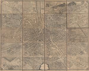
Plan de Paris.
sold
- Digital Map Information
- Suitable for large format printing
- File Size: 30.4 MB
- File Type: ZIP / TIFF
- ICC color profile embedded
- Delivered instantly via download link
This is the c. 1900 Taride edition of Louis Bretez and Michel-Etienne Turgot's monumental 1739 map of Paris. Turgot's map of Paris is possibly the most ambitious urban mapping ever undertaken. This map shows the whole of 18th century Paris and offers a wonderful perspective on the city before Baron Georges Eugène Haussmann's 19th-century redesign. Turgot, who held the mayor-like office of Prevôt des Marchands de Paris , commissioned Louis Bretez and Claude Lucas to produce this map in 1734. Oriented to the east on an axonometric projection, this map is best understood as an aerial view where in every building, window, tree, shadow, and park are shown. It took the team nearly five years of exhaustive sketching and surveying to assemble this masterpiece. In order to produce the thousands of sketches and surveys required to complete this map, Bretez was issued a permit to enter every building in Paris. (more details)
Two weeks before the Siege of Paris.
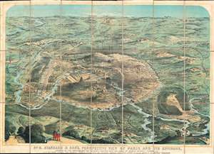
No. 8. Stannard and Son's, Perspective View of Paris and its Environs, Shewing All the Fortifications and Redoubts, Together with the Lines of Defense Recently Thrown Up, and the Roads, Rivers, and Railways Communication with the Interior.
sold
- Digital Map Information
- Suitable for large format printing
- File Size: 61.17 MB
- File Type: ZIP / TIFF
- ICC color profile embedded
- Delivered instantly via download link
Published eighteen days before the beginning of the Siege of Paris on September 17, 1870, this 1870 Alfred Concanen view of Paris and its environs details the newly constructed defensive works around the French capital. Paris itself occupies the center of the view, and the Louvre and Notre Dame are easily identifiable, along with the Arc de Triomphe, the Panthéon, and the Invalides. The city's walls encircle the entire city, spanning 20.5 miles. A series of sixteen disconnected forts, constructed to protect the city gates, surround the city. Redoubts and other fortifications were built as well to supplement the forts. (more details)
Paris after the Haussmann Renovations at the height of the Second Empire.
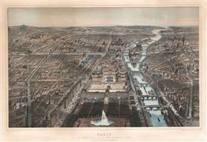
Paris Vue Générale Prise au Dessus de L'Entrée du Jardin ds Tuileries Le Nouveau Louvre, La Rue de Rivoli et Les boulevards.
sold
- Digital Map Information
- Suitable for large format printing
- File Size: 120.04 MB
- File Type: ZIP / TIFF
- ICC color profile embedded
- Delivered instantly via download link
An utterly captivating 1867 large-format lithograph view of Paris by Michel-Charles Fichot and Rose-Joseph Lemercier. The view looks southwest on Paris from hypothetical position above the Bassin Octagonal in the Jardin des Tuileries. The Louvre appears front and center, with the Rue de Rivoli on its left and the Seine on tis right. Notre Dame and the Ile de Cité, the Hôtel de Ville, Tour St. Jacques, and other monuments are apparent. (more details)
Bucolic Panorama of Paris and her Countryside.
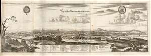
Prosp. der Statt Parys wie solche an ietzo an zusehen.
sold
- Digital Map Information
- Suitable for large format printing
- Full resolution TIFF file
- ICC color profile embedded
- Delivered instantly via download link
This is a 1655 Caspar Merian view of Paris, France - a superbly executed view showing that in artistry Caspar was indeed his father's son. The view is oriented to the west-south-west, from a perspective both further from the city and more to the east than the elder Merian's 1638 view. Rather than border the view with stylized or fanciful floral decoration, Caspar Merian has - following the lead of his father - chosen to frame the panorama in realistic semi-wild trees and bracken of the hillside from which the view was drawn, which has the effect of emphasizing that it was drawn from life. (more details)
Debut of the Eiffel Tower.
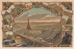
Exposition Universelle de Paris 1889.
sold
- Digital Map Information
- Suitable for large format printing
- File Size: 111.66 MB
- File Type: ZIP / TIFF
- ICC color profile embedded
- Delivered instantly via download link
This is an 1889 Gibert-Clarey (GTC) chromolithograph broadside issued to promote the Paris Exposition Universelle. Although numerous stunning broadsides were issued for the Exposition, this one stands out for its beautiful and technical mastery. (more details)
One of the most beautiful old color large format 19th century maps of Paris.
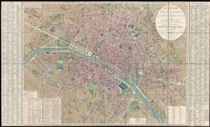
Plan Routier de la Ville de Paris, divise en XII Arrondissements ou Mairies et en Quarante Huit Quartiers, avec tous le Changements et Projets ordonnes par le Gouvernement.
sold
- Digital Map Information
- Suitable for large format printing
- DPI: 300
- File Size: 86.66 MB
- File Type: ZIP / TIFF
- ICC color profile embedded
- Delivered instantly via download link
This is a stunning large format map of Paris issued in 1839 by Pierre-Jacques Picquet. Centered on the Seine River, the map covers from the Champ de Mars eastward to Place du Trone. This map was first issued for administrative use during the Napoleonic ... (more details)
Debut of the Eiffel Tower.
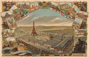
Exposition Universelle de Paris 1889.
sold
- Digital Map Information
- Suitable for large format printing
- File Size: 43.26 MB
- File Type: ZIP / TIFF
- ICC color profile embedded
- Delivered instantly via download link
This is an 1889 Gibert-Clarey (GTC) chromolithograph broadside issued to promote the Paris Exposition Universelle. Although numerous stunning broadsides were issued for the Exposition, this one stands out for its beautiful and technical mastery. (more details)
Paris takes on the automobile!
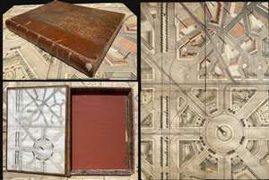
Accident d'Automobile.
sold
- Digital Map Information
- Suitable for large format printing
- File Size: 5.17 MB
- File Type: ZIP / TIFF
- ICC color profile embedded
- Delivered instantly via download link
A fascinating c. 1900 French manuscript gameboard that doubled as educational tool in the field of civic planning. Entitled Accident d'Automobile, the board consists of four panels, each representing a different 'traffic' problem, all of which were pertinent to Paris in the late 19th and early 20th century. The panels, each of which are mounted on sheets of cork, assemble according to a key found on the inside cover of the binder. The binder itself is a beautifully constructed French book box with the title embossed in gilt on the spine. This set is a testament to the fact that sometimes the best pedagogical tool is a game that models real-life scenarios. (more details)
Monumental map of Paris in nine panels.
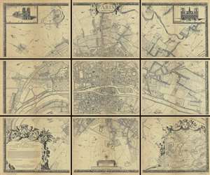
Paris et ses Environs.
sold
- Digital Map Information
- Suitable for large format printing
- File Size: 180.69 MB
- File Type: ZIP / TIFF
- ICC color profile embedded
- Delivered instantly via download link
A rare example of the c. 1900 reissue of Albert Jouvin de Rochefort's monumental 1675 nine panel map of Paris. Rochefort's plan of Paris was influential due to its illustration of the rapidly expanding urban center of Paris. This highly decorative ... (more details)
Majestic and revolutionary multi panel wall map of Paris.
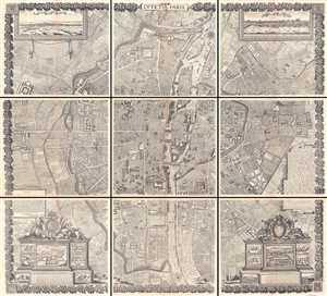
Lutetia Paris.
sold
- Digital Map Information
- Suitable for large format printing
- Full resolution TIFF file
- ICC color profile embedded
- Delivered instantly via download link
This majestic nine panel plan of Paris is the c. 1900 Taride reissue of an important map originally issued in 1652 by Jacques Gomboust. Gomboust held the position of Ingenieur du Roi and, in that capacity completed several important surveys of Paris ... (more details)
Majestic and revolutionary multi panel wall map of Paris.
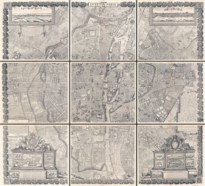
Lutetia Paris.
sold
- Digital Map Information
- Suitable for large format printing
- Full resolution TIFF file
- ICC color profile embedded
- Delivered instantly via download link
This majestic nine panel plan of Paris is the c. 1900 Taride reissue of an important map originally issued in 1652 by Jacques Gomboust. Gomboust held the position of Ingenieur du Roi and, in that capacity completed a number of important survey's of ... (more details)
Majestic and revolutionary multi panel wall map of Paris.
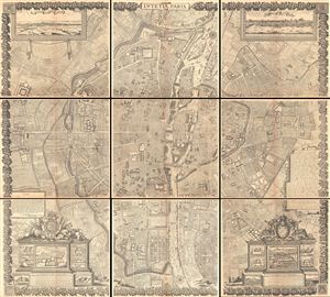
Lutetia Paris.
sold
- Digital Map Information
- Suitable for large format printing
- File Size: 30.77 MB
- File Type: ZIP / TIFF
- ICC color profile embedded
- Delivered instantly via download link
This majestic nine panel plan of Paris is the c. 1900 Taride reissue of an important map originally issued in 1652 by Jacques Gomboust. Gomboust held the position of Ingenieur du Roi and, in that capacity completed a number of important survey's of ... (more details)
Monumental map of Paris in nine panels.
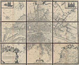
Paris et ses Environs.
sold
- Digital Map Information
- Suitable for large format printing
- File Size: 13.02 MB
- File Type: ZIP / TIFF
- ICC color profile embedded
- Delivered instantly via download link
A rare example of the c. 1900 reissue of Albert Jouvin de Rochefort's monumental 1675 nine panel map of Paris. Rochefort's plan of Paris was influential due to its illustration of the rapidly expanding urban center of Paris. This highly ... (more details)
Monumental map of Paris in nine panels.
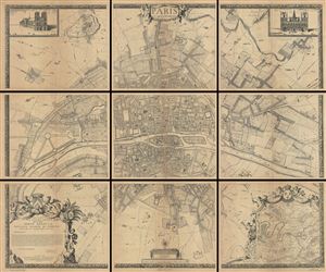
Paris et ses Environs.
sold
- Digital Map Information
- Suitable for large format printing
- File Size: 178.49 MB
- File Type: ZIP / TIFF
- ICC color profile embedded
- Delivered instantly via download link
A rare example of the c. 1900 reissue of Albert Jouvin de Rochefort's monumental 1675 nine panel map of Paris. Rochefort's plan of Paris was influential due to its illustration of the rapidly expanding urban center of Paris. This highly ... (more details)
All the world goes to Paris.

A striking 1947 / 62 Pierre Baudouin map illustration of Paris advertising Air France. Capturing the romance of the city of lights, this view offers an aerial view of Place Charles de Gaulle and the Arc de Triomphe. It is oriented to the east, with the Champs-Élysées exiting towards the bottom left. Air France offices are noted just a street away from the iconic monument. (more details)
A giraffe in a top hat takes in Paris.
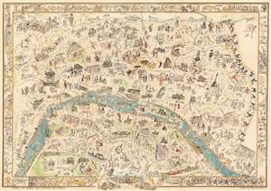
Visages de Paris - Plan humoristique de Paris.
sold
- Digital Map Information
- Suitable for large format printing
- Full resolution TIFF file
- ICC color profile embedded
- Delivered instantly via download link
This is a 1933 Paul Jeffay rare pictorial map of Paris, France, created to support out-of-work artists during the Great Depression (1929 - 1939). (more details)
A simply stunning large format city map of Paris during the reign of Napoleon I.
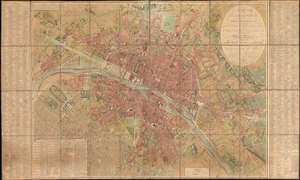
Plan Routier de la Ville de Paris et de ses Faubourgs, où se trouvent indiqués tous les Changements Opérés jusqu'à ce Jour avec les Projets d'Embellissement arrêtés par le Gouvernement.
sold
- Digital Map Information
- Suitable for large format printing
- DPI: 600
- File Size: 128.45 MB
- File Type: ZIP / TIFF
- ICC color profile embedded
- Delivered instantly via download link
This stunning large-format folding 1808 Charles Picquet case map of Paris presents the city during the heady years of the Napoleonic era. Depicting the city from the newly-constructed Pont d'Jena (now the Pont d'Iéna) and the Champs de Mars to the Place du Trône and from Montmartre (then a small hamlet outside Paris) to the Porte d'Italie, the splendor and luxury of Napoleon's imperial capital are on full display. (more details)
A scarce c. 1880 restrike of the lost 1550 Tapisserie Plan, the second earliest plan of Paris.
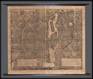
Paris De 1512-1547 de la Gran Gouache apres le plan Tapisserie.
sold
- Digital Map Information
- Suitable for large format printing
- File Size: 21.03 MB
- File Type: ZIP / TIFF
- ICC color profile embedded
- Delivered instantly via download link
An uncommon find, this is Charles Chardon's c. 1880 heliogravure reissue of the great c. 1550 Tapisserie Plan or Map of Paris, France. Though quite large, Chardon issued this map at only 1/5 the size the original now lost 1550 map. Though ... (more details)