
Brion de la Tour, Louis (sold)

Louis Brion de la Tour (1743 - 1803) was the Cartographer Royal to the King of France, his official title being Ingenieur-Geographe du Roi. Despite a prolific cartographic career and several important atlases to his name, little is actually known of his life and career. He may have been born in Bordeaux. His son of the same name was born in 1763 and published until his death in 1832. It is nearly impossible to distinguish the work of the father from the work of the son, as both used the same imprint and were active in roughly the same period. Much of their work was published in partnership Louis Charles Desnos (fl. 1750 - 1790). Their most notable work is generally regarded to be his 1766 Atlas General.
Rare deluxe edition of Desnos's Map of America.

Amerique.
sold
- Digital Map Information
- Suitable for large format printing
- DPI: 300
- File Size: 10.75 MB
- File Type: ZIP / TIFF
- ICC color profile embedded
- Delivered instantly via download link
This is an extremely rare example of Desnos and Brion de la Tour's c. 1760 mapping of America. Covers both North America and South America from Greenland to Cape Horn. Overall the general form of the continents exhibit an craggy and exceptionally rugged coast ... (more details)
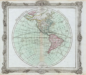
Hemisphere Occidental.
sold
- Digital Map Information
- Suitable for large format printing
- Full resolution TIFF file
- ICC color profile embedded
- Delivered instantly via download link
This is a rare and elegantly produced 1764 map of the Americas by French cartographer Louis Brion de la Tour. Depicts the whole of North and South America with several interesting cartographic features. The American northwest is largely ill defined though ... (more details)
First Edition of a Delicately Engraved World Map Featuring the Sea of the West
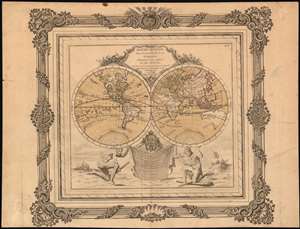
Mappe-Monde Dressée pour l'Etude de la Géographie : rélativement aux Auteurs les plus Modernes.
sold
- Digital Map Information
- Suitable for large format printing
- DPI: 600
- File Size: 18.34 MB
- File Type: ZIP / TIFF
- ICC color profile embedded
- Delivered instantly via download link
An attractive example, with delicately-applied old wash and outline color, of this fascinating map of the world. The map is executed in two hemispheres, each suspended by a titan, one of which is presumably Atlas. Superbly engraved cartocuhes embellish the cusps of the hemispheres. Boasting the state-of-the-art astronomical observations of both Chirikof and Delisle, the map reveals a conjectural Northwest Passage and a massive Sea of the West dominating the northwest part of North America. Australia (Nouvelle Holland on this map) and New Zealand appear in their pre-Cook delineation, with indistinct eastern coastlines. It was engraved using two separate copperplates: one for the map itself, and another for the decorative rococo border. (this allowed for different borders to be employed in later editions of the atlas.) (more details)
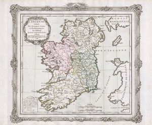
L’Irlande divisee Par Provinces Civiles et Ecclesiastiques.
sold
- Digital Map Information
- Suitable for large format printing
- DPI: 300
- File Size: 2.62 MB
- File Type: ZIP / TIFF
- ICC color profile embedded
- Delivered instantly via download link
This is a rare and elegantly produced 1766 map of Ireland by the French cartographer Louis Brion de la Tour and his associate Louis Charles Desnos. Depicts the island of Ireland divided into four sections. Decorative title cartouche in the upper left ... (more details)
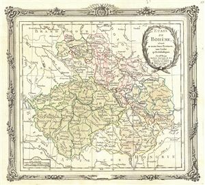
Etats de Boheme, divises en toutes leurs Provinces, tant Civiles qu Ecclesiastiques.
sold
- Digital Map Information
- Suitable for large format printing
- DPI: 300
- File Size: 5.1 MB
- File Type: ZIP / TIFF
- ICC color profile embedded
- Delivered instantly via download link
This is an appealing 1766 of Bohemia or modern day Czech Republic by Brion de la Tour and Louis Charles Desnos. It covers all of modern day Czech Republic and parts of Germany and Poland from Frankfurt in Germany to Linz in Austria. Major cities ... (more details)
Shows mythical River of the West.
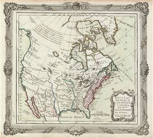
Nouveau Mexique, Louisiane, Canada, et Nlle. Angleterre.
sold
- Digital Map Information
- Suitable for large format printing
- DPI: 300
- File Size: 6.03 MB
- File Type: ZIP / TIFF
- ICC color profile embedded
- Delivered instantly via download link
An appealing first edition issue of Brion de la Tour and Loius Charles Desnos' 1766 map of North America. Depicts North America according to the French conception with hopeful speculative river passages extending west from Hudson Bay towards Lake ... (more details)
Map depicting the places known in the early ages of the world.
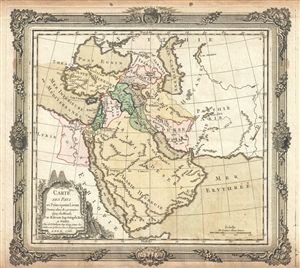
Carte des Pays et Principaux Lieux Connus dans les premiers ages du Monde.
sold
- Digital Map Information
- Suitable for large format printing
- DPI: 300
- File Size: 6.01 MB
- File Type: ZIP / TIFF
- ICC color profile embedded
- Delivered instantly via download link
This is an appealing 1766 map of the Middle East and Arabia by Brion de la Tour and Louis Charles Desnos. It covers the regions between the Caspian Sea and the Gulf of Aden and from Turkey east to the Indus Valley including Turkey, Cyprus, ... (more details)
Essential Map Bringing the American Revolution to a French Audience.
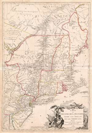
Carte du Theatre de la Guerre entre les Anglais et Les Americains.
sold
- Digital Map Information
- Suitable for large format printing
- DPI: 600
- File Size: 37.33 MB
- File Type: ZIP / TIFF
- ICC color profile embedded
- Delivered instantly via download link
This is a scarce, separately published American Revolutionary War map of New York and New England. First issued by Brion de la Tour in 1777, this map was intended to illustrate the important events at the height of the war. Brion de la Tour's map covers from the Delaware and Chesapeake Bays northward as far as Quebec City, inclusive of New York (with modern day Vermont), New Jersey, Massachusetts, Connecticut, New Hampshire, and parts of Pennsylvania, Maryland, Delaware, Maine, and Canada. It offers both political and topographical detail including mountains, rivers, roadways, regional boundaries, American Indian nations, towns, and cities. (more details)
Map that brought the French into the American Revolutionary War.
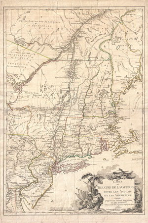
Carte du Theatre de la Guerre entre les Anglais et Les Americains.
sold
- Digital Map Information
- Suitable for large format printing
- DPI: 300
- File Size: 28.67 MB
- File Type: ZIP / TIFF
- ICC color profile embedded
- Delivered instantly via download link
First edition example of an extremely significant map of New York and New England. Issued by Brion de la Tour in 1777, this map was intended to illustrate the important events at the height of the American Revolutionary War. Brion's map ... (more details)
Revolutionary War map of the United States drawn to capitalize on French interest in the war.
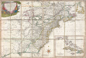
Carte Generale Des Colonies Angloises Dans L'Amerique Septentrionale.
sold
- Digital Map Information
- Suitable for large format printing
- Full resolution TIFF file
- ICC color profile embedded
- Delivered instantly via download link
This is an important and extremely rare 1779 case map of the English colonies in in North America at the height of the American Revolutionary War. Focusing on the English Colonies, this map covers the eastern part of North America from ... (more details)
An early, speculative mapping of the western hemisphere.
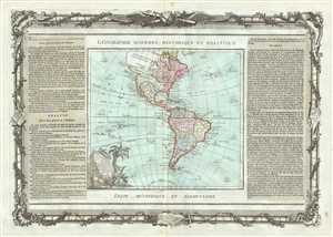
L'Amerique dressee pour l'etude de la Geographie.
sold
- Digital Map Information
- Suitable for large format printing
- DPI: 300
- File Size: 13.32 MB
- File Type: ZIP / TIFF
- ICC color profile embedded
- Delivered instantly via download link
A hard to find 1786 map of the North America and South America by French cartographer Louis Brion de la Tour. Depicts the whole of North and South America with several interesting cartographic features. The American northwest is largely ... (more details)
L'Amérique dressée pour l'étude de la géographie.
sold
- Digital Map Information
- Suitable for large format printing
- DPI: 300
- File Size: 3.78 MB
- File Type: ZIP / TIFF
- ICC color profile embedded
- Delivered instantly via download link
A hard to find 1786 map of the North America and South America by French cartographer Louis Brion de la Tour. Depicts the whole of North and South America with several interesting cartographic features. The American northwest is ... (more details)
18th century map of the Arabian Peninsula and Persia.
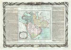
Perse, Turquie Asiatique et Arabie.
sold
- Digital Map Information
- Suitable for large format printing
- DPI: 300
- File Size: 13.37 MB
- File Type: ZIP / TIFF
- ICC color profile embedded
- Delivered instantly via download link
This is an appealing 1786 map of Persia, Arabia and Turkey by French cartographer Louis Brion de la Tour. It covers from the Mediterranean to the Indus River and includes the modern day nations of Saudi Arabia, Israel, Jordan, ... (more details)
Sea of Korea identified.
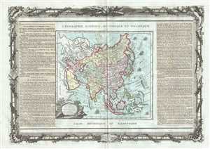
L'Asie, dressee pour l'etude de la Geographie.
sold
- Digital Map Information
- Suitable for large format printing
- DPI: 300
- File Size: 14.25 MB
- File Type: ZIP / TIFF
- ICC color profile embedded
- Delivered instantly via download link
This is an attractive example of French cartographer Louis Brion de la Tour’s 1786 map of Asia. It covers from Africa and the Mediterranean east to Bering Strait and south as far as Java and New Guinea. This map is most ... (more details)
The Burgundy wine producing region of France.
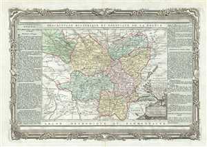
Carte des Departemens de la Cote d'Or, de Saone et Loire, de la Haute Saone, du Doubs, du Jura, de l'Ain, et de la partie Sud de celui d'Yonne.
sold
- Digital Map Information
- Suitable for large format printing
- DPI: 300
- File Size: 11.49 MB
- File Type: ZIP / TIFF
- ICC color profile embedded
- Delivered instantly via download link
This is an attractive 1790 map of the Bourgogne and Franche-Comte regions by the French cartographer Louis Brion de la Tour. The map extends from Auxerre south to Lyon and east as far as Lac Leman (Lac de Geneve) and ... (more details)
18th century map of the French wine and cheese producing region of Brittany.
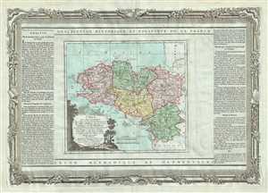
Carte des Departemens des Cotes du Nord, du Finisterre, de l'Ille et Vilaine, de la Loire inferieure et du Morbihan.
sold
- Digital Map Information
- Suitable for large format printing
- DPI: 300
- File Size: 13.08 MB
- File Type: ZIP / TIFF
- ICC color profile embedded
- Delivered instantly via download link
This is a lovely map of the Bretagne region in France by the French cartographer Louis Brion de la Tour. It map covers the French departments of Finistere, Cotes-d'Amor, Ille-et-Vilaine, Morbihan, and ... (more details)
European Russia under Catherine the Great.
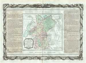
La Russie Europeenne.
sold
- Digital Map Information
- Suitable for large format printing
- DPI: 300
- File Size: 13.27 MB
- File Type: ZIP / TIFF
- ICC color profile embedded
- Delivered instantly via download link
This is a lovely 1786 map of European Russia by French cartographer Louis Brion de la Tour. It depicts the European portion of Russia extending from the Baltic Sea to the Ural Mountains and rendered ... (more details)
Early map of European Turkey.
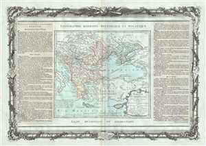
Turquie Europeenne, Avec Les Pays limitropes ou Theatre de la Guerre Actuelle.
sold
- Digital Map Information
- Suitable for large format printing
- DPI: 300
- File Size: 14.02 MB
- File Type: ZIP / TIFF
- ICC color profile embedded
- Delivered instantly via download link
This is a lovely 1786 example of French cartographer Louis Brion de la Tour’s map of European Turkey. The map covers from the boot of Italy eastward as far as Crimea and the Sea of Azov. It ... (more details)
Lovely map of the Republic of the United Provinces.
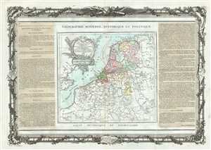
Les Pays Bas Francois, Autrichiens, et Hollandois.
sold
- Digital Map Information
- Suitable for large format printing
- DPI: 300
- File Size: 14.69 MB
- File Type: ZIP / TIFF
- ICC color profile embedded
- Delivered instantly via download link
This is beautiful map of Holland (The Netherlands) and Luxemburg by the French Cartographer Louis Brion de la Tour. It extends from the North Sea south to include Luxembourg. Covers ... (more details)
Beautiful map of Hungary and Romania.
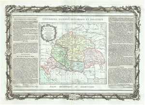
La Hongrie avec les Provinces adjacentes.
sold
- Digital Map Information
- Suitable for large format printing
- DPI: 300
- File Size: 14.23 MB
- File Type: ZIP / TIFF
- ICC color profile embedded
- Delivered instantly via download link
This is an attractive 1786 map of Hungary and Transylvania (modern day Romania) by French cartographer Louis Brion de la Tour. The map covers the region from the Carpathian ... (more details)
Home of the Champagne wines.
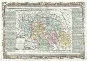
Carte des Departemens de Paris, de la Seine et de l'Oise de la Marne de l'Aube, de la Haute Marne, et de la partie Nord de celui d'Yonne.
sold
- Digital Map Information
- Suitable for large format printing
- DPI: 300
- File Size: 13.23 MB
- File Type: ZIP / TIFF
- ICC color profile embedded
- Delivered instantly via download link
This is a beautiful 1790 map featuring parts of the Ile-de-France, Champagne-Ardenne and Bourgogne regions of France, including Paris, by the French cartographer Louis ... (more details)
Early map of Southeast Asia identifies Singapore.
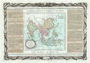
Chine, Et Indes Avec Les Isles.
sold
- Digital Map Information
- Suitable for large format printing
- DPI: 300
- File Size: 14.12 MB
- File Type: ZIP / TIFF
- ICC color profile embedded
- Delivered instantly via download link
This is an appealing 1786 map of India, Southeast Asia, China, and the East Indies by French cartographer Louis Brion de la Tour. Extends from the Indus River eastward ... (more details)
A decorative 18th century map of the West Indies with detailed description in French.
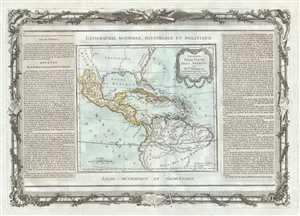
Guayane, Terre Ferme, Isles Antilles, et Nlle. Espagne.
sold
- Digital Map Information
- Suitable for large format printing
- DPI: 300
- File Size: 13.24 MB
- File Type: ZIP / TIFF
- ICC color profile embedded
- Delivered instantly via download link
A stunning decorative 1786 map of Mexico, Central America and the West Indies by Louis Brion de la Tour. It covers from the Chesapeake Bay south to Peru and the Amazon ... (more details)
Beautiful map of North America depicting the Northwest Passage.
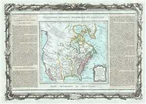
Nouveau Mexique, Louisiane, Canada, et les Etats Unis.
sold
- Digital Map Information
- Suitable for large format printing
- DPI: 300
- File Size: 14.64 MB
- File Type: ZIP / TIFF
- ICC color profile embedded
- Delivered instantly via download link
A rare and highly unusual 1786 map of North America by Desnos and Brion de la Tour. It depicts North America according to the French conception with a northwest ... (more details)
18th century map of the Piedmont wine region of Italy.
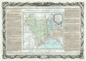
Partie De L'Italie, Comprenant Les Etats Du Roy De Sardaigne, De Milan, Parme, Et Genes.
sold
- Digital Map Information
- Suitable for large format printing
- DPI: 300
- File Size: 13.91 MB
- File Type: ZIP / TIFF
- ICC color profile embedded
- Delivered instantly via download link
This is a beautiful example of Desnos and Brion de la Tour’s 1786 map of the northern Italy. It covers from Lake Geneva south as far as Massa and depicts the ... (more details)
Poland following the First partition.
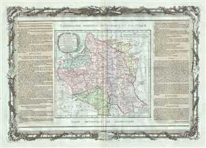
Etats de Pologne et de Lithuanie Divises par Palaunats et Provinces Ecclesiastiques Avec le Roiaume de Prusse et le Duche de Curlande.
sold
- Digital Map Information
- Suitable for large format printing
- DPI: 300
- File Size: 13.54 MB
- File Type: ZIP / TIFF
- ICC color profile embedded
- Delivered instantly via download link
This is a fine 1786 map of Poland and Lithuania by Brion de la Tour and Louis Charles Desnos. It covers modern day Poland, Lithuania, Latvia, Belarus, ... (more details)
Armillary spheres according to Ptolemy and Copernicus.
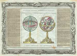
Sphere de Copernic. Sphere de Ptolemee.
sold
- Digital Map Information
- Suitable for large format printing
- DPI: 300
- File Size: 17.36 MB
- File Type: ZIP / TIFF
- ICC color profile embedded
- Delivered instantly via download link
This is an attractive 1786 chart by French cartographer Louis Brion de la Tour depicting two armillary spheres. The sphere in the left shows an ... (more details)
Sweden and Norway in the late 18th century.
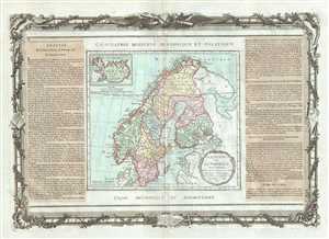
La Suede et La Norwege Avec l'Islande.
sold
- Digital Map Information
- Suitable for large format printing
- DPI: 300
- File Size: 13.15 MB
- File Type: ZIP / TIFF
- ICC color profile embedded
- Delivered instantly via download link
This is a nice example of French cartographer Louis Brion de la Tour’s 1786 map of Scandinavia. Covers Sweden and Norway in beautiful detail ... (more details)
Map depicting the regions producing some of France's finest wines.
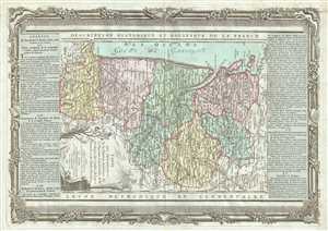
Carte des Departemens de la Charente Inferieure de la Charente, de la Gironde, de la Dordogne, des Landes, du Lot et Garonne et des Basses Pyrenees.
sold
- Digital Map Information
- Suitable for large format printing
- DPI: 300
- File Size: 12.58 MB
- File Type: ZIP / TIFF
- ICC color profile embedded
- Delivered instantly via download link
This is a beautiful 1790 map of the Aquitaine and part of the Poitou-Charentes regions of France by the French cartographer Louis Brion de la ... (more details)
Map of France's Normandy region, famous for its ciders.
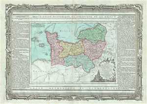
Carte des Departemens de la Manche, du Calvados, de l'Orne, de l'Eure et de la Seine Inferieure.
sold
- Digital Map Information
- Suitable for large format printing
- DPI: 300
- File Size: 13.32 MB
- File Type: ZIP / TIFF
- ICC color profile embedded
- Delivered instantly via download link
This is an attractive 1790 map of the Normandy region in northwest France by the French cartographer Louis Brion de la Tour. Covers the ... (more details)
Exceptional map of the western hemisphere depicting the two competing theories in the mapping of the Pacific Northwest.
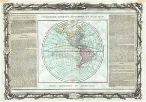
Hemisphere Occidental.
sold
- Digital Map Information
- Suitable for large format printing
- DPI: 300
- File Size: 13.89 MB
- File Type: ZIP / TIFF
- ICC color profile embedded
- Delivered instantly via download link
This is a exceptional map of the Western Hemisphere by de la Tour and Desnos dating to 1786. Covers the entire hemisphere in beautiful ... (more details)
Early map of the world depicting the Sea of the West.
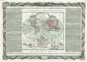
Mappe-Monde dressee pour l'Etude de la Geographie, relativement aux Auteurs les plus Modernes.
sold
- Digital Map Information
- Suitable for large format printing
- DPI: 300
- File Size: 13.42 MB
- File Type: ZIP / TIFF
- ICC color profile embedded
- Delivered instantly via download link
This is a beautiful example of Desnos and Brion de la Tour’s 1786 map of the world on a hemisphere projection. North America, ... (more details)
Shows Eastern Hemisphere.
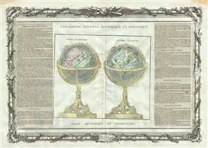
Globe Terrestre. Globe Celeste.
sold
- Digital Map Information
- Suitable for large format printing
- DPI: 300
- File Size: 12.91 MB
- File Type: ZIP / TIFF
- ICC color profile embedded
- Delivered instantly via download link
This is a beautiful 1786 map or chart by French cartographer Louis Brion de la Tour. The chart depicts a terrestrial and a ... (more details)
18th century map showing the leading cheese producing regions of France.
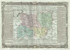
Carte des Departemens du Puy de Dome, du Cantal, Du Rhone et Loire et de la Haute Loire.
sold
- Digital Map Information
- Suitable for large format printing
- DPI: 300
- File Size: 12.76 MB
- File Type: ZIP / TIFF
- ICC color profile embedded
- Delivered instantly via download link
This is a lovely 1790 map of the regions of Auvergne and Rhone-Alpes in France by the French cartographer Louis Brion de ... (more details)
Beautiful map of the French Riviera.
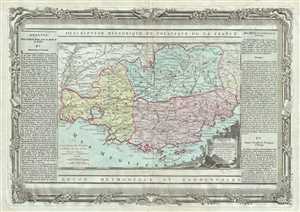
Provence, Divisee en Trois Departemens.
sold
- Digital Map Information
- Suitable for large format printing
- DPI: 300
- File Size: 13.71 MB
- File Type: ZIP / TIFF
- ICC color profile embedded
- Delivered instantly via download link
This is an attractive 1790 map depicting the southern coast or the Provence region of France by the French cartographer ... (more details)
One of the most richly informative cartographic productions ever created.
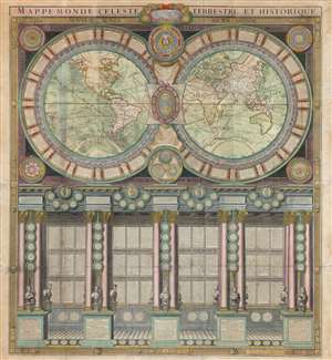
Mappe-Monde Celeste Terrestre et Historique.
sold
- Digital Map Information
- Suitable for large format printing
- DPI: 600
- File Size: 132.49 MB
- File Type: ZIP / TIFF
- ICC color profile embedded
- Delivered instantly via download link
A stunning large format wall map of the world in six panels issued in 1786 by Charles Desnos and Nicolas Jaugeon. Described by map historian Rodney W. Shirley as 'a veritable compendium of a map,' this is one of the most richly informative cartographic productions ever issued. The map consists of a double hemisphere map projection surrounded by no less than 60 Aeoli windheads, astronomical data on constellations, cosmic systems, and other charts - intentionally placing the world in the context of the greater cosmos. Its elegant presentation conveys confidence in the human capacity to describe not only the Earth, but the cosmos itself. The double hemisphere map rests upon Corinthian columns, underscoring the classical foundations of western scientific thought, here augmented by new discovery. The unique, neo-classical motif is carried through to the bottom half of the engraving, where panels of text are set within a portico supported by Corinthian columns. Completing the illusion are a coffered roof and a patterned tile floor. At the base of the columns there busts and accounts of the great explorers, among them Columbus, Magellan, and Vasco de Gama. (more details)
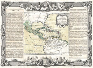
Guayane, Terre Ferme, Isles Antilles, et Nlle. Espagne.
sold
- Digital Map Information
- Suitable for large format printing
- File Size: 13.3 MB
- File Type: ZIP / TIFF
- ICC color profile embedded
- Delivered instantly via download link
A stunning decorative 1766 map of Mexico, Central America and the West Indies by Louis Brion de la Tour. Covers from ... (more details)
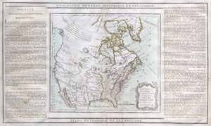
Nouveau Mexique, Louisiane, Canada, et les Etats Unis.
sold
- Digital Map Information
- Suitable for large format printing
- DPI: 300
- File Size: 4.11 MB
- File Type: ZIP / TIFF
- ICC color profile embedded
- Delivered instantly via download link
A rare and highly unusual late 18th century map of North America. Depicts North America according to the French ... (more details)
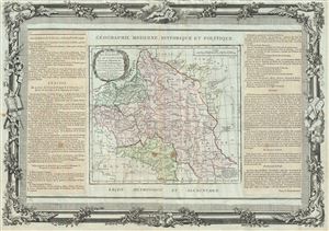
Etats de Pologne et de Lithuanie Divises par Palaunats et Provinces Ecclesiastiques Avec le Roiaume de Prusse et le Duche de Curlande.
sold
- Digital Map Information
- Suitable for large format printing
- DPI: 300
- File Size: 12.95 MB
- File Type: ZIP / TIFF
- ICC color profile embedded
- Delivered instantly via download link
This is a fine 1790 map of Poland and Lithuania by Brion de la Tour and Louis Charles Desnos. It covers modern ... (more details)
Beautifully Executed Manuscript Atlas.
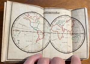
This is a beautifully-executed late 18th manuscript pocket atlas of the world. It is a student work - similar to later, 19th century 'schoolgirl' or 'schoolboy' maps - but has been produced with an unusual level of uniformity and care, and it has been attractively bound. The maps, all done in the same hand, are painstakingly drawn and lettered, and have been carefully and attractively illuminated in original hand color. While we generally associate this form with 19th century British and American students, this example is the work of a late 18th or early 19th century French student - or possibly more than one, as some place name notations appear in a different hand, and possibly at a later date than either of the source maps. (more details)