
Dolph, Frank B. (sold)
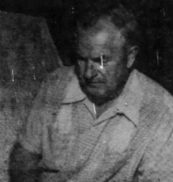
Frank B. Dolph (October 3, 1897 - November 26, 1975) was an American businessman and map publisher. Born in Great Neck, Long Island, New York, Dolph served as a Navy storekeeper during World War I. He began selling maps in 1919 after returning from England, likely for the George F. Cram Company, where he ultimately became an administrative aide. He also worked for the Rand McNally Company for some time before he founded his own map publishing firm, Dolph and Stewart, with his friend, sometime in the 1920s. Dolph and Stewart made maps throughout the 1920s and 1930s until they sold the firm in 1945 when Dolph decided to return to Florida. Dolph opened a new map publishing business, the Frank B. Dolph Map Co. in Ft. Lauderdale and published city plans of cities throughout the United States. Many of his maps were distributed by Chambers of Commerce or sold at newsstands. Real estate developers greatly appreciated his maps, those published by both the Dolph and Stewart Company and the Frank B. Dolph Company. Dolph retired as president of his firm around 1965, when he handed the business off to his son, Frank B. Dolph, Jr. Dolph worked with cartographer Theodore M. Politano for decades while operating the Frank B. Dolph Map Company.
Pre-war era map of Jacksonville.
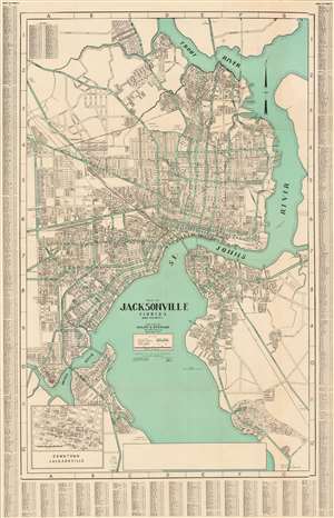
This is a c. 1930 Dolph and Stewart city plan or map of Jacksonville, Florida and its immediate environs highlighting the city's ongoing development. The map focuses on what is now the city's urban core, prior to consolidation; the area loosely delineated by the Ortega River, St. John's, and the Trout River. The Lake Forest neighborhood is shown at a time when it would have sported pecan groves. The proposed road and bridge linking Edgewood and Tallulah Avenues is marked, but has not yet been constructed: the bridge, crossing Moncrief Creek, was not completed until 1945. (more details)
Pre-war era map of Jacksonville.
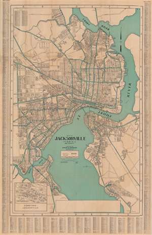
Map of Jacksonville, Florida, and vicinity.
sold
- Digital Map Information
- Suitable for large format printing
- File Size: 38.56 MB
- File Type: ZIP / TIFF
- ICC color profile embedded
- Delivered instantly via download link
This is a c. 1930 Dolph and Stewart city plan or map of Jacksonville, Florida and its immediate environs highlighting the city's ongoing development. The map focuses on what is now the city's urban core, prior to consolidation; the area loosely delineated by the Ortega River, St. John's, and the Trout River. The Lake Forest neighborhood is shown at a time when it would have sported pecan groves. The proposed road and bridge linking Edgewood and Tallulah Avenues is marked, but has not yet been constructed: the bridge, crossing Moncrief Creek, was not completed until 1945. (more details)
Pre-war era map of Jacksonville.
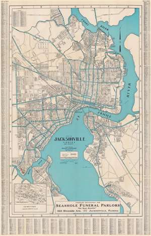
Map of Jacksonville, Florida, and vicinity.
sold
- Digital Map Information
- Suitable for large format printing
- Full resolution TIFF file
- ICC color profile embedded
- Delivered instantly via download link
This is a c. 1930 Dolph and Stewart city plan or map of Jacksonville, Florida and its immediate environs highlighting the city's ongoing development. The map focuses on what is now Jacksonville's urban core, prior to consolidation: the area loosely delineated by the Ortega River, St. John's, and the Trout River. The Lake Forest neighborhood is appears at a time when it would have sported pecan groves. The proposed road and bridge linking Edgewood and Tallulah Avenues is marked but has not yet been constructed. The bridge, crossing Moncrief Creek, was not completed until 1945. (more details)
Pre-war era map of Jacksonville.
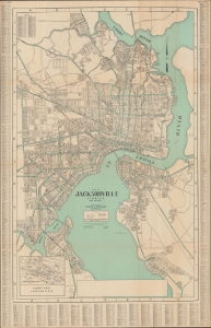
Map of Jacksonville, Florida, and vicinity.
sold
- Digital Map Information
- Suitable for large format printing
- File Size: 82.8 MB
- File Type: ZIP / TIFF
- ICC color profile embedded
- Delivered instantly via download link
This is a c. 1930 Dolph and Stewart city plan or map of Jacksonville, Florida and its immediate environs highlighting the city's ongoing development. (more details)
Palm Beach during World War II - a training ground for American troops.
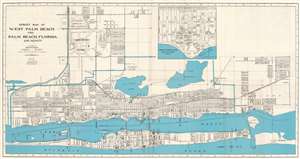
Street Map of West Palm Beach and Palm Beach, Florida and Vicinity.
sold
- Digital Map Information
- Suitable for large format printing
- Full resolution TIFF file
- ICC color profile embedded
- Delivered instantly via download link
This is a c. 1943 Frank B. Dolph city plan or map of West Palm Beach and Palm Beach, Florida, during World War II. Throughout the war, Palm Beach was a training ground for American troops and a target for German attacks - 8 ships were sunk off Pam Beach by German U-Boats. The map is oriented to the east. The Florida East Coast Railway cuts its way through West Palm Beach and its passenger station and freight depot are both identified. Clear Lake, Lake Mangonia, and Lake Worth are all illustrated. Morrison Field Air Base, a U.S. Army Air Corps base, opened in 1942 and operated as a military installation until it closed in 1962, when it was known as Palm Beach Air Force Base. An inset, situated just to the right of center, details the downtown business section of West Palm Beach. Department stores (including Montgomery Ward and Company and J.C. Penney), real estate offices, churches, the telephone company, and the county courthouse are among the labeled locations. (more details)
Casino Coast.
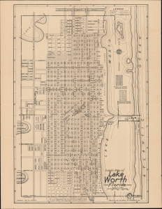
Dolph's Map of Lake Worth Florida / Map of Lake Worth Delray Beach and Lantana Florida.
sold
- Digital Map Information
- Suitable for large format printing
- Full resolution TIFF file
- ICC color profile embedded
- Delivered instantly via download link
A highly detailed, unrecorded city plan of Lake Worth (recently renamed Lake Worth Beach), Florida, with maps of nearby Delray Beach and Lantana on the verso, published in 1945 by Frank Dolph. (more details)
Poultry in Ft. Lauderdale.
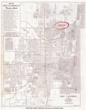
Map of Fort Lauderdale Florida and Environs.
sold
- Digital Map Information
- Suitable for large format printing
- Full resolution TIFF file
- ICC color profile embedded
- Delivered instantly via download link
This is a c. 1947 Dolph Map Company city plan or map of Fort Lauderdale, Florida. The map depicts from Northeast 56th Street south to the Broward County International Airport (now Fort Lauderdale-Hollywood International Airport) and from Federal Highway 441 east to the Atlantic Ocean. Schools, hospitals, parks, shopping centers, and a handful of government buildings are labeled. The Florida East Coast Railroad line cuts through the center of town. The most eye-catching detail is the red overprinting emphasizing the location of the Oakland Park Poultry Farm. (more details)
Post-war Pensacola.
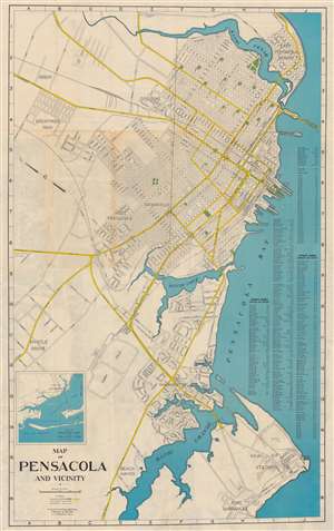
Map of Pensacola and Vicinity.
sold
- Digital Map Information
- Suitable for large format printing
- Full resolution TIFF file
- ICC color profile embedded
- Delivered instantly via download link
This is a c. 1947 Frank B. Dolph city plan or map of Pensacola, Florida, and vicinity. Parks, squares, Legion Field, and a playground all appear in green. Major thoroughfares are colored yellow and streets throughout the city are illustrated and identified. A street index is situated along the right border. An inset map of Pensacola Bay and the surrounding area occupies the lower left corner. (more details)
Schools, civic buildings, and parks in Fort Myers.
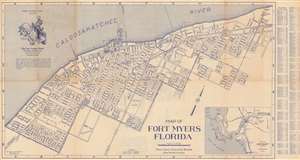
Map of Fort Myers Florida.
sold
- Digital Map Information
- Suitable for large format printing
- Full resolution TIFF file
- ICC color profile embedded
- Delivered instantly via download link
This is a 1950 Frank B. Dolph Company city plan or map of Fort Myers, Florida. Oriented toward the northwest, schools, parks, and streets are illustrated. Both the Atlantic Coast Line Railroad and the Seaboard Air Line Railroad tracks appear, with frieght and passenger terminals noted. The Lee County Bank distributed this map. An illustration of their central branch appears in the Caloosahatchee River. An inset map of Lee County, Florida appears in the lower right. (more details)
The early stages of Jacksonville's postwar development.
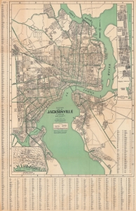
Map of Jacksonville, Florida, and vicinity.
sold
- Digital Map Information
- Suitable for large format printing
- File Size: 37.8 MB
- File Type: ZIP / TIFF
- ICC color profile embedded
- Delivered instantly via download link
This is a large-format c. 1952 Dolph city map of Jacksonville, Florida, and its immediate environs highlighting the city's ongoing development. (more details)
Real Estate in 1950s Fort Lauderdale.
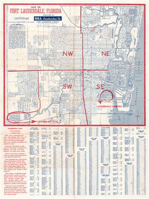
This is a c. 1954 Theodore Politano city plan or map of Fort Lauderdale, Florida. Streets throughout the city are illustrated and labeled. Schools, parks, the city incinerator, City Hall, and the county courthouse are identified. The Lauderdale Drive-In Theatre is also labeled, as are the city ballpark and the city water department. As this map was created to promote Lauderdale Harbors and Lauderdale Isles, two housing developments under construction by the Gill Construction Company, both developments are circled in red and prominently labeled with red block letters. (more details)
Visit Fort Lauderdale!
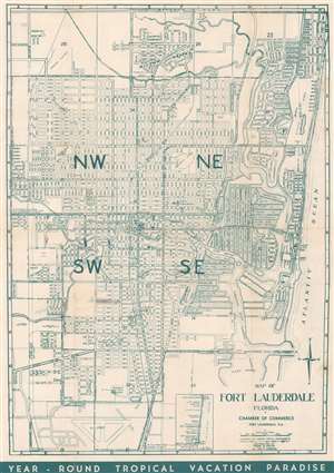
This is a c. 1955 Frank B. Dolph city plan or map of Fort Lauderdale, Florida. Depicting from Oakland Park to the Fort Lauderdale Airport. Schools, churches, hospitals, and parks, and the Florida East Coast Railway's route through Fort Lauderdale are included. Revealingly, this piece also includes references to the Jim Crow era in the South and clearly and explicitly labels segregated schools, cemeteries, and planned recreation centers. Printed photographs and text on the verso highlight activities in and around Fort Lauderdale in an effort to entice tourists. (more details)
Orlando before Disney World.
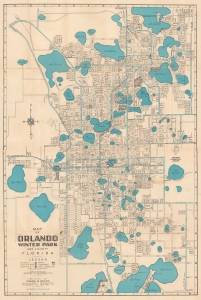
This is a c. 1961 Frank Dolph city plan or map of Orlando and Winter Park, Florida. The map captures the calm before the storm when the region was developing a modest tourism industry but before the explosive changes wrought by Disney World (W.D. purchased the land for Disney World in 1965, and construction began in 1969). (more details)
Orlando on the Eve of the Disney Boom.
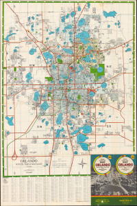
Map of Greater Orlando Winter Park and Maitland Florida / Dolph's Indexed Street Map Orlando Winter Park - Maitland and Orange County Florida.
sold
This is a c. 1965 Frank B. Dolph city plan or map of Orlando, Winter Park, and vicinity in Florida. It depicts the area in the early phase of a period of rapid growth, caught between the disappearing world of railroads and the emerging world of interstates and larger airports for long-distance jetliners. (more details)
Filling out Fort Lauderdale.
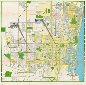
A large and colorful map of Fort Lauderdale, Florida produced c. 1962 by the Dolph Map Co., based in the same city. It depicts Fort Lauderdale in the midst of its postwar population boom, when it also became nationally renowned as a tourist destination. (more details)
Florida's Postwar Tranformations.
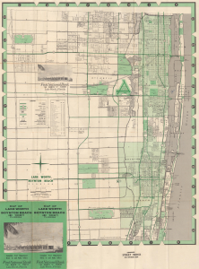
Map of Lake Worth Boynton Beach Florida and Vicinity. / Map of Lake Worth, Boynton Beach and Vicinity Florida.
sold
This is a c. 1963 Dolph map of Lake Worth, Palm Beach County, Florida. It is notable for reflecting the area's significant growth as part of a post-World War II demographic, economic, and real estate boom, as well as an early appearance of Interstate-95, still in the planning stages. (more details)
Charming tourist map of Delray Beach.
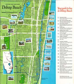
Visitors' Map and Guide Delray Beach.
sold
- Digital Map Information
- Suitable for large format printing
- Full resolution TIFF file
- ICC color profile embedded
- Delivered instantly via download link
This is a c. 1965 Dolph Map Company tourist city plan or map of Delray Beach, Florida. Printed photographs mark nineteen locations across Delray Beach, including the flower farms, the oceanfront promenade, and the boat club. Other identified locations include the post office, the chamber of commerce, and City Hall. Two country clubs and two golf courses are prominently illustrated. Thick white lines highlight important thoroughfares, while thin black lines mark and label streets. An inset along the left border situates Delray Beach in relation to Miami, Orlando, and Daytona Beach. (more details)
Suburban South Florida. Seminole Reservation.
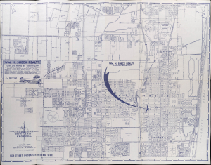
Dolph's Map of Hollywood and Vicinity Florida. / Dolph's Map of Hollywood and Eastern Broward County Florida.
sold
This is a c. 1965 Frank Dolph map of Hollywood, Florida, and environs. It captures the area in a period of rapid postwar growth, evidenced by new housing developments, infrastructure, and public buildings. (more details)
The first air conditioned mall in the southeastern United States.
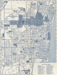
Dolph's Map of Fort Lauderdale Florida and Vicinity. / Map of Oakland Park Florida.
sold
This is a c. 1966 Dolph Map Company city plan or map of Fort Lauderdale, Florida. Numerous locations across the city are identified, including the Lauderhill Mall, which was recognized as the first air conditioned shopping center in the southeastern United States. (more details)
A charming map of Tampa created for First Federal of Tampa - a local bank.
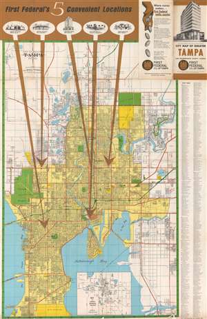
Map of Greater Tampa Florida. / City Map of Greater Tampa and Hillsborough County, Florida.
sold
This is a c. 1968 Dolph Map Company city plan or map of Tampa, Florida, produced for the First Federal Savings and Loan Association of Tampa. As befits the map's purpose, five large brown arrows emphatically point out the five First Federal of Tampa locations around the city. Charming views of each branch appear near the top border at the end of each arrow. Tampa itself is shaded yellow, with city streets illustrated and labeled. City parks are colored green, along with Tampa International Airport and the University of South Florida. City property, including baseball fields, hospitals, the city's industrial park, the shopping center, and its housing projects are shaded a bright yellow. Orange highlights major thoroughfares. Tampa's many suburbs appear in the white areas surrounding the city itself. An inset map of Limona, Brandon, and Valrico is situated along the bottom border and a street index appears outside the right border. (more details)
Winter Homes of the Rich and Famous.
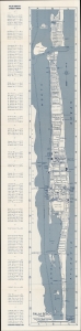
A detailed indexed folding map of Palm Beach, Florida, published c. 1968 by the Dolph. It catalogs the city's many hotels, motels, clubs, and other attractions, many of which were noted for their distinctive architecture. (more details)
Spring training home of the Detroit Tigers.
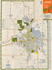
This is a c. 1969 Dolph Map Company city plan or map of Lakeland, Florida. (more details)
Includes an inset map of Marco Island on the verso!
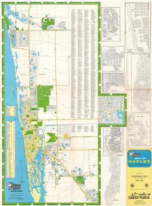
This is a c. 1974 Dolph Map Company city plan or map of Naples, Florida. Depicting from Del-Nor State Park to Keewaydin Island and the Myrtle Cove Acres subdivision, bright green highlights golf courses, country clubs, city and state parks, and the Naples airport. Streets are illustrated and labeled throughout, along with shopping centers, hospitals, and the county courthouse. Fifteen schools are marked by icons and numerically identified corresponding with an index along the left border. Bright blue circles bearing numbers identify subdivisions. These circles correspond with a second index situated along the left border. A street index occupies the space inside the right border. Numerous insets of subdivisions occupy the space outside the right border and among these are Port Royal, Vanderbilt Beach, Coquina Sands, and Park Shore. A highway map of Collier County occupies most of the verso, with an inset map of Marco Island and Big Key situated in the upper right. (more details)
(Administrative) Center of the Sunshine State.
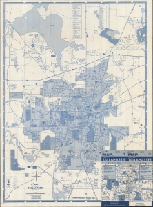
A detailed 1979 Dolph Map Company city map of Tallahassee, Florida. It presents the city during a period of growth and dynamism, punctuated by the new state capitol, constructed in 1977. (more details)