
NEW ACQUISITIONS
Key Port in the Indian Ocean.
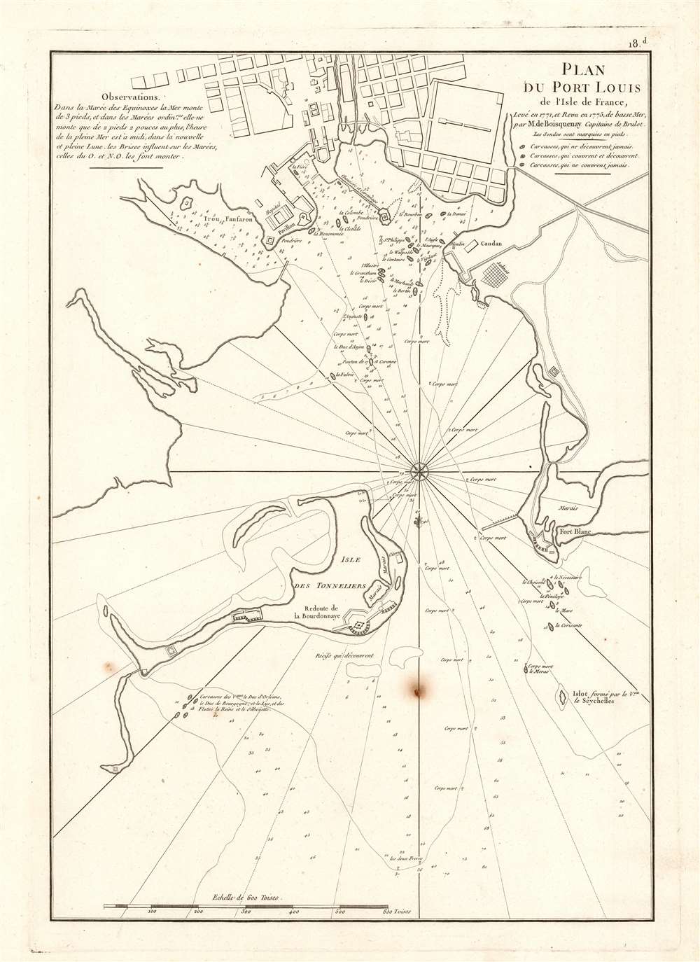
Plan du Port Louis de l'Isle de France, Levé en 1771 et Revu en 1775, de basse Mer, par M. de Boisquenay Capitaine de Brulot.
$950.00
Acquire
- Digital Map Information
- Suitable for large format printing
- DPI: 600
- File Size: 32.96 MB
- File Type: ZIP / TIFF
- ICC color profile embedded
- Delivered instantly via download link
This is a 1775 harbor chart of Port Louis, a critical port in northwest Mauritius for the Indian Ocean trade. At the time Mauritius was a French possession known as l'Isle de France. (more details)
An official U.S. State Department map of Occupation Zones in Post-War Germany.
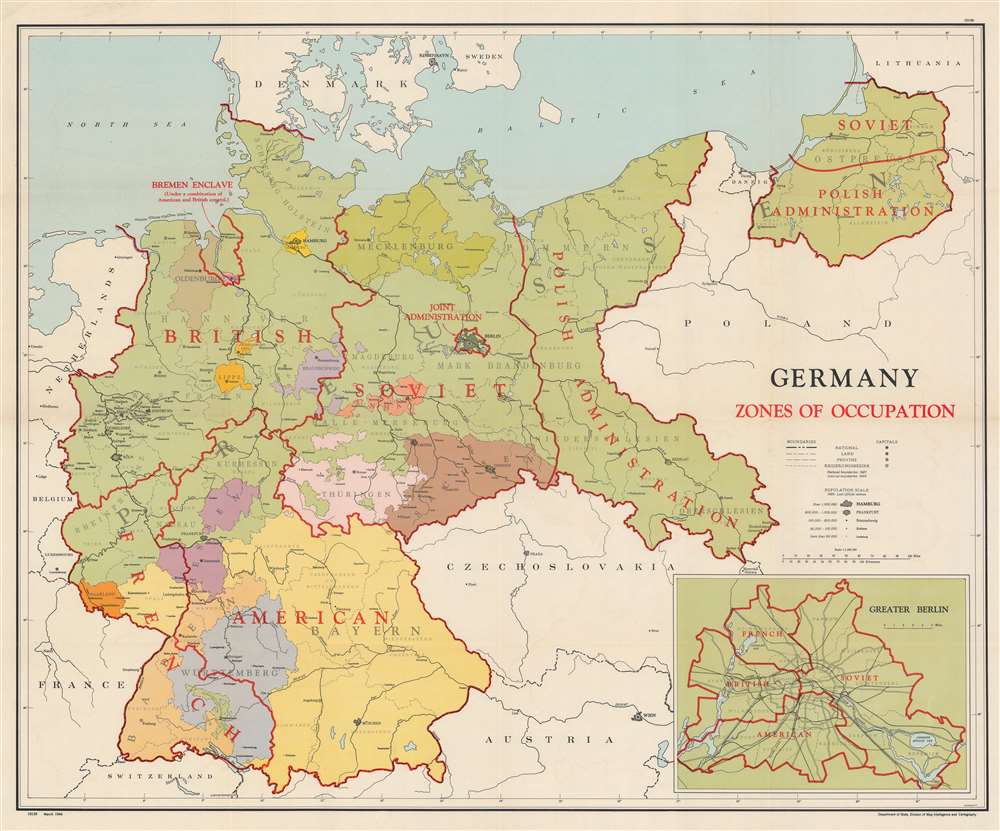
Germany Zones of Occupation.
$950.00
Acquire
- Digital Map Information
- Suitable for large format printing
- File Size: 178.99 MB
- File Type: ZIP / TIFF
- ICC color profile embedded
- Delivered instantly via download link
This is a 1946 Division of Map Intelligence and Cartography map of occupied Germany after World War II (1939 - 1945). Bold lines delineate British, American, French, Soviet, and Polish occupation zones. Berlin, within the Soviet Occupation Zone, was jointly occupied by the British, Americans, French, and Soviets, as detailed in the lower right. (more details)
American priorities: oil before disputes.
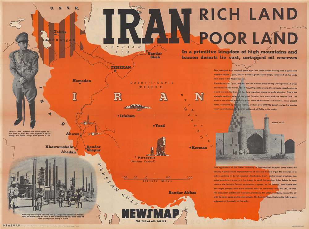
Iran. Rich Land Poor Land.
$550.00
Acquire
- Digital Map Information
- Suitable for large format printing
- Full resolution TIFF file
- ICC color profile embedded
- Delivered instantly via download link
This is a 1946 Army Information Branch pictorial map of Iran. Published during the Iran Crisis of 1946, dark brown stripes emphasize Iranian Azerbaijan, then occupied by Soviet troops and where two pro-Soviet separatist 'republics' were established. This crisis ranks as one of the first of the Cold War (1947 - 1991). (more details)
Britain's remaining North American colonies.
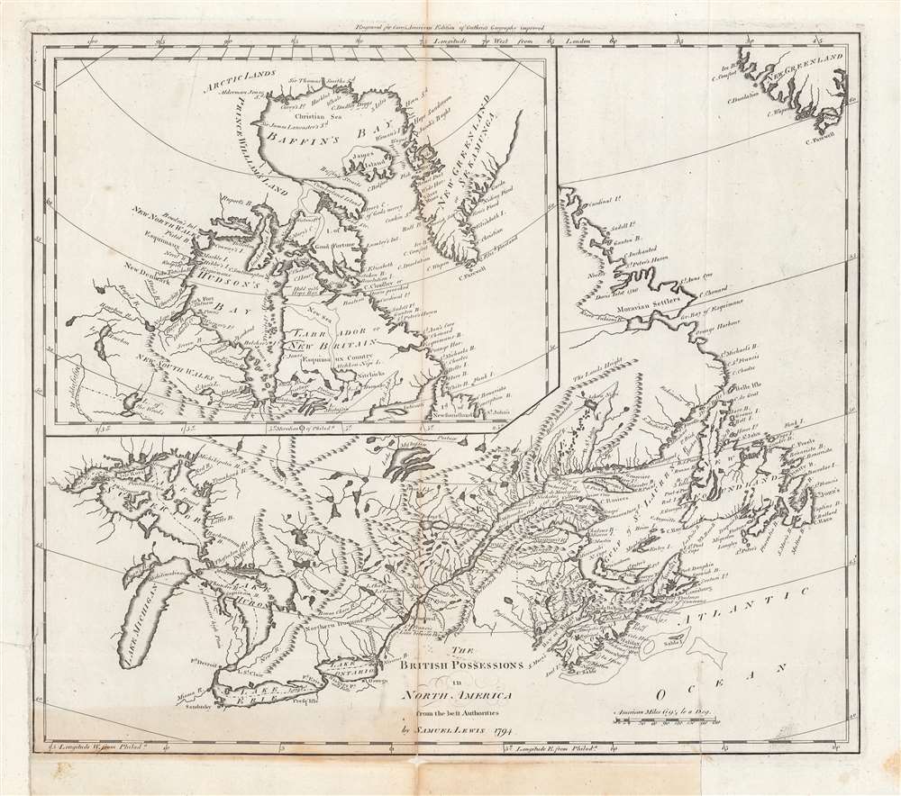
The British Possessions in North America from the best Authorities.
$450.00
Acquire
- Digital Map Information
- Suitable for large format printing
- DPI: 600
- File Size: 37.55 MB
- File Type: ZIP / TIFF
- ICC color profile embedded
- Delivered instantly via download link
This is a first edition example of Samuel Lewis' 1794 map of Canada for Carey's General Atlas, the first atlas published in the young American Republic. It depicts the remaining British colonies in North America (save for Bermuda) in the wake of the American Revolution, before they had cohered into a single entity and identity as Canada. (more details)
Highlights Florida's state parks and historic memorials.
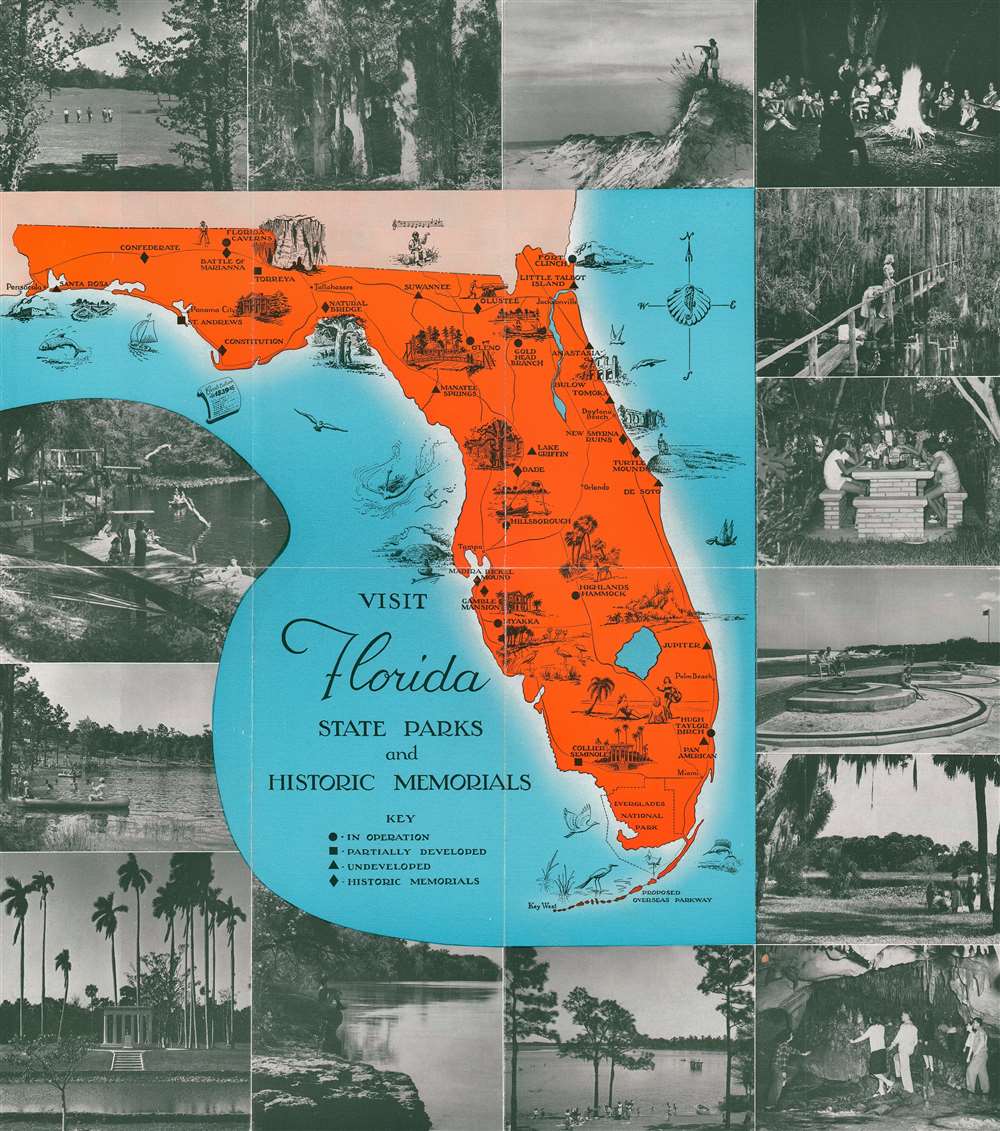
Visit Florida State Parks and Historic Memorials.
$200.00
Acquire
This is a c. 1970 pictorial tourist map of Florida. Ringed by photographs of Florida attractions and activities, the map depicts the state from Alabama to the Atlantic Ocean and from Georgia and Alabama to Key West. Pictorial vignettes highlight state parks and historic memorials throughout the state, including the Florida Caverns, Manatee Springs, Turtle Mound, and Collier Seminole. A key to the left of Key West notes that four different symbols are used when marking sites around the state: circles mark parks that are in operation, squares mark partially developed parks, and triangles note undeveloped parks. Diamonds denote historic landmarks. (more details)
Striking Art Nouveau wine advertisement.
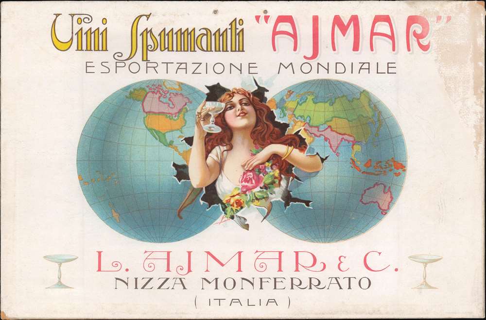
Vini Spumanti 'Ajmar' Esportazione Mondiale.
$1,200.00
Acquire
- Digital Map Information
- Suitable for large format printing
- File Size: 9.99 MB
- File Type: ZIP / TIFF
- ICC color profile embedded
- Delivered instantly via download link
A striking c. 1910 art-nouveau chromolithograph map of the world advertising Vini Spumanti Ajmar, an Italian fortified wine. The image depicts a red-haired woman bursting forth from a double hemisphere map of the world, champagne coupe raised in a toast. The image promotes Spumanti Ajmar's global reach (esportazione mondiale). Two holes appear at top center, where the piece was originally intended to be hung for display in cafes, restaurants, and wine shops. (more details)
The Bombing of Hiroshima.
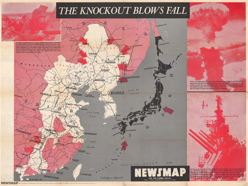
NEWSMAP For the Armed Forces. V-E Day + 15 Weeks - 192nd Week of U.S. Participation in the War.
$750.00
Acquire
- Digital Map Information
- Suitable for large format printing
- Full resolution TIFF file
- ICC color profile embedded
- Delivered instantly via download link
This is the chilling Atomic Bomb issue from the iconic World War II Newsmap series. Issued in 1945 as the 'Army Information Branch Newsmap of eastern China and Japan' shortly after the bombing of Hiroshima and Nagasaki, one week before the Japanese announced their surrender to the Allies to end the Pacific War, World War II. (more details)
A pleasant pastoral view of early Singapore.
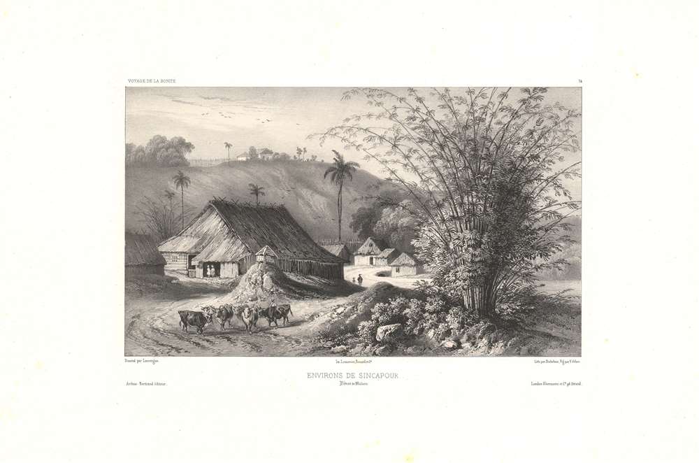
Environs de Sincapour, Détroit de Malacca.
$700.00
Acquire
- Digital Map Information
- Suitable for large format printing
- DPI: 600
- File Size: 26.45 MB
- File Type: ZIP / TIFF
- ICC color profile embedded
- Delivered instantly via download link
This is a rare c. 1845 chromolithograph of a rural scene in the early days of British Singapore by Barthélémy Lauvergne, one of the resident artists on the Bonite Expedition (1836 - 1837), a French scientific and diplomatic circumnavigation. (more details)
Victorian pastoral aesthetics in the tropics.
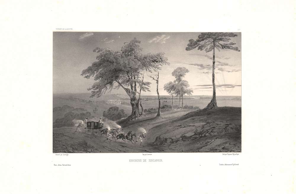
Environs de Sincapour.
$700.00
Acquire
- Digital Map Information
- Suitable for large format printing
- DPI: 600
- File Size: 33.39 MB
- File Type: ZIP / TIFF
- ICC color profile embedded
- Delivered instantly via download link
This is a rare c. 1845 chromolithograph of the countryside of Singapore in the early days of British rule by Barthélémy Lauvergne, one of the resident artists on the Bonite Expedition (1836 -1837), a French scientific and diplomatic circumnavigation. (more details)
Mapping the Transatlantic Slave Trade.
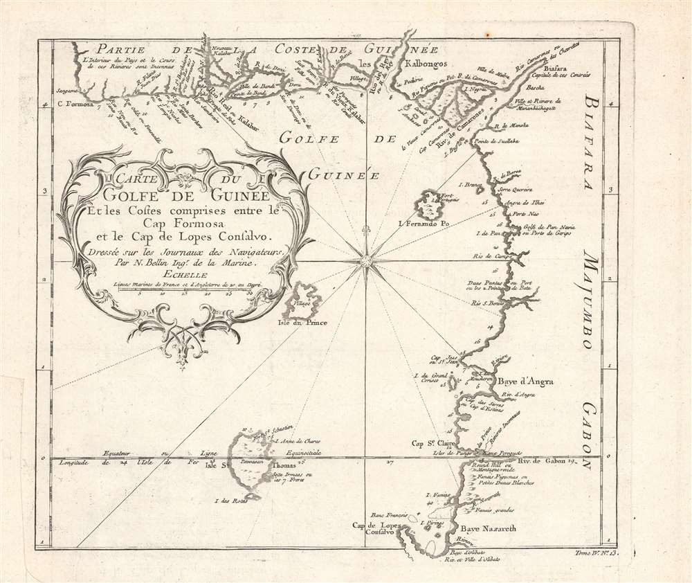
Carte du golfe de Guinée et les costes comprises entre le cap Formosa et le cap de Lopes Goncalvo.
$200.00
Acquire
- Digital Map Information
- Suitable for large format printing
- DPI: 600
- File Size: 17.75 MB
- File Type: ZIP / TIFF
- ICC color profile embedded
- Delivered instantly via download link
This is a c. 1754 map and chart of the Gulf of Guinea by Jacques-Nicolas Bellin that appeared in the Abbé Prévost's Histoire Generale Des Voyages. It notes a range of maritime and terrestrial features, especially rivers flowing from the African interior into the gulf. (more details)
Early maps of features in the western Pacific.
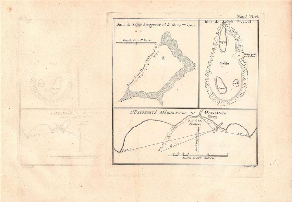
Banc de sable dangereux Vû le 28 Septbre. 1767; Isles de Joseph Freewell; l'extremité méridionale de Mindanao.
$125.00
Acquire
- Digital Map Information
- Suitable for large format printing
- DPI: 600
- File Size: 16.03 MB
- File Type: ZIP / TIFF
- ICC color profile embedded
- Delivered instantly via download link
Three maps on a single sheet. The map detailas geographic features encountered in the western Pacific during a 1766 - 1769 British voyage of circumnavigation captained by Philip Carteret. They were engraved by Robert Benard and published in the 1774 French translation of John Hawkesworth's An Account of the Voyages…, a very popular work which helped publicize British discoveries in the Pacific. (more details)
The founding of the Republic of Texas.
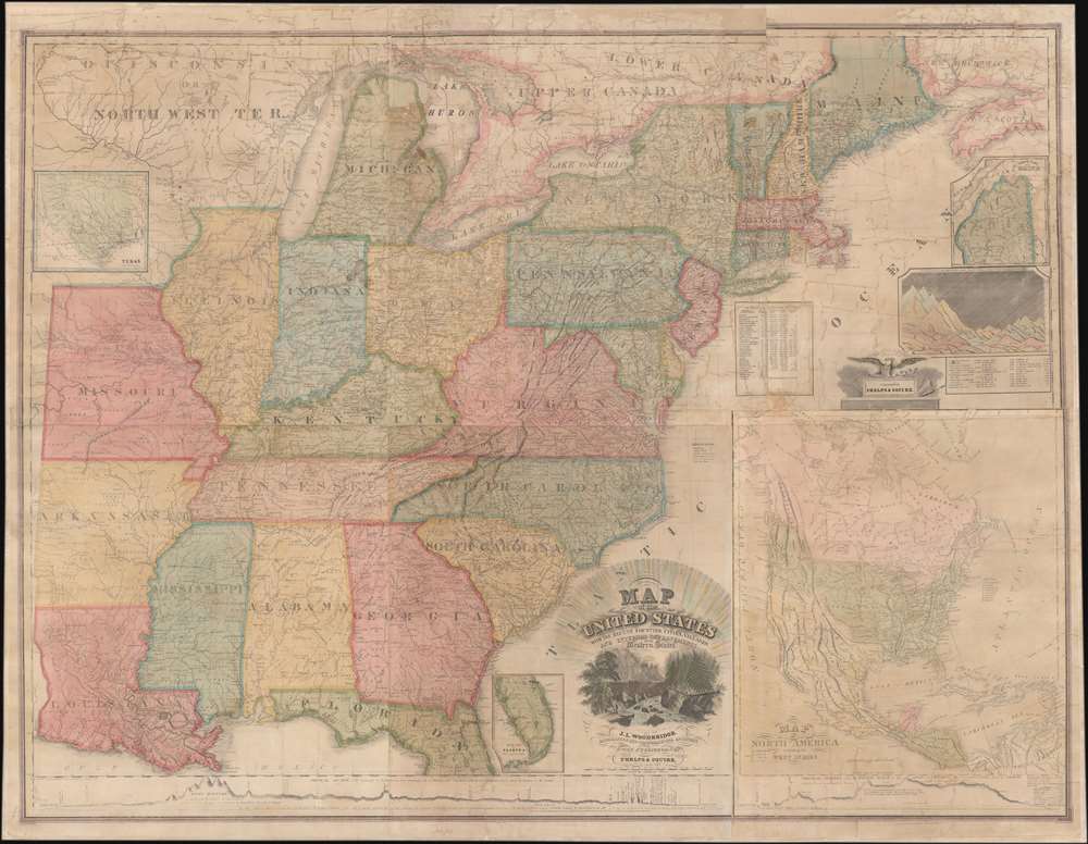
Map of the United States with the Recent Counties, Cities, Villages and Internal Improvements in the Western States.
$7,500.00
Acquire
- Digital Map Information
- Suitable for large format printing
- DPI: 600
- File Size: 209.92 MB
- File Type: ZIP / TIFF
- ICC color profile embedded
- Delivered instantly via download link
An impressive 1836 Phelps and Squire map of the United States with an inset of the newly formed Republic of Texas. This map is a much revised and updated variant on the 1817 Varlé map, and more specifically, the 1832 Stebbins / Varlé reissue. It stands out for its inclusion of the Republic of Texas as an inset - the Republic was declared shortly before this map was published. The map also illustrates U.S. claims to British Columbia - part of the Oregon Question or 54-40 border debate between the United States and British North America. (more details)
Real Estate on Martha's Vineyard.
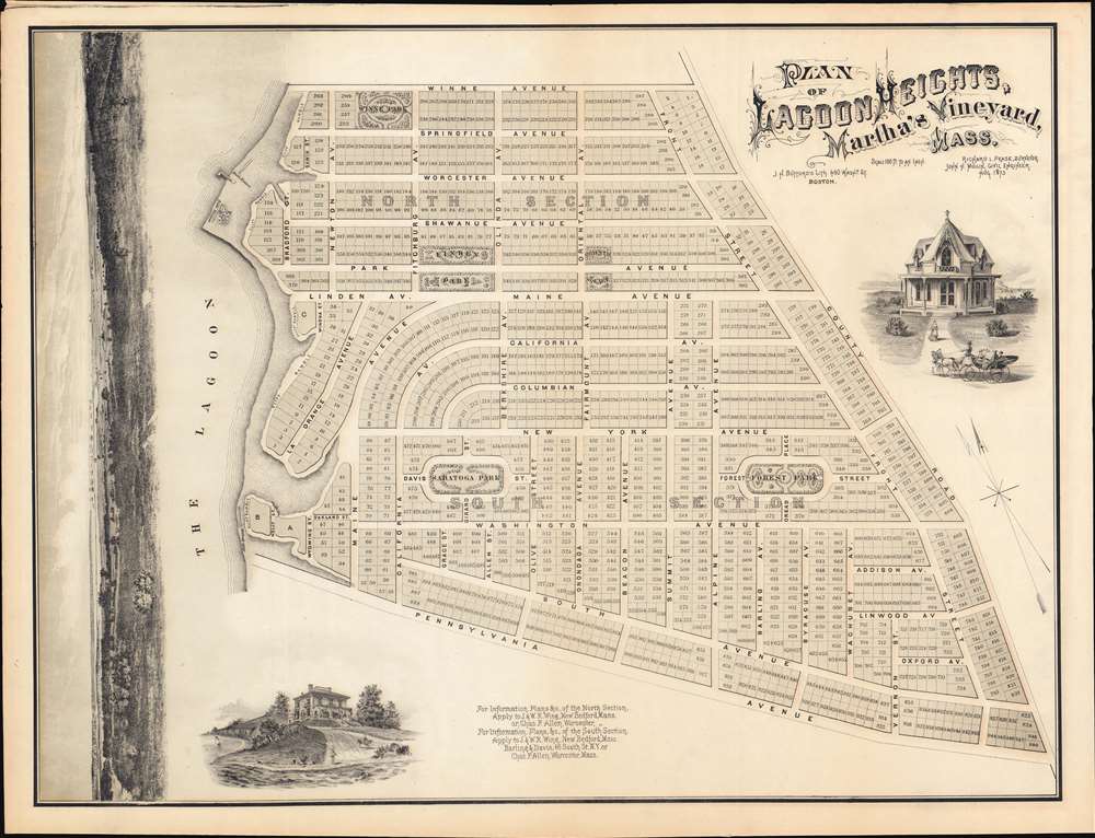
PLAN OF LAGOON HEIGHTS, Martha’s Vineyard, MASS.
$900.00
Acquire
- Digital Map Information
- Suitable for large format printing
- File Size: 59.7 MB
- File Type: ZIP / TIFF
- ICC color profile embedded
- Delivered instantly via download link
A beautiful 1873 promotional map of Lagoon Height, present-day Oak Bluffs, Martha's Vineyard, Massachusetts. The map consists of a detailed street plan with housing lots and parks, as well as wonderful vignettes of exceptionally elegant Victorian era summer homes. Along the left is a dramatic panoramic advertising the spectacular view potential home buyers might enjoy. A promotional imprint at the bottom center directs interested buyers to the attention of J. and W. R. Wing of New Bedford Massachusetts. (more details)
Wyoming in detail.
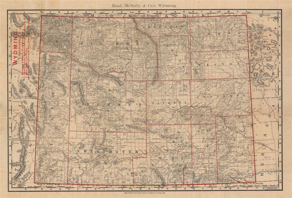
Rand, McNally and Co.'s Wyoming.
$400.00
Acquire
- Digital Map Information
- Suitable for large format printing
- Full resolution TIFF file
- ICC color profile embedded
- Delivered instantly via download link
This is a scarce 1895 separate-issue pocket map of Wyoming published by Rand McNally. It depicts the entire state, only elevated from a territory five years prior, with a range of administrative, geographic, and infrastructural information. The map may be derived from Rand McNally's atlas map of the same year, but exhibits red overprinting for titling and other important data. (more details)
Taking in the view of Mt. Fuji.

長岡古奈温泉名所圖繪 / [View of the Famous Onsen of Nagaoka and Kona].
$400.00
Acquire
- Digital Map Information
- Suitable for large format printing
- Full resolution TIFF file
- ICC color profile embedded
- Delivered instantly via download link
This is a scarce 1922 Yoshida Hatsusaburō bird's-eye view of Nagaoka on the Izu Peninsula in Shizuoka Prefecture. The view and the information on the verso focus on the area's hot springs (onsen), which became a popular tourist attraction in the years just prior to publication, in part due to the views of Mt. Fuji one could enjoy in Nagaoka. (more details)
Brazil emerges as an empire.
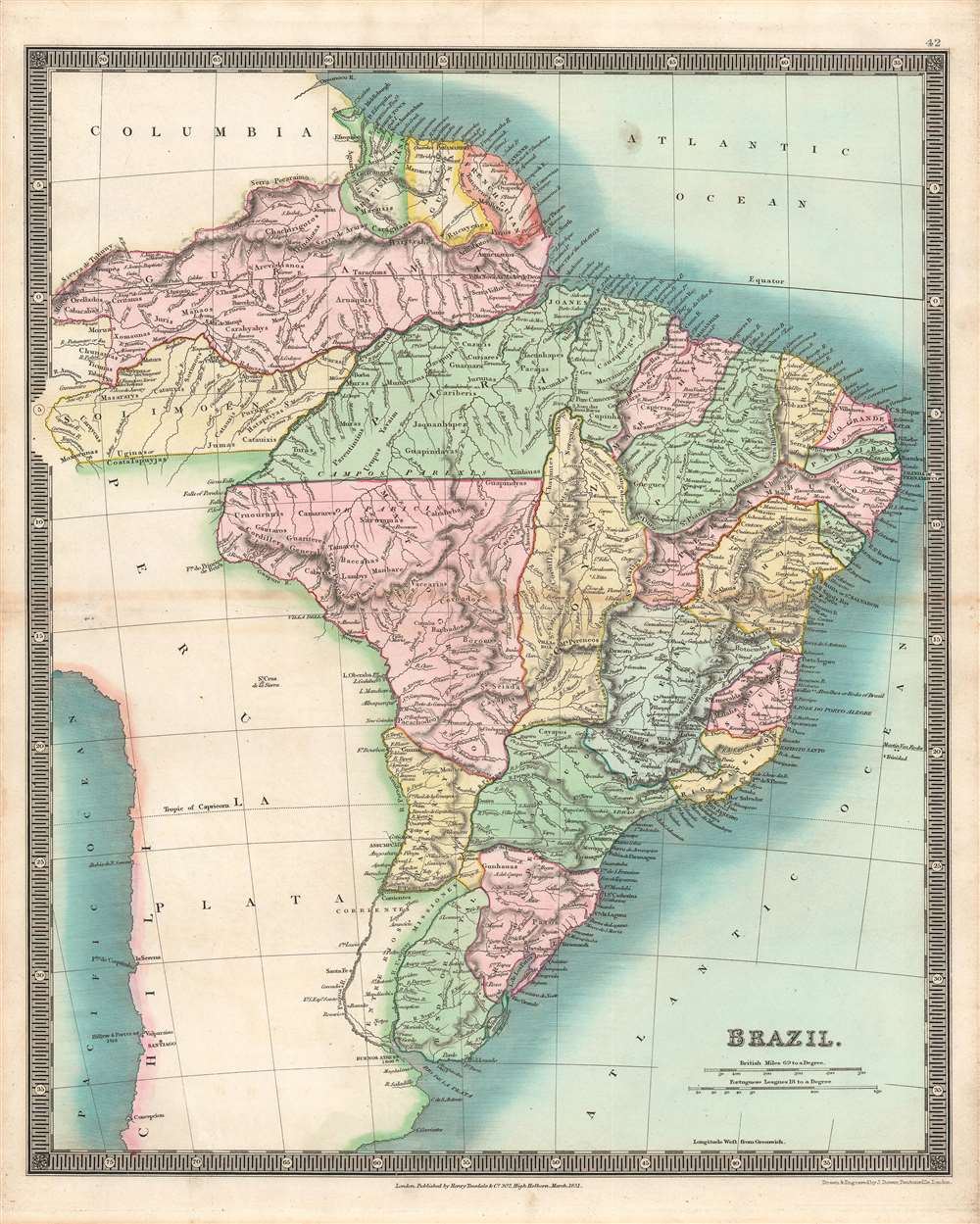
Brazil.
$300.00
Acquire
- Digital Map Information
- Suitable for large format printing
- DPI: 600
- File Size: 37.57 MB
- File Type: ZIP / TIFF
- ICC color profile embedded
- Delivered instantly via download link
This is a stunning example of the 1831 John Dower and Henry Teesdale map of Brazil and Guyana published in their A New General Atlas of the World. It depicts the region as it emerged from wars of independence against Spain and Portugal, when both borders and political systems were in flux. (more details)
By the greatest German cartographer of the 19th century.
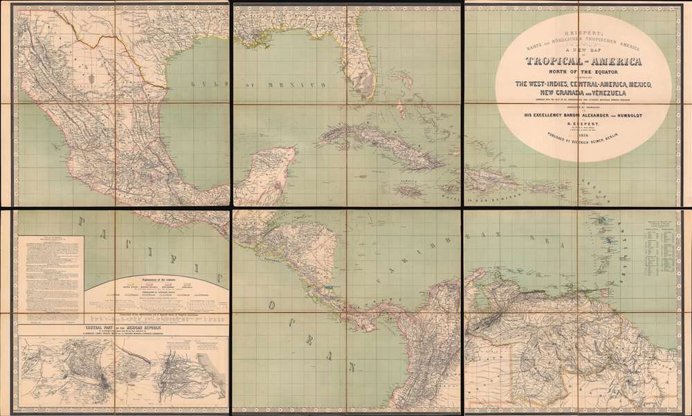
H. Kiepert's Karte des Nördlichen Tropischen America. A New Map of Tropical - America North of the Equator Comprising the West - Indies, Central - America, Mexico, New Cranada and Venezuela.
$3,500.00
Acquire
- Digital Map Information
- Suitable for large format printing
- Full resolution TIFF file
- ICC color profile embedded
- Delivered instantly via download link
This is a large and impressive 1858 map of Florida, the Gulf of Mexico, Central America, the West Indies, and northern South America, compiled by Heinrich Kiepert, the greatest German cartographer of the 19th century. The map presents the region in detail, with color coding to differentiate between countries and a key situated in the lower left. (more details)
State-of-the-art 18th Century Cartography.

Africa, Performed by the Sr. D'Anville under the Patronage of the Duke of Orleans.
$1,000.00
Acquire
- Digital Map Information
- Suitable for large format printing
- Full resolution TIFF file
- ICC color profile embedded
- Delivered instantly via download link
This large and evocative four-sheet 1755 wall map of Africa captures a transitional period in European understanding of African geography. It was bound, in its four separate sheets, in the second volume of Malachy Postlethwayte's The Universal Dictionary of Trade and Commerce. The map is the work of Solomon Boulton, who drafted the map as a largely faithful translation of the illustrious French cartographer Jean-Baptiste Bourguignon d’Anville's 1749 map of the continent. D'Anville was an extremely careful mapmaker, meticulous in detail and scrupulous in the data presented in his work, and for the most part Boulton preserves these qualities while translating the original text and adding an attractive rococo cartouche. (more details)
Wrapping paper!
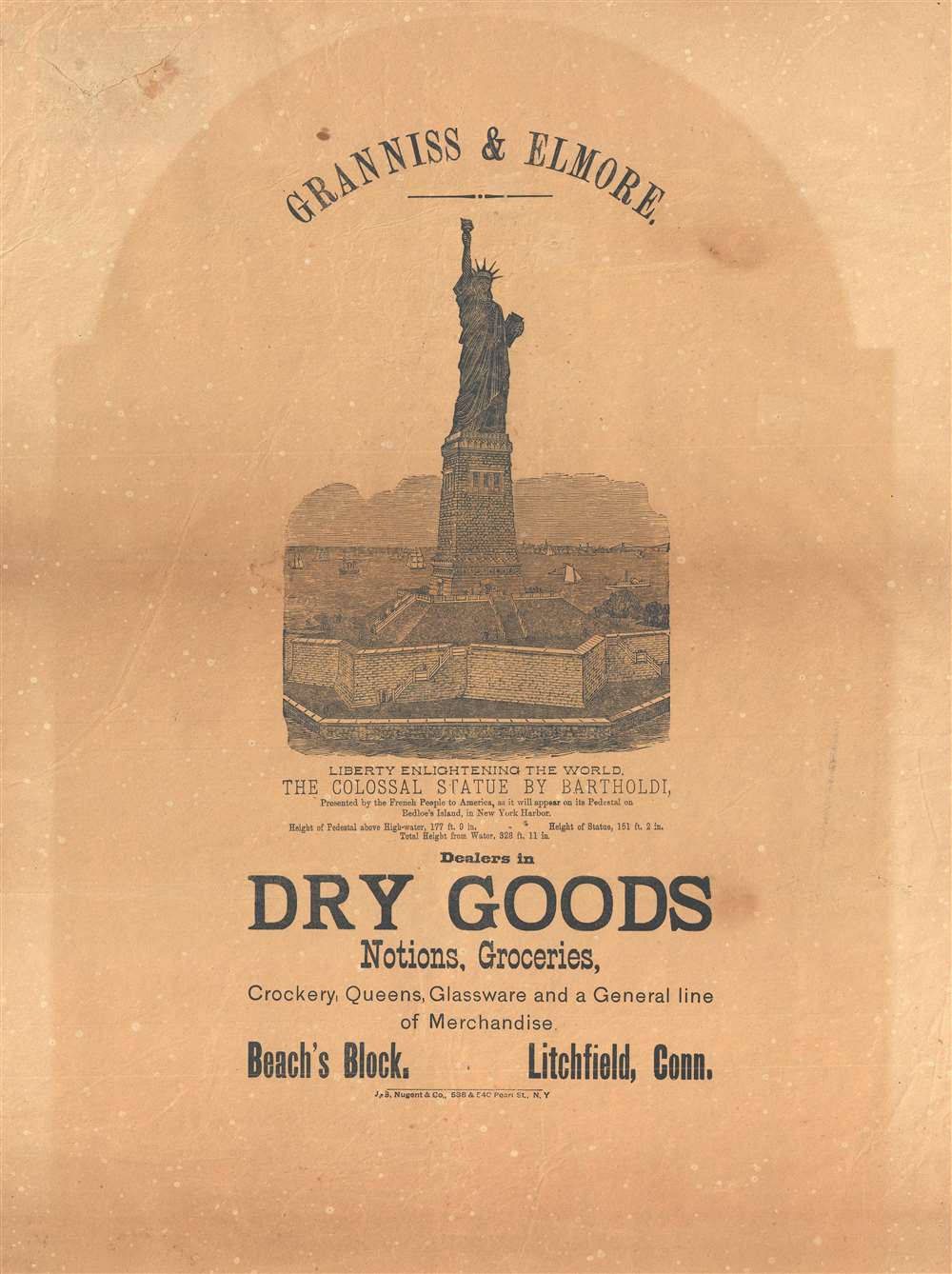
Granniss and Elmore. Liberty Enlightening the World. The Colossal Statue by Bartholdi, Presented by the French People to America, as it will appear on its Pedestal on Bedloe's Island, in New York Harbor.
$800.00
Acquire
- Digital Map Information
- Suitable for large format printing
- File Size: 8.24 MB
- File Type: ZIP / TIFF
- ICC color profile embedded
- Delivered instantly via download link
This is a rare c. 1885 broadside pre-construction view of the Statue of Liberty published to promote the Litchfield, Connecticut dry goods firm of Granniss and Elmore. The view illustrates the Statue of Liberty from the south, looking north towards southern Manhattan and the Brooklyn Bridge. The image of the iconic statue here pre-dates the construction of the monument on Bedloe Island and there are inconsistencies between the view and the actual statue. Among these are a taller base and variant platform structure. This image was derived from the stunning officially sanctioned 1884 lithograph illustration of the statue issued by Root and Tinker. (more details)
One of the First Acquirable Maps Specifically of Cuba.
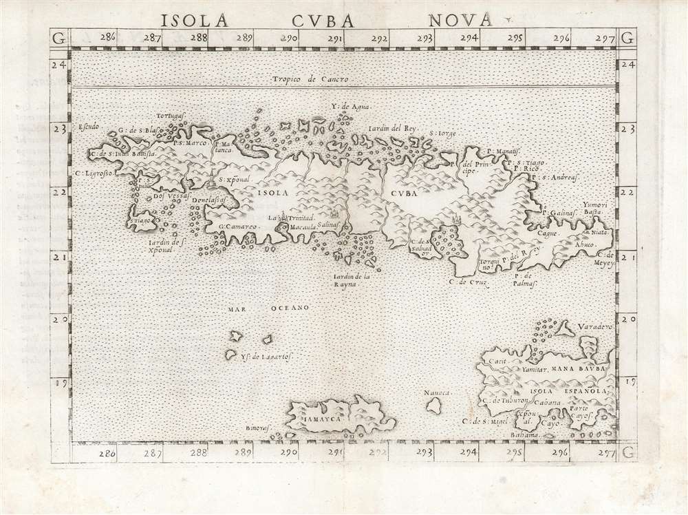
Isola Cuba Nova
$750.00
Acquire
- Digital Map Information
- Suitable for large format printing
- DPI: 600
- File Size: 12.43 MB
- File Type: ZIP / TIFF
- ICC color profile embedded
- Delivered instantly via download link
This is the first state of Girolamo Ruscelli's 1561 map of Cuba, Jamaica, the Cayman Islands, and the western part of Hispaniola. It is among the earliest detailed maps of these islands, and is the fourth printed map specifically of Cuba. (more details)