
NEW ACQUISITIONS
The haunts and hangouts of world famous authors around Los Angeles.
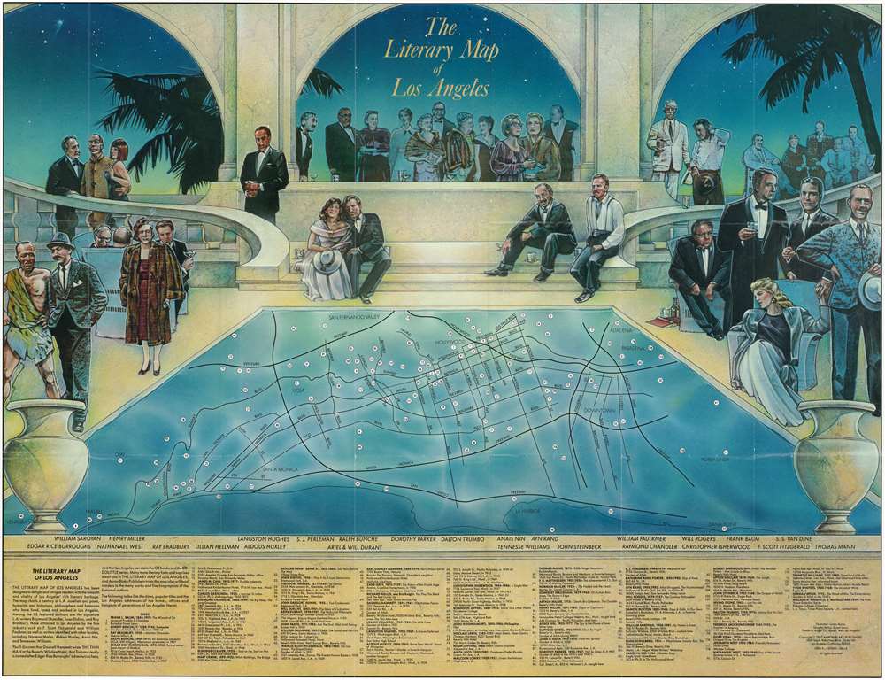
The Literary Map of Los Angeles.
$250.00
Acquire
This is a 1987 Linda Ayriss and Susan Lewis pictorial literary map of Los Angeles, California. The overall scene is the stereotypical idea of a fancy Hollywood party: people dressed to the nines drinking cocktails around a pool with palm trees in the background. A minimalist map of Los Angeles occupies the 'pool', with 122 locations numerically identified. These correspond with an index along the bottom border listing important sites in the lives of the city's most recognizable authors. The guests around the pool represent some of these authors, including Edgar Rice Burroughs (dressed as Tarzan), Ray Bradbury, Langston Hughes, Ayn Rand, John Steinbeck, Will Rogers, and F. Scott Fitzgerald. (more details)
Big Bend National Park.
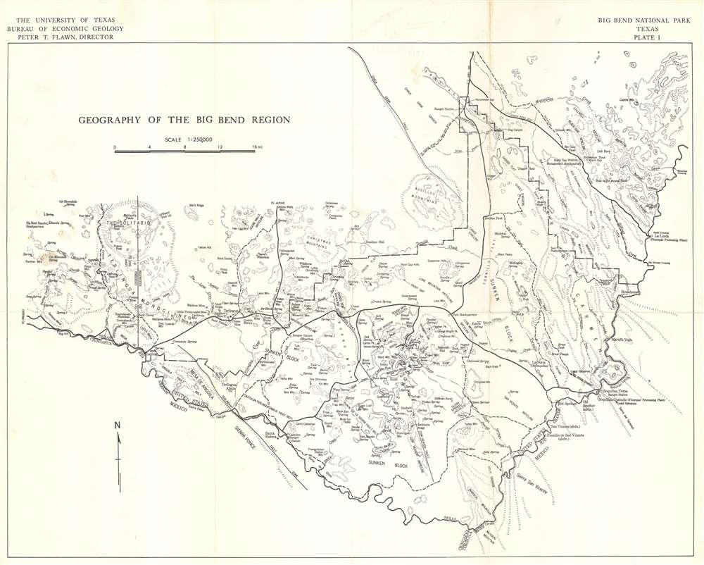
Geography of the Big Bend Region.
$200.00
Acquire
This is a c. 1968 Bureau of Economic Geology map of the Big Bend Region, Texas. Coverage embraces the entirety of Big Bend National Park and environs. Mountains, ridges, peaks, and other geological features are illustrated. A dotted and dashed line marks the boundary of Big Bend National Park (although it is unlabeled). Roads appear as thick black lines, while thinner black lines mark geological faults. (more details)
Exceptional East India Trade nautical chart.
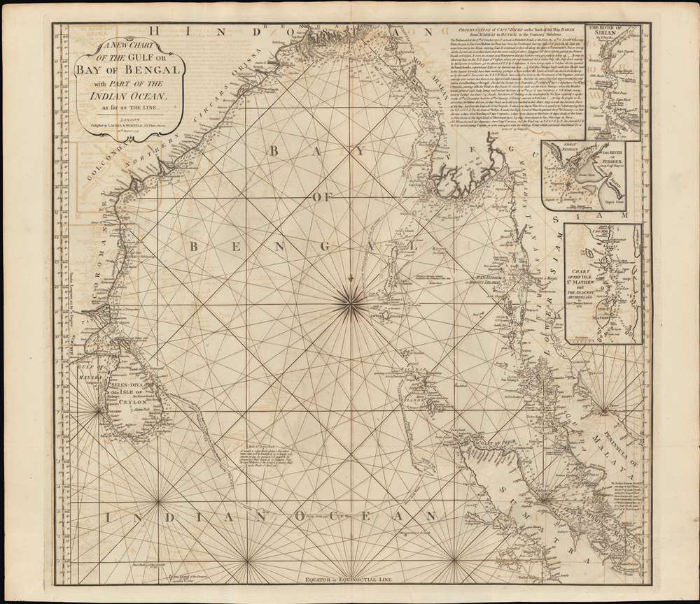
A New Chart of the Gulf or Bay of Bengal with Part of the Indian Ocean, as Far as the Line.
$750.00
Acquire
- Digital Map Information
- Suitable for large format printing
- Full resolution TIFF file
- ICC color profile embedded
- Delivered instantly via download link
This is a fine example of Laurie and Whittle's 1794 nautical chart or maritime map of the Bay of Bengal. The map covers from southeastern India and Ceylon (Sri Lanka) eastward to eastern Malaysia, north as far as the mouth of the Ganges River, and south to central Sumatra. There are three inset maps: The River of Sirian (based on D'Anville), but in fact the modern day Irrawaddy River, Burma / Myanmar; The River Perseen (based on Hayter), in fact the modern day Pathein River, Burma; and the Isle St. Mathew (after Thomas Forrest, 1783), which is probably the modern day Zadetky Island, Burma, but it is not clear. The Andaman and Nicobar Islands are in the center of the Bay, near the wind rose. In the upper right there is a lengthy observational note attributed to Captain Hicks and the ship Bahar on a 1770 voyage from Madras to Bengal in the Monsoon season. (more details)
Pre-Japanese look at indigenous Taiwan.
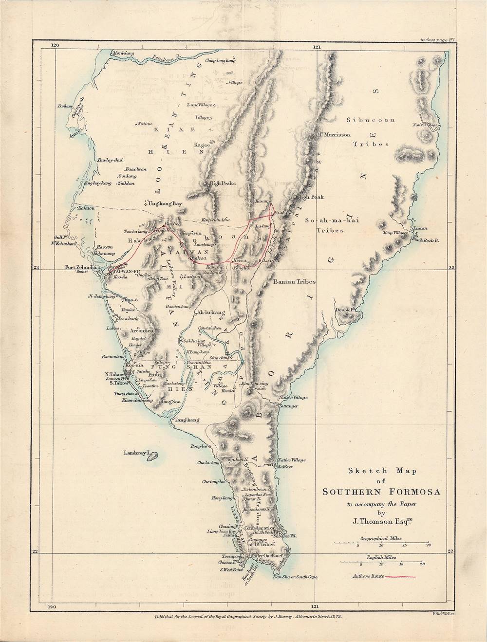
Sketch Map of Southern Formosa.
$650.00
Acquire
- Digital Map Information
- Suitable for large format printing
- File Size: 4.27 MB
- File Type: ZIP / TIFF
- ICC color profile embedded
- Delivered instantly via download link
This is a rare 1873 lithograph of the southern tip of Taiwan, published for the The Journal of the Royal Geographical Society. It encapsulates the geographical knowledge gained during an 1871 trip through southern Taiwan by the geographer and photographer John Thomson and his companion, the missionary James Laidlaw Maxwell. (more details)
Pre-war Japanese interest in the Philippines.
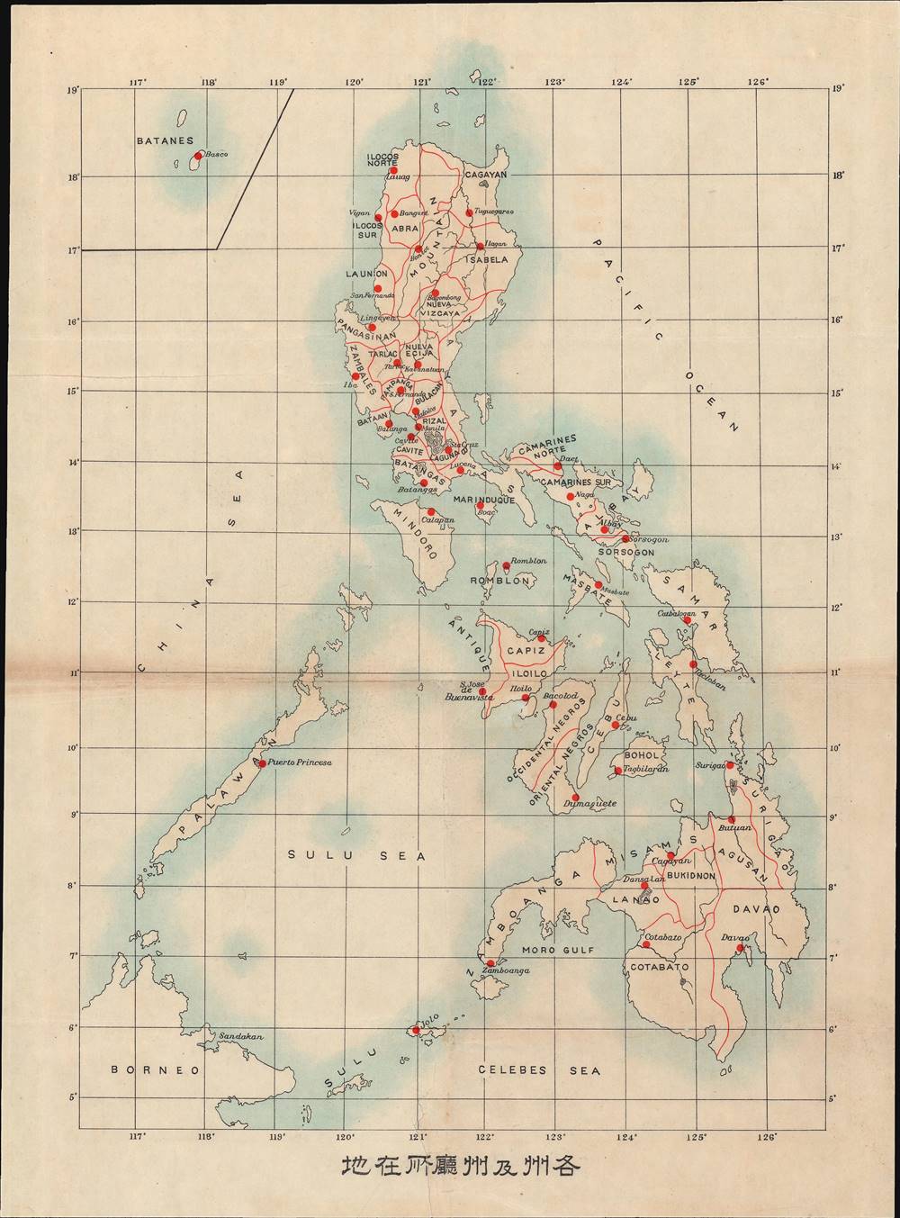
各州及州廳所在地 / [Locations of Provinces and Provincial Offices].
$500.00
Acquire
- Digital Map Information
- Suitable for large format printing
- File Size: 11.57 MB
- File Type: ZIP / TIFF
- ICC color profile embedded
- Delivered instantly via download link
This is a c. 1910 Japanese lithograph map of the Philippine Islands. It shows the provinces and provincial capitals of the Philippines either at the very end of the 19th century or the early 20th century. (more details)
Highlights South America's abundant natural resources.
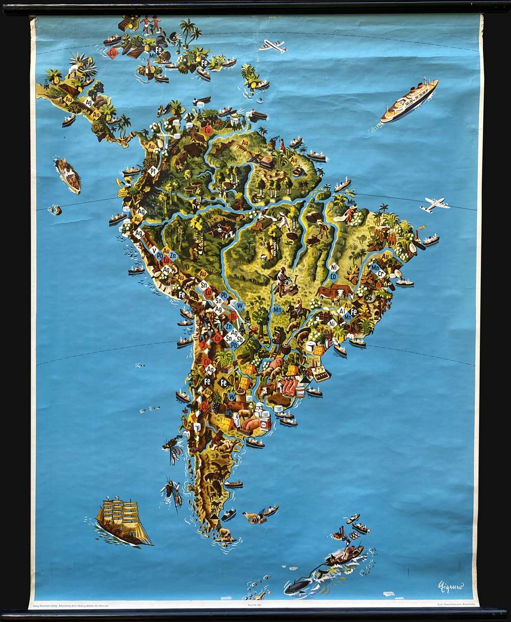
[Südamerika].
$450.00
Acquire
This is a c. 1957 Westermann Verlag pictorial resource wall map of South America. South America's rich landscape leaps off the page, with the lush green of the Amazon rainforest dominating the upper half of the continent. This natural wonder provides its bounty; rubber trees, timber, and other resources abound throughout the forest. Chemical symbols render the continent's mineral wealth unmissable, with copper, silver, gold, tin, lead, iron, and tungsten, (only a few of the metals found there) identified, particularly in the Andes Mountains. Ranchers raise livestock, including cattle, sheep, and pigs. Oil derricks mark oil strikes, and tanks highlight the importance of oil exports. Ships all along the South American coastline reinforce the continent's significance in an ever-interconnected world. (more details)
Beautiful Walnut Creek, California.
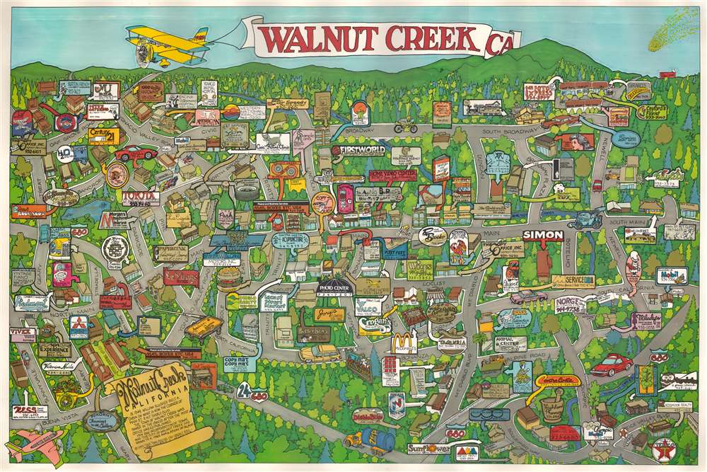
Walnut Creek CA.
$350.00
Acquire
This is a 1985 Joseph C. Pipia pictorial map of Walnut Creek, California, a city of nearly 70,000 located sixteen miles east of Oakland, Advertisements throughout promote Walnut Creek's many businesses: restaurants, shops, hardware stores, veterinary clinics, etc. A scroll in the lower-left presents a short history of Walnut Creek from the first cabin to the town's incorporation in 1914. (more details)
Hoover Dam under construction.
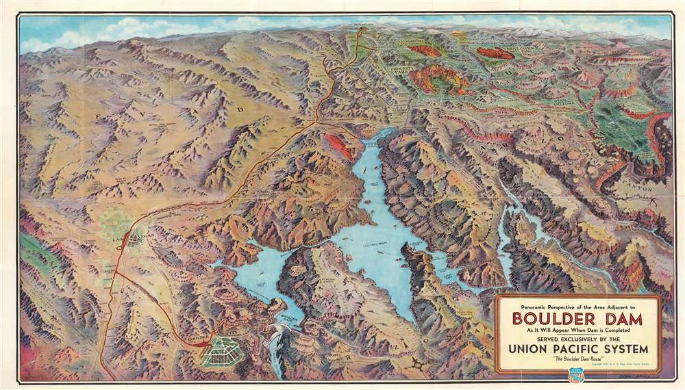
Panorama Perspective of the Area Adjacent to Boulder Dam as it Will Appear When Dam is Completed.
$300.00
Acquire
- Digital Map Information
- Suitable for large format printing
- Full resolution TIFF file
- ICC color profile embedded
- Delivered instantly via download link
This is a 1934 Gerald A. Eddy bird's-eye view perspective map of Hoover (Boulder) Dam, Lake Mead, and environs at the height of its construction. Hoover (Boulder) Dam appears in the lower-left next to Boulder City, explicitly founded to house the thousands of workers involved in construction. Lake Mead dominates the foreground, and the view stretches hundreds of miles north to Salt Lake City, Utah. This was published as a promotional piece for Union Pacific Railroad, and thus a red line traces the railroad's route south from Salt Lake City to Las Vegas and on to Boulder City and the construction site. The Grand Canyon, Zion National Park, Bryce Canyon National Park, and Cedar Breaks National Monument are highlighted, no doubt in the hopes of driving tourism despite the Great Depressing. The region's mountain ranges, canyons, and other natural wonders are also identified. (more details)
Albany's golden age.
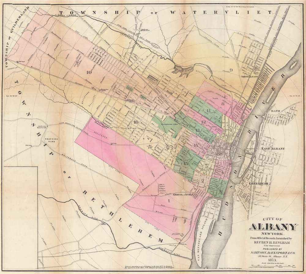
City of Albany, New York. From Official Records Furnished by Reuben H. Bingham City Surveyor.
$250.00
Acquire
- Digital Map Information
- Suitable for large format printing
- File Size: 24.92 MB
- File Type: ZIP / TIFF
- ICC color profile embedded
- Delivered instantly via download link
This is an 1873 Sampson, Davenport, and Company city plan or map of Albany, New York. (more details)
Away in a manger...
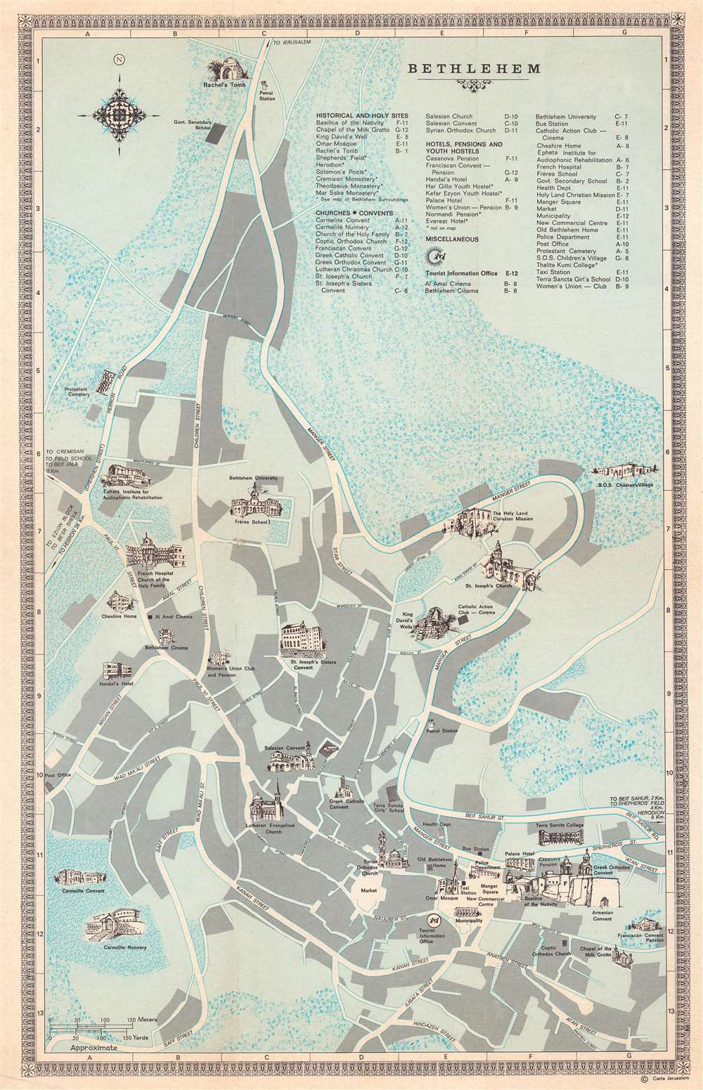
Map of Bethlehem.
$200.00
Acquire
This is a 1970 Carta Jerusalem pictorial tourist map of Bethlehem, West Bank, Israel. Profile illustrations depict sites across the city, including the Basilica of the Nativity, the Chapel of the Milk Grotto, King David's Well, the Omar Mosque, and Rachel's Tomb. Several churches and convents are also illustrated in profile, along with schools, cinemas, and hotels. Important parts of modern society, including a taxi station, gas (petrol) stations, and the Health Department are identified as well. (more details)
Strained U.S. - American Indian Relations.
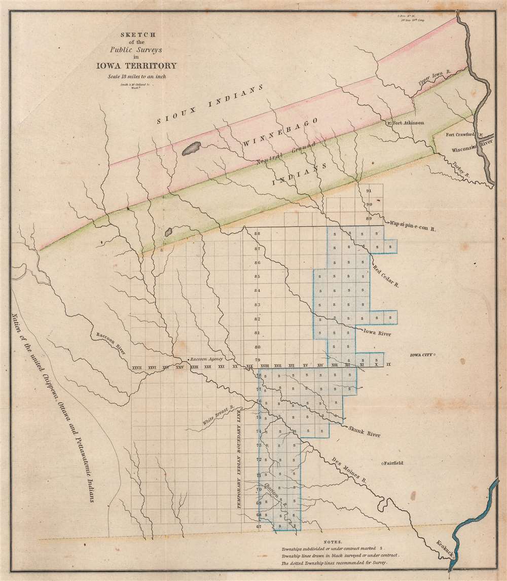
Sketch of the Public Surveys in Iowa Territory.
$200.00
Acquire
- Digital Map Information
- Suitable for large format printing
- Full resolution TIFF file
- ICC color profile embedded
- Delivered instantly via download link
This is an 1845 General Land Office map of the Iowa Territory, covering lands west of the Wisconsin River. The 'Neutral Ground' separating the warring Sioux and Sac and Fox Indian nations dominates the upper map. Fort Atkinson, established to protect the forcibly resettled Winnebago, is labeled within the 'Neutral Ground'. Townships appear below the 'Neutral Ground', and the settlements of Iowa City, Fairfield, and Keokuck are labeled. (more details)
Summarizes the D-Day landings, discusses the V-1, and lauds the B-29 Superfortress.
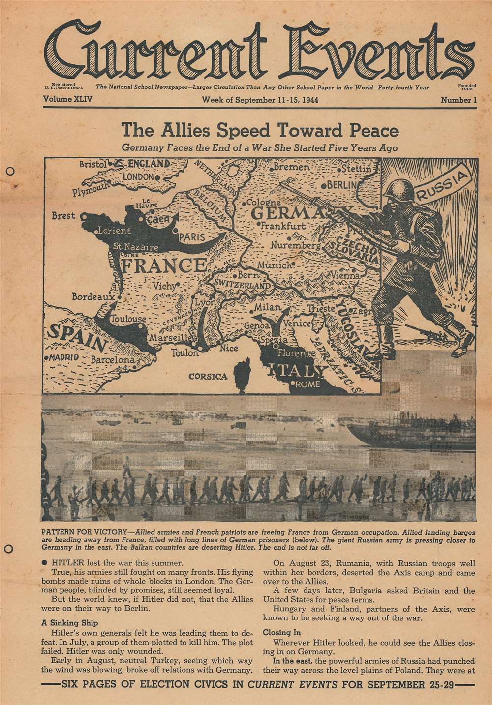
The Allies Speed Toward Peace. Germany Faces the End of a War She Started Five Years Ago.
$175.00
Acquire
- Digital Map Information
- Suitable for large format printing
- Full resolution TIFF file
- ICC color profile embedded
- Delivered instantly via download link
This is a 1944 Current Events map of Europe and the Allied advance across western Europe during World War II (1939 - 1945). Black areas illustrate territory conquered by the Allies, including Normandy, the Cherbourg Peninsula, the breakout toward Paris, the Operation Dragoon landings in southern France, and the Allied push north through Italy, having already liberated Rome and Florence when this broadside was published. An oversize Russian soldier menaces Germany from the east, having stormed across Eastern Europe throughout 1944. A photograph below the map shows German prisoners of war marching to a ship that would take them to England. (more details)
A scene of everyday life along the river near Buenos Aires.
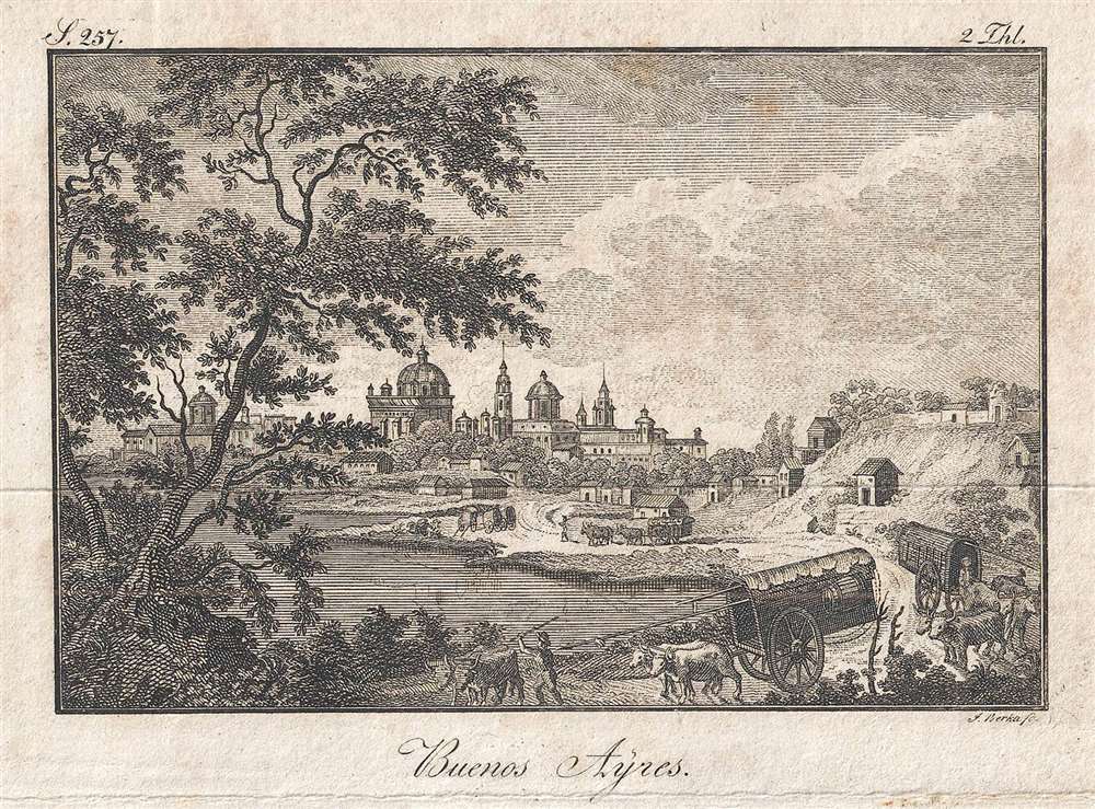
Buenos Ayres.
$150.00
Acquire
- Digital Map Information
- Suitable for large format printing
- DPI: 300
- File Size: 0.92 MB
- File Type: ZIP / TIFF
- ICC color profile embedded
- Delivered instantly via download link
This is a c. 1820 Johann Berka view of Buenos Aires. The beautifully engraved buildings of Buenos Aires are visible over treetops, while the homes of the less well-off populate the middle ground. A road winds along the river, while merchants lead oxen carts to and from town. An exquisitely engraved tree dominates the foreground, with the whole creating a slightly exotic scene, while at the same time depicting everyday activities. (more details)
A stunning decorative sea chart detailing Madeira.
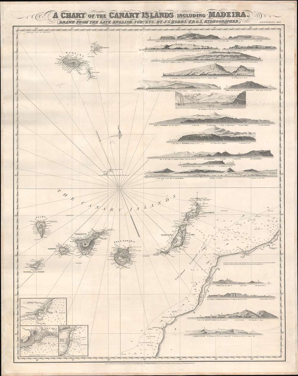
A Chart of the Canary Islands Including Madeira.
$850.00
Acquire
- Digital Map Information
- Suitable for large format printing
- File Size: 32.97 MB
- File Type: ZIP / TIFF
- ICC color profile embedded
- Delivered instantly via download link
An exceptionally beautiful 1867 James Norie and Charles Wilson nautical chart or maritime map of the Canary Islands and Madeira, including part of western Africa. As a whole the map offers excellent detail with inland topography on all of the islands as well as countless depth soundings. There are three inset detail maps in the lower left focusing on Arrecife, Funchal, and Santa Cruz. An additional seventeen land profile charts filling the upper right and lower right. The title is set in an elaborate typeface just outside the map's upper border. (more details)
Gathering storm clouds over Europe, as seen from Japan.
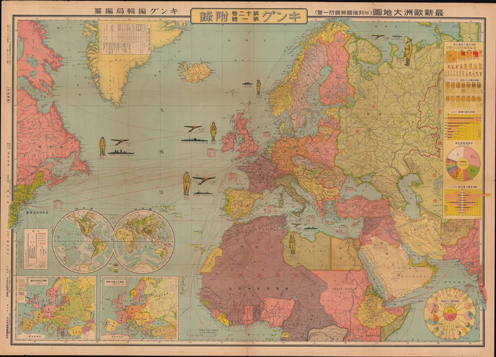
最新歐洲大地圖 (附列強國勢國防一覽) / [Latest Map of Europe (with an overview of the national strength and defenses of the major powers)].
$750.00
Acquire
- Digital Map Information
- Suitable for large format printing
- File Size: 80.15 MB
- File Type: ZIP / TIFF
- ICC color profile embedded
- Delivered instantly via download link
This is a very rare and unusual Japanese portrayal of European military power by Fuchida Tadayoshi - illustrated to support Japanese interest in the increasingly tense situation in Europe, as well as to emphasize to the Japanese public the value of European alliances. It was published as a supplement to the January 1, 1936 (Showa 11), edition of King (キング) magazine. The map, along with the included insets, charts, and graphs, describes the military and economic situation in Europe at the time and the relationship of Japan to the emerging European conflict. (more details)
Revised to Increase Accuracy and Avoid Beheading.
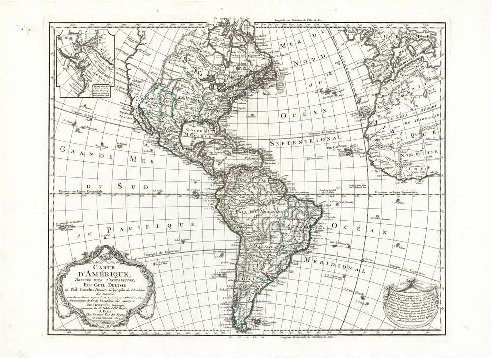
Carte D'Amerique Dressée Pour L'Instruction, Par Guil. Delisle Et Phil. Buache, Premiere Geographe de l'Academie des Sciences. Nouvellement Revue, Augmentée et Assujetie aux N.les Observations Astronomiques et Mrs. de l'Academie des Sciences. Par Dezauche Géographe, Successeur des Sr. Delisle et Phil. Buache. A Paris chez l'Auteur Rue des Noyers. Garantie Nationale An 9. 1800.
$750.00
Acquire
- Digital Map Information
- Suitable for large format printing
- Full resolution TIFF file
- ICC color profile embedded
- Delivered instantly via download link
This is Jean-Claude Dezauche's 1785 map of the Western Hemisphere, here in a superb example of its 1800 revision. While the map has its basis in the similarly titled map first printed in 1722 by De l'Isle, Dezauche did not use the plate inherited from De l'Isle's heir Buache. The map was re-drawn and re-engraved for its 1785 issue, and would be further amended in subsequent printings. (more details)
One of the most tectonically important and complicated terranes in the world.
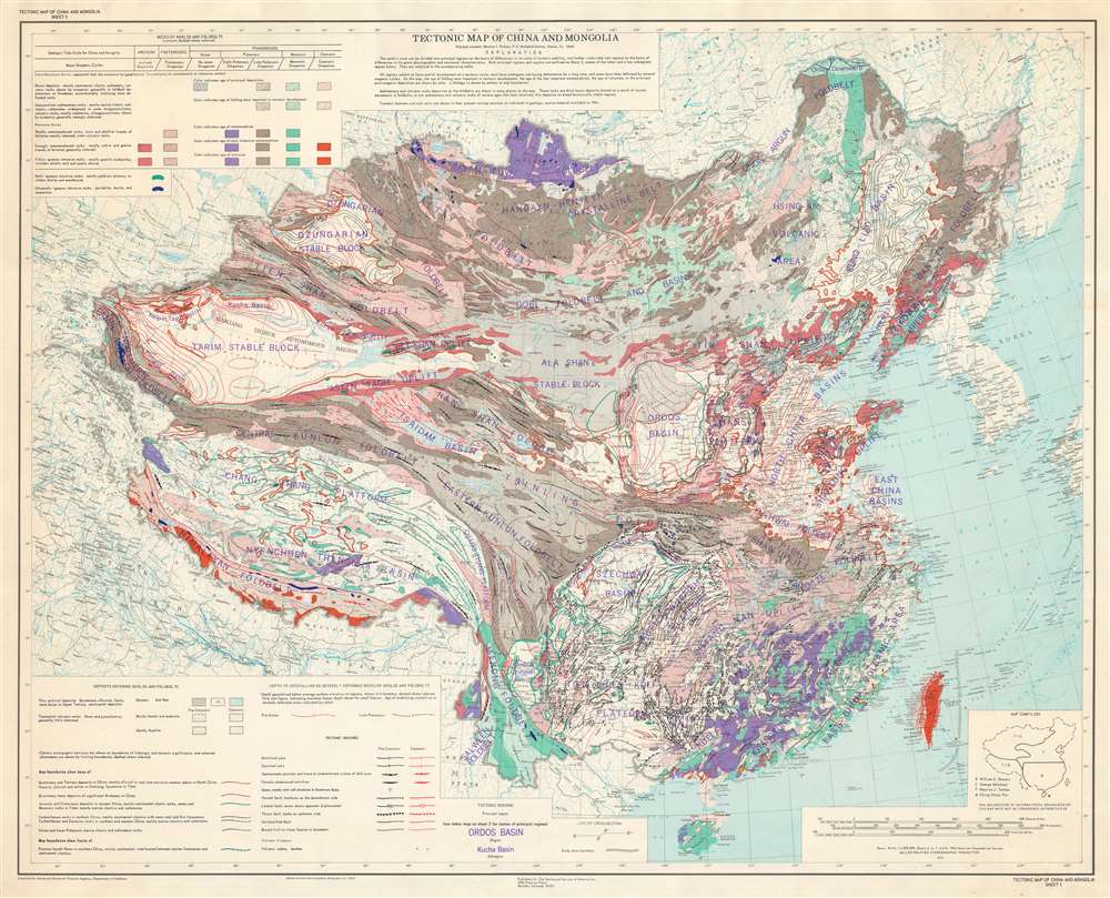
Tectonic Map of China and Mongolia.
$600.00
Acquire
This is a 1973 tectonic map of China and Mongolia - one of the most tectonically important and complicated terrains in the world. The map was published in the wake of the 1973 Luhuo Earthquake by the Geological Society of America and was compiled in the mid-1960s by Maurice J. Terman with help from William E. Bowers, George Soleimani, and Ching Chang Woo. Variations in color and shading patterns illustrate differences in the age and composition of geologic formations. Thick red and black lines indicate tectonic features, including faults. Other notations detail deposits covering shields and foldbelts, such as glaciers and salt flats. (more details)
Postal infrastructure in one of the most developed regions of China.
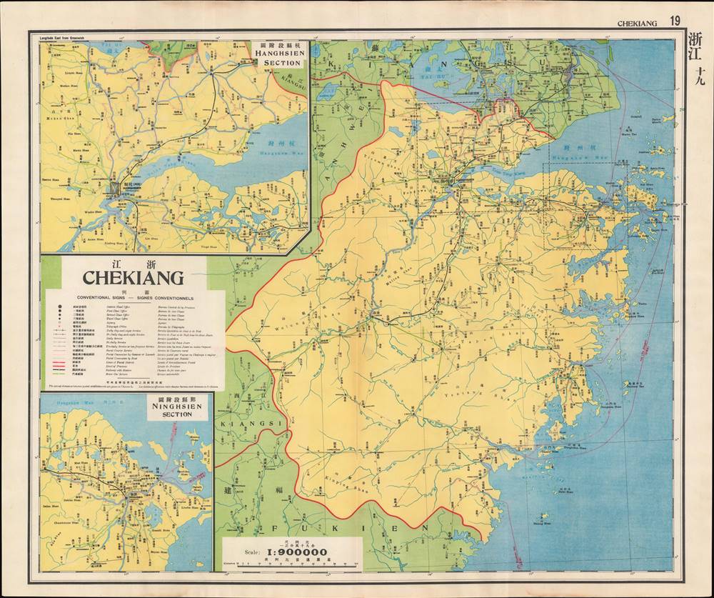
浙江 / Chekiang.
$400.00
Acquire
- Digital Map Information
- Suitable for large format printing
- File Size: 30.78 MB
- File Type: ZIP / TIFF
- ICC color profile embedded
- Delivered instantly via download link
This is a map of Zhejiang (Chekiang) Province from the 1933 edition of The Postal Atlas of China (中華郵政輿圖), compiled by Charles Jacot-Guillarmod. It presents the evolving postal infrastructure of the region, reflecting a broader modernization drive by the Nanjing government. (more details)
Combines the history of charm of Locust Valley and Oyster Bay.
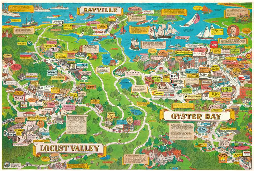
Bayville. Locust Valley. Oyster Bay.
$350.00
Acquire
Combining both the historical and the modern, this 1983 Barry Rockwell pictorial map of Bayville, Locust Valley, and Oyster Bay presents local businesses alongside historical events. Billboards (complete with phone numbers - the internet had not been invented yet!) abound and advertise local businesses ranging from bakeries to sweet shops, restaurants, markets, and small boutiques. Three 'scrolls' bear short histories of Bayville, Locust Valley, and Oyster Bay, and yellow banners describe important historical events. A portrait of President Theodore Roosevelt appears along the right border just below his home Sagamore Hill. Roosevelt's famed Great White Fleet occupies the upper left corner in Long Island Sound. Sailing ships in Oyster Bay illustrate a Revolutionary War naval battle, while a British fort and patrol underscore the area's fierce loyalty to the crown. Moments of levity appear as well, including people playing golf, a couple wandering through the Planting Fields Arboretum, and a man hiding under a tree spying on the 'Red Coats'. (more details)
Vacation all year! SoCal Life!
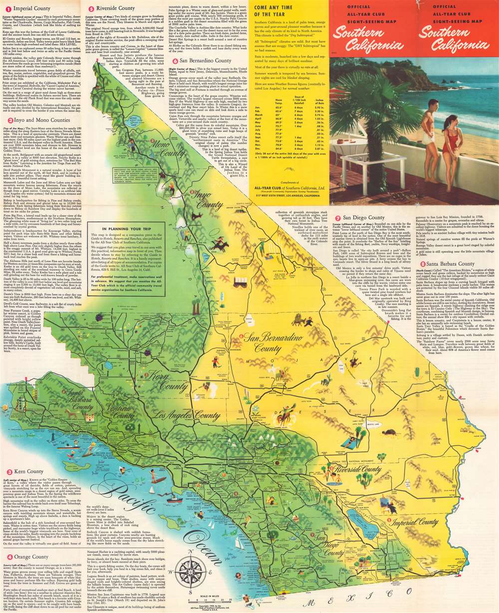
Official All-Year Club Sight-Seeing Map Southern California.
$200.00
Acquire
- Digital Map Information
- Suitable for large format printing
- Full resolution TIFF file
- ICC color profile embedded
- Delivered instantly via download link
This is a 1953 All-Year Club of Southern California pictorial tourist map. Coverage extends from Topaz Lake south to the U.S. - Mexico border and from the Pacific Ocean to the California - Nevada border. Pictorial vignettes add charm. Tourists are illustrated sunbathing, fishing, surfing, hiking, and rock climbing, while a rancher, a covered wagon, and a miner reference the region's history. Grapes, oranges, giant sequoias, and cacti highlight the breadth of California's flora. Block texts introduce the region's eight counties, recount history, and highlight places of interest. A yellow box in the upper right includes the All-year Club's pitch that weather in southern California is ideal year-round. (more details)