
Imray, James (sold) (James Imray and Son, Blanchford and Imray, Imray Laurie Norie and Wilson)

James Imray (May 16, 1803 - November 15, 1870) was a Scottish hydrographer and stationer active in London during the middle to latter part of the 19th century. Imray is best known as the largest and most prominent producer of blue-back charts, a type of nautical chart popular from about 1750 to 1920 and named for its distinctive blue paper backing (although not all charts called "blue-backs" actually have a blue backing). Unlike government charts issued by the British Admiralty, the U.S. Coast Survey, and other similar organizations, Imray's charts were a private, profit-based venture. They were not generally the result of unique survey work. Rather, Imray's charts were judicious and beautiful composites based on pre-existing charts (some dating to the 17th century) and new information gleaned from governmental and commercial pilots and navigators. Imray was born in Spitalfields, England, the eldest son of a Jacobite dyer also named James. Imray did not follow his father's profession; instead, he apprenticed to William Lukyn, a stationer. He established himself as a bookseller and bookbinder at 116 Minories Street, where he shared offices with the nautical chart publisher Robert Blanchford (1775 - c. 1852). In 1836, Imray signed on as a full partner in Blanchford's enterprise, christening themselves Blanchford & Imray. At the time, the Blanchford firm lagged far behind competing chart publishers Norie and Laurie; nevertheless, with the injection of Imray's marketing savvy, the firm began a long rise. James Imray bought out Blanchford's share in 1846, becoming the sole proprietor of the chart house, publishing under the imprint of James Imray. Relocating in 1850 to larger offices at 102 Minories, Imray was well on track to become the most prominent chart publisher in London. In 1854, when Imray's 25-year-old son, James Frederick Imray, joined as a full partner, the firm again changed its imprint, this time to James Imray and Son. The elder Imray was a master of marketing and quick to respond to shifts in trade and historical events. Many of his most successful charts were targeted at specific trade routes; for example, he issued charts titled "Cotton Ports of Georgia" and "Rice Ports of India". Other charts emerged quickly following such events as the 1849 California Gold Rush. Imray's rise also coincided with the development of governmental mapping organizations such as the Admiralty and the U.S. Coast Survey, whose work he appropriated and rebranded in practical format familiar to navigators. Imray's death in 1870 marked a major transition in the firm's output and the beginning of its decline. Though Imray's son, James Frederick, excelled at authoring pilot books, he had little experience with charts and issued few new publications. Most James Frederick Imray publications issued from 1870 to 1899 were either revisions of earlier maps prepared by his father or copies of British Admiralty charts. Charts from this period are recognizable as less decorative than the elder Imray's charts, which follow the stylistic conventions established by the Admiralty. The Admiralty itself at the same time began to rise in prominence, issuing its own official charts that were both cheaper and more up to date than those offered by private enterprises. By the end of the century, the firm was in decline, and in 1899, "James Imray and Son" amalgamated with the similarly suffering "Norie and Wilson", which was itself acquired by Laurie in 1904. Today, it continues to publish maritime charts as "Imray, Laurie, Norie and Wilson".
AKA: James Imray and Son, Blanchford and Imray, Imray Laurie Norie and Wilson
Manuscript Whaler's Annotations in Gulf of Mexico.
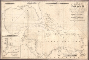
Blachfords, New General Chart of the West Indies, Including the Caribee and Virgin Islands, Porto Rico, St. Domingo, Jamaica and Cuba. The Windward Passages gulfs of Florida and Mexico, Bay of Honduras, And Coast of Colombia Compiled from the best Authorities, Including the surveys of Mr. A. de Mayne R.N., Mr. Lockwood etc.
sold
- Digital Map Information
- Suitable for large format printing
- File Size: 113.86 MB
- File Type: ZIP / TIFF
- ICC color profile embedded
- Delivered instantly via download link
A spectacular 1838 / 1843 Blachford blueback nautical map of the West Indies, including Florida, the Gulf of Mexico, the Caribbean, and Central America. This beautiful map features pencil manuscript annotations in the Gulf of Mexico that strongly suggest whaling. (more details)
One of only two known surviving examples of a scarce chart.
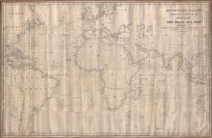
An Outline Chart for the Purpose of Marking off the Track of a Ship.
sold
- Digital Map Information
- Suitable for large format printing
- Full resolution TIFF file
- ICC color profile embedded
- Delivered instantly via download link
A large 1846 blueback nautical chart or maritime map of the world by Robert Blachford. Centered on a large and prominent Africa, this map covers most of the world excluding the Arctic climes from roughly the Orkney Islands to the Falkland Islands and from Yucatan (Mexico) to Borneo and Western Australia. Blachford intended this map for marking the route of a ship along the more common maritime routes - to the Americas and around Africa to India and the East Indies. It notably does not include the Pacific, an area in which Blachford had little interest. Notations in pencil indicate that this chart was used to mark off repeat voyages between England and the Americas, specifically New England and the West Indies. (more details)
Awe inspiring nautical chart of th north Pacific Ocean.
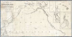
Chart of the North Pacific Ocean, Exhibiting the Eastern Shores of Asia and the Western Coast of North America from the Equator to Behring's Strait with plan, on an enlarge scale, of the Principal Island and Harbours.
sold
- Digital Map Information
- Suitable for large format printing
- DPI: 300
- File Size: 86.53 MB
- File Type: ZIP / TIFF
- ICC color profile embedded
- Delivered instantly via download link
A spectacular and massive 1849 James Imray nautical chart or maritime map of the northern Pacific. Roughly centered on Hawaii, this sprawling chart covers from Hainan and Borneo eastwards to Columbia and Panama, and from the Behring Strait to the Moluccas and the Galapagos Islands (the Equator). The chart is rendered on a Mercator Projection with latitude measured from Greenwich, England. Like most nautical charts, the cartographer offers very little inland detail, but a wealth of maritime data. This includes the identification of various ports and harbors, coastal topography, shoals and other undersea dangers, and countless depth soundings in fathoms. Additionally, the cartographer has noted aspects of various islands that may have been of importance to the mariner, for example Christmas Island has 'Plenty of Turtle, no fresh Water.'
This map is decorated with ten inset maps, from top center, Victoria Harbor (British Columbia), Awatska Bay on the east coast of Kamtschatka, the Mariana or Ladrones Islands (including Guam), the Hawaiian or Sandwich Islands (with four sub-insets: Waiakea or Byron Bay, Hanalei Bay (Kauai), Honolulu Harbor, and Kailua Bay), San Francisco Bay, the Mouth of the Columbia River (including the Fort Astoria settlement), and the Philippine Islands. (more details)
This map is decorated with ten inset maps, from top center, Victoria Harbor (British Columbia), Awatska Bay on the east coast of Kamtschatka, the Mariana or Ladrones Islands (including Guam), the Hawaiian or Sandwich Islands (with four sub-insets: Waiakea or Byron Bay, Hanalei Bay (Kauai), Honolulu Harbor, and Kailua Bay), San Francisco Bay, the Mouth of the Columbia River (including the Fort Astoria settlement), and the Philippine Islands. (more details)
Rare mid-19th century Nautical Chart of Hong Kong.
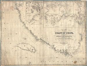
Chart of the Coast of China, Extending from Hong Kong to the River Yang-Tse, with Plans on a Large Scale of the Principal Harbours & C.
sold
- Digital Map Information
- Suitable for large format printing
- File Size: 65.86 MB
- File Type: ZIP / TIFF
- ICC color profile embedded
- Delivered instantly via download link
An impressive large 1855 format nautical chart or maritime map detailing the coast of China from the Yangtze River to Hong Kong and Macao. Map incudes Taiwan or Formosa in full. Drawn by the nautical chart maker James Imray, this is one of the rarest 19th century maps of Hong Kong and Taiwan. It includes insets of Hong Kong, the River Min, Amoy Harbor (Xiamen), Tongsang harbor, Hoo-e-Two and Chimmo Bays, the mouth of the Yangtze, and the Chusan Archipelago (Zhoushan). Dated 1855. (more details)
One of only three known examples of this important early chart covering Florida, Virginia, Georgia, New Jersey, and the Carolinas.
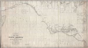
Chart of the East Coast of North America, Extending from New York to the Strait of Florida, including Plans on a Large Scale of the Principal Harbors, Drawn chiefly from the Surveys made by order of the United States Government.
sold
- Digital Map Information
- Suitable for large format printing
- File Size: 94.77 MB
- File Type: ZIP / TIFF
- ICC color profile embedded
- Delivered instantly via download link
An extremely scarce, highly decorative, and monumentally proportioned 1855 sea chart or maritime map detailing the eastern coast of the United States from New York City to southern Florida (roughly around Palm Beach). The map was prepared by the British chart publisher James Imray and Son in their distinctive expansive style. In a broad spread, it includes the coasts of New York, New Jersey, Delaware, Maryland, Virginia, North Carolina, South Carolina, and Florida. The Chesapeake Bay, Delaware Bay, New York Harbor, the Bahama Banks, and the Outer Banks are rendered in beautiful detail. The chart is presented on a Mercator Projection with latitude measured from Greenwich, England. Like most nautical charts, the cartographer offers very little inland detail, but a wealth of maritime data. This includes the identification of various ports and harbors, coastal topography, shoals and other undersea dangers, and countless depth soundings in fathoms.
This chart further features six large insets in the upper right quadrant offering detailed charts of 'Tybee Bay and the Mouth of the Savannah River', 'Cape Fear River and Frying-Pan Shoals', 'Cape Hatteras', 'Charleston Harbor', the 'entrance of the River Delaware', and the 'entrance to Chesapeake Bay'. The cartography of the insets generally follows the preliminary work of the U. S. Coast Survey in their respective regions. (more details)
This chart further features six large insets in the upper right quadrant offering detailed charts of 'Tybee Bay and the Mouth of the Savannah River', 'Cape Fear River and Frying-Pan Shoals', 'Cape Hatteras', 'Charleston Harbor', the 'entrance of the River Delaware', and the 'entrance to Chesapeake Bay'. The cartography of the insets generally follows the preliminary work of the U. S. Coast Survey in their respective regions. (more details)
Fantastic chart labeling both Montevideo and Buenos Aires - with insets details both!
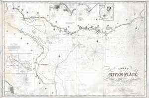
Chart of the River Plate, with Enlarged Plans of the Principal Harbors.
sold
- Digital Map Information
- Suitable for large format printing
- File Size: 17 MB
- File Type: ZIP / TIFF
- ICC color profile embedded
- Delivered instantly via download link
This is an 1856 James Imray blueback nautical chart or maritime map of the Río de la Plata in South America. The map depicts the Río de la Plata from Buenos Aires (Buenos Ayres) and the Entrance of the River Parana to Palmarones Island and from the entrance of the Uruguay River to Cape Saint Antonio. A highly detailed chart, this example shows evidence of having been used on board a ship. Both Montevideo and Buenos Aires are labeled, along with numerous other points along the coastline, including several mountains and hills that would be identifiable at sea. Innumerable depth sounding populate the bulk of the chart along with several banks. Hazards to the mariner are clearly marked. Three different compass roses are included. A note along the left border that warns the viewer that the shape of the shoals and depth of water over them is very likely to have changed since the last survey. The final sentence is a cautionary one – stating that 'strangers bound up the river beyond Monte Video ought to obtain a pilot.'
Six different inset maps are included around the border of the chart. These include Colonia and the Hornosi Islands, the Bay of Barragan, Buenos Aires (Buenos Ayres), Montevideo (Monte Video), the road of Maldonado, and the Anchorage of Cape St. Mary. Each of these inset maps includes numerous depth soundings and a detailed depiction of the area in question. (more details)
Six different inset maps are included around the border of the chart. These include Colonia and the Hornosi Islands, the Bay of Barragan, Buenos Aires (Buenos Ayres), Montevideo (Monte Video), the road of Maldonado, and the Anchorage of Cape St. Mary. Each of these inset maps includes numerous depth soundings and a detailed depiction of the area in question. (more details)
Rare blueback nuatical chart of Taiwan or Formosa.
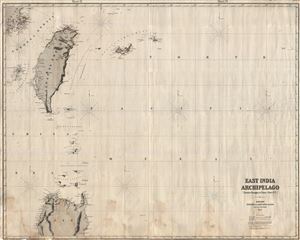
East India Archipelago [Eastern Passages to China and Japan] [Chart No. 7]
sold
- Digital Map Information
- Suitable for large format printing
- File Size: 64.16 MB
- File Type: ZIP / TIFF
- ICC color profile embedded
- Delivered instantly via download link
This is an extremely rare and highly desirable 1861 Imray blue-back chart depicting Taiwan (Formosa) and northern Luzon. Covers the regions between 16°30' to 25°40' North Latitude and between 188° 20' and 130° 20' East Longitude. Offers considerable ... (more details)
Island Paradise with some of the world's greatest fortified wines.
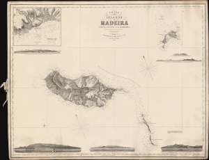
Chart of the Islands of Madeira Porto Santo and Dezerta.
sold
- Digital Map Information
- Suitable for large format printing
- File Size: 823.41 MB
- File Type: ZIP / TIFF
- ICC color profile embedded
- Delivered instantly via download link
A scarce 1863 James Imray nautical map of Madeira and nearby islands, based on a survey by Royal Navy officer Alexander Vidal. (more details)
Premier nautical mapping of the Rio de la Plata to appear in the second part of the 19th century.
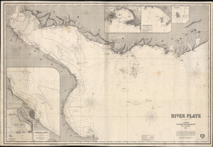
River Plate.
sold
- Digital Map Information
- Suitable for large format printing
- File Size: 123.49 MB
- File Type: ZIP / TIFF
- ICC color profile embedded
- Delivered instantly via download link
This large, richly detailed, and rare work is James Imray's 1868 working, blueback nautical chart of the Río de la Plata in South America. It was produced during the War of the Triple Alliance (1864 - 1870), a war fought by Brazil, Uruguay, and Argentina against Paraguay, largely over control of this waterway. It is the premier nautical mapping of the Río de la Plata to appear in the second half of the 19th century. (more details)
Impressive large format nautical chart of the West Indies.
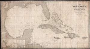
Chart of the Gulf of Mexico and Windward Passages including the Islands of Cuba, Haiti, Jamaica Puerto Rico and the Bahamas.
sold
- Digital Map Information
- Suitable for large format printing
- File Size: 91.19 MB
- File Type: ZIP / TIFF
- ICC color profile embedded
- Delivered instantly via download link
A large and expansive 1871 James Imray blueback nautical chart or maritime map of the Gulf of Mexico and the West Indies, including the Greater Antilles. As a working chart, it bears all of the hallmarks of a shipboard chart and a life at sea, including pencil marks related to navigation. The map covers from Mexico to the Virgin Island and from northern Florida to Honduras, including all of the Gulf of Mexico, Cuba, Florida, the Yucatan, Santo Domingo (Hispaniola), Jamaica, Porto Rico, and the Bahamas, as well as the Gulf Coast in the vicinity of Texas, Mississippi, Louisiana, and Alabama. Inset maps detail the River Goazacolcos, the port of Veracruz (Mexico), and the Laguna de Terminos. (more details)
Working nautical chart with annotations around Bermuda.
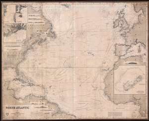
North Atlantic.
sold
- Digital Map Information
- Suitable for large format printing
- File Size: 553.47 MB
- File Type: ZIP / TIFF
- ICC color profile embedded
- Delivered instantly via download link
This is an uncommon 1871 James Imray and Son blueback nautical chart or maritime map of the North Atlantic. The map covers from the Equator and the mouth of the Amazon river to the southern shores of Greenland, and from the Gulf of Mexico to the Baltic Sea and Sardinia. The chart contains a wealth of nautical information regarding trade winds, oceanic depths, currents, and more. There are detailed inset maps of Bermuda, Fayal Channel (Faial-Pico Channel), Azores), Horta and Pim Bays (Azores), and Funchal Bay (Madeira). Some pencil marks and erasures suggest early maritime use in the vicinity of Bermuda. (more details)

East India Archipelago (Western Route to China Chart no. 2)
sold
- Digital Map Information
- Suitable for large format printing
- File Size: 52.8 MB
- File Type: ZIP / TIFF
- ICC color profile embedded
- Delivered instantly via download link
A large and impressive 1872 nautical chart by James Imray covering eastern Malaya (Malaysia), Singapore, and parts of Borneo and Sumatra. (more details)
Scarce nautical chart detailing the China Coast between Taiwan, Hong Kong, and the Philippines.

East India Archipelago (Western Route to China Chart no. 6)
sold
- Digital Map Information
- Suitable for large format printing
- File Size: 44.42 MB
- File Type: ZIP / TIFF
- ICC color profile embedded
- Delivered instantly via download link
A large and impressive 1872 nautical chart by James Imray covering southeastern China in the vicinity of Hong Kong and Guangdong Province, southern Taiwan, and the northern Philippines (Luzon and Mindanao). Two trade routes are identified including the 'Usual route to and from Hong Kong in fair Monsoon' and the 'course to Hong Kong in the Northeast Monsoon.' The chart achieves its greatest detail and accuracy in the vicinity of Hong Kong and Macao as well as in the seas around the Pescadores Islands between Taiwan and the China coast. Manila Bay, in the Philippines, is also well mapped. (more details)
Impressive working nautical chart of the Bahamas and Floridia Reefs tracing the voyage of Thomas Reese Anderson and the barque Arcadia.
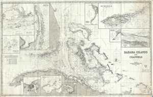
Bahama Islands and Channels.
sold
- Digital Map Information
- Suitable for large format printing
- File Size: 22.32 MB
- File Type: ZIP / TIFF
- ICC color profile embedded
- Delivered instantly via download link
A dramatic 1872 James Imray blueback nautical chart of maritime map of the Bahamas, south Florida, and northern Cuba. This massive map covers from Cape Canaveral to northern Cuba and Great Inagua Island, and from the western top of Cuba to Turks and Caicos. The work of one of the best marine chart makers of his era, this superb chart was the best general nautical chart of the Bahama Islands, and the surrounding waters, available. (more details)
Working blueback nautical chart of the Gulf of Mexico and the West Indies.
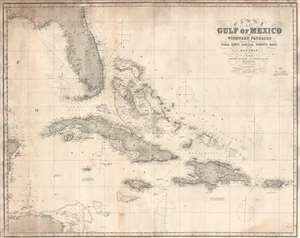
Chart of the Gulf of Mexico and Windward Passages Including the Islands of Cuba, Haïti, Jamaica, Puerto Rico, and the Bahamas.
sold
- Digital Map Information
- Suitable for large format printing
- Full resolution TIFF file
- ICC color profile embedded
- Delivered instantly via download link
This is an 1873 James Imray blueback nautical chart or maritime map of the Gulf of Mexico and the West Indies, including the Greater Antilles. The map depicts from Pensacola, Florida and the eastern tip of the Yucatan Peninsula to Puerto Rico and from Georgia to Honduras and the Mosquito Coast. Highly detailed, numerous depth soundings are included, particularly along the coast of the United States, the coast of Cuba, in the Bahamas. Locations throughout the region are labeled, mostly along the coastlines, but some inland locations are indicated on Cuba and Hispaniola. Havana, Pensacola, Cape Canaveral, St. Augustine, Port au Prince, and San Juan are among the locations labeled. Manuscript notations in the form of yellow dots mark the location of every lighthouse in the region from the Bay of Honduras and Pensacola to Puerto Rico. (more details)
Working Nauical Chart encompassing all of the Lesser Antilles, including the Virgin Island and St. Lucia.
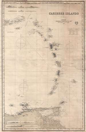
Caribbee Islands.
sold
- Digital Map Information
- Suitable for large format printing
- File Size: 17.42 MB
- File Type: ZIP / TIFF
- ICC color profile embedded
- Delivered instantly via download link
This is an 1873 James Imray blueback nautical chart or maritime map of the Lesser Antilles in the West Indies. The map depicts the region from the eastern portion of Puerto Rico to Barbados and from Puerto Rico to South America, including the Virgin Islands, Antigua and Barbuda, Montserrat, Martinique, Guadeloupe, Dominica, St. Lucia, St. Vincent and the Grenadines, and Trinidad and Tobago. Highly detailed, coastal locations are labeled on each of the islands and topography is illustrated on those islands that had been surveyed. Each island also bears the label of which colonial power controlled the island, whether it was France, Spain, the United Kingdom, the Netherlands, or Sweden. Depth soundings are included around the Virgin Islands, Anguilla, St. Martin, St. Bartholomew, Montserrat, Antigua and Barbuda, St. Eustatius, St. Christopher, Nevis, the Grenadines, and Trinidad and Tobago, as well as along the South American coast. Numerous locations along the coast of South America are also labeled, including the Orinoco River Delta and its mouth. Ten profile views of the islands are included along both the top and bottom border, including Guadeloupe, Martinique, Barbados, and St. Eustatius. Notes on the soundings and lines of longitude are situated along the right border, along with a note from the publishers stating that they 'request communications that may tend to the improvement of this, or any of their works'. (more details)
Natucial chart with extensive annotation regarding Newburyport whaling voyages.
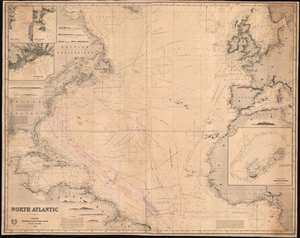
North Atlantic.
sold
- Digital Map Information
- Suitable for large format printing
- Full resolution TIFF file
- ICC color profile embedded
- Delivered instantly via download link
This is an uncommon 1874 James Imray and Son blueback nautical chart or maritime map of the North Atlantic with extensive whaling annotations relating to the voyages of Newburyport Captain John. N Pritchard. The map covers from the Equator and the mouth of the Amazon River to the southern shores of Greenland, and from the Gulf of Mexico to the Baltic Sea and Sardinia. The chart contains a wealth of nautical information regarding trade winds, oceanic depths, currents, and more. There are detailed inset maps of Bermuda, Fayal Channel (Faial-Pico Channel, Azores), Horta and Pim Bays (Azores), and Funchal Bay (Madeira). Some pencil marks and erasures suggest early maritime use in the vicinity of Bermuda. (more details)
Giant blueback working nautical chart of the Indian Ocean with in manuscript navigational notes.
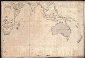
Indian Ocean.
sold
- Digital Map Information
- Suitable for large format printing
- Full resolution TIFF file
- ICC color profile embedded
- Delivered instantly via download link
This is a gigantic 1874 James Imray and Son blueback working nautical chart or maritime map of the Indian Ocean covered in manuscript notations. The map depicts the world from East Africa to Fiji and from Taiwan and the Persian Gulf to 60 degrees south latitude. Manuscript pencil notations trace at least three, possibly four, voyages across the Indian Ocean. These notations mark the vessel's location on its trip across the ocean and notes what is most likely the day of the expedition. Apart from these four voyages, numerous routes between various points throughout the region are also illustrated, with a particular concentration running from the Gulf of Aden to the East Indies, frequented trade routes between England and the Netherlands and these colonies rich in natural resources. Myriad locations are identified throughout, particularly along the coastlines and small islands making up parts of archipelagos situated throughout the Pacific Ocean and the China Sea. Eight inset maps are situated on the map's left side and illustrate Cargados Carajos, Coetivy, Rodrigues, Wood Island, Farquhar Passage, Tromelin, Réunion, and the cities of Saint Paul and Saint Denis on Réunion. (more details)
Enormous working nautical chart of the West Indies.
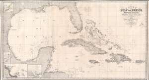
Chart of the Gulf of Mexico and Windward Passages including the Islands of Cuba, Haiti, Jamaica Puerto Rico and the Bahamas.
sold
- Digital Map Information
- Suitable for large format printing
- File Size: 100.7 MB
- File Type: ZIP / TIFF
- ICC color profile embedded
- Delivered instantly via download link
A large and expansive 1875 James Imray blueback nautical chart or maritime map of the Gulf of Mexico and the West Indies, including the Greater Antilles. As a working chart, it bears all the hallmarks of a shipboard chart and a life at sea, including pencil marks related to navigation. The map depicts from Mexico to the Virgin Islands and from northern Florida to Honduras, including all of the Gulf of Mexico, Cuba, Florida, the Yucatan, Santo Domingo (Hispaniola), Jamaica, Puerto Rico, and the Bahamas, as well as the Gulf Coast in the vicinity of Texas, Mississippi, Louisiana, and Alabama. Inset maps detail the River Goazacolcos (Coatzacoalcos), the port of Veracruz (Mexico), and the Laguna de Terminos. (more details)
Scarce nautical chart illustrating the Guianas.
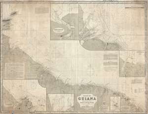
Coast of Guiana.
sold
- Digital Map Information
- Suitable for large format printing
- File Size: 53.4 MB
- File Type: ZIP / TIFF
- ICC color profile embedded
- Delivered instantly via download link
This is a large and impressive nautical chart of maritime map of the British Guiana, Surinam, and French Guiana coast in South America. The map covers from Trinidad and Tobago, and the mouth of the mouth of the Orinoco in Venezuela, east as far as Cape Orange and the River Uassa (River Oyapok), including the modern-day nations of British Guiana, Surinam (Dutch Guiana), and French Guiana. Insets detail the River Surinam, The Demerara and Essequibo Rivers, the River Maroni, Cayenne, the River Corentyn, and the Salut Islands. The chart contains copious annotations describing the difficult river navigation in this region. (more details)
Chart of the Canary Islands from Vidal's survyes.
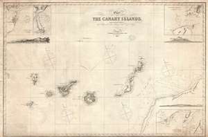
Chart of the Canary Islands, Drawn from the Surveys of Capt. Vidal and Liet. Arlett of the Royal Navy.
sold
- Digital Map Information
- Suitable for large format printing
- File Size: 22.22 MB
- File Type: ZIP / TIFF
- ICC color profile embedded
- Delivered instantly via download link
An elegant 1875 James Imray nautical chart or map of the Canary Islands. This map was originally published by Imray in 1860, the present example being a later edition, based upon the important surveys of Captain Alexander Thomas Emeric Vidal of the Royal Navy. Centered on Gran Canaria, the map extends to cover all of the islands as well as parts of the adjacent west African coast. Insets details Santa Cruz (Tenerife), Puerto da la Luz (Las Palmas, Gran Canaria), Arreciffe (Arrecife, Lanzarote), the Strait of Rio, and Bocayna Strait. Profiles detail Tenerife, Grand Canaria, and Santa Cruz. (more details)
Below 40 degrees latitude, there is no law; below 50, there is no God... - Old Sailor Adage.
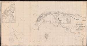
Chart of the East and West Coasts of South America Extending from teh River Platte Round Cape Horn to Valparaiso with Plans of the Principal Harbours.
sold
- Digital Map Information
- Suitable for large format printing
- File Size: 56.28 MB
- File Type: ZIP / TIFF
- ICC color profile embedded
- Delivered instantly via download link
A rare 1874 Imray and Son blueback nautical chart illustrating the southern part of South America, the Straits of Magellan, Cape Horn, Patagonia, and the South Shetland Islands. The map includes pencil annotations recording Captain Robert Jack and the Clipper Indiana particularly harrowing 1879 transit around Cape Horn, where the ship was repeated driven south by the notorious williwaw winds, before eventually exiting the treacherous conjunction of oceans. Jack himself was a known Maine sea captain whose letters have been preserved and offer priceless insights into seaman life in the late 19th century. The map is oriented to the east, and coverage extends from the Rio de La Plata to the South Shetland Islands, and covers Cape Horn on both the Atlantic and Pacific. Detailed insets detail important ports, as well as the Strait of Magellan - with charming place names such as 'Useless Harbor'. (more details)
A blueback chart of Guadeloupe, a French island department in the West Indies.
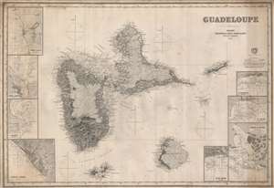
Guadeloupe.
sold
- Digital Map Information
- Suitable for large format printing
- File Size: 55.85 MB
- File Type: ZIP / TIFF
- ICC color profile embedded
- Delivered instantly via download link
This is an 1876 James Imray blueback nautical chart or maritime map of the islands of Guadeloupe and Marie Galante in the Caribbean Sea. The map depicts the region from the west coast of Guadeloupe to Désirade Island and from Point Grande Vigie to the Iles des Saintes. Cities, towns, and villages are labeled, including Basse Terre, Trois Rivieres (Trois Rivers as identified here), Goyave, and Pointe-a-Pitre. Coastal landmarks are identified on all the islands in the group, and myriad depth soundings are included along the coastlines as well. Eight inset maps are included along the chart's borders, each of which details a different city or town on Guadeloupe. Inset maps of Port Louis, Port du Moule, Sainte Marie, and Basse Terre as situated along the left border, while Saint Francois, Sainte Anne. Point a Pitre and Petit Havre are included along the right border. (more details)
Shows the disputed Pinnacle Islands (Senkaku or Diaoyu Islands)
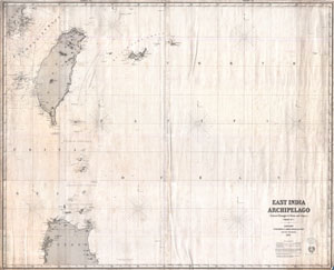
East India Archipelago [Eastern Passages to China and Japan] [Chart No. 7]
sold
- Digital Map Information
- Suitable for large format printing
- File Size: 41.68 MB
- File Type: ZIP / TIFF
- ICC color profile embedded
- Delivered instantly via download link
This is an extremely rare and highly desirable 1876 Imray blue-back chart depicting Taiwan (Formosa) and northern Luzon. Covers the regions between 16°30' to 25°40' North Latitude and between 188° 20' and 130° 20' East Longitude. Offers considerable detail along the cost of Formosa, particularly to the west in the Formosa Strait and around the Pescadore Islands. Countless depth soundings throughout. When Imray drew this nautical chart, very little was known about the seas between China and the Philippines. Indeed, the following note of caution appears in the lower right hand quadrant of the map:
The utmost care is requisite when navigating the seas comprised within the limits of this chart because they are very imperfectly known and it is believed that sunken reefs exist while have yet to be inserted on the chart, and the many of the known reefs are inaccurately placed in position.Despite the general paucity of information available, this chart represents one of the best mappings of the Taiwan region to appear in the 19th century. This region was not fully surveyed until the Japanese conquest of Taiwan in the late 19th and early 20th centuries. (more details)
Nautical Chart including Hong Kong and disputed South China Sea territory near Vietnam!
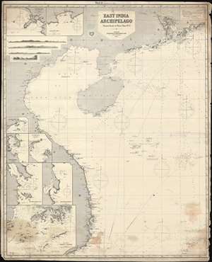
East India Archipelago. [Western Route to China. Chart No. 5.]
sold
- Digital Map Information
- Suitable for large format printing
- File Size: 116.5 MB
- File Type: ZIP / TIFF
- ICC color profile embedded
- Delivered instantly via download link
This is an uncommon 1878 James Imray map of the South China Sea region between Hong Kong, Hainan, and Vietnam. The chart covers from the Pearl River Delta, south past and including Hainan, and most of the coast of Vietnam to, roughly Saigon There are inset detail maps of Hong Kong, Nha-Trang, Cam-Ranh, Port Xuan-Dai, Touron Bay, Cape Boung-Quioua, Yu-Lin-Kan, Gaalong Bay (Yalang Wan). The map was used for actual navigation and there are pencil marks and manuscript updates associated with maritime use. It bears an 'Imray and Son 1880' stamp suggesting there may be printed updates, but his is not 100% clear as charts were not updated as frequently as one might think. (more details)
The finest map of Puerto Rico we have seen! Includes the Virgin Islands and names billionaire haven Necker Island.
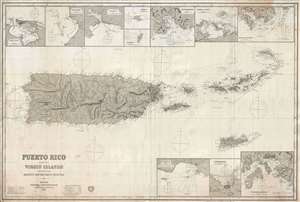
Puerto Rico and the Virgin Islands Compiled from Recent Government Surveys.
sold
- Digital Map Information
- Suitable for large format printing
- File Size: 43.51 MB
- File Type: ZIP / TIFF
- ICC color profile embedded
- Delivered instantly via download link
An expansive, exceptional, and extremely rare 1879 nautical chart or maritime map of Puerto Rico and the Virgin Islands. This is the largest and finest map specific map of Puerto Rico we have yet encountered. The chart covers the island in great detail, offering ... (more details)
Pacific Northwest w/ manuscript trade routes between San Francisco and Astoria.
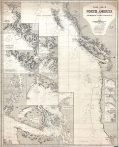
West Coast of North America from San Francisco to Queen Charlotte Ids.
sold
- Digital Map Information
- Suitable for large format printing
- File Size: 57.87 MB
- File Type: ZIP / TIFF
- ICC color profile embedded
- Delivered instantly via download link
A finely executed 1883 James Imray working nautical map of the American Pacific Northwest from San Francisco to the Queen Charlotte Islands. The map includes San Francisco Bay, Vancouver Island, the Strait of Juan de Fuca, the Columbia River and Astoria, and the coasts of Washington, Oregon, northern California, and British Columbia. Pencil manuscript annotations illustrate the route of a merchant ship, probably a fur trader, between the Columbia River frontier trading settlement of Astoria and San Francisco. (more details)
Surveying the Spice Islands.
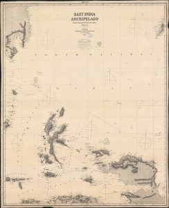
East India Archipelago [Eastern Passages to China and Japan] [Chart No. 5].
sold
- Digital Map Information
- Suitable for large format printing
- Full resolution TIFF file
- ICC color profile embedded
- Delivered instantly via download link
A large-format 1884 James Imray blueback chart of a portion of the Spice Islands, along with Palau and parts of Mindanao and New Guinea, centered on the Halmaheira (Halmahera) Sea. (more details)
Multiple China Trade voyages recorded.
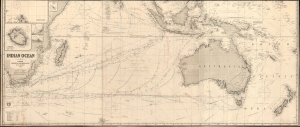
Indian Ocean.
sold
- Digital Map Information
- Suitable for large format printing
- File Size: 108.17 MB
- File Type: ZIP / TIFF
- ICC color profile embedded
- Delivered instantly via download link
This is an 1884 James Imray blueback nautical map illustrating the Indian Ocean, as well as Cape Horn, the East Indies, Australia, and New Zealand. This was the essential chart of navigation to China and the East Indies in the late 19th century. The piece is most fascinating for its detailed manuscript records of multiple voyages, from New York, Cardiff, and Liverpool to Hong Kong, Manila, Sydney, and Bombay. (more details)
...nearly everywhere extremely wild and desolate...
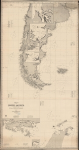
Coast of South America included between the Rio de la Plata and Valparaiso.
sold
- Digital Map Information
- Suitable for large format printing
- File Size: 130.66 MB
- File Type: ZIP / TIFF
- ICC color profile embedded
- Delivered instantly via download link
A massive 1886 Imray nautical map illustrating the coasts of southern South America, including Argentina, Chile, the Falkland Islands (Malvinas), Tierra del Fuego, and the northernmost parts of Antarctica. The map was designed for mariners navigating the treacherous waters of Drake's Passage south of Cape Horn - or navigating to the South Shetlands. (more details)
The Rhine-Meuse-Scheldt delta and the Strait of Dover.
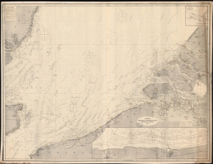
Flemish Banks etc. Western Sheet. [Sheet 1.] / Flemish Banks etc. Eastern Sheet. [Sheet 2.]
sold
- Digital Map Information
- Suitable for large format printing
- File Size: 223.22 MB
- File Type: ZIP / TIFF
- ICC color profile embedded
- Delivered instantly via download link
A detailed, large format 1890 blueback nautical map of the coast of Belgium, France, and Holland. (more details)
From the St. Lawrence to the Cape.
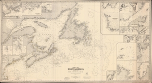
Coast of North America : between the Strait of Belle Island and Cape Cod.
sold
- Digital Map Information
- Suitable for large format printing
- File Size: 342.57 MB
- File Type: ZIP / TIFF
- ICC color profile embedded
- Delivered instantly via download link
A remarkable large-format nautical chart or map covering the coasts of Nova Scotia, New Brunswick, Newfoundland, and New England from Cape Cod northwards, published by James Imray and Son in 1890. (more details)
Impressive nautical chart detailing Singapore.
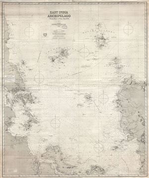
East India Archipelago (Western Route to China Chart no. 2)
sold
- Digital Map Information
- Suitable for large format printing
- File Size: 55.99 MB
- File Type: ZIP / TIFF
- ICC color profile embedded
- Delivered instantly via download link
A large and impressive 1891 nautical chart by James Imray covering eastern Malaya (Malaysia), Singapore, and parts of Borneo and Sumatra. (more details)
From Singapore to China.
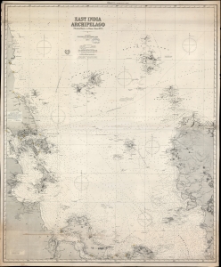
East India Archipelago [Western Route to China Chart no. 2]
sold
- Digital Map Information
- Suitable for large format printing
- File Size: 108.53 MB
- File Type: ZIP / TIFF
- ICC color profile embedded
- Delivered instantly via download link
A large and impressive 1891/1894 nautical chart by James Imray covering eastern Malaya (Malaysia), Singapore, the South China Sea, and parts of Borneo and Sumatra. This is part of a nine-map series Imray issued to illustrate trade routes between Singapore, China, and Japan. It corresponds to Chart no. 2 in the 'East India Archipelago' series and chart no. 4 in the 'Western Route to China' series. This is the most desirable map of the series due to ints inclusion of Singapore. (more details)
Microscopic View of Trade along the Thames.
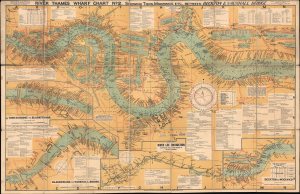
River Thames Wharf Chart No. 2 showing Tiers, Moorings Etc. between Becton and Vauxhall Bridge.
sold
- Digital Map Information
- Suitable for large format printing
- File Size: 75.94 MB
- File Type: ZIP / TIFF
- ICC color profile embedded
- Delivered instantly via download link
This is a large-format folding map and nautical chart of the River Thames in London and environs, published by Imray, Laurie, Norie, and Wilson. Cataloging individual wharves and their owners in great detail, it provides a comprehensive overview of London's bustling commercial activity in the later days of British global hegemony. (more details)