
Beginning of the 2nd Florida land boom - and grants!
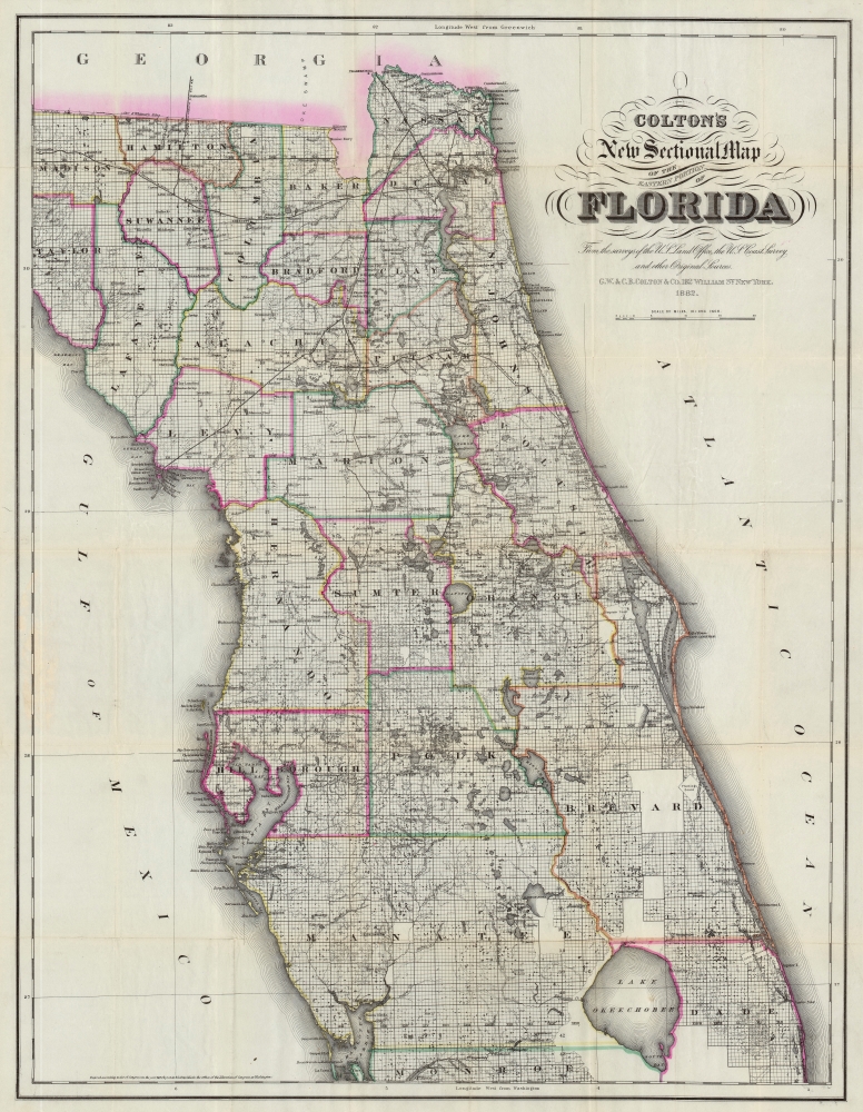
Colton's New Sectional Map of the Eastern Portion of Florida.
sold
- Digital Map Information
- Suitable for large format printing
- File Size: 80.28 MB
- File Type: ZIP / TIFF
- ICC color profile embedded
- Delivered instantly via download link
This is a striking large-scale 1882 map of northern and central Florida by G. W. and C. B. Colton - illustrating the most populous part of the state at the outset of the late 19th century Florida Land Boom. The map is derived from Florida Land Office, U.S. Coast Survey, and railroad survey work compiled up to 1882 - making it one of the largest and most detailed maps of central Florida of its generation. The map is further unique for its illustration of vast land grants. Some of these date to the Spanish era, but others, such as Levy's Jewish settlements, are more recent. Most of which were locked in litigation throughout the second half of the 19th century. (more details)
International steam packet (steamships delivering mail) routes.
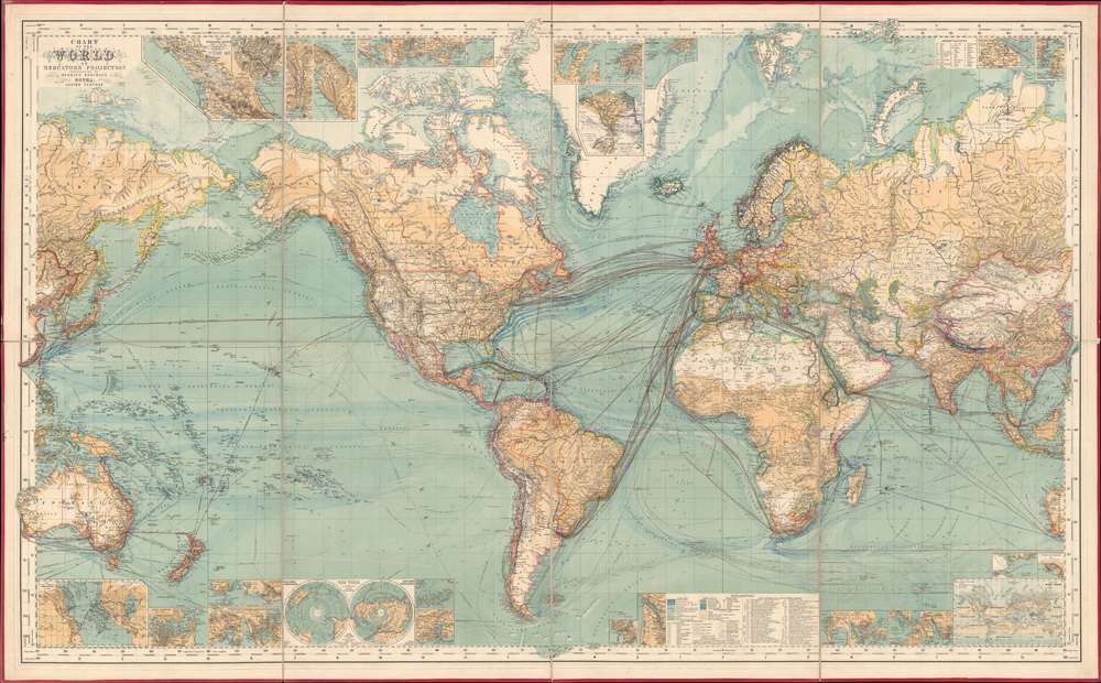
Chart of the World on Mercator's Projection.
sold
- Digital Map Information
- Suitable for large format printing
- Full resolution TIFF file
- ICC color profile embedded
- Delivered instantly via download link
This is an 1882 Hermann Berghaus large-scale map of the world. Typical of German maps production in the late 19th century, this map is both cartographically and informationally dense, featuring a wealth of detail and data systematically organized for easy digestion. This ranges from land and sea transportation networks, to climatological data, to topography, political distinctions, communication infrastructure (telegraph lines), oceanographic content, and more. Of particular interest is Berghaus' focus on the transatlantic mail packets. (more details)
Conflicting French and English claims to the Carolina, Georgia, and Florida seaboard.
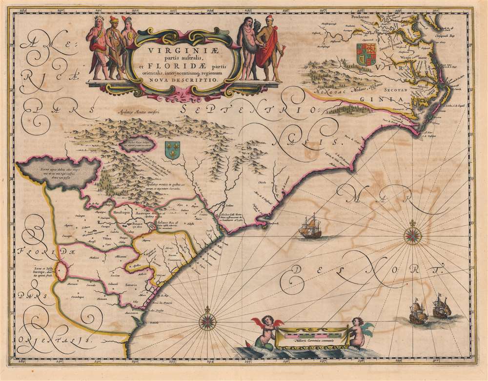
Virginiae Partis australis, et Floridae partis orientalis, interjacentiumque regionum Nova Descriptio.
$2,000.00
Acquire
- Digital Map Information
- Suitable for large format printing
- Full resolution TIFF file
- ICC color profile embedded
- Delivered instantly via download link
This is a beautiful c. 1644 Jan Jansson map of Virginia and Florida. This classic Dutch map, encompassing the Carolinas and the area that would become Georgia and part of Florida, was derived from that of Willem Blaeu, which has been called 'the most correct map of this area yet to appear' (Cumming). Blaeu's map was sufficiently authoritative for Jansson to make an extremely faithful copy. Both cartographers' maps would enjoy a long print life. (more details)
Planning Operation Downfall.
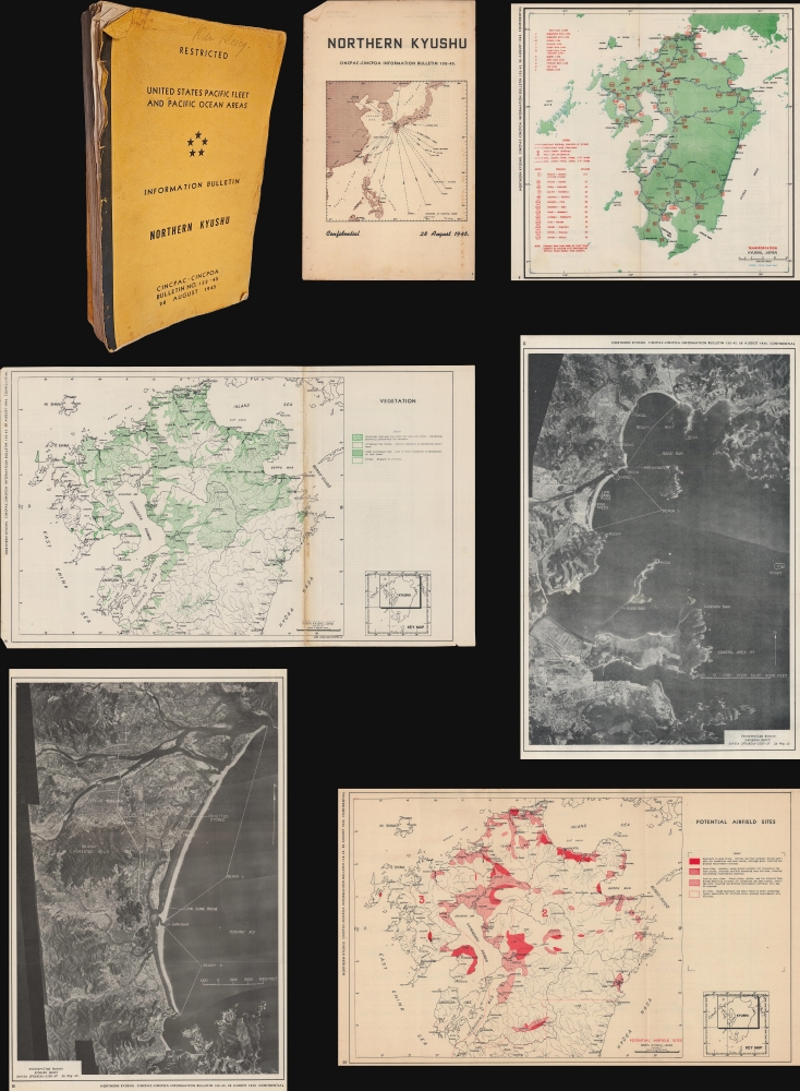
Restricted. United States Pacific Fleet and Pacific Ocean Areas. Information Bulletin. Northern Kyushu. CINCPAC-CINCPOA Bulletin No. 132-45. 28 August 1945.
sold
This is a 1945 United States Pacific Fleet report detailing northern Kyushu, prepared in advance for Operation DOWNFALL, the planned invasion of the Japanese Home Islands. With information current to June 1, 1945, this report was complete when the Japanese surrendered on August 15, 1945. Even though the war was over, the Pacific Fleet decided to publish the report, probably in the belief that it would help with the occupation. A short paragraph below the Table of Contents reads
The cessation of hostilities has permitted the reduction of classification of this bulletin from Confidential to Restricted. Consider the classification of 'Confidential' appearing on each page as changed accordingly.(more details)
Successful Men Do It Now, Failures Wait until Tomorrow.

The Home Seeker's Greatest Opportunity : Florida Land.
sold
- Digital Map Information
- Suitable for large format printing
- File Size: 15.85 MB
- File Type: ZIP / TIFF
- ICC color profile embedded
- Delivered instantly via download link
A relic of the early phase of the Florida Land Boom, this c. 1911 promotional broadside was produced by the Colonization Department of Sutherland, McConnel and Co., based in Jacksonville, Florida. It advertises land for sale in Baldwin, Duvall County, not far from Jacksonville (now a semi-independent consolidated town within the latter city). (more details)
Florida Keys and the Overseas Highway.
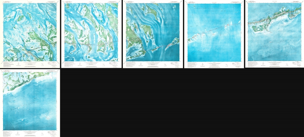
Marathon Quadrangle. Sevenmile Bridge Quadrangle. Big Pine Quadrangle. Summerland Key Quadrangle. Sugarloaf Key Quadrangle. Saddlebunch Keys Quadrangle.
sold
This is a strikingly beautiful set of 6 1973 U.S. Geological Survey maps of the Florida Keys. Coverage embraces roughly 40 miles of the western keys, from Saddleback No. 5 Channel and Similar Sound near Sugarloaf Key east to Fat Deer Key. (more details)
One of the Grandest Structures of Pre-Fire Chicago.
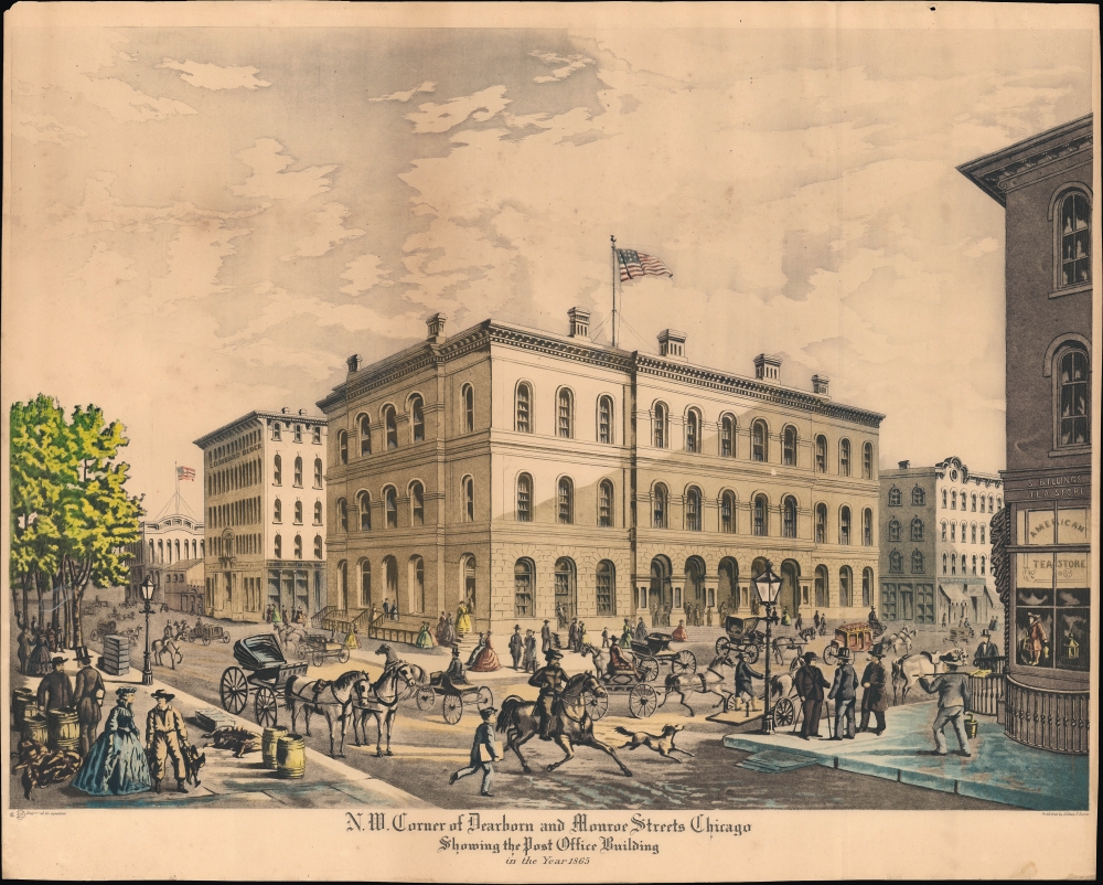
N.W. Corner of Dearborn and Monroe Streets, Chicago, Showing the Post Office Building in the Year 1865.
$950.00
Acquire
- Digital Map Information
- Suitable for large format printing
- File Size: 21.43 MB
- File Type: ZIP / TIFF
- ICC color profile embedded
- Delivered instantly via download link
A 1927 Raoul Varin aquatint view of the Post Office and Customs House, formerly on the northwest corner of Dearborn and Monroe Streets in Downtown Chicago. It depicts the building and its surroundings in 1865, before being destroyed in the 1871 Great Chicago Fire. (more details)
State of the art of the mapping of Peru.
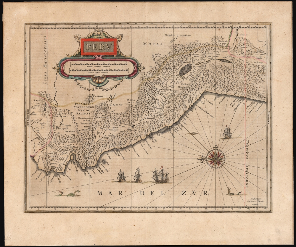
Peru.
sold
- Digital Map Information
- Suitable for large format printing
- Full resolution TIFF file
- ICC color profile embedded
- Delivered instantly via download link
This is Willem Blaeu's beautiful 1630 map of Peru. It is among the first maps included in Blaeu's Appendix, being one of the plates Blaeu purchased from Jodocus Hondius in 1629. (more details)
Ireland's natural wonders.
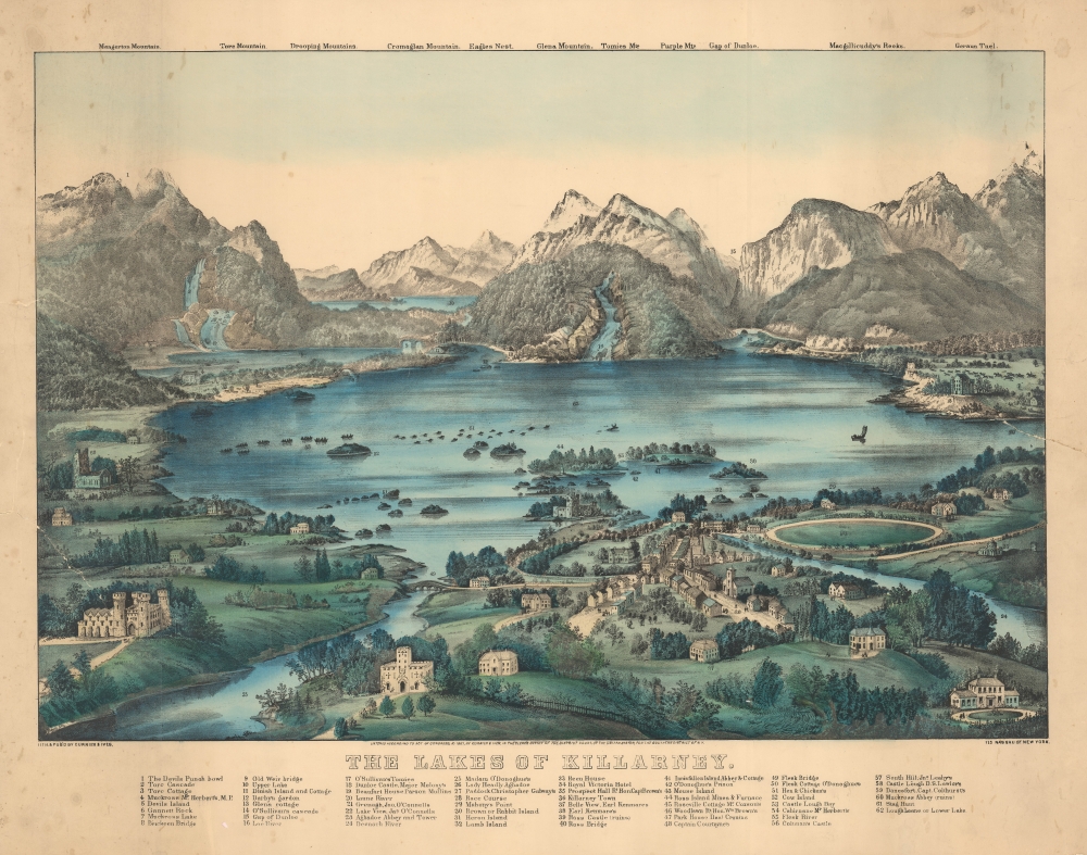
The Lakes of Killarney.
sold
- Digital Map Information
- Suitable for large format printing
- File Size: 81.06 MB
- File Type: ZIP / TIFF
- ICC color profile embedded
- Delivered instantly via download link
This is the 1867 Currier and Ives view of the Lakes of Killarney, Ireland. (more details)
Last Days of the Indian Territory.
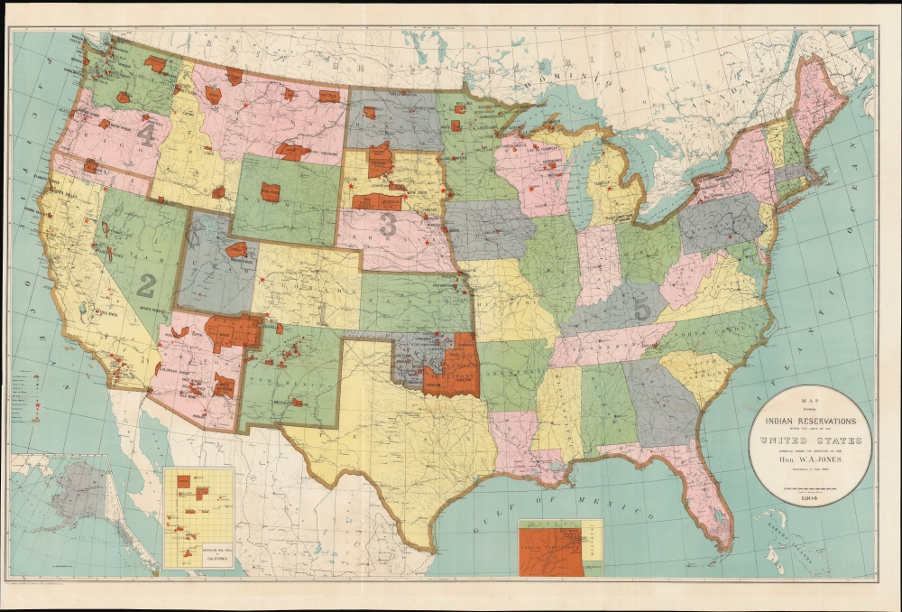
Map Showing Indian Reservations within the Limits of the United States.
sold
- Digital Map Information
- Suitable for large format printing
- File Size: 35.01 MB
- File Type: ZIP / TIFF
- ICC color profile embedded
- Delivered instantly via download link
An impressive large-format 1904 map of the United States highlighting the location of Indian reservations, produced during the tenure of William Arthur Jones as Commissioner of Indian Affairs. (more details)
WWII in the Pacific through October 1944.
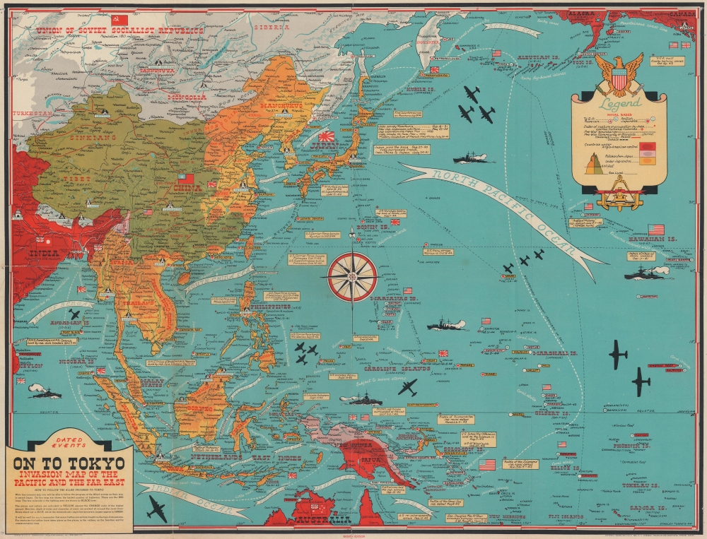
Dated Events. On to Tokyo. Invasion Map of the Pacific and the Far East. Eighth Edition. / War in Europe. Dated Events.
$425.00
Acquire
This is a Stanley Francis Turner map of the Pacific Theater of World War II (1939 - 1945), published in late October or early November 1944. As with Turner's other World War II maps, short text boxes highlight important events during the war up to publication, in this case from the Japanese attack on Pearl Harbor on December 7, 1941, until the U.S. invasion of the Philippines on October 17, 1944. (more details)
One of the great National Parks.
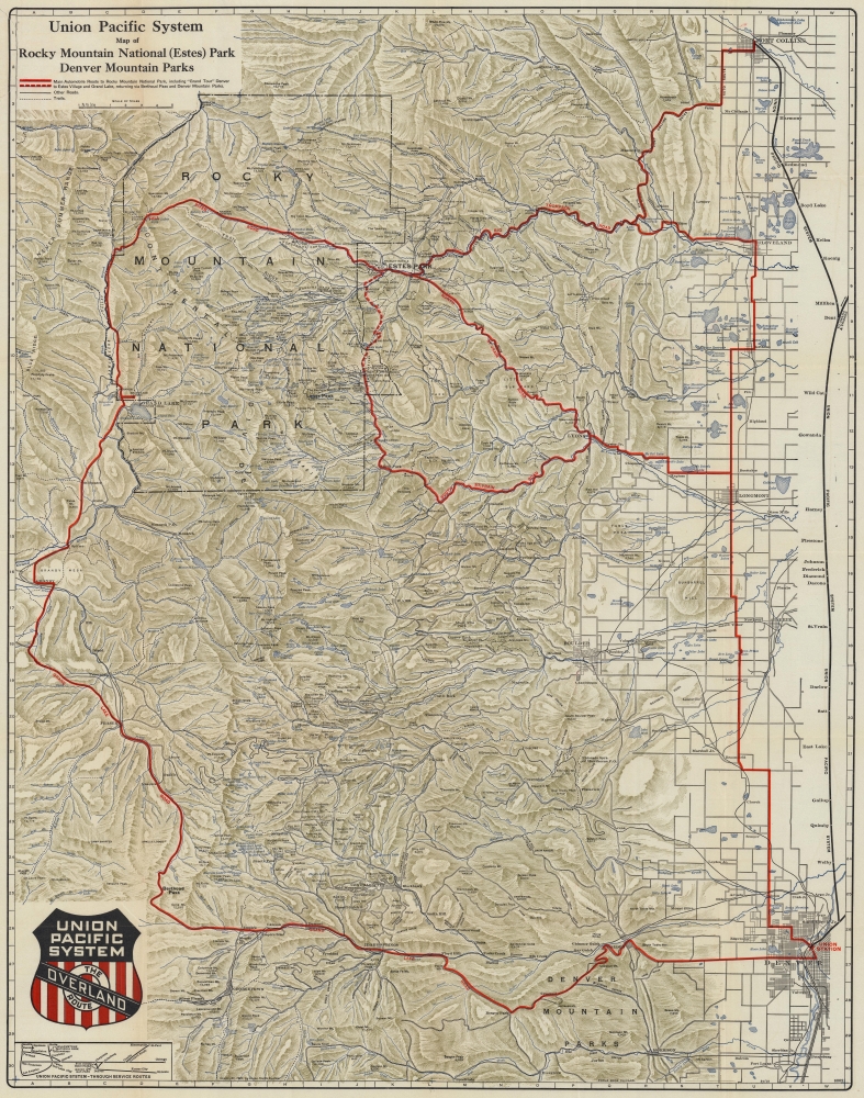
Union Pacific System Map of Rocky Mountain National (Estes) Park Denver Mountain Parks.
sold
- Digital Map Information
- Suitable for large format printing
- File Size: 123.85 MB
- File Type: ZIP / TIFF
- ICC color profile embedded
- Delivered instantly via download link
An uncommon 1924 map of Estes Park and the Rocky Mountain region west of Denver and Fort Collins issued by Poole Brothers on behalf of the Union Pacific Railroad. The map promotes travel to Denver on the Union Pacific Railroad and then continuing to Rocky Mountain National Park (Estes Park) by car. Red overprinting illustrates potential auto routes past noteworthy towns and natural wonders. (more details)
Sunshine and Scenic Splendor.

Arizona Welcomes You.
sold
- Digital Map Information
- Suitable for large format printing
- Full resolution TIFF file
- ICC color profile embedded
- Delivered instantly via download link
This is George Avey's whimsical 1942 pictorial map of Arizona as colorful desert paradise, issued to promote both tourism and emigration. (more details)
Plantation Key - in detail.
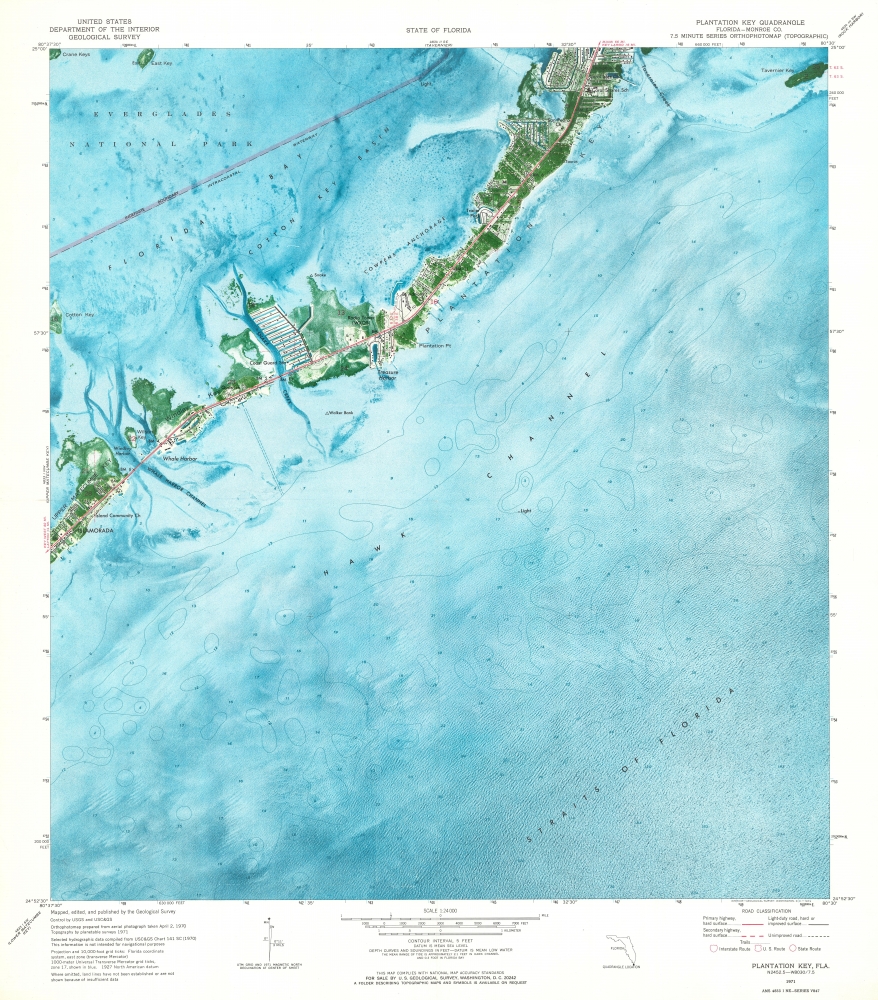
Plantation Key Quadrangle.
sold
This is a 1973 U.S. Geological Survey map of Plantation Key in the Florida Keys. Coverages embraces from Islamorada to Tavernier Key. (more details)
Engraved in prison by America's greatest bank note counterfeiter!
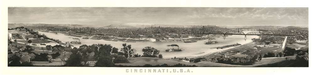
Cincinnati, U.S.A.
sold
- Digital Map Information
- Suitable for large format printing
- File Size: 40.1 MB
- File Type: ZIP / TIFF
- ICC color profile embedded
- Delivered instantly via download link
A production of extraordinary virtuosity, this is the outstanding masterpiece of the notorious bank note counterfeiter Charles F. Ulrich: a c. 1900 view of Cincinnati, Ohio. Ulrich engraved the view while in prison for counterfeiting. It is nonetheless a masterwork of engraving. (more details)
Walker's earliest chromolithograph 'wayfinder'.
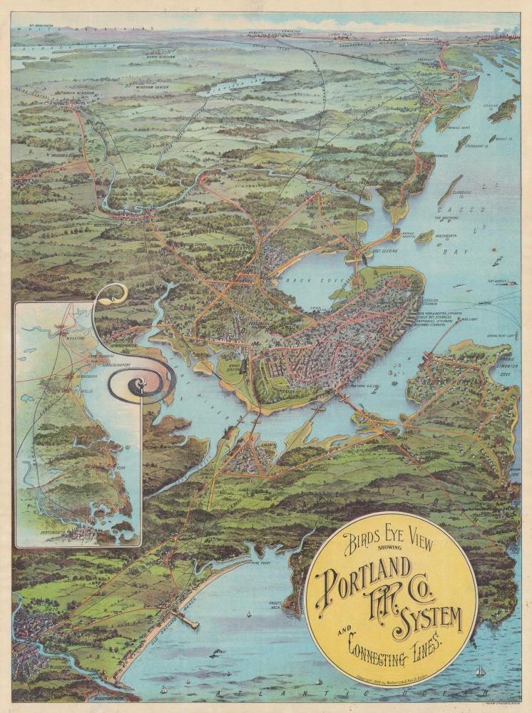
Birds Eye View Showing Portland R.R. Co. System and Connecting Lines.
sold
- Digital Map Information
- Suitable for large format printing
- Full resolution TIFF file
- ICC color profile embedded
- Delivered instantly via download link
A striking 1909 George Walker chromolithograph view of Portland, Maine, and the Portland Railroad System - really more of a combined streetcar, train, and trolley system. This view is the rarest and perhaps most beautiful of Walker's 'Trolley Wayfinder' views. (more details)
Post-imperial Splendor.

京都區組明細圖 / [Detailed Map of the Districts and Neighborhoods of Kyoto].
sold
- Digital Map Information
- Suitable for large format printing
- File Size: 35.45 MB
- File Type: ZIP / TIFF
- ICC color profile embedded
- Delivered instantly via download link
A scarce, colorful 1894 map of Kyoto, Japan, reflecting the city's past imperial splendor and partial modernization, edited by Kamisaka Yoshishige and published by Tanaka Jihei and Nakamura Asakichi. At this time, Kyoto had lost a degree of its cultural prestige with the relocation of the emperor to Tokyo in 1868, but it remained an important city and popular destination for tourists due to its temples, shrines, and castles. (more details)
First German Edition.
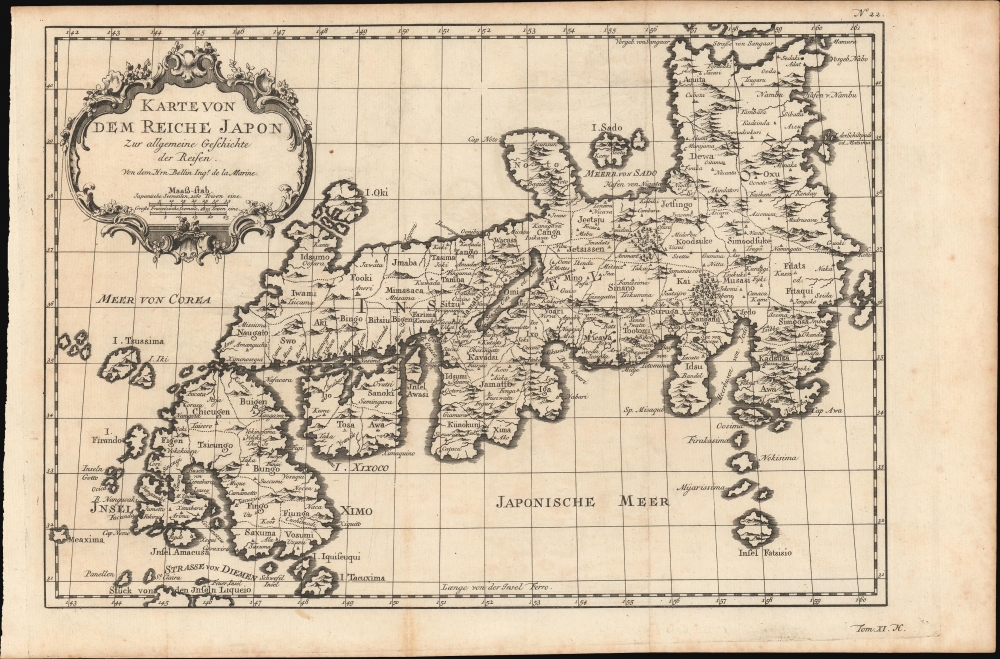
Karte Von Dem Reiche Japon.
sold
- Digital Map Information
- Suitable for large format printing
- DPI: 600
- File Size: 163.58 MB
- File Type: ZIP / TIFF
- ICC color profile embedded
- Delivered instantly via download link
This is a beautiful 1753 Bellin map of the empire of Japan - here in the first German edition. (more details)
New York City of the Roaring Twenties.
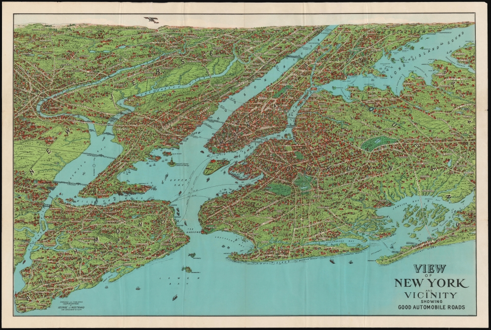
View of New York and Vicinity Showing Good Automobile Roads.
sold
- Digital Map Information
- Suitable for large format printing
- Full resolution TIFF file
- ICC color profile embedded
- Delivered instantly via download link
This is an engaging 1927 birds-eye view map of New York City and vicinity by George J. Nostrand. Brightly colored and evocative, the view presents New York City and its surrounds at the height of 'the Roaring Twenties.' As the title suggests, it was meant to highlight the most auto-friendly of New York City’s roads during an era in which the automobile was still a relative novelty and the outer boroughs were not yet fully developed. (more details)
People and wildlife around the world.

Mappamondo Figurato.
sold
Published in an Italian educational magazine, this is a 1958 Gianni Ciferri pictorial map of the world. Ciferri uses pictorial icons to highlight local dress and wildlife. (more details)