
First map of Maine produced in the American Republic.
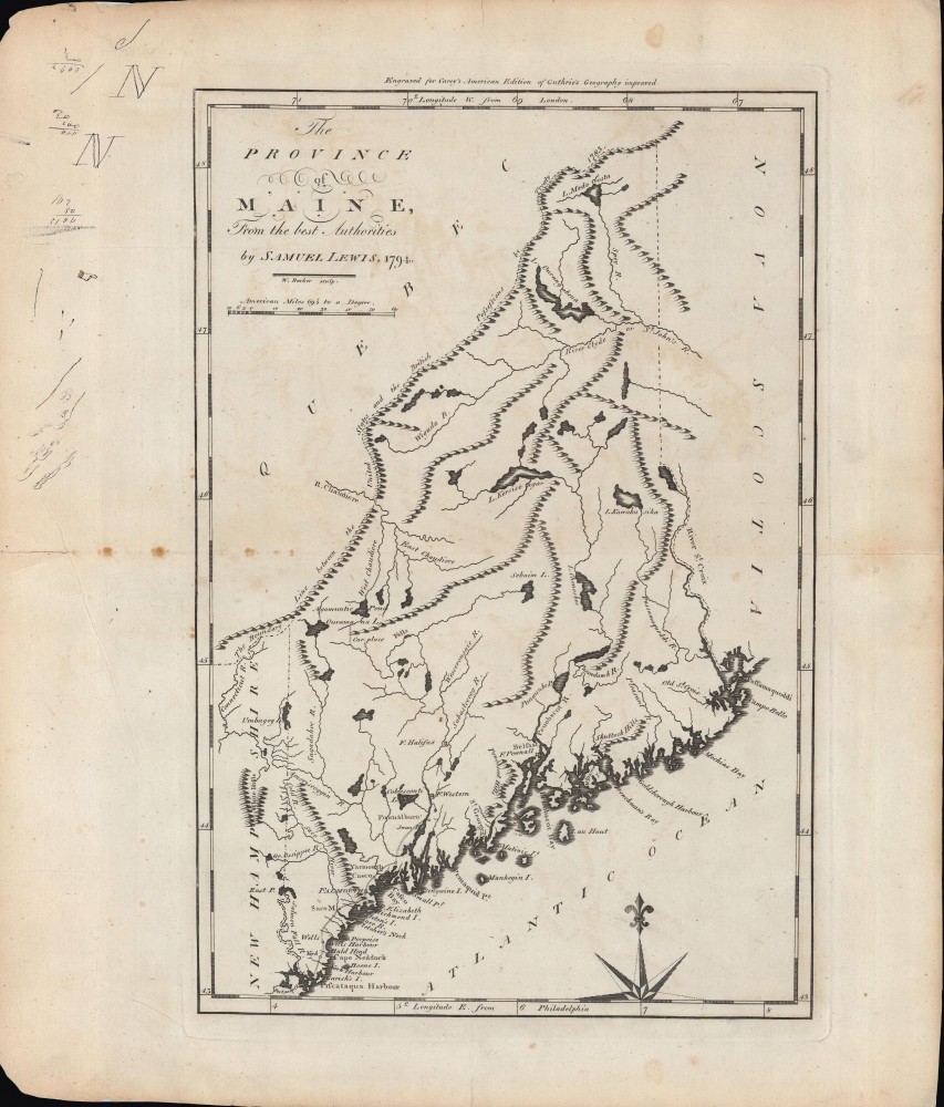
The province of Maine, from the best authorities.
sold
- Digital Map Information
- Suitable for large format printing
- Full resolution TIFF file
- ICC color profile embedded
- Delivered instantly via download link
A fascinating 1794 map of the 'Province of Maine' by Samuel Lewis and engraved by William Barker for Matthew Carey's American Edition of Guthrie's Geography improved, the first atlas published in the American Republic. It depicts the territory in the years just following independence, with borders that remained disputed and would later be shifted southwards as part of a compromise with Great Britain. (more details)
Development of Florida resort tourism.

Map of the Peninsula of Florida and Adjacent Islands.
sold
- Digital Map Information
- Suitable for large format printing
- File Size: 84.93 MB
- File Type: ZIP / TIFF
- ICC color profile embedded
- Delivered instantly via download link
A highly decorative c. 1915 map of Peninsular Florida issued by the Mathews-Northrup Company for the Henry Morrison Flagler’s (1830 - 1913) Florida East Coast Railway. It maps Flagler's resort empire and in doing so illustrating the underpinnings of modern East Florida. (more details)
Details the operations of the Berlin Airlift from California to Berlin.

How the 'Berlin Airlift' - an 'around the clock' Combined Operation of the Air Force, Navy, and Army - functions in keeping the 'Island City' of Berlin supplied with the necessities of life.
sold
- Digital Map Information
- Suitable for large format printing
- File Size: 43.22 MB
- File Type: ZIP / TIFF
- ICC color profile embedded
- Delivered instantly via download link
This is a 1949 Infographic Map of the Berlin Airlift. The map details the intricate workings of the Airlift, formally known as Operation Vittles. A description of the operation appears on the far left, next to ten bullet points that correspond to different parts of the infographic. Then, two maps, one above the other, depict Airlift operations from the Pacific Ocean across the Atlantic to Europe, and finally to Berlin. The top map provides a 'side view,' allowing the viewer to see how multiple different actions took place in the same airspace, and how these activities, both military and civilian, operated in concert to support blockaded Berlin. The lower map traces the distances traveled and provides a more geographic overview of where the thousands of planes were maintained, where flight crew training happened, and how the supplies and the aircraft themselves traveled from California to Germany and back regularly. A small inset along the bottom border details the different flight patterns that airplanes flying missions into Berlin flew and underscores how important it was for pilots to be aware of what they were doing at all times because of the complicated nature of the Airlift. An artistic rendering of airplanes flying the Frankfurt-Berlin route occupies the right third of the sheet and emphasizes the fact that every flight traversed the Russian occupation zone. This meant that when a crew was over the Russian zone, there was a complete lack of radio contact with Allied personnel on the ground. They then emerged within range of Tempelhof Airport in Berlin, and only had beacons to guide them to the airport. The diagram in the upper right corner details the approach and landing pattern for flights arriving at Tempelhof, which landed every three minutes. (more details)
Graphic Traveler's Guide to London.
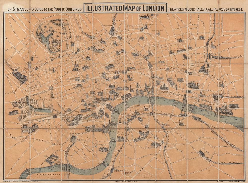
Illustrated Map of London, or Stranger's Guide to the Public Buildings, Theatres, Music Halls, and all Places of Interest.
sold
- Digital Map Information
- Suitable for large format printing
- Full resolution TIFF file
- ICC color profile embedded
- Delivered instantly via download link
This is an 1867 George Hartnell Bartlett pictorial map of London, England, with charming profile illustrations of landmarks. The building profiles were drawn by Bartlett himself and, while not unprecedented, were pioneering in a cartographic context. Bartlett went on to make related maps of New York, Boston, Paris, and Massachusetts, but this is his first and thus most significant work. (more details)
Vienna's many buildings and monuments illustrated in monumental fashion.
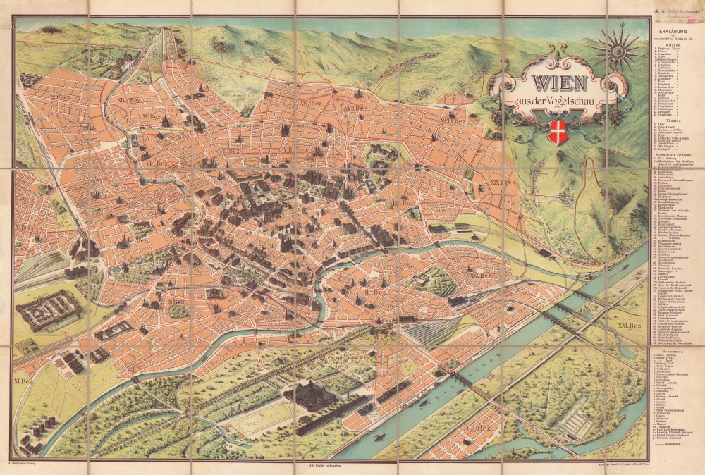
Wien aus der Vogelschau Plan von Wien mit sämtlichen Monumental-Bauten.
sold
- Digital Map Information
- Suitable for large format printing
- Full resolution TIFF file
- ICC color profile embedded
- Delivered instantly via download link
This is a beautiful c. 1900 Hartleben pictorial monumental map of Vienna, Austria. Ninety-two locations are illustrated pictorially and numerically identified, including St. Stephen's Cathedral (No. 1), the Rathaus (No. 40), and the Arsenal (No. 70). Thirty-two monuments are illustrated and alphabetically identified. The extensive index occupies the right margin outside the map. Prominent red lines trace Vienna's tram network. (more details)
Curious artifact reflecting the development of modern medicine.

Le corps humain. Anatomie de l'Homme.
sold
- Digital Map Information
- Suitable for large format printing
- Full resolution TIFF file
- ICC color profile embedded
- Delivered instantly via download link
A distinctive c. 1900 set of fold-out chromolithographed illustrations of human anatomy produced by Vigot Frères and the publisher Gerson Löwensohn. It is the product of a culmination of advances in both scientific knowledge and printing technology. (more details)
Russia's expanding empire.
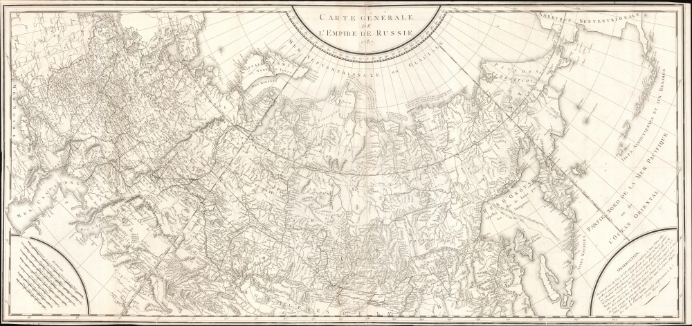
Carte Générale de L'Empire de Russie 1787.
$650.00
Acquire
- Digital Map Information
- Suitable for large format printing
- DPI: 600
- File Size: 1259.31 MB
- File Type: ZIP / TIFF
- ICC color profile embedded
- Delivered instantly via download link
An intricate large-scale c. 1787 French-language map of the Russian Empire engraved by Pierre-François Tardieu. It represents a significant improvement on earlier maps of the empire, especially its eastern portions and the northern Pacific, as both Russian and western European voyages of exploration proliferated in the late 18th century. (more details)
Reliving Jules Verne's great adventure novel.

Le Voyage autour du Monde en 80 jours, d'apres le roman de Jules Verne...
sold
- Digital Map Information
- Suitable for large format printing
- Full resolution TIFF file
- ICC color profile embedded
- Delivered instantly via download link
A delightful c. 1885 French-language chromolithograph board game produced by Roche Frères based on Jules Verne's novel Around the World in Eighty Days. Sticking close to the novel's plot, players travel from London through the Suez Canal, India, Singapore, Hong Kong, Shanghai, Tokyo, and the United States before returning to the Reform Club in London. (more details)
Republic of Texas and United Provinces of Central America.
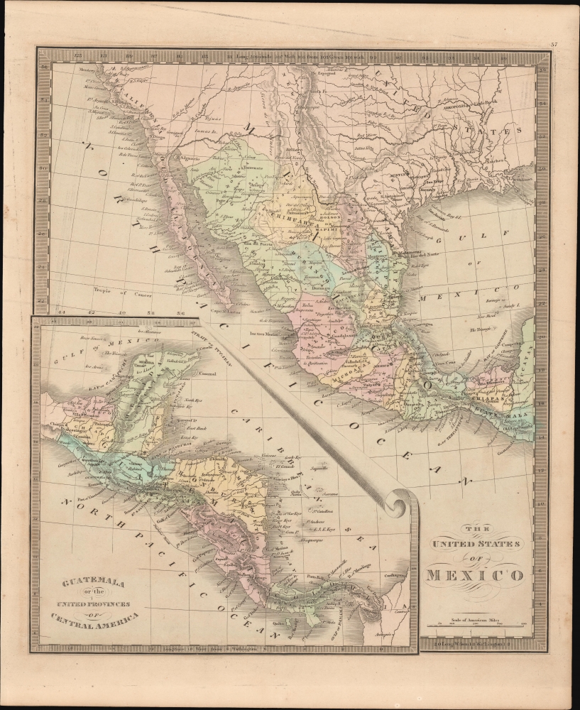
The United States of Mexico. / Guatemala or the United Provinces of Central America.
sold
- Digital Map Information
- Suitable for large format printing
- DPI: 600
- File Size: 206.96 MB
- File Type: ZIP / TIFF
- ICC color profile embedded
- Delivered instantly via download link
This is Jeremiah Greenleaf's 1849 map of Mexico and Central America. The map reflects the original boundaries of the Republic of Texas and the short-lived United Provinces of Central America (Guatemala). (more details)
Illustrates Newark and Elizabeth.

Sheet. No. 5. [Newark]
sold
- Digital Map Information
- Suitable for large format printing
- DPI: 600
- File Size: 138.94 MB
- File Type: ZIP / TIFF
- ICC color profile embedded
- Delivered instantly via download link
This is a c. 1846 U.S. Coast Survey chart or map of part of New York Bay, the Hudson River, Newark Bay, and Kill van Kull. Also includes the Hackensack River, Newark, Elizabethtown, and Jersey City. Bergen Neck's topography is brilliantly illustrated, and the Morris Canal is labeled. Farms and homesteads in eastern New Jersey are marked by small black boxes. (more details)
World events from the late 1930s to the founding of Israel.
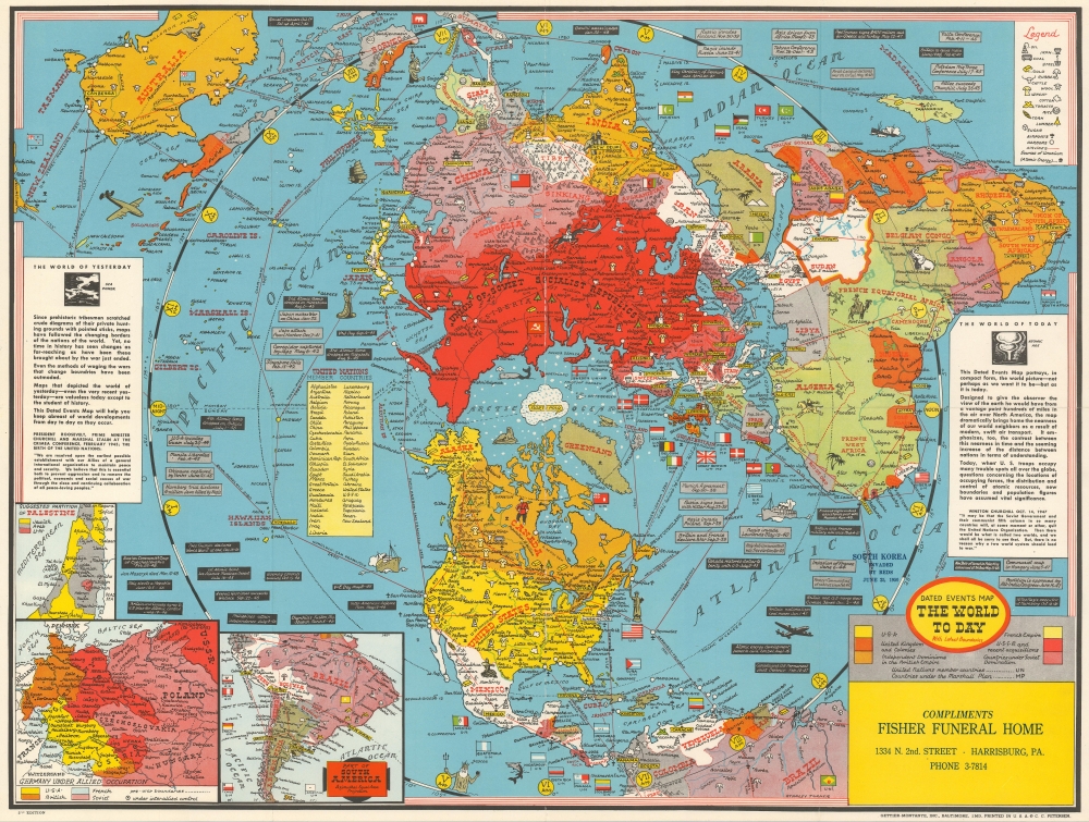
Dated Events Map The World To Day with Latest Boundaries.
sold
- Digital Map Information
- Suitable for large format printing
- File Size: 43.3 MB
- File Type: ZIP / TIFF
- ICC color profile embedded
- Delivered instantly via download link
This is a 1948 Stanley Francis Turner map of the world on a polar projection. Completed in Turner's iconic style, the countries of the world are all labeled and many of these countries' flags are illustrated as well. World capitals are highlighted in yellow and myriad other cities throughout the world are also labeled. Africa's geography still represents the era of colonialism, with French Equatorial Africa, French West Africa, the Belgian Congo, Rhodesia, and Tanganyika all labeled. Icons mark natural resources, including oil, coal, iron, steel, and gold, along with corn, wool, lumber, and rubber. Small mushroom clouds mark 'sources of uranium'. Insets in the lower left corner detail central and eastern Europe (including the Allied occupation of Germany), the suggested partition of Palestine (with yellow shaded areas marking proposed Jewish regions), and southern South America (which was cut off by the map's projection). (more details)
The best of Maui.
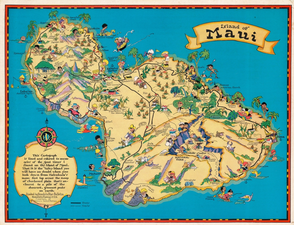
Island of Maui.
sold
- Digital Map Information
- Suitable for large format printing
- File Size: 46.7 MB
- File Type: ZIP / TIFF
- ICC color profile embedded
- Delivered instantly via download link
This is a 1931 Ruth Taylor White pictorial map of Maui, Hawaii, commissioned by the Hawaii Tourist Bureau. Tourists and Hawaiians intermingle, with golfers and sightseers appearing next to fishermen and other locals. Haleakala National Park and Haleakala Crater appear along with the 'old lava flows' below and to the left. Pineapples and sugarcane plantations dot the island. (more details)
Pictorial map of the Grand Canyon by one of the masters of the genre.

Grand Canyon.
sold
- Digital Map Information
- Suitable for large format printing
- File Size: 95.32 MB
- File Type: ZIP / TIFF
- ICC color profile embedded
- Delivered instantly via download link
A beautiful c. 1931 / 1957 pictorial map of the Grand Canyon by Jo Mora. Roughly following the Colorado River, the map covers the most visited parts of the Grand Canyon. Many of the Canyon's unique formations, which are named after a variety of figures from mythology, fairly takes, and folklore, are noted with pictorial representations of their namesakes. The borders of the map features numerous inset images that range from historical notes, to cultural illustrations, to humorous cartoon anecdotes. (more details)
The finest French wines.

La Bourgogne Viticole et Touristique.
sold
This is a c. 1960 Comité Professionnel du Bourgogne pictorial tourist map of Burgundy (Bourgogne), France. One of France's main wine-producing regions, Burgundy is divided into the Côte-d'Or, Chablis, Beaujolais, Mâcon, and Côte Chalonnaise regions. The region is also known for Dijon mustard and Charolais beef, as well as the Burgundian dishes boeuf bourguignon and coq au vin. (more details)
Published on New Year's Eve in 1944.
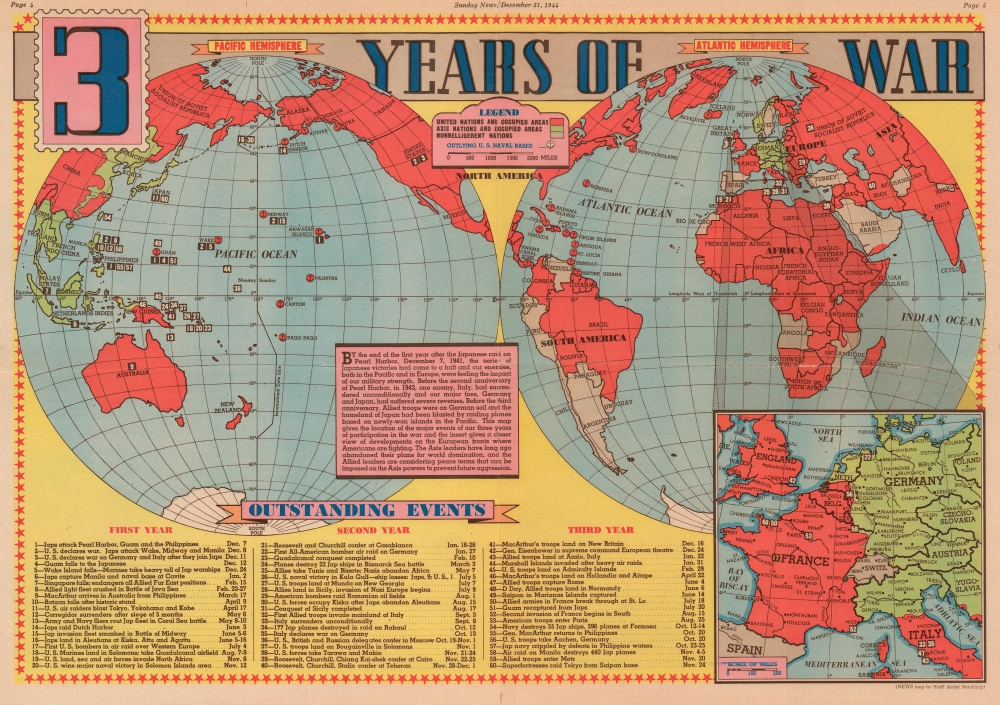
3 Years of War.
sold
- Digital Map Information
- Suitable for large format printing
- File Size: 25.07 MB
- File Type: ZIP / TIFF
- ICC color profile embedded
- Delivered instantly via download link
This is a 1944 Edwin Sundberg map of the world during World War II. Published on December 31, 1944, the map provides a visual summary of three years of American involvement in the global conflict. Allied nations are shaded red, while green codes parts of the world still occupied by Germany and Japan. It is worth noting that Leyte, an island in the Philippines that the Allies invaded in October 1944, is shaded red. A text box to the left of center over the South Pacific relates a summary of the three years following the Japanese attack on Pearl Harbor. The text uses that anniversary as a focal point and situates the war's events around that world-changing day. Sixty events from the preceding three years (twenty each) are numerically identified and correspond with an index along the bottom border. This numerical index includes a summary of each battle or event and the date it occurred. Among the noted actions are the Japanese attack on Pearl Harbor, the Battle of Midway, the conquest of Guadalcanal, the invasion of Italy, Italy's surrender, the D-Day landings in Normandy, and the liberation of Paris. An inset, situated in the lower right, focuses on the war in Western Europe and highlights Allied gains. (more details)
Among the earliest maps of the Dnipro River.

Tractus Borysthenis, Vulgo Dniepr er Niepr dicti.
sold
- Digital Map Information
- Suitable for large format printing
- Full resolution TIFF file
- ICC color profile embedded
- Delivered instantly via download link
A beautiful 1662 original-color set of Joan Blaeu maps of the Dnipro (Dnieper) River, the Ukrainian frontier of the Polish-Lithuanian Commonwealth. At the time, the region was undergoing a radical rearrangement, with Poland-Lithuania ejected as the major outside power and replaced by Tsarist Russia. (more details)
Bestiary of fantastical northern monsters.

Les marins monstres et terrestres, lesquelz on trouve en beaucoup de lieux es parties septentrionales.
sold
- Digital Map Information
- Suitable for large format printing
- DPI: 600
- File Size: 31.37 MB
- File Type: ZIP / TIFF
- ICC color profile embedded
- Delivered instantly via download link
An attractive printing of what is often euphemistically referred to as Munster's Monsters, this is Sebastian Münster's bestiary of sea serpents and other astonishing monsters, some fictional, some real. The image first appeared in the expanded 1550 editions of Munster's Cosmographia, a work which for more than half a century provided the European literate layperson their best source of information about the world. Most of the beasts here are derived from a 1539 map of Scandinavia by Olaus Magnus. As fanciful as these creatures may appear, many depict factual creatures that Scandinavian sailors and whalemen occasionally encountered. Among the more recognizable beasts are various forms of whales with obvious blowholes, at least two enormous lobsters, a sea serpent (possibly an oarfish), the whale fish (white fish at center, an Orca), and something that might very well be a walrus. Of course, there are fictional sea monsters too, including a pig faced sea beast, apparently seen by sailors in 1537, and the Sea Buffalo, something that looks like a cross between a bull and a fish. (more details)
Liberating an internment camp in the Philippines.

The Liberation Bulletin of Phillipine Internment Camp No: I. At Santo Tomas University. Manila, Philippines. February 3rd., 1945.
sold
- Digital Map Information
- Suitable for large format printing
- Full resolution TIFF file
- ICC color profile embedded
- Delivered instantly via download link
An incredible piece of World War II ephemera, this is the Liberation Bulletin printed and published by Peter C. Richards one day after the Santo Tomás Internment Camp was liberated. Richards, an internee at Santo Tomás (the largest internment camp in the Philippines), chronicles the camp's history and includes a detailed map of the camp. (more details)
Rare early map of KL.

Kuala Lumpur.
sold
- Digital Map Information
- Suitable for large format printing
- File Size: 40.65 MB
- File Type: ZIP / TIFF
- ICC color profile embedded
- Delivered instantly via download link
A very uncommon 1936 map of Kuala Lumpur, the capital of Malaysia, issued by Printers Ltd. of Singapore. This map is centered on the Kuala Lumpur City Center and the modern-day Central Market. It extends from the modern-day Perdana Botanical Garden (Public Gardens) east as far as Jalan Tun Razak (Circular Road). This map is based upon surveys completed by the Surveyor General of the Federated Malay States and the Straits Settlements.
Today Kuala Lumpur is a sprawling megacity and the capital of Malaysia. It is the only 'alpha world' city in Malaysia and is the nation's cultural, financial, and economic center. When this map was issued Kuala Lumpur was part of the Federated Malay States. (more details)
Today Kuala Lumpur is a sprawling megacity and the capital of Malaysia. It is the only 'alpha world' city in Malaysia and is the nation's cultural, financial, and economic center. When this map was issued Kuala Lumpur was part of the Federated Malay States. (more details)
The 'Whites', mapped.
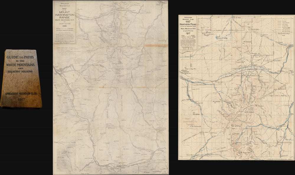
Guide to Paths in the White Mountains and Adjacent Regions. / Map of the Mount Washington Range. Part 1. / Map of the Northern Peaks.
sold
- Digital Map Information
- Suitable for large format printing
- Full resolution TIFF file
- ICC color profile embedded
- Delivered instantly via download link
This is part one of the rare third 1917 third edition of the Appalachian Mountain Club guide to the White Mountains, with the two important enclosed foldout maps by Louis F. Cutter: Map of the Mount Washington Range (1916) and Map of the Northern Peaks of the Mt. Washington Range (1917). (more details)