
A complete set of Cassini's globe gores.
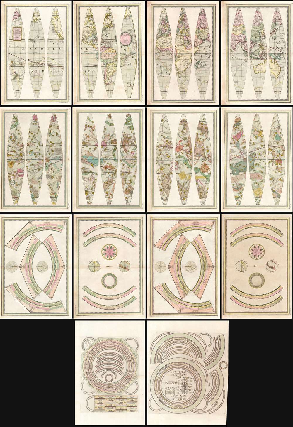
Globo Terrestre Delineato Sulle Ultime Osservazioni Con I Viaggi e nuove scoperte del Cap. Cook Inglese./ Globo Celeste Calolato per il corrente anno sulle Osservazioni de' Sigg. Flamsteed, e de la Caille. / Circolo per formare La Sfera Aremilare.
sold
- Digital Map Information
- Suitable for large format printing
- Full resolution TIFF file
- ICC color profile embedded
- Delivered instantly via download link
A beautiful, complete set of gores for the construction of Giovanni Maria Cassini's 1792 terrestrial and celestial globe pair, including the calottes and printed matter for the horizon and meridian rings. The gores are paired in four bordered sheets for each globe, plus two sheets containing each globe's calottes and labels for meridians. The set also includes the labels, printed to two sheets dated 1795, for the armillary sphere intended to accompany the globes. All are superbly engraved and beautifully colored, and are evocative artifacts of the world and its place in the universe as understood at the end of the eighteenth century. (more details)
Didactic cards for Astronomy and Geography.
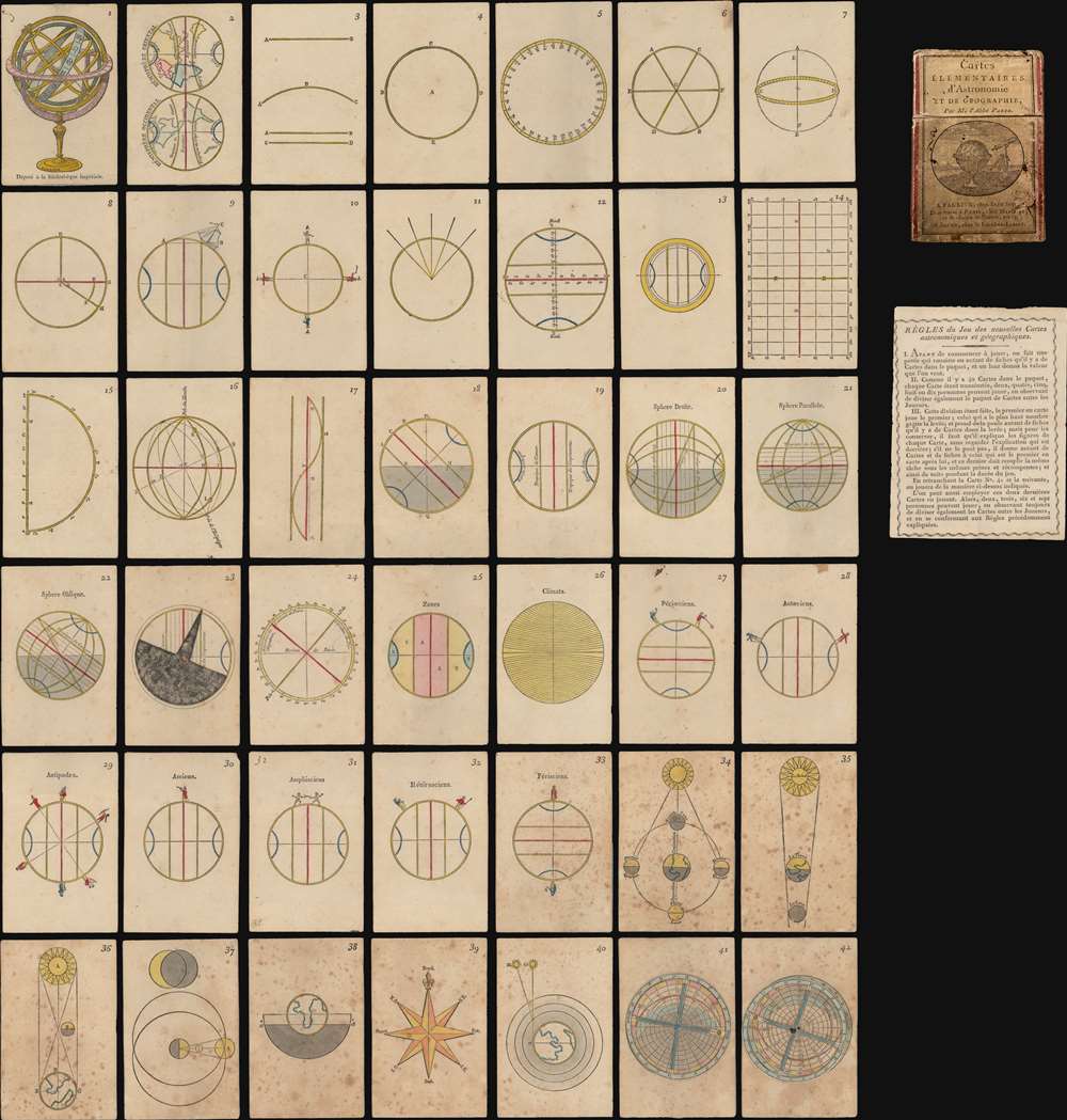
Cartes Elementaires d'Astronomie et de Géographie.
sold
- Digital Map Information
- Suitable for large format printing
- Full resolution TIFF file
- ICC color profile embedded
- Delivered instantly via download link
This is an extremely rare complete set of French c. 1807 hand-colored woodcut playing cards prepared as an introductory course on geography and astronomy - possibly the only surviving fully complete set. The forty-two cards feature a compass rose, an armillary sphere, maps, three volvelles, and more. On the verso of each is explanatory text.
The cards are the work of Louis-Michel Pâris, a French cleric and teacher active in Normandy. He published them as a teaching aid for his secondary school in Argentan. Although the card set is not dated, it was probably printed in 1805 or 1806. We know that Pâris was working on a second edition, which was never published, when he died in 1806. (more details)
The cards are the work of Louis-Michel Pâris, a French cleric and teacher active in Normandy. He published them as a teaching aid for his secondary school in Argentan. Although the card set is not dated, it was probably printed in 1805 or 1806. We know that Pâris was working on a second edition, which was never published, when he died in 1806. (more details)
An attractive advertisement from the heyday of railroad construction.

The Hinkley Locomotive Works, Boston.
sold
- Digital Map Information
- Suitable for large format printing
- File Size: 68.58 MB
- File Type: ZIP / TIFF
- ICC color profile embedded
- Delivered instantly via download link
A rare and gorgeous c. 1873 lithograph of a steam locomotive, advertising the Hinkley Locomotive Works, printed by C. H. Crosby and Company in Boston. It was produced in the heyday of railroad construction in the United States, coinciding with the westward territorial expansion of the country. (more details)
The World Known to Rome.
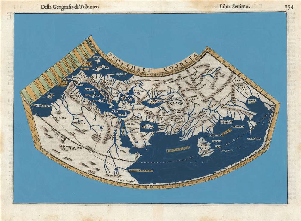
Ptolemaei Cognita.
sold
- Digital Map Information
- Suitable for large format printing
- DPI: 600
- File Size: 9.42 MB
- File Type: ZIP / TIFF
- ICC color profile embedded
- Delivered instantly via download link
This is Girolamo Ruscelli's 1599 edition of a foundational work of Renaissance cartography: The map of the known world as understood at the time of the Roman Empire. Claudius Ptolemy's second-century innovation in representing the three-dimensional world projected on a grid via mathematical formulae provided the basis of all modern cartography. Consequently, his Geographia and the maps derived from it remained canonical and continued to be printed well into the 17th century. (more details)
Overview of Montana's early railroad development.
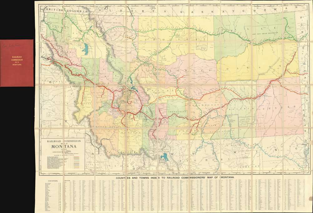
Railroad Commission Map of Montana.
sold
- Digital Map Information
- Suitable for large format printing
- Full resolution TIFF file
- ICC color profile embedded
- Delivered instantly via download link
A rare 1910 large format railroad map of Montana issued for the Railroad Commission - possibly the best map of Montana to be issued in the first ten years of the 20th century. The map covers all of Montana and parts of the adjacent lands in considerable detail, naming towns, Indian Reservations, rivers, National Forests, Battlegrounds, Indian Agencies, counties, and of course, railroads. Along the bottom, roughly 1,000 towns are identified and referenced. (more details)
An incredible detailed chart of Guanabara Bay - including many of its islands.
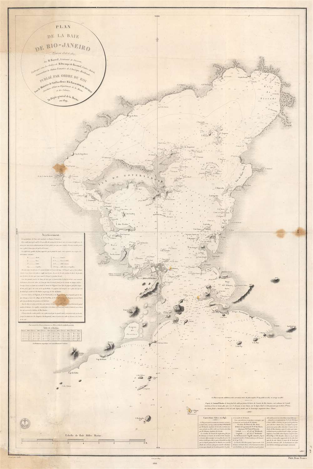
Plan de la Baie de Rio - Janeiro.
$1,000.00
Acquire
- Digital Map Information
- Suitable for large format printing
- File Size: 66.1 MB
- File Type: ZIP / TIFF
- ICC color profile embedded
- Delivered instantly via download link
This is an 1866 edition of the Dépôt de la Marine nautical chart or map of Guanabara Bay, Rio de Janeiro, Brazil. Rio de Janeiro appears near the mouth of the bay, with numerous buildings illustrated but not labeled. The only identified building is the Chateau S. Cristovaô (situated outside the city) which is marked as the Residence of the Emperor. The Ile do Governador (Ilha do Governador - today the site of Rio de Janeiro's Galeão - Antônio Carlos Jobim International Airport) is prominently illustrated, with its coastline appearing in detail. Numerous smaller islands throughout the bay are depicted as well. Smaller bays, capes, points, and even beaches are labeled around the bay. Depth soundings fill the bay, providing a more detailed understanding of its navigability. (more details)
French interest in the Caribbean and a Nicaragua Canal.
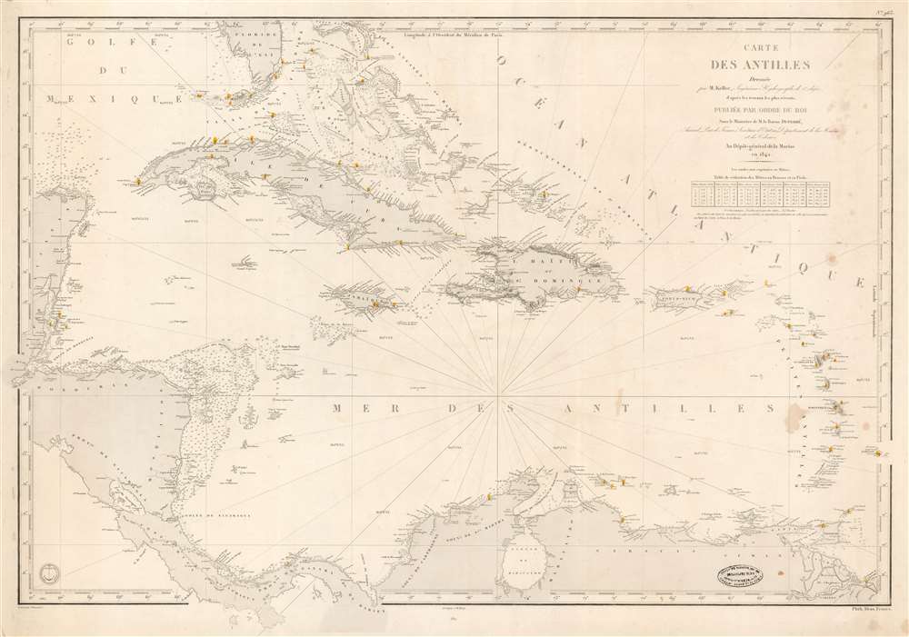
Carte des Antilles Dressée par M. Keller, Ingénieur Hydrographe de 2e Classe, d'après les travaus les plus récents.
sold
- Digital Map Information
- Suitable for large format printing
- DPI: 600
- File Size: 35.02 MB
- File Type: ZIP / TIFF
- ICC color profile embedded
- Delivered instantly via download link
This is the 1862 edition of the Dépôt de la Marine / Francois-Antoine-Edouard Keller nautical chart of the West Indies. It is the most general of Keller's West Indies charts reflecting the full scope of his definitive surveys - the coverage embracing the full Caribbean Basin from the Yucatan to Barbados and from Florida to Panama and the mouths of the Orinoco. This chart reflects French interest in the region relating to a possible Nicaragua Canal. (more details)
Backlight and Illuminate the planets and moons!
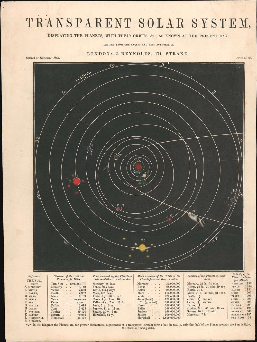
Transparent Solar System, Displaying the Planets, with Their Orbits, etc., as Known at the Present Day.
sold
- Digital Map Information
- Suitable for large format printing
- Full resolution TIFF file
- ICC color profile embedded
- Delivered instantly via download link
This is an 1850 James Reynolds map of the Solar System. Consisting of thick cardstock with translucent colored paper mounted on the back, the planets, moons, and other celestial objects can be illuminated from behind. The Sun is at the center, with the planets alphabetically identified and corresponding to a reference in the lower-left corner. Along with the planets, the four largest asteroids in the asteroid belt, Vesta, Juno, Pallas, and Ceres, are identified. Planet 'L' (Uranus but referred to here as 'Herschall') is named in honor of the legendary British astronomer William Herschel, who discovered it in 1781. The smaller circles mark moons discovered up to that point and 'M' highlights a comet, likely Halley's Comet, since that is the one referenced on other states of this piece. The signs of the zodiac appear along the outermost ecliptic. (more details)
The First Specific Norway Map in a Blaeu Atlas.
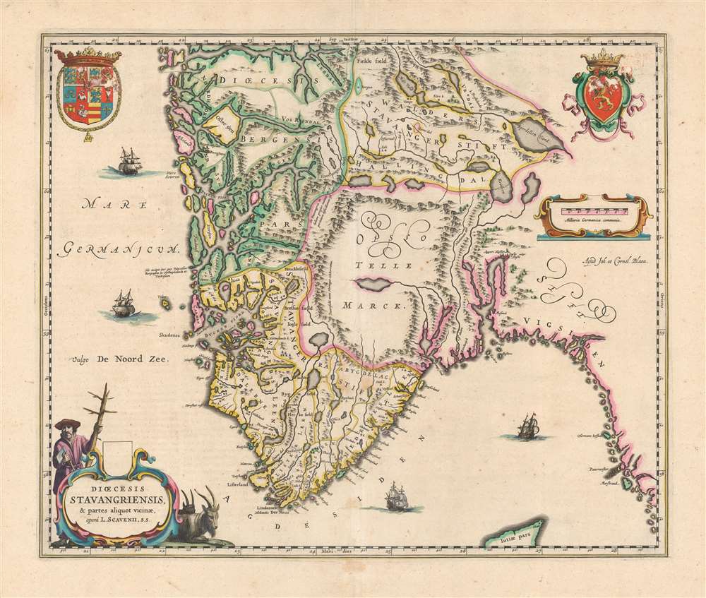
Dioecesis Stavangriensis et partes aliquot vicinae, operâ L. Scavenii, S.S..
sold
- Digital Map Information
- Suitable for large format printing
- DPI: 600
- File Size: 50.94 MB
- File Type: ZIP / TIFF
- ICC color profile embedded
- Delivered instantly via download link
This is a beautiful, original color example of Joan and Cornelis Blaeu's 1640 map of the Diocese of Stavanger, Norway - the first of the Blaeu maps to relate to Norway specifically. The map is a lovely example of the Blaeus' work: its geographical delineations clear, its lettering attractive and uniformly legible, and with an array of decorative elements. The waters of the North Sea are sailed by four ships; the coat of arms of Norway is displayed to the upper right while the arms of the kingdom of Denmark appears to the upper left (both countries were at the time ruled by King Christian IV of Denmark). In the lower left, a beautifully engraved title cartouche is flanked by two Norwegian goats, and a woodsman - an allusion to the region's role as exporter of lumber to Europe in general, and the Netherlands specifically. (more details)
Promotes American, British, and Canadian tourism in Nazi Germany and the 1936 Berlin Olympic Games.
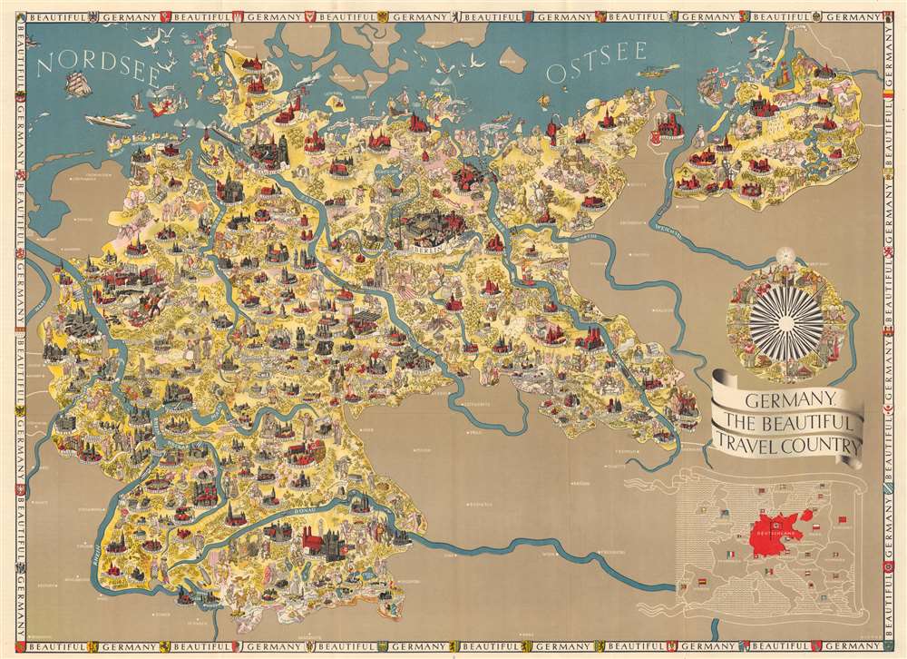
Germany, The Beautiful Travel Country.
sold
- Digital Map Information
- Suitable for large format printing
- Full resolution TIFF file
- ICC color profile embedded
- Delivered instantly via download link
This is a 1936 Walter Riemer pictorial propaganda / tourist map of Nazi Germany likely published to promote the 1936 Berlin Olympic Games with an Olympian appearing next to a banner in Berlin. The map depicts Germany from its western border with France, Luxembourg, Belgium, and the Netherlands to its eastern border with Poland and from the North Sea to its southern border with Austria and Czechoslovakia. The most striking and disturbing (with the benefit of history) aspect of the map is the plethora of swastikas and Nazi flags. Nuremberg, for example, was home of the Congresses of the Nazi Party, and a phalanx of Brownshirts carrying a Nazi flag is illustrated there. Other cities marked by flags include Munich and Berlin, while ships in the North Sea near Schleswig fly the flag, along with two airships near Stolp in northwest Germany, and a procession of people, who appear to be on parade, near Hannover. The only indication of the conflagration to come is the presence of the Nazi flag.
The presence of that hateful symbol aside, the map is highly detailed and incredibly drawn. Numerous cities and towns throughout Germany are illustrated and labeled, usually according to their size and importance. Berlin is one of the most detailed, with the Brandenburg Gate and the Berlin Cathedral (Berliner Dom) easily recognizable. Other cities include recognizable buildings or historical figures, such as an illustration of Martin Luther in Wittenberg and the Frauenkirche in Munich (Munchen). A gentleman with a wagon full of beer is also illustrated near Munich. Numerous other cities and towns include cathedrals and other buildings drawn in profile or a portrait of a famous citizen. Townspeople, peasants, and people on vacations are illustrated throughout the map, giving Germany the appearance of a welcoming and vibrant country. Livestock are included throughout the map, along with some wild animals, such as a moose near Tilsit. Outside of Germany, several cities in France, Austria, Czechoslovakia, and Poland are labeled such as: Vienna, Salzburg, and Innsbruck in Austria; Strasbourg, Besançon, Nancy, and Metz in France; Prague (Praha), and Bratislava in Czechoslovakia; and Warsaw and Poznań in Poland.
An inset map of Europe is situated in the lower right corner, with Germany (Deutschland) dominating the map in red. Each of the other countries in Europe is labeled by its German name and its flag. A border around the entire map repeats the phrase 'Beautiful Germany' and includes illustrations of the coats of arms of numerous German cities. Located above the inset map is an illustrated compass rose highlighting the achievements of German society.
On the verso, practical information for tourists is present in detail, describing the German 'Reich' and its cities, theatre, music, spas, and what money and visas are necessary when visiting Germany. Other information, pertaining to travel by train, plane, and automobile, is also included. A road map of Germany occupies a third of the verso, with smaller inset maps depicting Reich motor roads and the network of German airways in Europe. The verso also informs the reader that this map and more information are available for free from offices of the German Railways Information Bureau located in London, New York City, Chicago, San Francisco, and Toronto (more details)
The presence of that hateful symbol aside, the map is highly detailed and incredibly drawn. Numerous cities and towns throughout Germany are illustrated and labeled, usually according to their size and importance. Berlin is one of the most detailed, with the Brandenburg Gate and the Berlin Cathedral (Berliner Dom) easily recognizable. Other cities include recognizable buildings or historical figures, such as an illustration of Martin Luther in Wittenberg and the Frauenkirche in Munich (Munchen). A gentleman with a wagon full of beer is also illustrated near Munich. Numerous other cities and towns include cathedrals and other buildings drawn in profile or a portrait of a famous citizen. Townspeople, peasants, and people on vacations are illustrated throughout the map, giving Germany the appearance of a welcoming and vibrant country. Livestock are included throughout the map, along with some wild animals, such as a moose near Tilsit. Outside of Germany, several cities in France, Austria, Czechoslovakia, and Poland are labeled such as: Vienna, Salzburg, and Innsbruck in Austria; Strasbourg, Besançon, Nancy, and Metz in France; Prague (Praha), and Bratislava in Czechoslovakia; and Warsaw and Poznań in Poland.
An inset map of Europe is situated in the lower right corner, with Germany (Deutschland) dominating the map in red. Each of the other countries in Europe is labeled by its German name and its flag. A border around the entire map repeats the phrase 'Beautiful Germany' and includes illustrations of the coats of arms of numerous German cities. Located above the inset map is an illustrated compass rose highlighting the achievements of German society.
On the verso, practical information for tourists is present in detail, describing the German 'Reich' and its cities, theatre, music, spas, and what money and visas are necessary when visiting Germany. Other information, pertaining to travel by train, plane, and automobile, is also included. A road map of Germany occupies a third of the verso, with smaller inset maps depicting Reich motor roads and the network of German airways in Europe. The verso also informs the reader that this map and more information are available for free from offices of the German Railways Information Bureau located in London, New York City, Chicago, San Francisco, and Toronto (more details)
Mapping the moon.

[untitled lunar view].
sold
- Digital Map Information
- Suitable for large format printing
- DPI: 600
- File Size: 9.07 MB
- File Type: ZIP / TIFF
- ICC color profile embedded
- Delivered instantly via download link
A charming c. 1798 hand-colored lunar map included in J.F. Bertuch's Kinderbuch, a popular educational work of the early 19th century. It displays the surface of the moon and includes information on the height of its tallest peaks. (more details)
From Pirate Haven to Tourist Heaven.
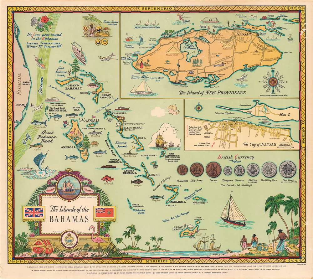
The islands of the Bahamas.
sold
- Digital Map Information
- Suitable for large format printing
- File Size: 58.9 MB
- File Type: ZIP / TIFF
- ICC color profile embedded
- Delivered instantly via download link
A splendid and vibrant 1951 pictorial map of the Bahamas by George Annand. It highlights elements of the islands' history, economy, and leisure activities, with the likely intention of attracting tourists. (more details)
A rare nautical chart of the French overseas collective St. Pierre.
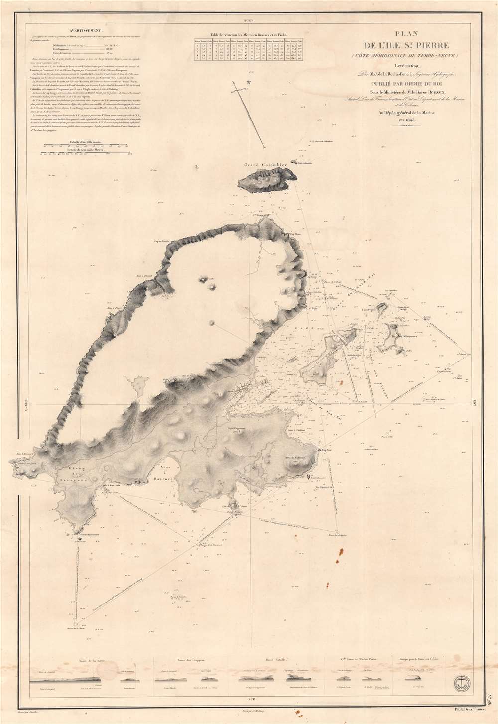
Plan de l'Ile St. Pierre (Côte Méridionale de Terre Neuve).
$450.00
Acquire
- Digital Map Information
- Suitable for large format printing
- DPI: 600
- File Size: 81.96 MB
- File Type: ZIP / TIFF
- ICC color profile embedded
- Delivered instantly via download link
This is an 1834 Jules de la Roche-Poncié and Dépot de la Marine nautical chart or maritime map of St. Pierre Island, part of the French overseas collective, ('collectivité d'outre-mer'), St. Pierre and Miquelon. St. Pierre dominates the sheet, and its coastlines appear in impressive detail. Coves, points, bays, and other coastal locations are labeled. The Ile aux Chiens, Ile aux Vainqueurs, the Ile aux Pigeons, and Grand Colombier are illustrated and labeled, along with numerous smaller coastal islands. Depth soundings, navigation directions, and other notations provide mariners with navigational assistance. Nine coastal views appear along the bottom border to further aid navigation. (more details)
The comet craze of 1832.

Der Komet vom Jahre 1832.
sold
- Digital Map Information
- Suitable for large format printing
- DPI: 600
- File Size: 7.23 MB
- File Type: ZIP / TIFF
- ICC color profile embedded
- Delivered instantly via download link
Here is a c. 1840 German-language celestial chart displaying the course of the Comet of 1832 (Biela's Comet). The comet briefly caused a mass panic in October 1832, when it was incorrectly believed to be on a collision course with the Earth. (more details)
Charting Cook's travels along the Alaska coast.
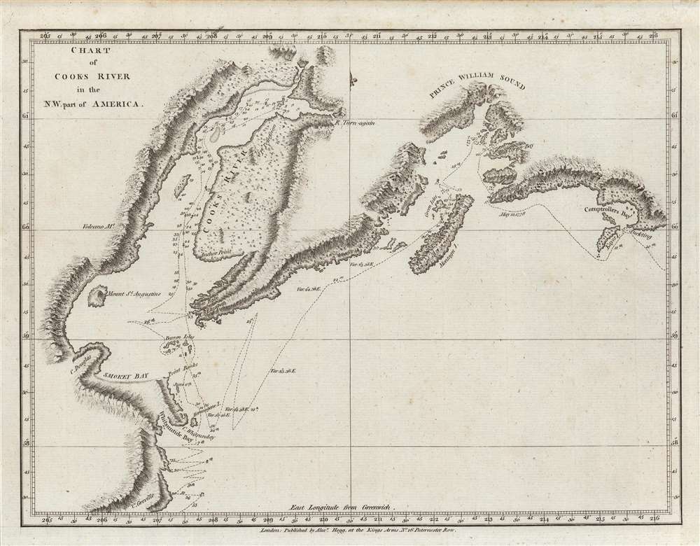
Chart of Cooks River in the N.W. part of America.
sold
- Digital Map Information
- Suitable for large format printing
- DPI: 600
- File Size: 14.04 MB
- File Type: ZIP / TIFF
- ICC color profile embedded
- Delivered instantly via download link
An important c. 1784 nautical chart or map of the Cook Inlet and Prince William Sound along the Kenai Peninsula, just south of Anchorage, Alaska. It was the product of the third and final Pacific voyage of Captain James Cook, and was published in George William Anderson and Alexander Hogg's A New, authentic, and complete collection of voyages round the world, undertaken and performed by royal authority.... (more details)
Gorgeous alpine glacial lakes.

Carte d`Excursions, Lugano et les trois lacs.
sold
- Digital Map Information
- Suitable for large format printing
- File Size: 46.75 MB
- File Type: ZIP / TIFF
- ICC color profile embedded
- Delivered instantly via download link
A charming c. 1930 folding relief map or view of, from west to east, Lakes Maggiore, Lugano, and Como, along the border of Switzerland and Italy. It was produced by A. Trub and Co., a local printer of such foldout maps and brochures catering to tourists. (more details)
Dedicated to Galileo's Patron.
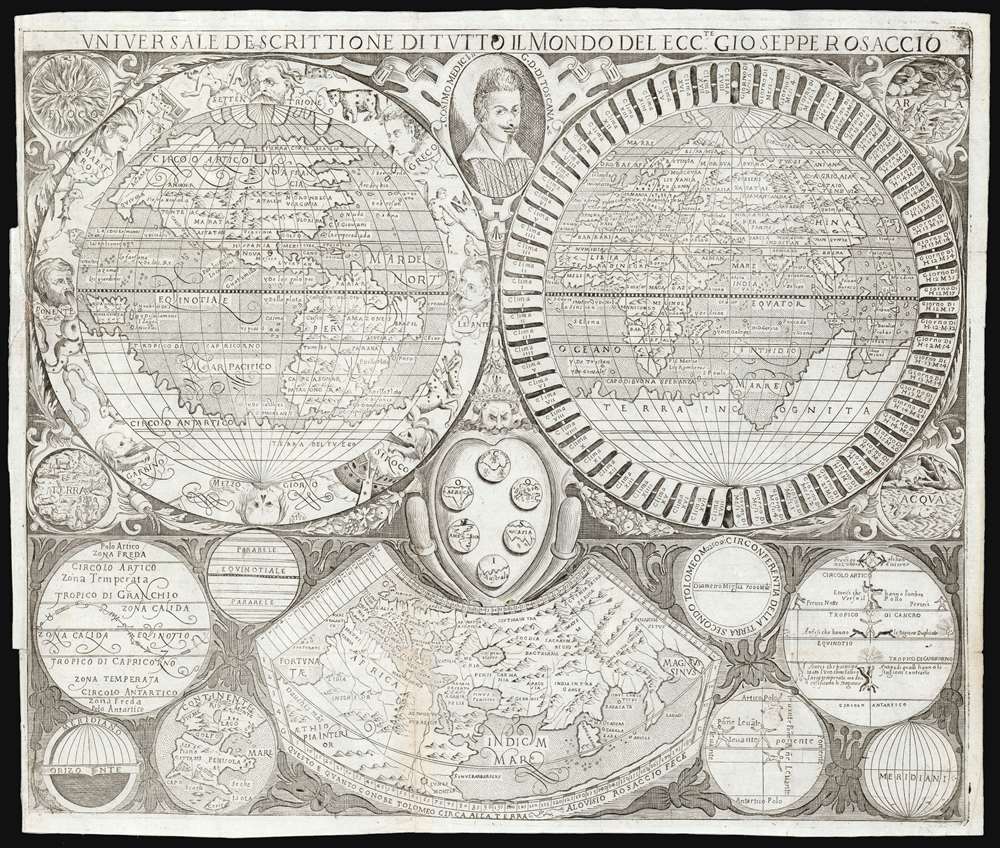
Universale Descrittione di Tutto Il Mondo Del Eccte. Gioseppe Rosaccio.
sold
- Digital Map Information
- Suitable for large format printing
- DPI: 600
- File Size: 22.03 MB
- File Type: ZIP / TIFF
- ICC color profile embedded
- Delivered instantly via download link
This is a rare c. 1610 map of the world, engraved by Luigi Rosaccio for inclusion in his father Giuseppe Rosaccio's final geographical text. This being the only map to accompany the work, it was tasked with conveying a broad array of concepts. Thus, the attractive engraving contains two main maps, eight diagrams, and four vignettes in addition to the decorative and dedicatory elements of the work. (more details)
Essential Map Bringing the American Revolution to a French Audience.
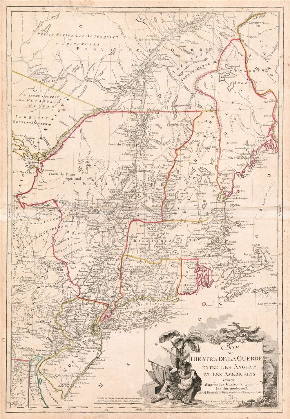
Carte du Theatre de la Guerre entre les Anglais et Les Americains.
sold
- Digital Map Information
- Suitable for large format printing
- DPI: 600
- File Size: 37.33 MB
- File Type: ZIP / TIFF
- ICC color profile embedded
- Delivered instantly via download link
This is a scarce, separately published American Revolutionary War map of New York and New England. First issued by Brion de la Tour in 1777, this map was intended to illustrate the important events at the height of the war. Brion de la Tour's map covers from the Delaware and Chesapeake Bays northward as far as Quebec City, inclusive of New York (with modern day Vermont), New Jersey, Massachusetts, Connecticut, New Hampshire, and parts of Pennsylvania, Maryland, Delaware, Maine, and Canada. It offers both political and topographical detail including mountains, rivers, roadways, regional boundaries, American Indian nations, towns, and cities. (more details)
An open invitation to Piracy?
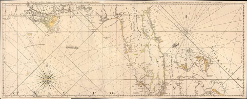
The Coast of West Florida and Louisiana. / The Peninsula and Gulf of Florida or Channel of Bahama with the Bahama Islands.
sold
- Digital Map Information
- Suitable for large format printing
- DPI: 600
- File Size: 44.18 MB
- File Type: ZIP / TIFF
- ICC color profile embedded
- Delivered instantly via download link
This is the 1775 first edition of Thomas Jeffreys' seminal map of Florida and the Gulf Coast - considered the first large-scale map to address the region in any detail. The map is significant for its accessible delineation of Florida and the Gulf, but is made more interesting through its graphic illustration of the Spanish Treasure Fleet and its route from Havana, around Florida, and then through the Bahamas - an unspoken but open invitation to pirates and privateers. (more details)
Rare chart of the Gulf.
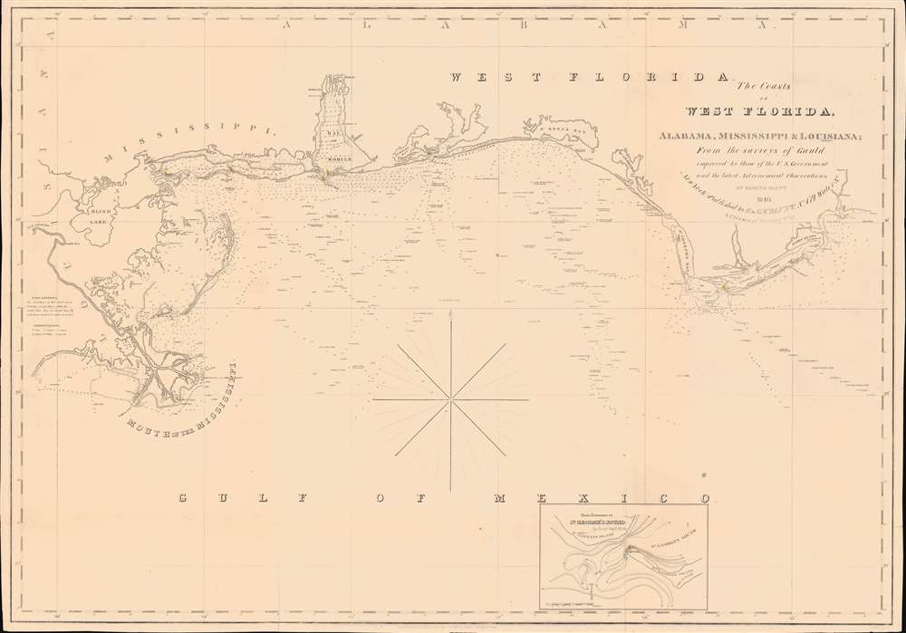
The Coasts of West Florida, Alabama, Mississippi and Louisiana; From the surveys of Gauld improved by those of the U.S. Government and the latest Astronomical Observations.
sold
- Digital Map Information
- Suitable for large format printing
- Full resolution TIFF file
- ICC color profile embedded
- Delivered instantly via download link
A rare Edmund March Blunt 1840 nautical map of West Florida, embracing the Gulf Coast from the mouths of the Mississippi to the Saint Marks River. The survey is based upon the groundbreaking work of Scottish hydrographer George Gould following the French and Indian War (1754 - 1763). Despite being nearly seventy years old by the time this chart was published, it remained the definitive mapping of the Gulf Coast until after the American Civil War (1861 - 1865). (more details)