
A resplendent Rheinpanorama.

New panorama of the Rhine from Mannheim to Cologne.
sold
- Digital Map Information
- Suitable for large format printing
- Full resolution TIFF file
- ICC color profile embedded
- Delivered instantly via download link
This is a gorgeous example of Frederick Herchenhein's c. 1869 panorama of the Rhine River from Mannheim to Cologne. It provides a bird's eye view of the great river, flanked by illustrations of riverside cities and countryside and adorned by dozens of vignettes. (more details)
Scandinavia under the shadow of Russia.
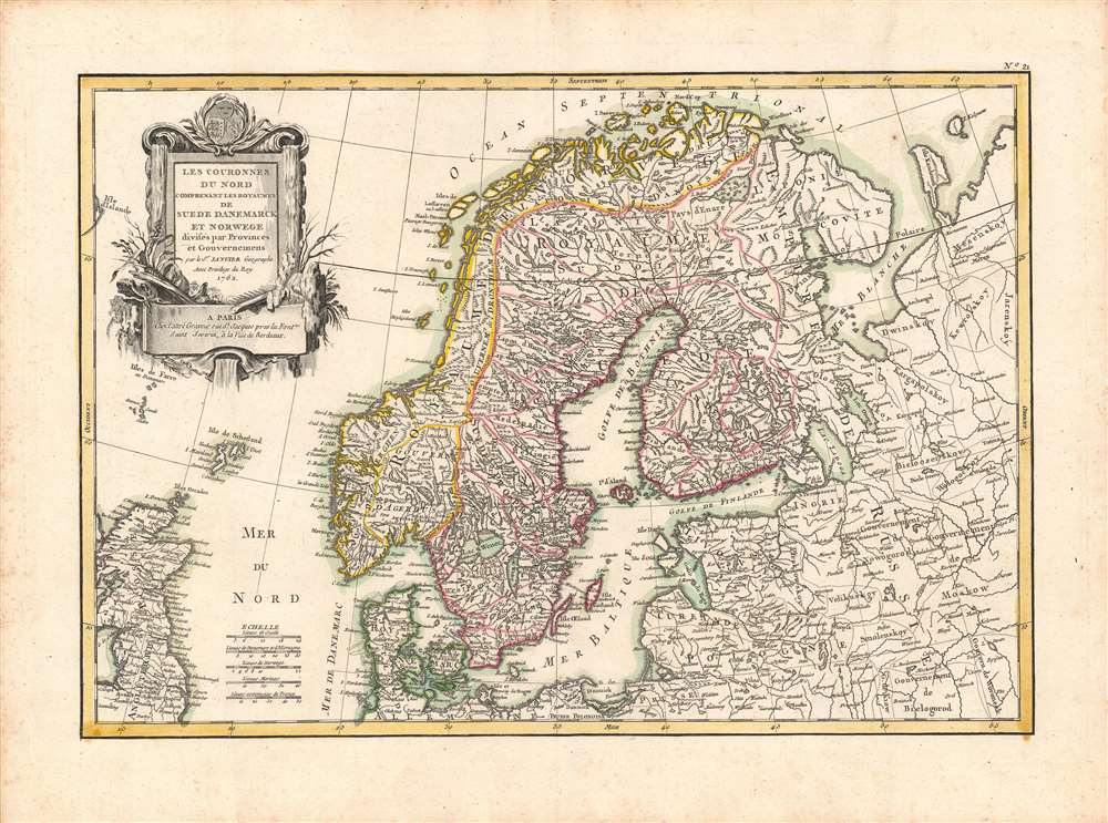
Les Couronnes du Nord Comprenant les Royaumes de Suede Danemarck et Norwege divisés par Provinces et Gouvernemens.
sold
- Digital Map Information
- Suitable for large format printing
- DPI: 600
- File Size: 46.24 MB
- File Type: ZIP / TIFF
- ICC color profile embedded
- Delivered instantly via download link
This is a beautiful example of Jean Janvier's 1762 decorative map of Scandinavia published for Jean Lattre's Atlas Moderne. It illustrates the kingdoms of Norway, Sweden, and Denmark, along with portions of the Russian Empire, the British Isles, and the German lands. (more details)
Sailing map of Western Long Island Sound's Sailing Grounds by a Sail Lover.
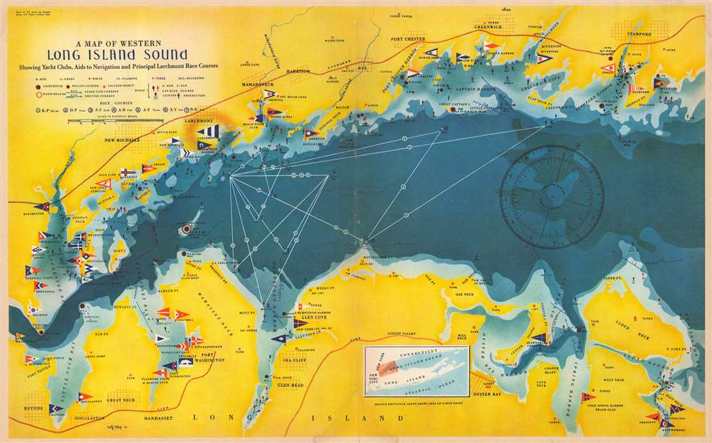
A Map of Western Long Island Sound: Showing Yacht Clubs, Aids to Navigation and Principal Larchmont Race Courses.
sold
- Digital Map Information
- Suitable for large format printing
- Full resolution TIFF file
- ICC color profile embedded
- Delivered instantly via download link
This is a delightful 1939 Rolf Klep pictorial map of western Long Island Sound. It covers the waters off Westchester County, Fairfield County, and the ‘Gold Coast’ of Long Island, specifically those frequented by the members of the Larchmont Yacht Club. A note on the verso describes this as ‘a Yachting Paradise’ and ‘the most populous yachting center in the world, with about fifty clubs lining some seventeen miles of Long Island Sound.’ The locations of indeed fifty yachting clubs are marked with flags on the map, as are lighthouses, buoys, and radio beacons. The routes of seven Larchmont Regatta race courses are shown in white overlapping triangles throughout the Sound. Though soundings are not numbered, depths are indicated by varying shades, the darkest showing the deepest water, over 120 feet. Ebb and flood tides are marked on the map with arrows, as are key landmarks used by yachtsmen to take compass bearings - chimneys, domes, water towers, and even specific houses. Despite the map’s richness of detail, the author of the article it accompanied was at pains to explain that ‘though accurate, this map should not be used for navigation’ directing the reader instead to consult the U.S. Coast and Geodetic Survey and Texaco cruising charts from which the map’s data was drawn. (more details)
Fascinating American School Map of the World.
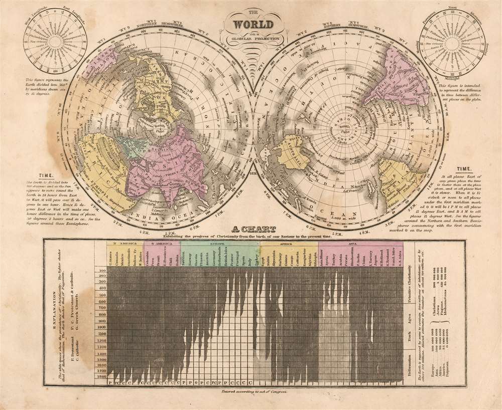
The World on a Globular Projection.
sold
- Digital Map Information
- Suitable for large format printing
- DPI: 600
- File Size: 14.39 MB
- File Type: ZIP / TIFF
- ICC color profile embedded
- Delivered instantly via download link
This is a fascinating 1841 Jesse Olney polar projection world map reflecting the educational, geographical, and religious values of mid-19th century America. (more details)
An optimistic view of the upcoming war.
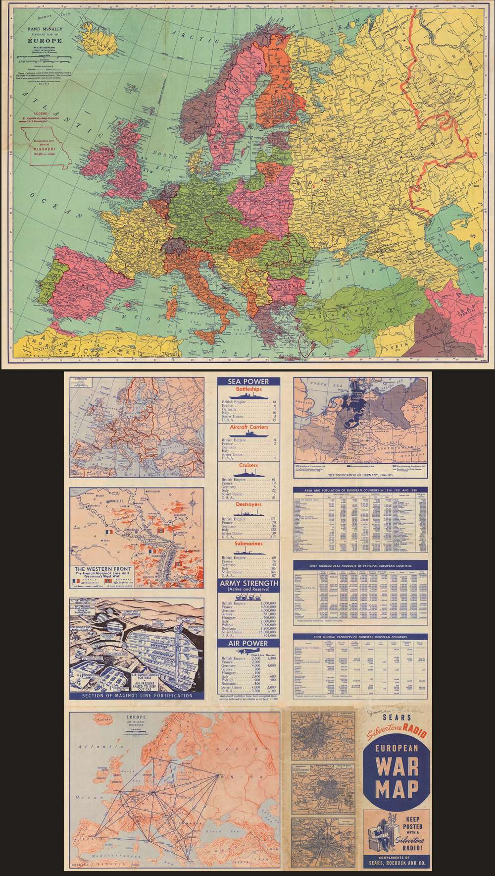
Rand McNally standard map of Europe./ Sears Silvertone radio European War Map.
sold
- Digital Map Information
- Suitable for large format printing
- Full resolution TIFF file
- ICC color profile embedded
- Delivered instantly via download link
This is a 1940 Rand McNally Map of Europe, published for Sears and Roebuck as a promotion for their Silvertone line of electronics - 'Keep Posted with a Silvertone Radio!' The recto map displays what was, for the American audience, the theatre of what was expected to be a simple re-play of World War I (1914 - 1918): the continent of Europe. The brightly-colored map shows the 1939 national boundaries, with pre-World War borders marked in red for reference. (Thus, the borders of Austria-Hungary and the Balkans can be seen, as can the pre-Soviet Russia.) To provide a sense of scale for the American reader, an outline of the State of Missouri has been added - suggesting that any one of the players in the upcoming conflict was barely the size of just one small part of the United States. (more details)
Tourist tchotchkes meet Japanese craftsmanship.

日光東照宮栞 / [Nikkō Tōshō-gū ‘Bookmark’].
sold
- Digital Map Information
- Suitable for large format printing
- Full resolution TIFF file
- ICC color profile embedded
- Delivered instantly via download link
This is a curious c. 1935 pop-up card of the Tōshō-gū Shrine of Tokugawa Ieyasu, the founder of Japan's Tokugawa Shogunate, located in Nikkō. On the reverse is a map of Nikkō and a depiction of a famous red lacquer bridge there. (more details)
First published view of Singapore.
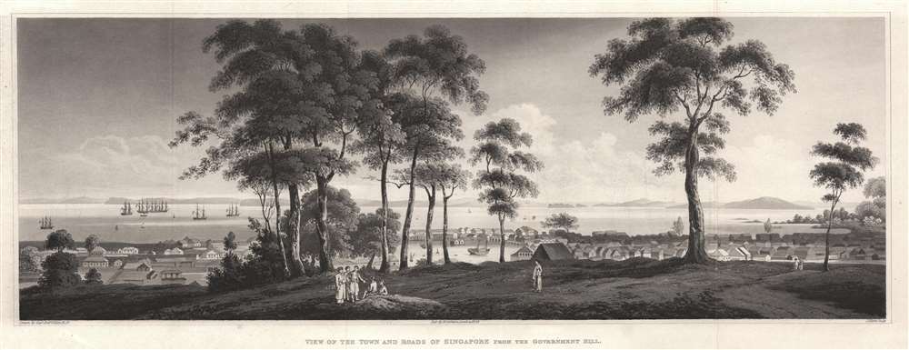
View of the Town and Roads of Singapore from the Government Hill.
sold
- Digital Map Information
- Suitable for large format printing
- Full resolution TIFF file
- ICC color profile embedded
- Delivered instantly via download link
The first printed view of Singapore, issued less than 10 years after it was founded by Sir Thomas Stamford Raffles (1781 - 1826). This aquatint view was published in 1828 after a painting by Royal Navy Captain Robert James Elliot. It looks on Singapore from Government Hill, covering the Plain, Singapore River, and Chinatown. Even at this early stage, presents a bustling city with numerous buildings and a lively port. We have not been able to trance Elliot's original painting. (more details)
A Most Psychedelic Map of Guam.

Guam, U.S.A.
sold
This is a visually entertaining, psychedelic pictorial map of Guam, published by the Bush Advertising Agency of Agana, Guam in 1971. It was produced on behalf of, or in partnership with United Key International, a company formed to promote tourism to the island. Consequently, the map highlights features of interest to both tourist and American military visitors. It is screen-printed in red, black, and metallic gold, on cornflower-gold paper. The map is a caricature of the heavily jungled, mountainous island: scattered amongst the island's fauna are many colonnades, the indigenous Chamorro 'Latte Stones' (the old foundations of Chamorro houses). The old terminal of Guam International Airport and the Peace Memorial are prominently featured, as is Agana's Dulce Nombre de Maria Cathedral. The cities of Agana, Agt, Umatea, Merizo, and Inarajan are highlighted along with their many hotels, restaurants, resorts, and shops. Natural sites such as 'Two Lovers Point,' Mount Lam Lam (Guam's highest peak), and Talafofo Falls are shown. The tower of KUAM, Guam's radio station, nearly tops the highest point of the image (KUAM was in operation from 1954 until shuttered in 2020.) There is a particular focus on Cocos island: important for UKI, who operated glass-bottom-boat tours from Merizo to the smaller island. (more details)
The Monumental City, soon after the War of 1812.
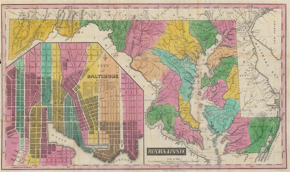
Maryland.
sold
- Digital Map Information
- Suitable for large format printing
- Full resolution TIFF file
- ICC color profile embedded
- Delivered instantly via download link
This is a rare and brilliantly colored example of Fielding Lucas' 1819 map of Maryland, with a large inset of Baltimore. It was made in the aftermath of the War of 1812, when Baltimore had been the site of a critical American victory in 1814. (more details)
One of the earliest depictions of California Wine Making on a map.
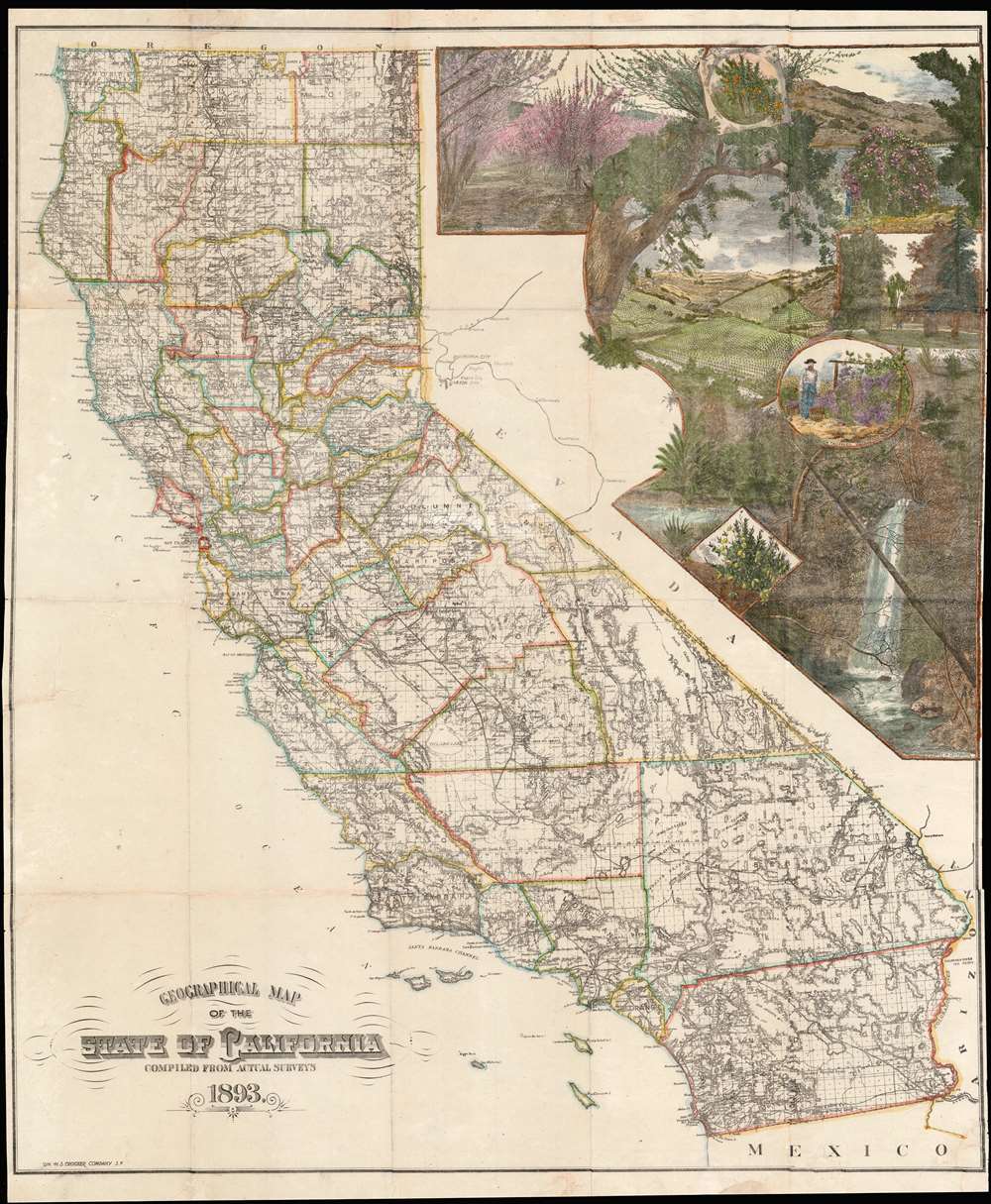
Geographical Map of the State of California Compiled from Actual Surveys.
sold
- Digital Map Information
- Suitable for large format printing
- File Size: 53.86 MB
- File Type: ZIP / TIFF
- ICC color profile embedded
- Delivered instantly via download link
A stunning separately-issued 1893 decorative map of California issued to promote the Crocker family business interests in the development and settlement of California. It is alone one of the earliest cartographic representations of viticulture in California. While the mapmaker, Henry Smith Crocker was on the surface a printer, his business interests were inextricably linked to those of this brother, Central Pacific railroad magnate Charles Crocker (1822 - 1888). H. S. Crocker used his publishing and printing empire to propagandize the Central Pacific as well as the general virtues of California as a place to resettle - this map being one such example, probably issued as a booster publication for the California exhibit at the 1893 Chicago Columbian Exposition. (more details)
Complete rare geography game.

Game of Uncle Sam's mail.
sold
- Digital Map Information
- Suitable for large format printing
- Full resolution TIFF file
- ICC color profile embedded
- Delivered instantly via download link
This is an 1893 McLoughlin Brothers game titled 'Uncle Sam's Mail' in which the board is a map of the United States crisscrossed by rail lines. It was produced as the contours of the lower 48 states were being finalized, a prime opportunity for teaching children about the new national geography. The game includes original tokens, cards, dice, board, and box. (more details)
Northern Savoy Just After France Captured It.
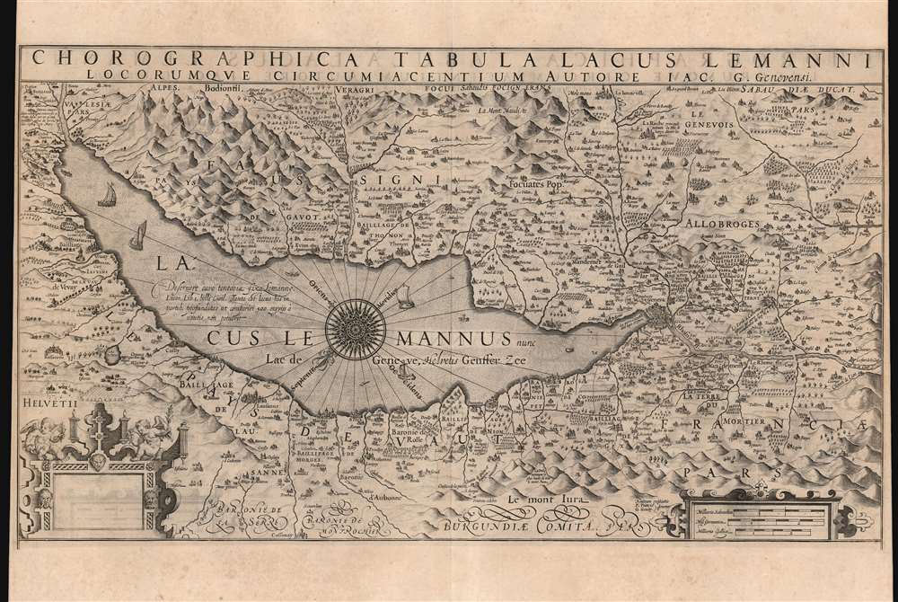
Chorographica Tabula Lacus Lemanni Locorumque Circumiacentium Auctore Iac. G. Genevensi.
sold
- Digital Map Information
- Suitable for large format printing
- DPI: 600
- File Size: 52.73 MB
- File Type: ZIP / TIFF
- ICC color profile embedded
- Delivered instantly via download link
An uncommon and beautiful map of Lake Geneva engraved by Jodocus Hondius for inclusion in his 1606 edition of the Mercator Atlas. This southeast-oriented map depicts the Canton of Geneva in detail and centers on Lake Geneva. The Rhone River can be seen flowing into the lake in the southeast and out again, through the city of Geneva in the west. It is a superb engraving, with elegant strapwork cartouches and dramatic, pictorially-represented mountains. The stippled Lake Geneva is graced with an elaborate compass rose, an array of ships, and even a handful of rowboats. Several geese menace the western coastline, while peeking from the water northwest of the compass rose is a remarkably understated sea monster. (more details)
Presenting the North Parts of the World.
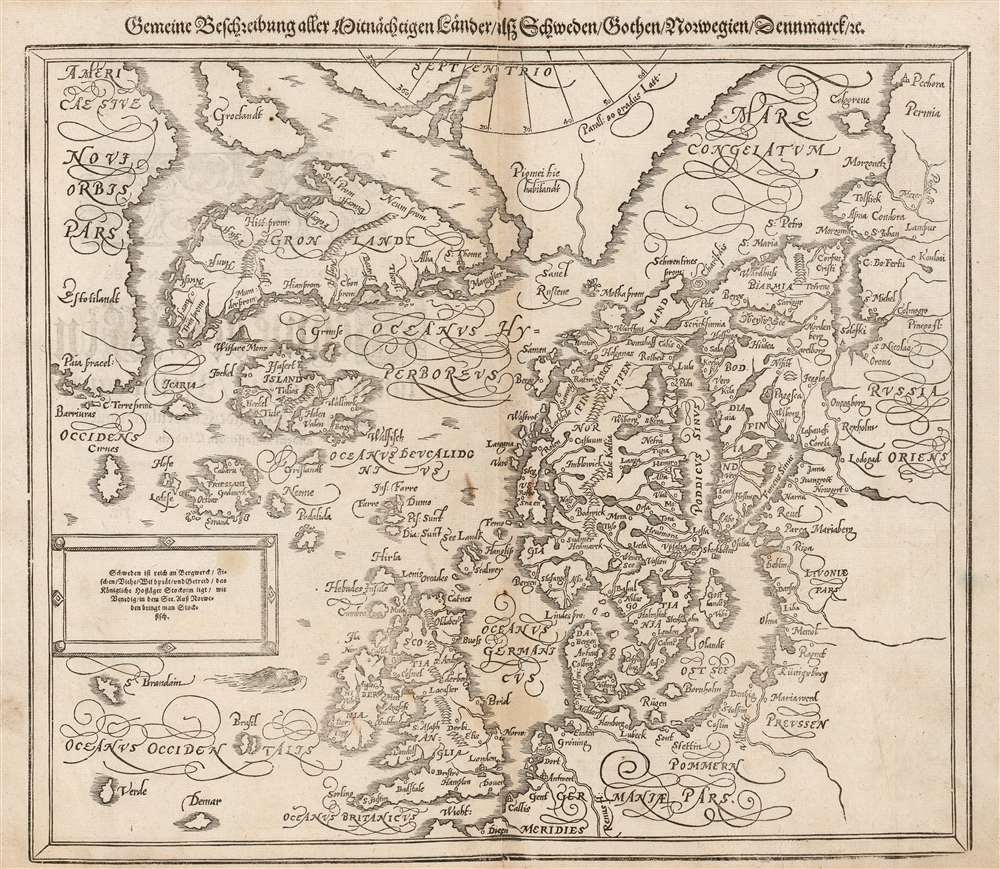
Gemeine Beschreibung Aller Mitnåchtigen Lander Alsz Schweden, Gothen, Norwegien, Denmarck etc.
sold
- Digital Map Information
- Suitable for large format printing
- DPI: 600
- File Size: 28.65 MB
- File Type: ZIP / TIFF
- ICC color profile embedded
- Delivered instantly via download link
This is an attractive woodcut map of Scandinavia and the north parts of the European world, added to Sebastian Münster's Cosmographia in 1588. It replaced the by now obsolete map based on the work of Olaus Magnus similar, albeit smaller and simpler, woodcut which had appeared in the work from 1544 to 1578. Sebastian Petri, who had inherited the publishing rights of Münster's masterpiece from his father, knew that its maps were no longer state of the art. In order to keep the book current, he ordered the production of a new set of woodcut maps based on the maps of Antwerp publisher Abraham Ortelius, and a selection of new city views derived from those of Braun and Hogenberg. The present map, though retaining the title of the earlier Münster map, is an artful copy on wood of Ortelius' copperplate Septentrionalium Regionum Desrip. Being a woodcut, the Münster/ Petri map presents very differently from its copperplate source. It also includes a brief descriptive text not present on the Ortelius: 'Sweden is rich in mines, fish, cattle, game, and grain. The Royal Court of Stockholm lies, like Venice in a lake: stockfish are brought to Norway.' (more details)
Brilliant, data rich depiction of mid-century New York.

The City of New York.
sold
- Digital Map Information
- Suitable for large format printing
- File Size: 141.99 MB
- File Type: ZIP / TIFF
- ICC color profile embedded
- Delivered instantly via download link
This 1939 Richard Edes Harrison map of New York City - published in conjunction with the New York World’s Fair – represents a triumph of the visual display of quantitative information. Its aesthetic impact is all the more impressive in its clear expression of municipal and demographic data, making this a map of the people of New York City, as much as of the physical city itself. All five boroughs are represented in the primary map. On it, Harrison’s masterful use of vivid color to distinguish between residential, commercial, industrial, and federal use of land is clear yet supple, able to make distinction (for example) of low-income housing projects using the same palette. Parks and cemeteries both appear as green spaces, with white spots - evoking headstones - indicating the difference between the two. The two major airports (Floyd Bennett Field and North Beach Airport) are given their own color as well. The city’s industrial areas, shown in black, dominate the East River and Hudson coastlines, a reminder of the centrality of trade to the city’s development and history. (more details)
Developing geographical knowledge in tandem with the slave trade.
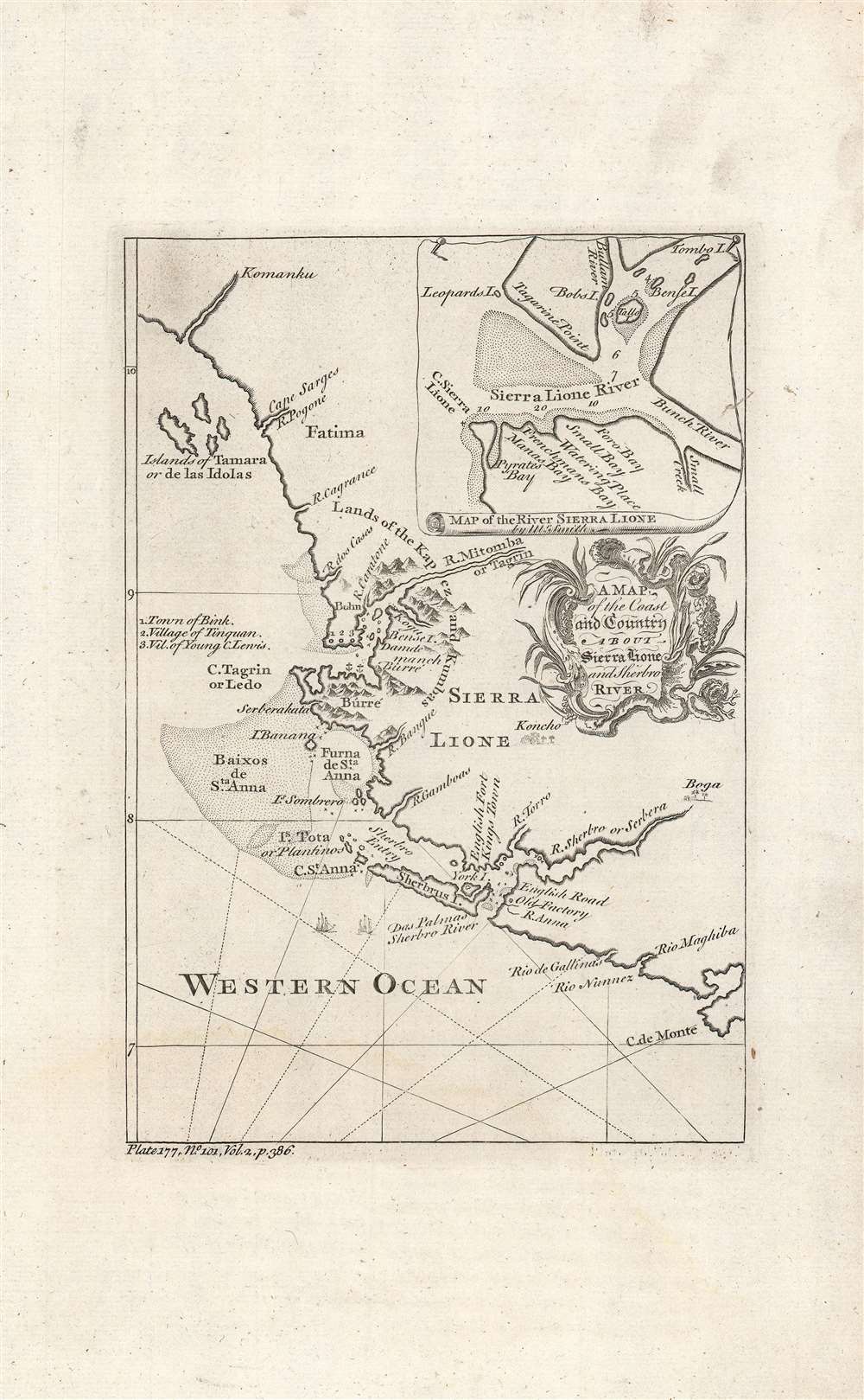
A map of the coast and country about Sierra Lione and Sherbro River.
sold
- Digital Map Information
- Suitable for large format printing
- DPI: 600
- File Size: 14.05 MB
- File Type: ZIP / TIFF
- ICC color profile embedded
- Delivered instantly via download link
This is a c. 1747 map and chart of the coast of Sierra Leone most likely engraved by Isaac Basire for John Green's A New General Collection of Voyages and Travels, published between 1745 and 1747. Made during the height of the Transatlantic Slave Trade, this map depicts the major source of slaves bound for the British colonies in America. (more details)
A colossal map oof the Ottoman Europe at the moment of its collapse.
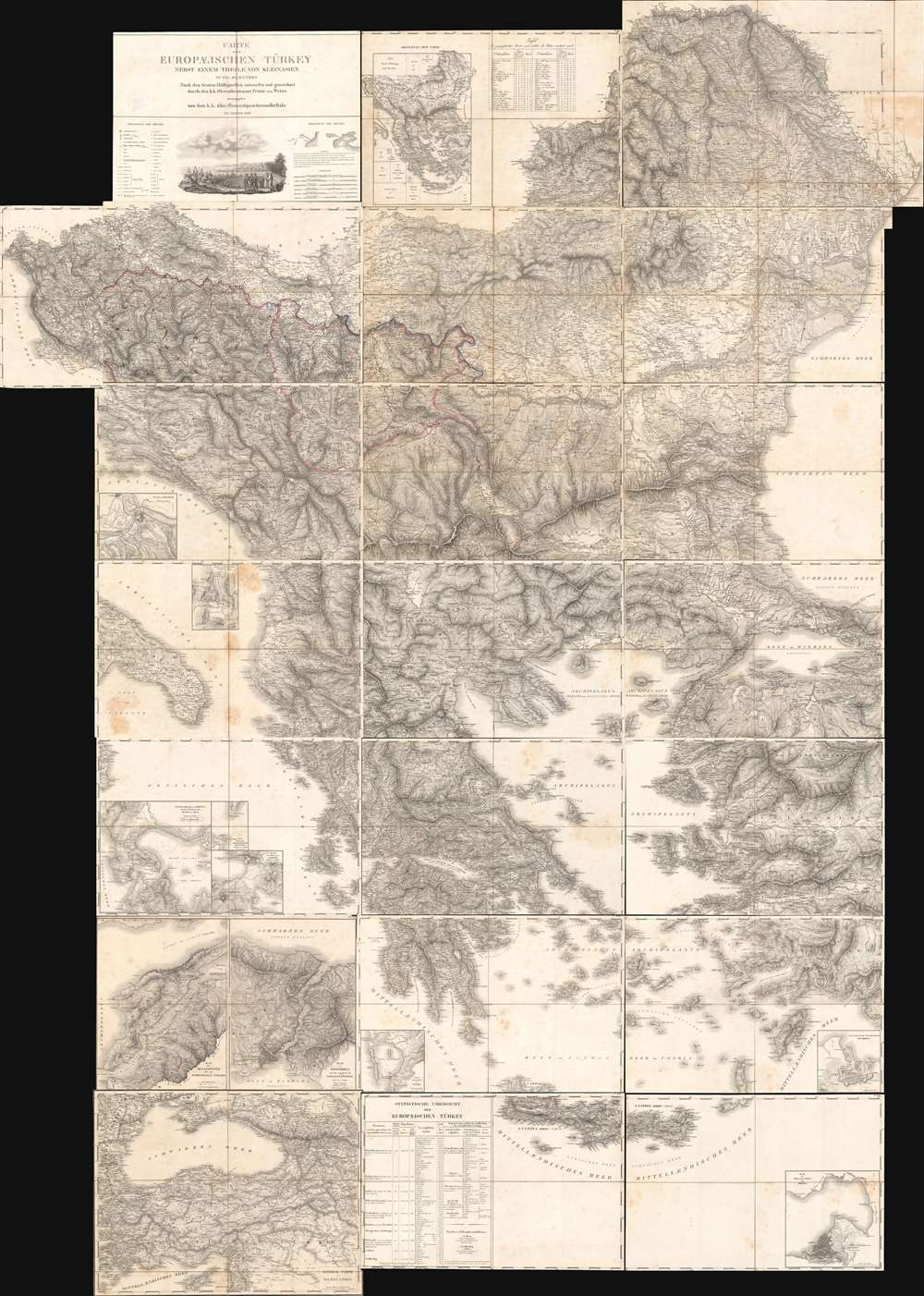
Carte der Europaeischen Tuerkey nebst einem Theile von Kleinasien in XXI. Blattern.
sold
A monumental composite map of European Turkey consisting of 21 linen-backed sheets contained within its original handsome box. This 1829 Franz von Weiss map of 'European Turkey' (Greece, the Balkans, Bulgaria), produced under the auspices of the Austrian military. It is an extraordinary work of military intelligence, made just as the Ottoman Empire's European holdings were collapsing and neighboring powers, including Austria, sought to craft a reaction. (more details)
A cursed lineage!
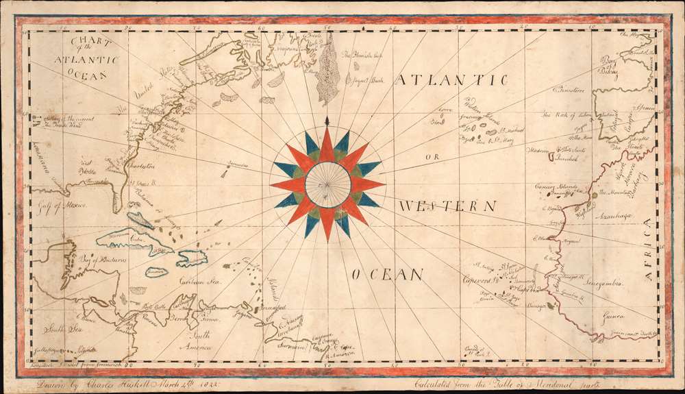
Chart of the Atlantic Ocean.
sold
- Digital Map Information
- Suitable for large format printing
- DPI: 600
- File Size: 12.51 MB
- File Type: ZIP / TIFF
- ICC color profile embedded
- Delivered instantly via download link
An exceptional and finely executed manuscript school-boy map illustrating the North Atlantic, here called the 'Western Ocean.' A striking compass rose dominates the center of the map. It was executed on March 4, 1822 by Charles Haskell (see below), when he must have been about 14. Despite being young, the map, which is based on Blunt's c. 1820 Chart of the Atlantic Ocean, is finely executed, covering from Louisiana to Gibraltar, incorporating most of the eastern United States, part of South America, and west Africa. As one would suspect of a scion of New England fishermen, the many cod fishing banks off the coast, and the Grand Banks, are illustrated with impressive meticulousness. Curiously, the map includes the Saint Peter and Saint Paul Archipelago, at bottom center, a remote atoll in the Atlantic - rarely visited save by occasional whalers. Haskell also notes prevailing wind and currents. (more details)
Quezon's infrastructure vision.
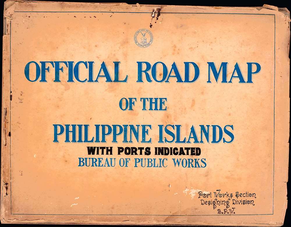
Official Road Map of the Philippine Islands: with Ports Indicated.
sold
The only known example of a c. 1936 road atlas of the Philippines, produced by the islands' Bureau of Public Works, Manila. It includes 15 maps, plus a title page and an index, covering the entire archipelago in impressive detail. (more details)
Most Visually Engaging Seventeenth Century Map of Russia.
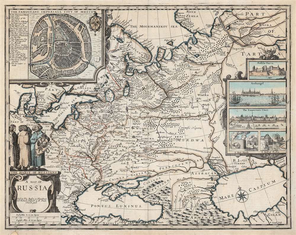
A Map of Russia.
sold
- Digital Map Information
- Suitable for large format printing
- DPI: 600
- File Size: 65.3 MB
- File Type: ZIP / TIFF
- ICC color profile embedded
- Delivered instantly via download link
This is John Speed's scarce 1676 map of Russia, one of the first English maps of Russia and certainly the most decorative. The map is scarce, having appeared only in the latter, Basset and Chiswell edition of the Speed atlas. Centered on Moscow, the map covers from the North Sea to the Caspian Sea and from Nova Zembla to Trabzon (Black Sea south coast). There is a large and impressive inset map of Moscow: this is centered on the Kremlin, Belygorod, and the Kityagorod. Five inset views depict the Emperor's Court in the Kremlin, the vital port of Archangel, the Russian fort at Narva (in modern Estonia and a crucial stronghold on Russia’s western border), bathhouses and a mill. Above the cartouche are figures dressed in 'The Habit of Russians,' one of whom carries the Russian coat of arms. (more details)
First edition of the the second map of Iceland based on local information.
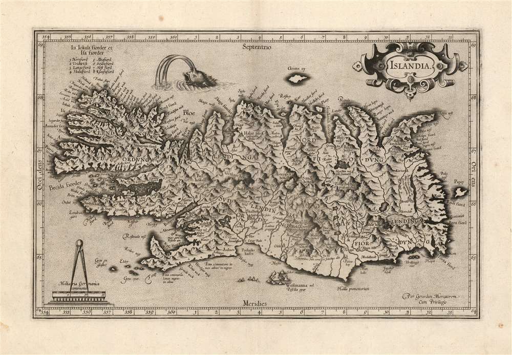
Islandia.
sold
- Digital Map Information
- Suitable for large format printing
- Full resolution TIFF file
- ICC color profile embedded
- Delivered instantly via download link
This is a beautiful strike of Gerhard Mercator's map of Iceland, in a beautiful 1595 first edition example. It is the second map of Iceland to appear in a modern atlas, and the second map overall of Iceland based on data originating from an Icelander, placing it among the first accurate maps of the island. Mercator's map first appeared in 1595, only five years after Abraham Ortelius' famous map; both maps shared the same ultimate source: Guðbrandur Þorláksson, Bishop of Holar. (more details)