
Largest map of the Philippines Printed in the Philippines w/ Distinguished Provenance.
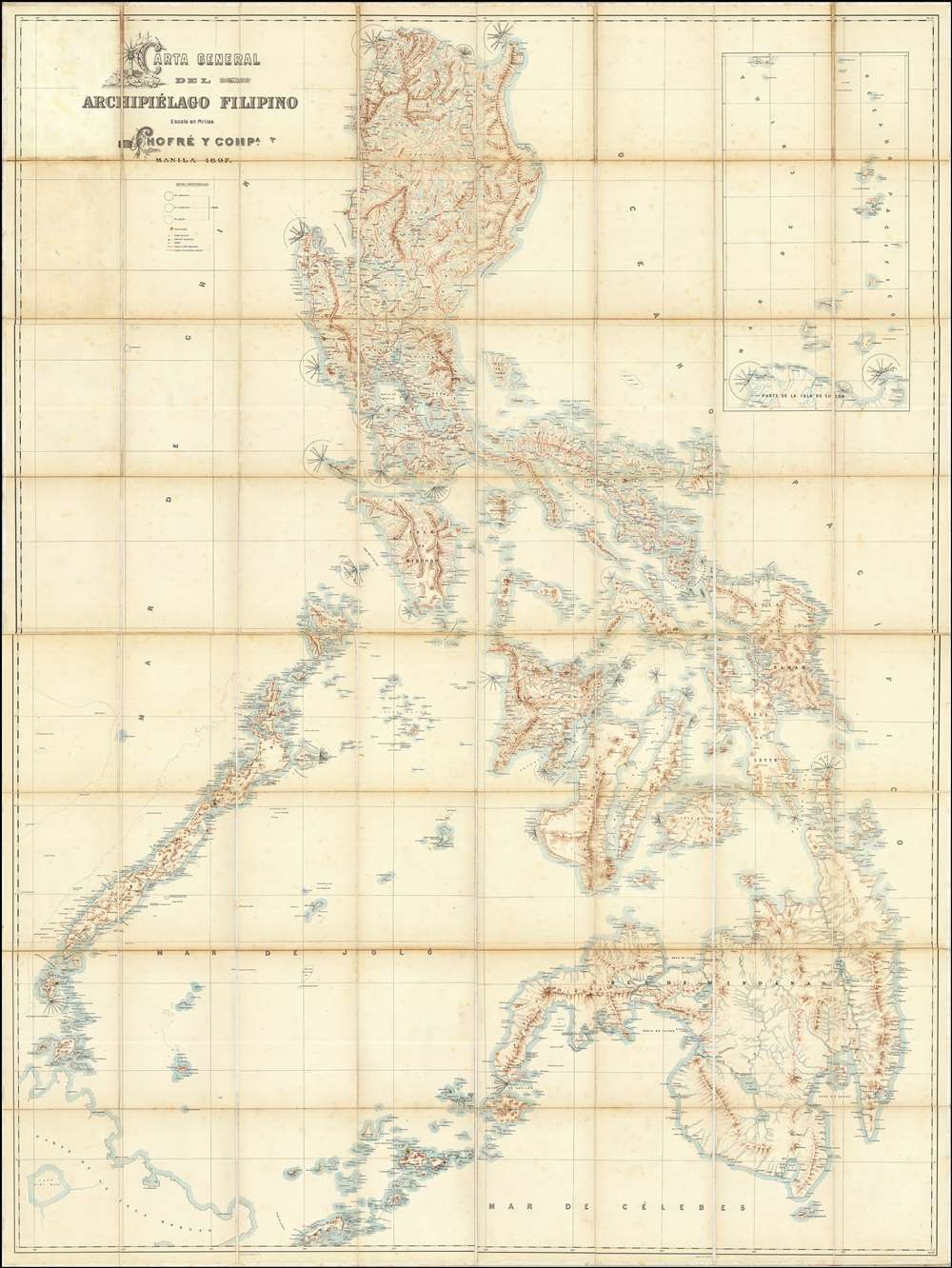
Carta General del Archipiélago Filipino.
sold
- Digital Map Information
- Suitable for large format printing
- File Size: 2002.83 MB
- File Type: ZIP / TIFF
- ICC color profile embedded
- Delivered instantly via download link
This is the only known example of Salvador Chofré's spectacular 1897 map of the Philippines - what must be considered the largest and most detailed Spanish map of the Philippines issued in the 19th century. The map was produced by Salvador Chofré, Manila's first lithographer at the height of his career, likely by government request in the face of the Philippine Revolution (1896 - 1898). The present example is likely a proof, as no other example or publishing history is known. What is known is that this example was acquired by American naval officer Henry Glass in 1898, when he participated in the invasion and surrender of Manila. The U.S. Navy reportedly reproduced it, very likely from this example, at a 50% reduced scale, although we have found no trace of said reproduction. The present map accompanied Glass when he returned to the United States, serving in San Francisco and attaining the rank of Rear Admiral, and was subsequently passed down through his family until we acquired it. (more details)
The first official Japanese regional map using western cartographic technology. A wonder of copper engraving!
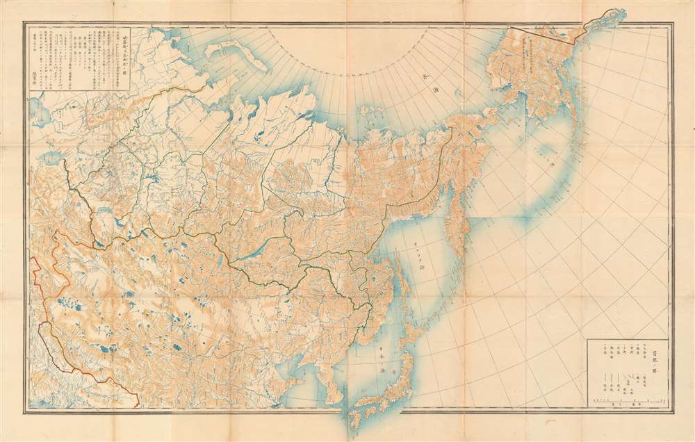
峨羅斯及亞西亞ノ圖 / [Map of Russia and Asia].
$12,000.00
Acquire
- Digital Map Information
- Suitable for large format printing
- File Size: 109.25 MB
- File Type: ZIP / TIFF
- ICC color profile embedded
- Delivered instantly via download link
An extraordinary 1867 (Keio 3) map of Siberia and Alaska illustrates a moment of cultural collision and transformation. Printed in Japan using a remarkable multi-color copperplate process, the map is a conic projection covering Asia from the Caspian Sea to the Bering Strait. It extends farther east to include Alaska, and south to encompass Nepal, Korea, Tibet, most of China, and all of Japan. This is the first Japanese regional map to incorporate contemporaneous western cartographic technology for official strategic and military use. (more details)
Best general map of the Southeast of the 18th Century.
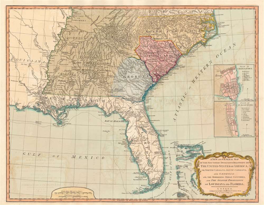
A New and General Map of the Southern Dominions Belonging to The United States of America, viz: North Carolina, South Carolina, and Georgia: with the Bordering Indian Countries, and The Spanish Possessions of Louisiana and Florida.
sold
- Digital Map Information
- Suitable for large format printing
- DPI: 600
- File Size: 24.34 MB
- File Type: ZIP / TIFF
- ICC color profile embedded
- Delivered instantly via download link
A scarce 1794 Laurie and Whittle / Sayer map of the southeastern part of the United States and Florida. This is the second edition of Sayer's map of the southeast, and the first to recognize the United States as an independent nation. At the time of initial publication, it represented the finest general cartography of the southeast obtainable. (more details)
British Foothold in the African Slave Trade.
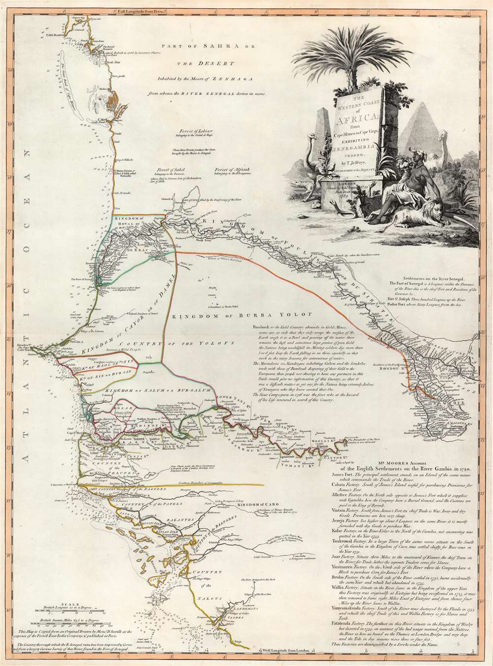
The Western Coast of Africa from Cape Blanco to Cape Vigo, Exhibiting Senegambia Proper by T. Jefferys, Geographer to His Majesty.
sold
- Digital Map Information
- Suitable for large format printing
- DPI: 600
- File Size: 29.76 MB
- File Type: ZIP / TIFF
- ICC color profile embedded
- Delivered instantly via download link
This is a beautiful example of Robert Sayer's 1789 map of western coastal Africa. It is focused on Senegal, but includes parts of modern Mauritania, Mali, Guinea-Bissau, and Guinea. It reaches from as far north as Cap Blanco and the Arguin Banks to the mouth of the Rio Nuñez and Cap Virgo in the south. The map traces the course of the Senegal River as far east as the Felou Rocks, present site of the Félou Hydroelectric Plant in Mali. (more details)
Traces the first half of Stanley's first expedition across Africa from 1874 - 1877.
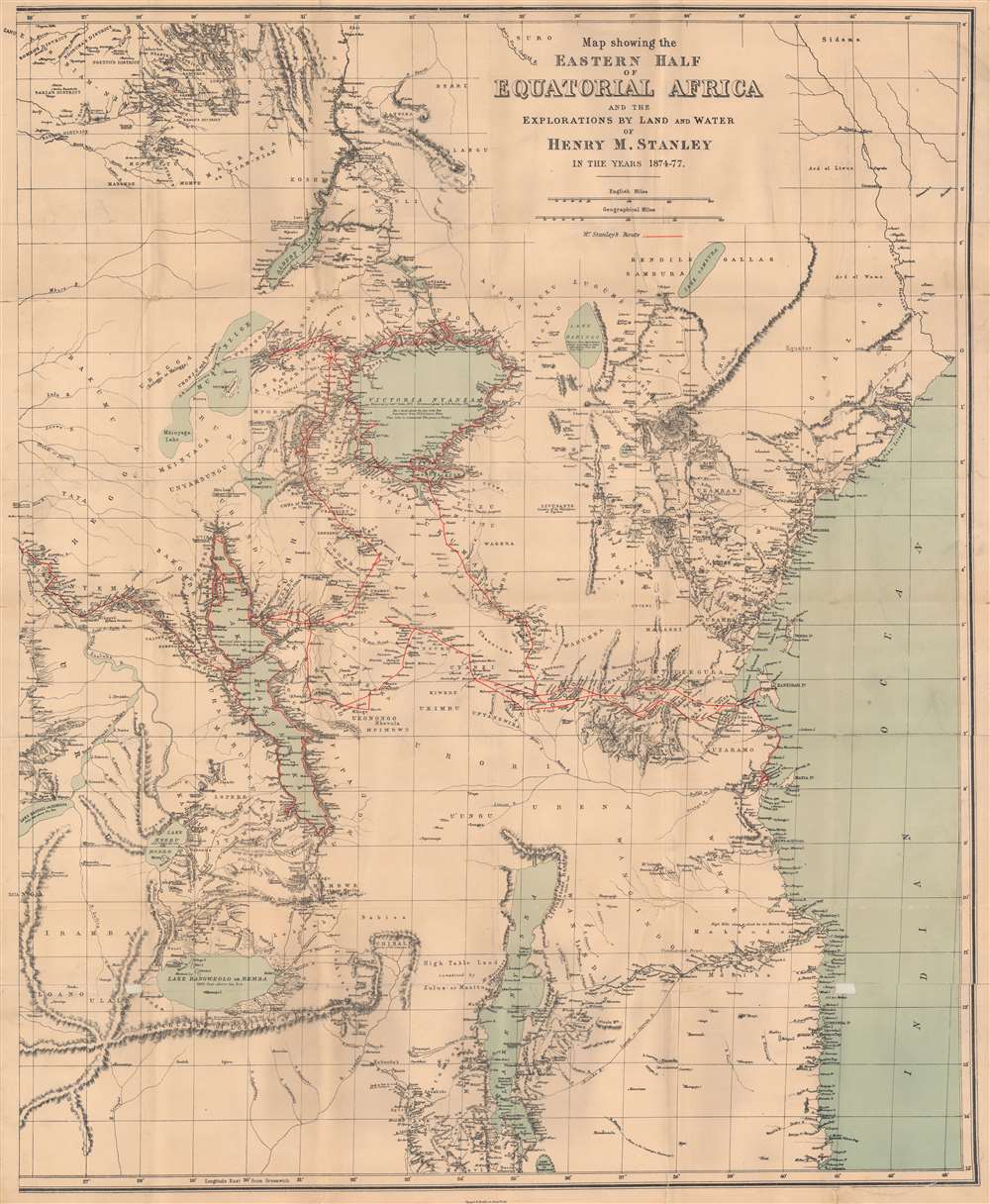
Map showing the Eastern Half of Equatorial Africa and the Explorations by Land and Water of Henry M. Stanley in the years 1874 - 1877.
sold
- Digital Map Information
- Suitable for large format printing
- File Size: 31.76 MB
- File Type: ZIP / TIFF
- ICC color profile embedded
- Delivered instantly via download link
This is a rare 1879 Henry Morton Stanley map of East Africa - one of the first maps to accurately illustrated the Rift Valley. Coverage extends from South Sudan to Zambia and Mozambique and from the Democratic Republic of the Congo to the Indian Ocean. A study in stark contrast, Stanley's route from Zanzibar across the continent to Uzimba in the modern-day Democratic Republic of the Congo, is highly detailed. Points all along the route are labeled, including during his circumnavigation of Lake Victoria and Lake Tanganyika. Notes concerning the region's larger lakes are also included, such as their elevation above sea level and the name of the first European to 'discover' each lake. However, outside of the immediate vicinity of Stanley's expedition, the map is blank, underscoring a general lack of knowledge. Tribes are named, and river courses are included, but the majority of the territory is blank. (more details)
Japanese intelligence map from the decisive battle of the Pacific War.

ガダルカナル要圖 / [Guadalcanal Plan].
sold
- Digital Map Information
- Suitable for large format printing
- File Size: 14.23 MB
- File Type: ZIP / TIFF
- ICC color profile embedded
- Delivered instantly via download link
A unique 1942 U.S. Army Map Service print of a Japanese military intelligence manuscript map of Guadalcanal, Solomon Islands. It details, from a Japanese perspective, the early stages of the Guadalcanal Campaign, a critical turning point in the Pacific Theater of World War II (1939 - 1945). Written entirely in Japanese, the map shows American positions around Henderson Field, the strategically important airstrip that was the main objective of both sides in the months-long battle for the island. (more details)
Africa is just a flight away!
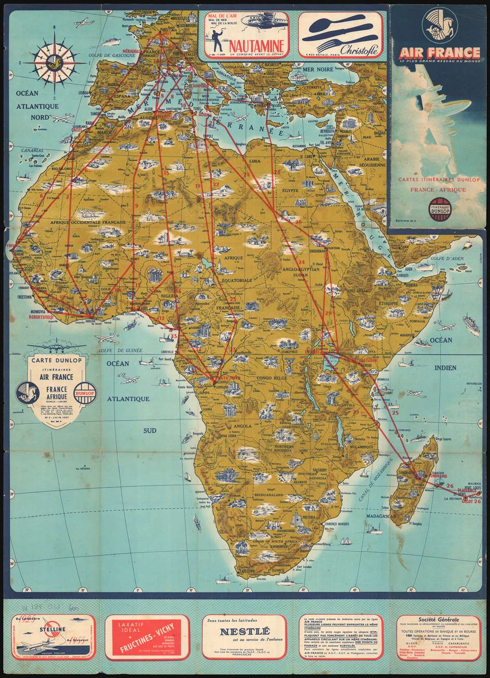
Carte Dunlop Itinéraires Air France France Afrique.
sold
An uncommon 1957 pictorial map of Africa issued for Air France by Dunlop. The attractive map highlights the cultural and natural wonders of Africa pictorially with red overprinting highlighting air-route operated by Air France. Red routes connect major hubs, with their airports noted: Yofe in Dakar, Robertsfield in Monrovia, Maya Maya in Brazzaville, etc. Although more beautiful than most, this map is part of a series of travel maps popular in the 1950s known as the 'Itinerarie Dunlop,' illustrating tours and air travel throughout Air France's coverage area. (more details)
The height of the Great Game.
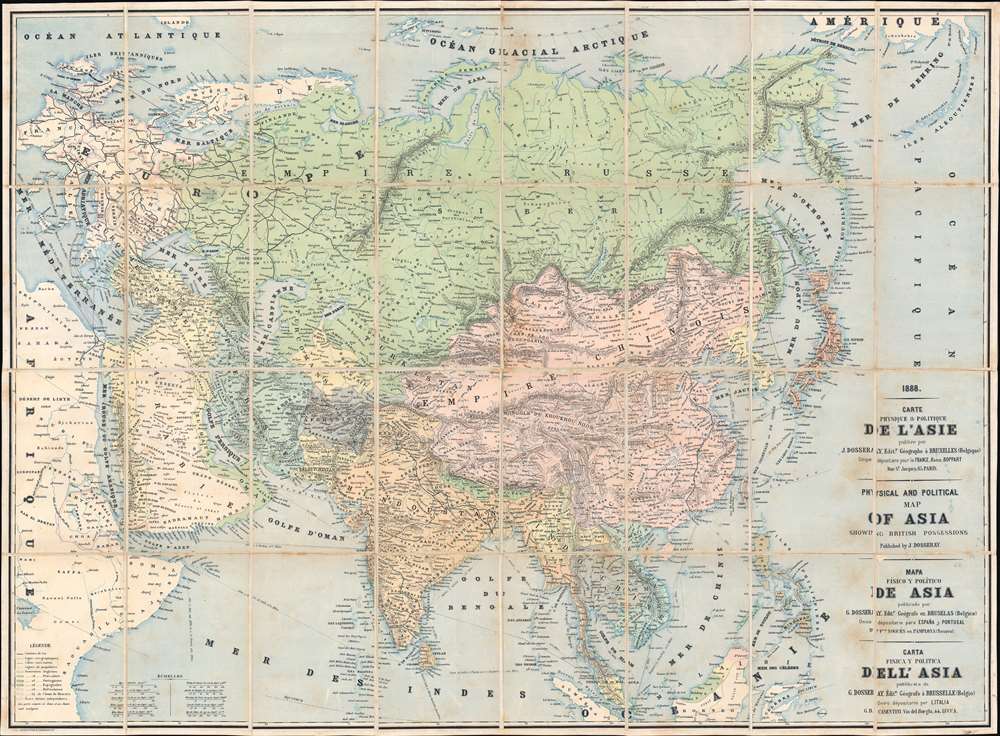
Carte Physique et Politique de l'Asie. Physical and Political Map of Asia Showing British Possessions. Mapa Físico y Político de Asia. Carta Fisica y Politica dell'Asia.
$750.00
Acquire
- Digital Map Information
- Suitable for large format printing
- Full resolution TIFF file
- ICC color profile embedded
- Delivered instantly via download link
This is an 1888 Jean Dosseray map of Asia, published at the height of the Great Game. Dosseray's map broadly covers all of Asia. It is titled in French, English, Spanish, and Italian, suggesting he intended it for a pan-European audience. Regions are identified by a mix of local and Western names, with tribes referenced in certain areas, suggesting a remarkable level of ethnic sensitivity for the period. (more details)
Pre-war era map of Jacksonville.

Map of Jacksonville, Florida, and vicinity.
sold
- Digital Map Information
- Suitable for large format printing
- File Size: 38.56 MB
- File Type: ZIP / TIFF
- ICC color profile embedded
- Delivered instantly via download link
This is a c. 1930 Dolph and Stewart city plan or map of Jacksonville, Florida and its immediate environs highlighting the city's ongoing development. The map focuses on what is now the city's urban core, prior to consolidation; the area loosely delineated by the Ortega River, St. John's, and the Trout River. The Lake Forest neighborhood is shown at a time when it would have sported pecan groves. The proposed road and bridge linking Edgewood and Tallulah Avenues is marked, but has not yet been constructed: the bridge, crossing Moncrief Creek, was not completed until 1945. (more details)
First map of India published in the American Republic.
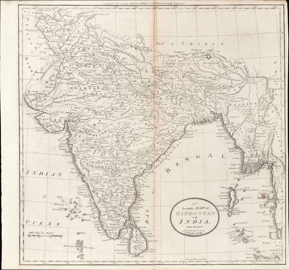
Map of Hindostan or India.
sold
- Digital Map Information
- Suitable for large format printing
- DPI: 600
- File Size: 10.77 MB
- File Type: ZIP / TIFF
- ICC color profile embedded
- Delivered instantly via download link
This is a rare c. 1796 map of South Asia from Carey's General Atlas, the first atlas published in the new American Republic. It shows the Indian subcontinent at a period of rapid transition towards the hegemony of the British East India Company (EIC). (more details)
Literary wonders of Paris.

The Literary Map of Paris.
sold
This is a 1988 Linda Ayriss pictorial literary map of Paris celebrating the City of Light and its contribution to world literature. Nearly 150 locations throughout Paris with connections to the lives of French and expatriate authors are numerically identified. Parisian monuments are illustrated pictorially, including the Eiffel Tower, the Louvre, Notre Dame, and the Arc de Triomphe. Major streets are illustrated, and city parks are highlighted, such as the Jardin des Tuileries, the Jardin des Plantes, and the Parc des Buttes Chaumont. Portraits of French literary giants appear to the left and right of the map, with Simone de Beauvoir, Jules Verne, Victor Hugo, Jean-Paul Sartre, Marcel Proust, and Colette among them. An illustration of the café Aux Deux Magots (a play on Les Deux Magots, a popular hangout for literary and intellectual elite in Paris beginning in the 1920s) dominates the bottom third of the sheet. The index of French authors occupies the café's awning and spills into the bottom left corner. An index of expatriates occupies the bottom right corner. (more details)
Urban development in the Land of Lincoln.
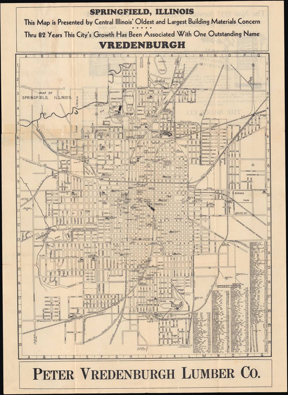
Map of Springfield, Illinois.
sold
- Digital Map Information
- Suitable for large format printing
- Full resolution TIFF file
- ICC color profile embedded
- Delivered instantly via download link
This is a very rare 1937 map of Springfield, Illinois, incorporated into an advertisement for Peter Vredenburgh Lumber Co. The map highlights important sites around the city, especially those connected to Abraham Lincoln, who resided in Springfield when he began his legal and political career. (more details)
Manuscript notations tracing the battle from the landings to the final day.
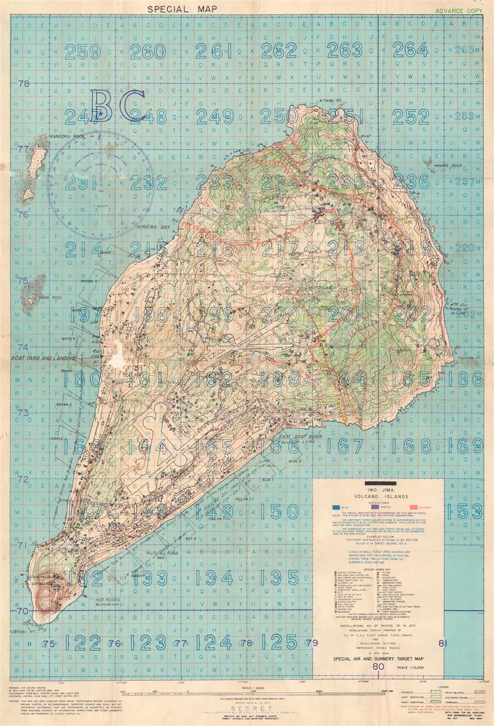
Iwo Jima Volcano Islands.
sold
- Digital Map Information
- Suitable for large format printing
- File Size: 43.45 MB
- File Type: ZIP / TIFF
- ICC color profile embedded
- Delivered instantly via download link
This is a 1944 U.S. Navy map of Iwo Jima. Depicting the entirety of the island, Iwo Jima's terrain is illustrated in detail, with contour lines emphasizing changes in elevation while color highlights changes in vegetation. Both airfields are identified and thirty-four symbols mark locations of Japanese positions, including pillboxes, radar, anti-tank guns, and machine guns. Unfortunately for the Marines landing on Iwo Jima, these installations were identified in November 1944, three months before the invasion in February 1945, meaning that this map is likely inaccurate. The invasion beaches are noted along the southern coasts of the island and their codenames, including Yellow 1 and Yellow 2, are provided. A grid meant to be used for directing airstrikes, artillery fire, and bombardment from naval vessels is superimposed over the entire map and instructions for how to direct this fire are provided. (more details)
…most complete and most comprehensive map undertaken by the Jesuits up to the middle of the eighteenth century. - Furlong
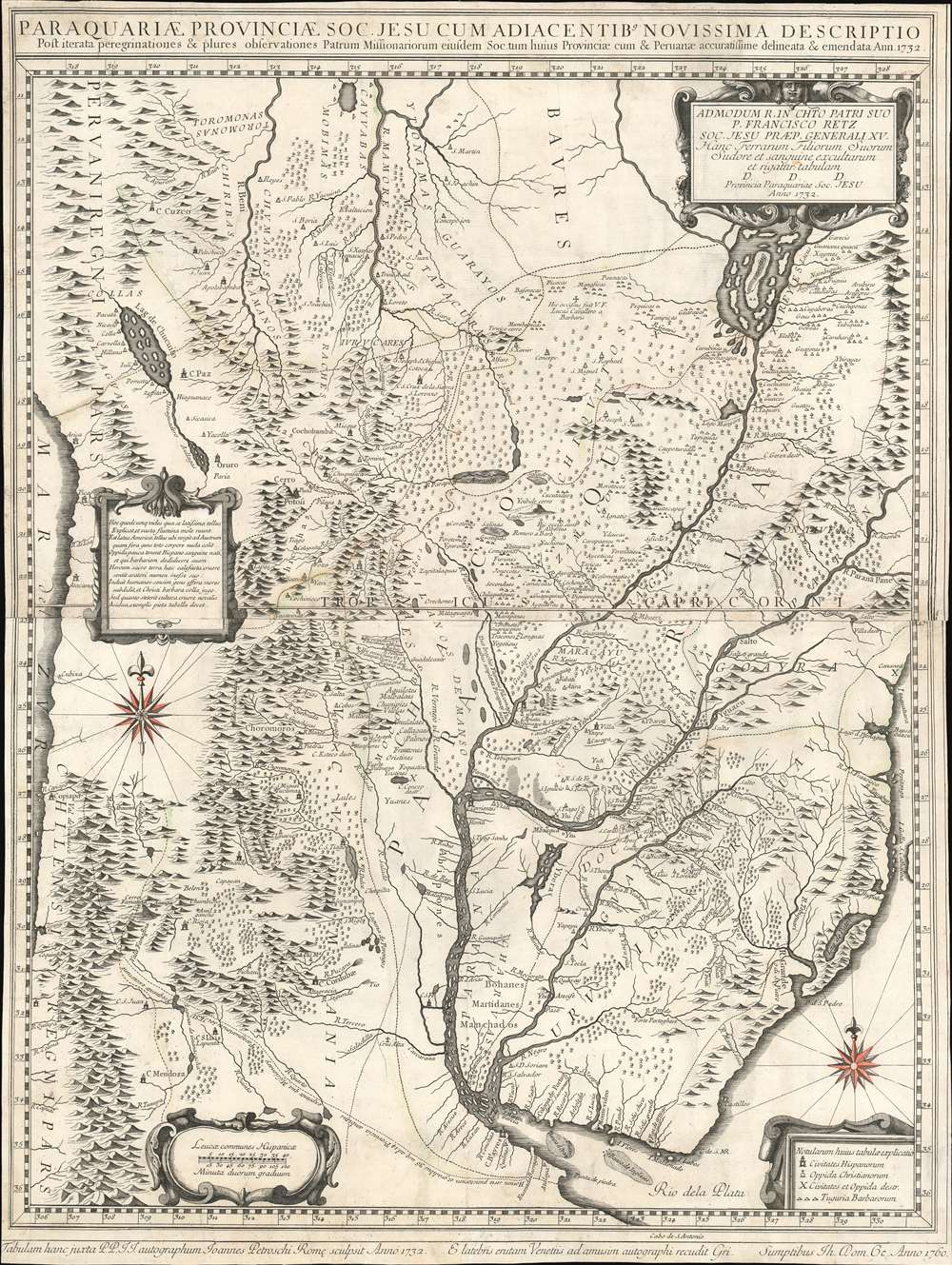
Paraquariae Provinciae Soc. Jesu Cum Adiacentibus Novissima Descriptio Post iterata peregrinationes et plures observationes Patrum Missionariorum . . . 1732.
sold
- Digital Map Information
- Suitable for large format printing
- Full resolution TIFF file
- ICC color profile embedded
- Delivered instantly via download link
A rare example of the 1760 edition of Jesuit lay brother Juan Francisco Dávila's map of Paraguay, Uruguay, and La Plata. The map details the Río de la Plata basin, presenting the most advanced cartographic representation of the region available at the time of publication. Coverage extends from the Pantanal region and the northern extremis of the Paraguay River, the fictional Laguna de Xarayes, to Buenos Aires, Montevideo, and the mouth of the Río de la Plata. Focus is on the Jesuit Reductions, inland Jesuit missionary settlements of extreme wealth and prosperity that dominated the inland river systems between the Paraná River and the foothills of the Andes. (more details)
Cornerstone map of Australian discovery and colonization.
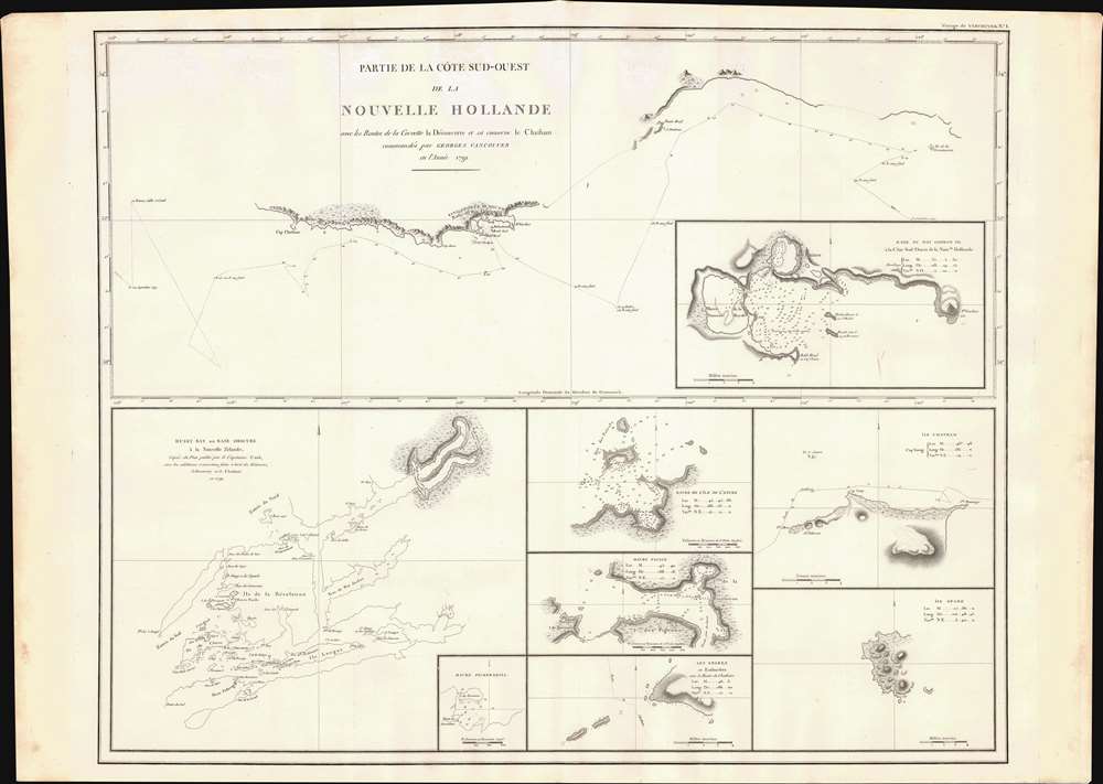
Partie de la Cote Sud-Ouest de la Nouvelle Hollande avec les Routes de la Corvette la Decouverte et sa conserve le Chatham commandes par Georges Vancouver en l'Annee 1791.
sold
- Digital Map Information
- Suitable for large format printing
- DPI: 600
- File Size: 29.25 MB
- File Type: ZIP / TIFF
- ICC color profile embedded
- Delivered instantly via download link
One of the great navigator George Vancouver's most important and influential maps, this is Vancouver's 1799 mapping of southwestern Australia and New Zealand. Though less well known than his historic mapping of the Pacific Northwest, Vancouver's work in Australia and New Zealand is no less significant. (more details)
Stealing Zimbabwe.
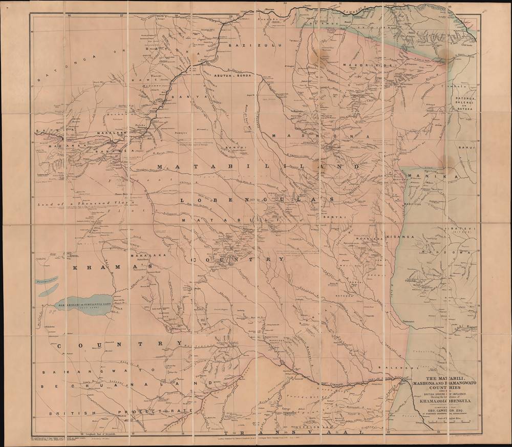
The Matabili, Mashona and Bamangwato countries within the British sphere of influence.
sold
- Digital Map Information
- Suitable for large format printing
- Full resolution TIFF file
- ICC color profile embedded
- Delivered instantly via download link
This is an important 1889 George Cawston folding map of gold fields and other mineral resources in territories that now are primarily in Zimbabwe. It was made as British interest in establishing mining operations in these regions was peaking, cemented by the formation of the British South Africa Company, of which Cawston was a founding member. (more details)
Published the year after the Adirondack Park was created.
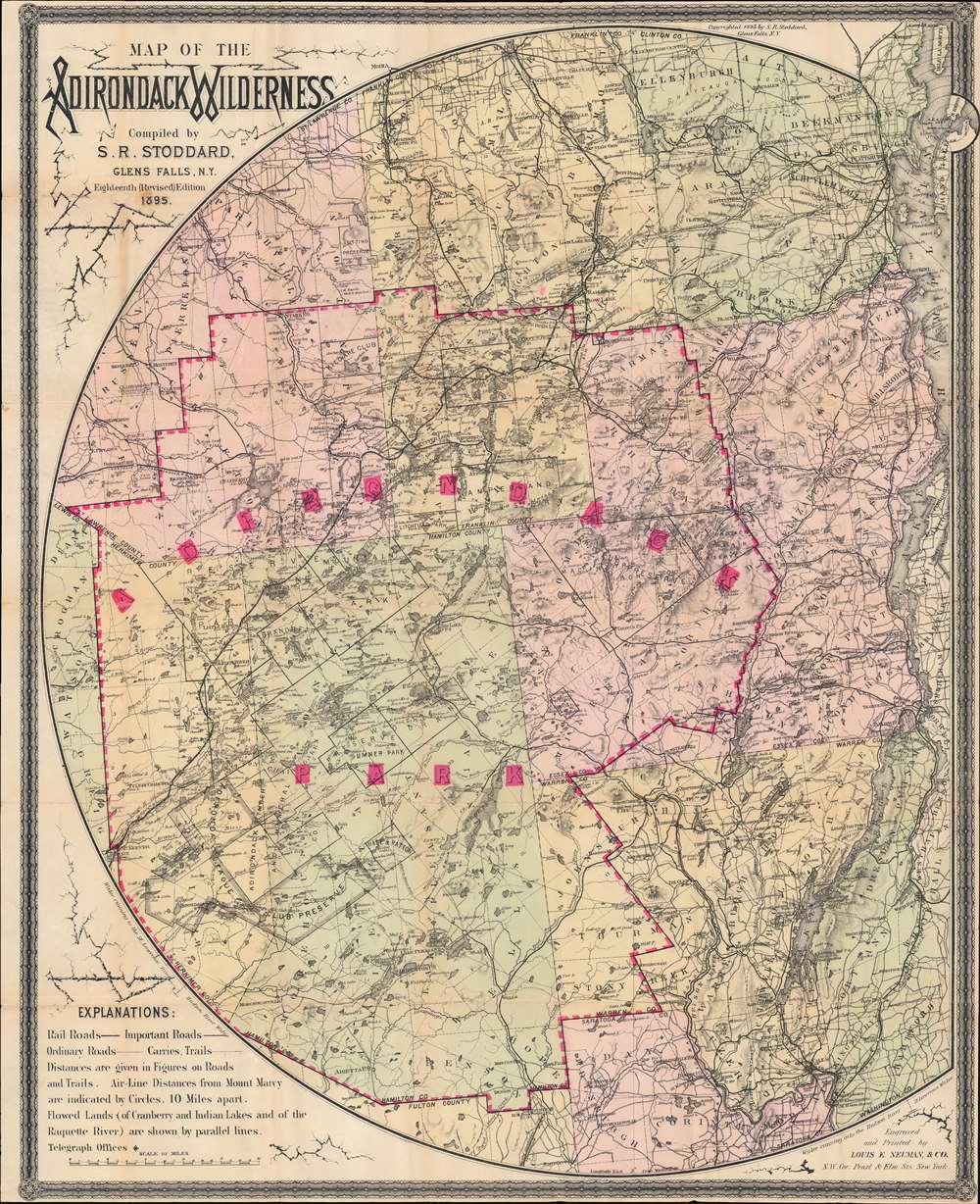
Map of the Adirondack Wilderness.
sold
- Digital Map Information
- Suitable for large format printing
- Full resolution TIFF file
- ICC color profile embedded
- Delivered instantly via download link
This is an 1895 Seneca Ray Stoddard map of the Adirondacks, New York, highlighting the Adirondack State Park. This one of the earliest obtainable commercial maps of the Adirondack Wilderness, published only 2 years after the park's founding, at the height of the Naturalist Movement and the Adirondack Gilded Age. (more details)
Considered to be a landmark map in the field of geology.
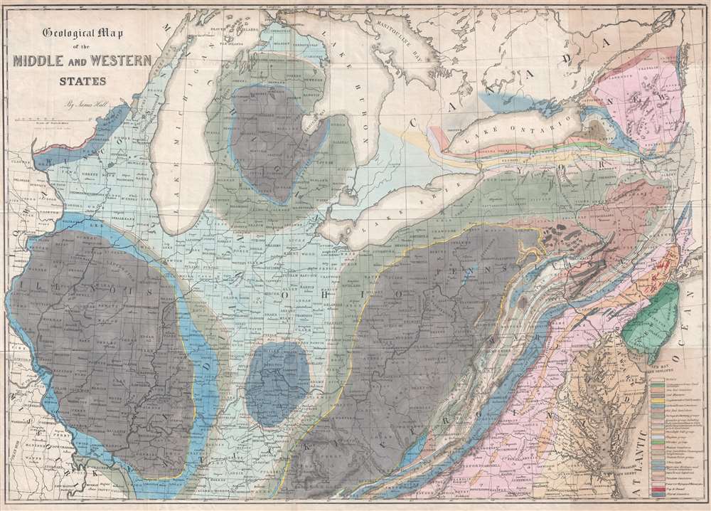
Geological Map of the Middle and Western States.
sold
- Digital Map Information
- Suitable for large format printing
- DPI: 300
- File Size: 17.64 MB
- File Type: ZIP / TIFF
- ICC color profile embedded
- Delivered instantly via download link
This is an 1843 James Hall geological map of the central United States. The map depicts the region from the Mississippi River to the Atlantic Ocean and from the Straits of Michilimackinac (Michillimaoinac) and Montreal, Canada to Virginia, Kentucky, and Missouri. As the first published map to use the 'New York System' of stratigraphic nomenclature, developed by Hall and other members of the New York Geological Survey, Hall's map is considered a landmark map in geological cartography. Rivers, lakes, and other physical features are also illustrated, with four of the five Great Lakes situated along the top. (more details)
A colorful city plan or map of Mumbai / Bombay.
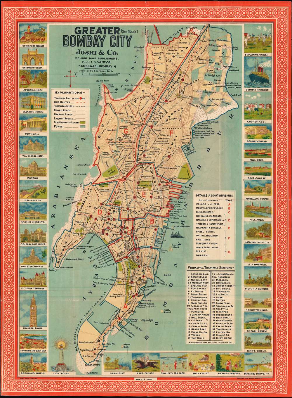
Bombay City.
sold
- Digital Map Information
- Suitable for large format printing
- File Size: 30.54 MB
- File Type: ZIP / TIFF
- ICC color profile embedded
- Delivered instantly via download link
This is a c. 1940 Joshi and Company city plan or map of Bombay (Mumbai), India. Depicting the city from the Arabian Sea to Bombay Harbor and from Mahim Creek to Colaba Point, districts and neighborhoods are labeled throughout. Locations identified, include temples, hospitals, and mills. The city's tram and bus routes are illustrated, with forty numbered tramway stations listed in a table in the lower right. Pictorial views of sites around the city are included along the left, right, and bottom borders and include views of the Taj Mahal Hotel, the museum, the Science Institute, Victoria Gardens, and the racecourse. (more details)
One of the best places to live in Florida.

The Coral Springs Master Development Plan.
sold
This is the only known surviving example of the c. 1966 masterplan of Coral Springs, Florida. The map was issued for Coral Ridge Properties, the town's developer. Coral Springs is today a successful example of community planning, consistently ranked as one of the best places to live in Florida. (more details)