
Translating calendars and thought systems between the West and China.

中西合厯 / Combined Chinese and Western Calendar.
sold
- Digital Map Information
- Suitable for large format printing
- File Size: 15.75 MB
- File Type: ZIP / TIFF
- ICC color profile embedded
- Delivered instantly via download link
A rare 1889 (Guangxu 15) missionary broadside printed by the Combined Learning Publishing House (同文書局), the first Chinese owned lithographic press in Shanghai. The broadside attempts to link the wonders of western technology, such as trains and suspension bridges, with Christianity. (more details)
Geographical gaming at its best!
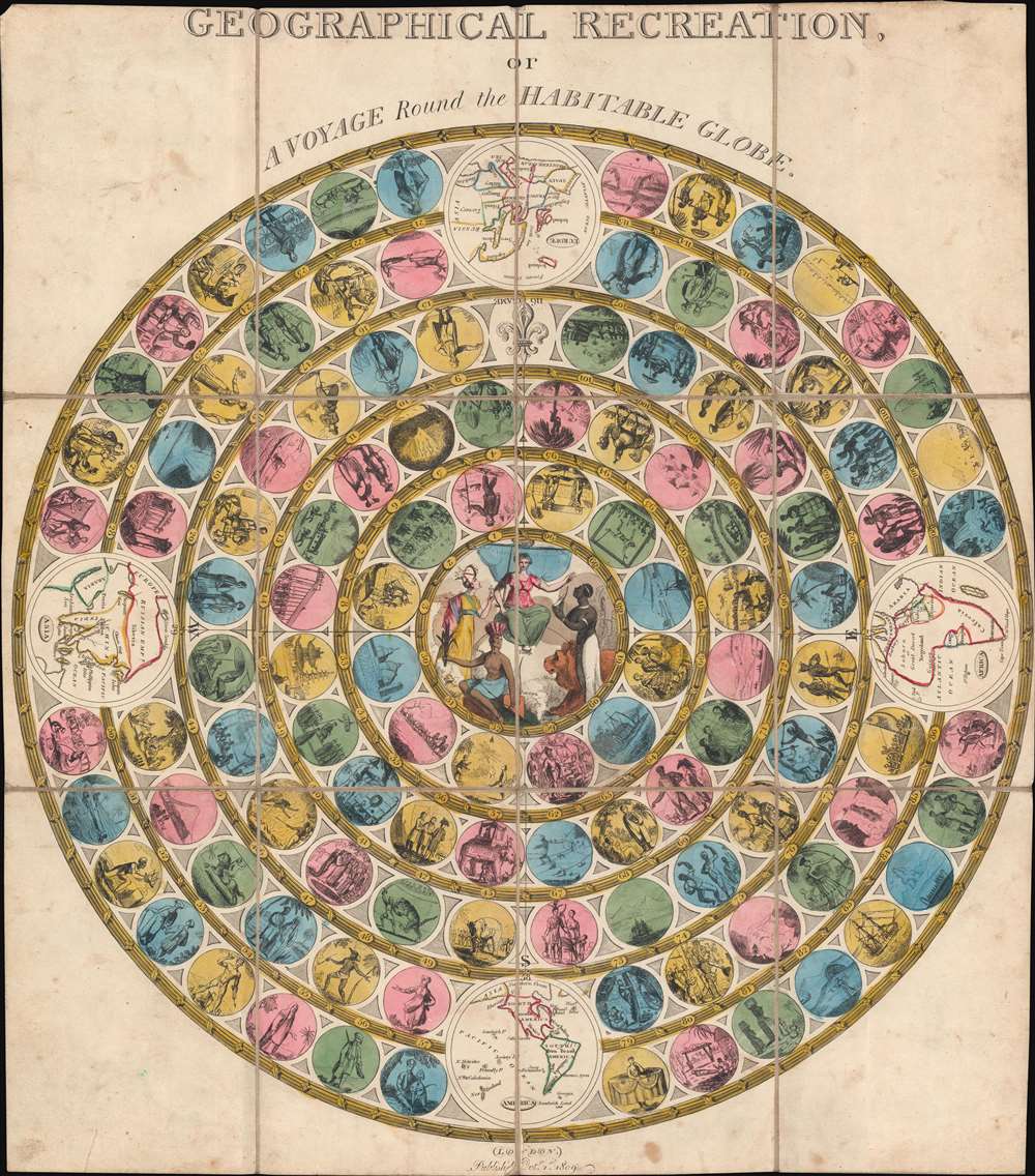
Geographical Recreation, or A Voyage Round the Habitable World.
sold
- Digital Map Information
- Suitable for large format printing
- Full resolution TIFF file
- ICC color profile embedded
- Delivered instantly via download link
A different take on a classic game, this 1809 John Harris map game of the world takes players on a journey through the British Empire. Divided into four quadrants (Asia, the Americas, Africa, and Europe), players move along concentric rings filled with 116 circles. Each circle bears a vignette of something encountered by players on the journey around the world. One such circle bears the death of Captain James Cook. Britannia appears in the middle, with personifications of Africa, Asia, and the Americas fawning over her. Slightly larger circular vignettes present maps of the continents. (more details)
Rare map of Nantucket printed in Nantucket!
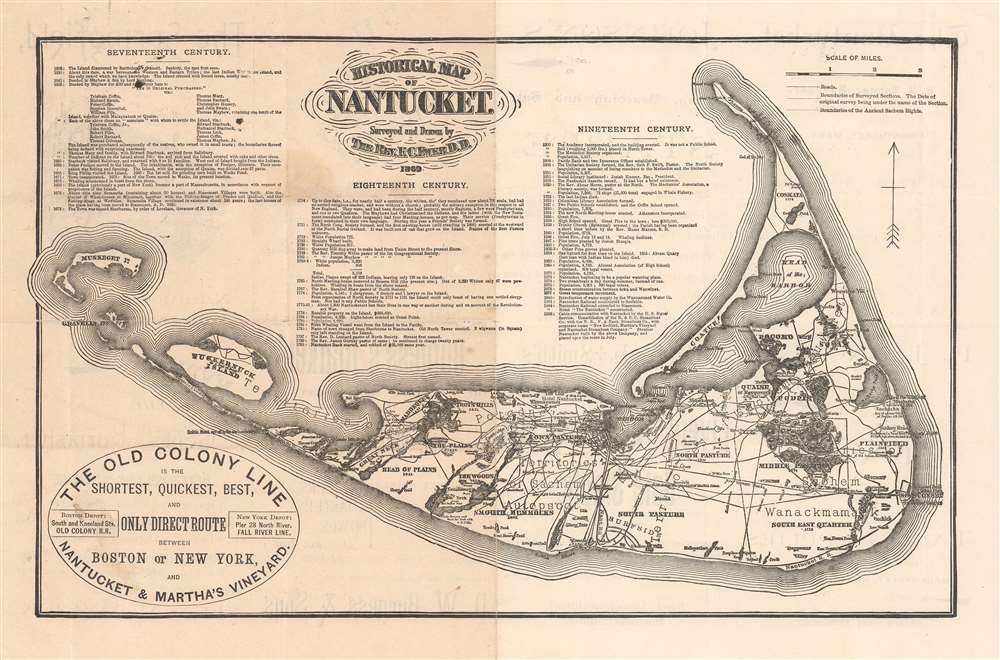
Historical Map of Nantucket.
sold
- Digital Map Information
- Suitable for large format printing
- Full resolution TIFF file
- ICC color profile embedded
- Delivered instantly via download link
This attractive c. 1886 map is a reduced version of Reverend F. C. Ewers important 1869 map of Nantucket. Printed in Nantucket, this variant was issued by the Old Colony Line in various formats from roughly 1872 to 1889. A medallion in the lower-left promotes the 'Old Colony Line' as the 'Shortest, Quickest, Best, and Only Direct Route between Boston or New York and Nantucket and Martha's Vineyard.' Features three columns of text breaking down the history of Nantucket from its discovery by Bartholomew Gosnold in 1602 to the laying of the first communications cables between Nantucket and the mainland in 1886 - hence our dating. (more details)
Pundit explorations in Tibet and Nepal.
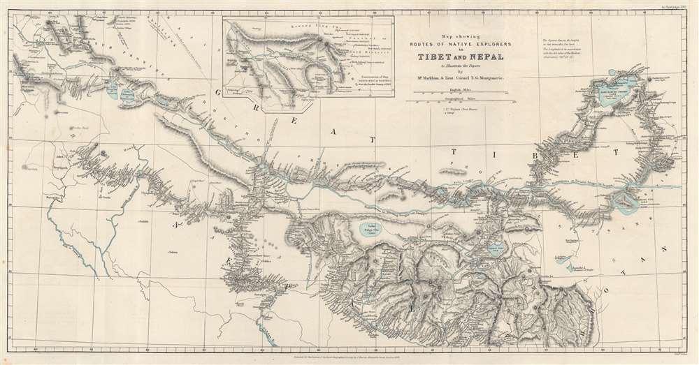
Map showing Routes of Native Explorers in Tibet and Nepal to Illustrate the Papers by Mr. Markham and Lieut. Colonel T.G. Montgomerie.
sold
- Digital Map Information
- Suitable for large format printing
- File Size: 14.11 MB
- File Type: ZIP / TIFF
- ICC color profile embedded
- Delivered instantly via download link
Discover routes of secret survey and exploration trips in the vicinity of Mount Everest with this 1875 John Murray and Royal Geographical Society map of Nepal and Tibet. Dashed and dotted lines follow the routes of 'pundits', native Indian surveyors employed by the British to secretly survey Tibet and Nepal - areas restricted to the British on pain of death. (more details)
Rare navigational chart detailing Cape Ann.
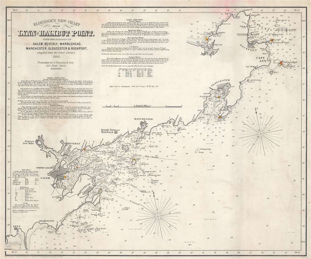
Eldridge's New Chart From Lynn to Halibut Point. With the Harbors of Salem, Beverly, Marblehead, Manchester, Gloucester, and Rockport.
sold
- Digital Map Information
- Suitable for large format printing
- File Size: 15.2 MB
- File Type: ZIP / TIFF
- ICC color profile embedded
- Delivered instantly via download link
This is an 1880 George Eldridge nautical chart or maritime map of Cape Ann and Marblehead, this embracing the Massachusetts North Shore. Focusing on the Massachusetts coast from Halibut Point and Annisquam to Lynn, the chart identifies important navigational landmarks as well as hazards. Cities and towns, including Rockport, Gloucester, Manchester, Beverly, Salem, and Marblehead, appear. Yellow and red manuscript notations mark coastal lights. Coastal features, such as points, heads, bays, and coves, are marked. Islands are illustrated. Depth soundings are indicated along the coast, with ledges, banks, shoals, and other hazards noted as well. Navigation instructions for approaching Salem, Beverly, and Marblehead are present as well. Detailed sailing directions are included in the upper left corner. (more details)
A rare city plan of Lisbon.
Lissabon und seine Umgegend.
sold
- Digital Map Information
- Suitable for large format printing
- Full resolution TIFF file
- ICC color profile embedded
- Delivered instantly via download link
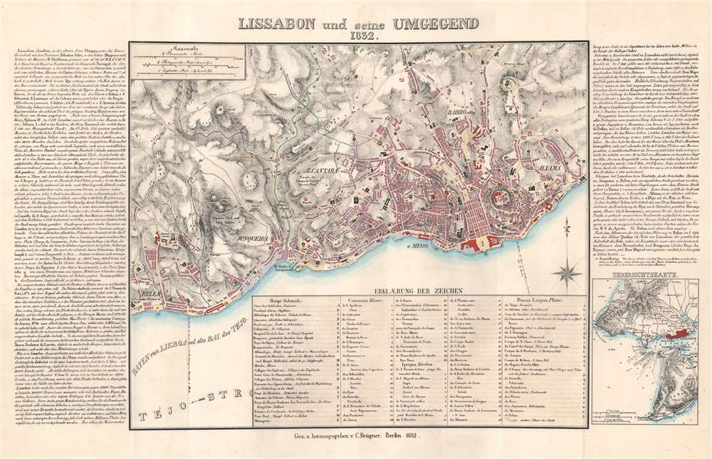
This is a rare 1832 C. Brügner city plan or map of Lisbon, Portugal, and environs. Depicting the central Lisbon from Belem to Alfalma, locations throughout are identified alphabetically and numerically. Uppercase letters mark important buildings: eg. the hospital, schools, and zoo. Lowercase letters identify public plazas. Coded typefaces label locations, with italicized numbers for churches, and non-italicized numbers for convents. German text along the left and right provide information about the city. Cartographically it is derived from the great Jozé Fava plan of 1831 - the definitive plan of Lisbon until the late 19th century. (more details)
A graphically stunning postcard image celebrating the Panama Canal.

Meeting of the Atlantic and Pacific. 'The Kiss of the Oceans 1915'.
sold
- Digital Map Information
- Suitable for large format printing
- File Size: 3.17 MB
- File Type: ZIP / TIFF
- ICC color profile embedded
- Delivered instantly via download link
This is a 1910 Charles A. de Lisle-Holland postcard map of the America's drawn to promote the construction of the Panama Canal. The postcard, entitled, 'the kiss of the oceans', incorporates two nereids, representing the Atlantic and Pacific, kissing at the Panama Canal. Statistics about the canal appear in the upper right, including its length, width, history, estimated concrete usage, and anticipated date of completion. (more details)
A relic of the golden age of polar exploration.
Nord-Grönland. / [North Greenland].
sold
- Digital Map Information
- Suitable for large format printing
- File Size: 23.19 MB
- File Type: ZIP / TIFF
- ICC color profile embedded
- Delivered instantly via download link
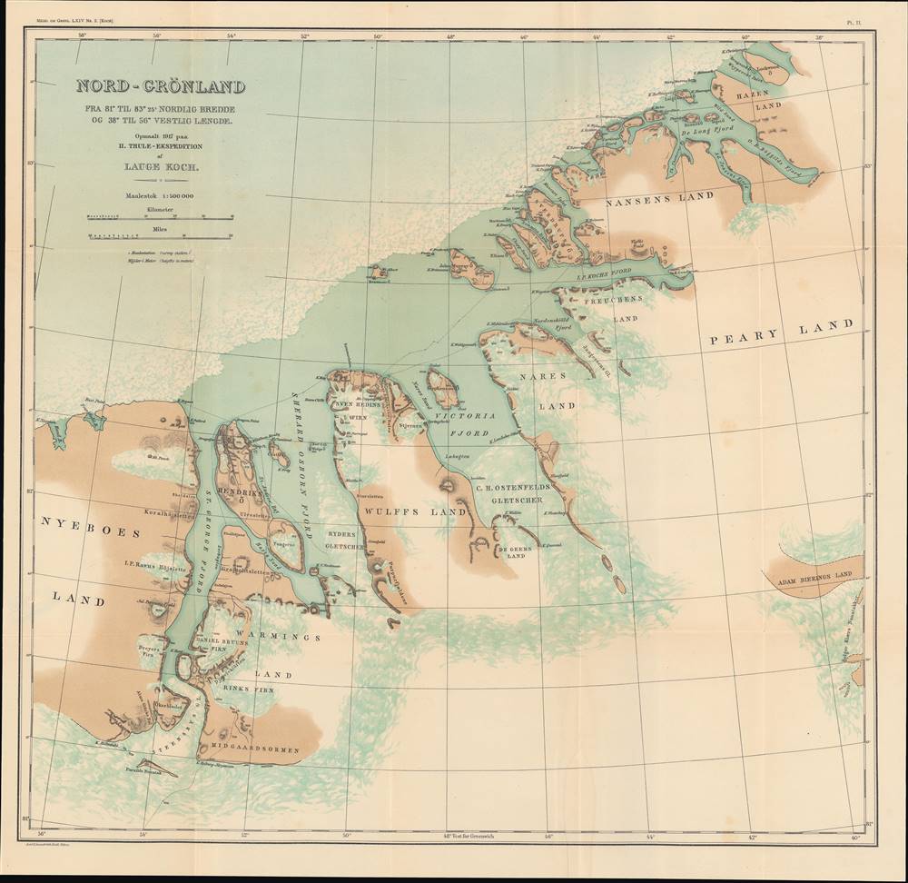
This is a very rare 1922 map of northern Greenland by Lauge Koch. Koch participated in the Second Thule Expedition (Knud Rasmussen; 1916 - 1918), an important achievement in the history of polar exploration. It details the route of the expedition, undertaken in 1916 – 1918, and the surrounding geography, much of it mapped for the first time. (more details)
Uncatalogued state of an Orlando, Florida city map.

Orlando - 'Florida's City Beautiful'.
sold
- Digital Map Information
- Suitable for large format printing
- File Size: 21.47 MB
- File Type: ZIP / TIFF
- ICC color profile embedded
- Delivered instantly via download link
This is a 1936 Orlando Chamber of Commerce city plan or map of Orlando, Florida. Coverage extends from central Orlando from Par Avenue south to Lake Wade. An alphabetic street index spreads across three of the map's four corners, further aiding motorists. A thick red line highlights a 'twenty-three mile scenic drive' promoted by the Orlando Chamber of Commerce that visits many of Orlando's lakes and other landmarks, including the Mead Botanical Garden. (more details)
Animals from all over the world!

Map of the Animals in the Zoo.
sold
This is a c. 1955 Lloyd Sandford pictorial map of the Bronx Zoo, New York City. Small profile illustrations highlight many of the different species found in the zoo, including their famous bison, giraffe, wolverines, moose, hippos, camels, polar bears, and Pere David Deer. Some animals, including the platypus and the penguins, are mentioned but not illustrated. Four different areas within the zoo are listed along the bottom and present an even more detailed overview of what animals and amenities can be found where. (more details)
The Most Beautiful 15th Century Map of the World.
[Untitled map of the World].
sold
- Digital Map Information
- Suitable for large format printing
- DPI: 600
- File Size: 18.86 MB
- File Type: ZIP / TIFF
- ICC color profile embedded
- Delivered instantly via download link
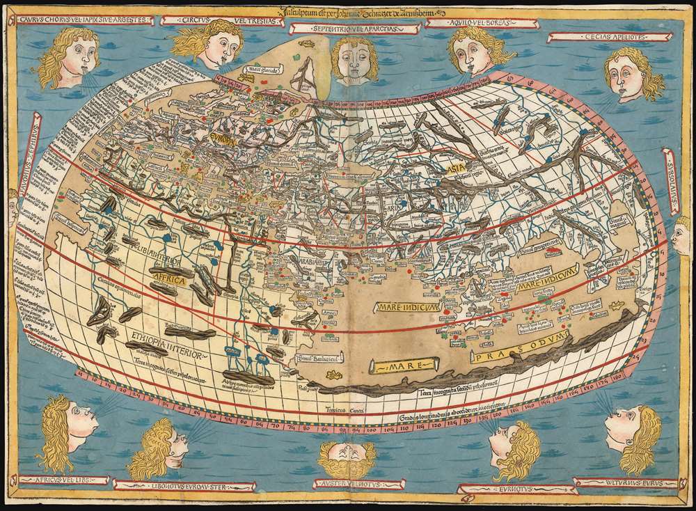
This is a beautiful example, in rich original color, of the world map of the 1486 Ulm Ptolemy: regarded as the most beautiful, printed world map of the 15th century. The present example is one of the finest to appear on the market in recent years. It appeared in the first edition of Ptolemy printed north of the Alps, and as such it provided the foundation for the revolution in geographical knowledge that occurred in the opening years of the 16th century. The 'world' as depicted here is mainly the Oikumene, the inhabited world as it was known to 2nd century Romans. It covers the 'Old World' from the islands of the Atlantic Ocean (both real and legendary) to Indochina, and from the Arctic to the Tropic of Capricorn. But this was also the first printed world map to depart from a purely Ptolemaic model, offering more contemporaneous knowledge: the early depiction of Scandinavia and Iceland. (more details)
Very rare early map of the waters around Bombay (Mumbai).
A large chart of part of the coast of GUZARATT and INDIA from Diu head to Bombay.
sold
- Digital Map Information
- Suitable for large format printing
- DPI: 600
- File Size: 19.99 MB
- File Type: ZIP / TIFF
- ICC color profile embedded
- Delivered instantly via download link
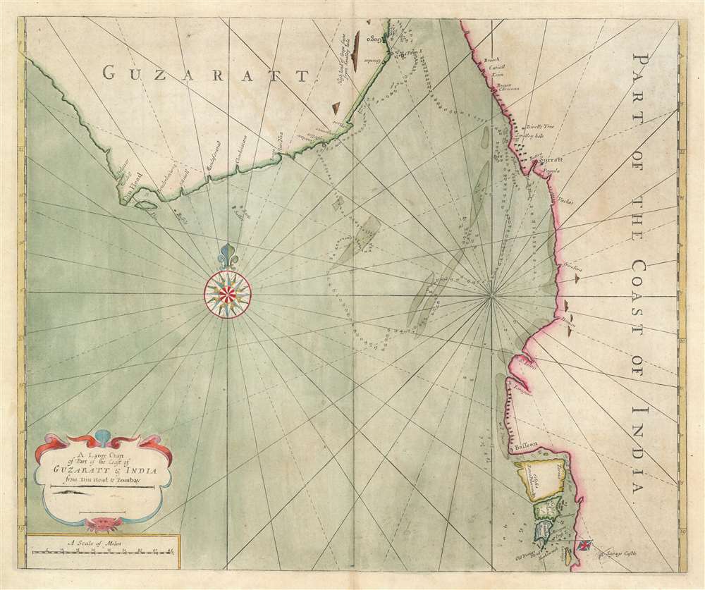
An extremely rare c. 1716 nautical chart or maritime map illustrating the Gujarat coast of India and the Gulf of Khambhat in the vicinity of Bombay or Mumbai. The map covers the coastline from, roughly Somnath and Diu to Vadodara, and south to Mumbai. The area now occupied by the Mumbai Peninsula is here divided into three islands, Tarma, Salset, and Bombay. Only one of these islands, Tarma, is connected to the mainland via a narrow bridge. On the southernmost island, Bombay is identified with the British flag, making this one of the earliest maps to illustrate Bombay following the 1661 British takeover. At sea, there are tenuous soundings and shadings around the shoals in the Gulf of Khambhat, also known as the Gulf of Cambay, and around Bombay itself. (more details)
First European map to identify polities within the Malay Peninsula.
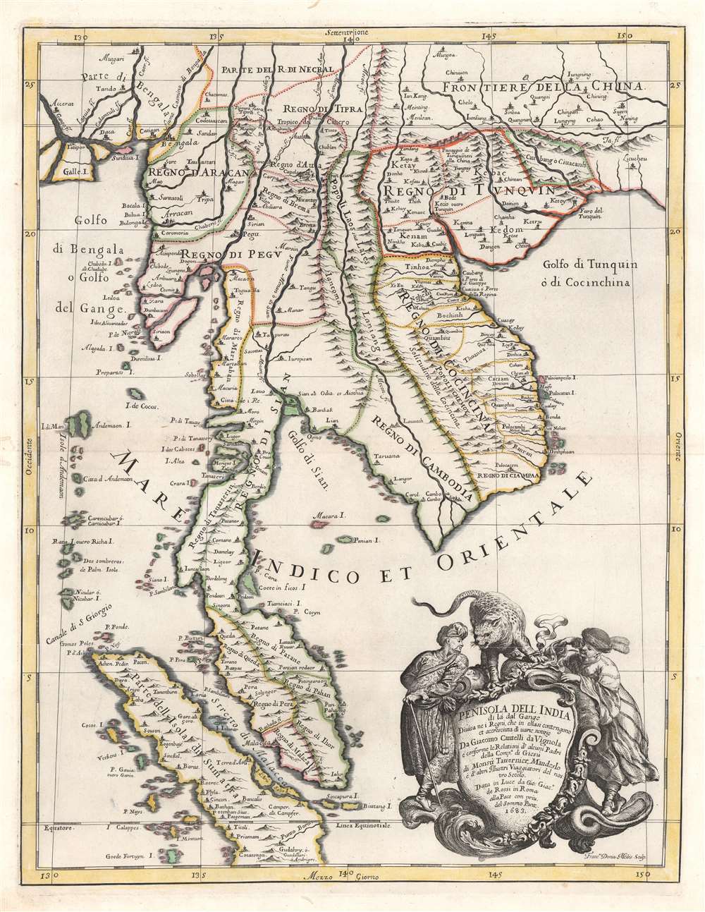
Penisola Dell India di la dal Gange Diusa ne i Regni, che in essasi contengono et accresciuta di varie notizie. Da Giacomo Cantelli da Vignola e conforme le Relationi di alcuni Padri della Compa di Giesu di Monsu Tavernier, Mandeslo e d`altri Illustri Viaggiatori del nostro Secolo . . . 1683.
sold
- Digital Map Information
- Suitable for large format printing
- Full resolution TIFF file
- ICC color profile embedded
- Delivered instantly via download link
A rare, highly decorative, and cartographically significant 1683 map of Southeast Asia by Giacomo Cantelli da Vignola and Giacomo de Rossi. This is one of the first maps of Southeast Asia to incorporate independent polities in Malay based on new information from Johan Albrecht de Mandelslo (1616 - 1644) and Jean-Baptiste Tavernier (1605 - 1689). Centered on modern-day Bangkok, which is noted, this stunning map includes most of modern-day Thailand, all of Malaysia, Laos, Cambodia, Vietnam, and Singapore, and parts of Burma, China, and Sumatra. Bangkok is noted, although when this map was published, it had not yet risen to prominence. Conversely so too is the city of Aracan, which, when this map was issued, was at its height of nearly 160,000 people. Today it is better known as the remote and crumbling ruin of Mrauk U. A large and dramatic cartouche demands attention in the lower right and features two Southeast Asian potentates in postures of aristocratic savoir-faire. The shield itself is surmounted by an impressive snarling leopard. (more details)
The Shanghai Taxi War!

Map of Shanghai. Compliments of Navy Y.M.C.A. Shanghai, China.
sold
- Digital Map Information
- Suitable for large format printing
- Full resolution TIFF file
- ICC color profile embedded
- Delivered instantly via download link
This is a 1938 Navy Y.M.C.A. city plan or map of Shanghai, China, featuring red overprinted advertisements for Coca-Cola. Focusing on the International Settlement, a haven of relative calm in a war-torn city, the map depicts the part of the city from Kwang Wha University to the Huangpu (Whangpoo) River and from the Far Eastern Race Course to South Station. Highly detailed, individual streets throughout the International Settlement are illustrated and labeled, as are the major streets outside the settlement. A red border marks the boundaries of the International Settlement and red overprinting indicates the location of the Navy Y.M.C.A. (more details)
Identifies all the U.S. Army divisions tasked with the defense of Saigon.
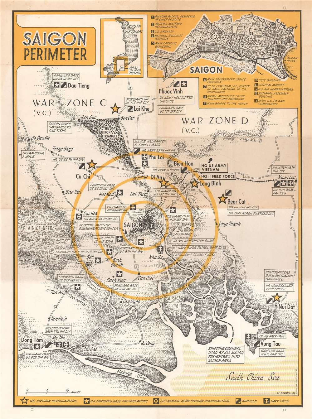
Saigon Perimeter.
sold
This is a c. 1968 G.W. Braunsdorf map of the vicinity of Saigon, South Vietnam during the Vietnam War. Depicting the region from Go Dau Ha to Xuan Loc and from Dau Tieng to the Mekong River and the South China Sea. Saigon is illustrated just below center with concentric circles emanating out from the city. U.S. Army division headquarters are marked by yellow stars, and each are labeled, marking the headquarters of the U.S. 25th Infantry Division, 9th Infantry Division, 11th Armored Cavalry Regiment, and the 199th Light Infantry Brigade, among others. The division headquarters of several South Vietnamese army divisions are also identified, along with forward headquarters of several American infantry divisions. Airfields and naval bases are also indicated. An inset map of Saigon itself is situated in the upper right corner and identifies fourteen important locations around the city. Some, such as bars that catered to American personnel, the central market, the U.S. Embassy, main U.S. military headquarters, and the main U.S. PX and commissary would be important to Americans in Saigon, while others, such as the National Buddhist Institute and the main Catholic cathedral, would have been of more touristic interest. A second, smaller inset situates the larger map in respect to the rest of the country. (more details)
Propaganda map with a preemptive declaration of victory.

旅順陷落占領地早見 / [Early Look at Captured and Occupied Lüshun].
sold
- Digital Map Information
- Suitable for large format printing
- File Size: 36.22 MB
- File Type: ZIP / TIFF
- ICC color profile embedded
- Delivered instantly via download link
This is an exceptionally rare 1904 birds-eye view of Korea, Manchuria, Japan, and China, focusing on Port Arthur (Lüshunkou; 旅順口), made by Sehara Sutematsu during the Russo-Japanese War. The map's title is a bit presumptive. While Japan had won a series of victories just before the map's production and besieged the Russians in Port Arthur, the defenders would hold out until early January 1905. (more details)
A guide to the historically and archaeologically rich region of Sistan.
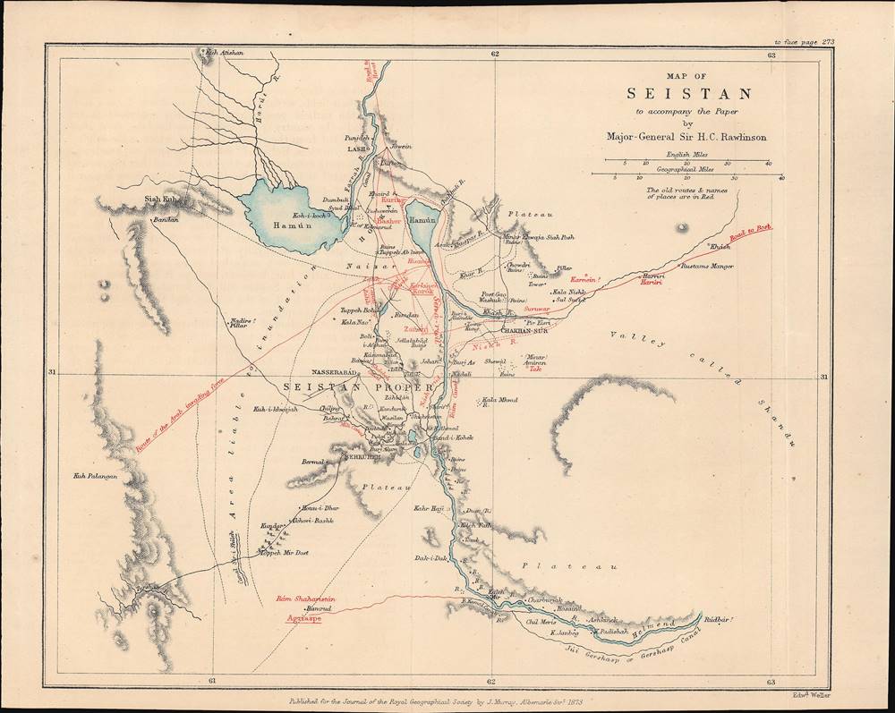
Map of Seistan, to accompany the Paper by Major-General Sir H.C. Rawlison.
sold
- Digital Map Information
- Suitable for large format printing
- File Size: 3.47 MB
- File Type: ZIP / TIFF
- ICC color profile embedded
- Delivered instantly via download link
This is a rare 1873 Weller and H. C. Rawlinson map of Sistan (Seistan), on the border of modern Iran and Afghanistan near Baluchistan, Pakistan. It was prepared to illustrate the British intelligence officer, H. C. Rawlinson's, expedition into the region - a strategic reconnaissance in the Great Game. This region remains to this day little known and is rarely prested cartographically - this possibly being the only 19th-century specific map. (more details)
Japan's Expanding Empire on the Eve of the Second-Sino Japanese War.

日滿露支交通國境大地圖 / [Map of Transportation and National Borders of Japan, Manchukuo, the Soviet Union, and China].
sold
- Digital Map Information
- Suitable for large format printing
- File Size: 92.59 MB
- File Type: ZIP / TIFF
- ICC color profile embedded
- Delivered instantly via download link
This is a large 1935 map of Northeast Asia (Japan, Korea, Manchuria, northern China, Mongolia, Siberia) that appeared in the Japanese newspaper, Osaka Mainichi Shimbun. It is designed to highlight transportation and communication lines connecting Japan's empire at a time when the empire was expanding and Japan's domestic politics were moving towards militarism. (more details)
Early astronomical diagram.

[Untitled Celestial Sphere].
sold
- Digital Map Information
- Suitable for large format printing
- Full resolution TIFF file
- ICC color profile embedded
- Delivered instantly via download link
This elegant celestial chart is a woodcut illustration from Sebastian Münster's magnum opus, Cosmographia Universalis, entitled in its later editions Cosmographey. Beginning in 1544, this work would be the primary source of information for anyone who wished to know about not only the rest of the world, but the cosmos as it was understood. So, in addition to Münster's better-known maps and views, the first part of his Cosmographia included an array of astronomical charts. The present diagram is meant to explain the mechanism by which the seasons change in different parts of the world. It shows the axis of the Earth's poles in relation to the sun; illustrates the equator, the tropics of Cancer and Capricorn; and shows the apparent axial tilt of the rotation of the heavens around the Earth. (Münster sidesteps the question of whether it is the Earth that rotates, or the heavens around it, although his language in the accompanying text implies somewhat that it is the heavens that move. Copernicus' writings on heliocentrism were still quite new. Although Münster's world map, produced with Grynaeus and Hans Holbein the Younger, suggests that Münster was well aware of the idea of the rotation of the globe.) (more details)
Ernest Hemingway's life, work, and adventures.
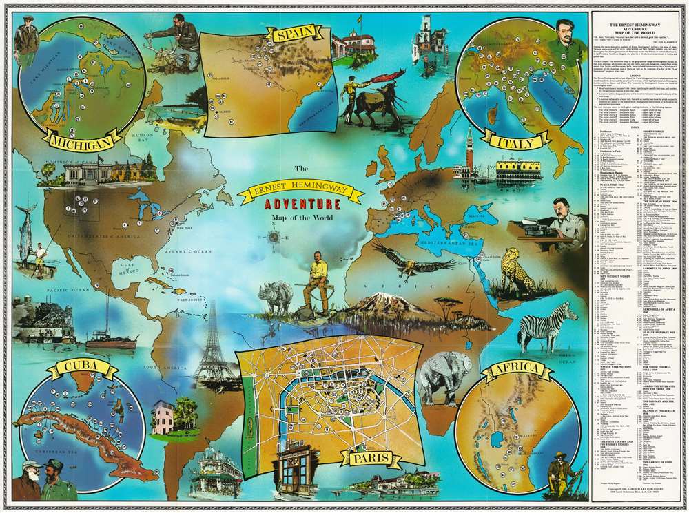
The Ernest Hemingway Adventure Map of the World.
sold
This is Molly Maguire and Jay Strabala 1986 'Ernest Hemmingway' literary map of the world, highlighting residences, haunts, and literary sites. Coverage extends from the Americas to the Middle East with six inset maps situated along the borders. 190 numerically identified locations are scattered across the map marking important places in Hemingway's life or works. Illustrations of some, including Mount Kilimanjaro, Havana Harbor, Venice, and several Parisian sites (such as the Eiffel Tower, Shakespeare and Company, and the Seine River) create the sense of worldwide adventure. Beginning in the upper left, the inset maps detail Michigan, Spain, Italy, Cuba, Paris, and Africa. Portraits of 'Papa' Hemingway appear close to each of these insets. An index along the right lists Hemingway's residences (his residences in Paris are separated out), and sites in his books, including The Sun Also Rises, A Farewell to Arms, For Whom the Bell Tolls, and The Old Man and the Sea. (more details)