
Mozarabic archeological wonder.
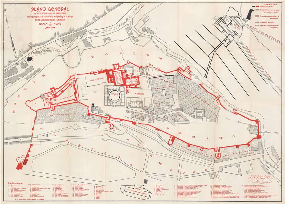
Plano General de la Fortaleza de la Alhambra con las propiedades particulares enclavadas en el mismo así como las exteriores adosadas á las murallas.
sold
- Digital Map Information
- Suitable for large format printing
- File Size: 30.85 MB
- File Type: ZIP / TIFF
- ICC color profile embedded
- Delivered instantly via download link
This is a 1908 Modesto Cendoya y Busquets map of the Alhambra, Granada, Spain. Three indexes identify locations around the palace / fortress. One identifies towers, gates, and other places along the Alhambra's extensive walls and the second uses letters to mark major buildings within the complex. The third index, also numerical, labels rooms and smaller buildings. Buildings colored red and solid black were built by the Arabs when they ruled southern Spain. However, some buildings were built after the Reconquista, when the building was used as a palace by Christian kings. (more details)
One of the Earliest Colonial Maps of the North American East Coast.
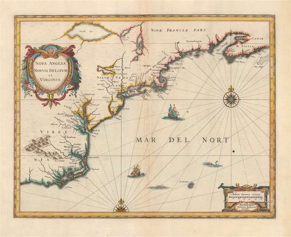
Nova Anglia Novum Belgium et Virginia.
sold
- Digital Map Information
- Suitable for large format printing
- Full resolution TIFF file
- ICC color profile embedded
- Delivered instantly via download link
A beautiful first state example of Jan Jansson's 1636 map of the North American coastline from Cape Lookout (here identified as C. of Feare) to Nova Scotia. The map includes parts of modern-day North Carolina, Virginia, Maryland, Delaware, New York, New Jersey, Massachusetts, Connecticut, Rhode Island, Vermont, New Hampshire, Maine, and Nova Scotia. Most particularly, it offers some of the earliest depictions of the Chesapeake Bay, Delaware Bay, Manhattan Island, New Amsterdam, Long Island, and the Great Lakes. It is also among the first maps to accurately portray the position of Bermuda vis-a-vis the American coastline. (more details)
Qing Beijing!

清國北亰全圖 / [Complete Map of Qing Beijing].
sold
- Digital Map Information
- Suitable for large format printing
- Full resolution TIFF file
- ICC color profile embedded
- Delivered instantly via download link
This is a rare 1894 map of Beijing by the Japanese cartographer Kitaro Kumazawa (熊澤喜太郎) that details the streets and hutong of Beijing along with important buildings and sites. The map has two inset drawings of the Forbidden City (故宮, noted here in the Japanese style as 皇居) and the Zhengyang Gate (正陽門), the main southern gate to the inner city just below Tiananmen Square. A description at the right gives a brief history of Beijing and an explanation of the division of the city into inner and outer sections. (more details)
One of the earliest works of a seminal American mapmaker.
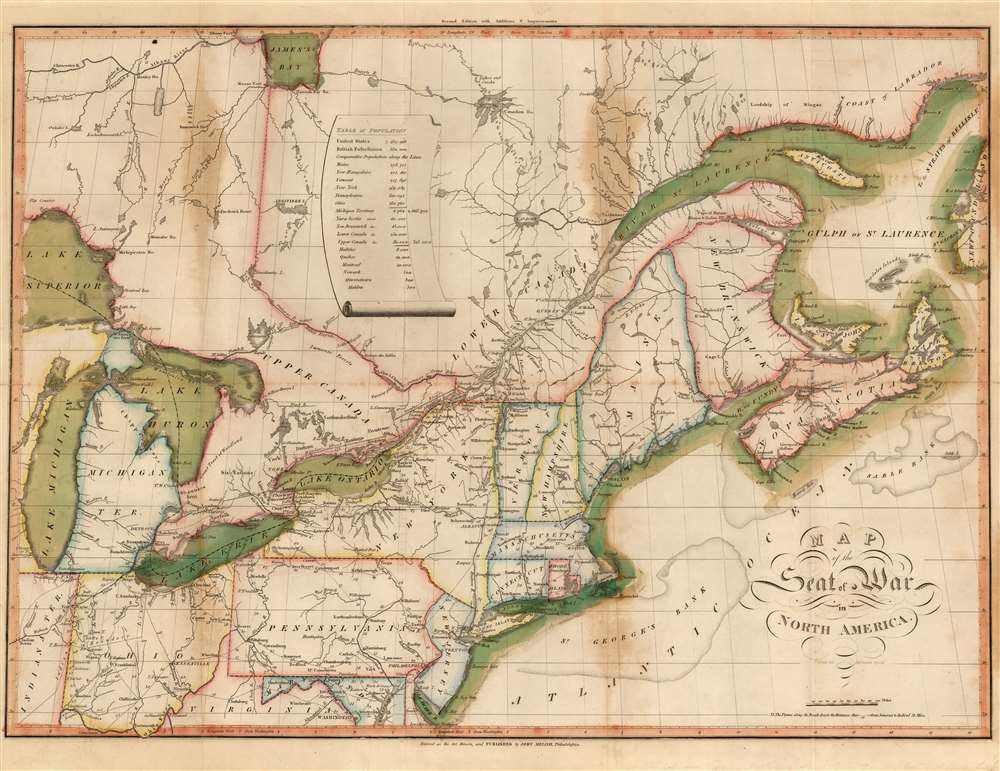
Map of the Seat of War in North America.
sold
- Digital Map Information
- Suitable for large format printing
- Full resolution TIFF file
- ICC color profile embedded
- Delivered instantly via download link
This John Melish's 1815 map of the northeastern United States and Canada, one of the earliest works by the first American publisher to concentrate specifically on maps. It is moreover one of the earliest maps specifically relating to the War of 1812 (1812 - 1815), and is one of the few maps pertinent to the war that was printed while it was still underway. It is, moreover, one of the best Federal Period maps available to the collector. Melish drew the map prior to the declaration of the war, and published it in conjunction with his 1812 A description of the British possessions in North America. So successful was that work that the plate swiftly wore out. This second edition of the map - 'with additions and improvements' - was engraved to accompany Melish's 1813 Military and Topographical Atlas of the United States. The identical second edition appeared in the 1815 second edition of the work. Both editions were engraved by Henry Schenck Tanner, and in this respect the map represents the work of two definitive figures in American map publishing. (more details)
Tokyo transforming into a modern metropolis.

蜂印香竄葡萄酒 東京案内圖 / [Hachijirushi Kozan Wine Tokyo Guide Map].
sold
- Digital Map Information
- Suitable for large format printing
- Full resolution TIFF file
- ICC color profile embedded
- Delivered instantly via download link
This rare bird's-eye view map of Tokyo from 1926 was published by Yoshida Kobundo (光文堂吉田印刷所) with a promotional advertisement for 'Bee Brand' fragrant wine (蜂印香竄葡萄酒 / Hachijirushi Kozan Budoshu), a popular drink in the Meiji and Taisho eras. The verso advertisement includes information about the drink and the company that produced it, Kamiya brewery (神谷本店釀造元), the address of the Kondō Rihē Shōten shop where it could be purchased, and an inset map of Ueno Park. (more details)
World’s busiest shipping corridor.
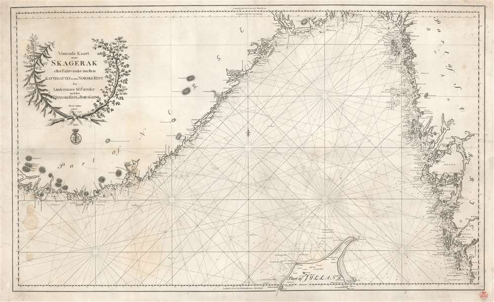
Voxende Kaart over Skagerak eller Fahrvandet iomellem Kattegattet of den Norske Kyst fra Lindersaes til Faerder med den SvenskeKystafBohusLehn.
sold
- Digital Map Information
- Suitable for large format printing
- DPI: 600
- File Size: 32.66 MB
- File Type: ZIP / TIFF
- ICC color profile embedded
- Delivered instantly via download link
This is an 1820 Royal Danish Nautical Charts Archive nautical chart or map of the Skagerrak and the Kattegat, two straits in Scandinavia. Depicting the region from southern Norway to the western coast of Sweden, rhumb lines criss-cross the illustrated sea areas, serving as navigational aids. Depth soundings appear along the Danish and Swedish coasts and along essential sea lanes, but are curiously absent from the Norwegian coastline. Coastal islands are illustrated and labeled. The presence of manuscript notes suggests this chart was sailed. (more details)
Unrecorded, unique details from unidentified sources.
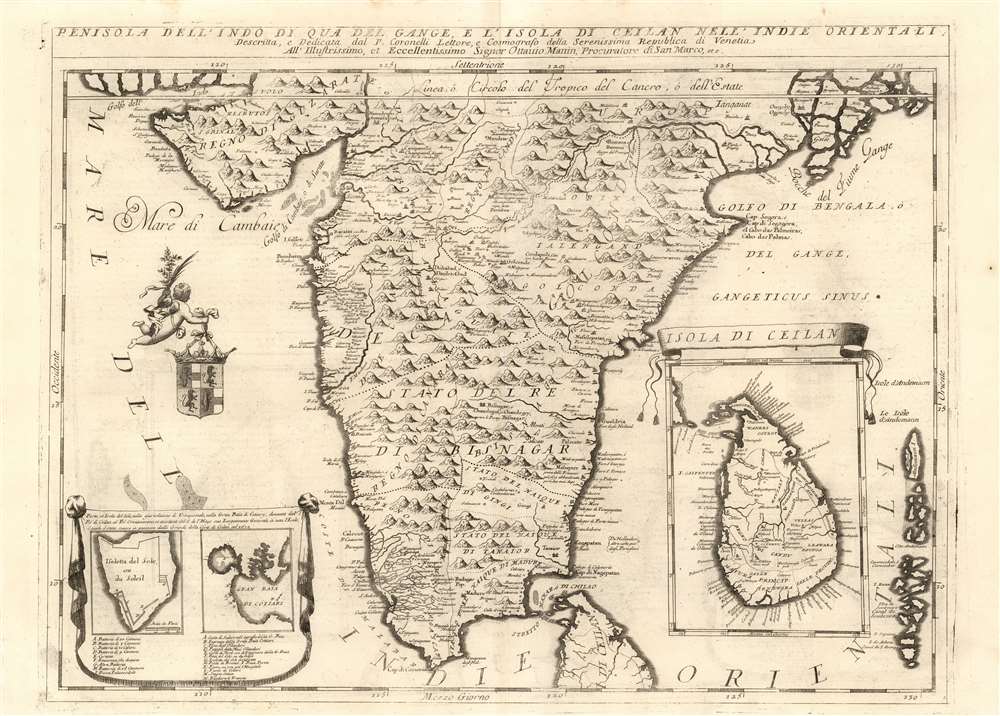
Penisola dell'Indo di qua del Gange, e L'Isola di Ceilan Nell'Indie Orientali.
sold
- Digital Map Information
- Suitable for large format printing
- Full resolution TIFF file
- ICC color profile embedded
- Delivered instantly via download link
This is Vincenzo Maria Coronelli's large 1692 map of the Indian peninsula, presenting detail not appearing on any prior map.. Many of Coronelli's maps, even most of them, were derived from his globes - notably his 1688 42-inch terrestrial globe. However, the details here do not refer to his printed gores. Coronelli intended his initial atlases - his Atlante Veneto and Corso Geografico Universale - to be extensions of Blaeu's great atlas. Thus it makes sense that in the first volume of his work, Coronelli focused on peninsular India, a region neglected by Blaeu. While Blaeu had produced a map of the Mogul Empire based on the 1619 Baffin map, the full extent of India south of the Moguls was included only in Blaeu's general map of the East Indies. Coronelli was not the only mapmaker after Blaeu to address the region, but he was the first to present it in so grand a format. (more details)
Gigantic geological map of Kentucky.
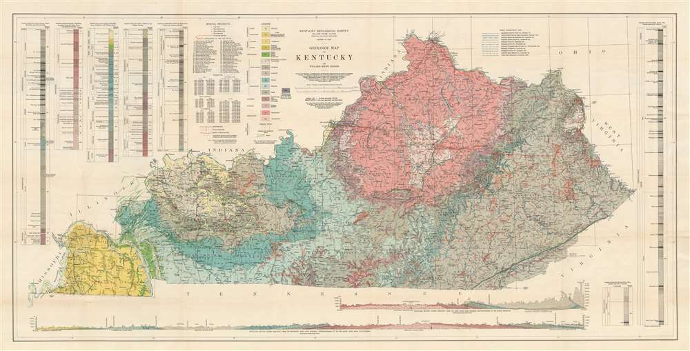
Geologic Map of Kentucky.
sold
- Digital Map Information
- Suitable for large format printing
- File Size: 81.68 MB
- File Type: ZIP / TIFF
- ICC color profile embedded
- Delivered instantly via download link
This is a gigantic 1929 Willard Rouse Jillson geological map of Kentucky. The map locates seventeen geological zones with distinct colors and patterns, each defined in legend in the upper right. Fault lines are also noted and traced in green. As are resources: coal mines, rock asphalt mines, and oil and gas fields. Oil and gas fields are numerically identified and correspond with an index in the upper left. Five different geologic cores are also included in the upper left and right. Two profile sections illustrating layered geological formations are included along the bottom border. (more details)
Western U.S. Railroads.
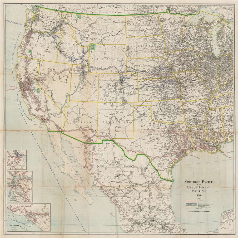
Southern Pacific and Union Pacific Systems.
sold
- Digital Map Information
- Suitable for large format printing
- File Size: 98.79 MB
- File Type: ZIP / TIFF
- ICC color profile embedded
- Delivered instantly via download link
This is a 1910 Rand McNally railroad map of the western United States, depicting from Michigan, Kentucky, Tennessee, and Alabama to the Pacific Ocean. Color coding highlights railroads throughout the American West. Union Pacific routes are illustrated in blue, with blue dashed lines representing those under construction. South Pacific routes are colored red. Brown routes are half owned by either the Southern Pacific or Union Pacific and the green routes are operated by the San Pedro, Los Angeles, and Salt Lake Railroad. Black lines trace the rest of the railroad network. National parks appear in green, including Yellowstone, Crater Lake, Glacier, and Yosemite. Insets of Portland, San Francisco, and Los Angeles detailing their railroad networks are situated in the lower-left. (more details)
Between revolutions.
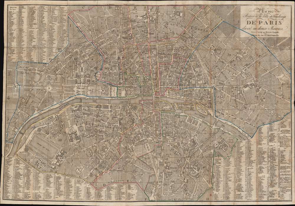
Plan Routier de la Ville et Fauxbourgs de Paris divisé en douze Mairies.
sold
- Digital Map Information
- Suitable for large format printing
- File Size: 48.18 MB
- File Type: ZIP / TIFF
- ICC color profile embedded
- Delivered instantly via download link
This is a striking 1824 Eustache Hérisson city plan or map of Paris, France. Centered on the Ile de la Cité, this map depicts central Paris from the Champ de Mars and the Arc de Triomphe to the Place du Trone (Place de la Nation), and from the Hôpital St. Louis to the Observatoire de Paris. The map illustrates gardens, important buildings, cemeteries, parks, streets, public places, bridges, and twelve districts, or Maries. Surrounding the map is a comprehensive street index. This is the Paris of Victor Hugo, Théodore Rousseau, and Jean-Pierre Dantan. (more details)
Depicts the 1780 Siege of Charleston and the 1861 Battle of Fort Sumter.

Four Periods of Historic Charleston.
sold
- Digital Map Information
- Suitable for large format printing
- File Size: 26.94 MB
- File Type: ZIP / TIFF
- ICC color profile embedded
- Delivered instantly via download link
This is a c. 1940 broadside featuring four views of Charleston, South Carolina, by an unknown artist. These views illustrate the city in 1735, 1780, 1861, and 1925. Two of the views are signed. 'Claude Lord' is written in the lower right corner of the 1735 view and 'Lord' appears in the lower right corner of the 1925 view. In 1735, Charleston (or Charles Town) was a prosperous harbor city with a wealthy planter elite. Charleston was also one of the main ports of embarkation for captured Africans forced into American slavery. The 1780 view depicts Charleston during the American Revolutionary War. Sir Henry Clinton laid siege to Charleston from April 1, 1780 to May 12, when Patriot leader Benjamin Lincoln surrendered. This was the greatest American defeat of the war. In 1861, war descended on Charleston again. South Carolina became the first state to secede from the Union after President Abraham Lincoln was elected, precipitating the American Civil War (1861 - 1786). Charleston Harbor became the site of the first battle of the war on April 12, 1861, when Confederate forces opened fire on Fort Sumter, a fort in the harbor held by the U.S. Army. The 1925 view emphasizes the trappings of modern life, including modern ocean liners, airplanes, and a speedboat. (more details)
War and recreation.
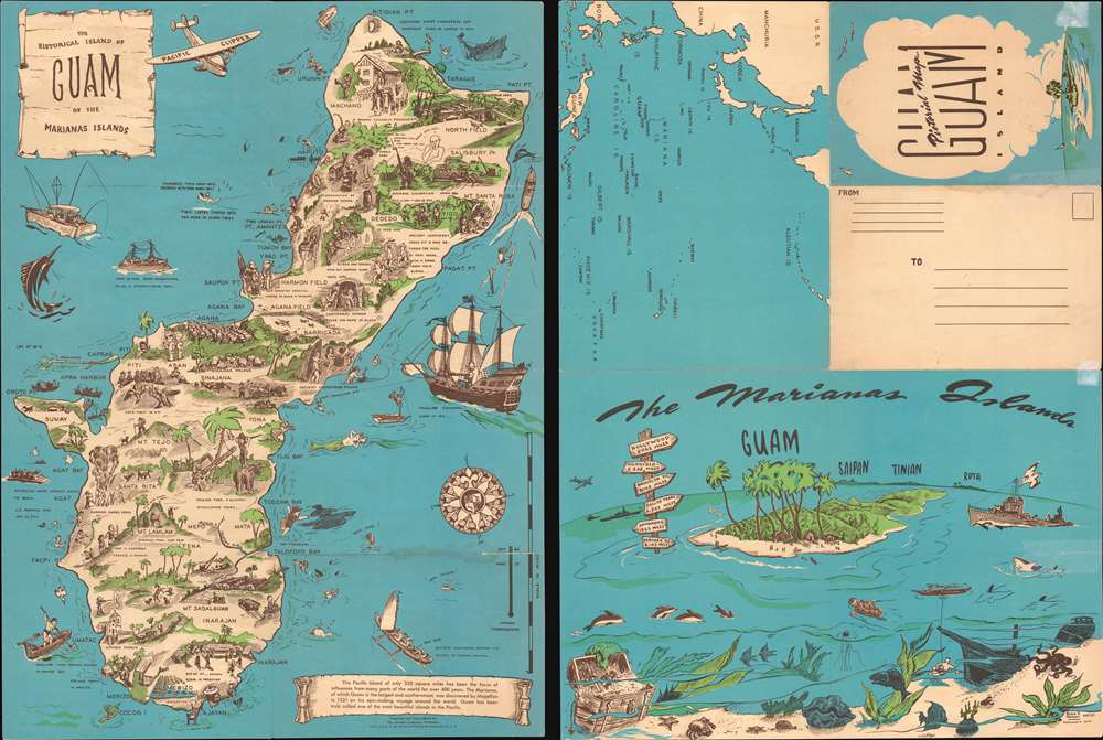
The Historical Island of Guam of the Marianas Islands.
sold
This is a c. 1958 Bruce N. Nelson pictorial map of Guam, the southernmost of the Marianas Islands. Depicting the entirety of the island, vignettes highlight historical events from Magellan's 1521 discovery of the island to the construction of modern roads. A sailing canoe, situated in the lower right just above a short text on the history of Guam, illustrates the ancient Chamorros (the indigenous people of the Marianas Islands) exploring the Pacific. More recent history is also illustrated, with several airfields noted and a caricature of a Japanese soldier marking the Japanese occupation of Guam from December 11, 1941 to August 10, 1944, and an Amtrack ferrying the first wave of U.S. Marines to assault the landing beaches on July 22, 1944. These serious references are interspersed among people playing on the beaches, hiking Guam's mountainous interior, and ogling a mermaid. A map of the Pacific is printed on the verso, along with a stylized view of Guam, Saipan, Tinian, and Rota, all islands in the Marianas. (more details)
A wonderful view of Boston Harbor.

Boston Harbor.
sold
- Digital Map Information
- Suitable for large format printing
- File Size: 21.25 MB
- File Type: ZIP / TIFF
- ICC color profile embedded
- Delivered instantly via download link
An uncommon 1897 early example of a George H. Walker aquatint view of Boston Harbor. Centered on South Boston, the view depicts Boston Harbor from East Boston and Nahant eastward as far as Squantum and Slate Island. The bustling harbor is illustrated full of ships and ferries traveling between various islands and cities. Islands throughout the harbor are illustrated, including Thompson's Island, Castle Island, Spectacle Island, Governors Island, Deer Island, Lovell's Island, Calf Island, and Peodock's Island. Various lighthouses are illustrated and labeled. Among these are Boston Light, Bug Light, and Minots Ledge Light. Ferry routes are indicated. Such views were sold and given to customers of various Boston-based ferry services. (more details)
Includes an inset map of Marco Island on the verso!

Map of Naples Florida.
sold
This is a c. 1974 Dolph Map Company city plan or map of Naples, Florida. Depicting from Del-Nor State Park to Keewaydin Island and the Myrtle Cove Acres subdivision, bright green highlights golf courses, country clubs, city and state parks, and the Naples airport. Streets are illustrated and labeled throughout, along with shopping centers, hospitals, and the county courthouse. Fifteen schools are marked by icons and numerically identified corresponding with an index along the left border. Bright blue circles bearing numbers identify subdivisions. These circles correspond with a second index situated along the left border. A street index occupies the space inside the right border. Numerous insets of subdivisions occupy the space outside the right border and among these are Port Royal, Vanderbilt Beach, Coquina Sands, and Park Shore. A highway map of Collier County occupies most of the verso, with an inset map of Marco Island and Big Key situated in the upper right. (more details)
Promoting Hawaii as a tourist destination.

Island of Hawaii 'The Scenic Isle' Territory of Hawaii U.S.A. Map and Guide.
sold
- Digital Map Information
- Suitable for large format printing
- Full resolution TIFF file
- ICC color profile embedded
- Delivered instantly via download link
This is a 1917 Hawaii Promotion Committee map of the island of Hawaii. Locations throughout are labeled, including Mauna Loa, Mauna Kea, and Kilauea. Lava formations, steam cracks, numerous lava flows, and other formations relating to the volcanoes are illustrated. Major roads are illustrated along with the Hilo Railroad. Information concerning distances, elevations, and hotels in Hilo, Kau, Kona, Kohala, and Hamakua appear along the bottom border. A map of the crater of Kilauea appears on the verso. (more details)
America's first 'leisure' highway.
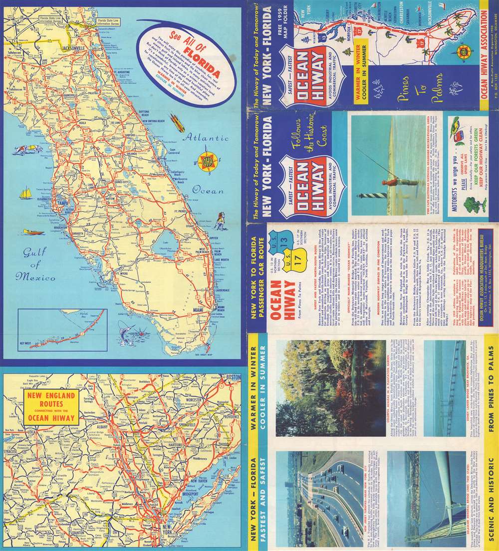
Official 1959 Map of the Ocean Hiway Safest - Fastest - Smoothest New York to Florida.
sold
This is a 1959 Ocean Hiway Association map of Florida, the U.S. east coast, and the Ocean Highway. Cities and towns throughout Florida are identified, with solid red lines tracing the state's highway network. Pictorial elements off Florida's coastlines reinforce its image as a tropical paradise ready to welcome visitors all year. An inset in the lower-left illustrates the Overseas Highway from Tavernier to Key West. A second, smaller map, details the highway network in New England from Boston to New York and shows how it connects with the Ocean Highway. To the right of the map, short texts and color photographs promote the Ocean Highway as the ideal route for any vacation south from New England, particularly for those traveling to Florida. (more details)
Victoria Gold Rush!
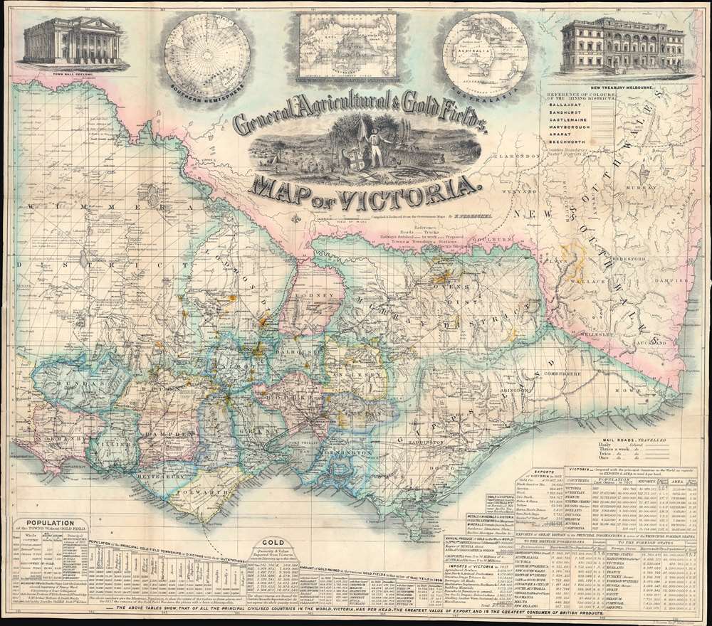
General, Agricultural, and Gold Fields Map of Victoria.
sold
- Digital Map Information
- Suitable for large format printing
- Full resolution TIFF file
- ICC color profile embedded
- Delivered instantly via download link
This is a rare 1859 Frederick Proeschel pocket map of Victoria, Australia, published to capitalize on Victoria Gold Rush emigration. Such maps were sold cheaply to hopeful prospectors who often carried them in-hand to mining and agricultural camps - the harsh conditions contributing to such maps having exceptionally low survival rate. The central cartouche engraved by D. Tulloch, illustrates Victoria's many blessings, including rich flora and fauna, excellent agricultural lands, and of course, the all-important gold mines. Herein, gold 'diggings' are highlighted throughout in brilliant yellow - offering essential data to the emigrant. In addition, the map names settlements, offers commentary on terrain, and highlights both planned and active transportation networks. For those disinclined to rough gold camp life, It also notes 'good sheep pastures'. A view of the Geelong town hall occupies the upper left, and a view of the Melbourne 'Gold Office' the upper right. Three inset maps illustrate, from left to right, the southern hemisphere, the world on a Mercator projection (with Australia at the center) and Australasia. Statistics are included along the bottom border, with particular attention to 'principal gold field townships or diggings', the values of gold extracted from specific fields, Victoria's exports, and Great Britain's exports. (more details)
An exemplar. The true Miller-printed first edition in a rare large-format variant.
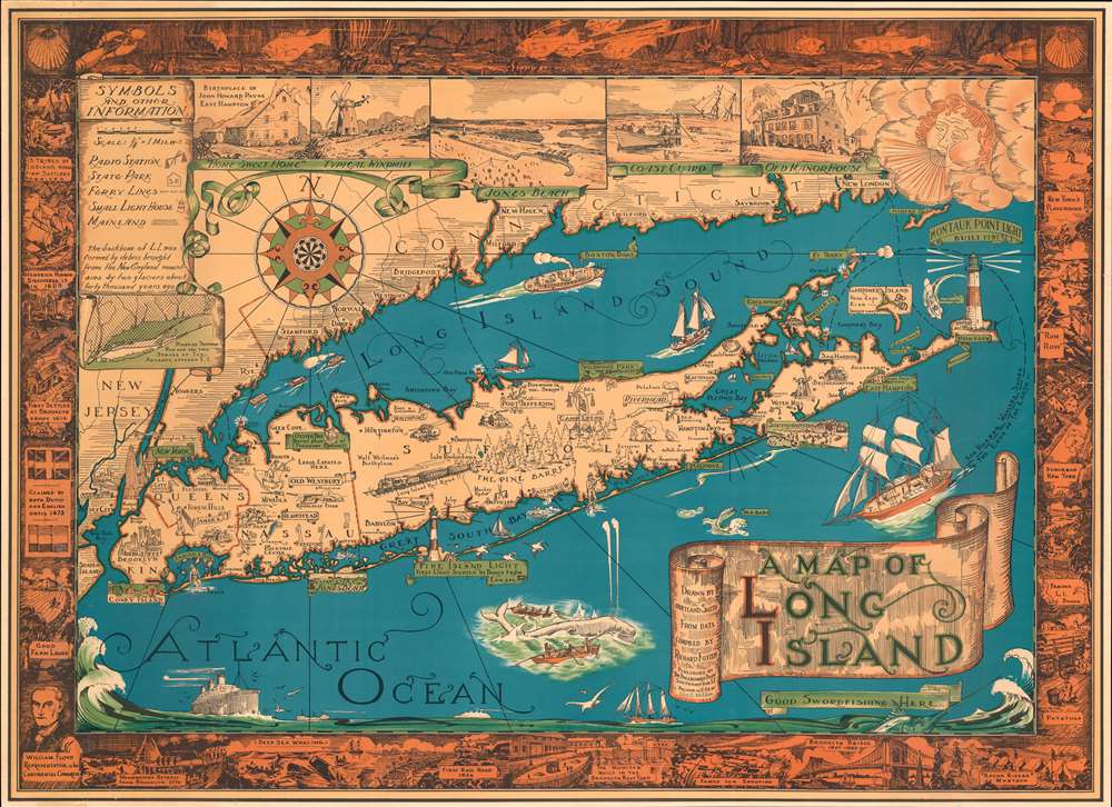
A Map of Long Island.
sold
- Digital Map Information
- Suitable for large format printing
- File Size: 62.98 MB
- File Type: ZIP / TIFF
- ICC color profile embedded
- Delivered instantly via download link
The exemplar example of Courtland Smith's 1933 pictorial map of Long Island - here in the first large-format George Miller edition. This is the first time in more than 25 years that we have seen this larger format variant of this iconic and much-reproduced map (all other known examples measure 20 x 27, this example is 26.5 x 36.5 inches). This historical map covers from New London in Connecticut and Fishers Island south as far as the Lower New York Bay and Staten Island. Long Island is depicted in its entirety from Brooklyn and Queens east to Montauk. Throughout, the map notes cities, towns, beaches, radio stations, parks, ferry lines, lighthouses and several other important landmarks, scenes, and activities. Several landmarks have been attractively illustrated, including the Montauk Point Light, Fire Island Light, Southampton, Coney Island, etc. Gardiner's Island - 'here Capt. Kidd buried loot' and 'Oyster Bay - Burial Place of Theodore Roosevelt' are noted. When Smith died, the mayor of Southampton remarked about this map:
That map has had a significant impact on the development of not only Southampton, but all the other towns on Long Island that it features.(more details)
Stunning example of the dominant 17th century map of Iceland.

Tabula Islandiae Auctore Georgio Carolo Flandro.
sold
- Digital Map Information
- Suitable for large format printing
- Full resolution TIFF file
- ICC color profile embedded
- Delivered instantly via download link
This is a superb example of Willem and Joan Blaeu's map of Iceland, among the most influential and widely-copied seventeenth century maps of the island. It was engraved in 1628 by Jodocus Hondius the younger, who credited the map to Joris Carolus. Carolus was a noted Dutch navigator and explorer whose extensive travels to Spitzbergen, Davis Strait and other islands of the North Atlantic - and whose own exaggerations of the extent of those travels - established him as an authority on the northern oceans. Carolus' travels did take him to Iceland more than once, but it may be that Hondius used the navigator's name specifically in order to incorporate the navigators' authority without necessarily relying on any information from him. (more details)
San Francisco as Ali'gay'tor heaven!

Tales of the City Alligator Oz The land of Make-Believe.
sold
A rare and most humorous 1976 J. Clark Henley pictorial map of San Francisco as the 'gay' paradise, 'Alligator Oz'. The cartography roughly mirrors the northern top of San Francisco Peninsula, with the San Francisco Bridge, Alcatraz Island, and the Bay Bridge clearly recognizable. Most structures have been transformed into penis shaped towers, with some, such as the Transamerica Pyramid, the Palace of Fine Arts, Painted Ladies, and City Hall recognizable. Throughout, homosexual alligators, some in drag, frolic and enjoy themselves, their notably salacious thoughts on clear display. In what would be Golden Gate Park, a parade of happy alli'gay'tors sing,
Oh happy day, we don't have wives who need their hair done, or children who need their stocking filled, so we can need Bill Blass, Vidal Sassoon, Elsa Peretti, and Wilkes Bashford, not to mention a complete collection of toys from Leather Forever…(more details)