
A charming map of Tampa created for First Federal of Tampa - a local bank.
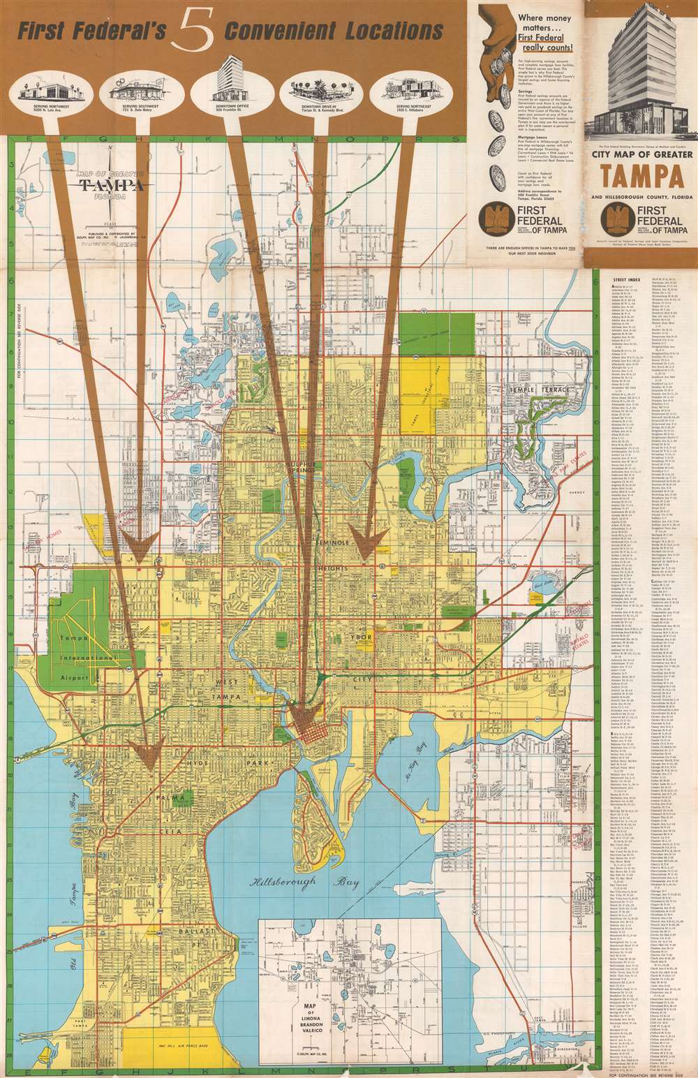
Map of Greater Tampa Florida. / City Map of Greater Tampa and Hillsborough County, Florida.
sold
This is a c. 1968 Dolph Map Company city plan or map of Tampa, Florida, produced for the First Federal Savings and Loan Association of Tampa. As befits the map's purpose, five large brown arrows emphatically point out the five First Federal of Tampa locations around the city. Charming views of each branch appear near the top border at the end of each arrow. Tampa itself is shaded yellow, with city streets illustrated and labeled. City parks are colored green, along with Tampa International Airport and the University of South Florida. City property, including baseball fields, hospitals, the city's industrial park, the shopping center, and its housing projects are shaded a bright yellow. Orange highlights major thoroughfares. Tampa's many suburbs appear in the white areas surrounding the city itself. An inset map of Limona, Brandon, and Valrico is situated along the bottom border and a street index appears outside the right border. (more details)
Detailed road map of Cape Cod - includes inset maps of Martha's Vineyard and Nantucket!
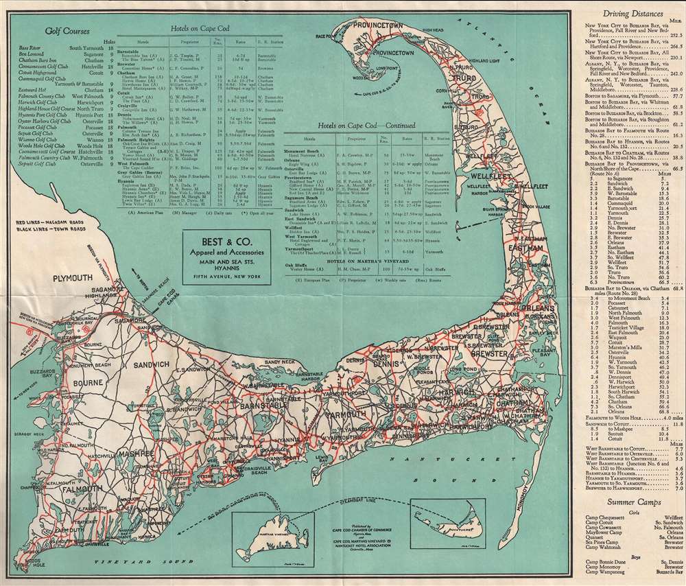
Welcome to Cape Cod Road Map and Directory.
sold
- Digital Map Information
- Suitable for large format printing
- File Size: 4.96 MB
- File Type: ZIP / TIFF
- ICC color profile embedded
- Delivered instantly via download link
This is a 1934 Cape Cod Chamber of Commerce and Cape Cod, Martha's Vineyard, and Nantucket Hotel Association road map of Cape Cod. The map depicts Cape Cod from Plymouth and Sagamore Highlands to the Atlantic Ocean and from Provincetown to Woods Hole, Monomoy, Nantucket Sound, and Vineyard Sound. Inset maps of Martha's Vineyard and Nantucket are located along the bottom border. (more details)
South America from the Finest Globemaker of the 17th Century.
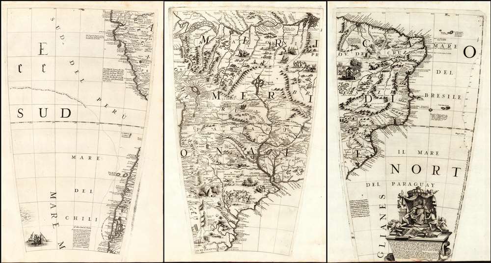
(Set of three Globe Gores of South America from the Equator to 50º south).
sold
- Digital Map Information
- Suitable for large format printing
- Full resolution TIFF file
- ICC color profile embedded
- Delivered instantly via download link
This is a matched trio of globe gore sections covering most of South America, issued by Vincenzo Maria Coronelli in 1697. They are printed from the plates of Coronelli's 1688 3 1/2 foot Terrestrial globe. Coronelli considered the 1688 terrestrial and celestial globe pair to be his greatest work in print. He was not without justification: their superb engraving and encyclopedic geographic detail, not to mention their great size, set them easily amongst the finest globes produced in the 17th century. Desiring to display the quality of these works to a broader audience, and to challenge any potential competition, Coronelli published in 1697 a volume variously titled Libro dei Globi or Palestra Litteraria containing his globe gores (The title page bore a date of 1693, but the earliest known printing of the book was four years later.) 1697 was busy: Coronelli also included most of the gores from his terrestrial globe among conventional maps in his Atlante Veneto and Isolario that same year. In this case, less a product of the mapmaker's braggadocio and more a sensible reuse of expensively-produced copperplates. (more details)
1st to show Vancouver Island and Puget Sound.
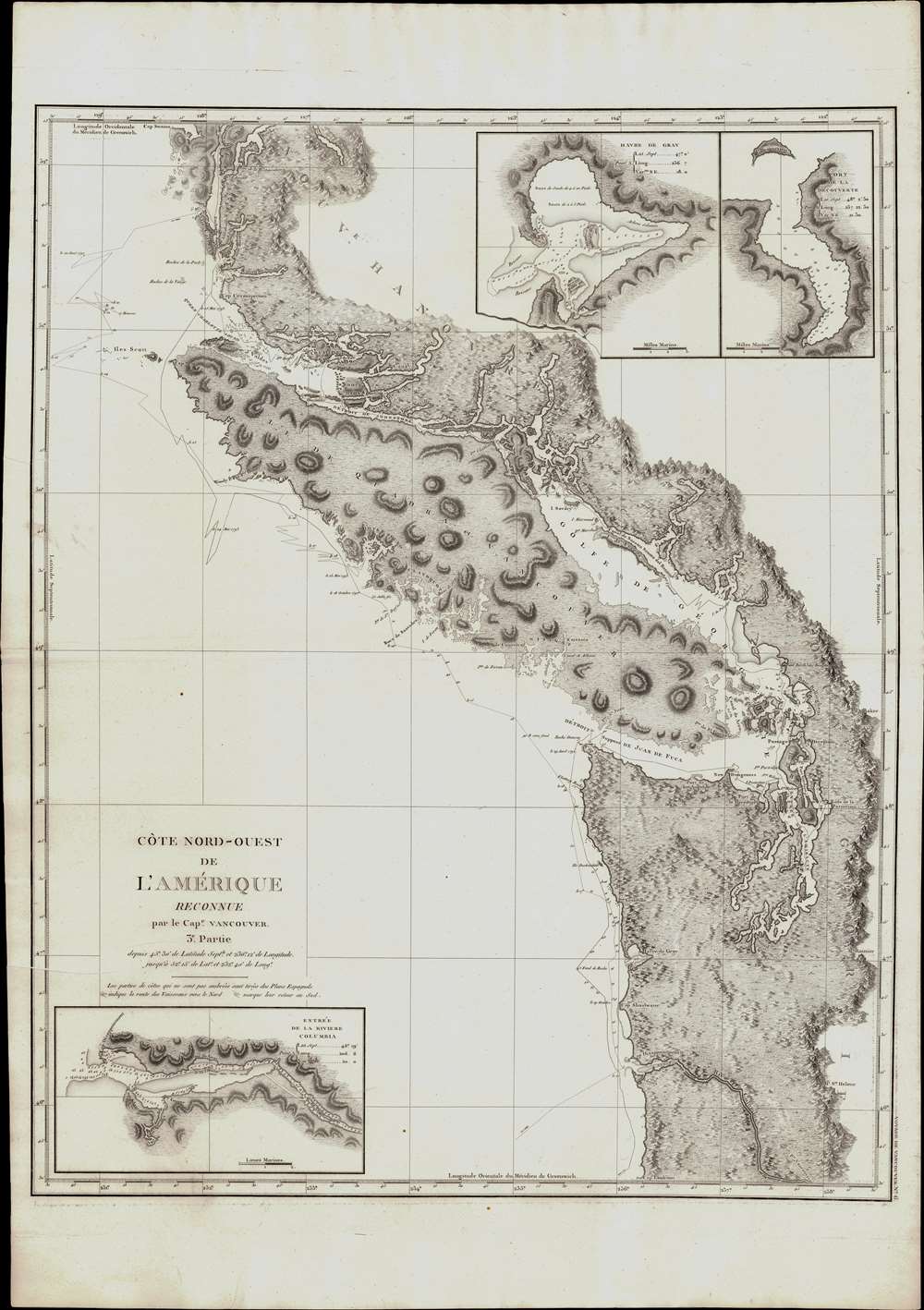
Cote Nord-Ouest de L'Amerique Reconnue par le Cape. Vanouver. 3e. Partie.
sold
- Digital Map Information
- Suitable for large format printing
- Full resolution TIFF file
- ICC color profile embedded
- Delivered instantly via download link
This is the 1799 French edition of George Vancouver's 1799 nautical map of the region around Vancouver Island, the Strait of Juan de Fuca, the mouth of the Columbia River, and Queen Charlotte Sound, extending from Cape Lookout (in modern-day Oregon) to Cape Swaine (Alaska). It is considered to be the great navigator George Vancouver's most important and influential map, among those he produced in his foundational reconnaissance of the northwest coast of America (1791 - 1795). (more details)
Best map of the West Indies of the late 18th century.
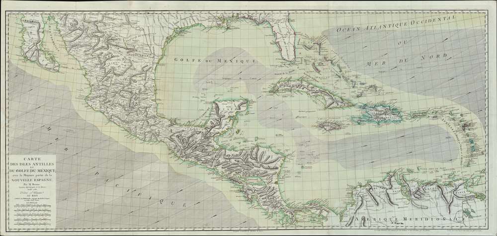
Carte des Isles Antilles et du Golfe du Méxique; avec la Majeure partie de la Nouvelle Espagne.
sold
- Digital Map Information
- Suitable for large format printing
- Full resolution TIFF file
- ICC color profile embedded
- Delivered instantly via download link
A spectacular large-scale 1786 Rigobert Bonne map of Florida, the West Indies, the Gulf of Mexico, and the Caribbean. This finely engraved and enormous map represents the best and most detailed general map of the West Indies to appear during and shortly after the American Revolutionary War (1775 - 1783). Coverage extends from Baja California and the Pacific to Barbados, and from northern Florida to the Gulf of Panama, including all of Central America, Mexico, parts of the Spanish Main, and the Greater and Lesser Antilles. The map includes a finely engraved illustration of the prevailing winds - important information for regional maritime commerce. Tiny anchors mark safe anchorages. Colonial claims are color coded, with the British represented in red, The Spanish in yellow, and the French in blue. (more details)
Limited Edition Woodcut variant.

The New York Times New York City Marathon.
sold
This is a 1983 James Grashow limited edition woodcut print created for the New York City Marathon. The marathon route, complete with runners, is highlighted in blue. Buildings and other landmarks appear in profile, including the Verrazano Bridge, the Brooklyn Bridge, Manhattan Bridge, the Chrysler Building, the Empire State Building (complete with King Kong), and the World Trade Center's Twin Towers. Central Park, where the marathon finishes, is prominent. The Statue of Liberty, of course, stands tall in New York Harbor as the State Island Ferry steams towards Battery Park. Spectators appear at various points along the route, but true to form, as important as the marathon is, life continues otherwise unabated. The whole is surrounded by a border composed of used running shoes. (more details)
Amazing early Southern California Advertising!

Dunsmore Poultry Ranch Ltd. Van Nuys, Cal.
sold
- Digital Map Information
- Suitable for large format printing
- Full resolution TIFF file
- ICC color profile embedded
- Delivered instantly via download link
A stunning finely executed c. 1929 advertising artwork for the Dunsmore Poultry Ranch. In a circular format, the advertising takes the form of an armorial crest on which is superimposed a bright and bold leghorn rooster. In the background, on the left, the view looks westward from Van Nuys, illustrating the Mission San Gabriel and the snowcapped San Gabriel Mountains. On the right the Pacific is visible along with several sailing ships. In the foreground, chicken coops and walnut trees are illustrated – representing the ranch's primary products. (more details)
First map to name Alaska and the first specific published map of Alaska as American territory.
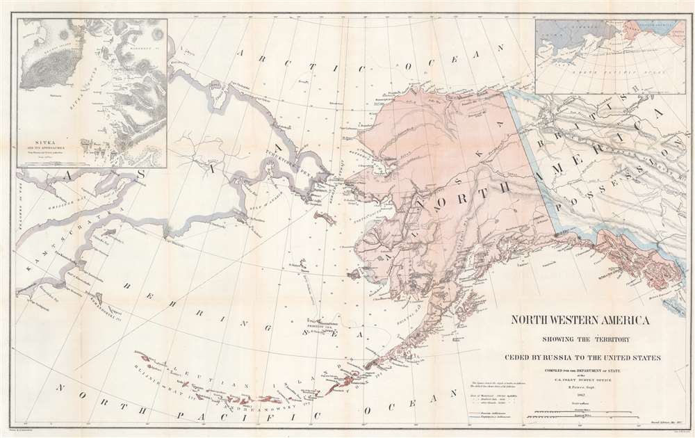
North Western America showing the territory ceded by Russia to the United States.
sold
- Digital Map Information
- Suitable for large format printing
- File Size: 38.22 MB
- File Type: ZIP / TIFF
- ICC color profile embedded
- Delivered instantly via download link
A seminal production, this is the first map to name Alaska and the first specific published map of Alaska as an American territory. Centered on the Bering Strait, the map covers all of Alaska as well as parts of adjacent Russia (as far as the Sea of Okhotsk) and Canada. Offers inland detail, especially along the coasts, as well as topography and a breakdown of Russian and Inuit settlements. (more details)
Exceedingly rare, highly decorative, and important map of the Cape of Good Hope.
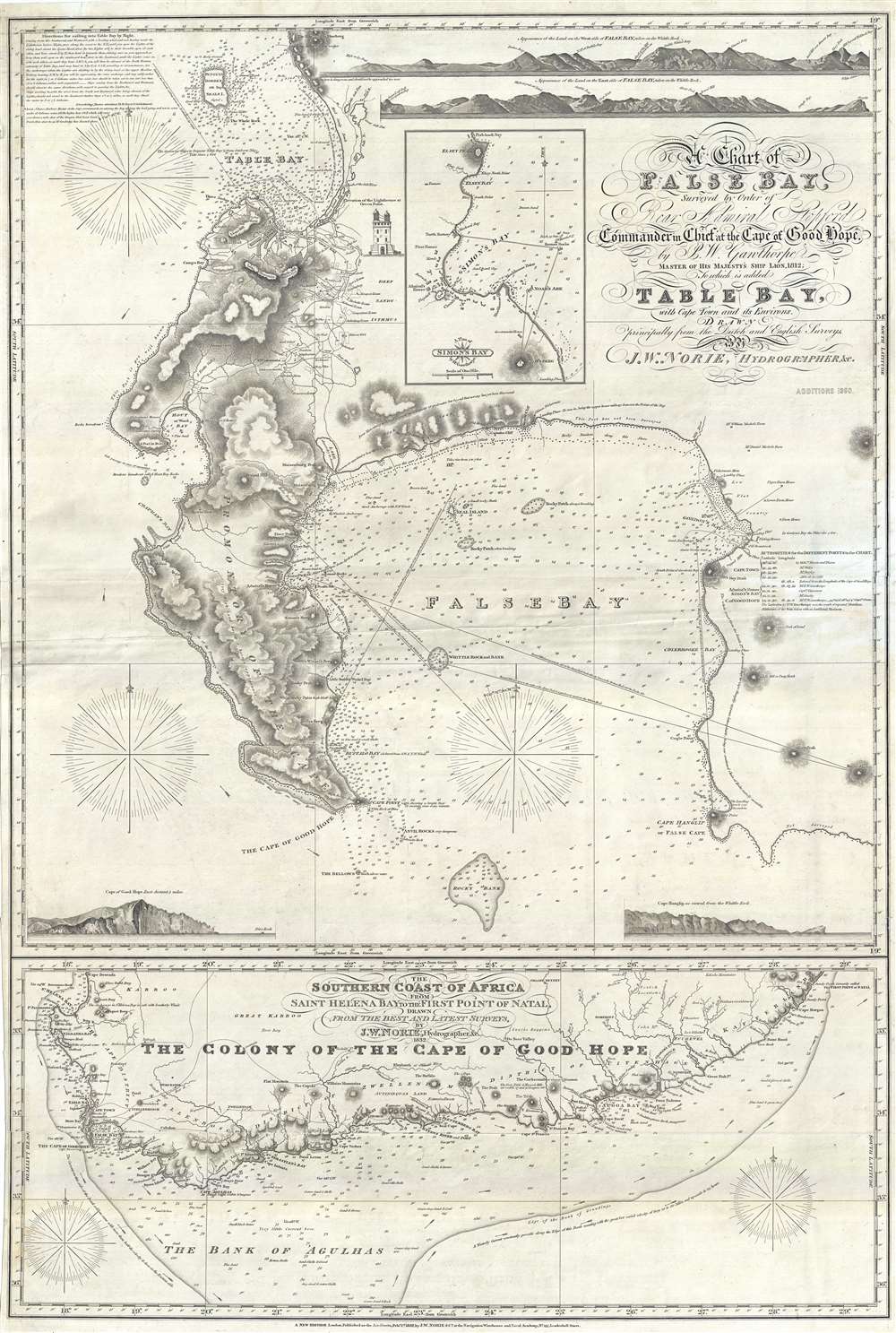
A Chart of False Bay Surveyed by Order of Rear Admiral Stopford, Commander in Chief at the Cape of Good Hope, by P. W. Gawthorpe, Master of His Majesty's Ship Lion, 1812; to which is added Table Bay, with Cape Town and its Environs.
sold
- Digital Map Information
- Suitable for large format printing
- File Size: 22.91 MB
- File Type: ZIP / TIFF
- ICC color profile embedded
- Delivered instantly via download link
A remarkable and very rare 1860 British commercial nautical chart of False Bay and the Cape of Good Hope, South Africa. Issued by John William Norie, this map is based upon surveys ordered by Sir Robert Stopford during his time as Commander-in-Chief of the Cape of Good Hope Station (1810 – 1827). The chart depicts from Robben Island south to the Cape of Good Hope and False Cape, including Rocky Bank. False Bay and the Promontory of the Cape are illustrated in full. In the vicinity of Cape Town, the map offers exceptional inland detail, identifying numerous private estates by the name of their owners, along the various rivers between Table Bay and False Bay. An inset of Simon's Bay appears in the upper right, near the title area, with important buildings identified. (more details)
A most decorative early Map of Ireland.

Le Royaume d'Irlande divisé en ses provinces, subdivisé en Shireries ou Comtes...
sold
- Digital Map Information
- Suitable for large format printing
- Full resolution TIFF file
- ICC color profile embedded
- Delivered instantly via download link
Hubert Jaillot's 1693 map of Ireland is among the largest and most beautiful atlas maps of Ireland produced in the 17th century. A sculptor-turned-mapmaker, Jaillot's maps were mostly based on geographical scholarship of the great French mapmaker Nicolas Sanson. Where Sanson's maps tended to be Spartan academic works, Jaillot intended his maps to be 'Bel et Utilite', beautiful as well as informative. Also, while Sanson's maps were printed to single folio sheets or smaller formats, Jaillot printed his maps to two folio sheets, meant to be joined into impressive large-scale maps. The map is superbly detailed, with towns, cities, and roads plainly visible. Topography is shown pictorially. An inset map in the lower right situates Ireland in relation to England, France, and the Netherlands, placing the island in the context of the greater conflict. (more details)
An Ostrich, Elephant, and Alligator walk into the Northwest Passage...

Nuove Scoperte De'Russi al Nord del Mare del Sud si nell'Asia, che nell'America.
sold
- Digital Map Information
- Suitable for large format printing
- DPI: 600
- File Size: 10.97 MB
- File Type: ZIP / TIFF
- ICC color profile embedded
- Delivered instantly via download link
A stunning example of Antonio Zatta's 1776 map of the northwestern parts of America and the northeastern parts of Asia. This map is one of the most sought after and decorative 18th century pre-Cook maps of the Pacific Northwest. The map covers the region from the Hudson Bay and the Great Lakes westward as far as Siberia and Japan, north well into the Arctic, and southwards as far as Cabo San Lucas in Baja California. In this stunning map, Zatta, combining almost every 17th and 18th century myth and fact of the American west into a single map, offers up a veritable smorgasbord of speculative geography. (more details)
Canal that never was but may yet be!
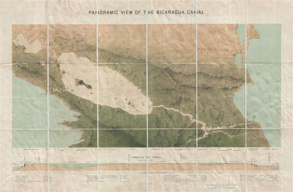
Panoramic View of the Nicaragua Canal.
sold
- Digital Map Information
- Suitable for large format printing
- File Size: 18.46 MB
- File Type: ZIP / TIFF
- ICC color profile embedded
- Delivered instantly via download link
A fascinating c. 1899 Julius Bien chromolithograph view of the proposed Nicaragua Canal. The development of an intercontinental canal connecting the Caribbean (and therefore the Atlantic) with the Pacific in Central America was one of the major engineering goals of the late 19th and early 20th centuries. While the French were focusing on the Panama Canal, Americans were looking to Nicaragua. As early as 1899, United States Navy Bureau of Navigation Captain A. S. Crownshield visited the region and published a defense of the Nicaragua Route as the only reasonable route for an intercontinental canal. It was perhaps general interest spurred by Crownshild's article that inspired Bien to create this view. (more details)
Unique transitional state with Compromise of 1850 details in manuscript and C. S. Williams copyright.
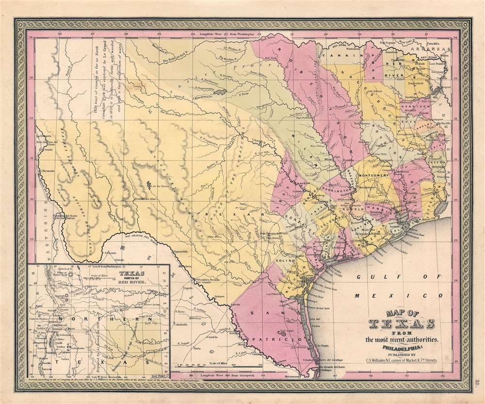
Map of Texas from the most recent authorities.
sold
- Digital Map Information
- Suitable for large format printing
- Full resolution TIFF file
- ICC color profile embedded
- Delivered instantly via download link
A unique transitional state of the 1850 Samuel Augustus Mitchell / C. S. Williams map of Texas. Based upon the Tanner/Burroughs map, coverage here has been updated in manuscript by the publisher to reflect the Compromise of 1850, in which the Republic of Texas Era borders were reduced to the state's current configuration. Here the map is clearly divided between Bexar County, in yellow, and the more populated parts of Texas to the east. The county structure there is sophisticated and reflects numerous updates and revisions over the original 1845 Tanner plate. (more details)
Unrecorded proof state archeological map of Pompeii.
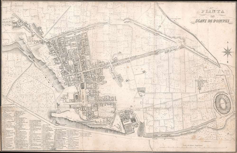
Pianta degli Scavi di Pompei.
sold
- Digital Map Information
- Suitable for large format printing
- Full resolution TIFF file
- ICC color profile embedded
- Delivered instantly via download link
This is a previously unrecorded proof state of the c. 1850 Carlo Bonucci city plan or map of ancient Pompeii, Italy. Destroyed during an eruption of Mt. Vesuvius in 79 A.D., this map details the archaeological site as it appears c. 1850. Superbly engraved and amazingly detailed, individual buildings are noted along the city's streets. Important sites around the city, including the Villa of Diomedes, several temples, the theatre and the amphitheater, are labeled. 137 additional sites are numerically identified and correspond with an index situated in the lower left corner. (more details)
Intellectual property - redefined.

Gentium Foederationis de Tuenda Industriali Proprietate Nova Descriptio. / [A New Description of the Federation of Nations for Protecting Industrial Property].
sold
A most unusual 1958 map of the world issued for presentation to attendees of the 1958 Lisbon Industrial Property Symposium - a meeting intended to review and set global trademark and patent protections. The map itself covers the entire world on a much-distorted Mercator Projection - such that only Europe is vaguely proportional. The cartographer has added decorative elements borrowed from the 16th century cartography of Ortelius (border, ships, title cartouche) and the 17th century work of the Blaeu firm (compass rose) - giving the whole an Old World aesthetic, despite modern cartography. (We find it ironic that for a map celebrating intellectual property protections, so much is copied from older maps.) The map, curiously, uses loose color coding to emphasize colonial empires - although the coding is by no means comprehensive. The British sphere of influence is red, the French green, and unaffiliated countries, yellow. (more details)
The World War I Western Front in June 1918.
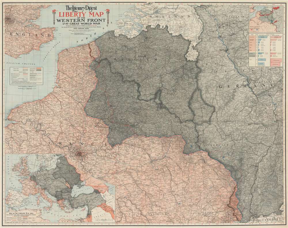
The Literary Digest Liberty Map of the Western Front of the Great World War Showing the Battle Line of Liberty as it Stood June 5, 1918.
sold
- Digital Map Information
- Suitable for large format printing
- Full resolution TIFF file
- ICC color profile embedded
- Delivered instantly via download link
This is a 1918 Matthews-Northrup wall map of northern France, Belgium, Germany, and the surrounding region highlighting the World War I Western Front as of June 5, 1918. A tricolor blue, white, and red line (reminiscent of the French flag) traces the front from the North Sea to Switzerland through parts of western Belgium and northern France. Entente Powers (Britain and France) are shaded pink, while hues of gray fill in members of the 'Teutonic Allies' (Germany) or territory occupied by them (Belgium, Luxembourg, and northeastern France). A blue dashed line marks Germany's farthest advance, while a red dashed line illustrates the advancement of French forces. An accompanying index identifies over 11,000 place names. An inset in the upper right highlights coal and iron regions in occupied territory and Germany and a table just below it quantifies the production. An inset in the lower left corner depicts everywhere fighting was happening around the world. Red lines reinforce these disparate regions: northern France, Russia, Romania, northeastern Italy, Greece, Palestine, and modern-day Iraq. (more details)
Charming pictorial map of Cape Cod.

The Pilgrim Map Cape Cod Martha's Vineyard and Nantucket.
sold
This is a 1956 Clara K. Chase revision of Ernest Dudley Chase's iconic map of Cape Cod, Martha's Vineyard, and Nantucket. The map covers from Marshfield to Nantucket and from Martha's Vineyard to Provincetown, comprehensive of the towns of Duxbury, Kingston, Plymouth, Falmouth, Hyannis, Chatham, Wellfleet, Nantucket, and Edgartown, among others. Historical sites are rendered in profile. Wonderful vignettes surround the map, most of which are annotated with descriptive text, some of which are quite humorous. (more details)
Rare Nepalese Trekking Map of the Annapurna Circuit.
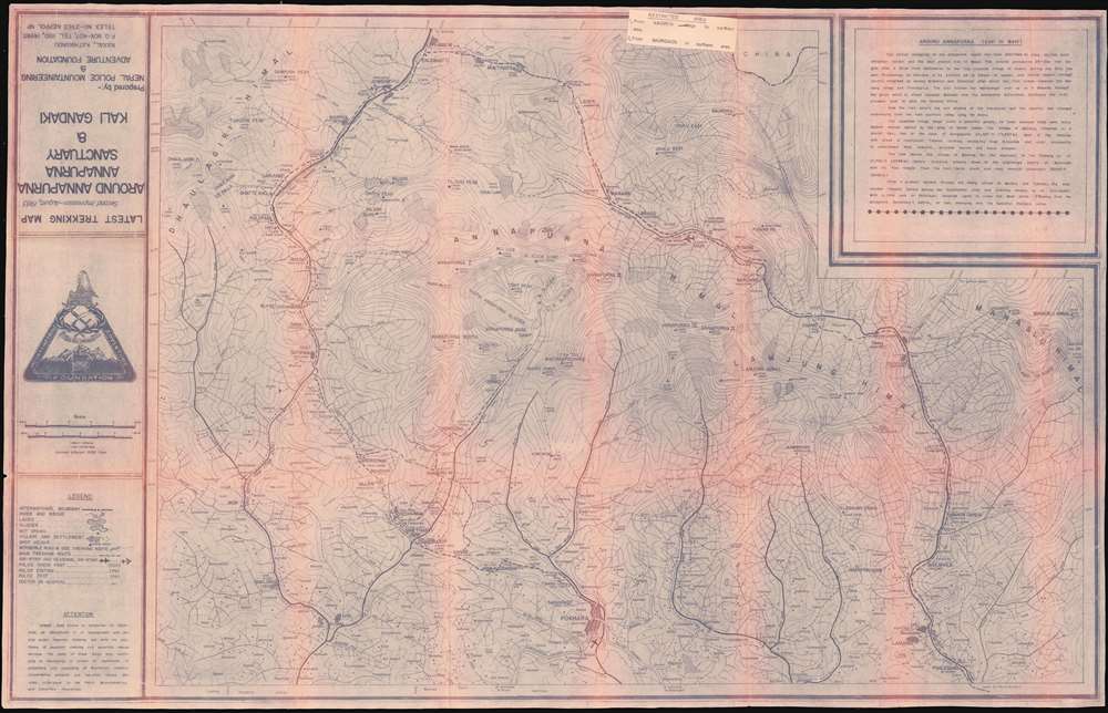
Latest Trekking Map Second Impression August 1983 Around Annapurna, Annapurna Sanctuary, and Kali Gandaki.
$400.00
Acquire
This is a 1983 Nepal Police Mountaineering and Adventure Foundation cyanotype map of the Annapurna Circuit. It is centered on the Annapurna Massif, showing the major towns as well as settlements too small to be named. Typical stops on the trek - Besisahar, Khudi, Bahundanda, Jagat, Dharapani, Chame, Pisang (upper and lower,) Manang, Letdar, the Thorong Pass, Muktinath, Marpha, Lete, Tatopani, Ghorepani, Birethani and Pokhara - are identified. In addition, the trekking path to Annapurna Base Camp via Ghandrung is shown. (more details)
Scarce map of South Africa.
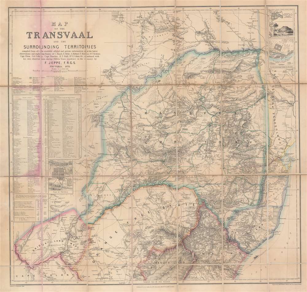
Map of the Transvaal and the Surrounding Territories.
sold
- Digital Map Information
- Suitable for large format printing
- File Size: 27.23 MB
- File Type: ZIP / TIFF
- ICC color profile embedded
- Delivered instantly via download link
This is a beautiful and scarce 1878 map of the Transvaal or the South African Republic by F. Jeppe. It covers the Boer ruled country in South Africa from modern day Zimbabwe south as far as Durban and depicts the Transvaal, Orange Free State, and Griqualand West, as well as parts of Natal, Zululand, and Basutoland. The map depicts the region in extraordinary detail, noting native tribes, goldfields, mines, roads, towns, farms, bushes, forests, lakes and a host of important topographical features. The routes of various travelers, including Erskine, Sanderson, Hope, Mauch, and several others are noted throughout. A table of postal routes is included near the left margin. A table showing distances and altitudes of projected railway lines appears as well. The upper right quadrant features two insets focusing on the 'Plan of Lourenco Marques (Del. Bay)' and a 'Continuation of Mauch's route to the ruins of Zimbabwe' along with a 'View of the ruins.' Another inset situated in the left lower quadrant contains a 'Plan of Pretoria.' (more details)
Wonderful Silver Springs, Florida!

America's Finest Highways Lead to Silver Springs.
sold
This is a 1957 Haynes Lithograph Company road map of Florida. Created as a promotional for Silver Springs, a tourist destination outside Ocala, Florida, a large red 'arrow' points the way. U.S. highways are illustrated in red. Four highways pass through Ocala, highlighting the destination's easy access. Five inset maps, each focused on a part of the United States, trace highway routes from numerous major cities in the U.S. and Canada to Silver Springs. (more details)