
Nova Scotia and its Vicinity Attractively Engraved.
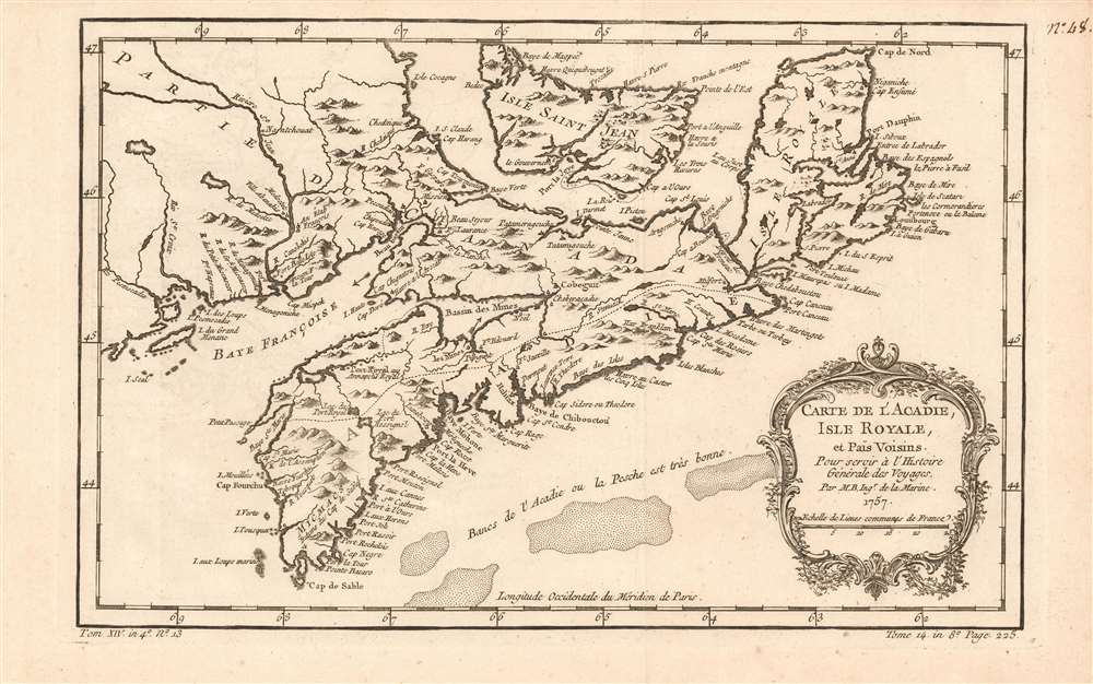
Carte Du Golphe De St. Laurent et Pays Voisins Pour servir a l'Histoire Generale des Voyage.
sold
- Digital Map Information
- Suitable for large format printing
- Full resolution TIFF file
- ICC color profile embedded
- Delivered instantly via download link
This is a lovely example of Nicolas Bellin's 1757 map of New Brunswick, Nova Scotia, and Newfoundland. It includes Prince Edward Island (I. Isle Sainte Jean) and Isle Royale (Cape Breton Island). While a number of rivers are illustrated inland detail is sparse and the focus overall is on the coastlines. A dotted line divides 'Acadia' from the northern parts of Nova Scotia from the rest of Canada. The map includes arrows indicating currents in several locations, and a notation on the shallows to the south, in French: 'The Banks of Acadie, where the fishing is very good.' (more details)
Treasures of India.
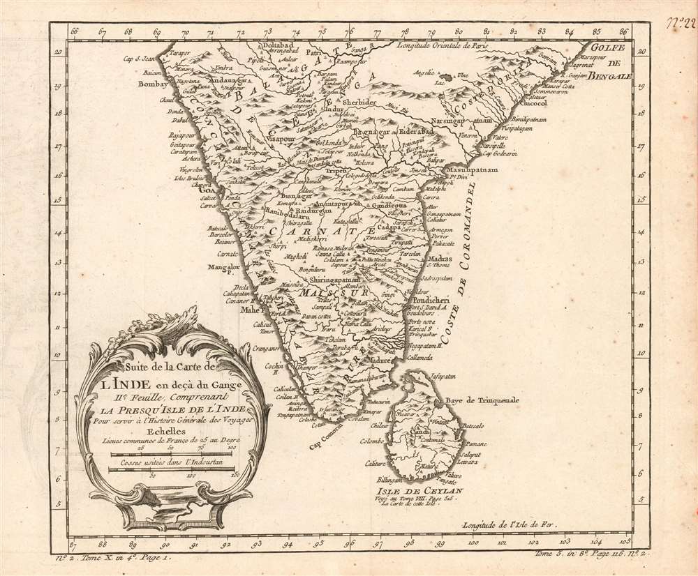
Suite de la carte de l'Inde en deçà du Gange IIe. feuille, comprenant la Presqu' Isle de l'Ind pour servir à l'Histoire générale des voyages.
$200.00
Acquire
- Digital Map Information
- Suitable for large format printing
- Full resolution TIFF file
- ICC color profile embedded
- Delivered instantly via download link
This is a 1780 Bellin map of India and Sri Lanka. Unlike many of Bellin's smaller works, this is strictly a map, as opposed to a nautical chart: the focus of the map is on the interior, particularly between areas of French influence on the Coromandel Coast such as Pondicheri, and the old Mogul Empire to the northwest. (more details)
Rumelia.

Map of Turkey in Europe, Roumania, Servia, Bulgaria and Montenegro.
sold
- Digital Map Information
- Suitable for large format printing
- File Size: 32.28 MB
- File Type: ZIP / TIFF
- ICC color profile embedded
- Delivered instantly via download link
This is a beautiful example of Rand McNally and Company's 1892 map of European Turkey. It covers Rumelia including modern-day Romania, Bulgaria, Serbia, Montenegro, Albania, Macedonia, and parts of Greece. An inset in the lower right quadrant details Crete or Candia. (more details)
On the cusp of greatness.
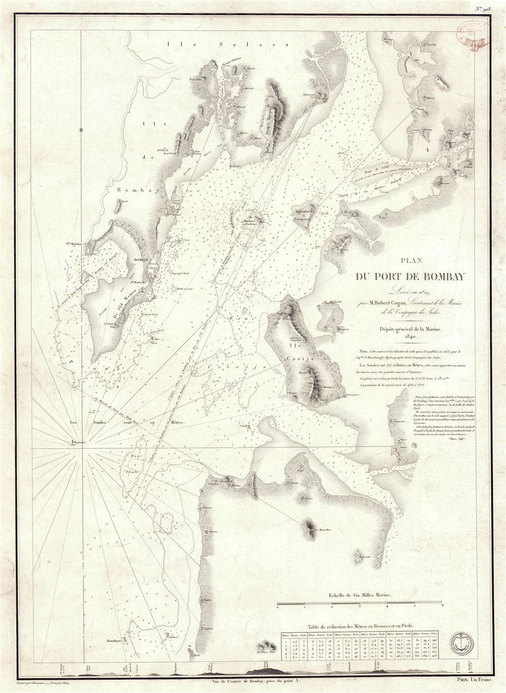
Plan du Port de Bombay.
sold
- Digital Map Information
- Suitable for large format printing
- Full resolution TIFF file
- ICC color profile embedded
- Delivered instantly via download link
This is a rare 1840 / 1843 nautical chart or maritime map of Bombay / Mumbai harbor, India. The map covers from Salsette to Kundaree Island. Detail focuses heavily on the inner harbor, where thousands of depth soundings in meters and trigonometric survey lines are included. This chart, compiled from the survey work of India Navy Lieutenant Robert Cogan represents the first major scientific survey of Bombay Harbor since the late 18th-century work of Captain John Watson. (more details)
Early, English Edition of the First Acquirable Chart of San Francisco Bay.
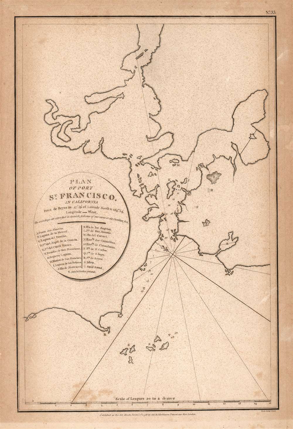
Plan of Port St. Francisco in California.
sold
- Digital Map Information
- Suitable for large format printing
- Full resolution TIFF file
- ICC color profile embedded
- Delivered instantly via download link
This is the 1798 English edition of La Pérouse's seminal 1797 map of San Francisco Bay. It is the first acquirable chart of these waters to be printed in English; La Pérouse's original of the previous year is the earliest acquirable overall. The 1798 John Robinson (1752 - 1813) edition of La Pérouse's travels was one of the earliest, and best, works to bring to English audiences the discoveries of this French circumnavigator's ill-fated voyage. (more details)
Reconciling State and Private Land Ownership.
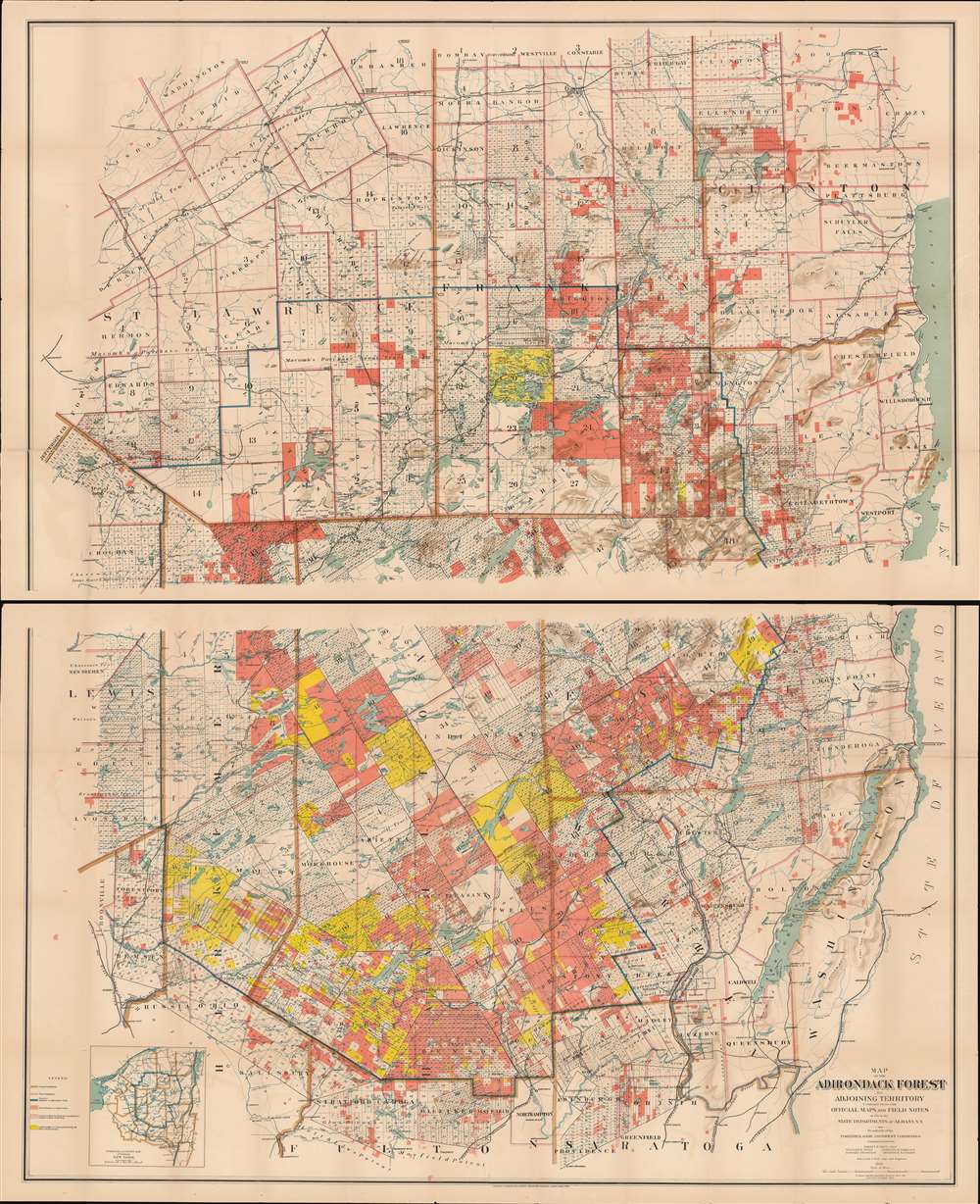
Map of the Adirondack Forest and Adjoining Territory Compiled from Official Maps and Field Notes on file in the State Departments at Albany, N.Y.
sold
- Digital Map Information
- Suitable for large format printing
- Full resolution TIFF file
- ICC color profile embedded
- Delivered instantly via download link
An uncommon large scale 1898 William Fox map of the Adirondack mountains of New York. The map covers the entire Adirondack Mountain region, extending from Saratoga to Plattsburg, and from Lewis County to Lake George and Lake Champlain. The map was made on behalf of the State Fisheries, game Commission for administrative purposes. The boundaries of the Adirondack State Park are defined by a bold blue line. Additional color coding designates the state of various lands. Pink shading identifies state forest preserve lands, yellow illustrates those lands bought or contract by the Forest Preserve Board, and lighter pink lands in which the state has joint ownership. (more details)
Commemorating the Speech that Created Modern Turkey.

Harp Tarihçi Encümeninden mavrut aslından inşakoya edilmiştir. / [Drawn from the original of the War Historian Committee.]
sold
- Digital Map Information
- Suitable for large format printing
- File Size: 21.76 MB
- File Type: ZIP / TIFF
- ICC color profile embedded
- Delivered instantly via download link
This is an extremely rare 1927 map of Turkey, in Ottoman Turkish, based on the map employed in Mustafa Kemal Atatürk's October 1927 Nutuk, his foundational speech delivered at the second congress of Cumhuriyet Halk Partisi. This legendary thirty-six-hour speech covered the events from the start of the Turkish War of Independence to the 1923 foundation of the Republic of Turkey. The speech outlined the evolution of modern Turkey after World War I (1914 - 1918), and was adopted as the official national narrative: a status reinforced by Turkish law criminalizing slights to Atatürk (1881 - 1938). As this narrative (and consequently, this map) begins with the partition of Turkey under the Treaty of Sévres, they elide the events preceding that partition - notably, the Armenian Genocide of 1915. (more details)
A poineering railroad.
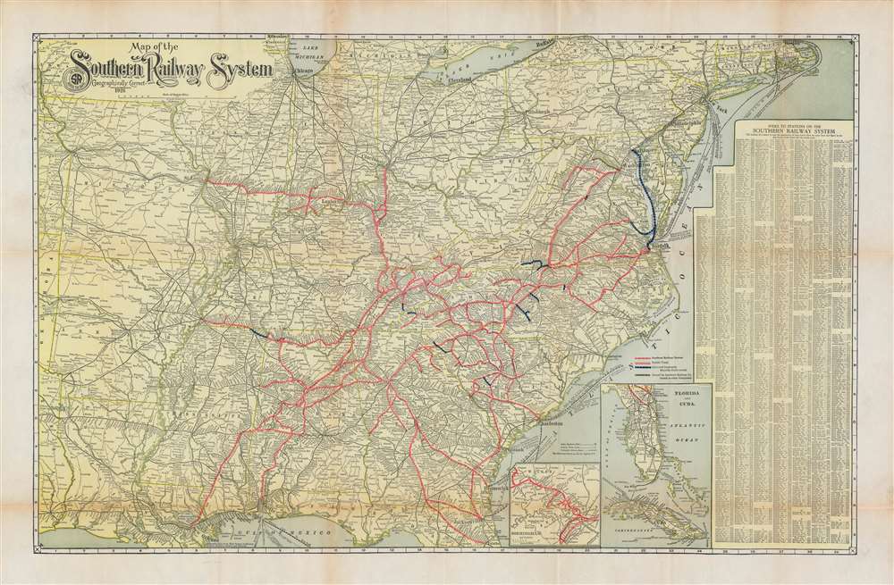
Map of the Southern Railway System Geographically Correct.
sold
- Digital Map Information
- Suitable for large format printing
- File Size: 52.92 MB
- File Type: ZIP / TIFF
- ICC color profile embedded
- Delivered instantly via download link
A scarce 1926 Matthews Northrup map of the southeastern and southcentral United States detailing the routes of the Southern Railway System. The map covers from the Sabine River and Oklahoma borderlands eastward to the Atlantic Seaboard and from the Great Lakes to the Gulf of Mexico. Coverage is extended to include Florida via an inset. Rail lines either owned outright, in part, or leased by the Southern Railway are highlighted and color-coded. The map also notes steamship routes that provide vital maritime connections to various domestic and foreign ports. (more details)
Rare pictorial map of Key West.
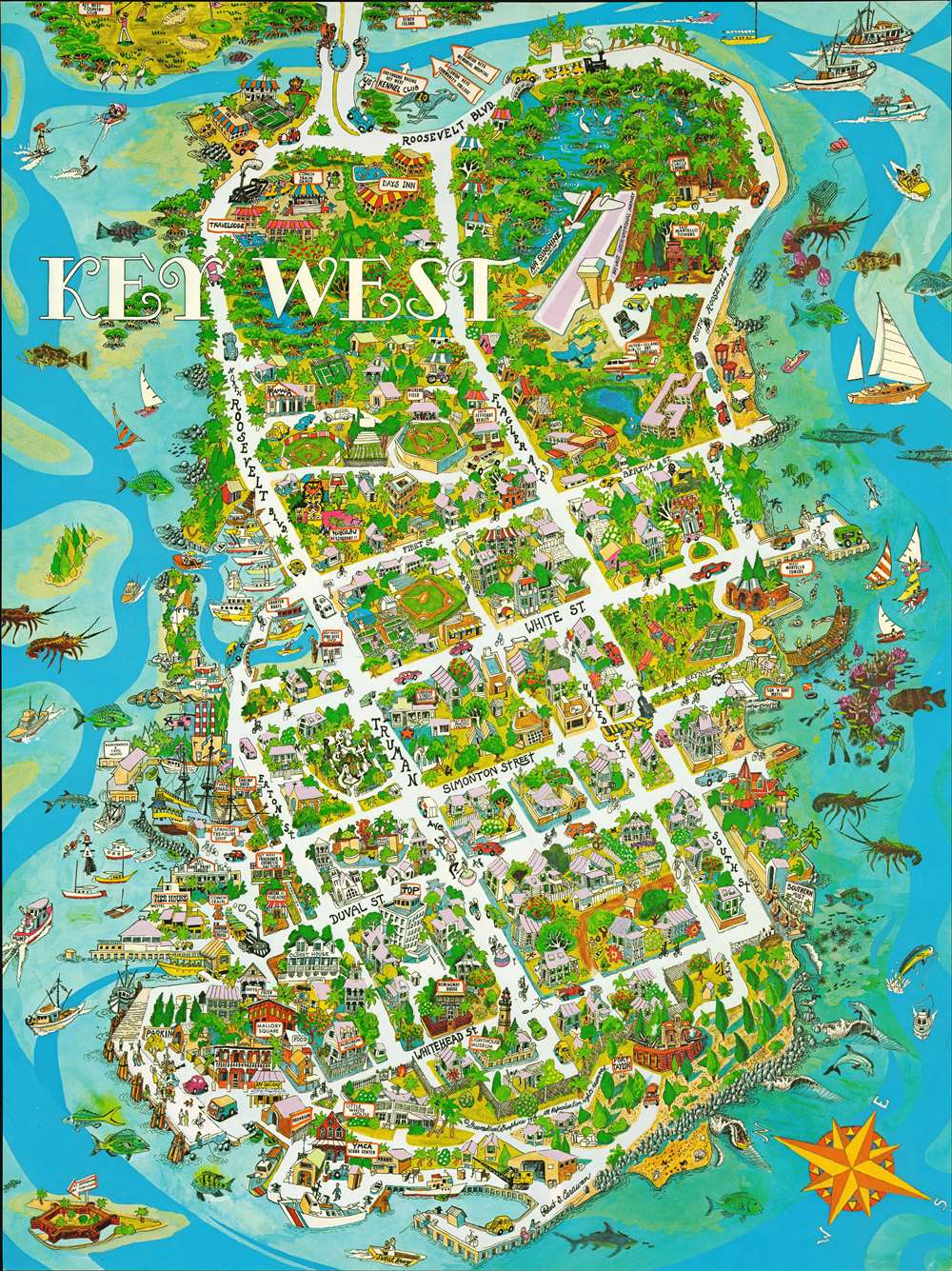
Key West.
sold
This is a comical 1976 Robert G. Carawan pictorial map of Key West, Florida. Streets are illustrated and labeled throughout the city and buildings all across the island are illustrated in profile. Both the Hemingway House and the Audubon House are named, as are the Little White House (where presidents from William Howard Taft through John F. Kennedy spent time, but President Truman spent the most time - 175 days), Fort Taylor, and the Southernmost Point in the continental United States. The Days Inn and Travelodge, and Ramada Inn are identified as well, along with numerous restaurants, shops, and the Lighthouse Museum. Several Conch Train Tours appear throughout the town, an attraction that visitors to Key West can still enjoy. (more details)
French Pirate Haven of Martinique.
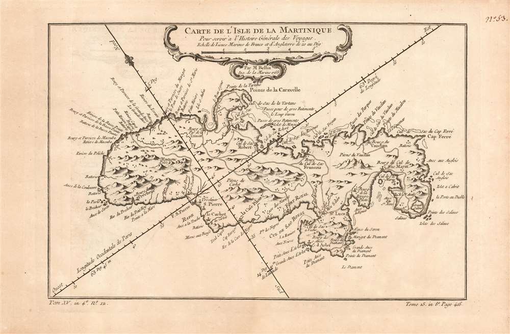
Carte de l'Isle de la Martinique.
sold
- Digital Map Information
- Suitable for large format printing
- DPI: 600
- File Size: 6.93 MB
- File Type: ZIP / TIFF
- ICC color profile embedded
- Delivered instantly via download link
This is a beautifully engraved 1780 map of the island of Hispaniola or Saint Domingue, modern-day Haiti and the Dominican Republic. The map shows topographical features pictorially. Lakes, rivers and towns are marked and named, including Santo Domingo and Port-au-Prince. In the central part of the island is the town of Hinche (Hincha). This village, founded by Spanish settlers in 1704, was in an economically driven population boom when this map was engraved: it was a cattle town able to capitalize on selling beef to the neighboring French colony (Haiti) where it was more than seven times as expensive. (more details)
Occupied Germany after World War II.
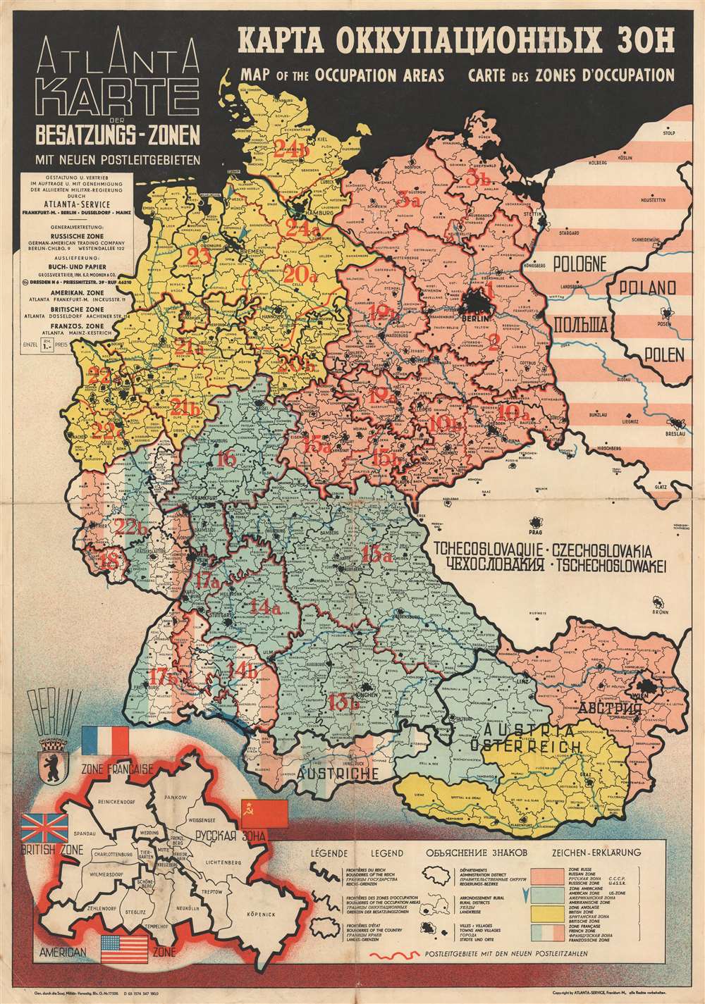
Atlanta Karte der Besatzungs-Zonen mit Neuen Postleitgebieten. КАРТА ОККУПАЦИОННЫХ ЗОН. Map of the Occupation Areas. Carte des Zonesd'Occupation.
sold
- Digital Map Information
- Suitable for large format printing
- File Size: 19.93 MB
- File Type: ZIP / TIFF
- ICC color profile embedded
- Delivered instantly via download link
This is the c. 1946 Atlanta Service map of Germany delineating the Allied Occupation Zones after the defeat of Nazi Germany. Text appears in four different languages: English, Russian, French, and German. The Oder-Neisse Line, the basis for the border between Germany and Poland, is in bold. The four Occupation Zones, administered by the United States, Great Britain, France, and the Soviet Union, are divided and shaded accordingly. Former Eastern Germany is highlighted to indicate that it was now part of a reconstituted Poland, and possibly its allegiance to the Soviet Union. Berlin is specifically highlighted, because, as it was the capital of defeated Nazi Germany, it was decided that all four Allies would occupy and administer a sector of the city. An inset in the lower-left depicts a divided Berlin, illustrating neighborhoods within each zone. (more details)
Florida in the 1950s.
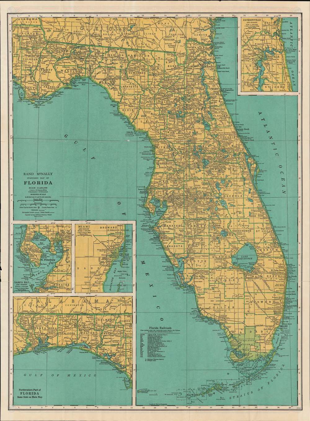
Rand McNally Standard Map of Florida. / Rand McNally Road Map Florida.
sold
- Digital Map Information
- Suitable for large format printing
- Full resolution TIFF file
- ICC color profile embedded
- Delivered instantly via download link
An uncommon 1950 Rand McNally Map of Florida. Printed on both sides, the map combines Rand McNally's Standard Map of Florida on the recto, detailing towns, cities, and political divisions, with their Road Map Florida on the verso, focusing on roads and highways. The 'standard' map includes insets of Jacksonville, Tampa Bay, Miami, and the Florida panhandle. The 'road' map also details the panhandle, but has a further inset extending the map's coverage to Cuba, underscoring the active communication between Cuba and Florida before the 1961 Cuban Missile Crises closed the borders. (more details)
Best early nautical chart of Singapore.

To The Honourable The Court of Directors of the United East India Company This Chart of Malacca Strait Singapore Strait and the Southernmost Promontory of Asia, is Inscribed by their Faithful and Obedient Servant James Horsburgh.
sold
- Digital Map Information
- Suitable for large format printing
- File Size: 27.57 MB
- File Type: ZIP / TIFF
- ICC color profile embedded
- Delivered instantly via download link
This 1857 nautical chart or maritime map of the Strait of Singapore and the southern part of the Malacca Strait is considered to be James Horsburgh's most desirable chart. Made for the British East India Company, this is one of the first charts to accurately map these heavily trafficked but treacherous straits. The chart covers the Malay peninsula roughly from Penang (Prince of Wales Island) to the island of Singapore and from the Sumatran coast to the China Sea. It features sixteen profile views as well as countless depth soundings, especially around the dangerous southern part of the Malacca Strait in the vicinity of Singapore. (more details)
Joint work by Chinese and German surveyors.
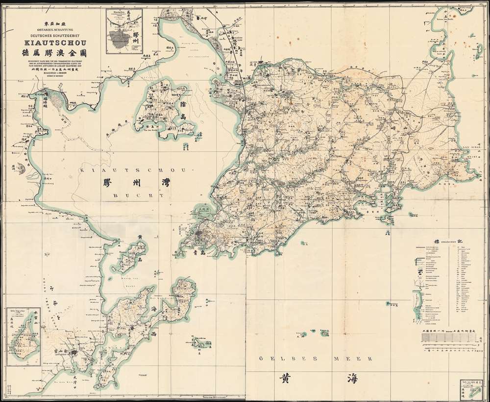
Ostasien-Schantung Deutsches Schutzgebiet Kiautschou 德属膠澳全圖 gezeichnet nach der von der Vermessung Kiautschou 1898/99 augenommenen topographischen Karte und nach eigenen Aufnahmen im Landamt Kiautschou, 1907.
sold
- Digital Map Information
- Suitable for large format printing
- File Size: 57.16 MB
- File Type: ZIP / TIFF
- ICC color profile embedded
- Delivered instantly via download link
A rare and important 1907 zincographic map of Kiautschou Bay Concession, Qingdao / Tsingtau, compiled by a joint German-Chinese team led by Jacoby. This was an official map issued in Qingdao for official use. The map covers most of what is today Qingdao, Shandong, China (青岛市), embracing Jiaozhou Wan (Kiautschou Bay), and the surrounding territories. Place names appear both in English and Chinese - reflecting the fact that this map was made jointly by Jacoby and two Chinese surveyors, draughtsman Yang Kebin (杨可斌) and translator Gao Jingtao (高景陶). The city Tsingtau (meaning 'Green Island' in German) is here laid out, consisting of a German quarter to the south and a Chinese quarter (the original fishing village) to the north. The expansive harbor, constructed around the now-famous Zhanqiao Pier (青岛栈桥), was the heart of the colony, facilitating both maritime trade and German naval activity. (more details)
Plantations along the 'Father of Waters'.
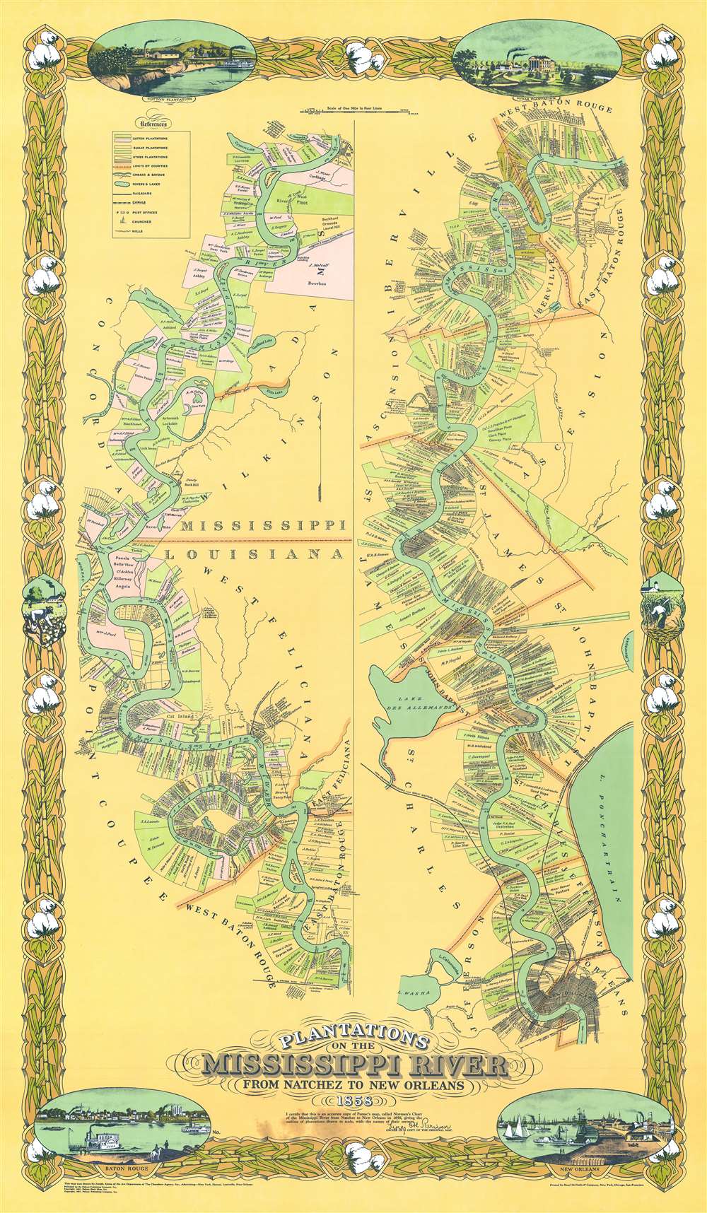
Plantations on the Mississippi River From Natchez to New Orleans 1858.
sold
This is an attractive 1967, special edition, Joseph Anthony Aiena re-envisioning of the famous 'Persac Map' or 'Norman Map', illustrating the plantations on the Mississippi River from New Orleans to Natchez. The map is divided into two sections. The left section covers from Natchez to Baton Rouge, and the right section from Baton Rouge to New Orleans. Along the way, plantation estates are illustrated and color-coded with the owners duly named. The properties are universally long and thin, assuring all-important river access to all. The map is surrounded by a decorative cotton-themed border. (more details)
Christ Church - the first Anglican Church in the Jerusalem Old City.
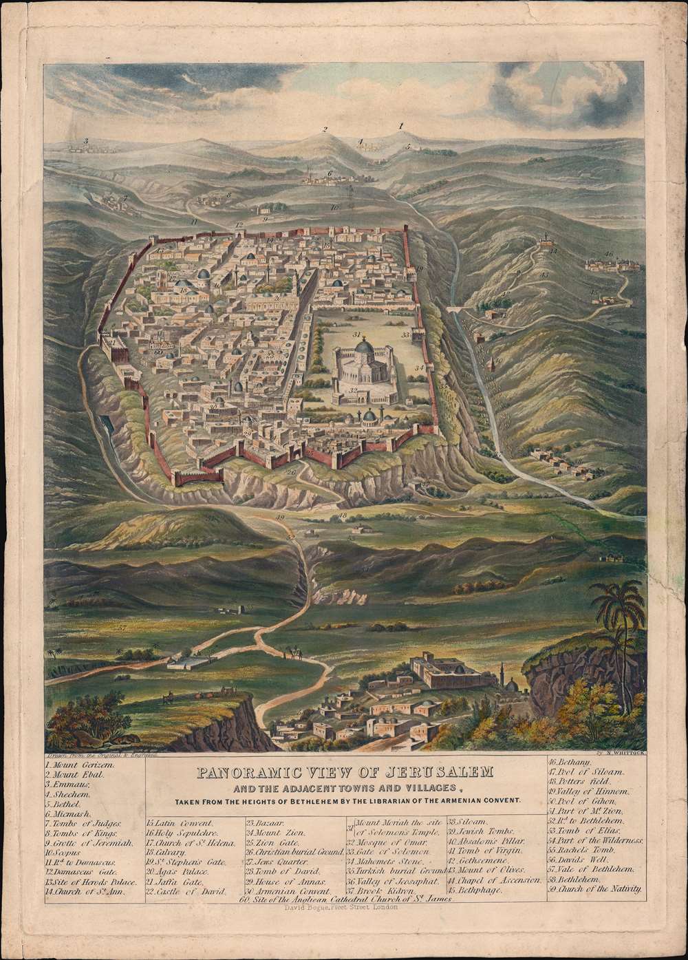
Panoramic View of Jerusalem and the Adjacent Towns and Villages, taken from the Heights of Bethlehem by the Librarian of the Armenian Convent.
sold
- Digital Map Information
- Suitable for large format printing
- Full resolution TIFF file
- ICC color profile embedded
- Delivered instantly via download link
A very attractive 1845 view of Jerusalem issued by Nathaniel Whittock. The view, purportedly drawn by the Librarian of the Armenian Convent, looks northward on Jerusalem from a hill to the south, in Bethlehem. The city walls, Dome of the Rock, and the Church of the Holy Sepulcher are recognizable. (more details)
Losing the war in Vietnam.

越南人民抗美救国形势图. / [Vietnamese people's anti-US and national saving situation map.]
sold
This is a c. 1967 Chinese anti-American propaganda broadside created by Zhu Yu Lian. The map depicts the region from Laos and Cambodia to the South China Sea and from China to the Cà Mau Peninsula. Both North Vietnam (Orange) and South Vietnam (Red) are included. Three colors are present in South Vietnam: red, teal, and white. The red areas denote territory that to be 'liberated' by the North Vietnamese, the teal represents areas controlled by the United States, and the white regions are where guerillas were active and the territory in dispute. Major US Air Force bases are marked by airplanes inscribed in black circles, while major naval installations are noted by much the same symbol, except the airplane is exchanged for an anchor. Roads and highways are illustrated and labeled, and provinces are outlined by dotted lines. (more details)
Wyoming's pioneer history.

Map of the History and Romance of Wyoming.
sold
- Digital Map Information
- Suitable for large format printing
- File Size: 13.63 MB
- File Type: ZIP / TIFF
- ICC color profile embedded
- Delivered instantly via download link
This is a 1936 Grace Raymond Hebard and Paul M. Paine pictorial map of Wyoming celebrating and romanticizing the state's pioneer history. Stylized vignettes of covered wagons, stagecoaches, cowboys, and Indians reinforce the stereotypical views of Wyoming during its early days as a territory. Historical references abound, with the Texas Trail, Bozeman Trail, Old Oregon Trail, and Overland Trail defined. Both Laramie and Cheyenne are labeled, along with Jackson Hole and Cody, noted as the 'Home of Buffalo Bill'. Other comments mark battles between Indians and U.S. soldiers, frontier forts, and areas explored by 'some pioneers of Wyoming'. Both Grand Teton National Park and Yellowstone National Park are identified in the upper-left corner of the state. Wyoming's counties are illustrated and labeled as well, along with mountain ranges and the state's many rivers. Vignettes appear along the left and right borders and illustrate a wagon train, a Pony Express transfer, and the state's flag. A longhorn steer, two elk, and two meadowlark, all important parts of Wyoming's history, adorn the map's top border. (more details)
Striking railroad map of Massachusetts.
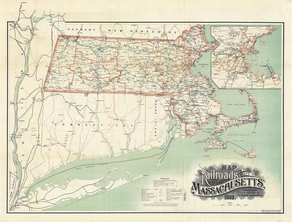
Map of the Railroads of the State of Massachusetts.
sold
- Digital Map Information
- Suitable for large format printing
- File Size: 55.53 MB
- File Type: ZIP / TIFF
- ICC color profile embedded
- Delivered instantly via download link
An uncommon and striking 1892 3-color chromolithograph map of Massachusetts illustrating railroad development throughout the state. The map covers the entire state, with 17 different railroad company routes defined using a combination of color and pattern coding. A large inset in the upper right details the dense greater Boston metropolitan area. The map offers additional coverage to the Hudson Valley and southwest to New York City, illustrating important commercial and passenger connections. The finely engraved title block, appearing in the lower right, stands out for its masterful execution. (more details)
Frontier Imagery and the Pony Express.
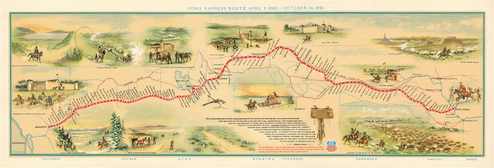
Pony Express Route April 3, 1860 - October 24, 1861.
sold
- Digital Map Information
- Suitable for large format printing
- File Size: 25.6 MB
- File Type: ZIP / TIFF
- ICC color profile embedded
- Delivered instantly via download link
This is a 1951 first edition of the William Henry Jackson and Howard Roscoe Driggs pictorial map of the Pony Express. The map depicts the region from the Pacific Ocean to Kansas City, Missouri, and from Platte Bridge, Wyoming to San Francisco Bay. The Pony Express Route itself is highlighted in red and most of the 190 stations along the way are identified. (more details)