
Administrative map issued at the height of the WWII Japanese occupation fo the Philippines.
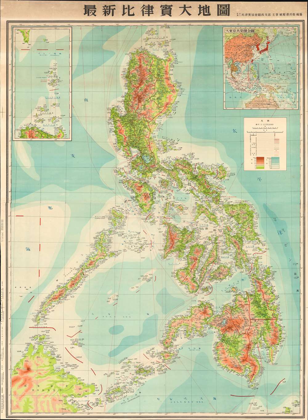
New Large Map of the Philippines. / 圖地大質律比新最
sold
- Digital Map Information
- Suitable for large format printing
- File Size: 122.27 MB
- File Type: ZIP / TIFF
- ICC color profile embedded
- Delivered instantly via download link
A scarce 1943 or Showa 18 Japanese World War II Era wall map of the Philippines. This is the largest single map of the Philippines we have encountered from the period of the Japanese occupation. Based upon earlier American maps, this massive chart focuses on topography and infrastructure, illustrating roads, existing railroads, nautical routes, and more. It was intended for administrative and management use, rather than active military aggression and advocates for the Philippines as an active part of the Greater East Asia Co-Prosperity Sphere. In addition, the map shows an international boundary, drawn along part of the 117th meridian, that indicates Japan’s claim of sovereignty over the Spratly Islands, which the Japanese occupied in 1939 and administered from Taiwan. (more details)
Unique! w/ Manuscript notations tracing Roberts' famous march from Kabul to Kandahar.

Stanford's Map of the Seat of War in Afghanistan.
sold
- Digital Map Information
- Suitable for large format printing
- File Size: 38.6 MB
- File Type: ZIP / TIFF
- ICC color profile embedded
- Delivered instantly via download link
This is an 1880 Edward Stanford map of Afghanistan during the Second Anglo-Afghan War. Manuscript notations trace the events of July through September 1880, including the General Roberts' famous march from Kabul to Kandahar in August 1880. Roberts' march, and that of the force under the command of General Phayre, are both illustrated here in red. The blue traces the movements of Ayub Khan. (more details)
The best 18th century survey of the interior of South America
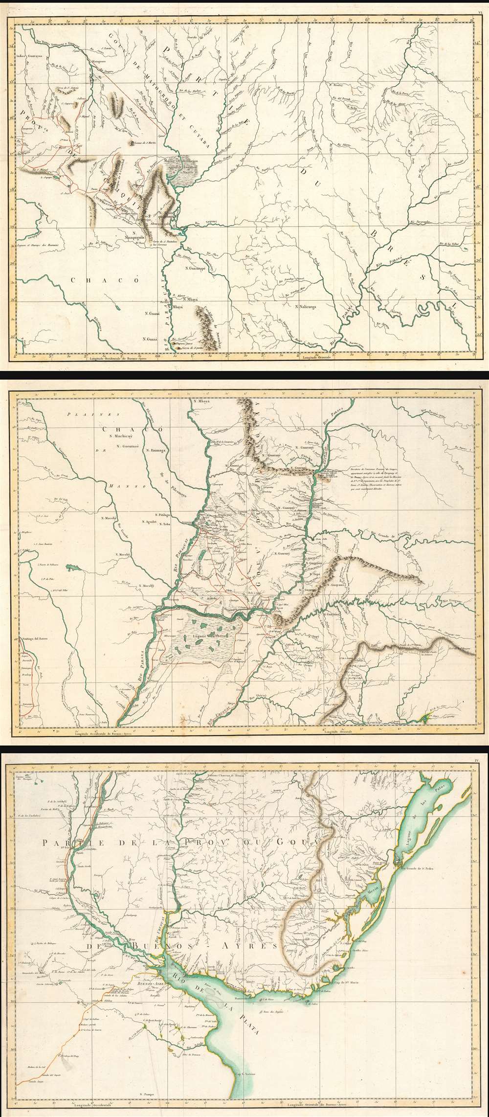
(Untitled Maps of the Viceroyalty of the Río de la Plata)
sold
- Digital Map Information
- Suitable for large format printing
- Full resolution TIFF file
- ICC color profile embedded
- Delivered instantly via download link
This is a set of three 1809 maps of the Rio de la Plata region of South America, produced by the Spanish border commissioner and military engineer Félix de Azara. The map shows the results of Azara's surveys, made over the course of twenty years, in order to fix the borders between the Spanish and the Portuguese colonies there pursuant to the First Treaty of San Ildefonso. Beyond simply establishing the border of Brazil, the surveys were intended to realize the establishment of The Viceroyalty of the Río de la Plata (Virreinato del Río de la Plata), the last organized and the shortest-lived of the Viceroyalties of the Spanish Empire in the Americas.
The Viceroyalty was first established in 1776, and comprised parts of modern day Argentina, Chile, Bolivia, Paraguay and Uruguay. Its borders contained the watersheds of the Parana, Uruguay, and Paraguay Rivers from the Rio de la Plata up to Bolivia and Brazil. Buenos Aires was to be the capital, chosen because of its position opposite the Río de la Plata estuary from the Portuguese outpost of Colonia del Sacramento. Very little of these lands had been well surveyed prior to the treaty, and for Azara's team to be successful in fixing the borders such surveys had to be undertaken. In many cases, the treaty indicated that the border should fall on rivers which in fact did not exist.
The three untitled maps are as follows: (more details)
The Viceroyalty was first established in 1776, and comprised parts of modern day Argentina, Chile, Bolivia, Paraguay and Uruguay. Its borders contained the watersheds of the Parana, Uruguay, and Paraguay Rivers from the Rio de la Plata up to Bolivia and Brazil. Buenos Aires was to be the capital, chosen because of its position opposite the Río de la Plata estuary from the Portuguese outpost of Colonia del Sacramento. Very little of these lands had been well surveyed prior to the treaty, and for Azara's team to be successful in fixing the borders such surveys had to be undertaken. In many cases, the treaty indicated that the border should fall on rivers which in fact did not exist.
The three untitled maps are as follows: (more details)
A superbly executed map of Lake Como and its region.
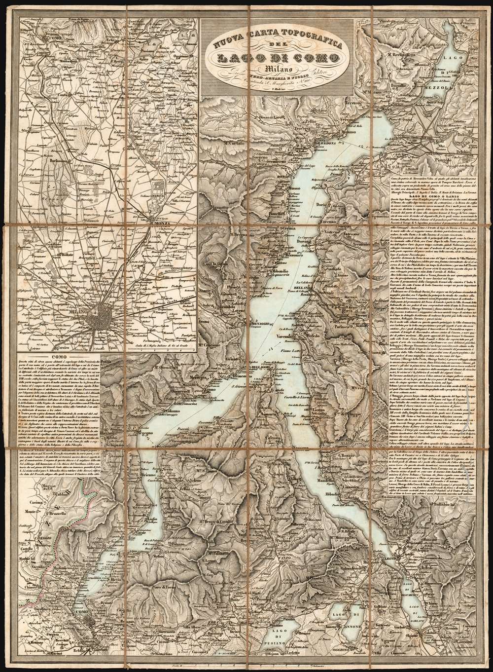
Nuova Carta Topografica Del Lago Di Como.
sold
- Digital Map Information
- Suitable for large format printing
- Full resolution TIFF file
- ICC color profile embedded
- Delivered instantly via download link
This is a rare 1864 Artaria map of Lake Como and its vicinity, produced shortly after Giuseppe Garibaldi's campaign recaptured the territory from Austria. It masterfully evokes the mountainous terrain, shown with some of the finest hachure-engraving we have seen in this medium. The map includes the area surrounding the cities of Como and Lecco, and the Lago di Pusiano, Lago di Annone, Lago di Mezzola, and the smaller lakes surrounding Lake Como. An inset map in the upper left details the route between Como and Milan, showing the rail connection between the two cities via Monza. The map includes detailed descriptive text for both the city of Como and the lake, its towns and its attractions. (more details)
The first detailed mapping of the Okavango Delta, a Natural Wonder of Africa and a UNESCO World Heritage Site.
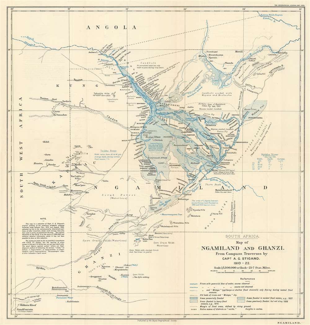
South Africa. Map of Ngamiland and Ghanzi. From Compass Traverses by Capt. A.G. Stigand. 1910 - 1922.
sold
- Digital Map Information
- Suitable for large format printing
- File Size: 8.96 MB
- File Type: ZIP / TIFF
- ICC color profile embedded
- Delivered instantly via download link
Recognized as one of the most significant maps of the region, this is the influential 1923 Almar Gordon Stigand map of Ngamiland or North-West District and Ghanzi, Botswana, including the world-famous Okavango Delta. Created after nearly ten years of surveying, Stigand's map contains more detail than any previously published, including those of the Livingstone era. Even Stigand believed in the importance of his work. In the article published in the Geographical Journal, he stated that
This paper has been written as an adjunct to the writer's sketch-map - the results of numerous journeys by land and water in Ngamiland during the last thirteen years - rather than the map being supplementary to the paper.Regarding the level of detail, villages, islands, rivers, and streams are labeled, all in Sechwana, the native language. Stigand also includes notes concerning landscape, flooding tendencies, and water levels. (more details)
French recognition of the Republic of Texas.

Carte de l'Amerique Septentrionale.
sold
- Digital Map Information
- Suitable for large format printing
- DPI: 600
- File Size: 21.6 MB
- File Type: ZIP / TIFF
- ICC color profile embedded
- Delivered instantly via download link
A fine example of Lapie’s 1838 map of North America. The map covers the entire North American continent and Greenland, embracing the Caribbean. An inset in the lower left corner details the Bering Sea and the Aleutian Islands. This map was engraved by Armand Joseph Lallemand as plate no. 42 in the first edition of Lapie’s important Atlas Universel, and it was retained in later editions major updates by Pierre Tardieu. The hand color this example conforms to that of the 1838 edition, which is of significance because it is with color that the mapmaker illuminates the political borders on the map, particularly that of the Republic of Texas. (more details)
Highlights the 'inland sea' of Lake Parima and El Dorado!

Partie de Terre Ferme ou sont Guiane et Caribane.
sold
- Digital Map Information
- Suitable for large format printing
- DPI: 600
- File Size: 18.29 MB
- File Type: ZIP / TIFF
- ICC color profile embedded
- Delivered instantly via download link
This is a remarkable 1679 Nicolas Sanson map of the northwestern parts of South America, including Lake Parima (Parime), and the route to El Dorado. Cartographically, this map is loosely based upon cartographic conventions established by Johannes De Laet. However, Sanson introduced some exciting new ideas, including some of the first fixed political borders in Guiana. The map depicts from Isla Margarita and the Orinoco Delta eastward as far as Tampico and southwards as far as the mouth of the Amazon River. (more details)
The Spanish-American War in Cuba.

Goff's Historical Map of the Spanish-American War in the West Indies, 1898.
sold
- Digital Map Information
- Suitable for large format printing
- File Size: 12.72 MB
- File Type: ZIP / TIFF
- ICC color profile embedded
- Delivered instantly via download link
This is a cartographically and typographically beautiful 1899 Eugenia Wheeler Goff and Henry Slade Goff map of the West Indies. The map depicts the region from the Yucatan Channel to Barbados and from Tampa, Florida to Grenada. Islands throughout are illustrated and labeled, along with their colonial overlords, including many of the Bahamas, Virgin Islands, and all the Lesser Antilles. Color coding differentiates between provinces in Cuba and Santo Domingo. Three insets depict San Juan, Puerto Rico; Havana, Cuba; and the Santiago Campaign. Its original binder and a stamp on the map suggest this was issued as a promotional item for Chester Hunnewell Beane's drugstore in Gardiner, Maine. (more details)
Labels Spiritu Santo Bay - Tampa Bay.
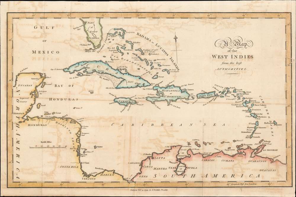
A Map of the West Indies.
sold
- Digital Map Information
- Suitable for large format printing
- DPI: 600
- File Size: 6.19 MB
- File Type: ZIP / TIFF
- ICC color profile embedded
- Delivered instantly via download link
This is a 1799 Bryan Edwards map of the West Indies. Depicting from Florida to northern South America, islands throughout the Caribbean Sea are labeled, including many of the Bahama and the Leeward Islands. Cozumel is identified off the Yucatan coast, and coastal lagoons, islands, and gulfs are named throughout. Very little detail is present in Florida, apart from labeling Martyr's Reef and Spiritu Santo Bay, today's Tampa. (more details)
West-Central Switzerland mapped during the first geometrically accurate survey of Switzerland.

[Blatt XII. Freyburg - Bern].
sold
- Digital Map Information
- Suitable for large format printing
- Full resolution TIFF file
- ICC color profile embedded
- Delivered instantly via download link
This superbly detailed 1860 Dufour map of western and central Switzerland, from the first geometrically accurate map of the Swiss Confederation; this example is an 1875 revision of the map. It spans from the canton of Fribourg to the canton of Bern. The eastern portion of Lac de Neuchatel is shown; the map reaches as far East as the Thuner See, and as far south as Gruyères. (more details)
Depression-era Minnesota.
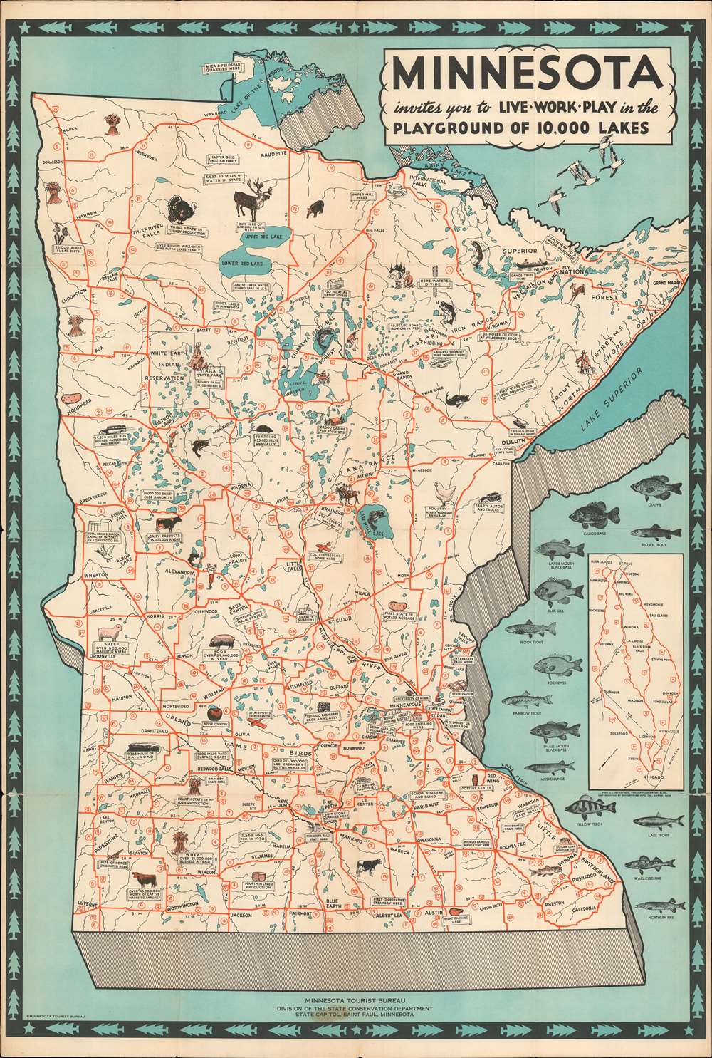
Minnesota invites you to Live World Play in the Playground of 10,000 Lakes.
sold
- Digital Map Information
- Suitable for large format printing
- File Size: 31.47 MB
- File Type: ZIP / TIFF
- ICC color profile embedded
- Delivered instantly via download link
This c. 1935 Minnesota Tourist Bureau pictorial tourist map of Minnesota presents an intriguing mix of economic facts and potential tourist sites. Minnesota's fishing, while not expressly touted, takes center stage. Illustrations of fourteen different fish species 'swim' along the right border and facts about the piscine population are scattered throughout. Red lines trace state highways, and white banners proclaim everything from the 'largest freshwater inland lake in the U.S.' and the '11,007 lakes in Minnesota' to the state's annual dairy, barley, and raspberries production. The University of Minnesota and the Mayo Clinic both make an appearance. State parks and an Indian reservation are illustrated next to references to resort hotels, tourist cabins, and '36 holes of golf'. (more details)
Hawaii as the nexus of Japanese WWII Pacific strategy.

Newest Pacific Situation Map. / 最新太平洋形勢地圖
sold
- Digital Map Information
- Suitable for large format printing
- File Size: 122.08 MB
- File Type: ZIP / TIFF
- ICC color profile embedded
- Delivered instantly via download link
This is a rare 1943 (Showa 18) large format Japanese map of the Pacific, North and South America, and East Asia. Issued at the height of World War II, this map highlights the significance of Hawaii to the Japanese Pacific strategy - as a nexus for all traffic, military and otherwise, between Asia and America. Japanese claimed territories, in this case Korea, Japan, parts of Sakhalin, Taiwan, parts of Malaysia, and Micronesia are highlighted in red. Those areas under the Japanese sphere of influence, including Manchuria, China, Burma, and Cambodia are outlined in red. Also highlighted are the Japanese Kuril Islands and several Aleutian Islands where Japanese air based had been constructed in anticipation of action against the United States. A stamp in the upper left underscores that his map is approved by the Imperial Japanese authorities. (more details)
A landmark map of New England.

Map of the States of Maine New Hampshire Vermont Massachusetts Connecticut and Rhode Island.
sold
- Digital Map Information
- Suitable for large format printing
- DPI: 600
- File Size: 35.54 MB
- File Type: ZIP / TIFF
- ICC color profile embedded
- Delivered instantly via download link
This is an 1825 Henry S. Tanner map of New England. The map depicts the states of Connecticut, Massachusetts, Rhode Island, Maine, Vermont, and New Hampshire. The map is cartographically most interesting in Maine, where it exhibits a primitive county structure. There is a stunning decorative vignette in the lower right containing the map's title, as well as an illustration of a surveyor on top of a rocky outcrop. In the foreground fisherman work the cod fisheries while a larger sailing vessel is being repaired in the background. (more details)
An Early, Revolutionary-War era Plan of Boston.
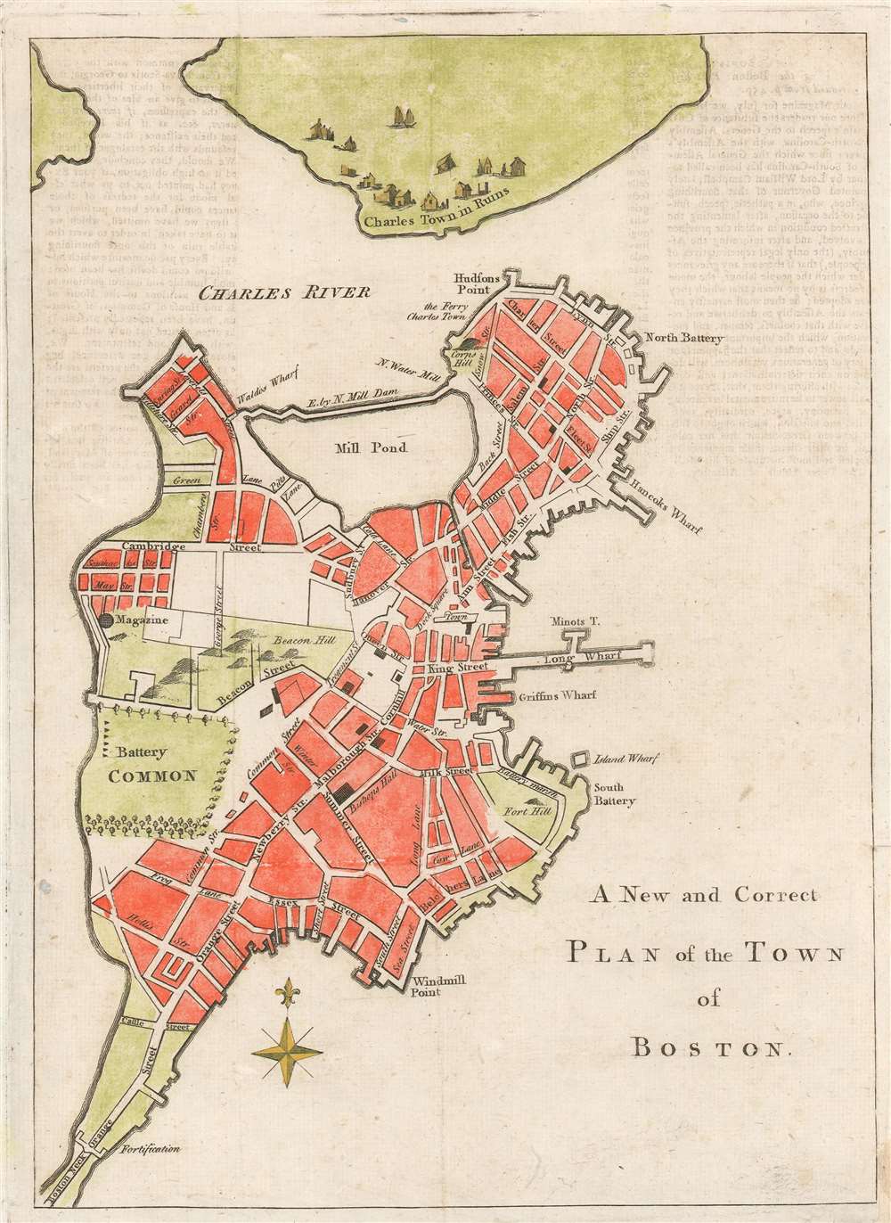
A New and Correct Plan of the Town of Boston.
sold
- Digital Map Information
- Suitable for large format printing
- DPI: 600
- File Size: 3.8 MB
- File Type: ZIP / TIFF
- ICC color profile embedded
- Delivered instantly via download link
An uncommon and attractive 1775 map of Boston issued in the early days of the American Revolutionary War just following the Battle of Bunker Hill. The map covers the original peninsula of Boston as well as the ruins of Charleston just across the river. The plan names streets, including Beacon Street with a topographical representation of Beacon Hill, Newberry Street, and indications of fortifications, batteries, and other landmarks. Major buildings are represented, as are wharfs, including Hancock's Warf, Long Warf, and Griffins Warf, among others. The mill dam is identified. (more details)
A richly detailed map revealing early European settlement and administration.

Isola di Madagascar, o di S. Lorenzo scoperta da Portoghesi nell'Anno 1506, Descritta dal P. Mrō Coronelli M.C. Cosmografo della Seren.ma Rep: Di Venetia, Dedicata All' Ill.mo Sigr. Antonio Magliabecchi, Bibliotecario dell' A. Serenissima Del Gran Duca di Toscana.
sold
- Digital Map Information
- Suitable for large format printing
- DPI: 600
- File Size: 29.33 MB
- File Type: ZIP / TIFF
- ICC color profile embedded
- Delivered instantly via download link
This is Vincenzo Maria Coronelli's 1697 map of Madagascar. It is the most detailed of the 17th century maps of the island. While the southeastern portion of the island reflects the cartography of Étienne de Flacourt, who from 1648 to 1653 was French East India’s Governor of Madagascar, and who in 1658 published the first natural history of the island, this map includes detail beyond that which appeared in any of the French or Dutch maps sourced from Flacourt's manuscripts. Typical of Coronelli's meticulously researched work, the map provides a granular catalogue of the toponymy of the island's coastline. The interior has been broken into administrative regions and includes tribal names not present on any earlier printed maps of which we are aware. (more details)
Important post-Revolutionary War map of New England!
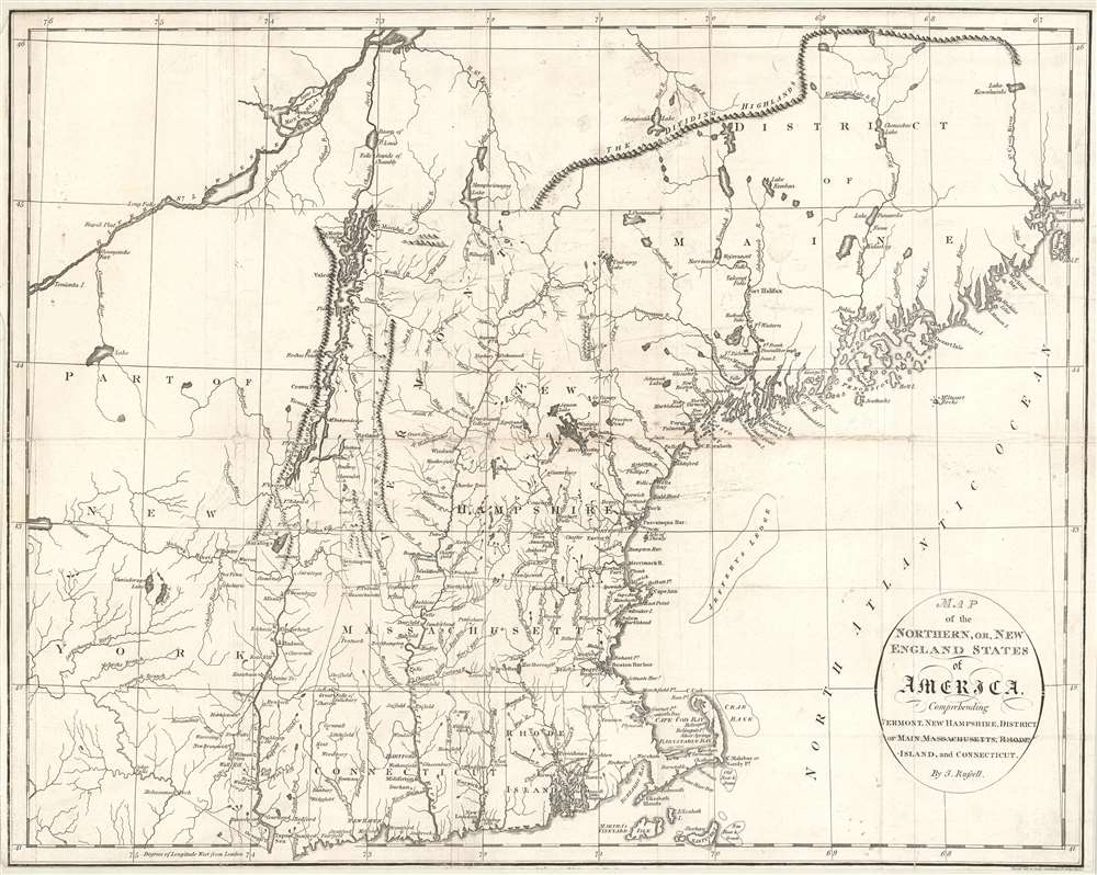
Map of the Northern, or, New England States of America, Comprehending Vermont, New Hampshire, District of Main, Massachusetts, Rhode Island, and Connecticut.
sold
- Digital Map Information
- Suitable for large format printing
- DPI: 600
- File Size: 11.76 MB
- File Type: ZIP / TIFF
- ICC color profile embedded
- Delivered instantly via download link
An attractive and finely engraved 1795 map of New England by John Russell - one of the few commercial maps of New England issued immediately following the American Revolutionary War (1775 - 1783). The map covers the northwestern part of the United States from, roughly, Lake Oneida (near Fort Stanwix) to Passamaquoddy Bay, New Brunswick, and from Montreal south as far as Tappan Zee, Martha's Vineyard, and Nantucket. This includes the District of Maine (which was then under the governance of Massachusetts), Vermont, New Hampshire, Massachusetts, Connecticut, and Eastern New York. (more details)
Tolkien's Middle-Earth!
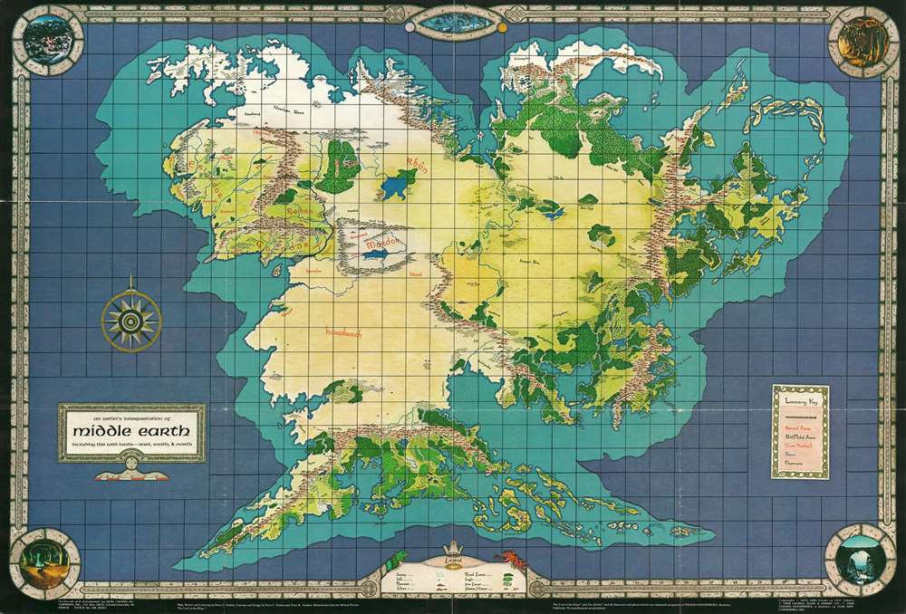
An Artist's Interpretation of Middle Earth including the Wild Lands - east, south, and north.
sold
This is a 1982 map of J. R. R. Tolkien's fantasy world 'Middle-Earth' by Peter C. Fenlon. Fans of Tolkien will be quick to recognize the northeastern part of the map, generally known as the Westlands, encompassing the main theater of both the Hobbit and The Lord of the Rings. The cartography for these areas, from Forodwaith to Umbar and from the western ocean (Belegaer) to the Sea of Rhûn, is drawn directly from the iconic map that accompanied the The Lord of the Rings. Unlike the maps published in Tolkien's famous books, the present map extends south and west to embrace the entire continent of Endor. Cartographically, Endor roughly mirrors Europe (Westlands), Africa (Haradwraith), and Asia (east of Rhûn). Although Tolkien's Legendarium does in fact give some hints regarding the lands and topography to the east of Mordor and Rhûn, much of the cartography here seems to have been imagined by Fenlon. Nonetheless, this map proved popular in the 1980s and was distributed to complement Iron Crown Enterprises successful LOTR-based role-playing game series. (more details)
An Elegant Chart comparing the Rivers and Mountains of the World.
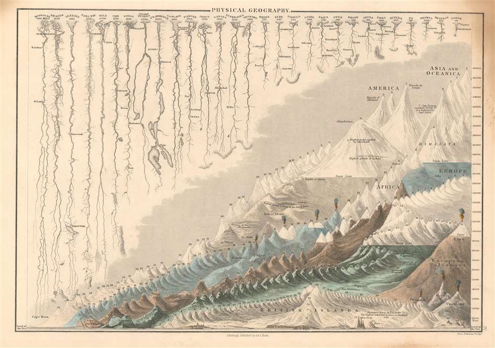
Physical Geography.
sold
- Digital Map Information
- Suitable for large format printing
- DPI: 600
- File Size: 10.43 MB
- File Type: ZIP / TIFF
- ICC color profile embedded
- Delivered instantly via download link
This is a handsome example of Adam and Charles Black's 1844 depiction of the comparative sizes of the mountains and rivers of the world. Charts of this type were first introduced in England around 1823 and became a common feature in atlases throughout the 19th century. The present example is admired as one of the more attractive British examples of the style. (more details)
Early Tourism Map.
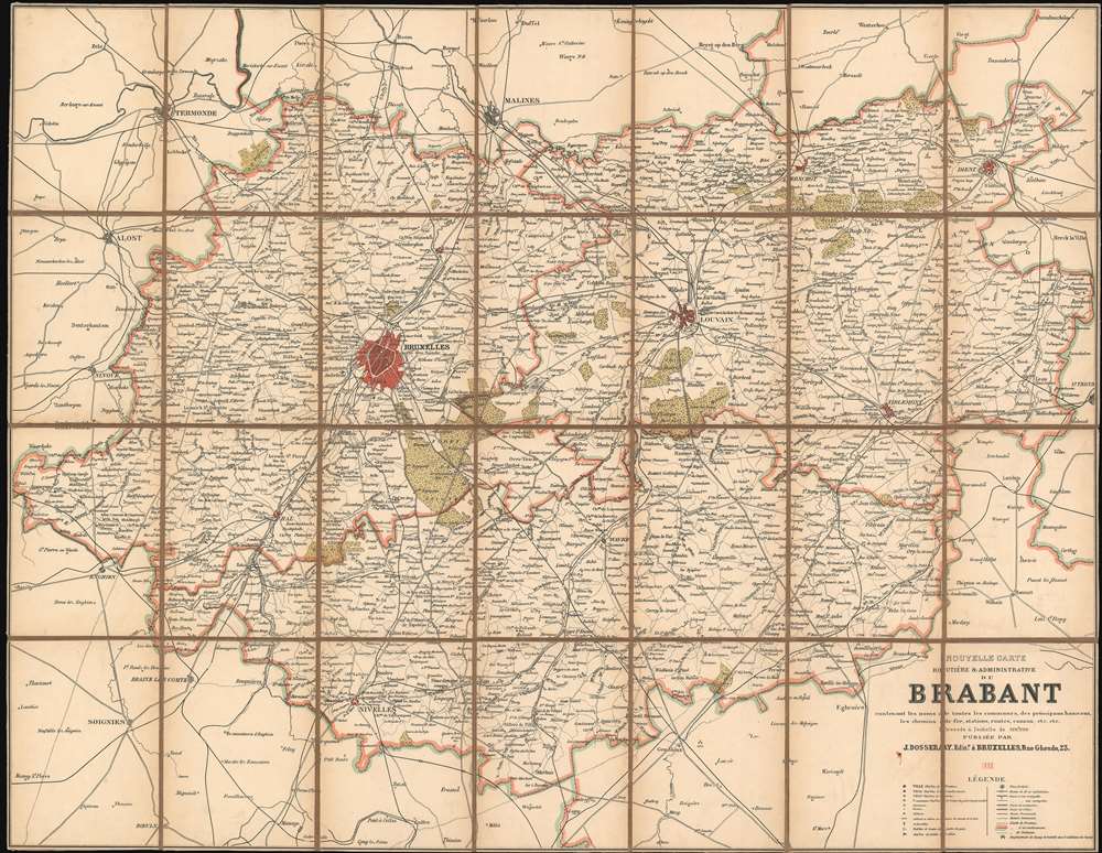
Nouvelle Carte Routière et Administrative du Brabant contenant les noms de toutes les communies, des principaux hameaux, les chemins de fer, station, routes, canaux, etc. etc.
sold
- Digital Map Information
- Suitable for large format printing
- File Size: 49.66 MB
- File Type: ZIP / TIFF
- ICC color profile embedded
- Delivered instantly via download link
This is an 1886 Jean Dosseray map of Brabant Province in Belgium. The map was published to capitalize on the growing ease of rail travel and the rise of commercial tourism. Numerous cities and towns are identified throughout the province, with Brussels (the capital of Belgium and the province) and Louvain shaded red. Major roads, railroads, and canals are illustrated as well. (more details)
An amazing example of Harrison's innovative spherical perspective.
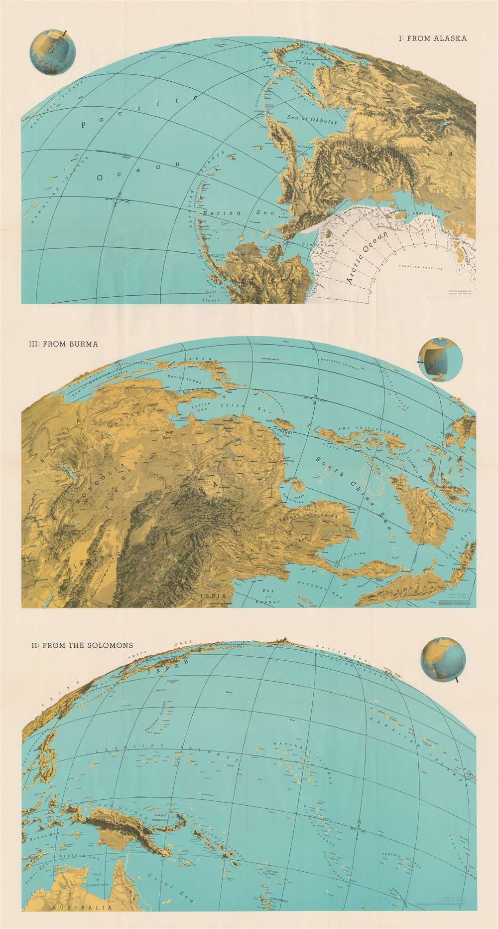
I: From Alaska. III: From Burma. II: From the Solomons.
sold
- Digital Map Information
- Suitable for large format printing
- File Size: 62.02 MB
- File Type: ZIP / TIFF
- ICC color profile embedded
- Delivered instantly via download link
This 1943 Richard Edes Harrison map of the Pacific exemplifies his innovative spherical projection - successfully employed in countless WWII maps. Harrison uses the Pacific Ocean, an important World War II theater, to present his new cartographic paradigm. Here, Harisson exaggerates vertical topography to stand out prominently on land spherically projected to imitate a relief globe. The result leads the reader to interpret the often localized events on which he is focusing, from a global perspective. Today Google Earth and other mapping apps adopt a similar approach. Harrison's audience in 1943, obsessed with every detail about the global war, responded enthusiastically to his approach. (more details)