
Plan of Boston Detailing the City Prior to the Filling of the Back Bay
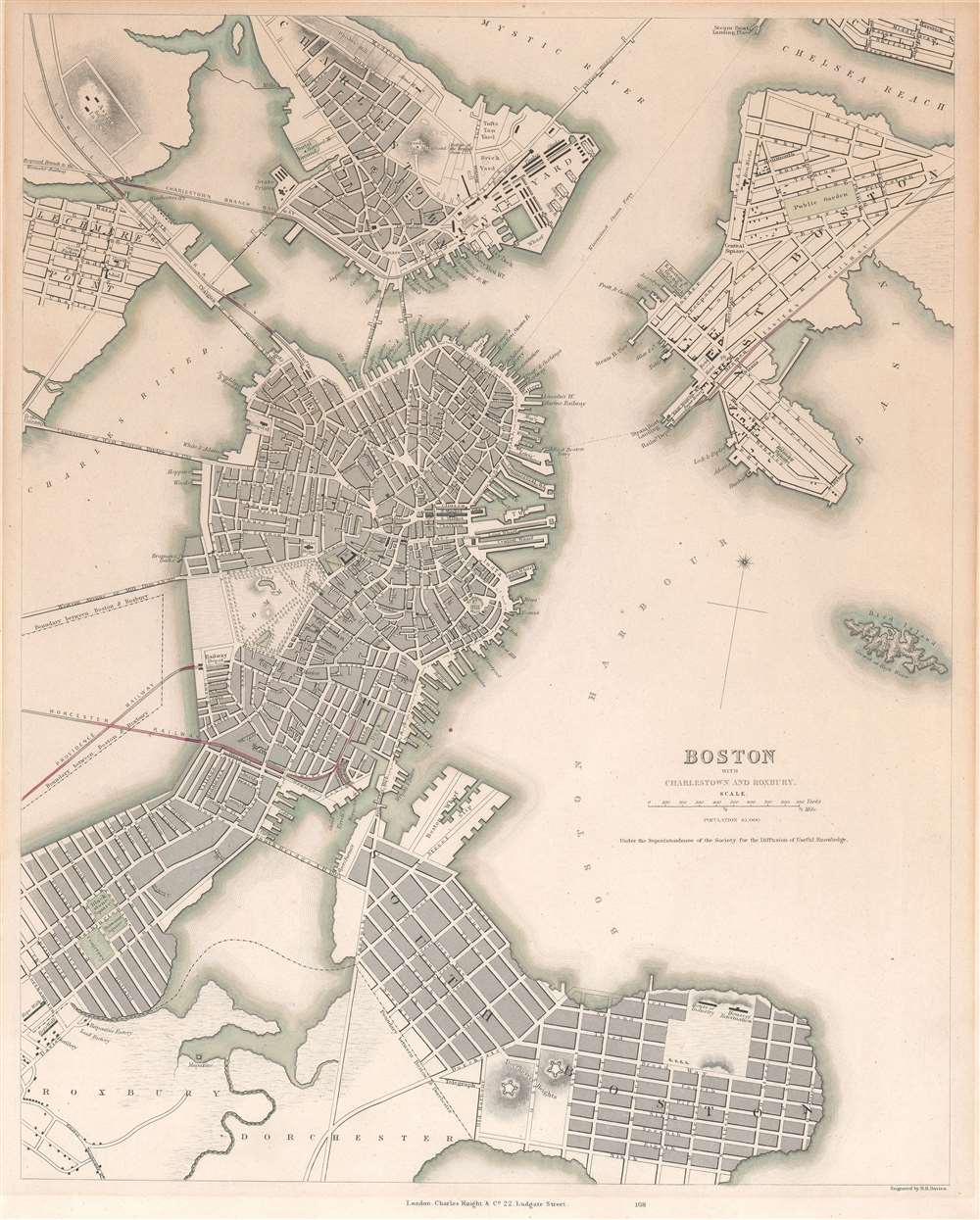
Boston with Charlestown and Roxbury.
sold
- Digital Map Information
- Suitable for large format printing
- DPI: 600
- File Size: 16.34 MB
- File Type: ZIP / TIFF
- ICC color profile embedded
- Delivered instantly via download link
This is an 1845 Society for the Diffusion of Useful Knowledge (S.D.U.K.) map of Boston and its vicinity. The map shows the city from Charlestown and the Chelsea Reach in the north, down to Dorchester and South Boston; the map reaches as far west as Lechmere and part of Roxbury, and as far east as roughly the intersection of Chelsea and East Eagle streets. Bird island appears in the harbor with the notation indicating that it is underwater at high tide. Forts, municipal structures and factories are marked on the map, as are gardens and commons. (more details)
Japanese interest in the WWI Zimmermann Telegram.

Latest Full Map of the Republic of Mexico 1917 / Saishin mekishiko kyowakoku zenzu. / 最新墨西哥共和國全圖
sold
- Digital Map Information
- Suitable for large format printing
- File Size: 42.78 MB
- File Type: ZIP / TIFF
- ICC color profile embedded
- Delivered instantly via download link
A relic of one of the most extraordinary events in World War I, this is a 1917 Japanese Gen Muraoka (村岡玄 著) map of Mexico issued in response to the infamous Zimmermann Telegram. The Telegram, intercepted by British Intelligence, proposed an alliance between Mexico, Japan, and Germany against the United States in the event that the U.S. entered World War I. While the missive was intercepted and the proposed protocol failed, it generated Japanese interest in Mexico and influenced U.S. participation in WWI against Germany. This is the only known map to demonstrate Japanese interest in the Zimmermann Telegram. (more details)
Pictorial tribute to American history!
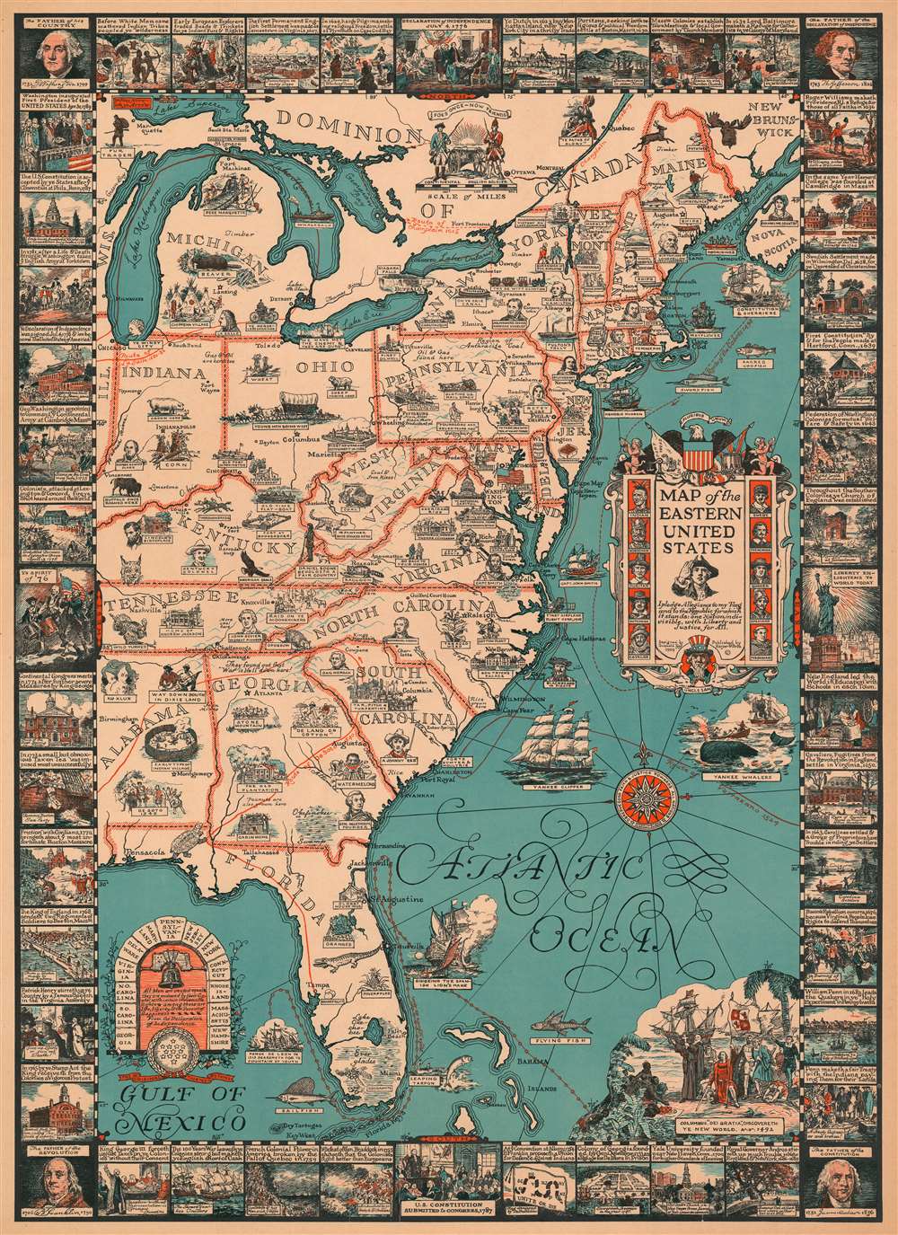
Map of the Eastern United States.
sold
- Digital Map Information
- Suitable for large format printing
- File Size: 59.38 MB
- File Type: ZIP / TIFF
- ICC color profile embedded
- Delivered instantly via download link
This is a 1929 Griswold Tyng pictorial map of the eastern United States highlighting important events and figures in American history. Pictorial vignettes scattered throughout identify these moments and people, sometimes explicitly, while others necessitate a certain level of familiarity with the subject. For instance, the portraits presented here refer back to not only the founding of the colonies but the exploration of the continent, with La Salle illustrated in Michigan and the routes of La Salle, Champlain, Ponce de Leon, de Soto, and Verrazano traced across the continent and the seaboard. Other portraits include American presidents, among these Theodore Roosevelt and Abraham Lincoln; writers, such as James Fenimore Cooper and Henry Wadsworth Longfellow; and reminders of less exultant parts of the country's past, including the Ku Klux Klan, ' Johnny Reb', and Jefferson Davis, the President of the Confederacy.
Historical events, such as the Surrender at Appomattox Court House that ended the American Civil War, President Lincoln's Gettysburg Address, and the horrible winter suffered by the Continental Army at Valley Forge are also referenced. American industry makes an appearance, with references made to ship building, whaling, and iron smelting. Agricultural pursuits are also highlighted. Wheat and sheet are included in Ohio, while cotton and tobacco adorn North Carolina, and oranges and grapefruit populate Florida. The whole is surrounded by a pictorial summary of American colonial history, from before the arrival of the first European settlers until George Washington's inauguration as the First President of the United States in 1789. Portraits of Washington, Thomas Jefferson, James Madison, and Benjamin Franklin adorn the corners. (more details)
Historical events, such as the Surrender at Appomattox Court House that ended the American Civil War, President Lincoln's Gettysburg Address, and the horrible winter suffered by the Continental Army at Valley Forge are also referenced. American industry makes an appearance, with references made to ship building, whaling, and iron smelting. Agricultural pursuits are also highlighted. Wheat and sheet are included in Ohio, while cotton and tobacco adorn North Carolina, and oranges and grapefruit populate Florida. The whole is surrounded by a pictorial summary of American colonial history, from before the arrival of the first European settlers until George Washington's inauguration as the First President of the United States in 1789. Portraits of Washington, Thomas Jefferson, James Madison, and Benjamin Franklin adorn the corners. (more details)
Extremely rare pocket map of New York's Central Park.

Map of the Central Park Showing the progress of the Work up to January 1st 1860.
sold
- Digital Map Information
- Suitable for large format printing
- File Size: 13.41 MB
- File Type: ZIP / TIFF
- ICC color profile embedded
- Delivered instantly via download link
A very attractive 1860 pocket map of New York City's Central Park. This is an extremely rare pocket map variant on the map of Central Park that later appeared in the 1860 Commissioner's Annual Report on the Progress of Central Park. This map is not listed in Haskell and to our knowledge was not issued to the public in pocket format – only in the Commissioner's Annual Report. Most likely it was available only to those city officials actually involved in the planning and construction of Central Park.
This extraordinary map reveals Central Park as conceived by the landscape architects, and indeed 'artists,' Calvert Vaux and Frederick Law Olmsted. Vaux and Olmsted were awarded the task of designing Central Park in 1853 by the City Common Council. Olmsted's vision drove the overall design while Vaux concentrated his attentions on bridges, buildings, and other structures within the park. The creation of Central Park, which was to consist of some 800 acres of public forest, pathways, promenades, lakes, bridges, and meadows, was a seminal moment in civic urban design. The park itself was designed as a whole with every tree, pond, and bench meticulously planned. Olmsted wrote: 'Every foot of the Park's surface, every tree and bush, as well as every arch, roadway, and walk has been fixed where it is with a purpose.'
Historian Gloria Deak writes,
This extraordinary map reveals Central Park as conceived by the landscape architects, and indeed 'artists,' Calvert Vaux and Frederick Law Olmsted. Vaux and Olmsted were awarded the task of designing Central Park in 1853 by the City Common Council. Olmsted's vision drove the overall design while Vaux concentrated his attentions on bridges, buildings, and other structures within the park. The creation of Central Park, which was to consist of some 800 acres of public forest, pathways, promenades, lakes, bridges, and meadows, was a seminal moment in civic urban design. The park itself was designed as a whole with every tree, pond, and bench meticulously planned. Olmsted wrote: 'Every foot of the Park's surface, every tree and bush, as well as every arch, roadway, and walk has been fixed where it is with a purpose.'
Historian Gloria Deak writes,
There was a staggering amount of work to be done to transform the area into a blend of pastoral and woodland scenery. This involved the design and construction of roadways, tunnels, bridges, arches, stairways, fountains, benches, lamp posts, gates, fences and innumerable other artifacts. It also involved the supervision of an army of about five thousand laborers…Olmsted, to whom most of the credit goes, insisted on seeing the multidimensional project as a single work of art, which he was mandated to create. For this purpose, he ventured to assume to himself the title of ‘artist.'Today, because of Vaux and Olmsted's efforts, New York Yorkers, ourselves included, have the privilege of enjoying what is, perhaps, the finest example of a planned urban public recreation area in the world. (more details)
Set of landmark maps of the Moon made for the Apollo 11 Lunar Landing.
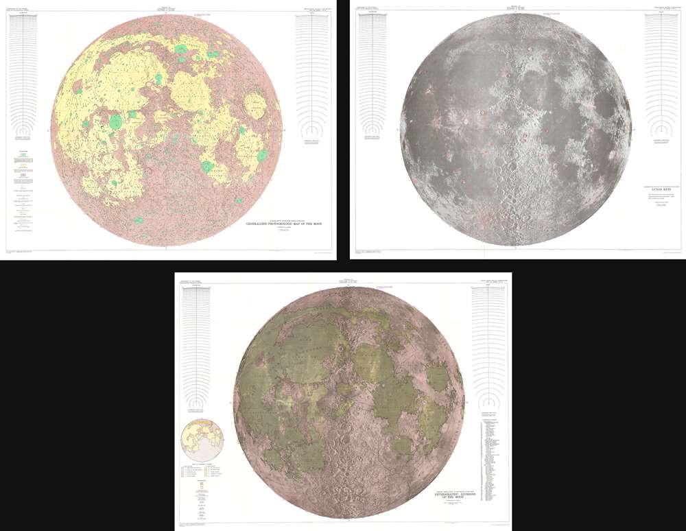
Engineer Special Study of the Surface of the Moon Generalized Photogeologic Map of the Moon. / Lunar Rays. / Physiographic Divisions of the Moon.
sold
- Digital Map Information
- Suitable for large format printing
- File Size: 358.37 MB
- File Type: ZIP / TIFF
- ICC color profile embedded
- Delivered instantly via download link
This is a set of three 1961 landmark maps of the Moon made by the U.S. Geological Survey in preparation for the Apollo 11 Lunar Landing Mission. All three represent the near side of the Moon on a scale of 1:3,800,000. Each map illustrates the Moon in a different spectacular monumentally proportioned manner and illustrates the physical geography of the moon, noting craters, seas, mountains, and other formations. (more details)
A Richly Decorative Dutch Map of the West Indies
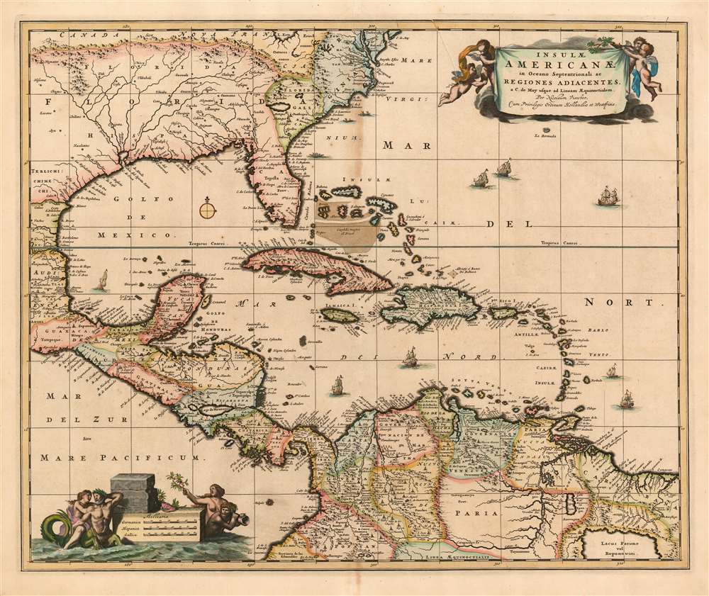
Insulae Americanae in Oceano Septentrionali ac regiones adiacentes: a C. de May usque ad Lineam Aequinoctialem.
sold
- Digital Map Information
- Suitable for large format printing
- DPI: 600
- File Size: 24.68 MB
- File Type: ZIP / TIFF
- ICC color profile embedded
- Delivered instantly via download link
This is Nicolas Visscher II's c. 1680 map of the West Indies, one of the first maps in the lineage of Dutch maps of the region to detail inland areas rather than strictly adhering to coastlines. The map shows the Caribbean Islands, the eastern part of Mexico, Central America, the northern part of South America, Florida, and an area now part of Georgia and South Carolina. Oddly, this area is named French Florida (Florida Galli) despite the reality that the French colonies in the area had been destroyed by the Spanish well before this map was drawn. The map extends as far north as Virginia and Delaware Bay. (more details)
By far the best map of Siam available to the public at the turn of the century' -H. Meinheit
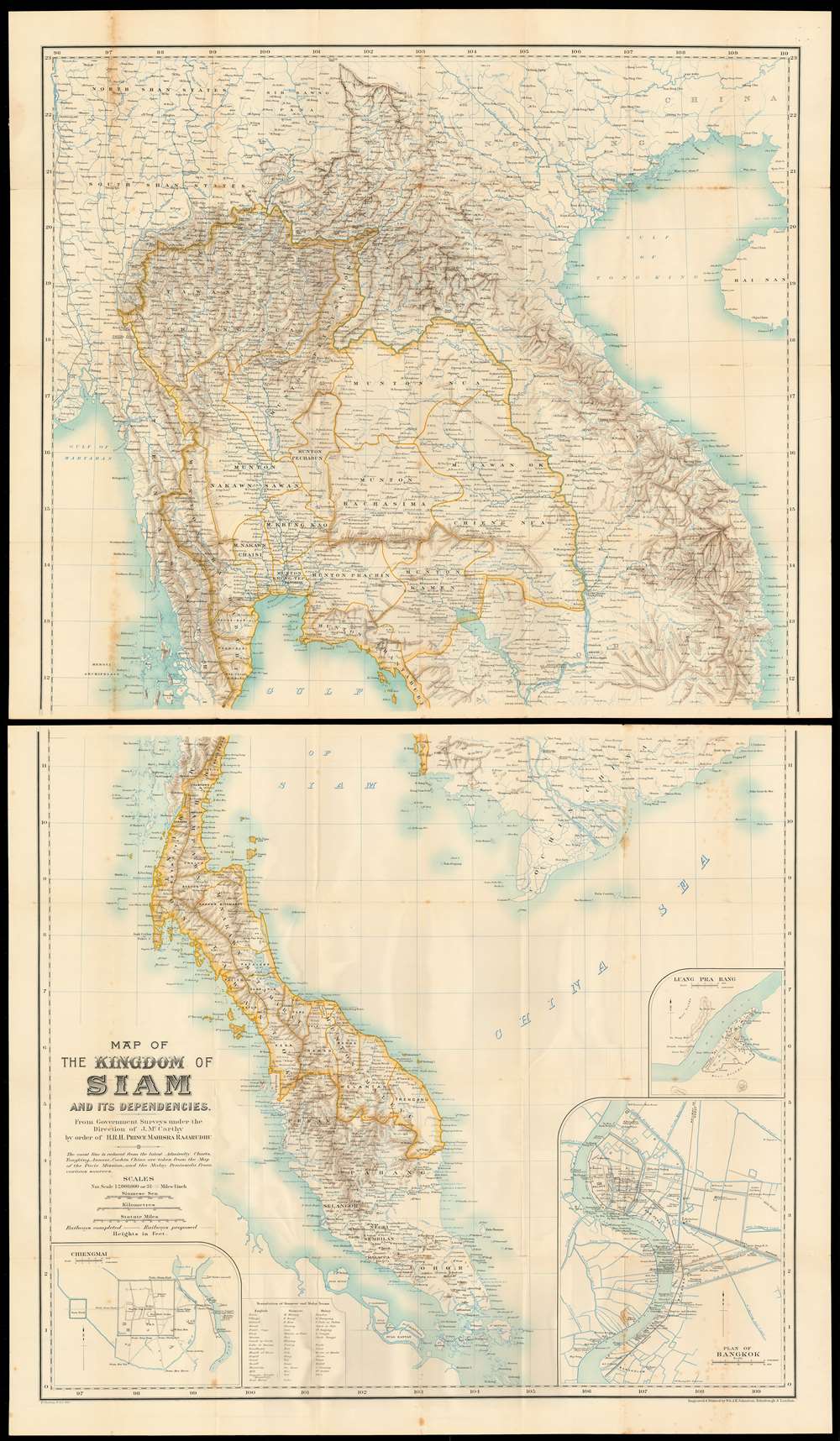
Map of the kingdom of Siam and its dependencies
sold
- Digital Map Information
- Suitable for large format printing
- File Size: 66.39 MB
- File Type: ZIP / TIFF
- ICC color profile embedded
- Delivered instantly via download link
This is James Fitzroy McCarthy’s 1900 Map of Thailand / Siam and the surrounding countries: it is the first complete, scientific map to present this region, produced at a time when French diplomat, explorer and surveyor August Pavie was surveying the same region. The two-sheet map shows all of Siam, eastern Burma, Laos, Cochinchina and the Malay Peninsula. There are inset plans of Bangkok, Chiang Mai, and Luang Prabang on the lower sheet. (more details)
A French map of the situation in the East Indies before the Japanese offensives of 1941.
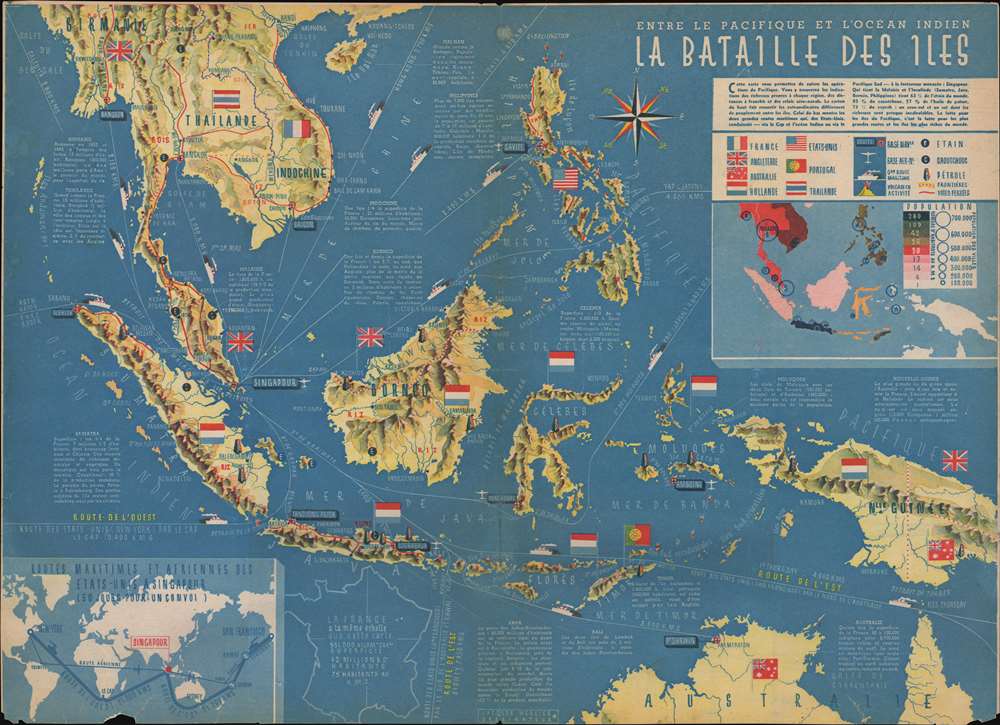
Entre le Pacifique et l'Océan Indien La Bataille des Iles
sold
- Digital Map Information
- Suitable for large format printing
- File Size: 26.25 MB
- File Type: ZIP / TIFF
- ICC color profile embedded
- Delivered instantly via download link
This is a c. 1941 Jacques Mercier map of the East Indies before the Japanese offensives of late 1941. By using the flags of the colonial powers in the region, Mercier renders is immediately apparent that only Thailand is governed by the people that live there. Everywhere else in the region is controlled by the Americans, British, French, Dutch, or Portuguese. Short commentaries on each island or colony are included, informing the viewer of each location's population and economic output. Many of these exports, such as rice, cotton, tobacco, and wood, are printed in the corresponding locations in red ink. Tin, rubber, and oil deposits are marked by symbols. Another symbol is used to mark active volcanoes. The thick red lines printed on the map represent the region's railroads, which had been constructed in Malaysia, Thailand, Indochina, the Philippines, and Java. International trade routes are illustrated as well, with distances to the United States given in kilometers. An inset map, situated in the upper right corner below the legend provides an overview of population density of the islands and countries in the region, while a second inset map, expands the network of air and sea routes to Singapore across the world. (more details)
A Classic, Beautiful Dutch Golden Age Map of Europe
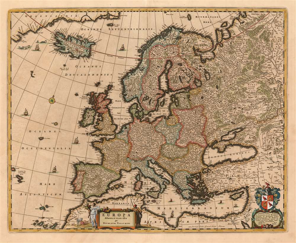
Europa delineata et recens edita per Nicolaum Visscher.
sold
- Digital Map Information
- Suitable for large format printing
- DPI: 600
- File Size: 23.17 MB
- File Type: ZIP / TIFF
- ICC color profile embedded
- Delivered instantly via download link
This is Nicolas Visscher's c. 1677 map of Europe, one of the defining Dutch maps of the continent for the second half of the 17th century. The maps of the Visscher family are prized for the superb quality of engraving and the high level of artistry in their compositions; this map is no exception - from the delicate plumes on the volcanoes of Stromboli, Aetna and Hekla, to the multiplicity of sailing ships decorating the seas, to the lovely dedicatory and title cartouches (see below.) (more details)
A Beautifully Engraved, Practical Tourists Map of New Hampshire's White Mountains
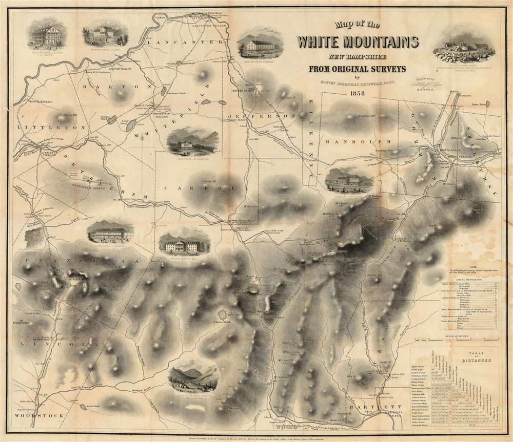
Map of the White Mountains New Hampshire from Original Surveys.
sold
- Digital Map Information
- Suitable for large format printing
- File Size: 33.25 MB
- File Type: ZIP / TIFF
- ICC color profile embedded
- Delivered instantly via download link
This is Harvey Boardman's 1859 map of the White Mountains, New Hampshire. The remarkably useful map features roads, carriage ways and summit trails throughout the presidential range as well as Mount Moriah, Mount Lafayette, Mount Willard and Cannon Mountain. It notes the locations of public buildings, churches, mills and hotels. It is attractively decorated with vignettes of public houses and hotels throughout the region, naming their proprietors. Two tables in the lower right-hand corner allow easy calculation of distances between lodgings in the area, making it particularly relevant to the tourist traveler relying on such dwellings. While Boardman is known to have surveyed the distances of the roads on his maps personally - contemporary reports have him trekking about the mountains with an odometer - he relied on the 1853 work of George Bond for the mountain elevations marked on the map, with few deviations. (more details)
A wonderful wall map of the White Mountains.
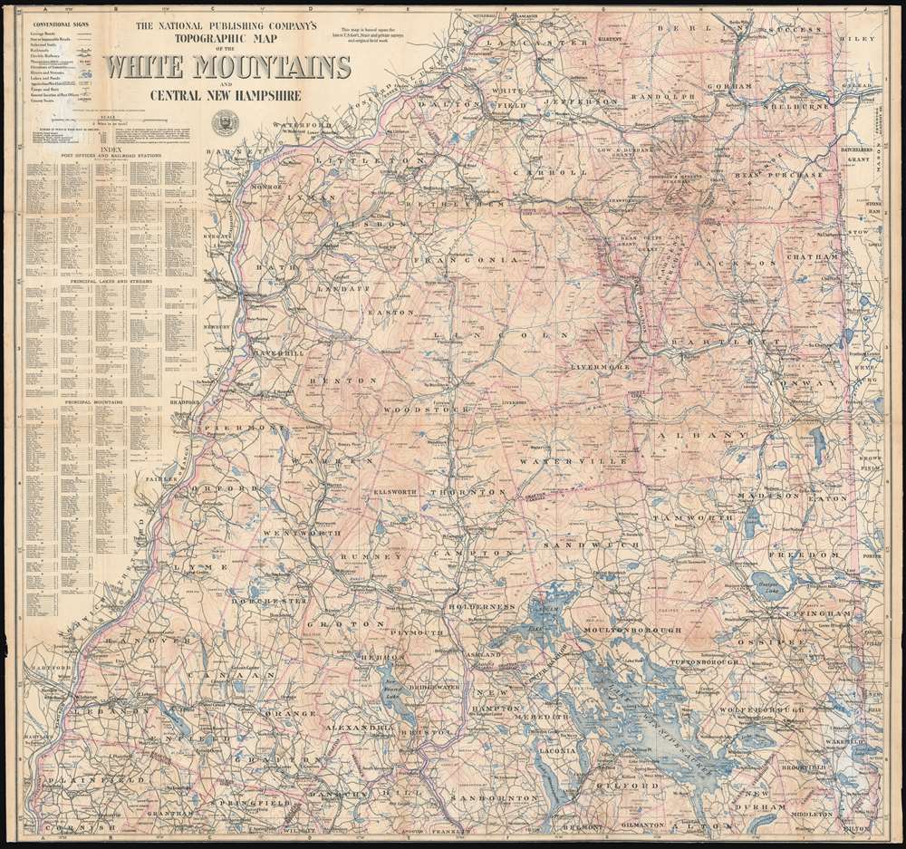
The National Publishing Company's Topographic Map of the White Mountains and Central New Hampshire.
sold
- Digital Map Information
- Suitable for large format printing
- File Size: 88.83 MB
- File Type: ZIP / TIFF
- ICC color profile embedded
- Delivered instantly via download link
This is a 1902 National Publishing Company map of the White Mountains and central New Hampshire that labels individual peaks throughout the area. Depicting central New Hampshire from Lancaster and Berlin Mills south to Cornish, South Danbury, and Alton Bay, cities, towns, and villages are labeled, with communities served by post offices and railroad stations are labeled as such. Grants and purchases around the area are labeled in different typefaces, with some marked in large bold lettering, while others, like the Allen grant in Waterville County, are much less noticeable. Roads are illustrated, as are several railroads, including the Northern Division and the White Mountain Division of the Boston and Maine Railroad and several abandoned lumber railroads. Counties are demarcated and identified, and rivers and lakes are colored blue and labeled. Mountains are illustrated using contour lines, labeled, and their elevations provided. An index along the left side lists post offices, railroad stations, principal lakes and streams, and principal mountains and provides the grid location for each one. (more details)
Showing the border as of thr Treaty Ending the Mexican-American War
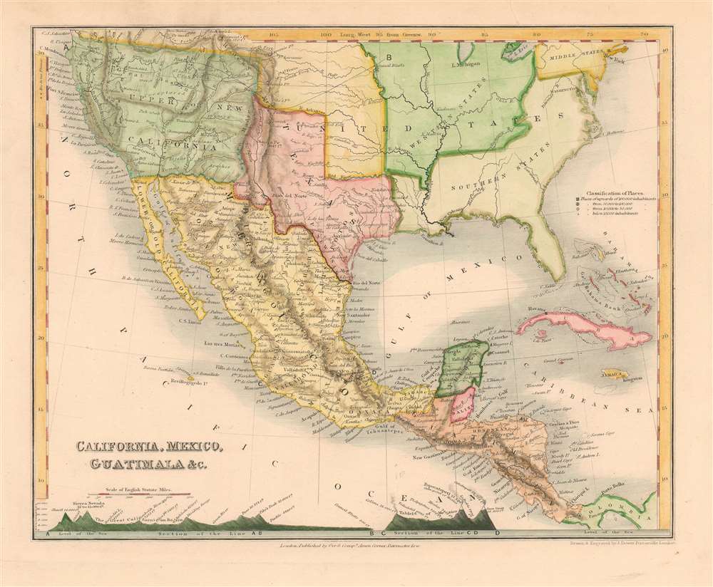
California, Mexico, Guatimala etc.
sold
- Digital Map Information
- Suitable for large format printing
- DPI: 600
- File Size: 5.67 MB
- File Type: ZIP / TIFF
- ICC color profile embedded
- Delivered instantly via download link
This is John Dower's 1850 map of Mexico, Texas, Central America and Western North America. Includes Texas in its post-statehood, pre-'Compromise of 1850' configuration, with full borders extending west beyond Santa Fe and north to include a small ill-defined stovepipe. The map has been updated to show the 1848 border as per the Treaty of Guadalupe Hidalgo; Mexico's lost claims north of the new border are collectively named 'Upper New California' on the map. This region, in particular, has been extensively re-worked, showing abundant mountain ranges not present in earlier issues of this map. (more details)
An Attractive 16th Century Bird's Eye View of Salzburg, Austria

Salzburg.
sold
- Digital Map Information
- Suitable for large format printing
- DPI: 600
- File Size: 12.32 MB
- File Type: ZIP / TIFF
- ICC color profile embedded
- Delivered instantly via download link
This is Merian’s 1644 bird’s eye view of Salzburg, Austria. The beautifully engraved southern-oriented view centers upon the city’s cover bridge across the Salzach (the present Staatsbrücke is the tenth bridge to occupy the same location) linking the two pats of Salzburg's Altstadt, then the entirety of the walled city. Twenty four major structures - monasteries, fortifications, churches, and palaces - are marked with letters and linked to a key. The Cathedral (Thum Kirch) is noted and recognizable. The northern (east bank) of the river is dominated by the forested Kapuzinerberg hill - today, the city's main green space. Though the fortress walls of the northern part of he old city shown here can now only be guessed at by the route of the Franz-Josef Strasse, the gardens of the Schloss Mirabell and the University Mozarteum can be easily found on the plan. (more details)
A patriotic propaganda piece that declares 'Remember Pearl Harbor' and touts America's ability to fight World War II.

Democracy in Action. Freedom Defense Recovery.
sold
- Digital Map Information
- Suitable for large format printing
- File Size: 16.46 MB
- File Type: ZIP / TIFF
- ICC color profile embedded
- Delivered instantly via download link
This is a 1941 Frank T. Perone pictorial map of the United States promoting American involvement in World War II. An outline of the continental United States on top of an American flag serves as the central image, with the phrase 'Freedom Defense Recovery' superimposed over the top. The F., D., and R. in the three words are large block letters each containing one of the words in smaller type, emphasizing the initials, which are the same as those of the President in 1941, Franklin Delano Roosevelt, F.D.R., and a portrait of the President is situated in the lower left corner.
Within the outlined United States, Freedom, Defense, and Recovery are illustrated by one large collage made up of those themes. Freedom, the furthest to the left, is depicted by a newspaper with the headline 'Free Press', a 1940s era microphone, a church with its steeple, and the Statue of Liberty. The newspaper, microphone, and church symbolize the Freedom of the Press, the Freedom of Speech, the Freedom of Religion, respectively, each of which are enshrined in the First Amendment to the United States Constitution. The Statue of Liberty is a recognizable symbol for freedom that is not associated with any specific form. Defense is, of course, symbolized by military strength. An airplane, a battleship, and a tank effectively summarize America's drive to win this war and a young man in uniform personifies who will be fighting it. Recovery is furthest to the right and is illustrated by a factory, a farmer plowing a field, and a cashier's window. It may sound crass, but the truth of the matter is that the United States finally pulled out of the Great Depression because of the effort that came with arming for war. America's economy had never functioned at such a high capacity before and, with that effort, finally was able to recover from a decade of economic depression. (more details)
Within the outlined United States, Freedom, Defense, and Recovery are illustrated by one large collage made up of those themes. Freedom, the furthest to the left, is depicted by a newspaper with the headline 'Free Press', a 1940s era microphone, a church with its steeple, and the Statue of Liberty. The newspaper, microphone, and church symbolize the Freedom of the Press, the Freedom of Speech, the Freedom of Religion, respectively, each of which are enshrined in the First Amendment to the United States Constitution. The Statue of Liberty is a recognizable symbol for freedom that is not associated with any specific form. Defense is, of course, symbolized by military strength. An airplane, a battleship, and a tank effectively summarize America's drive to win this war and a young man in uniform personifies who will be fighting it. Recovery is furthest to the right and is illustrated by a factory, a farmer plowing a field, and a cashier's window. It may sound crass, but the truth of the matter is that the United States finally pulled out of the Great Depression because of the effort that came with arming for war. America's economy had never functioned at such a high capacity before and, with that effort, finally was able to recover from a decade of economic depression. (more details)
A highly detailed city map of Brooklyn from around the beginning of World War II.
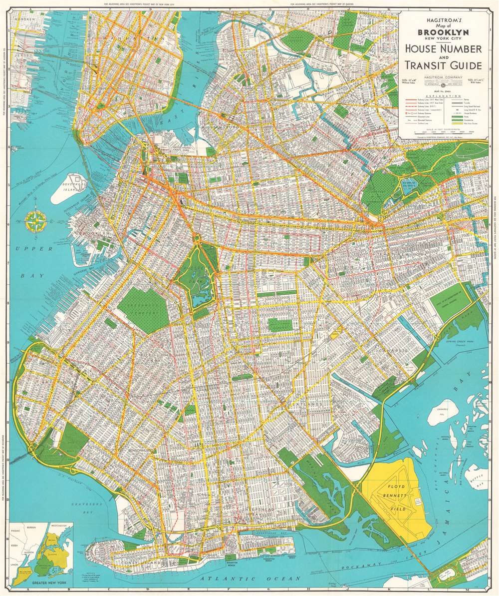
Hagstrom's Map of Brooklyn, New York City House Number and Transit Guide.
sold
- Digital Map Information
- Suitable for large format printing
- File Size: 49.56 MB
- File Type: ZIP / TIFF
- ICC color profile embedded
- Delivered instantly via download link
This is a c. 1940 Hagstrom map of Brooklyn, New York, and the immediate vicinity. Every street in Brooklyn is labeled, as are the streets in Manhattan up to East 25th Street and part of Queens. Subway lines are illustrated in red, with different symbols used to differentiate between the IRT West Side, the IRT East Side, the BMT, and the IND. Surface streetcar lines are also marked by thin red lines, while elevated subway lines are illustrated by solid black lines. The Long Island Railroad is also illustrated. Parks are colored green, along with cemeteries, which are identified by small crosses. Prospect Park and the Botanic Gardens are depicted in some detail, with both the Central Library and the Brooklyn Museum illustrated and labeled, along with Grand Army Plaza. (more details)
Rare American Map of Long Island Promoting the Long Island Canal Company.
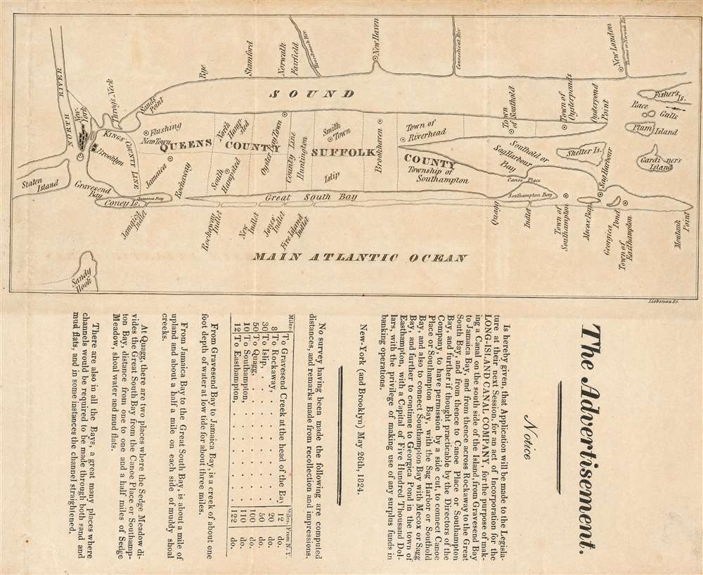
The Advertisement. Notice is hereby given, that Application will be made to the Legislature next Session, for an Act of Incorporation for the Long-Island Canal Company…
sold
- Digital Map Information
- Suitable for large format printing
- DPI: 600
- File Size: 3.86 MB
- File Type: ZIP / TIFF
- ICC color profile embedded
- Delivered instantly via download link
This is an 1824 map of Long Island, the earliest separate map we have identified of Long Island printed in the United States. The map was drawn with accompanying text to promote the construction of a new canal in southern Long Island - an effort that would presumable have significantly increased trade communication between southeastern Long Island and New York City, and from there, the world. It shows the cities of New York and Brooklyn pictorially; the Long Island towns of Flushing, Jamaica, Hampsted, Oyster Bay, Smithtown Brookhaven, Riverhead, Southold, Oysterponds, Southhampton, and Easthampton are marked on the map. In Connecticut, Rye, Stamford, Norwalk, Fairfield, New Haven and New London are named. The map is schematic in the extreme, with its best detail shown along the southern shore of the island - detailing the inlets along the barrier islands from Coney Island, Rockaway and Fire Island, and the waterways just inland. (more details)
Scarce Edition of a Separately Issued Folding Map of Nebraska Detailing the Union Pacific Railroad

Colton's new sectional map of the state of Nebraska.
sold
- Digital Map Information
- Suitable for large format printing
- File Size: 75.22 MB
- File Type: ZIP / TIFF
- ICC color profile embedded
- Delivered instantly via download link
This is a large, scarce 1871 Colton map of Nebraska. This separately-issued, folding map details the state four years after its admission to the Union, during the population boom brought on by the opening of the prairie - both by the ongoing forcible resettlement of Native American tribes, and by the completion in 1869 of the Union Pacific Railroad. (more details)
Rare Tourist's Pocket Map of San Francisco Highlighting The Iconic Street Car Routes
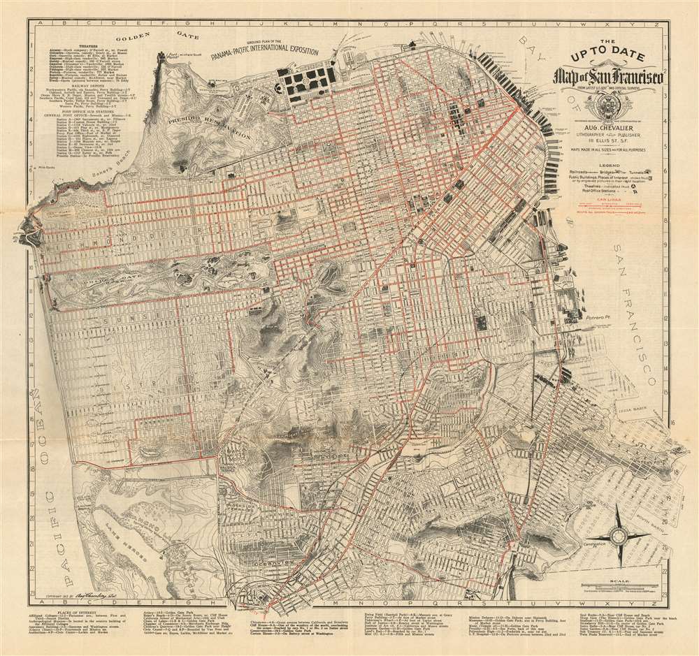
The Up To Date Map of San Francisco From Latest U.S. Gov. and Official Surveys.
sold
- Digital Map Information
- Suitable for large format printing
- File Size: 30.76 MB
- File Type: ZIP / TIFF
- ICC color profile embedded
- Delivered instantly via download link
This is August Chevalier’s updated 1915 map of San Francisco. Produced in pocket-map format for the use of visitors to both the city and the then-active Panama-Pacific International Exposition, the map details the city's neighborhoods, parks, and other features needful to the visitor. Buildings of particular importance - the newly built city hall, the mint, the post office, railroad depots, Sutro Baths, Cliff House, and others - are shown pictorially. The city's distinctive topography is shown with a combination of hachure and contour lines, including elevations. The map provides lists, keyed to coordinates on the map, of Theaters, railway depots, post offices, and 'Places of Interest.'
The map also features excellent transportation information, including railroads, bridges, tunnels, and steamer piers - including prospective ones. Most distinctive to San Francisco are the “car lines” in red: the now-dwindling cable car and electric street car routes that once spanned virtually the entire city. (more details)
The map also features excellent transportation information, including railroads, bridges, tunnels, and steamer piers - including prospective ones. Most distinctive to San Francisco are the “car lines” in red: the now-dwindling cable car and electric street car routes that once spanned virtually the entire city. (more details)
A Chinese propaganda broadside extolling the victories won in South Vietnam.

南越人民反美爱国斗爭形势图 / South Vietnam People's anti-American Patriotic Struggle Situation Map.
sold
- Digital Map Information
- Suitable for large format printing
- File Size: 29.32 MB
- File Type: ZIP / TIFF
- ICC color profile embedded
- Delivered instantly via download link
An unusual Communist perspective 1964 pictorial propaganda map of the Vietnam War issued by Chinese People's Liberation Army. (more details)
Rare Nepalese Trekking Map of the Kathmandu Region
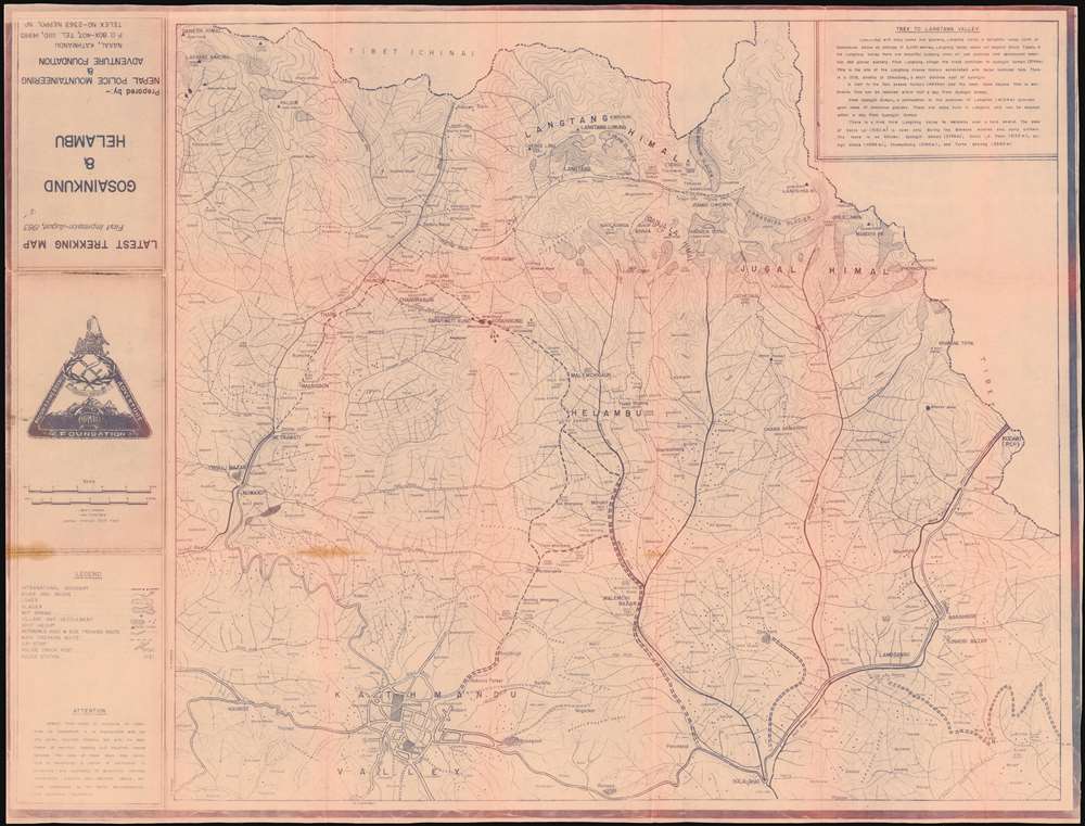
Latest Trekking Map First Impression August 1983 Gosainkund and Helambu.
$550.00
Acquire
This is a 1983 Nepal Police Mountaineering and Adventure Foundation cyanotype map of the trekking routes from Kathmandu to Gosainkunda lake in Nepal's Langtang National Park, and the Helambu region. Gosainkunda, in particular, is a place of great religious significance, and is a major pilgrimage destination.
The cyanotype map shows rivers and bridges, lakes glaciers, hot springs, villages and towns, passable roads, as well as air strips, police stations and check posts. The map covers the region between the Tibetan border and Kathmandu, and is peppered with hundreds of settlements - many too small to be named. The mountainous topography is shown with great detail, using gradients and altitudes above sea level. (more details)
The cyanotype map shows rivers and bridges, lakes glaciers, hot springs, villages and towns, passable roads, as well as air strips, police stations and check posts. The map covers the region between the Tibetan border and Kathmandu, and is peppered with hundreds of settlements - many too small to be named. The mountainous topography is shown with great detail, using gradients and altitudes above sea level. (more details)