
Quite simply the largest, most beautiful, and most important early map of Hawaii ever published.
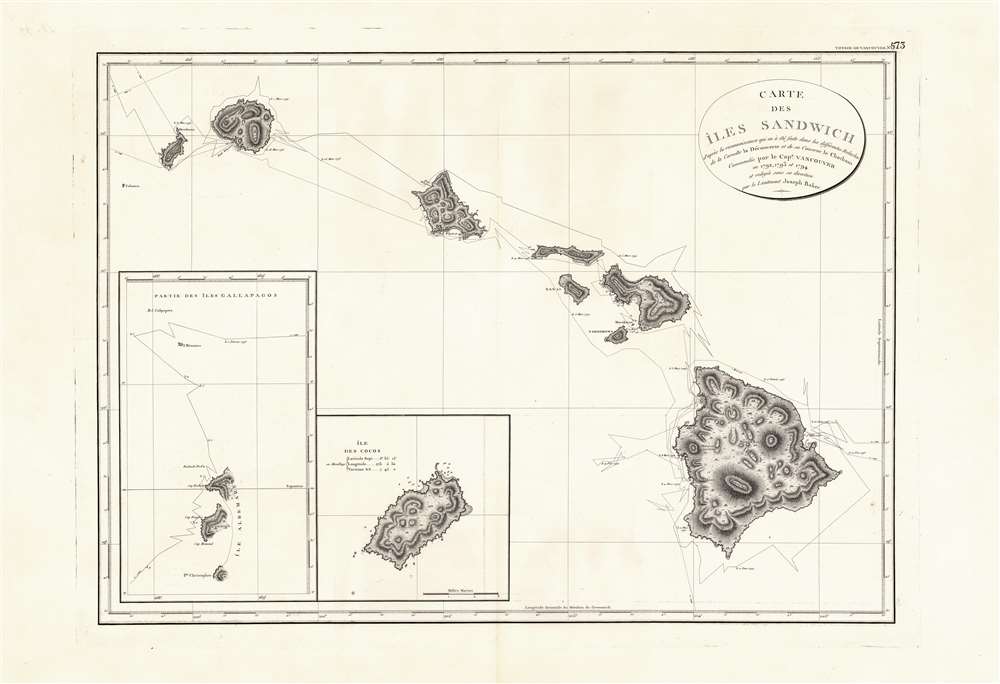
Carte des Iles Sandwich d'apres la reconnoissance qui en a ete faite dans les differentes relaches de la corvette La Decouverte et de sa conserve Le Chatham commandes par le Capt. Vancouver en 1792, 1793 et 1794.
sold
- Digital Map Information
- Suitable for large format printing
- DPI: 600
- File Size: 21.69 MB
- File Type: ZIP / TIFF
- ICC color profile embedded
- Delivered instantly via download link
This is a beautiful example of George Vancouver's seminal 1799 map of the Hawaiian Islands, considered the largest, most important, and most beautiful map of Hawaii to appear in the 18th century. George Vancouver first sighted Hawaii on January 18, 1778, when, as a midshipman on the HMS Discovery, consort ship to Captain James Cooks' HMS Resolution, becoming one of the first Europeans to see the idyllic island group. Despite Cook's having been killed by angry Hawaiian natives, Vancouver formed a good opinion of the both the archipelago and the Hawaiian people. Fourteen years later and captain of his own ship, George Vancouver chose the Hawaiian Islands as a winter base while exploring the Northwest Coast of America in search of the elusive Northwest Passage. During his three seasonal visits to the Hawaiian Islands, Vancouver and his Lieutenant Joseph Baker completed this, the first complete map of the archipelago. His route, which zigzags around and between the islands, is carefully noted and includes visits in 1792, 1793, and 1794. (more details)
Highlights the extensive phone network around President Franklin D. Roosevelt's Hyde Park estate just weeks before his untimely death.
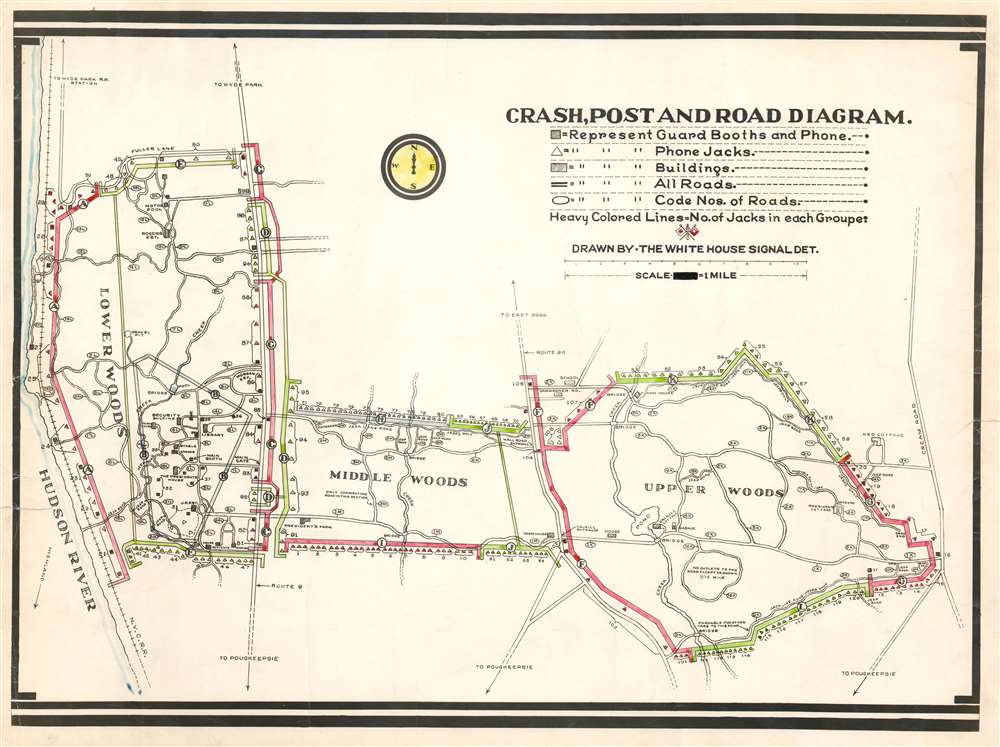
Crash, Post and Road Diagram.
sold
- Digital Map Information
- Suitable for large format printing
- Full resolution TIFF file
- ICC color profile embedded
- Delivered instantly via download link
This is a c. 1945 White House Signal Detachment map of the phone network at Hyde Park, New York near the end of President Franklin D. Roosevelt's final term as President of the United States. The map depicts the Springwood estate from the Hudson River to Cream Road and from Fuller Lane to just south of the estate. The estate is divided into three sections: lower woods, middle woods, and upper woods. Roads in each section are labeled numerically with an 'L', 'M', or 'X' to identify the part of the estate in which it is located, and roads that are only passable by jeep are labeled as such. Solid colored lines shaded red, green, and gray immediately jump out at the viewer, with each section labeled by a capital letter. It is unclear exactly what each section denotes. One possibility is that each letter marks a different telephone switchboard, since each of the small triangles marks a phone jack. These may also mark patrol routes, owing to the fact that the map is accompanied by two sheets of Secret Service code names, and the phone jacks mark points where agents on patrol could report back. Several buildings around the estate are labeled, including the President's House, the security building, the library, the Morgan Estate, the Rogers Estate, the J.R. Estate, Valkill Cottage, and the President's Cottage. (more details)
Plan of the Battle of Yorktown drawn from a French eye-witness account.

Plan D'York en Virginie avec les attaques et les Campemens de l'Armee combinee de France et d'Amerique. [Battle of Yorktown]
sold
- Digital Map Information
- Suitable for large format printing
- DPI: 600
- File Size: 11.9 MB
- File Type: ZIP / TIFF
- ICC color profile embedded
- Delivered instantly via download link
An important 1787 American Revolutionary War map illustrating the Battle of Yorktown, the last major conflict of the war. The map centers on the battleground just south of Yorktown on the shores of the York River. Gloucester is apparent just across the river. Finely engraved detail is exhibited throughout with fields, swamps, roads, and houses noted. The map was most likely drawn by Querenet de la Combe, a French officer commanding the French Royal Corps of Engineers at the Siege of Yorktown. (more details)
The First Atlas Map of Mexico in a Beautiful, Bold Example
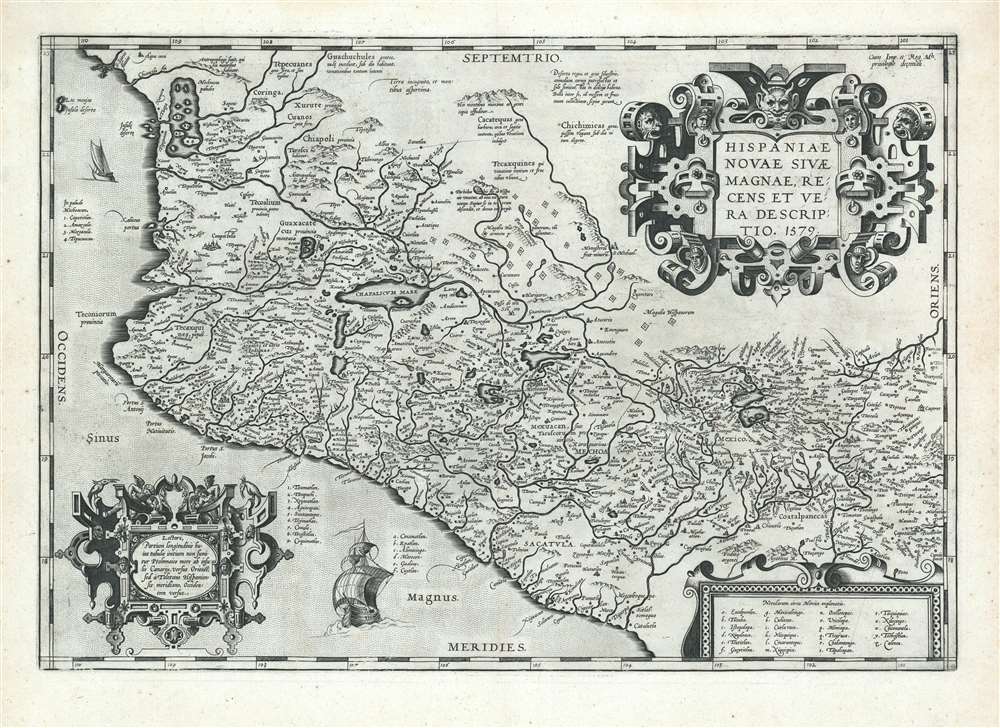
Hispaniae Novae Sivae Magnae, Recens et Vera Descriptio. 1579.
sold
- Digital Map Information
- Suitable for large format printing
- DPI: 600
- File Size: 19.77 MB
- File Type: ZIP / TIFF
- ICC color profile embedded
- Delivered instantly via download link
This is a superb example of Ortelius' 1579 Map of Mexico, the first Atlas map of New Spain, in a Latin-text edition of 1592. It shows Spanish settlements in the interior, and an array of rivers and lakes both actual and imagined. The beautifully executed strapwork cartouches are embellished with putti, heads in native headgear, and ferocious beasts. (more details)
Blair's remarkable 19th century Temperance Movement map of New York City.

Map of New York City to Accompany 'The Temperance Movement or the Conflict between Man and Alcohol.'
sold
- Digital Map Information
- Suitable for large format printing
- File Size: 13.55 MB
- File Type: ZIP / TIFF
- ICC color profile embedded
- Delivered instantly via download link
A fascinating 1887 persuasive map of New York City in which the locations of some 9000 licensed bars and saloons are identified in red. The map covers Manhattan south of 115th street as well as adjacent parts of Jersey City, Hoboken, Brooklyn, and Queens. Cartographically it is a reduced version of J. H. Colton's map of New York City overprinted to illustrated licensed bars and saloons in Manhattan. The map was printed on behalf of Henry William Blair, a Republican senator from New Hampshire and ardent advocate for the Temperance Movement. It was intended to illustrated his book, The Temperance Movement or the Conflict between Man and Alcohol. As pointed out by map expert P. J. Mode, the book is heavy reading, but Blair's words (p. 363) at the end of the tome clarify the purpose of the map
The eye is the chief inlet to knowledge, and the map of New York City which accompanies this book, upon which are located over 9000 of the 10,168 saloons and places where intoxicating liquor was for sale in that metropolis on the thirtieth day of June, 1886, looks like a chart of the capital city of the regions of despair.(more details)
A large Soviet-era propaganda map celebrating the Russian defense of Moscow against the German Wehrmacht.

ВЕЛИКАЯ БИТВА ПОД МОСКВОЙ - The Great Battle of Moscow.
sold
This is a 1975 General Directorate of Geodosy and Cartography of the Council of the USSR (Главное управление геодезии и картографии при Совете Министров СССР) map of the Battle of Moscow in 1941. A large educational propaganda broadside, maps of two separate engagements are presented: the large central map highlights the Soviet defense of Moscow which halted the German blitzkrieg across the Russian steppes presented in the smaller map along the left side. A key explaining the various notations employed on both maps is situated along the bottom border at center and identifies the symbols used to mark actions of both Nazi and Soviet troops, battle lines on given days, and the dates when individual villages and towns fell to the invading Germans and then were liberated by the advancing Soviets. Both Nazi and Soviet tank positions are marked, as are Soviet airborne operations and the activities of both the Soviet Air Force and the German Air Force. Statistics concerning both the Nazi advance on Moscow and the subsequent Soviet counterattack are provided in large infographic sections which overlay photographs: one depicting antitank artillery and the other Katyusha rocket launcher. An illustration of a celebrated Soviet propaganda poster stating ‘Let’s Make a Stand for Moscow!’ is included in the upper left superimposed over the front page of an issue of Pravda, the Russian state newspaper. (more details)
Scarce Example of the First Official Highway Map of Wyoming, Signed by the Author
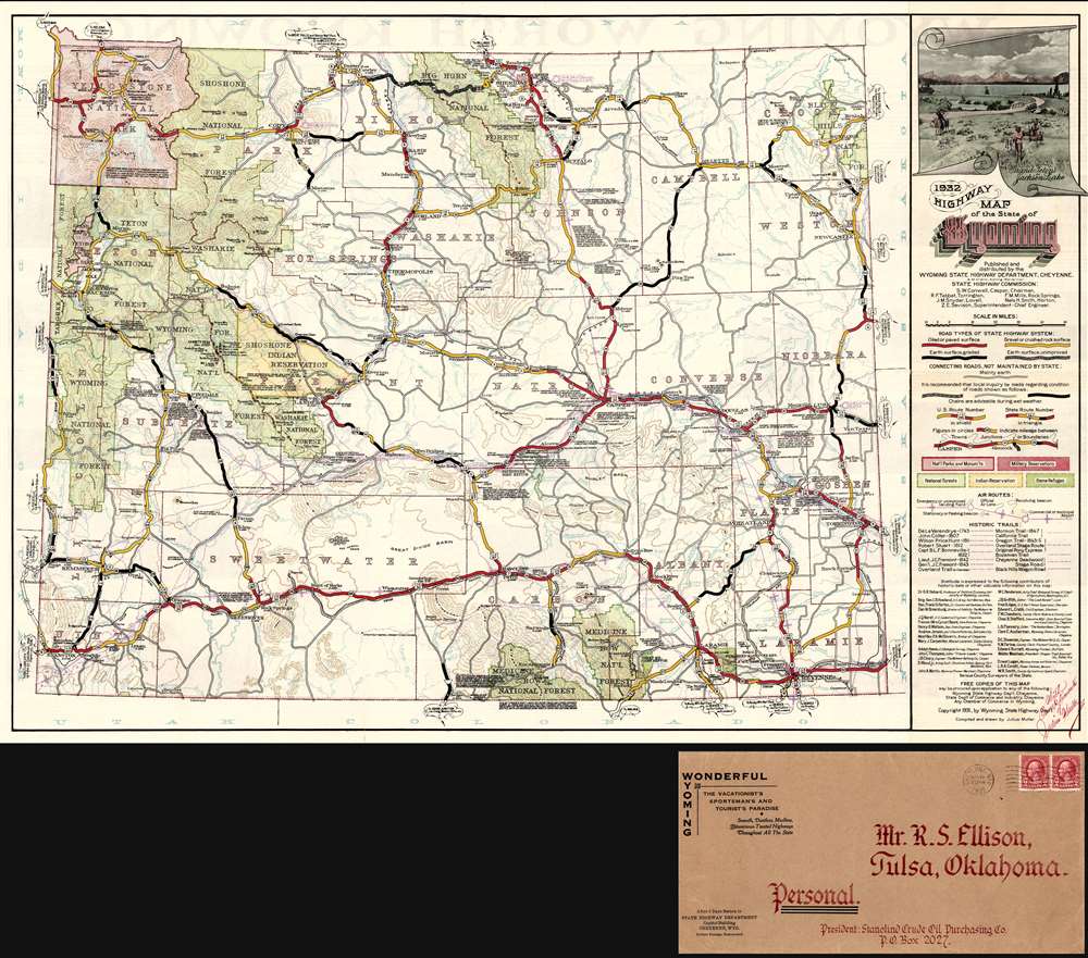
1932 Highway Map of the State of Wyoming.
sold
- Digital Map Information
- Suitable for large format printing
- Full resolution TIFF file
- ICC color profile embedded
- Delivered instantly via download link
A superb example of the first official highway map of Wyoming, signed by the mapmaker, Julius Muller and printed in 1932. The map's title is surmounted with a decorative view of the Grand Tetons and Jackson Lake. The map shows the network of roads, differentiating between those in the State Highway System and those not maintained by the state. Color is used to distinguish oiled or paved roads, gravel roads, graded dirt roads and 'unimproved' dirt roads. Among the roads not maintained by the state, shading and thickness indicates roads that invite 'local inquiry regarding condition' and on which 'chains are advisable during wet weather.' A truly modern map, it includes air routes, and shows landing fields, airports and navigational beacons. Where roads lead the reader off the map, attractively-framed text indicates the prime destinations via that specific route (eg., 'To Rocky Man Nat'l Park or DENVER via Fort Collins and Loveland.') (more details)
Earliest Accurate Map of Yemen, Source of the World's Coffee
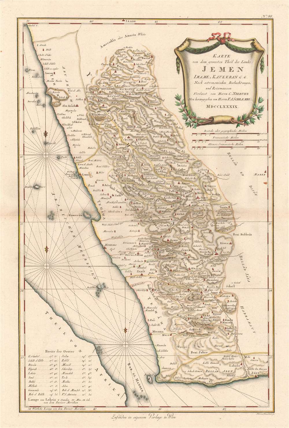
Karte von dem Groessten Theil des Landes Jemen, Imame, Kaukeban et C.
sold
- Digital Map Information
- Suitable for large format printing
- Full resolution TIFF file
- ICC color profile embedded
- Delivered instantly via download link
This 1789 Franz Anton Schraembl map of the southwestern part of the Arabian Peninsula is the first printed map specifically of Yemen, and the earliest map to be based on actual exploration of this region. It is derived from data collected by the German mathematician Carsten Niebuhr, who was the sole survivor of the Danish Arabia Expedition (1761-67). The map covers what is now the western part of Yemen and the southwestern extents of Saudi Arabia. Many recognizable place names are shown with accuracy. The ports of Aden and Mocha appear, and do Al Hudaydah, Al Luhayyah, and the Red Sea islands of Kameran, Jazirat Jabel Zuqar, and Perim Island. More impressively (considering that Europeans seldom ventured further than the coast), Sana'a and Damar, Yarim and Taizz are accurately placed, along with many other towns, cities and wadis. Abu Arish, in Saudi Arabia is shown as well. The topography of the inland regions is indicated with hachures. A table in the lower left gives the precise latitude of key cities for ease in location. (more details)
A great city plan of Kathmandu including an inset of the Ram Shah Path Area.
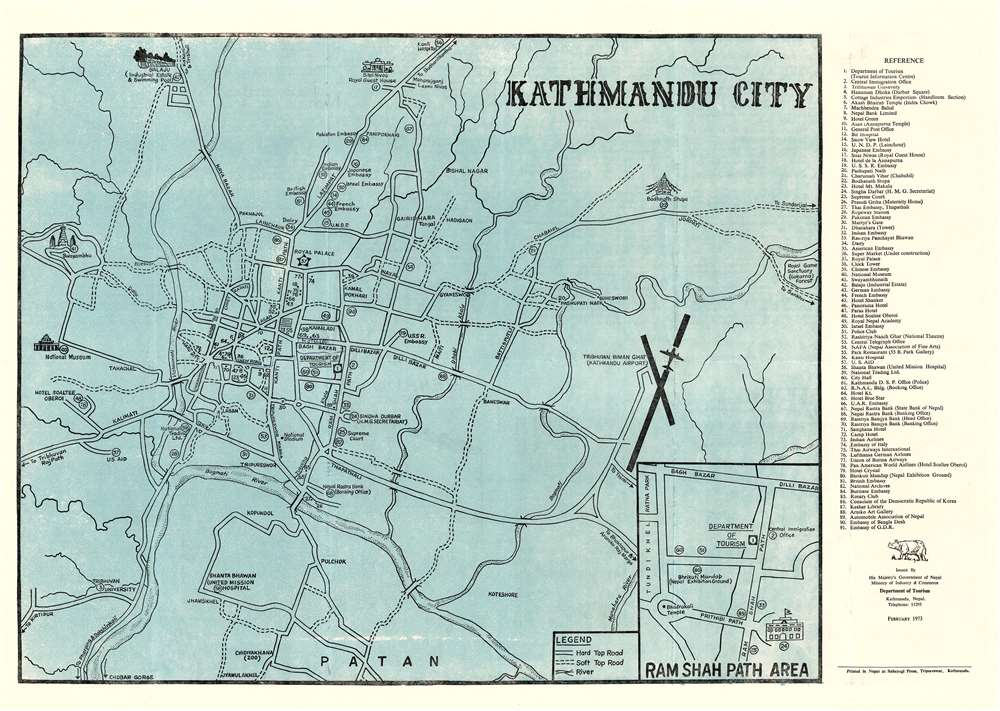
Kathmandu City.
sold
- Digital Map Information
- Suitable for large format printing
- File Size: 30.9 MB
- File Type: ZIP / TIFF
- ICC color profile embedded
- Delivered instantly via download link
This is a 1973 Department of Tourism city plan or map of Kathmandu, Nepal. The map depicts the city from the National Museum and Swayambhunath and from the Sital Niwas, the official residence of the President of Nepal, to Patan. Seventy-five locations across the city are numerically identified and correspond with a reference situated along the right border. Some of these locations, such as the Soviet Embassy, the French Embassy, the Royal Palace, and the Supreme Court are labeled on the map as well. The National Stadium, though identified, is not one of these locations. Other sites, including the National Museum, Sital Niwas, Swayambhunath, and Boudanath Stupa are illustrated in profile. Streets are labeled and the Hotel Leo along Bagh Bazar, is labeled in manuscript. An inset of the Ram Shah Path Area is situated in the lower right corner. (more details)
A psychedelic fantastical map of the world bordered by nightmarish creatures.

Humbead's Revised Map of the World with List of Population.
sold
- Digital Map Information
- Suitable for large format printing
- File Size: 48.66 MB
- File Type: ZIP / TIFF
- ICC color profile embedded
- Delivered instantly via download link
This is an iconic 1970 Earl Crabb and Rick Shubb map of the world, the last of three different editions of Humbead's Revised Map of the World. Celebrated for its place in the history of the West Coast folk scene and the hippie counterculture, the map depicts a world reimagined from this perspective. Much like the 1969 edition, San Francisco, Berkeley, Los Angeles, New York City, and Cambridge dominate one large continent, with Southeast Asia, North Africa, and Boston making up the rest of this landmass. Places within these cities are illustrated and labeled as well, adding some detail to the map. In San Francisco, for example, Golden Gate Park is illustrated, and Vancouver, Seattle, Portland, Santa Barbara, and Marin County are labeled. In New York City, Washington Square Park and Central Park, while Harlem, Chicago, and New Orleans are dots on the map. Southeast Asia is situated between San Francisco and Los Angeles, while the entire continent of Africa is situated between Cambridge and New York City. Nashville sits at the center of the continent, perhaps a reference to Crabb and Shubb's love of folk music.
This Pangea-esque continent is illustrated on a beige background meant to represent the ocean given that it is labeled as 'The Farspooming Ocean' and 'The Whelming Brine'. Gigantic scrolls of parchment are also illustrated underneath the continent and bear a list of over 1,300 names - the population to which the map's title refers. Among the celebrities references are Stanley Kubrick, Salvador Dali, Peter Cushing, Pablo Picasso, Stan Lee, and John Lennon. The whole is surrounded by a border that borders on the nightmarish. Fantastical beasts appear everywhere, psychedelically colored with numerous limbs, all reminiscent of the beasts described during the acid trips in Hunter S. Thompson's 1971 classic Fear and Loathing in Las Vegas. In many ways the border defies explanation; it simply must be viewed to be appreciated. (more details)
This Pangea-esque continent is illustrated on a beige background meant to represent the ocean given that it is labeled as 'The Farspooming Ocean' and 'The Whelming Brine'. Gigantic scrolls of parchment are also illustrated underneath the continent and bear a list of over 1,300 names - the population to which the map's title refers. Among the celebrities references are Stanley Kubrick, Salvador Dali, Peter Cushing, Pablo Picasso, Stan Lee, and John Lennon. The whole is surrounded by a border that borders on the nightmarish. Fantastical beasts appear everywhere, psychedelically colored with numerous limbs, all reminiscent of the beasts described during the acid trips in Hunter S. Thompson's 1971 classic Fear and Loathing in Las Vegas. In many ways the border defies explanation; it simply must be viewed to be appreciated. (more details)
Beautiful city plan of Dublin, Ireland's capital city.
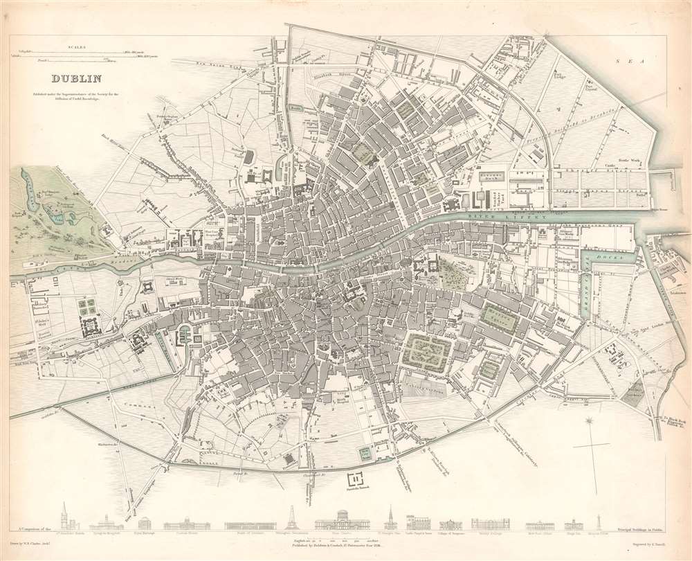
Dublin.
sold
- Digital Map Information
- Suitable for large format printing
- DPI: 600
- File Size: 13.67 MB
- File Type: ZIP / TIFF
- ICC color profile embedded
- Delivered instantly via download link
This is a lovely 1836 map of the city of Dublin, Ireland issued by the Society for the Diffusion of Useful Knowledge, or S.D.U.K. It depicts the city of Dublin, at the time confined mainly within the Circular Road located at the mouth of the Liffey River, including part of Phoenix Park. Highly detailed, the map notes individual streets, buildings, parks, squares, and docks. Trinity College is labeled to the right of center, with several hospitals, the military barracks, and the College Botanic Gardens among the other identified locations around the city. Artistic profile views of fourteen of the most important buildings of the city, such as St. George's Church, the Royal Exchange, St. Patrick's Church, and Nelson's Pillar. (more details)
A Beautiful Map of Greece and Macedonia

Macedonia Epirus et Achaia Per Gerardum Mercatorem Cum Priviligeo.
sold
- Digital Map Information
- Suitable for large format printing
- DPI: 600
- File Size: 19.65 MB
- File Type: ZIP / TIFF
- ICC color profile embedded
- Delivered instantly via download link
This is a 1613 map of Greece north of the Pelopponesus, engraved in 1595 by Gerard Mercator and included here in a 1613 edition of Jodocus Hondius' Atlas. It shows present day Thrace, Macedonia, Epirus, Thessaly, Euboea and Central Greece, including the island of Corfu and the northern shore of the Peloponnese. Mercator's superb engraving is displayed in the water and mountain areas; the map is further embellished with an attractive strap work cartouche. (more details)
Highlights Lake Tahoe and the Squaw Valley Olympics Area.

1960 Winter Olympic Games Squaw Valley, California.
sold
- Digital Map Information
- Suitable for large format printing
- File Size: 38.03 MB
- File Type: ZIP / TIFF
- ICC color profile embedded
- Delivered instantly via download link
This is a 1960 Don Bloodgood pictorial map of the 1960 Winter Olympic Games at Squaw Valley, California. With the Squaw Valley Olympics Area just to the left of center, the map depicts the region from Auburn, California to Virginia City, Nevada and the 'Famous Comstock Mine' and from Reno, Nevada to El Dorado, California. Cities and towns are labeled throughout, as are state and national highways. Lakes, rivers, creeks, and mountains are highlighted by yellow signs. The University of Nevada is labeled in Reno. (more details)
The finest and largest map of Sicily of the 18th century.
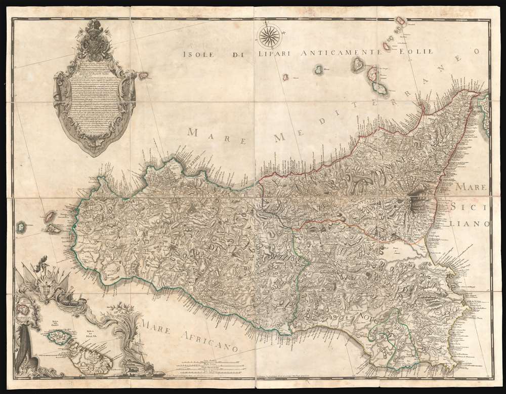
Descrizione Geografica del Regno di Sicilia e sue Isole …
sold
- Digital Map Information
- Suitable for large format printing
- DPI: 600
- File Size: 128.63 MB
- File Type: ZIP / TIFF
- ICC color profile embedded
- Delivered instantly via download link
Issued in 1779 by Gian Giuseppe Orcel, this is the greatest map of Sicily to appear in the 18th century. One of the few maps published in Sicily (Palermo), this map is derived from a survey completed in 1720 by the Austrian Field Marshal Samuel Graf von Schmettau, but is much advanced upon, with significant corrections, and on a far grander scale. Oriented slightly to the east of north, coverage extends to the whole of Sicily with the Aeolian Islands, and an inset mapping nearby Malta and Gozo. The map is dedicated to Marc Antonio Colonna II, Prince of Stigliano, who from 1775 to 1781 was Viceroy of Sicily under the House of Bourbon of the Two Sicilies. (more details)
The First Scienific Survey of the Andes Mountains and Central Ecuador
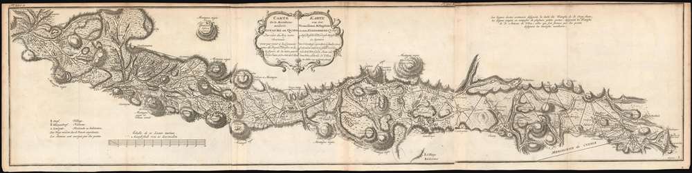
Carte de la Meridiene mesurée au Royaume de Quito; Par ordre du Roy notre Souverain pour parvenir à la Connoissance du Dégré Teirestre et de la figure de la teire par D. Jorge Juan et D. Ant. de Ulloa en 1744./ Karte von der gemessenen Mittagslinie in dem Koenigreiche Quito Auf Befehl Sr. Koenigl. Majest. in Spanien zur Erkentniss des rechten Gehalts eines Erdgrades und der Gestalt der Erde von dem Hrn Georg Juan und dem Hrn Antonio de Ulloa im Jahre 1744 zu Stande gebracht.
sold
- Digital Map Information
- Suitable for large format printing
- DPI: 600
- File Size: 20.88 MB
- File Type: ZIP / TIFF
- ICC color profile embedded
- Delivered instantly via download link
This is a rare, 1752 map of Ecuador's La Sierra region, from Carchi Province in the north to Cañar Province in the south. It encompasses one full degree of arc along the Quito meridian, and represents the first scientific survey of this high Andes valley. It appeared in the 1752 French and German editions of Antonio de Ulloa and Jorge Juan's Relacion Historica del Viaje a la America Meridional, a landmark work of South American geography, culture, history and science produced to report the two scientist's labors for the French Geodesic Mission, which were carried out in what is modern Ecuador over ten years. Specifically, the map shows the triangulations performed by Juan (his work indicated by solid lines) and Ulloa (dotted lines) during the expedition. It mapped Ecuador's Central Valley with unparalleled precision, marking rivers, towns and major peaks from El Angel, to Quito, to El Tambo. Towns of various sizes are differentiated with a key; relief is shown in hachure. Forests and plains are shown pictorially. Roads are marked with a dotted line, and bridges over rivers are indicated as well. (more details)
The Best Large-Scale Map of Northern Mexico Based on First-Hand Survey.
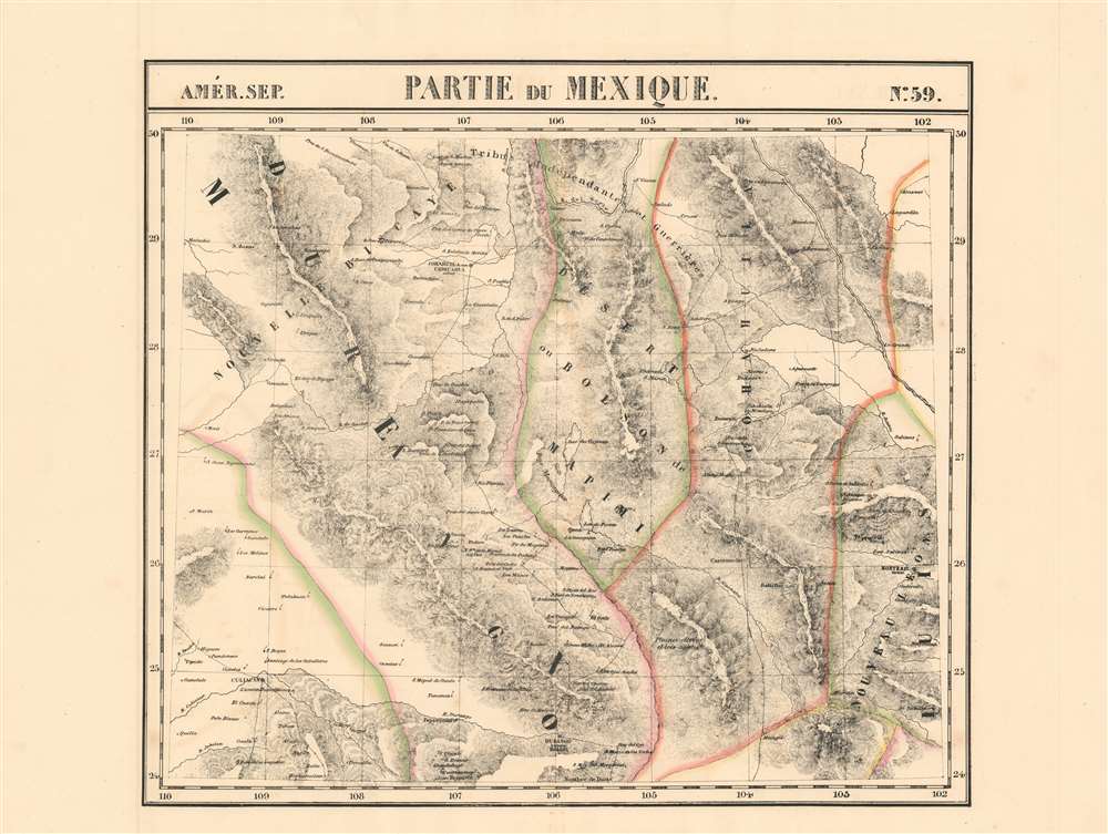
Parties du Mexique. Amer. Sep. no. 59.
sold
- Digital Map Information
- Suitable for large format printing
- DPI: 600
- File Size: 30.61 MB
- File Type: ZIP / TIFF
- ICC color profile embedded
- Delivered instantly via download link
This is the 1827 Vandermaelen map of the northern gold and silver mining region of Mexico, showing the states immediately south of the Rio Grande: Monterrey, parts of Chihuahua, Coahuila, Nuevo Leon, Zacatecas, Durango, and Sinaloa. Vandermaelen drew on the incomparable firsthand surveys of Alexander von Humboldt, whose 1803-4 travels informed his definitive 1804 map of Mexico. Vandermaelen's map, by addressing the geographical data at significantly higher scale than the Humboldt map, provides the best large-format mapping of the region - presented with the remarkable clarity afforded by the new printing technology of lithography. The map faithfully retains Humboldt's own array of symbols to distinguish cities and towns, mines, haciendas, ranches and presidios. No other map of the period provides this level of detail and focus on this region. (more details)
The First Large-Scale Atlas Map of Thailand, Cambodia and Central Vietnam.
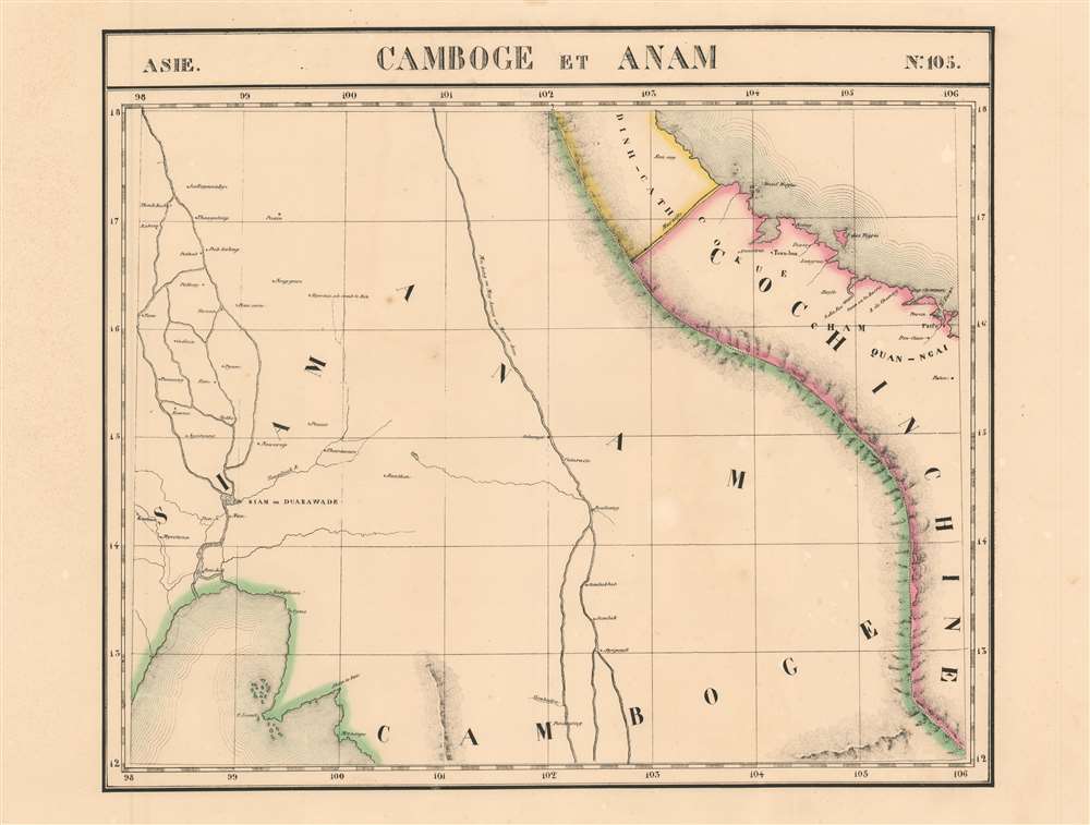
Camboge et Anam. Asie no. 105
sold
- Digital Map Information
- Suitable for large format printing
- DPI: 600
- File Size: 17.87 MB
- File Type: ZIP / TIFF
- ICC color profile embedded
- Delivered instantly via download link
This is 1827 Vandermaelen map of Thailand, Vietnam and the Mekong River delta. It is the first large-scale atlas map of the region, and the first to be executed in lithography. Despite its title, the map embraces central Thailand as well as Cambodia and Vietnam (known as Annam in the west at that time.) As is the case with many of Vandermaelen's maps, his strict adherence to a scale of 1 : 1641836 throughout his atlas resulted in the production of very large-scale maps of regions about which the west knew little. The present map is no exception. (more details)
An attractive lithograph touring map of the region around San Francisco Bay

[Central California]
sold
- Digital Map Information
- Suitable for large format printing
- File Size: 21.93 MB
- File Type: ZIP / TIFF
- ICC color profile embedded
- Delivered instantly via download link
This is a 1915 tourist map of central California by James J. Rhea (1876-1934). It was printed on behalf of the Tourist Association of Central California, and it highlights the routes, by road and rail, for reaching San Francisco in order to visit the he Panama–Pacific International Exposition that year. The exposition was a world's fair, ostensibly celebrating the completion of the Panama Canal, but seen by San Franciscans as an opportunity to showcase the city's recovery from the 1906 earthquake. (more details)
The Earliest Acquirable Map of Bohemia, and the First Acquirable Map to Use a Key
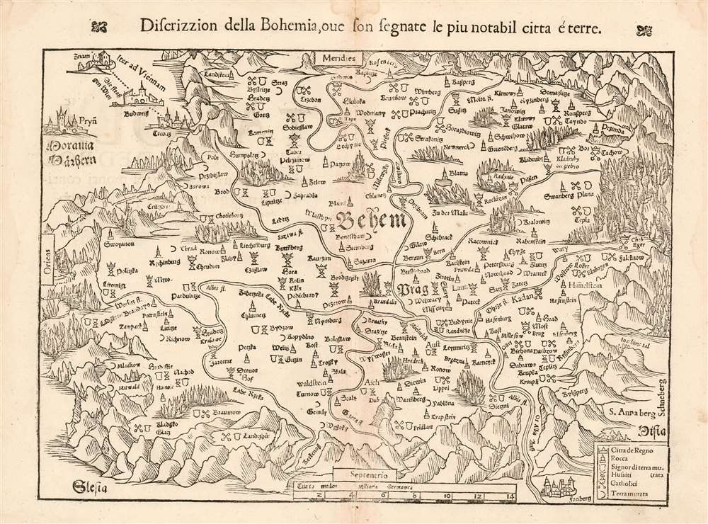
Discrizzion della Bohemia, oue son segnate le piu notabil citta é terre.
sold
- Digital Map Information
- Suitable for large format printing
- DPI: 600
- File Size: 10.23 MB
- File Type: ZIP / TIFF
- ICC color profile embedded
- Delivered instantly via download link
This is Munster's 1545 map of Bohemia, the earliest acquirable printed map of what is now the Czech Republic. The map appeared in an Italian edition of Munster’s Cosmographia Universalis, a work notable for presenting to a broad lay audience many of the first printed maps to rely on recent surveys and toponymy, rather than data from classical sources. Munster’s source for this map was Nicolaus Claudianus’ 1518 map of Bohemia, which now exists in only one known copy. Munster's map is the only version of Claudianus' map available to the collector. (more details)
One of the Earliest Modern Maps of Switzerland
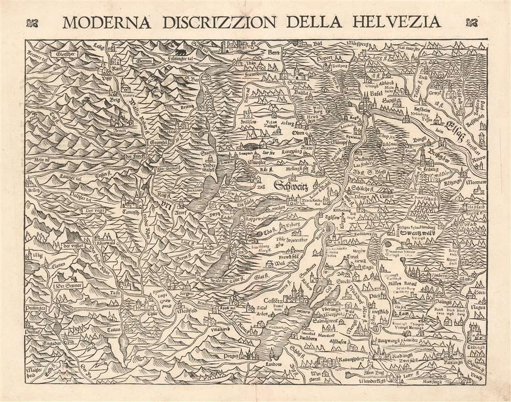
Moderna Discrizzion Della Helvezia.
sold
- Digital Map Information
- Suitable for large format printing
- DPI: 600
- File Size: 11.67 MB
- File Type: ZIP / TIFF
- ICC color profile embedded
- Delivered instantly via download link
This is a bold, sharp example of Sebastian Munster's 1544 map of Switzerland, from an Italian edition of Munster's Cosmographia Universalis.. Among the many cities and towns shown are Berne, Basel, Konstans, Lucerne, and Friburg. Of the modern maps included in Munster's grand opus, this was one of those most informed by the editor's direct experience: The majority of Munster's life and work were spent living in Basel, and he surveyed the area personally. In fact, this map and the others of the Rhineland are, aside from his modern World map, the only of Munster's double-page maps to be substantialy revised during his lifetime. Drawing on his surveys of 1542, Munster produced this map to replace the one appearing in the pre-Cosmographia editions of Munster's Ptolemy. The new map improved both on the map's geographical detail and on its artistic quality. Switzerland's mountains, forests, lakes, rivers and cities are shown pictorially in the evocative woodcut. As the mountains grow higher and the population more sparse in the southern part of the map, Munster has added goats, a bear, and a hunter with a bow. (more details)