
A wonderfully charming pictorial map of New York City featuring a devil at Hell Gate and a fishbowl for the New York Aquarium.
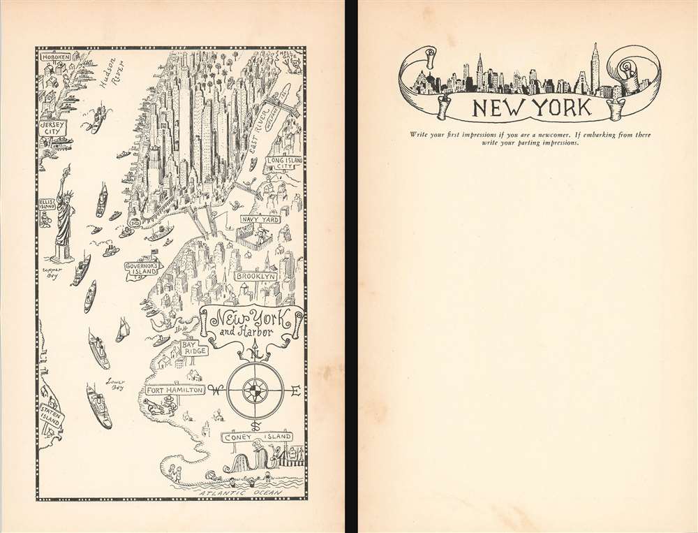
New York and Harbor.
sold
- Digital Map Information
- Suitable for large format printing
- File Size: 3.14 MB
- File Type: ZIP / TIFF
- ICC color profile embedded
- Delivered instantly via download link
This is a delightful 1933 Jo Mora pictorial map of New York City. The map depicts the region from Jersey City to Long Island City and from Central Park to Coney Island and the Atlantic Ocean. True to the aesthetic he cultivated over the course of his career, Mora employs numerous comic vignettes to illustrate this work. The New York Aquarium, then located in Battery Park, is marked simply by a goldfish in a fishbowl. Manhattan's elevated railway, now a thing of the past, curves around Lower Manhattan near Battery Park as well, evoking a note of nostalgia in the modern viewer. Hell Gate, though labeled, is marked by the devil brandishing a pitchfork. All four East River bridges are not illustrated as the wonders of modern engineering that they are, rather as four very simple foot bridges, complete with steps on either end. A man is illustrated fishing off of the Manhattan Bridge, while another figure pushes a wheelbarrow across the Queensboro Bridge.
Mora highlights the Brooklyn Navy Yard, labeled here as simply 'Navy Yard', but doesn't choose to Forth Hamilton in southern Brooklyn is marked by a doughboy (identifiable by his hat) is preparing to fire a cannon into The Narrows, and Coney Island is marked by a carnival barker and a rollercoaster. A very cheerful Statue of Liberty is illustrated greeting the ships entering and exiting the harbor, with an immigrant standing behind her on Ellis Island, then the nation's busiest immigration station.
On a more serious note, Manhattan's iconic, and ever-changing, skyline is highlighted, with the. Empire State Building in the center. Central Park, near the top border, is filled with trees and has a vehicle of some kind illustrated driving through it. Manhattan's many piers along the Hudson River are full, highlighting New York's economic importance and its stature as the largest city in the world. Jersey City and Hoboken are labeled in New Jersey, while the boroughs of Staten Island and Brooklyn are identified in New York.
The verso is mostly blank, but features a wonderful illustration of the New York skyline and a prompt to use the space as a diary entry, 'Write your first impressions if you are a newcomer. If embarking from there write your parting impressions.' (more details)
Mora highlights the Brooklyn Navy Yard, labeled here as simply 'Navy Yard', but doesn't choose to Forth Hamilton in southern Brooklyn is marked by a doughboy (identifiable by his hat) is preparing to fire a cannon into The Narrows, and Coney Island is marked by a carnival barker and a rollercoaster. A very cheerful Statue of Liberty is illustrated greeting the ships entering and exiting the harbor, with an immigrant standing behind her on Ellis Island, then the nation's busiest immigration station.
On a more serious note, Manhattan's iconic, and ever-changing, skyline is highlighted, with the. Empire State Building in the center. Central Park, near the top border, is filled with trees and has a vehicle of some kind illustrated driving through it. Manhattan's many piers along the Hudson River are full, highlighting New York's economic importance and its stature as the largest city in the world. Jersey City and Hoboken are labeled in New Jersey, while the boroughs of Staten Island and Brooklyn are identified in New York.
The verso is mostly blank, but features a wonderful illustration of the New York skyline and a prompt to use the space as a diary entry, 'Write your first impressions if you are a newcomer. If embarking from there write your parting impressions.' (more details)
A Beautiful Map of Massachusetts Rich in Geological Data
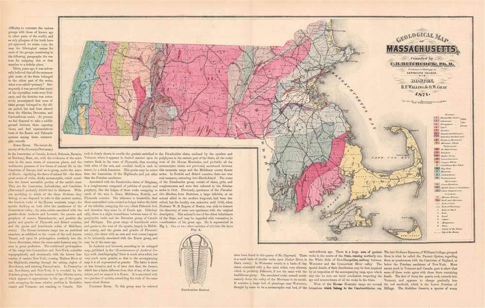
Geological Map of Massachusetts, Compiled by C. H. Hitchcock, Ph. D. Professor of Geology in Dartmouth College.
sold
- Digital Map Information
- Suitable for large format printing
- File Size: 23.38 MB
- File Type: ZIP / TIFF
- ICC color profile embedded
- Delivered instantly via download link
This is an attractive and richly informative geological map of Massachusetts, compiled by the geographer Charles Hitchcock and published by Walling and Gray in 1871. The map shows sources of iron, lead, copper, manganese and zinc; beds of coal, plumbago (not the ... (more details)
The largest and most decorative map of Shanghai!
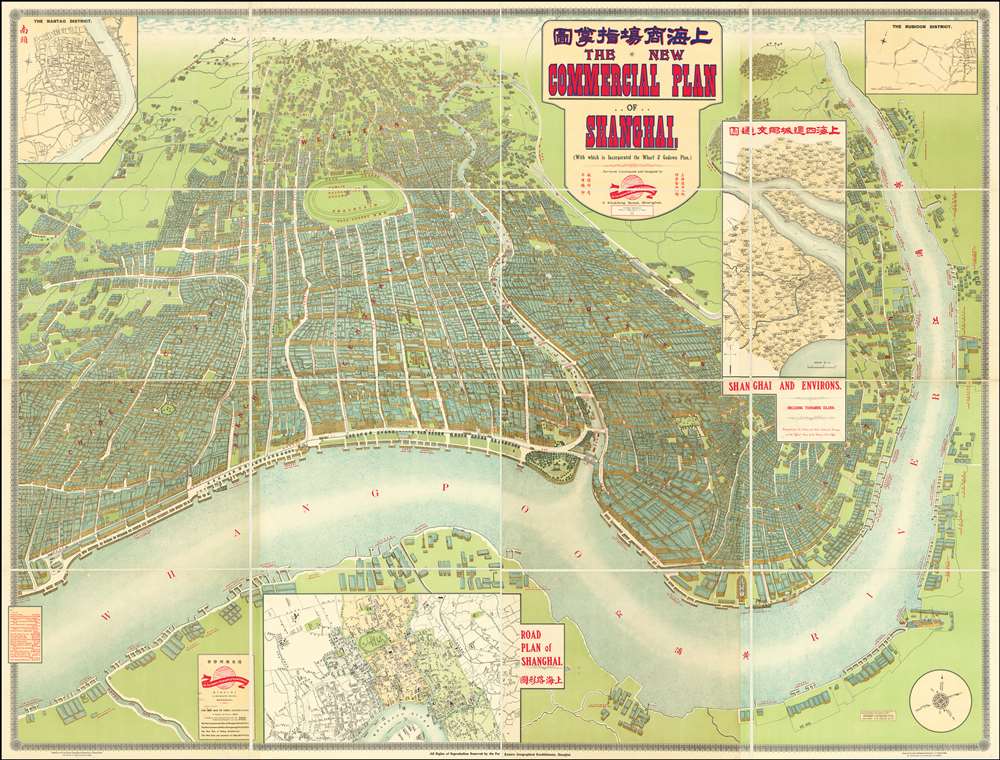
The New Commercial Plan of Shanghai (with which is incorporated the Wharf and Godown Plan). Surveyed, constructed and designed by the Far Eastern Geographical Establishment 6 Kiukiang Road Shanghai.
sold
- Digital Map Information
- Suitable for large format printing
- File Size: 300.62 MB
- File Type: ZIP / TIFF
- ICC color profile embedded
- Delivered instantly via download link
The greatest and most impressive map of Shanghai we have yet seen. Issued in 1915, this is the Far Eastern Geographical Establishment / Edwin John Dingle / H. J. Fruin pictorial view and map of Shanghai. The map is a staggering 83 x 63 inches. The view looks on Shanghai from the east, at a high point across the Huangpu River in what is today the hip Pudong district. In includes the Bund, the Shanghai International Settlement, and the British and French Concessions, as well as the old Chinese City at left. It was issued shortly after the shortly after the 1911 Xinhai Revolution. One can follow Wusong Creek westward into the Horizon, which is illustrated with clouds. Inset maps detail Shanghai and Environs, Road Plan of Shanghai, The Nantao District, and The Rubicon District. (more details)
Map of Nigerial likely used during the Berlin Conference of 1884-1885 to divide up Africa between European Powers.

[Cotonou-Port Novo-Lagos, Nigeria]
sold
- Digital Map Information
- Suitable for large format printing
- File Size: 87.04 MB
- File Type: ZIP / TIFF
- ICC color profile embedded
- Delivered instantly via download link
A unique discovery c. 1900 Ferro-Gallic map this is without a doubt the finest map of the Lagos, Nigeria region issued in the colonial era - probably made for Berlin Conference of 1884-85 (Congo Conference / West Africa Conference) which formally divided up west Africa among colonial powers. This colossal production showcases a stretch of the West African Coastline that runs from Cotonou, Benin to Lagos, Nigeria, as it appeared during the 1880s, when the region was contested between French and British colonial zones. (more details)
One of the earliest obtainable English maps to name and recognize the newly created United States.

Map of the United States in North America: with the British, French and Spanish Dominions adjoining, according to the Treaty of 1783.
sold
- Digital Map Information
- Suitable for large format printing
- DPI: 600
- File Size: 19.55 MB
- File Type: ZIP / TIFF
- ICC color profile embedded
- Delivered instantly via download link
After nine years of war between the mother country and its American colonies, this first edition 1783 Thomas Kitchin map of the United States is one of the earliest obtainable English printed maps that names and recognizes the newly independent United States of America. The map depicts the nascent country from just west of the Mississippi River to the Atlantic Ocean and from Hudson Bay to New Orleans and the Gulf of Mexico. Unique geography catches the viewer's attention, with Pennsylvania occupying a fair portion of southern New York and Virginia, North Carolina, South Carolina, and Georgia stretching from the Atlantic coast to the Mississippi River. Myriad cities, towns, and villages are labeled, including Philadelphia, New York, Boston, Newport, Baltimore, Charleston, and Savannah. Native American tribes are referenced, including the Iroquois, Miami, Cherokee, Creek, Chickasaw, and Choctaw. Important coastal locations, such as Cape Cod, Boston Harbor, Delaware Bay, Chesapeake Bay, Cape May, Cape Hatteras, and Cape Fear are also identified. All five Great Lakes are labeled and rivers, lakes, and mountains are noted. (more details)
Psychedelic pictoral map of San Francisco Epitomizing the Summer of Love.

San Francisco.
sold
- Digital Map Information
- Suitable for large format printing
- Full resolution TIFF file
- ICC color profile embedded
- Delivered instantly via download link
Rare, likely one-of-a-kind erroneous proof of this large, attractive and thoroughly far-out 1967 pictorial map of San Francisco. This engaging and exciting view, screen-printed in red, black, and metallic gold, captures the ideal of city in the midst of the Summer of Love, with particular reference to the music that epitomized the year. This example appears to be a unique survival. The print was executed in three colors. The red and the gold, printed first, are registered properly with each other. The black image, added last, has been printed upside-down in relation to the other colors. The error suggests that this example was a test proof; its survival is a testament to the added psychedelic effect presented by the mismatched colors. The poster has four neat tack-holes, indicating that it was put on the wall, and enjoyed for many years despite (or indeed due to) the errors in its execution.
The city’s hilly layout is ludicrously exaggerated, presenting the viewer with a rambunctious pile of iconic references and insider’s jokes springing up from the foot of the Golden Gate Bridge, topped with a ‘Love’ Banner. The image is richly informed with an insider’s knowledge of the scene, providing the viewer with a wealth of detail. Sausalito, in the foreground, features hillside meadows and a ‘Hippy Summer Camp.’ The bucolic scene ends abruptly with a teeming crowd of pedestrians and buses filling the Golden Gate Bridge (though it is not clear whether this horde is entering or leaving the city.) (more details)
The city’s hilly layout is ludicrously exaggerated, presenting the viewer with a rambunctious pile of iconic references and insider’s jokes springing up from the foot of the Golden Gate Bridge, topped with a ‘Love’ Banner. The image is richly informed with an insider’s knowledge of the scene, providing the viewer with a wealth of detail. Sausalito, in the foreground, features hillside meadows and a ‘Hippy Summer Camp.’ The bucolic scene ends abruptly with a teeming crowd of pedestrians and buses filling the Golden Gate Bridge (though it is not clear whether this horde is entering or leaving the city.) (more details)
Beautiful chromolithograph advertising map of San Francisco.
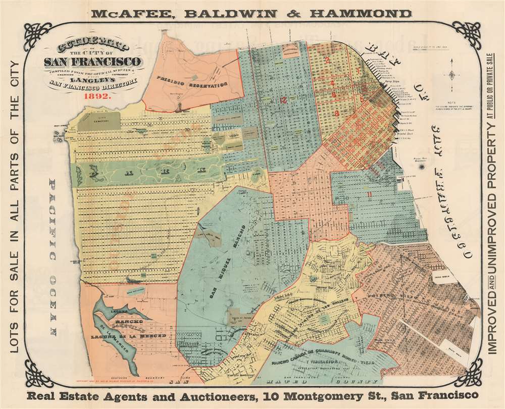
Guide Map of the City of San Francisco.
sold
- Digital Map Information
- Suitable for large format printing
- File Size: 50.89 MB
- File Type: ZIP / TIFF
- ICC color profile embedded
- Delivered instantly via download link
A beautifully produced five-color chromolithograph 1892 map of San Francisco at the end of the 19th century. This map covers all of San Francisco from Lake Merced to the Golden Gate and from the Pacific to San Francisco Bay. Vivid color defines city districts with numbers identifying individual blocks. Various commercial slips and wharves are noted. Red overprinting highlights more active real estate development. The map itself is surrounded by advertising text promoting real estate. (more details)
Rare chart by an uncommon but important English blueback maker.
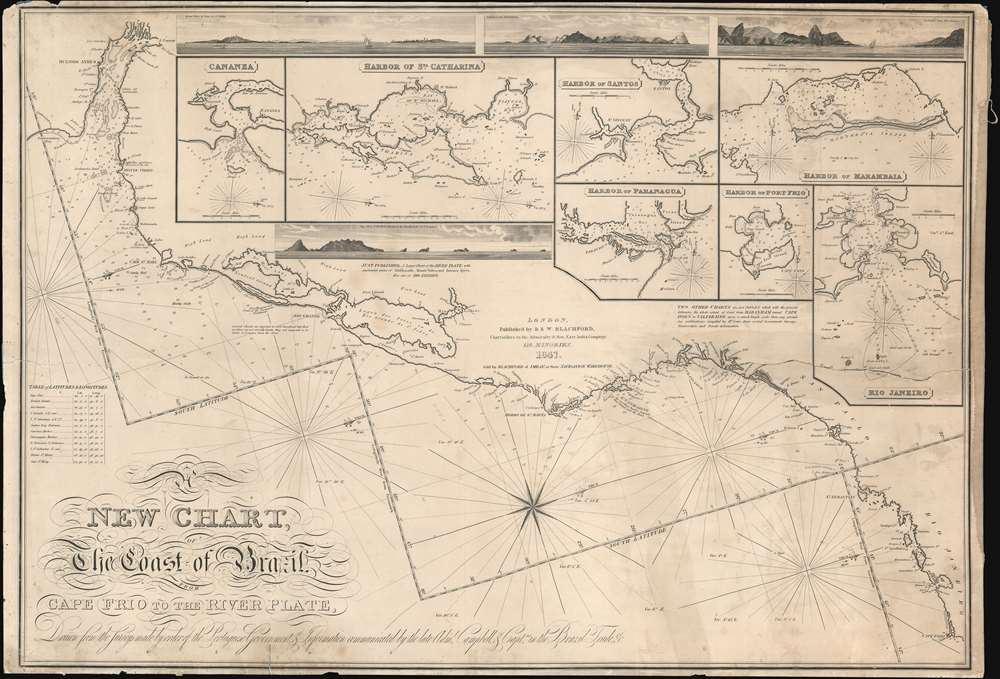
A New Chart, The Coast of Brazil, Cape Frio to the River Plate.
sold
- Digital Map Information
- Suitable for large format printing
- DPI: 600
- File Size: 65.21 MB
- File Type: ZIP / TIFF
- ICC color profile embedded
- Delivered instantly via download link
A very rare 1847 Robert Blachford blueback nautical chart or maritime map of the Coast of Brazil from the Rio de la Plata (Buenos Aires) to Rio de Janeiro. The chart includes four profile recognition views and seven inset charts including: Rio Janeiro; Harbor of Marambaia; Harbor of Port Frio; Harbor of Paranagua; Harbor of Santos; Harbor of St. Catharina; and Cananea. The cartography is attributed to Rear-Admiral Donald Campbell (1752 - 1819), briefly commandant of the Brazilian squadron of the Portuguese navy during the early 19th century. Campbell, although Scottish, was in the employ of the Portuguese Navy, as the British had interest in defending the Brazil trade against possible French attack during the transition of the Portuguese monarchy to the New World. (more details)
The California-as-an-island Myth At A Glance

Carte de la Californie suivant I. La carte manuscrite de l'Amerique de Mathieu Neron Pecci olen dresse a Florence en 1604 II. Sanson 1656 III. De L'Isle Amerique Sept. 1700 IV. le Pere Kino Jesuite en 1705 V. La Societe des Jesuites en 1767.
sold
- Digital Map Information
- Suitable for large format printing
- DPI: 600
- File Size: 12.45 MB
- File Type: ZIP / TIFF
- ICC color profile embedded
- Delivered instantly via download link
This is a rare and important engraving combining five seminal maps of California on one sheet. European understanding of the region’s geography was convoluted and changed many times over the course of more than a century. This map, engraved by the important French cartographer Robert De Vaugondy for the 1772 edition of the Denis Diderot (1713-84) Encyclopedie, traces the gradual clarification of the geography of California through five key stages in the mapping of the region. It opens with the work of Italian cartographer Matheau Neron Pecci (1604) which correctly presumed that the main body of California extended southward into a peninsula. The next map illustrated, by Nicolas Sanson in 1656, was among the most influential of the maps of the 17th century to propose an insular California. Map no. III, by Guillaume Delisle (1700), was one of the first maps produced by a prominent geographer to abandon the insular California. The fourth is the seminal Kino Map. This map, rendered by a Jesuit missionary c.1705, was the work that finally disproved the California Insular theory. Father Franz Kino walked this region between 1698 and 1701. The final map, produced by unnamed Jesuits c. 1767 is a more accurate depiction of the Baja California peninsula. These maps all predate the discoveries of Captain Cook's voyages and hence Diderot's work was as much speculative as historical in many respects - though the Jesuit reports pertaining to California’s non-insularity were authoritative. A fine example of an essential work for all serious California collections.
This map is part of the 10 map series prepared by Vaugondy for the Supplement to Diderot's Encyclopedie, of which this is plate 5. This remarkable map series, exploring the mapping of North America and specifically the Northwest Passage was one of the first studies in comparative cartography. (more details)
This map is part of the 10 map series prepared by Vaugondy for the Supplement to Diderot's Encyclopedie, of which this is plate 5. This remarkable map series, exploring the mapping of North America and specifically the Northwest Passage was one of the first studies in comparative cartography. (more details)
First map of Florida as a United States Territory

Geographical, Statistical, and Historical Map of Florida.
sold
- Digital Map Information
- Suitable for large format printing
- DPI: 600
- File Size: 29.86 MB
- File Type: ZIP / TIFF
- ICC color profile embedded
- Delivered instantly via download link
Arguably the first map of Florida as a United States Territory. This is the 1822 first edition example of Henry Charles Carey and Isaac Lea's map of Florida, drawn by Lucas, Fielding, Jr. (1781-1854). The map depicts the region from the Perdido River to the Atlantic Ocean, and from Alabama and Georgia to the Florida Keys. The map presents Florida at a fairly early state of survey and settlement. It shows only two counties, Escambia and St. Johns. (Jackson and Duval were created in 1822 but do not appear here). In the north of Florida a number of towns appear - St. Augustine, Pensacola and St. Pedro, for example - but native settlements and forts predominate. The bulk of the peninsula shows little habitation. Roads, rivers, lakes and swamps are also labeled. The river system running the length of the peninsula is highly conjectural.
As with all the maps of the Carey and Lea atlas, this one is bordered on left and right with detailed and vigorously composed descriptions of the territory. The 'Historical Sketch' on the right hand side of the map takes the reader from Cabot's arrival in 1496 to the formation of the Territory in July of 1821 (formally declared thus by Congress March 20, 1822). (more details)
As with all the maps of the Carey and Lea atlas, this one is bordered on left and right with detailed and vigorously composed descriptions of the territory. The 'Historical Sketch' on the right hand side of the map takes the reader from Cabot's arrival in 1496 to the formation of the Territory in July of 1821 (formally declared thus by Congress March 20, 1822). (more details)
Highlights the realities of a possible war between the United States and Japan in the Pacific.

U.S. v. Japan The Pacific Problem.
sold
- Digital Map Information
- Suitable for large format printing
- File Size: 97.93 MB
- File Type: ZIP / TIFF
- ICC color profile embedded
- Delivered instantly via download link
This is a rare 1940 Robert M. Chapin, Jr. map of the Pacific Ocean and the potential for war between the United States and the Empire of Japan. Stretching from Asia to the Americas and from Alaska to New Zealand and Cape Horn, Chapin highlights areas that could become battlegrounds if the tensions between the U.S. and Japan boiled over into war. Black and white stripes identify the United States, a deliberate reference to the American flag. It is worth noting that the Philippines, an archipelago in the East Indies, is also shaded with this pattern, as the islands were a U.S. possession in 1940. Japanese territory is black, including Manchukuo, the puppet state the Japanese created in northeastern China, Taiwan (Formosa), and Hainan.
With the benefit of hindsight, modern viewers know what lies ahead, but Chapin and those viewing this map in TIME Magazine in 1940 could only guess. Islands across the Pacific are labeled and captions provide context for the most important locations. The Hawaiian Islands, specifically Pearl Harbor, are one such location, with a caption providing distances between the naval base and San Francisco, Tokyo, and Manila, the capital of the Philippines. The American base at Dutch Harbor, Alaska is also among the locations singled out, as is Guam, and island in the Western Pacific and a U.S. possession, but unfortified and poorly defended. The map also posits that the Panama Canal Zone, then occupied by the United States, could be used as a base for the fleet. Two large circles emanate across the Pacific from the Americas and Hawaii, illustrating just how far the American military can reach. This clearly informs the viewer in no uncertain terms that as of the publication of this map, the U.S. military is unable to reach the Western Pacific and Japan.
The Japanese position, however, appears to be much stronger. By 1940, the Japanese had been fighting in Asia for nine years and, as Chapin points out, had recently gained a foothold in French Indochina, a benefit gained from Nazi Germany's stunning defeat of France in June. Japanese fortified islands in the Marshall Islands and Marianas Islands are also highlighted, creating a stark contrast between Japanese and American preparedness in the region. These islands, Saipan, Jaluit, and Truk to name a few, are relatively close to Guam, and the Japanese have taken the time to fortify them, while the American have left Guam essentially undefended. Chapin also posits the question of whether or not the United States would fight for oil, rubber, and tin in the Dutch East Indies (Java, Sumatra, Borneo), and quickly states that Japan would, creating yet another noticeable difference between the two powers.
Yet another important comparison is drawn by an infographic along the bottom border: the relative tonnage of the U.S. Navy and Japanese Navy are compared side by side. The strength of each country's battleships, cruisers, aircraft carriers, destroyers, and submarines are all compared, and the U.S. tops Japan in nearly every category. This advantage, though important, would be difficult to maintain in the beginning stages of the coming war. But Japan was not completely outnumbered, as their greatest advantages, their technological superiority in torpedoes and fighter planes for example, more than made up for slightly less in naval tonnage. (more details)
With the benefit of hindsight, modern viewers know what lies ahead, but Chapin and those viewing this map in TIME Magazine in 1940 could only guess. Islands across the Pacific are labeled and captions provide context for the most important locations. The Hawaiian Islands, specifically Pearl Harbor, are one such location, with a caption providing distances between the naval base and San Francisco, Tokyo, and Manila, the capital of the Philippines. The American base at Dutch Harbor, Alaska is also among the locations singled out, as is Guam, and island in the Western Pacific and a U.S. possession, but unfortified and poorly defended. The map also posits that the Panama Canal Zone, then occupied by the United States, could be used as a base for the fleet. Two large circles emanate across the Pacific from the Americas and Hawaii, illustrating just how far the American military can reach. This clearly informs the viewer in no uncertain terms that as of the publication of this map, the U.S. military is unable to reach the Western Pacific and Japan.
The Japanese position, however, appears to be much stronger. By 1940, the Japanese had been fighting in Asia for nine years and, as Chapin points out, had recently gained a foothold in French Indochina, a benefit gained from Nazi Germany's stunning defeat of France in June. Japanese fortified islands in the Marshall Islands and Marianas Islands are also highlighted, creating a stark contrast between Japanese and American preparedness in the region. These islands, Saipan, Jaluit, and Truk to name a few, are relatively close to Guam, and the Japanese have taken the time to fortify them, while the American have left Guam essentially undefended. Chapin also posits the question of whether or not the United States would fight for oil, rubber, and tin in the Dutch East Indies (Java, Sumatra, Borneo), and quickly states that Japan would, creating yet another noticeable difference between the two powers.
Yet another important comparison is drawn by an infographic along the bottom border: the relative tonnage of the U.S. Navy and Japanese Navy are compared side by side. The strength of each country's battleships, cruisers, aircraft carriers, destroyers, and submarines are all compared, and the U.S. tops Japan in nearly every category. This advantage, though important, would be difficult to maintain in the beginning stages of the coming war. But Japan was not completely outnumbered, as their greatest advantages, their technological superiority in torpedoes and fighter planes for example, more than made up for slightly less in naval tonnage. (more details)
Richly detailed map of the major tributaries of the Ohio River immediately following the American Revolution

Esquisse des rivieres Muskinghum et Grand Castor que j'ai tiree du Journal du General Bouquet.
sold
- Digital Map Information
- Suitable for large format printing
- DPI: 600
- File Size: 11.19 MB
- File Type: ZIP / TIFF
- ICC color profile embedded
- Delivered instantly via download link
This is a scarce 1787 map of the Ohio River and its tributaries by Pierre Tardieu. Divided into three maps, this is one of the earliest maps of the region. The large map in the left depicts the course of the Ohio River from western Pennsylvania to the confluence of the Hockhoking River. The Sandusky River, which flows north into Lake Erie, appears at the top of the map. Its primary focus is the course of the Muskinghum River, the largest of the Ohio's tributaries in the region and the site of many indigenous and European settlements.
The center map depicts the Scioto River and its various tributaries, showing many indigenous settlements in the future location of Columbus, Ohio. The third map features the River Grand Castor - now known as the Beaver River, in Western Pennsylvania - and its tributaries. As in the other two maps, native and European settlements are noted throughout, with mountains beautifully rendered in profile. All three maps note sources for salt, trails between settlements, and native warpaths. (more details)
The center map depicts the Scioto River and its various tributaries, showing many indigenous settlements in the future location of Columbus, Ohio. The third map features the River Grand Castor - now known as the Beaver River, in Western Pennsylvania - and its tributaries. As in the other two maps, native and European settlements are noted throughout, with mountains beautifully rendered in profile. All three maps note sources for salt, trails between settlements, and native warpaths. (more details)
An allegorical map of the Civilization torn between Extravagance and Depression at the height of the Great Depression.

Civilization Struggles Between Extravagance and Depression
sold
- Digital Map Information
- Suitable for large format printing
- File Size: 12.84 MB
- File Type: ZIP / TIFF
- ICC color profile embedded
- Delivered instantly via download link
This is a 1933 John Scott Williams allegorical map of the world highlighting the struggle between extravagance and depression at the height of the Great Depression. Drawn in an Art Deco style, Civilization, illustrated as a man superimposed over the Earth, stands at the center in a position reminiscent of a crucifixion and is flanked by Extravagance and Depression. Extravagance, on the left, is showering himself in gold coins, while Depression is hiding his eyes and commanding a gigantic Octopus to drag Civilization down into the depths. (more details)
An iconic piece of 1960s West Coast history and hippie culture.
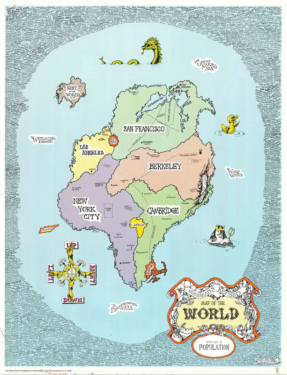
Humbead's Revised Map of the World with List of Population.
sold
- Digital Map Information
- Suitable for large format printing
- File Size: 37.89 MB
- File Type: ZIP / TIFF
- ICC color profile embedded
- Delivered instantly via download link
This is an iconic 1969 Earl Crabb and Rick Shubb map of the world. Celebrated for its place in the history of the West Coast folk scene and the hippie counterculture, the map depicts a world reimagined from this perspective. San Francisco, Berkeley, Los Angeles, New York City, and Cambridge dominate one large continent, with Southeast Asia, North Africa, and Boston making up the rest of this landmass. Places within these cities are illustrated and labeled as well, adding some detail to the map. In San Francisco, for example, Golden Gate Park and the intersection of Haight Street and Ashbury Street are included, as is San Francisco Bay. In New York City, Washington Square Park, Central Park, Tompkins Square Park, and Café Au Go Go are included, with Fire Island and Coney Island illustrated off the coast. Harlem, Chicago, and New Orleans are dots on the map. Southeast Asia, situated between San Francisco and Los Angeles, is illustrated as a round red splotch, a reference to the bloody completely incomprehensible war in Vietnam raging at the time, while the entire continent of Africa is situated between Cambridge and New York City.
An ocean surrounds this large Pangea of a landmass and is labeled as 'The Whelming Brine', 'The Farspooming Ocean', and 'The Wavy Waste'. A rubber duck, Neptune, and a sea monster occupy this vast expanse of water, as does an island known simply as 'Rest of the World Island' which houses Rome, London, Paris, Moscow, Bombay, Delhi, Liverpool, Copenhagen, and Singapore. An island shaped like the state of Tennessee and labeled 'Nashville' floats off the coast of New York City, probably a reference to Nashville as the home of country music. A whimsical compass in the lower right corner provides directions, 'Up', 'Down', 'Right', and 'Left' are the cardinal directions, while 'This Way', 'That Way', 'Hither', and 'Yon' are noted in between. The whole is surrounded by a border made up of hundreds of names of celebrities of every sort, including Arlo Guthrie, Timothy Leary, Ray Bradbury, L. Ron Hubbard, Norman Mailer, Paul McCartney, William Burroughs, Earl Scruggs, Aretha Franklin, J.R.R. Tolkein, Ken Kesey, and Stan Lee just to list a few. (more details)
An ocean surrounds this large Pangea of a landmass and is labeled as 'The Whelming Brine', 'The Farspooming Ocean', and 'The Wavy Waste'. A rubber duck, Neptune, and a sea monster occupy this vast expanse of water, as does an island known simply as 'Rest of the World Island' which houses Rome, London, Paris, Moscow, Bombay, Delhi, Liverpool, Copenhagen, and Singapore. An island shaped like the state of Tennessee and labeled 'Nashville' floats off the coast of New York City, probably a reference to Nashville as the home of country music. A whimsical compass in the lower right corner provides directions, 'Up', 'Down', 'Right', and 'Left' are the cardinal directions, while 'This Way', 'That Way', 'Hither', and 'Yon' are noted in between. The whole is surrounded by a border made up of hundreds of names of celebrities of every sort, including Arlo Guthrie, Timothy Leary, Ray Bradbury, L. Ron Hubbard, Norman Mailer, Paul McCartney, William Burroughs, Earl Scruggs, Aretha Franklin, J.R.R. Tolkein, Ken Kesey, and Stan Lee just to list a few. (more details)
Civil War Era Map of Maine.

Johnson's Maine.
sold
- Digital Map Information
- Suitable for large format printing
- File Size: 22.89 MB
- File Type: ZIP / TIFF
- ICC color profile embedded
- Delivered instantly via download link
This is Johnson and Ward's 1864 map of Maine. It covers the entire state along with adjacent portions of Canada and New Hampshire. The map is color coded according to county and notes several roads, railways, rivers, cities, towns and various other topographical details. It features the fretwork style border common to Johnson’s atlas work from 1863 to 1869. (more details)
Informative and entertaining map of the world's principal animals and industries

Map of The World showing the Geographical Distribution and Range of The Principal Members of The Animal Kingdom. Map of The World illustrating the Productive Industry Of Various Countries, and exhibiting the principal features of Commerce And Navigation.
sold
- Digital Map Information
- Suitable for large format printing
- File Size: 13.29 MB
- File Type: ZIP / TIFF
- ICC color profile embedded
- Delivered instantly via download link
This is a beautiful example of A. J. Johnson and R. Browning's 1861 map of the World's animal kingdom and the productive industries of various countries. The sheet contains two maps. The first shows the geographical distribution and range of the principal ... (more details)
Combining science and cartography.
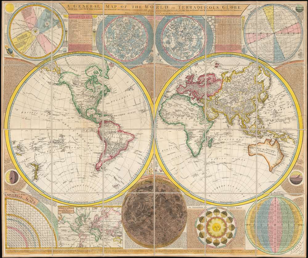
A General Map of the World, or Terraqueous Globe with all the New Discoveries and Marginal Delineations, Containing the Most Interesting Particulars in the Solar, Starry and Mundane System, by Sam. Dunn, Mathematician.
sold
- Digital Map Information
- Suitable for large format printing
- DPI: 600
- File Size: 127.69 MB
- File Type: ZIP / TIFF
- ICC color profile embedded
- Delivered instantly via download link
An absolutely stunning and monumental double hemisphere wall map of the world by Samuel Dunn dating to 1794. This extraordinary map is so large and so rich in detail that it is exceptionally challenging to do it full justice in either photographic or ... (more details)
A charming pictorial map featuring all five Great Lakes.
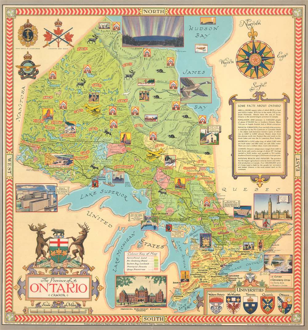
The Province of Ontario, Canada.
sold
- Digital Map Information
- Suitable for large format printing
- File Size: 33.53 MB
- File Type: ZIP / TIFF
- ICC color profile embedded
- Delivered instantly via download link
This is a 1950 Thomas Wesley McLean and Alexander Scott Carter pictorial map of the five Great Lakes and the province of Ontario, Canada. The map depicts the region from Manitoba to Quebec and from the Hudson Bay to Lake Erie. Each of the five Great Lakes, situated in the bottom half of the map, are labeled. Ships are illustrated plying their waters and fish hint at the natural bounty provided by the lakes themselves. Manitoulin Island, the largest freshwater island in the world, is illustrated and labeled. Vignettes present charming scenes of life in Ontario, such as a musher with a team of sled dogs, a woodsman transporting logs via horse-drawn sledge, and people in a canoe on one of the province's many rivers and lakes. Other vignettes highlight Ontario's industry, such as power stations, grain elevators, iron mines, and individual industries, including lumbering, fur, pulp and paper, farming, and the mining of iron and gold are referenced by colorful banners. Illustrations of animals native to Ontario, including polar bears, caribou, moose, and beaver, dot the landscape.
Toronto, Sault St. Marie, Kingston, and Ottawa are among the numerous cities, towns, and villages labeled throughout the province. Railroads connect many of these cities, although no roads are shown. A key situated in the bottom third of the map explains the different colors used and how they provide information concerning land use. A decorative title cartouche is situated in the lower left corner, with a view of the Provincial Parliament Building in Toronto to its right. In the lower right corner sits an inset that displays the coats of arms of five universities based in Ontario, including Ottawa, Toronto, and Queen's. An illustration of the Dominion Parliament Building in Ottawa, placed along the right border, appears below a cartouche bearing facts about the province of Ontario. Badges of the Canadian Army, Navy and Air Force are included in the upper right corner. (more details)
Toronto, Sault St. Marie, Kingston, and Ottawa are among the numerous cities, towns, and villages labeled throughout the province. Railroads connect many of these cities, although no roads are shown. A key situated in the bottom third of the map explains the different colors used and how they provide information concerning land use. A decorative title cartouche is situated in the lower left corner, with a view of the Provincial Parliament Building in Toronto to its right. In the lower right corner sits an inset that displays the coats of arms of five universities based in Ontario, including Ottawa, Toronto, and Queen's. An illustration of the Dominion Parliament Building in Ottawa, placed along the right border, appears below a cartouche bearing facts about the province of Ontario. Badges of the Canadian Army, Navy and Air Force are included in the upper right corner. (more details)
A stunning birds eye view of the Amalfi Coast and Naples, Italy.

Naples Italy.
sold
- Digital Map Information
- Suitable for large format printing
- File Size: 55.28 MB
- File Type: ZIP / TIFF
- ICC color profile embedded
- Delivered instantly via download link
This is a stunning c. 1920 Richter and Company bird's eye view of the majestic Amalfi Coast, Naples, and Capri, Italy and environs, here it its only known example. The view depicts the Italian Mediterranean coastline from the northeast, illustrating from Salerno to Ischia Island and as far inland as Casoria. Naples (Napoli) is situated to the right of center along the Gulf of Naples while Mount Vesuvius is on the left. Numerous cities are labeled, including Sorrento, Pompeii, Castellammare, Amalfi, and Salerno, along with smaller towns and villages. Roads and railroads connect them all. Capri and Mount Solaro are illustrated just above center. (more details)
Rewards players for resisting the Occupation and punishes them for activities that aid the Occupier.

Laf en Flink Tijdens Hinkepink. [Laf and Flink During Hinkepink].
sold
- Digital Map Information
- Suitable for large format printing
- File Size: 35.45 MB
- File Type: ZIP / TIFF
- ICC color profile embedded
- Delivered instantly via download link
This is a 1945 Handelsonderneming Omnium Dutch pictorial gameboard of life under the Nazi occupation of the Netherlands during World War II. Played by between two and twelve players, each player starts with four chips. Using two dice, the players move along the game board moving the number of spaces rolled. Whichever player reaches the 100th space at the center of the board, the 'Tree of Liberty' with the seals of the eleven provinces of the Netherlands, is the winner. (more details)