
A lovely part of Long Island popular with artists because of its unique light - near the Hamptons.
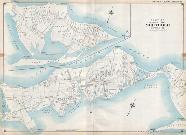
Part of Town of Southold Suffolk Co.
sold
- Digital Map Information
- Suitable for large format printing
- File Size: 22.8 MB
- File Type: ZIP / TIFF
- ICC color profile embedded
- Delivered instantly via download link
This is a 1909 E. Belcher Hyde map of part of the town of Southold located on the North Fork of Long Island in Suffolk County, New York. Often considered a quieter atlernative to the Hamptons in the South Fork, the map depicts the region from Hashamomuck Pond to ... (more details)
Nautical Chart depicting Alabama's Mobile Bay.

H No. 10 Preliminary Sketch of Mobile Bay.
sold
- Digital Map Information
- Suitable for large format printing
- DPI: 300
- File Size: 3.98 MB
- File Type: ZIP / TIFF
- ICC color profile embedded
- Delivered instantly via download link
This is an uncommon 1851 U.S. Coast Survey Chart or Map of Mobile Bay, Alabama. The map depicts the region from Grand Bay and the mouths of the Alabama and Apalachee Rivers south to Mobile Point, Dauphine Island, and the Sand Island Bank and extends westward into ... (more details)
A detailed view of Boston Harbor.

Bird's Eye View of Boston Harbor along the South Shore to Provincetown.
sold
- Digital Map Information
- Suitable for large format printing
- File Size: 9.09 MB
- File Type: ZIP / TIFF
- ICC color profile embedded
- Delivered instantly via download link
This is a 1917 William J. Finn color lithograph bird's eye view of Boston Harbor from Boston to Provincetown. All of Cape Cod Bay, Quincy Bay, and Dorchester Bay are depicted, along with the communities of Boston, East Boston, South Boston, Dorchester, Quincy, and ... (more details)
The advance of the 79th Division across northern France - including a vignette of the critical crossing of the Seine at Mantes Gassicourt.
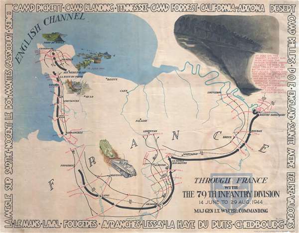
Through France with the 79th Infantry Division 14 June to 29 Aug, 1944. Maj Gen I.T. Wyche, Commanding.
sold
- Digital Map Information
- Suitable for large format printing
- File Size: 18.53 MB
- File Type: ZIP / TIFF
- ICC color profile embedded
- Delivered instantly via download link
This is a 1945 Steve Kaliher and Harry D. White pictorial map of the 79th Infantry's route through northern France. The map depicts northern France from the English Channel south to Le Mans and from Mont Saint-Michel Bay to Mantes Gassicourt and the Seine River. ... (more details)
A wonderful pictorial tourist map of Florida highlighting Florida's history and numerous points of interest.
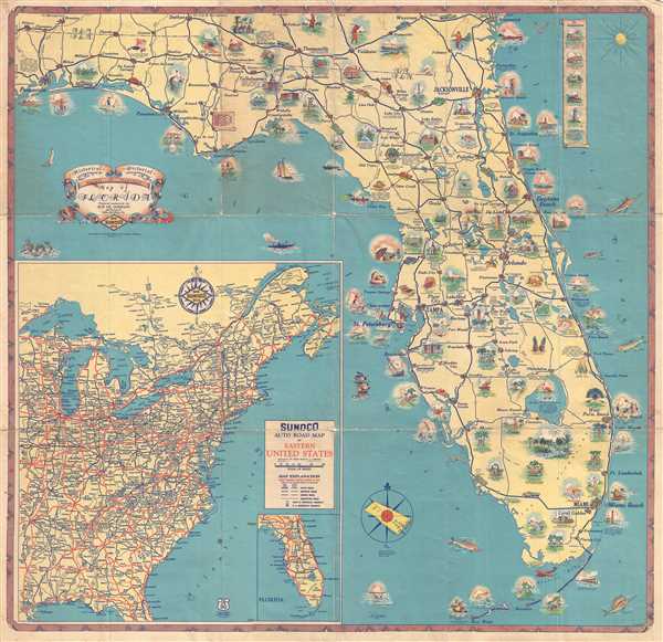
Historical Pictorial Points of Interest Map of Florida.
sold
- Digital Map Information
- Suitable for large format printing
- Full resolution TIFF file
- ICC color profile embedded
- Delivered instantly via download link
This is a 1937 Sun Oil Company (SUNOCO) and Rand McNally pictorial map of Florida. The map depicts the region from Pensacola Bay to the Atlantic Ocean and from Alabama to Key West. Functioning as both a road map and a tourist map, Florida's history is traced ... (more details)
Stunning case map of Boston and vicinity.

Map of the City and Vicinity of Boston, Massachusetts.
sold
- Digital Map Information
- Suitable for large format printing
- DPI: 300
- File Size: 0.65 MB
- File Type: ZIP / TIFF
- ICC color profile embedded
- Delivered instantly via download link
This is a stunning large format first edition 1852 case map of Boston, Massachusetts, and vicinity. Centered on Boston, the map covers from Danvers to Hingham, and from Weston to Massachusetts Bay. Towns are coded in bright original color. The map is ... (more details)
Decorative Carte-a-Figure map of Poland!
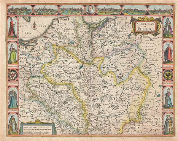
A Newe Mape of Poland.
sold
- Digital Map Information
- Suitable for large format printing
- Full resolution TIFF file
- ICC color profile embedded
- Delivered instantly via download link
This is a 1676 John Speed carte-a-figure map of Poland issued at the end of the Second Polish-Ottoman War. The map depicts from the Baltic Sea and eastern Bohemia to Prussia, Lithuania, and western Russia and from the Baltic to Kraków (Cracow; ... (more details)
A beautiful example of Blaeu's first map of Italy.
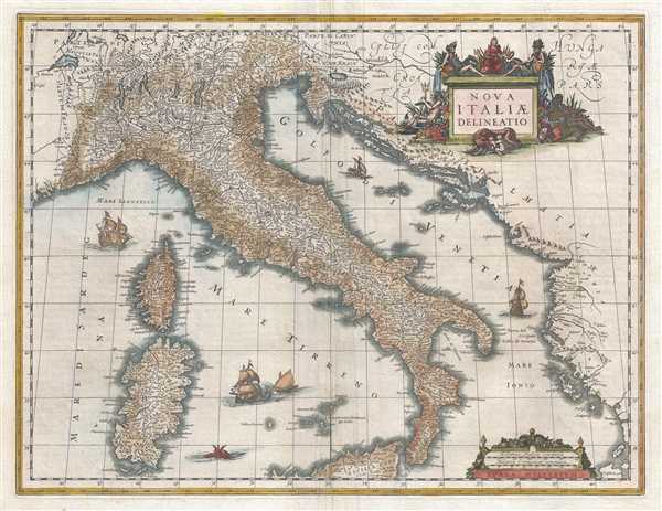
Nova Italiæ Delineatio.
sold
- Digital Map Information
- Suitable for large format printing
- DPI: 300
- File Size: 10.86 MB
- File Type: ZIP / TIFF
- ICC color profile embedded
- Delivered instantly via download link
This is a 1635 first edition Willem Janszoon Blaeu map of Italy. The map depicts the region from western France to the Balkans and from Switzerland (labeled here as Parte di Germania ) to northern Sicily. Highly detailed, myriad cities, towns, ... (more details)
Striking decorative map of Poland and Lithuania!

Regni Poloniae et Ducatus Lithuaniae Voliniae, Podoliae, Ucraniae, Prussiae, Lovoniae, et Curlandiae descriptio.
sold
- Digital Map Information
- Suitable for large format printing
- DPI: 300
- File Size: 13.24 MB
- File Type: ZIP / TIFF
- ICC color profile embedded
- Delivered instantly via download link
This is a striking and highly decorative c. 1682 Frederik de Wit map of Poland and Lithuania. The map covers from the Baltic Sea to the Black Sea and from Latvia to Moldova, including much of modern day Poland and Lithuania. The map was ... (more details)
The last edition of a landmark map in the cartography of Mount Desert Island.
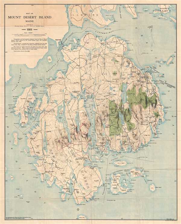
Map of Mount Desert Island Maine.
sold
- Digital Map Information
- Suitable for large format printing
- File Size: 19.96 MB
- File Type: ZIP / TIFF
- ICC color profile embedded
- Delivered instantly via download link
This is a 1911 map of Mount Desert Island, Maine compiled by Waldron Bates, Edward L. Rand, and Herbert Jaques. The map depicts the island from Blue Hill Bay to Frenchman's Bay and from Lamoine, Hancock, and Sorrento to Great Gott Island. Highly detailed, locations throughout the island are labeled, including the towns of Bar Harbor (labeled here as Eden), Mount Desert, Southwest Harbor, and Tremont. Villages throughout each of these towns are also labeled, including Salisbury Cove, Somesville, West Tremont, and Seal Harbor. The topography, illustrating elevation changes in forty-foot intervals, was adapted from the Map of Mount Desert Island issued by the United States Coast and Geodetic Survey in 1882, as was the hydrography.
(more details)
(more details)
An advertisement created by the Northern Pacific Railroad to publicize land for sale by the railroad.

Township and Railroad Map of Minnesota and Dakota Showing the Northern Pacific R.R. and its Connections.S6571
sold
- Digital Map Information
- Suitable for large format printing
- File Size: 10.92 MB
- File Type: ZIP / TIFF
- ICC color profile embedded
- Delivered instantly via download link
This is an 1878 Northern Pacific Railroad map of Minnesota and the Dakotas advertising land for sale. The map depicts the region from Wyoming and Montana to Lake Superior and Wisconsin and from Canada (British Possessions) to Iowa and Nebraska (though Nebraska is not labeled). Created as an advertisement proclaiming the availability of land for purchase within the Northern Pacific Railroad's land grant from the federal government, the grid organized by the Public Land Survey System is illustrated, along with counties, cities, towns, and rail lines. St. Paul, Minneapolis, and Mankato are among the identified cities and towns, and the several railroads other than the Northern Pacific are labeled, including the St. Paul and Pacific Railroad, the Winona and St. Peter Railroad, and the Southern Minnesota Railroad. (more details)
An incredibly entertaining pictorial map of Wyoming.
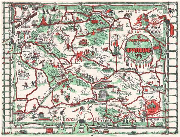
Paint-Brush Map of Wyoming.
sold
- Digital Map Information
- Suitable for large format printing
- File Size: 3.26 MB
- File Type: ZIP / TIFF
- ICC color profile embedded
- Delivered instantly via download link
This is a 1938 Thomas Graham Carrigen pictorial map of Wyoming. The map depicts the entire state and highlights some of the most well-known locations in Wyoming, including Yellowstone National Park, Grand Tetons National Park, and Devil's ... (more details)
The first commercially produced large format map of Washington Territory.
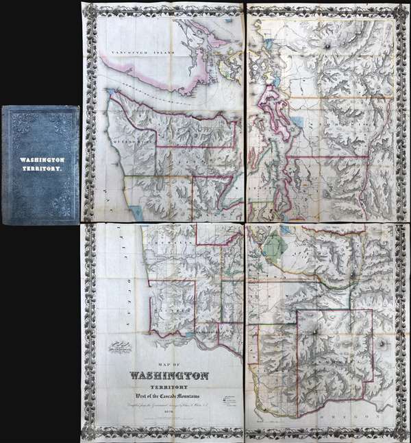
Map of Washington Territory West of the Cascade Mountains Compiled by the Government Surveys by Chas. A. White. C. E.
sold
A landmark production, this is the first large format commercially issued map of Washington Territory. It was issued by Charles A. White, woring with George Woolworth and Charles B. Colton, in 1870. The Colton brothers doubtless intended the map to capitalize on general interest in the region stemming from the imminent construction of the Northern Pacific Railroad. Although the Northern Pacific had been delayed for many years, construction finally began in 1870 and brought with it the promise of a land rush and an associated trade explosion to this previously remote and inaccessible part of the country.
Washington Territory Land Rush
The map's coverage extends from Vancouver to the Columbia River and from the Pacific to the Cascade Mountains. The region's rich topography is illustrated via shading and hachure. Cartographically, this map based upon the U.S. Government Land Surveys and the United States Coast Survey. The platting work of the U.S. Land Survey for Washington Territory is evident throughout in the form of small and large squares. Some of this land had clearly been assigned and color coding indicates Prairie Lands (Green), Government Reserves (Red), and Indian Reservations (Light Blue). Among other things, the prevalence of largely unassigned plats indicates the extraordinary wealth of excellent land available to enterprising pioneer settlers. Between 1870, when his map was issued, and 1880, the population of Washington Territory over tripped, from about 23,500 to 75,000 (more details)
Washington Territory Land Rush
The map's coverage extends from Vancouver to the Columbia River and from the Pacific to the Cascade Mountains. The region's rich topography is illustrated via shading and hachure. Cartographically, this map based upon the U.S. Government Land Surveys and the United States Coast Survey. The platting work of the U.S. Land Survey for Washington Territory is evident throughout in the form of small and large squares. Some of this land had clearly been assigned and color coding indicates Prairie Lands (Green), Government Reserves (Red), and Indian Reservations (Light Blue). Among other things, the prevalence of largely unassigned plats indicates the extraordinary wealth of excellent land available to enterprising pioneer settlers. Between 1870, when his map was issued, and 1880, the population of Washington Territory over tripped, from about 23,500 to 75,000 (more details)
An incredibly detailed map of Singapore and Johore Bahru published only months before the Japanese surrender.
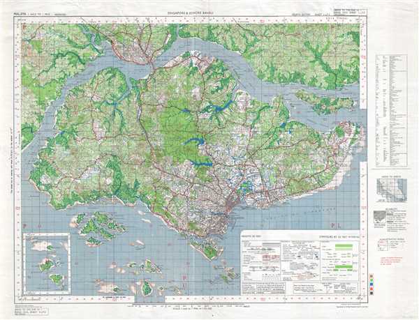
Singapore and Johore Bahru. HIND 1035, SHEET 3L/12 4th Edition.
sold
- Digital Map Information
- Suitable for large format printing
- File Size: 22.24 MB
- File Type: ZIP / TIFF
- ICC color profile embedded
- Delivered instantly via download link
This is a 1945 British Army map of Singapore and Johore Bahru, Malaysia. The map depicts the region from the Lee Wah Blank Estate to Changi Airfield on Singapore and from an airfield north of Johore Bahru to Selat Sudong. Highly detailed, ... (more details)
A scarce and highly detailed map of the vicinity of Kuala Lumpur.
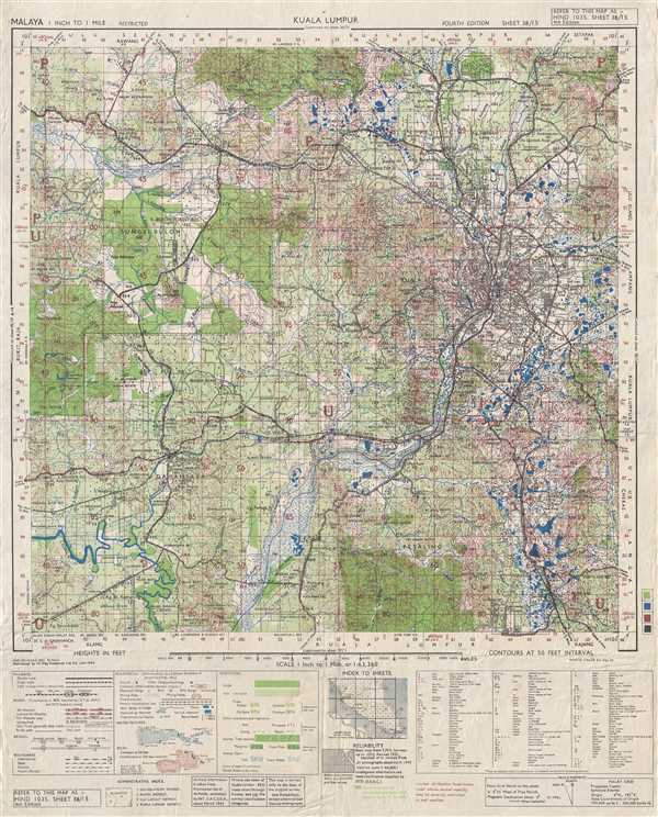
Kuala Lumpur. HIND 1035, Sheet 3B/15 4th Edition.
sold
- Digital Map Information
- Suitable for large format printing
- File Size: 12.94 MB
- File Type: ZIP / TIFF
- ICC color profile embedded
- Delivered instantly via download link
This is a 1945 British Army map of the city of Kuala Lumpur and its environs. The map depicts the region from west of Batu Tiga to Batu Ampat and from the Batu Caves to Serdang. Kuala Lumpur is situated along the map's right side, with ... (more details)
A double-view that create a connection between the Jerusalem of the 1570s and Biblical Jerusalem.
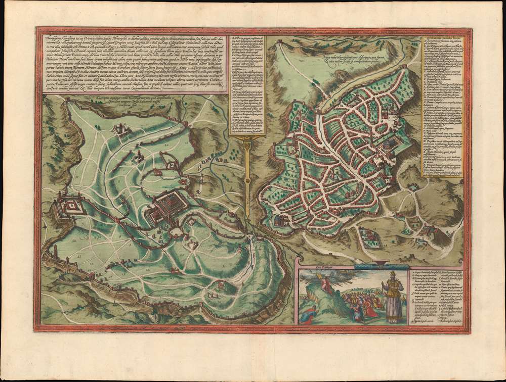
Hierosolyma, Clarrisima Totius Orientis Civitas ludaee Metropolis…
sold
- Digital Map Information
- Suitable for large format printing
- DPI: 600
- File Size: 26.03 MB
- File Type: ZIP / TIFF
- ICC color profile embedded
- Delivered instantly via download link
This is a 1572 Georg Braun and Frans Hogenberg double-view of Jerusalem depicts Biblical Jerusalem and the modern city during the 16th century. Biblical Jerusalem appears on the left 'in its full splendor'. In the lower left, the ... (more details)
Exceedingly scarce first edition of Johnson's southwest map.
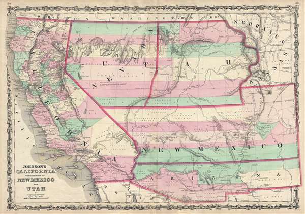
Johnson's California Territories of New Mexico and Utah.
sold
- Digital Map Information
- Suitable for large format printing
- File Size: 12.37 MB
- File Type: ZIP / TIFF
- ICC color profile embedded
- Delivered instantly via download link
The scarcest and most historically significant of Alvin Jewett Johnson’s southwest map series. This is the 1860 first edition of A. J. Johnson and Ross C. Browning’s map of California, Utah, Nevada, New Mexico, and Arizona. The map covers from the 42nd parallel south to the Mexico border and from the Pacific to modern day Colorado. Although later editions of Johnson's Family Atlas are common, the 1860 edition, which was Johnson’s first, had the smallest print run of the entire series and is for all intent and purposes, unobtainable. (more details)
Nebraska Territory in its fullest expression.
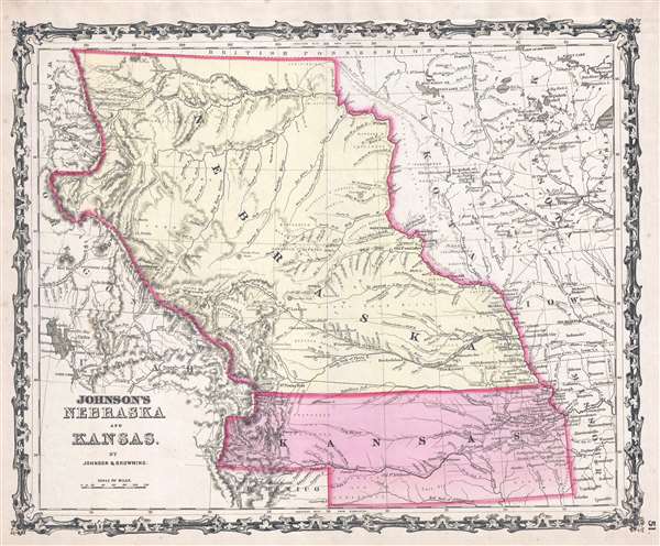
Johnson's Nebraska and Kansas.
sold
- Digital Map Information
- Suitable for large format printing
- File Size: 6.28 MB
- File Type: ZIP / TIFF
- ICC color profile embedded
- Delivered instantly via download link
A beautiful 1860 first edition example of Johnson's map of Nebraska and Kansas. This is one of the rarest and most desirable of all Johnson atlas maps. Like most of Johnson's state maps, this map was derived from the work of J. H. Colton, who derived his atlas maps from an earlier wall map of North America produced by Colton and D. Griffing Johnson. The map details the regions between the Great Salt Lake and Iowa and between the Canadian Border and New Mexico, covering territorial Kansas and Nebraska as well as parts of adjacent Minnesota, Iowa, Missouri and Utah. (more details)
Illustrates both Cape May and Cape Henlopen.
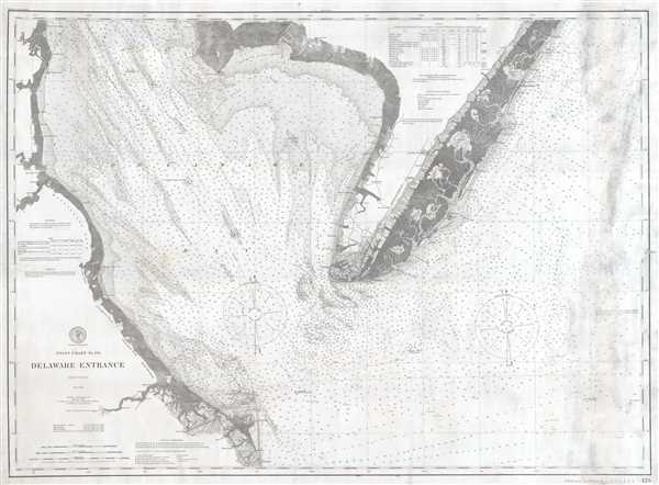
Delaware Entrance.
sold
- Digital Map Information
- Suitable for large format printing
- File Size: 23.39 MB
- File Type: ZIP / TIFF
- ICC color profile embedded
- Delivered instantly via download link
This is a 1902 United States Coast and Geodetic Survey nautical chart or maritime map of the entrance to Delaware Bay. The Map depicts the region from Delaware to the Atlantic Ocean and from Little Bombay Hook, Delaware, and ... (more details)
Important Signed and dedicated example of Curtis' rare map of New Orleans!
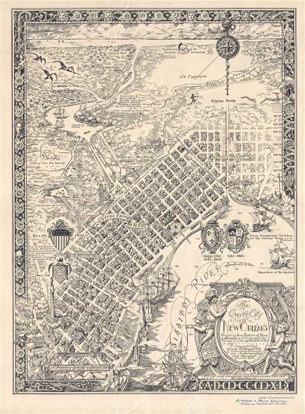
The Creole City of New Orleans. Founded by Jean Baptiste Le Moyne de Bienville in 1718, Surveyed and Planned by Sieur Le Blond de la Tour in 1720. A Composite View showing the Original City and surrounding Municipalities to which are added some Monuments of a later Date.
sold
- Digital Map Information
- Suitable for large format printing
- File Size: 17.86 MB
- File Type: ZIP / TIFF
- ICC color profile embedded
- Delivered instantly via download link
This is a SIGNED 1930 Nathaniel Cortlandt Curtis pictorial map of New Orleans, Louisiana. The map depicts the Old City of New Orleans along the Mississippi River from St. Paul's Church through the Faubroug Sainte Marie to ... (more details)