
Israel - Palestine - Holy Land (sold)
Most Desirable Edition of Bünting's Biblical Geography.
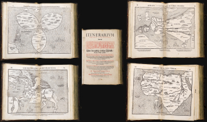
Itinerarium Sacrae Scripturae Das ist/ Ein Reisebuch, Uber die gantze heilige Schrifft in zwey Bücher getheilet. Das Erste Theil begreifft alle Reisen der lieben Patriachen/ Richter/ Könige/ Propheten ... Das Ander/ gehet auff das Newe Testament ... Zuuor gemehret mit einem büchlein DE MONETIS ET MENSVRIS... Insonderheit aber mit einer feinen nützlichen erklerung des Buchs Josua/ Durch M. Henricum Bünting/ Pfarherr der Kirchen zu Grunaw im Lande zu Brunshweig. Mit einer Vorrede des Herrn D. Martini Chemnitij.
sold
- Digital Map Information
- Suitable for large format printing
- Full resolution TIFF file
- ICC color profile embedded
- Delivered instantly via download link
This is a superb example of Heinrich Bünting's 1587 Itinerarium Sacrae Scripturae, the first complete work of biblical geography. This 1587 edition is the first to contain its full complement of figured maps of the continents. Africa, Europa Regina, and Asia-as-a-Pegasus first appear in this edition. Along with the famous cloverleaf world map, Die ganze Welt in einem Kleberblat, it is largely these figural maps for which this work is today most admired. Thus, this is the most desirable form in which this influential and long-lived book appears. (more details)
A separately-issued rarity of Biblical Cartography.
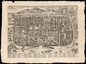
L'antichissima città di Gierusalemme come era nei tempo di N.S. Gisu Christo, con le sue dechiaratione.
sold
- Digital Map Information
- Suitable for large format printing
- Full resolution TIFF file
- ICC color profile embedded
- Delivered instantly via download link
This is a rare, separately-issued Lafreri-school broadsheet map of Jerusalem, printed c. 1595 by Matteo Florimi. It is an iteration of the influential 1584 Adrichem plan, itself an allegorical depiction of Jerusalem during Christ's lifetime, instrumental in codifying elements of Christian veneration of the Holy City, in particular the Stations of the Cross. (more details)
Strikingly engraved view of Jerusalem at the time of Solomon's Temple.
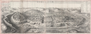
Ierusalem. Hierusalem Veteris Imago Vera.
sold
- Digital Map Information
- Suitable for large format printing
- DPI: 600
- File Size: 124.93 MB
- File Type: ZIP / TIFF
- ICC color profile embedded
- Delivered instantly via download link
A spectacularly engraved large-scale 1660 Wenceslaus Hollar bird's-eye of Jerusalem during the period of the Solomon's Temple. The view is based upon the 1604 writings and drawings of Juan Bautista Villalpando (Villalpandus; 1552 - 1608), a Spanish Jesuit of Sephardic ancestry. The work, although mostly imaginary, proved highly influential. (more details)
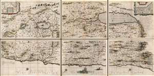
Arguably, the finest 17th century large-scale map of the Holy Land.
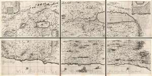
[Situs Terrae Promissionis.]
sold
- Digital Map Information
- Suitable for large format printing
- Full resolution TIFF file
- ICC color profile embedded
- Delivered instantly via download link
An extraordinary and rare map, this is the 1662 Johannes Jansson and Georgius Hornius six sheet map of the Holy Land. Divided into six panels and oriented to the east, this map covers Israel or the Holy Land from the southern tip of the Dead Sea and Edom to the Golan Heights and modern-day Lebanon. This map is an expansion and enlargement of a smaller plan of the same general area issued by Christian van Adrichem around 1590. Jansson expanded and embellished Adrichem's map in order to illustrate the text composed by Georgius Hornius (George Horn) for volume six of his Novus Atlas, Accuratissimia Orbis Antiqui Delineatio. Consequently some refer to this map, which is as a whole untitled, as the 'Hornius Map.' As a whole this map is embellished with countless vignettes and other images drawn from Biblical tradition. The smoking ruins of Sodom and Gomorra appear in the Dead Sea, Jonas is drawn being devoured by the whale, Jesus is shown being tempted by Satan (for the third time) atop a mountain, etc. Each of the tribes of Israel are named and associated with their lands. Mountains and forests and shown in profile. (more details)
Extremely rare and dramatic bird's eye view of Jerusalem with an abundance of scriptural references.
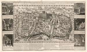
A correct Plan of the City of Jerusalem, with the genealogy of Our Blessed Lord and Saviour Jesus Christ.
sold
- Digital Map Information
- Suitable for large format printing
- DPI: 600
- File Size: 73.65 MB
- File Type: ZIP / TIFF
- ICC color profile embedded
- Delivered instantly via download link
This is a rare 1795 separate-issue pictorial view of Jerusalem, by London copperplate printer John Haines. Haines' maps, all large-scale wall maps intended for education and moral edification, were separately published in small numbers and very few survive. (more details)
Arguably, the finest 17th century large-scale map of the Holy Land.
[Situs Terrae Promissionis.]
sold
- Digital Map Information
- Suitable for large format printing
- Full resolution TIFF file
- ICC color profile embedded
- Delivered instantly via download link
An extraordinary and rare map, this is the 1662 Johannes Jansson and Georgius Hornius six sheet map of the Holy Land in a beautifully colored example. Divided into six panels and oriented to the east, this map covers Israel or the Holy Land from the southern tip of the Dead Sea and Edom to the Golan Heights and modern-day Lebanon. (more details)
'Next Year, In Jerusalem!'
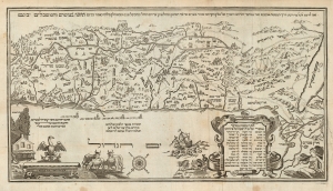
Seder Haggadah Shel Pasah.
sold
- Digital Map Information
- Suitable for large format printing
- DPI: 600
- File Size: 30.74 MB
- File Type: ZIP / TIFF
- ICC color profile embedded
- Delivered instantly via download link
This is Abraham bar Yaaqov's 1695 map of the Holy Land - the first acquirable such map in Hebrew. It stands distinct from most other Holy Land maps produced in the 17th century, not only in its Hebrew text, but also the map's iconography which adheres to themes from the Torah, applying specifically to the Passover story. It was printed to accompany the famous Amsterdam Haggadah, the most lavishly illustrated printed Haggadah to date. Both thematically and aesthetically, it would set the standard for printed Haggadot to follow. (more details)
The Hornius Map, possibly the finest obtainable map of the Holy Land issued in the 17th century.
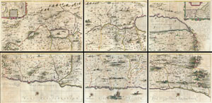
[Situs Terrae Promissionis.]
sold
- Digital Map Information
- Suitable for large format printing
- DPI: 300
- File Size: 94.93 MB
- File Type: ZIP / TIFF
- ICC color profile embedded
- Delivered instantly via download link
An extraordinarily rare map, this is the 1662 Johannes Jansson and Georgius Hornius six part map of the Holy Land. Divided into six panels and oriented to the east, this map covers Israel or the Holy Land from the southern tip of the Dead Sea and Edom to the Golan ... (more details)
Strange Arabic- Boston imprint from first wave of Islamic immigration to the United States.
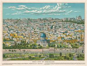
Bird's Eye View of Holy Jerusalem. / Vue Générale de la Villie de Jerusalem. / القدس الشف
sold
- Digital Map Information
- Suitable for large format printing
- File Size: 59.52 MB
- File Type: ZIP / TIFF
- ICC color profile embedded
- Delivered instantly via download link
The only known example of a magnificent and previously unknown c. 1896 Boston-Arab chromolithograph view of Jerusalem by the Palestinian / Syrian immigrant Aece Hage. This view is a veritable masterpiece of chromolithography, employing at least six separate plates, a feat even more remarkable when compounded with the knowledge that this view was produced in a flophouse under extenuating circumstances and on a low budget. The unusual view looks on Jerusalem from the Mount of Olives, east of the Old City, and centers on the Temple Mount and the Dome of the Rock (Qubbat al-Sakhrah), with other holy sites of multiple religions appearing behind it. In the foreground the Eastern Wall of Jerusalem, the walled off Golden Gate, the open Lion's Gate, and the 1400-year-old Bab-ur-Rahmah Cemetery are illustrated. The predominate colors, blue and green, are significant in Islamic tradition, representing protection, hope, and life. The view, although stylized, is mostly accurate, suggesting that Hage (or the artist) had been to or lived in Jerusalem and drew the image from life.
The view is titled in light brown lettering to either side of the view, and in the bottom right just below the view. Title text appears in English (left), French (right) and Arabic (bottom right). Text below the map identifies 15 locations, which correspond to numerical assignments appearing on the map. The cartographer identifies Christian, Muslim, and Jewish religious sites, without apparent preference. (more details)
The view is titled in light brown lettering to either side of the view, and in the bottom right just below the view. Title text appears in English (left), French (right) and Arabic (bottom right). Text below the map identifies 15 locations, which correspond to numerical assignments appearing on the map. The cartographer identifies Christian, Muslim, and Jewish religious sites, without apparent preference. (more details)
Beautifully Executed Manuscript Atlas.
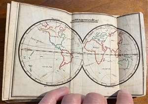
This is a beautifully-executed late 18th manuscript pocket atlas of the world. It is a student work - similar to later, 19th century 'schoolgirl' or 'schoolboy' maps - but has been produced with an unusual level of uniformity and care, and it has been attractively bound. The maps, all done in the same hand, are painstakingly drawn and lettered, and have been carefully and attractively illuminated in original hand color. While we generally associate this form with 19th century British and American students, this example is the work of a late 18th or early 19th century French student - or possibly more than one, as some place name notations appear in a different hand, and possibly at a later date than either of the source maps. (more details)
Last Days of Mandatory Palestine.
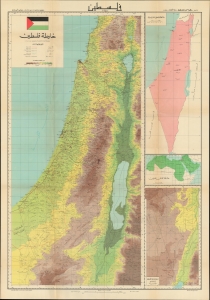
A large wall map of Palestine as it appeared in 1948, in the waning days of the British Mandate, produced by the Palestine Liberation Organization Research Center c. 1966. The map's compilation was overseen by Said Kamel Sabbagh, an accomplished Palestinian-Lebanese geographer, and thus represents the PLO's approved reference map for the Mandatory period. It represents the opening phase of the Nakba or 'Catastrophe.' (more details)
Last Days of Mandatory Palestine.
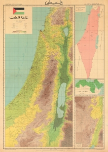
A large wall map of Palestine as it appeared in 1948, in the waning days of the British Mandate, produced by the Palestine Liberation Organization Research Center c. 1966. The map's compilation was overseen by Said Kamel Sabbagh, an accomplished Palestinian-Lebanese geographer, and it became the PLO's approved reference map for the Mandatory period. (more details)
The Holy City for the Armchair Pilgrim.
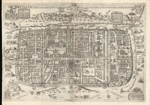
Ierusalem, et suburbia eius, sicut tempore Christi floruit ... descripta per Christianum Adrichom Delphum.
sold
- Digital Map Information
- Suitable for large format printing
- DPI: 600
- File Size: 108.93 MB
- File Type: ZIP / TIFF
- ICC color profile embedded
- Delivered instantly via download link
This is an elegant example of Christian van Adrichem's influential 1584 plan of the Biblical Jerusalem. It was included in his 1584 Theatrum Terrae Sanctae, a Biblical atlas intended to provide visual structure to Catholic catechism - not only to inform the religious scholar, but to provide the basis for a sort of 'virtual pilgrimage' to the holy sites of Jerusalem when actual travel there was, for most, utterly impossible. (more details)
Stunning view of the Holy Land!
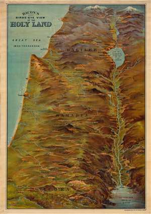
Bacon's Bird's-Eye View of the Holy Land.
sold
- Digital Map Information
- Suitable for large format printing
- File Size: 62.24 MB
- File Type: ZIP / TIFF
- ICC color profile embedded
- Delivered instantly via download link
A striking c. 1890 chromolithograph view of the Holy Land / Israel / Palestine by G. W. Bacon. Coverage extends from Mt. Lebanon and Mt. Hermon to the Dead Sea, Bethlehem, and Gath - thus covering the northern half of modern-day Israel and southern Lebanon. The Jordan River valley is particularly striking, with bold exaggerated depictions of both the Sea of Galilee and the northern part of the Dead Sea. Jerusalem is prominent at bottom center. (more details)
Documenting the Nakba.
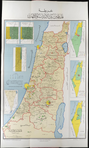
خريطة فلسطين بين الانتداب والنهاب / [Map of Palestine Between the Mandate and the Plunder.] / فلسطين العربية قبل النكبة / [Arab Palestine Before the Nakba.]
sold
This is a rare 1964 Egyptian-issued Arabic-language map of Palestine and Israel illustrating the Nakba, the Palestinian term meaning 'Catastrophe'. The map illustrates the demographic transition from a primarily Arabic population in 1920 to a mainly Jewish population by 1964, with an emphasis on the dramatic changes brought on by the 1948 Arab-Israeli War. The content further undercuts the ongoing tensions that, in 1967, would erupt in the Six-Day War. (more details)
Documenting the Nakba.
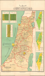
خريطة فلسطين بين الانتداب والنهاب / [Map of Palestine Between the Mandate and the Plunder.] / فلسطين العربية قبل النكبة / [Arab Palestine Before the Nakba.]
sold
This is a rare 1964 Egyptian-issued Arabic-language map of Palestine and Israel illustrating the Nakba, the Palestinian term meaning 'Catastrophe'. The map illustrates the demographic transition from a primarily Arabic population in 1920 to a mainly Jewish population by 1964, with an emphasis on the dramatic changes brought on by the 1948 Arab-Israeli War. The content further undercuts the ongoing tensions that, in 1967, would erupt in the Six-Day War. (more details)
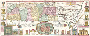
Chorographia Terrae Sanctae in Angustiorem Formam Redacta, et ex Variis Auctoribus a Multis Erroribus Expurgata
sold
- Digital Map Information
- Suitable for large format printing
- DPI: 300
- File Size: 12.36 MB
- File Type: ZIP / TIFF
- ICC color profile embedded
- Delivered instantly via download link
This is an extraordinary c. 1632 map of the Holy Land by the Jesuit monk Jacobus Tirinus. Oriented to the east, map depicts from Syria and Tyre southward as far as the Sinai, Egypt and Thebes. Ours survey of the map begins at the southern most point, in Egypt, ... (more details)
Exceptional Freemason iconography.
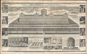
A Beautiful and Accurate Elevation of the Temple of Solomon.
sold
- Digital Map Information
- Suitable for large format printing
- File Size: 81.4 MB
- File Type: ZIP / TIFF
- ICC color profile embedded
- Delivered instantly via download link
This is a c. 1868 John Sherer masonic instructional wall map incorporating an impressive view of the model of the Temple of Solomon as commissioned in 1863 by Hamberger chancellor Gerhard Schott. (more details)
A Modern Pilgrim's Views of the Holy Land.
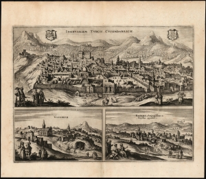
Iherusalem Turcis Cusembareich. / Nazareth. / Ramma Antiquitissimum in Palestina oppidum.
sold
- Digital Map Information
- Suitable for large format printing
- Full resolution TIFF file
- ICC color profile embedded
- Delivered instantly via download link
This rare 1657 engraving compiles Jan Jansson's views of Jerusalem, Nazareth, and Ramallah - which, as the title suggests, is 'the oldest town in Palestine'. (more details)
Philanthropy in the Face of Atrocity.
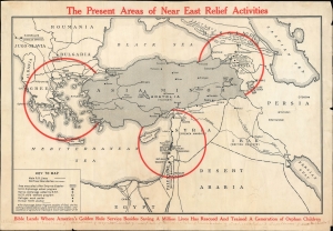
The Present Areas of Near East Relief Activities.
sold
- Digital Map Information
- Suitable for large format printing
- File Size: 25.46 MB
- File Type: ZIP / TIFF
- ICC color profile embedded
- Delivered instantly via download link
A scarce c. 1922 map of the Near East, produced by Near East Relief, an organization tasked with assisting refugees, particularly Armenians and Greeks, fleeing from Turkey. It was produced in the wake of one of the worst atrocities, the Burning of Smyrna, which destroyed the Greek and Armenian quarters. The efforts of the New East Relief saved over a million lives and are considered of the most successful humanitarian efforts of the 20th century. (more details)
The Fifth Aliyah.
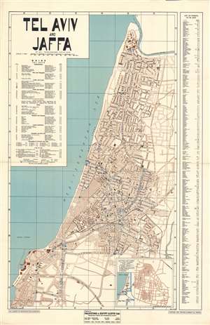
Tel Aviv and Jaffa.
sold
- Digital Map Information
- Suitable for large format printing
- File Size: 63.27 MB
- File Type: ZIP / TIFF
- ICC color profile embedded
- Delivered instantly via download link
This is an impressive large-scale 1936 map of Tel Aviv and Jaffa, Israel, by Zvi H. Friedlander, issued during the Fifth Aliyah (1929 - 1939). The map reflects Tel Aviv at the height of its Pre-War growth, when thousands of Jews, fleeing ever increasing antisemitism in Europe, made a new home in British Palestine. It also reflects the height of Bauhaus construction in Tel Aviv. (more details)
The first scientific map of Jerusalem made during the Oriental Incident of 1840.
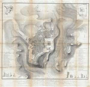
Plan of the town and environs of Jerusalem: Copied by Permission of Field Marshal the Marquis of Anglesey, K.G. G.C.H. Master General of the Ordnance, from the original drawing of the survey made in the month of March 1841.
sold
- Digital Map Information
- Suitable for large format printing
- DPI: 300
- File Size: 31.59 MB
- File Type: ZIP / TIFF
- ICC color profile embedded
- Delivered instantly via download link
This seminal 1849 map, printed on linen, is the first scientific survey of Jerusalem. Based upon survey work completed by John Frederick Anthony Symonds and Edward Aldrich, the map is centered on the walled city of Jerusalem, which is covered in considerable detail. It extends beyond the wall, illustrating topography, as far east at the Mount of Olives, west to Birket Mamillah, north as far as Kubur el Muluk (Tomb of the Kings), and south to the 'Hill of Evil Council.' Streets, roads, and important buildings are illustrated with scientific precision. The map offers several insets detailing important archeological sites, such as the El-Kalah, or the Tower of David, and the Temple Mount. At the base of the map there are cross-sections of the Old City's walls at various points. (more details)
Scholarship, Zionism, and Arab nationalism.
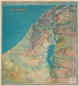
Palestine In Third Dimension.
sold
- Digital Map Information
- Suitable for large format printing
- File Size: 298.95 MB
- File Type: ZIP / TIFF
- ICC color profile embedded
- Delivered instantly via download link
This is a 1942 G. Frederick Owen bird's-eye view map of British Mandatory Palestine. It was published six years before the creation of modern Israel during a period of academic renaissance in 'Holy Land Studies' and a Zionist resurgence. (more details)
Palestine on the Precipice.
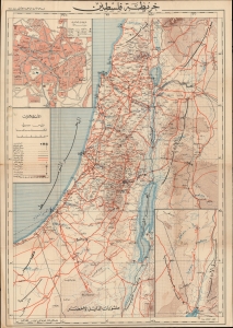
خريطة فلسطين / [Map of Palestine].
sold
- Digital Map Information
- Suitable for large format printing
- File Size: 652.68 MB
- File Type: ZIP / TIFF
- ICC color profile embedded
- Delivered instantly via download link
An unrecorded Arabic-language folding map of Palestine, published in 1948 by the Catholic Press in Beirut. It reflects the situation at the end of the Mandatory period and the start of the most intense phase of Arab-Israeli conflict. (more details)
Stunning view of the Holy Land!
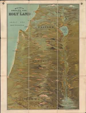
Bacon's Bird's-Eye View of the Holy Land.
sold
- Digital Map Information
- Suitable for large format printing
- File Size: 49.65 MB
- File Type: ZIP / TIFF
- ICC color profile embedded
- Delivered instantly via download link
A striking c. 1890 chromolithograph view of the Holy Land / Israel / Palestine by G. W. Bacon. Coverage extends from Mt. Lebanon and Mt. Hermon to the Dead Sea, Bethlehem, and Gath - thus covering the northern half of modern-day Israel and southern Lebanon. The Jordan River valley is particularly striking, with bold exaggerated depictions of both the Sea of Galilee and the northern part of the Dead Sea. Jerusalem is prominent at bottom center. (more details)
Master-pan of Haifa during its peak of prosperity.
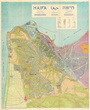
Haifa./ הָ יפֵ ח / حيفا
sold
- Digital Map Information
- Suitable for large format printing
- File Size: 85.14 MB
- File Type: ZIP / TIFF
- ICC color profile embedded
- Delivered instantly via download link
This is an enormous rare 1937 map of Haifa, Israel (then British Mandate Palestine) at a time when it was an oasis of peace and cultural plurality in an otherwhile war-torn and chaotic region. It is the masterplan of that underpinned the city's growth at the height of this Interwar expansion. (more details)
Magnificent decorative map of the Holy Land showing the Exodus.
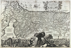
Perigrinatie ofte Veertich-Iarige Reyse der Kinderen Israels
sold
- Digital Map Information
- Suitable for large format printing
- DPI: 300
- File Size: 10.9 MB
- File Type: ZIP / TIFF
- ICC color profile embedded
- Delivered instantly via download link
An absolutely stunning 1702 map of the Holy Land, Israel, or Palestine by N. Visscher and D. Stoopendaal. This map, from Keur's important Dutch Bible of 1702, is oriented to west and covers from the Nile Delta, Cairo and Memphis, Egypt, across the Red Sea and ... (more details)
Social Realism and Zionism.
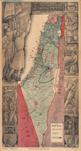
Second Year of the State of Israel. / שנת שתיים למדינת ישראל
sold
- Digital Map Information
- Suitable for large format printing
- File Size: 29.11 MB
- File Type: ZIP / TIFF
- ICC color profile embedded
- Delivered instantly via download link
A rare and striking 1950 Joseph Szapiro (Shapiro) Zionist map of Israel in Hebrew, with striking Social Realist imagery, celebrating the second anniversary of Israel's 1948 founding. The map depicts the region from the Mediterranean Sea to Jordan (Transjordan) and Syria and from Lebanon to Egypt and the Gulf of Eilat (Gulf of Aqaba). Highly detailed, cities, towns, and villages are labeled throughout, with Jerusalem and Tel Aviv given prominence. (more details)
Social Realism and Zionism.
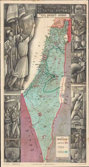
Second Year of the State of Israel. / שנת שתיים למדינת ישראל
sold
- Digital Map Information
- Suitable for large format printing
- File Size: 54.84 MB
- File Type: ZIP / TIFF
- ICC color profile embedded
- Delivered instantly via download link
A rare and striking 1950 Joseph Szapiro (Shapiro) Zionist map of Israel in Hebrew, with striking Social Realist imagery, celebrating the second anniversary of Israel's 1948 founding. The map depicts the region from the Mediterranean Sea to Jordan (Transjordan) and Syria and from Lebanon to Egypt and the Gulf of Eilat (Gulf of Aqaba). Highly detailed, cities, towns, and villages are labeled throughout, with Jerusalem and Tel Aviv given prominence. (more details)
Stunning map of Israel just after it was created with striking artwork combining Social Realism and Zionism.
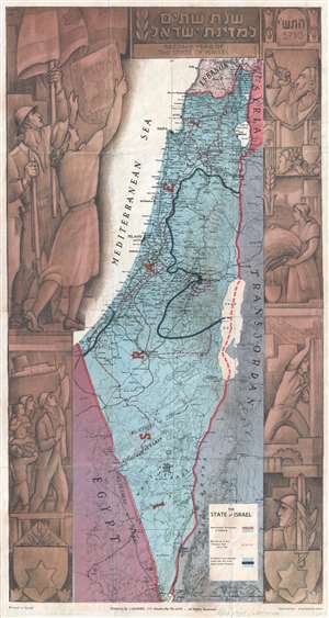
Second Year of the State of Israel. / שנת שתיים למדינת ישראל
sold
- Digital Map Information
- Suitable for large format printing
- File Size: 9.69 MB
- File Type: ZIP / TIFF
- ICC color profile embedded
- Delivered instantly via download link
A rare and stunning 1949 Joseph Szapiro (Schapiro) Zionist map of Israel, with striking Social Realist imagery, celebrating the second year after its founding in 1947.The map depicts the region from the Mediterranean Sea to Jordan (Transjordan) and Syria and from Lebanon to Egypt and the Gulf of Eilat (Gulf of Aqaba). Highly detailed, cities, towns, and villages are labeled throughout, with Jerusalem and Tel Aviv given prominence. (more details)
Scarce imaginative 1650 plan of Jerusalem.
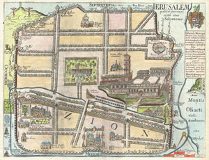
IERUSALEM qualis (ut plurimum) extitit ætate Solomonis
sold
- Digital Map Information
- Suitable for large format printing
- DPI: 300
- File Size: 7.23 MB
- File Type: ZIP / TIFF
- ICC color profile embedded
- Delivered instantly via download link
An extremely rare and altogether fascinating 1650 map of Jerusalem by Thomas Fuller. Depicts the old walled city of Jerusalem during the reign of the Biblical King Solomon, ca. 961-922 BC. On the whole this is a highly imaginative map of the city and likely ... (more details)
Social Realism and Zionism.
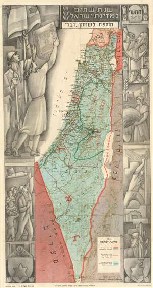
Second Year of the State of Israel. / שנת שתיים למדינת ישראל
sold
- Digital Map Information
- Suitable for large format printing
- File Size: 25.76 MB
- File Type: ZIP / TIFF
- ICC color profile embedded
- Delivered instantly via download link
A rare and striking 1949 Joseph Szapiro (Schapiro) Zionist map of Israel, with striking Social Realist imagery, celebrating the second anniversary of Israel's 1947 founding. The map depicts the region from the Mediterranean Sea to Jordan (Transjordan) and Syria and from Lebanon to Egypt and the Gulf of Eilat (Gulf of Aqaba). Highly detailed, cities, towns, and villages are labeled throughout, with Jerusalem and Tel Aviv given prominence. (more details)