
Israel - Palestine - Holy Land
Finest 17th century large-scale map of the Holy Land.
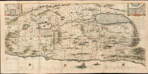
[Situs Terrae Promissionis.]
$6,500.00
Acquire
- Digital Map Information
- Suitable for large format printing
- File Size: 118.78 MB
- File Type: ZIP / TIFF
- ICC color profile embedded
- Delivered instantly via download link
Commonly known as the 'Hornius Map', this is the 1662 Johannes Jansson and Georgius Hornius 6-sheet map of the Holy Land in a beautifully colored, joined example. This map is an expansion on the allegorical Holy Land cartography pioneered by Christian van Adrichem around 1590. Jansson expanded and embellished Adrichem's map to illustrate the text composed by Georgius Hornius (George Horn) for volume six of his Novus Atlas, Accuratissimia Orbis Antiqui Delineatio. (more details)
Rare, separately-issued Biblical Jerusalem.
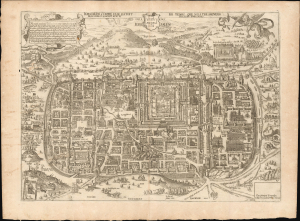
Jerusalem comme elle estoit du temps que Nostre Sauveur Jesus Christ souffrit mort et passion pour nous.
$4,500.00
Acquire
- Digital Map Information
- Suitable for large format printing
- File Size: 26.38 MB
- File Type: ZIP / TIFF
- ICC color profile embedded
- Delivered instantly via download link
This is a rare, separately-issued c. 1670 Gerard Jollain the Elder broadsheet map of Biblical Jerusalem, after Christian van Adrichem: an allegorical depiction of Jerusalem during Christ's lifetime. This work was instrumental in codifying elements of Christian veneration of the Holy City, in particular the Stations of the Cross. (more details)
Scientific and Biblical Geography Meet.
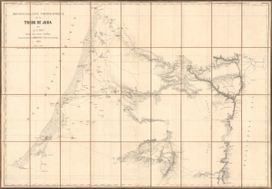
Reconaissance topographique de la Tribu de Juda.
$4,000.00
Acquire
- Digital Map Information
- Suitable for large format printing
- File Size: 76.98 MB
- File Type: ZIP / TIFF
- ICC color profile embedded
- Delivered instantly via download link
This is Alban-Emmanuel Guillaume Rey's c. 1859 large-format folding map of the Holy Land, and more specifically, the lands of the Tribe of Judah, one of the ancient Twelve Tribes of Israel. Rey's expedition to Palestine, which resulted in this map, was an early example of Biblical geography, combining modern surveying techniques with the scholarly study of religion, archaeology, linguistics, and other emerging disciplines. (more details)
Second Map Printed in Palestine by a Palestinian Mapmaker.
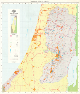
المستعمرات الإسرائيلية في المناطق المحتلة ١٩٦٧ – ١٩٩٣ / [Israeli Settlements in the Occupied Territories 1967-1993].
$3,900.00
Acquire
This is a scarce Arabic-language wall map of Israel-Palestine published in 1994 by Dr. Khalil Toufakji of the Arab Studies Society in Jerusalem. A map of great importance, focusing on Israeli Settlements in the Occupied Palestinian Territory, this is the second map ever printed in post-1948 Palestine and made by a Palestinian map maker. (more details)
Influential, orderly view of Biblical Jerusalem.
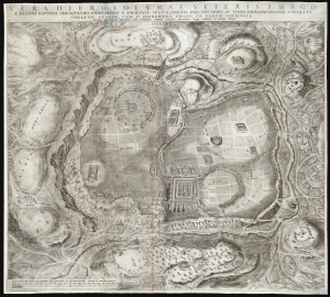
Vera Hierosolymae veteris imago.
$3,000.00
Acquire
- Digital Map Information
- Suitable for large format printing
- DPI: 600
- File Size: 154.73 MB
- File Type: ZIP / TIFF
- ICC color profile embedded
- Delivered instantly via download link
This is Juan Batista Villalpando's large 1604 map of Jerusalem. This attractive and influential plan of the Holy City appeared in his commentary on Ezekiel, published to complete the work of Hieronymus Prado. Villalpando's architectural interpretation of scripture influenced the design of monasteries, churches, and synagogues well into the 17th century. (more details)
Last Days of Mandatory Palestine.
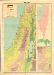
A large wall map of Palestine as it appeared in 1948, in the waning days of the British Mandate, produced by the Palestine Liberation Organization Research Center c. 1966. The map's compilation was overseen by Said Kamel Sabbagh, an accomplished Palestinian-Lebanese geographer, and thus represents the PLO's approved reference map for the Mandatory period. It represents the opening phase of the Nakba or 'Catastrophe.' (more details)
German edition of one of the most important 19th century maps of the Holy Land.
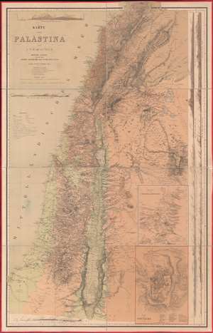
Karte von Palästina.
$2,500.00
Acquire
- Digital Map Information
- Suitable for large format printing
- File Size: 100.2 MB
- File Type: ZIP / TIFF
- ICC color profile embedded
- Delivered instantly via download link
One of the most important 19th-century maps of the region, this is the 1866 German edition of the Charles William Meredith van de Velde map of the Holy Land. Created from Van de Velde's surveys, the map depicts from Syria to the Dead Sea and from the Mediterranean Sea to Mount Zalmon (Alsadamus Mons). Per Mapping the Holy Land: The Foundation of a Scientific Cartography of Palestine, Van de Velde's map of Palestine
represented the complete body of Western geographical knowledge on Palestine, critically compiled, verified on-site and completed by his own measurements and his own (physical) experience, including the hardships needed to make a scientific map.Van de Velde effortlessly blends the modern and the ancient. Myriad cities and towns are labeled throughout, including Jerusalem, Hebron, Tyre, Sidon, and Damascus, and inset maps focus on Jerusalem itself and Jerusalem and its environs. Several terrain profiles appear around the sheet as well. One, in the upper left corner above the title, depicts the road from Beirut to Damascus. Another, below the title, illustrates the region from Cap Carmel to the Lake of Tiberias. Several profiles appear along the right border and run one into another, making it difficult to discern exactly where one stops and the next begins at a glance. (more details)
A Medieval Holy Land.
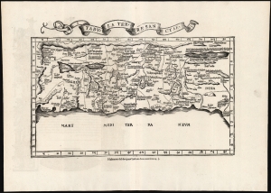
Tabula Terre Sanctae.
$2,250.00
Acquire
- Digital Map Information
- Suitable for large format printing
- Full resolution TIFF file
- ICC color profile embedded
- Delivered instantly via download link
This is the Lorenz Fries 1535 edition of Pietro Vesconte's 14th-century manuscript map of Palestine. It is one of the earliest obtainable iterations of a c. 1320 manuscript map compiled to accompany Marino Sanudo's letters promoting a new crusade. Thus, it is one of the earliest surviving maps to support a specific military effort. Relating to this, Vesconte's map was the earliest surviving map to present the region in a Biblical context, naming the areas occupied by the Tribes of Israel, thus opening a long history of presenting the Levant in a religio-historical context. (more details)
Earliest acquirable medieval plan of Jerusalem.
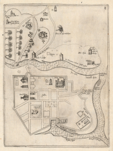
[Jerusalem.]
$2,000.00
Acquire
- Digital Map Information
- Suitable for large format printing
- Full resolution TIFF file
- ICC color profile embedded
- Delivered instantly via download link
This rare plan of Jerusalem is the earliest printed iteration of Pietro Vesconte's manuscript plan of the city. While not committed to print until this 1611 edition by Jacques Bongars, the map is the work of the 14th-century Venetian cartographer Vesconte, who produced it c. 1320 to promote Marino Sanudo's proposed crusade to recapture the city. As such, it is one of the earliest surviving plans to support a specific military effort. (more details)
Masterpiece of chromolithography.
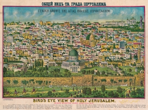
Bird's Eye View of Holy Jerusalem. Jesus Weeping Over Jerusalem. / Γενικη Αηοψις Της Αγιας Ηολεως Ιερουσαλημ. / القدس الشف
$2,000.00
Acquire
- Digital Map Information
- Suitable for large format printing
- File Size: 65.83 MB
- File Type: ZIP / TIFF
- ICC color profile embedded
- Delivered instantly via download link
A rare example of Rand McNally's 1900 chromolithograph view of Jerusalem. Although here unattributed, this view is a revised version of an earlier view issued in 1896 by the Palestinian / Syrian immigrant Aece Hage. Sometime after Hage's original printing, the view was acquired and revised by the Rand McNally Company, who updated and 'Christianized' it, adding a figure of Jesus in the upper right. They published from about 1900 both on their own account and to order - in this case, for the Chapel of Our Lady of the Cedars of Mt. Lebanon in West Roxbury, Massachusetts. The map is titled in Greek and English. Aece Hage's own title, in Arabic, also appears at the bottom right. Text below the view identifies 17 locations, which correspond to numerical assignments. The cartographer identifies Christian, Muslim, and Jewish religious sites. (more details)
The Holy City for the Armchair Pilgrim.
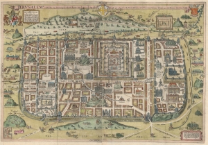
Ierusalem, et suburbia eius, sicut tempore Christi floruit ... descripta per Christianum Adrichom Delphum.
$2,000.00
Acquire
- Digital Map Information
- Suitable for large format printing
- File Size: 43.73 MB
- File Type: ZIP / TIFF
- ICC color profile embedded
- Delivered instantly via download link
This is an elegant example of Christian van Adrichem's influential 1584 plan of the Biblical Jerusalem. It was included in his 1584 Theatrum Terrae Sanctae, a Biblical atlas intended to provide visual structure to Catholic catechism - not only to inform the religious scholar, but to provide the basis for a sort of 'virtual pilgrimage' to the holy sites of Jerusalem when actual travel there was, for most, utterly impossible. (more details)
Earliest printing of a Military Portolan of the Eastern Mediterranean.
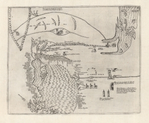
[Holy Land, Eastern Mediterranean, Egypt, Arabia and Mesopotamia.]
$1,800.00
Acquire
- Digital Map Information
- Suitable for large format printing
- Full resolution TIFF file
- ICC color profile embedded
- Delivered instantly via download link
This is the earliest printed iteration of Pietro Vesconte's 1611 portolan map of the Eastern Mediterranean, the Lower Nile, the Arabian Peninsula, and Mesopotamia. While not committed to print until this 1611 edition by Jacques Bongars, the map is the work of the 14th-century Venetian cartographer Vesconte, who produced it c. 1320 to promote Marino Sanudo's proposed crusade. As such, it is one of the earliest surviving maps to support a specific military effort. (more details)
The Nakba. A rare cartographic look at the Palestinian perspective of the Arab-Israeli Conflict.
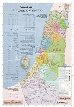
This is a 1998 Salman Abu Sitta map of Palestine and the Nakba in 1948 - a rare cartographic look at the Palestinian side of the Arab-Israeli Conflict. The Nakba (meaning 'disaster,' 'catastrophe,' or 'cataclysm' in Arabic) refers to the dispossession of the Palestinians of their land and homes, the destruction of Palestinian society, and the permanent displacement of most of the Palestinian population in 1948. (more details)
Connecting Biblical events pictorially with modern geography.
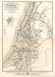
Karte von Palästina oder dem heiligen Lande.
$1,800.00
Acquire
- Digital Map Information
- Suitable for large format printing
- Full resolution TIFF file
- ICC color profile embedded
- Delivered instantly via download link
This is an 1843 Carl Beiling map of Palestine or the Holy Land. The richly illustrated and colorful map was designed as a didactic tool, connecting Biblical events pictorially with modern geography. (more details)
Revival-tent map of the Holy Land.
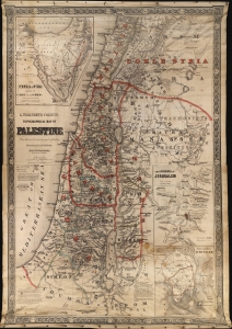
G. Woolworth Colton's Topographical Map of Palestine From the most recent surveys and exploration.
$1,800.00
Acquire
- Digital Map Information
- Suitable for large format printing
- File Size: 1094.81 MB
- File Type: ZIP / TIFF
- ICC color profile embedded
- Delivered instantly via download link
This is G. Woolworth Colton's large map of the Holy Land / Palestine / Israel, which has here been reformatted and revised for missionary field use. The map is printed on cloth and blown up to an enormous 50 x 71 inches - ideal for use in evangelical tents. The use of lithography on cloth also made the map more durable and 'packable' than its paper counterparts. (more details)
The Holy City for the Armchair Pilgrim.
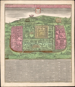
Ierusalem, cum suburbiis prout tempore Christi floruit...
$1,500.00
Acquire
- Digital Map Information
- Suitable for large format printing
- File Size: 39.56 MB
- File Type: ZIP / TIFF
- ICC color profile embedded
- Delivered instantly via download link
This is an attractive example of Matthias Seutter's c. 1745 map of Jerusalem following the influential 1584 model of Christian van Adrichem's. For centuries, Adrichem's portrayal of Jerusalem provided the basis for a sort of 'virtual pilgrimage' to the holy sites when actual travel there was, for most, impossible. Seutter's version of the plan here appears in its Lotter imprint of 1756. (more details)
Rare, Revised edition of a Foundational Map.
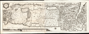
Tabula Geographica Terrae Sanctae.
$1,500.00
Acquire
- Digital Map Information
- Suitable for large format printing
- File Size: 41.75 MB
- File Type: ZIP / TIFF
- ICC color profile embedded
- Delivered instantly via download link
This is a large, rare map of the Holy Land, engraved in 1743 for inclusion in the fifth volume of Blasio Ugolino's monumental Thesaurus Antiquitatum Sacrarum, ultimately a thirty-four collection of Latin descriptions of Jewish customs, laws, institutions, and rites. (more details)
Decoding the Dead Sea.
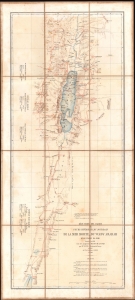
Réduction des cartes du cours inférieur du Jourdain, de la mer Morte, du wady Arabah et du wady El Jeib.
$1,200.00
Acquire
- Digital Map Information
- Suitable for large format printing
- File Size: 13.15 MB
- File Type: ZIP / TIFF
- ICC color profile embedded
- Delivered instantly via download link
A scarce 1866 separate-issue folding map of the Dead Sea and the Jordan Rift Valley by Louis Vignes. It was the product of the Duc de Luynes's 1864 expedition to the Dead Sea, noted for its scientific discoveries, as well as the early photographs of the region taken by Vignes. (more details)
Stunning view of the Holy Land!
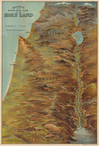
Bacon's Bird's-Eye View of the Holy Land.
$1,000.00
Acquire
- Digital Map Information
- Suitable for large format printing
- Full resolution TIFF file
- ICC color profile embedded
- Delivered instantly via download link
A scarce c. 1890 chromolithograph bird's-eye view of the Holy Land, Israel, and Palestine, published in London by G. W. Bacon. Brilliantly colored and rendered from an elevated oblique perspective, the view presents the Biblical landscape from Mount Lebanon and Mount Hermon south along the Jordan River Valley, encompassing the Sea of Galilee, Jerusalem, Bethlehem, and the Dead Sea. Bacon dramatically exaggerates key geographical features, transforming the ancient Biblical landscape into an immediately comprehensible three-dimensional panorama. (more details)
Symbolic geography - the Stations of the Cross.
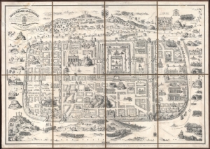
Plan de Jérusalem et de ses Faubourgs telle que cette ville célèbre existait du tems de Jésus-Christ, d'Après les Historiens sacrés et profanes...
$1,000.00
Acquire
- Digital Map Information
- Suitable for large format printing
- File Size: 87.69 MB
- File Type: ZIP / TIFF
- ICC color profile embedded
- Delivered instantly via download link
This is an 1840 Delahaye, Charpentier, and Dupuis plan of Biblical Jerusalem on the 16th-century Christian Adrichem model. Although the city, as depicted, is largely symbolic, the map highlights hundreds of sites within Biblical Jerusalem, allowing readers to follow biblical events cartographically. (more details)
Ottoman Empire's Turkish-speaking Orthodox Minority.
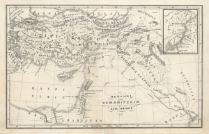
ΜΕΜΑΛΙΚΙ ΟΣΜΑΝΙΓΕΝΙΝ ΑΣΙΑ ΚΗΤΑΣΗ. / [Territories of the Ottoman Empire - Asian Possessions.]
$950.00
Acquire
- Digital Map Information
- Suitable for large format printing
- File Size: 5.46 MB
- File Type: ZIP / TIFF
- ICC color profile embedded
- Delivered instantly via download link
This is a fascinating c. 1880 map of the Asian portion of the Ottoman Empire in the Karamanli Turkish type. The map reflects the complex and contradictory trends of the late Ottoman period, in which the empire's remarkable cosmopolitanism collided with 19th-century nationalism. (more details)
Unusual Scriptural Depiction of Jerusalem.
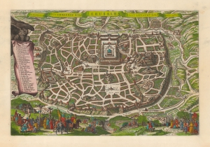
De heylige en wytvermaerde stadt Ierusalem eerst genaemt Salem: Genesis 14, vers 18.
$950.00
Acquire
- Digital Map Information
- Suitable for large format printing
- DPI: 600
- File Size: 49.38 MB
- File Type: ZIP / TIFF
- ICC color profile embedded
- Delivered instantly via download link
This is Claes Janszoon Visscher's scarce 1645 view/map of Biblical Jerusalem, depicting the Temple of Solomon, Herod's Palace, and the city's streets and markets as derived from scriptural sources. Vignettes include Solomon's anointment in the lower right, and the Crucifixion on the lower left. The plan's title is displayed across the top. To the left, a banner held unfurled by an eagle offers a legend of thirty-six numbered features.
Visscher's source is the unacquirable 1630 plan printed by Lünenburg theological publishers Johann and Heinrich Stern. The present work is larger than the Sterm map, and is of a much higher caliber of engraving artistry. While there are certainly earlier depictions of the Holy City based on scriptural sources, most such were based on the fanciful 1584 Christian van Adrichom map. The Stern brothers perspective is both accurate and sophisticated. (more details)
Visscher's source is the unacquirable 1630 plan printed by Lünenburg theological publishers Johann and Heinrich Stern. The present work is larger than the Sterm map, and is of a much higher caliber of engraving artistry. While there are certainly earlier depictions of the Holy City based on scriptural sources, most such were based on the fanciful 1584 Christian van Adrichom map. The Stern brothers perspective is both accurate and sophisticated. (more details)
Proof state of the first Israeli map of Jaffa.
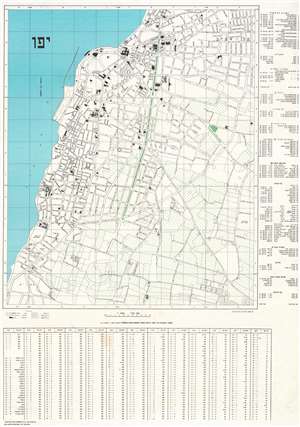
.יפו
$950.00
Acquire
- Digital Map Information
- Suitable for large format printing
- File Size: 106.33 MB
- File Type: ZIP / TIFF
- ICC color profile embedded
- Delivered instantly via download link
A true rarity, this is a c. 1949 E. Lewin Epstein city map of Yafo / Jaffa, Israel. Here in a proof state, this is likely the first published Israeli map of Jaffa. Individual buildings are illustrated and streets are labeled throughout. An index, situated along the right side, lists 106 locations throughout the city. (more details)
Medieval Acre, as a Hospitaller Stronghold.
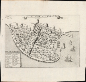
Civitas Acon Sive Ptolomaida.
$750.00
Acquire
- Digital Map Information
- Suitable for large format printing
- Full resolution TIFF file
- ICC color profile embedded
- Delivered instantly via download link
This is J. Picart's striking 1629 plan of the fortified city of Acre (in modern day Israel / Palestine), based on the c. 1320 manuscript plan of Pietro Vesconte: a depiction of the medieval port as a stronghold of the Knights Hospitaller in the Holy Land and the most important Crusader beachhead to the east. (more details)
Tribes of Israel.
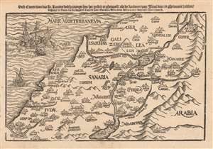
Dese Caerte van des H. Landts Beschrijvinge/ hoe het gestelt is gheweest/ als de kinderen van Israel daer in ghewoont hebben.
$750.00
Acquire
- Digital Map Information
- Suitable for large format printing
- DPI: 600
- File Size: 4.78 MB
- File Type: ZIP / TIFF
- ICC color profile embedded
- Delivered instantly via download link
This is a scarce 1635 Dutch woodcut map of the Holy Land, presenting (as per the title) a 'map of the Holy Lands, describing how it was when the Children of Israel lived there.' The map depicts the location of present-day Israel, Palestine, and parts of Lebanon, Syria, and Jordan. (more details)
One of the earliest contemporaneous depictions of Jerusalem.
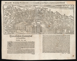
Die heylige Statt Ierusalem / contrafehtet nach Form und Gestallt wie sie zu unsern zeiten erbawen ist.
$750.00
Acquire
- Digital Map Information
- Suitable for large format printing
- Full resolution TIFF file
- ICC color profile embedded
- Delivered instantly via download link
One of the earliest printed views of Jerusalem, executed in woodcut by Jacob Clauser for Sebastian Munster's Cosmographia, from a 1598 German edition. Unlike most early depictions, this bird's-eye view is not a purely retrospective depiction of the ancient city but rather a modern view, showing the city at the time of publication. As explained in the view's title, it is meant to depict the Holy City in the 'form and shape as it was built in our times'. In its initial 1550 printing, this was one of the earliest contemporaneous images of the city. (more details)
A 'valuable map' of the Sinai Peninsula - RGS
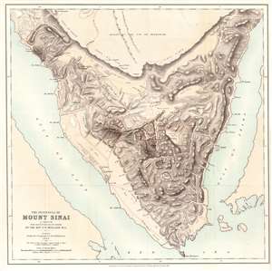
The Peninsula of Mount Sinai. A Sketch from Observations on the Ground by the Rev. F. W. Holland. M.A.
$750.00
Acquire
- Digital Map Information
- Suitable for large format printing
- Full resolution TIFF file
- ICC color profile embedded
- Delivered instantly via download link
This is Frederick Whitmore Holland's 1868 map of the Sinai Peninsula. The peninsula's mountainous terrain is illustrated in detail, with numerous peaks labeled with transliterations of their Arabic names. Holland traces the many wadis (valley, ravine, or channel that is dry except in the rainy season) and provides some commentary on the terrain. Mount Sinai, labeled here as J. Musa (its Arabic name), appears just south of the center of the peninsula. (more details)
One of the Earliest Modern Maps of the Holy Land and Cyprus.
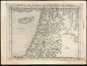
Soria et Terra Santa Nuova Tavola.
$650.00
Acquire
- Digital Map Information
- Suitable for large format printing
- Full resolution TIFF file
- ICC color profile embedded
- Delivered instantly via download link
This is a handsome example of Girolamo Ruscelli's 1561 / 1574 map of the Holy Land and Cyprus. It is an enlarged, more finely-engraved iteration of Giocomo Gastaldi's 1548 Soria e Terra Sancta nova tabula. While Tibbetts avers that the Ruscelli contains fewer place names than its Gastaldi source, he is incorrect: Ruscelli's map preserves all the data of the Gastaldi, but between the increased size of the plate and the clear, legible, and well-spaced engraving of the newer map, its data is presented without the crowding evident on the 1548 map. The skill evident in this work can be credited to the engraver Giulio Sanuto, one of the few Venetian engravers whose career was not isolated either to map engraving or to figurative artistic works, but consisted of both over a career of more than forty years. (more details)
The lands of the Twelve Tribes of Israel.
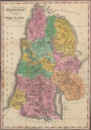
Palestine, or The Holy Land.
$650.00
Acquire
- Digital Map Information
- Suitable for large format printing
- Full resolution TIFF file
- ICC color profile embedded
- Delivered instantly via download link
This is a vibrant c. 1834 map of the Holy Land or Palestine by Thomas Smiley. It illustrates the location of the Twelve Tribes of Ancient Israel, as discussed in the Bible, in particular the Book of Joshua. In an unusual mover, coverage extends to incorporate parts of modern-day Jordan and Syria. (more details)
The 1949 Armistice Agreement - 'the Green Line'.
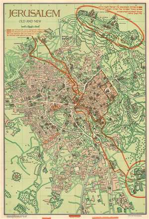
Jerusalem Old and New.
$650.00
Acquire
- Digital Map Information
- Suitable for large format printing
- Full resolution TIFF file
- ICC color profile embedded
- Delivered instantly via download link
This is a 1949 Steimatzky pictorial map of Jerusalem. The map boldly illustrates the 1949 'Green Line' (although it's illustrated here in red). The 'Green Line' separated Israeli and Jordanian-controlled areas of Jerusalem following the 1948 Arab-Israeli War. (more details)
Development of West Jerusalem.
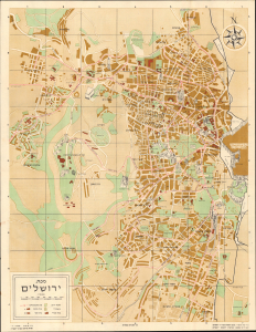
This is a 1958 Hebrew-language pictorial map of West Jerusalem, prepared by the Jerusalem Institute of Photogrammetry. Intended to highlight the city's bus lines, it also serves as a reminder of the ad hoc boundaries that divided the city in the wake of the First Arab-Israeli War. (more details)
Illustrates the Old City and the Temple Mount in detail.
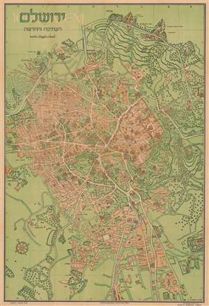
ירושלם העתיקה והחדשה / Jerusalem Old and New.
$600.00
Acquire
- Digital Map Information
- Suitable for large format printing
- Full resolution TIFF file
- ICC color profile embedded
- Delivered instantly via download link
This is a 1942 Steimatzky pictorial map of Jerusalem in Hebrew. The map depicts the city from Karem es Sila to El Tur and the Mount of Olives and from the Hadassa Medical Center, the Hebrew University and Mt. Scopus to Meqor Hayim. Illustrating numerous buildings in profile, the Old City and the Temple Mount act as the focal point. Surrounded by walls, several buildings within the Old City, such as the Holy Sepulcre, St. Anne's, the Supreme Muslim Council, and several gates are labeled. On the Temple Mount, the Dome of the Rock and the Al Aksa Mosque are illustrated. Some of the locations illustrated outside the Old City include the Citadel, the Church of Dormition, the Tomb of the Virgin, the Tombs of the Kings, and several monasteries and convents. Neighborhoods throughout the city are labeled, along with streets and the railway which enters the city near the bottom of the map. (more details)