
Bowles Family (sold)

The Bowles Family (fl. c. 1714 - 1832) were publishers and map sellers active in London from c. 1714 to c. 1832. The firm, under Thomas Bowles (fl. 1714 - 1763), John Bowles (1701 - 1779), Carrington Bowles (1724 - 1793), and as Bowles and Carver (fl. 1794 - 1832), produced a massive corpus of work that included numerous atlases, pocket maps, and wall maps. The Bowles publishing tradition was kept alive for four generations, starting with Thomas Bowles, a print engraver active in the late 17th century. His son, Thomas Bowles II, produced the firm's first maps at St. Paul's Churchyard, London. Thomas's brother, John Bowles (a.k.a. 'Old John Bowles' or 'Black Horse Bowles'), was also an active publisher established at no. 13 Cornhill. He is credited as one of the first publishers of William Hogarth's works. There, John's son, Carrington Bowles, was introduced to the trade. Carrington took over the Cornhill bookshop and eventually merged it with his uncle's shop in St. Paul's Churchyard. On Carrington's 1793 death, the business was passed to his son Henry Carrington Bowles (1763 - 1830), who partnered with his father's former apprentice Samuel Carver (1756 - 1841), renaming the firm 'Bowles and Carver'. Under this imprint, the firm continued to publish maps and atlases until 1832. Henry Carrington Bowles died in 1830, but Samuel Carver, himself in advanced years and poor health, kept it going for another 2 years before closing the business.
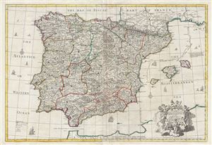
A correct map of Spain and Portugal : according to the newest observations and discoveries communicated to the Royal Society at London and the Royal Academy at Paris…
sold
- Digital Map Information
- Suitable for large format printing
- DPI: 300
- File Size: 40.04 MB
- File Type: ZIP / TIFF
- ICC color profile embedded
- Delivered instantly via download link
An exception c. 1708 elephant folio (large format) map of Spain and Portugal by the English cartographer John Senex. This enormously proportioned map covers the entirety Iberia from the Atlantic Coast to Minorca and from the Bay of Biscay to the Strait of ... (more details)
An unrecorded variant of Senex's large map of North America.

North America corrected from the observations communicated to the Royal Society at London, and the Royal Academy at Paris.
sold
- Digital Map Information
- Suitable for large format printing
- DPI: 300
- File Size: 21.34 MB
- File Type: ZIP / TIFF
- ICC color profile embedded
- Delivered instantly via download link
An exceptional and influential 1710 British map of North America by John Senex. Hands down the most ambitions British mapping of North America produced thus far, Senex's large format map covers all of North America from the unexplored high arctic to ... (more details)
An extraordinary and rare elephant folio map of Asia naming boh the Sea of Korea and the Eastern Sea.
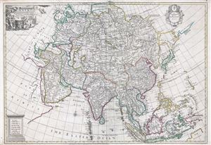
Asia Corrected from the Observations communicated to the Royal Society at London and the Royal Academy at Paris.
sold
- Digital Map Information
- Suitable for large format printing
- DPI: 300
- File Size: 35.55 MB
- File Type: ZIP / TIFF
- ICC color profile embedded
- Delivered instantly via download link
An exception c. 1725 elephant folio (large format) map of Asia by the English cartographer John Senex. This remarkable map covers the entirety of Asia from the Mediterranean to Japan and from Nova Zembla to Java and the Maldives. This map is ... (more details)
Map of a short-lived Scottish colony in Panama whose failure led to the creation of the United Kingdom.
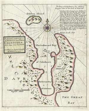
The Scots settlement in America called New Caledonia, A.D. 1699. Lat. 8°-30ʹ north.
sold
- Digital Map Information
- Suitable for large format printing
- DPI: 300
- File Size: 2.16 MB
- File Type: ZIP / TIFF
- ICC color profile embedded
- Delivered instantly via download link
A fascinating map with huge political ramifications, this is Herman Moll's 1729 map of the short-lived Scottish colony in Panama, New Caledonia. New Caledonia was situated on the south eastern coast of modern day Panama in the Gulf of Darien, ... (more details)
The Post Road Map' - Considered the first Postal Map of New England.
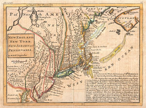
New England, New York, New Jersey and Pensilvania.
sold
- Digital Map Information
- Suitable for large format printing
- DPI: 300
- File Size: 3.81 MB
- File Type: ZIP / TIFF
- ICC color profile embedded
- Delivered instantly via download link
Known among cartographic historic as the 'Post Map,' this is Herman Moll's important 1729 map of New England and the adjacent colonies. Though variants of this map appear as early as 1708, this is the most important of the series due to its ... (more details)
An 18th century treasure map of the West Indies and Caribbean.
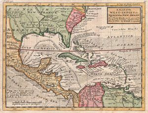
A Map of the West-Indies & c. Mexico or New Spain. Also ye Trade Winds, and ye Several Tracts made by ye Taleons and Flota from Place to Place.
sold
- Digital Map Information
- Suitable for large format printing
- DPI: 300
- File Size: 3.93 MB
- File Type: ZIP / TIFF
- ICC color profile embedded
- Delivered instantly via download link
This is Herman Molls small but significant c. 1732 map of the West Indies. Moll's map covers all of the West Indies, eastern Mexico, all of Central America, the Gulf of Mexico, North America as far as the Chesapeake Bay, and the northern ... (more details)
A c. 1720 map guide to English piracy and privateering in the West Indies.
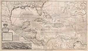
A Map of the West-Indies or the Islands of America in the North Sea; with ye adjacent Countries; explaining what belongs to Spain, England, France, Holland &c. also ye Trade Winds, and ye several Tracts made by ye Galeons and Flota from place to place. According to ye newest and most exact observations, by Herman Moll, Geographer.
sold
- Digital Map Information
- Suitable for large format printing
- DPI: 300
- File Size: 39.29 MB
- File Type: ZIP / TIFF
- ICC color profile embedded
- Delivered instantly via download link
One of the most remarkable and intriguing maps of the West Indies to appear in the 18th century. This is Herman Moll's superb circa 1720 mapping of the West Indies, Caribbean, Gulf of Mexico, Mexico, and the Spanish Main. Monumental ... (more details)
Labels individual farmsteads and plantations!
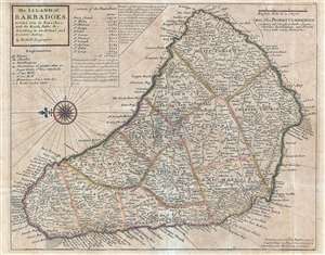
The Island of Barbadoes. Divided into its Parishes, with the Roads, Paths, etc. According to an Actual and Accurate Survey.
sold
- Digital Map Information
- Suitable for large format printing
- DPI: 300
- File Size: 4.8 MB
- File Type: ZIP / TIFF
- ICC color profile embedded
- Delivered instantly via download link
This is a 1736 Herman Moll map of the island of Barbados. The map depicts the entire island with north oriented to the left. The island is divided into eleven parishes. Myriad locations are labeled all over the island, including the ... (more details)
Beautifully colored Homann Heirs map of Havana and Havana Harbor.
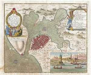
Neu und Verbesserter Plan der St. u Hafens Havana auf der Ins. Cuba
sold
- Digital Map Information
- Suitable for large format printing
- DPI: 300
- File Size: 3.45 MB
- File Type: ZIP / TIFF
- ICC color profile embedded
- Delivered instantly via download link
This is a 1739 Bowles map of Havana, Cuba. The map depicts the city of Havana, Havana Harbor, and the surrounding area. Depth soundings are given throughout the harbor and two beautifully colored compass rose are illustrated. Eleven ... (more details)
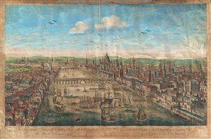
A General View of the City of London, next the River Thames. Vue Generale de la Ville de Londres qui comprend la partie la plus voisine de la Tamise.
sold
- Digital Map Information
- Suitable for large format printing
- DPI: 300
- File Size: 8.15 MB
- File Type: ZIP / TIFF
- ICC color profile embedded
- Delivered instantly via download link
An attractive 1753 view of London set midstream on the Thames, looking west. Set amidst busy river commerce, this view shows London Bridge (foreground), Blackfriars Bridge (middle ground) and, around the bend, Westminster Bridge ... (more details)
The Fall of French Power in America on the Eve of the Seven Years' War.
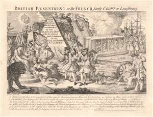
British Resentment, or, the French fairly Coopt at Louisbourg.
sold
- Digital Map Information
- Suitable for large format printing
- Full resolution TIFF file
- ICC color profile embedded
- Delivered instantly via download link
This is an English 1755 satirical cartoon celebrating and encouraging the British to take up arms against France in North America, and lampooning France' waning power during the buildup of what would become the French and Indian War (1754 - 1763). The 'resentment of the British', as in the title, refers to British annoyance at French interference in their sphere of influence in the Americas, and French attacks on British Colonists; the Scottish motto above Britannia's throne (Nemo me impune lacessit, no one attacks me with impunity) reiterates the justification for war. But while referencing many points of conflict between the two powers throughout the prospective theatre of war, this work is most specifically in reference to the action of June 8, 1755 - a controversial British naval victory over the French which contributed to the 1756 declaration of war. Hostilities between French and British colonial forces were already underway in 1754 over control of the Ohio River Valley and Nova Scotia, and both Britain and France were rushing troops to reinforce their respective colonial interests. The British Navy sent a fleet (under the command of Vice Admiral Edward Boscawen) to the Gulf of St. Lawrence to intercept French ships en route to Quebec City, but for the most part the French eluded the blockade, landing ships at Louisbourg in Nova Scotia. (more details)
Scarce broadside satirizing the folly of England's 18th century Bubble economics, specifically the disastrous South Sea Bubble.
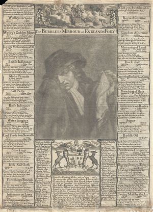
The Bubblers Mirrour: or Englands Folly.
sold
- Digital Map Information
- Suitable for large format printing
- DPI: 300
- File Size: 6.22 MB
- File Type: ZIP / TIFF
- ICC color profile embedded
- Delivered instantly via download link
An exceptional 1720 Thomas Bowles broadside satirizing the rise and fall of the South Sea Company. The South Sea Company was an English joint-stock venture dreamed up by John Blunt in 1711. Blunt developed a complicated scheme ... (more details)
Capital of New England - one of the earliest views of Boston based on actual observation.
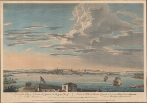
A View of the City of Boston the Capital of New England, in North America. / Vue de la Ville de Boston Capitale de la Nouvelle Angleterre, dans l'Amérique Septemtrionale.
sold
- Digital Map Information
- Suitable for large format printing
- DPI: 600
- File Size: 387.91 MB
- File Type: ZIP / TIFF
- ICC color profile embedded
- Delivered instantly via download link
This is the rare Thomas Pownall view of Boston, published in 1768. It is one of the earliest obtainable views of Boston offering a look at the city shortly after the French and Indian War (1754 - 1763). (more details)
Issued just after the Battle of Bunker Hill.
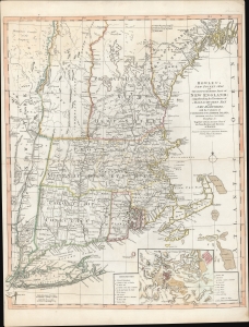
Bowles's New Pocket Map of the Most Inhabited Part of New England; comprehending the Provinces of Massachusets Bay and New Hampshire; with the Colonies of Connecticut and Rhode Island; Divided into their Counties, Townships, and c. Together with an Accurate Plan of The Town, Harbour and Environs of Boston.
sold
- Digital Map Information
- Suitable for large format printing
- DPI: 600
- File Size: 29.62 MB
- File Type: ZIP / TIFF
- ICC color profile embedded
- Delivered instantly via download link
A rare separately published 1776 American Revolutionary War map of New England by Carington Bowles - here in the scarce 4th edition that immediately followed the action at Bunker Hill. It represents one of the best and most up-to-date Revolutionary Era maps of New England. This map was initially issued by Carington Bowles in 1765 as a reduced and updated improvement upon the 1755 John Green / Braddock Mead map. The map transitioned through six known states, the present example representing the fourth state, updated with relevant content at the beginning of the American Revolutionary War (1775 - 1783). (more details)
The hypothetical Muller Peninsula.
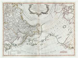
Bowles's New Pocket Map of the Discoveries made by the Russians on the North West Coast of America Published by the Royal Academy of Sciences at Petersburg.
sold
- Digital Map Information
- Suitable for large format printing
- Full resolution TIFF file
- ICC color profile embedded
- Delivered instantly via download link
An attractive example of Carrington Bowles' 1780 map of the North Pacific, including parts of Alaska, the Pacific Northwest, and Northeast Asia. Coverage extends from the Arctic Circle south to the latitudes of Vancouver and Japan. Most dramatically, the map includes a large speculative pre-Cook peninsula extending westward from North America towards Asia. This is generally known as the Muller Peninsula after Gerhard Muller, who hypothesized it in 1754. The map is also notable for its unusual Bulbous promontory in northern Siberia, an interpretation of the Witsen Peninsula, which is a mismapping of the Chukchi Peninsula. (more details)
Speculative proto-Alaskan Muller Peninsula.
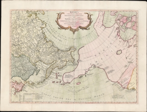
Bowles's New Pocket Map of the Discoveries made by the Russians on the North West Coast of America Published by the Royal Academy of Sciences at Petersburg.
sold
- Digital Map Information
- Suitable for large format printing
- Full resolution TIFF file
- ICC color profile embedded
- Delivered instantly via download link
An attractive example of Carrington Bowles' 1780 map of the North Pacific, including parts of Alaska, the Pacific Northwest, and Northeast Asia. Most dramatically, the map includes a large speculative pre-Cook peninsula extending westward from North America toward Asia. This is generally known as the Muller Peninsula after Gerhard Muller, who hypothesized it in 1754. The map is also notable for its unusual bulbous promontory in northern Siberia, an interpretation of the Witsen Peninsula, which is a mismapping of the Chukchi Peninsula. (more details)
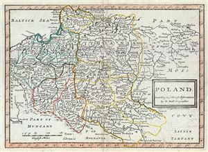
Poland According to ye Newest Observations by Herman Moll Geographer.
sold
- Digital Map Information
- Suitable for large format printing
- Full resolution TIFF file
- ICC color profile embedded
- Delivered instantly via download link
This is a beautiful 1784 map of Poland by Herman Moll, issued by Carrington Bowles. The map covers Poland and Lithuania as well as parts of Germany, the Russian Empire, Hungary, Transylvania (Romania), and Latvia. Several ... (more details)
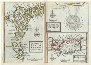
The Islands of Fero or Farro by Jacobson Debes. The Form of the Whirlpool At the South East of Sumbo with the Soundings. Iceland by Herman Moll Geographer.
sold
- Digital Map Information
- Suitable for large format printing
- Full resolution TIFF file
- ICC color profile embedded
- Delivered instantly via download link
This is a singularly fascinating 1784 map of Iceland and the Faroe Islands issued by Carrington Bowles. Essentially a compilation of three maps on a single sheet, this map of the North Atlantic islands is festooned with ... (more details)
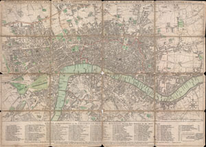
BOWLES'S Reduced NEW POCKET PLAN of the CITIES of LONDON and WESTMINSTER, with the BOROUGH of SOUTHWARK, exhibiting the NEW BUILDINGS to the YEAR 1795.
sold
- Digital Map Information
- Suitable for large format printing
- DPI: 300
- File Size: 15.85 MB
- File Type: ZIP / TIFF
- ICC color profile embedded
- Delivered instantly via download link
This is a rare 1795 folding pocket map or street plan of London, England by Carrington Bowles. Covers London on both sides of the Thames River from Hyde Park in the west to White Horse Street in the East and from ... (more details)
A rare and important Post-Revolutionary War Era map of New England. One of the first maps to recognize Vermont as a state.
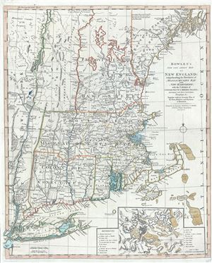
Bowles's New One-Sheet Map of New England; comprehending the Provinces of Massachusets Bay And New Hampshire; with the Colonies of Connecticut & Rhode Island; Divided into their Counties, Townships &c. Together with an Accurate Plan of the Town, Harbour and Environs of Boston.
sold
- Digital Map Information
- Suitable for large format printing
- DPI: 300
- File Size: 20.29 MB
- File Type: ZIP / TIFF
- ICC color profile embedded
- Delivered instantly via download link
A rare separately published c. 1796 map of New England by Bowles and Carver. Centered on Massachusetts, this map covers the New England coastline from Long Island, New York, to Little Kennebec Bay, Maine, and from ... (more details)
Recognizing British Honduras.
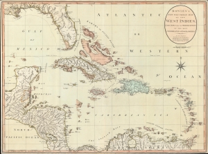
Bowles's New One-Sheet Map of the West Indies, Laid Down from the Observations of Celebrated Geographers.
sold
- Digital Map Information
- Suitable for large format printing
- File Size: 27.66 MB
- File Type: ZIP / TIFF
- ICC color profile embedded
- Delivered instantly via download link
An exceptional example of Bowles and Carver's c. 1798 map of the West Indies - this is one of the first maps to recognize formal British claims over Belize (British Honduras). (more details)
Celebrating the exploratory explosion of late 18th century.
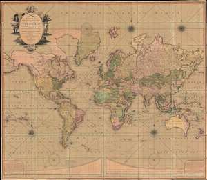
Bowles's New Four-Sheet Map of The World on Mercator's Projection Exhibiting the Several Quarters of the Globe divided into their respective Empires, Kingdoms, States, and c. agreeable to the latest Treaties and Political Regulations now existing; Together with all the New Discovers and most interesting Tracks of those eminent Circumnavigators Cook, Byron, Bougainville, Perouse, Vancouver and c.
sold
- Digital Map Information
- Suitable for large format printing
- Full resolution TIFF file
- ICC color profile embedded
- Delivered instantly via download link
A beautiful old-color example of the Bowles and Carver 1801 large-format wall map of the world, on a Mercator Projection. The map celebrates the great strides forward made in world-exploration in the late 18th century - particularly by British navigators. The striking cartouche, situated in the upper left, features a sea captain consulting a nautical chart on the left, and a navigator with a sextant on the right. The cartouche is surmounted by a large anchor, the symbol of the British Admiralty. At the base of the map trade goods pile up, signifying wealth. Within the title area itself, a trumpet and telescope are crossed like swords, equating exploration with conquest. (more details)
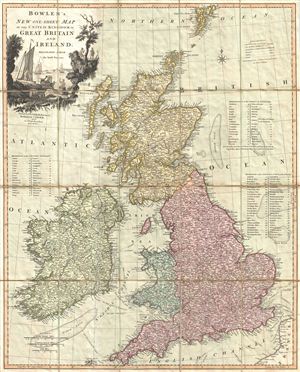
Bowles's New One-Sheet Map of the United Kingdom of Great Britain and Ireland; Delineated from the latest Surveys.
sold
- Digital Map Information
- Suitable for large format printing
- DPI: 300
- File Size: 22.99 MB
- File Type: ZIP / TIFF
- ICC color profile embedded
- Delivered instantly via download link
A surprisingly scarce 1801 case or pocket map of the British Isles, including england, Scotland, and Ireland, by Carrington Bowles and Samuel Carver. Bowles' map covers all of the British Isles from the Shetland ... (more details)
Bowles map of the western United States.
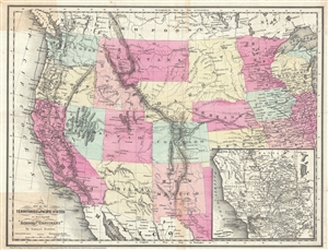
Map of the Territories and Pacific States to Accompany 'Across the Continent'.
sold
- Digital Map Information
- Suitable for large format printing
- File Size: 8.31 MB
- File Type: ZIP / TIFF
- ICC color profile embedded
- Delivered instantly via download link
A highly appealing 1865 map of the western parts of the United States drawn to illustrate Samuel Bowles' Across the Continent . The map covers from the Pacific Ocean to Illinois and the Great Lakes. It is ... (more details)