
Direccion Hidrografia (sold)

The Direccion Hidrografía (1787 - 1927), also known as the Deposito Hydrografico and the Direction de Hidrografía, was the Spanish equivalent of the British Admiralty or the U.S. Coast Survey. This organization, founded in 1787, was commissioned to collect and produce accurate nautical charts of all waters frequented by Spanish vessels. In essence, it replaced the Casa de la Contratación de las Indias (House of Trade of the Indies), which closed its doors in 1790. Like most such organizations, the Direccion Hidrografía marked a new age in cartography. Rather than simply collect charts created by navigators, explorers, and merchants, the Direccion Hidrografía worked closely with naval and military personnel to mount cartographic and hydrographic expeditions in pursuit of the most accurate hydrographical, astronomical, and geodetic measurements. The Direccion Hidrografía created a massive library of nautical charts that, though not nearly as common as similar nautical charts by the U.S. Coast Survey and British Admiralty, are highly desirable for the beauty of their manufacture as well as their accuracy and detail. The office was originally located on Calle Ballesta, but relocated to 36 Alcala, both in Madrid. After 1908 the Dirección was subsumed into other governmental agencies. In 1927 the Direccion was absorbed into the Institute and Observatory of San Fernando, located in Cadiz. The library of original maps, charts, and journals was transferred to the Naval Museum of Madrid - where it resides to this day.
Rare early nautical chart of the Virgin Islands.
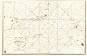
Carta Esferica de la Islas Caribes de Sotavento.
sold
- Digital Map Information
- Suitable for large format printing
- Full resolution TIFF file
- ICC color profile embedded
- Delivered instantly via download link
A rare 1804 Direccion Hidrografica nautical chart or maritime map of the Virgin Islands. Centered on Virgin Gorda Island, the map covers from eastern Puerto Rico to St. Christopher and St. Barts. When it was printed, this was the finest map of the Virgin Islands yet produced, the result of a meticulous 1792 survey by Spanish officers Joaquin Francisco Fidalgo and Cosme Damián de Churruca y Elorza. (more details)
Rare early nautical chart of the Virgin Islands.
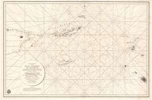
Carta Esferica de la Islas Caribes de Sotavento.
sold
- Digital Map Information
- Suitable for large format printing
- DPI: 600
- File Size: 49.61 MB
- File Type: ZIP / TIFF
- ICC color profile embedded
- Delivered instantly via download link
A rare 1804 Direccion Hidrografica nautical chart or maritime map of the Virgin Islands. Centered on Virgin Gorda Island, the map covers from eastern Puerto Rico to St. Christopher and St. Barts. When it was printed, this was the finest map of the Virgin Islands yet produced, the result of a meticulous 1792 survey by Spanish officers Joaquin Francisco Fidalgo and Cosme Damián de Churruca y Elorza. (more details)
'The first large-scale printed chart of the Texas coast based on actual soundings and explorations.' - Martin and Martin
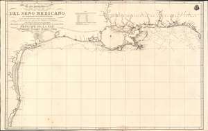
Carta Particular de las Costas Setentrionales del Seno Mexicano que comprende las de Florída Ocidental Las Margenes de la Luisiana y toda la rivera que sigue por la Bahia de S. Bernardo y el Rio Bravo del Norte hasta la Laguna Madre.
sold
- Digital Map Information
- Suitable for large format printing
- Full resolution TIFF file
- ICC color profile embedded
- Delivered instantly via download link
One of the most important maps of Texas, considered 'the first large-scale printed chart of the Texas coast based on actual soundings and explorations' (Martin and Martin). This is the 1807 Spanish Direccion Hidrografica map of the Gulf Coast in the vicinity of Texas and Louisiana. The chart follows directly on the seminal Jose Antonio de Evia (1740 - 18??) survey of the Gulf Coast, conducted between 1785 and 1786. This was the first scientific mapping of this region, resulting in, among other things, the naming of Galveston Bay. The Evia survey resulted in two subsequent maps, the 1799 Carta Esferica que Comprehende las Costas del Seno Mexicano - essentially a general chart of the Gulf of Mexico, and this more specific 1807 map offering considerably more detail to the costliness of Texas and Louisiana. (more details)
Extremely rare early 19th century Spanish scientific mapping of Mobile Bay.
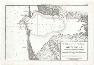
Plano de la Bahía de Movila Situado el Fuerte del mismo nombre en la latitud N. de 30º 36'' 30. y longitud de 81º 44' 00'' al O. del meridiano de Cádiz.
sold
- Digital Map Information
- Suitable for large format printing
- DPI: 300
- File Size: 1.98 MB
- File Type: ZIP / TIFF
- ICC color profile embedded
- Delivered instantly via download link
A stunning and rare 1809 map of Mobile Bay, Alabama by the Spanish maritime cartographic agency, La Dirección Hidrográfica . Oriented to the west, this map covers all of Mobile Bay from the French city of Mobile to the entrance to the Bay and from Dauphin Island ... (more details)
Remarkable and extremely rare Spanish nautical chart of Central America, Colombia, and the antilles.
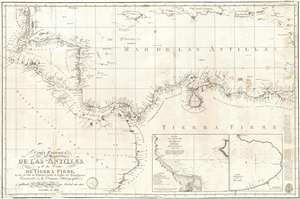
Carta Esferica del Mar de Las Antillas y de la Costas de Tierra Firme, desde la Isla de Trinidad, hasta el Golfo de Honduras Construida en la Direccion Hidrografica y pubicada de orden superior en Mardrid ano 1805.
sold
- Digital Map Information
- Suitable for large format printing
- Full resolution TIFF file
- ICC color profile embedded
- Delivered instantly via download link
A rare Spanish Dirección de Hidrografía 1809 nautical chart or maritime map of the coasts of Central America, Colombia, and Venezuela. The map covers from the Gulf of Honduras to Panamá and Maracaibo. In extends north to include the island of Jamaica as well ... (more details)
Rare and important Spanish chart of St. Augustine.
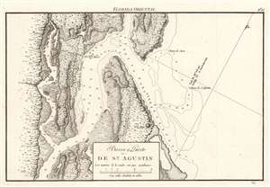
Barra y Puerto de Sn. Agustin.
sold
- Digital Map Information
- Suitable for large format printing
- DPI: 600
- File Size: 11.39 MB
- File Type: ZIP / TIFF
- ICC color profile embedded
- Delivered instantly via download link
A rare find, this is the 1809 Dirección de Hidrografía nautical chart or map of St. Augustine, Florida, published in Portulano de la America Setentrional. Detail includes the settlement's individual buildings and fields, with the more prominent constructions, such as the Castello de San Marcos labeled. Depth soundings appear in the Matanzas River and the Saint Augustine Inlet, with markings for safe anchorage. (more details)
Rare Spanish nautical chart of the Balearic Islands.
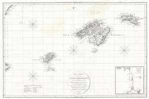
Carta Esferica de las Islas Baleares y Pithyusas, arreglada a la que se construyo en 1807 en la Dirección Hidrografica de Madrid.
sold
- Digital Map Information
- Suitable for large format printing
- DPI: 300
- File Size: 10.36 MB
- File Type: ZIP / TIFF
- ICC color profile embedded
- Delivered instantly via download link
A rare 1812 Dirección de Hidrografía nautical chart or maritime map of the Balearic Islands: Mallorca, Menorca, Ibiza and Formentera. The chart offers extraordinarily detail throughout with topography, town names rivers, roads, and depth soundings. An inset in ... (more details)
Rare Spanish nautical chart of the Balearic Islands.
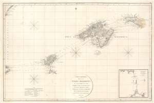
Carta Esferica de las Islas Baleares y Pithyusas, arreglada a la que se construyo en 1807 en la Dirección Hidrografica de Madrid.
sold
- Digital Map Information
- Suitable for large format printing
- Full resolution TIFF file
- ICC color profile embedded
- Delivered instantly via download link
A rare 1812 Dirección de Hidrografía nautical chart or maritime map of the Balearic Islands: Mallorca, Minorca, Ibiza and Formentera. The chart offers extraordinarily detail throughout with topography, town names rivers, roads, and depth soundings. An inset in the lower right details the channels between Ibiza and Formentera (1 : 69400). (more details)
Spain shores up its colonies.
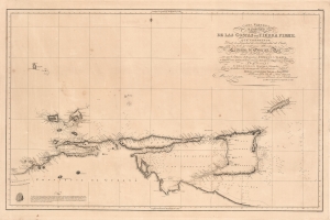
Carta Esferica en quatro hojas de las Costas de Tierra Firme.
sold
- Digital Map Information
- Suitable for large format printing
- Full resolution TIFF file
- ICC color profile embedded
- Delivered instantly via download link
This is a rare 1816 Dirección de Hidrografía chart of what is now northern Venezuela and the island nation of Trinidad and Tobago. It is the product of an effort by the Spanish to better understand the coasts of their waning empire at the end of the 18th century, resulting in charts markedly improved over their predecessors. (more details)
Chart that enabled the accurate measurement of Cuba. (Humboldt).
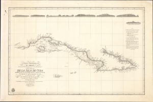
Carta esferica que comprende la costa meridional, parte de la setentrional é yslas adyacentes de la isla de Cuba: desde la punta de Maisi hasta Cabo S. Antonio levantada de orden superior en 1793 por el Teniente de Navio Don Ventura de Barcaiztegui, y en 1804, por el Capital de Fragata D. José del Rio.
sold
- Digital Map Information
- Suitable for large format printing
- Full resolution TIFF file
- ICC color profile embedded
- Delivered instantly via download link
This superb nautical map, produced in 1821 by Spain's Dirección de Hidrografía, presents the best charting of Cuba's southern coast then published. Its quality was hailed by no less a contemporary luminary than German geographer, naturalist, and explorer Alexander von Humboldt (1769 - 1859). Before its publication, it was impossible to accurately determine Cuba's actual size. In addition to its novel mapping of Cuba, the chart also features updated coverage of the Cayman Islands, including seven place names on Grand Cayman. (more details)
Chart that enabled the accurate measurement of Cuba. (Humboldt).
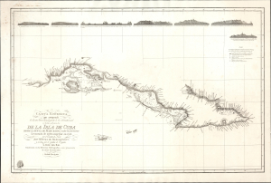
Carta esferica que comprende la costa meridional, parte de la setentrional é yslas adyacentes de la isla de Cuba: desde la punta de Maisi hasta Cabo S. Antonio levantada de orden superior en 1793 por el Teniente de Navio Don Ventura de Barcaiztegui, y en 1804, por el Capital de Fragata D. José del Rio.
sold
- Digital Map Information
- Suitable for large format printing
- Full resolution TIFF file
- ICC color profile embedded
- Delivered instantly via download link
This superb nautical map, produced in 1821 by Spain's Dirección de Hidrografía, presents the best charting of Cuba's southern coast then published. Its quality was hailed by no less a contemporary luminary than German geographer, naturalist, and explorer Alexander von Humboldt (1769 - 1859). Before its publication, it was impossible to accurately determine Cuba's actual size. In addition to its novel mapping of Cuba, the chart also features updated coverage of the Cayman Islands, including seven place names on Grand Cayman. (more details)
The Spanish Malaspina Expedition!
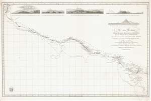
Carta Esferica desde el Golfo Dulce en la Costa Rica hasa Sn. Blas en la Nueva Galicia.
sold
- Digital Map Information
- Suitable for large format printing
- DPI: 600
- File Size: 34.8 MB
- File Type: ZIP / TIFF
- ICC color profile embedded
- Delivered instantly via download link
Representing the most advanced data available to the Spanish Admiralty at the time, this 1822 Direccion Hidrografía nautical chart or maritime map details the Pacific coast of Central America from southern Mexico and Guatemala to Costa Rica. The chart traces the movements of the 1789 - 1794 Spanish government sponsored Malaspina Expedition, a scientific expedition akin to those of Captain Cook, and labels the expedition's two ships the Descubierta and the Altrevida. Guatemalan volcanoes, Lake Nicaragua, and Acapulco are among the many coastal features. Five coastal views are included along the top border and illustrate the Volcán de Colima in Mexico, the Volcán de Vieja in Costa Rica, and the volcanoes of Guatemala. (more details)
First edition of a foundational chart.
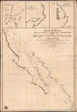
Carta Esferica de las Costas y Golfo de Californias llamado Mar de Cortes Que Comprende desde el Cabo Corrientes hasta el Puerto de S. Diego.
sold
- Digital Map Information
- Suitable for large format printing
- File Size: 26.15 MB
- File Type: ZIP / TIFF
- ICC color profile embedded
- Delivered instantly via download link
A spectacular 1825 1st edition of the Felipe Cardano y Bauzá / Dirección Hidrográfico foundational nautical chart or maritime map of Baja California and the Gulf of California. This important chart is the basis for much of the subsequent mapping of this region and is reflected in subsequent French and English charts. Coverage extends along the west coast of Mexico from San Diego, California, to Cabo Corrientes, Jalisco, Mexico, including all of modern-day Baja, the Gulf of California, and the Sonora and Sinaloa coasts. (more details)
Extremely rare Spanish nautical chart of Florida and the Gulf of Mexico with mansucript annotations. Associated with the Trienio Liberal and Spanish democracy.
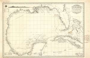
Carta Esferica de la costas del seno Mexicano Con parte de la isla de Cuba y canales adjacentes.
sold
- Digital Map Information
- Suitable for large format printing
- DPI: 600
- File Size: 56.35 MB
- File Type: ZIP / TIFF
- ICC color profile embedded
- Delivered instantly via download link
This is a finely engraved and rare 1836 Spanish Depósito Hidrográfico nautical chart or maritime map by Felipe Bauzá detailing the western Caribbean, the Gulf of Mexico, Florida, the Bahamas, and Cuba. The chart contains interesting manuscript annotations regarding Spanish naval traffic in the region and a defaced London imprint, indicative of political turmoil in Spain and the author's exile. (more details)
The Cadiz-Havana Route.
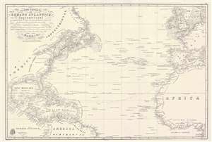
Carta General del Oceano Atlantico Septentrional que comprende desde el Ecuador hasta 55° 35' de latitud norte, y entre la longitud de 93° 45' al Oeste, y 17° al Este del meridiano de Cadiz.
sold
- Digital Map Information
- Suitable for large format printing
- Full resolution TIFF file
- ICC color profile embedded
- Delivered instantly via download link
This is a rare 1837 / c. 1851 Direccion Hidrografía nautical chart or maritime map of the Atlantic Ocean with manuscript notations relating to an 1864 voyage from Cadiz to Havana. Coverage extends from Labrador and the North Sea to the Equator, and from the Gulf of Mexico to the Mediterranean. The chart offers meticulous coastal detail throughout, as well as interesting annotations regarding sighting of rocks, banks, and reefs sighted along the central route between Europe and America. Such charts were used for broad voyage planning and open sea, smaller more detailed charts were then used for approaches to land. (more details)
Rare early map of Florida based upon Spanish navigation.
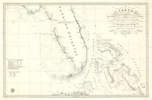
Carta de los Canales de Bahama, Providencia y Santaren, Costas de la Florida e Isla de Cuba con los cayos y bajos, las islas y sondas adyacentes a esta
sold
- Digital Map Information
- Suitable for large format printing
- DPI: 600
- File Size: 36.24 MB
- File Type: ZIP / TIFF
- ICC color profile embedded
- Delivered instantly via download link
A stunningly engraved 1838 Spanish nautical chart of Florida and the Bahamas (Lucayas) used by the Dirección Hidrografía. Coverage extends from roughly from St. Augustine to Cuba, and from the Bay of St. Andres (Saint Andrew Bay) to Rum Cay and I. Conception. There is very little inland detail, but the Florida Keys, Tampa bay, and the Vicinity of Miami are well maps - with notes as to where fresh water can be found. The routes of several seven voyages are noted here, and were influential in preparing the map, most undertaken between 1794 and 1820. The general shape of Florida of Florida is consistent with maps of the period, including an exaggerated hook south of Cape Romano, and an unexplored region in the vicinity of the Crystal River south of the Cedar Keys. (more details)
Early days Florida as part of the U.S.
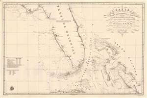
Carta de los Canales de Bahama, Providencia y Santaren, Costas de la Florida e Isla de Cuba con los cayos y bajos, las islas y sondas adyacentes a esta...
sold
- Digital Map Information
- Suitable for large format printing
- Full resolution TIFF file
- ICC color profile embedded
- Delivered instantly via download link
A strikingly engraved 1838 Spanish nautical chart of Florida and the Bahamas (Lucayas) published in Madrid by the Spanish Dirección Hidrografía. Coverage extends roughly from St. Augustine to Cuba, and from the Bay of St. Andres (Saint Andrew Bay) to Rum Cay and I. Conception. There is very little inland detail, but the Florida Keys, Tampa Bay, and Biscayne Bay are well mapped - with notes identifying water sources. The routes of several voyages influential in preparing the map are noted, for the most part, undertaken between 1794 and 1820. The Cape Florida lighthouse near Miami, constructed in 1825, is also noted. The general shape of Florida is consistent with maps of the period, including an exaggerated hook south of Cape Romano, and an unexplored region in the vicinity of the Crystal River south of the Cedar Keys. Pencil marks track the map's use on a single voyage, from Cadiz (Spain) to Havana. (more details)
Rare set of Spanish nautical charts.
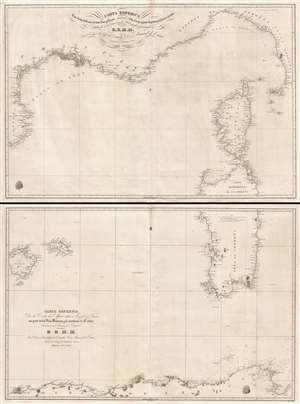
Carta esférica de las costas de Francia, Cerdeña, Luca y Toscana con las yslas de Elba, Córcega y parte septentrional de la de Cerdeña. / Carta Esférica de la Costa de Africa entre Argel y Tunez con parte de las Yslas Baleares y la meridional de Cerdeña.
sold
- Digital Map Information
- Suitable for large format printing
- DPI: 300
- File Size: 33.51 MB
- File Type: ZIP / TIFF
- ICC color profile embedded
- Delivered instantly via download link
This is a rare 1838 two-part Spanish nautical chart of the western Mediterranean in the vicinity of Corsica, Sardinia, and the Balearic Islands. The map covers from Majorca (Mallorca) and Menorca (Minorca) east to Sardinia and Corsica and from the French Rivera ... (more details)
One of the first trigonometric charts of Puerto Rico.
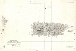
Carta Esferica De La Isla De Puerto-Rico y las adyacentes, que a la misma pertenecen Vicques, Culebra, Cajades Muertos, Mona, Monito y Desecho, con partie de las islas de Santa Domino y Saona…
sold
- Digital Map Information
- Suitable for large format printing
- DPI: 600
- File Size: 37.27 MB
- File Type: ZIP / TIFF
- ICC color profile embedded
- Delivered instantly via download link
A stunning 1840 first edition nautical map of Puerto Rico (Porto Rico) by Miguel Moreno of the Spanish Depósito Hidrográfico. It is one of the earliest trigonometric charts of the island. (more details)
Most dangerous Maritime passage in West Africa.
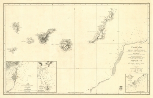
Carta Esférica de las Islas Canarias y Parte de la Costa Ocidental de Africa, que Comprende desde Puerto Cansado Hasta Cabo Bojador, levantada en 1834 á 1838.
sold
- Digital Map Information
- Suitable for large format printing
- DPI: 600
- File Size: 55.49 MB
- File Type: ZIP / TIFF
- ICC color profile embedded
- Delivered instantly via download link
A striking 1853 nautical chart or maritime map of the Canary Islands and the coast of Africa in the vicinity of Cape Bojador. The map depicts one of the most dangerous passages in African navigation - the rounding of Cape Bojador. The Canary Islands were significant to mariners from the 15th through the 19th centuries, when they were considered a vital stopover point and bridge between four continents: Africa, North America, South America, and Europe. (more details)
Scarce Spanish nautical chart of Cuba.
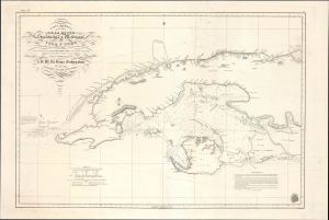
Carta Esferica de una Parte de la Costa Setentrional y Meridional de la Isla de Cuba … 1834.
sold
- Digital Map Information
- Suitable for large format printing
- Full resolution TIFF file
- ICC color profile embedded
- Delivered instantly via download link
This is an 1854 Direccion Hidrografica nautical chart or maritime map of the western part of Cuba, an update of a chart originally published in 1837. It demonstrates the difficulties of navigating the coastal waters off the coast of Cuba, due to shallow waters, strong currents, numerous hazards, and a lack of good anchorages. (more details)
Scarce Spanish nautical chart of Cuba.
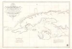
Carta Esferica de una Parte de la Costa Setentrional y Meridional de la Isla de Cuba … 1834.
sold
- Digital Map Information
- Suitable for large format printing
- Full resolution TIFF file
- ICC color profile embedded
- Delivered instantly via download link
This is a dramatic and rare 1854 Direccion Hidrografica nautical chart or maritime map of the western part of Cuba. The map depicts the West India island from Cape San Antonio eastward as far as the Gulf of Cazones. It includes the Isla de Pinos and the city of Havana. Countless depth soundings are indicated, along with notes on the construction of the chart and navigation. Some inland detail is included, such as a number of important mountains as well as the villages of Guanajayu, San Antonio de los Banos, San Antonio de Bedia, Manajau, Madruga, among others. While generally black and white, yellow and red markers denote lighthouses. A directional title cartouche appears in the upper left quadrant. The logo of the Direcction Hidrografica is situated in the lower right. (more details)
Extremely scarce Spanish nautical chart of Cuba.
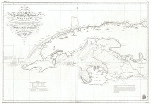
Carta Esferica de una Parte de la Costa Setentrional y Meridional de la Isla de Cuba … 1834.
sold
- Digital Map Information
- Suitable for large format printing
- DPI: 300
- File Size: 18.88 MB
- File Type: ZIP / TIFF
- ICC color profile embedded
- Delivered instantly via download link
This is a dramatic and exceptionally rare 1854 nautical chart or map of the western part of Cuba by the Spanish mapping agency, Direccion Hidrografica . Covers the West India island from Cape San Antonio eastward as far as the Gulf of Cazones. Includes the ... (more details)
The Pleasure of Vipers...
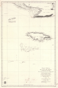
Carta Esférica de la Isla de Jamaica y Parte de la de Cuba.
sold
- Digital Map Information
- Suitable for large format printing
- File Size: 41.35 MB
- File Type: ZIP / TIFF
- ICC color profile embedded
- Delivered instantly via download link
A scarce 1857 Dirección de Hidrografía nautical chart or maritime map of Jamaica, the Little Cayman Islands, and Southern Cuba. Centered on Pendro Bank (Vibora), the map extends as far north as Nipe Bay on Cuba's north coast, and as far west as Little Cayman. The seas to the south are largely empty, but the Serrana Bank atoll in the western Caribbean is noted. (more details)
Spanish issue nautical chart of Florida and the Bahamas.
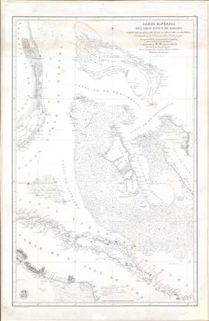
Carta Esférica del Gran Banco de Bahama parte de la Isla de Cuba y Costa de la Florida.
sold
- Digital Map Information
- Suitable for large format printing
- File Size: 33.52 MB
- File Type: ZIP / TIFF
- ICC color profile embedded
- Delivered instantly via download link
A scarce, large, and highly detailed 1858 nautical chart or maritime map of the Bahamas by the Spanish Direccion de Hidrografia. Within 3 years, this and similar maps would become a hot commodity for enterprising smugglers and blockade-runners supplying the Confederacy from bases in the Bahamas and Matazas, Cuba. Centered on Andros Island, the largest of the Bahama archipelagic state, the map depicts from Grand Bahama to Cuba and from Florida to Exuma. Cartographically and hydrographically, it is a compilation of Spanish and English surveys artfully combined. The Florida coast is illustrated in meticulous detail from, roughly, modern day Vero Beach to Matecumbe Key. Fort Jupiter, Boca Raton, the Miami River, Fort Lauderdale, and Fort Dallas are all noted. The Bahama Bank itself is dense with thousands of soundings - underscoring just how dangerous navigating these low-lying waters could be. The Cuba coast, is also illustrated with exceptional detail, as one would expect from a Spanish chart. (more details)
Highly detailed Spanish issue nautical chart of Florida and the Bahamas.
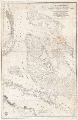
Carta Esférica del Gran Banco de Bahama parte de la Isla de Cuba y Costa de la Florida.
sold
- Digital Map Information
- Suitable for large format printing
- File Size: 20.42 MB
- File Type: ZIP / TIFF
- ICC color profile embedded
- Delivered instantly via download link
A scarce, large, and highly detailed 1858 nautical chart or maritime map of the Bahamas by the Spanish Direccion de Hidrografia . Centered on Andros Island, the largest of the Bahama family, the map covers from Grand Bahama to Cuba and from Florida to ... (more details)
Rare map of the Virgin Islands in the final days of the Danish West Indies.
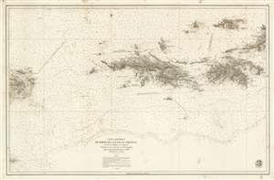
Carta Esférica de Parte de Las Islas Virgenes desde la Culebra a La Tortola.
sold
- Digital Map Information
- Suitable for large format printing
- File Size: 72.25 MB
- File Type: ZIP / TIFF
- ICC color profile embedded
- Delivered instantly via download link
A stunningly engraved 1859 Dirección Hidrografía nautical chart or maritime map of the Virgin Islands, including the U.S. Virgin Islands of St. Thomas and St. John. Centered on St. Thomas, the map covers from Isla de Culbera (Puerto Rico) to the island of Tortola (British Virgin Islands), and from Jost Van Dyke as far south as Vieques. The chart exhibits meticulously rendered topography and illustrates cities and towns in exacting detail, showing individual streets, blocks, and even important buildings throughout. At sea, there are countless soundings and other information useful to the navigator. (more details)
Rare Spanish nautical chart of the Strait of Malacca, one of the world's busiest shipping thoroughfares.
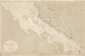
Carta Esférica de Estrecho de Malaca segun los trabajos mas modernos ingleses y holandeses.
sold
- Digital Map Information
- Suitable for large format printing
- File Size: 28.38 MB
- File Type: ZIP / TIFF
- ICC color profile embedded
- Delivered instantly via download link
A rare 1863 Dirección de Hidrografía nautical chart or maritime map of the Strait of Malacca. The chart covers the southern portion of the strait from Selangor to the Strait of Singapore, including parts of adjacent Malaysia and Sumatra. Although ... (more details)
Issued during the American Civil War for Spanish Blockade Runners!
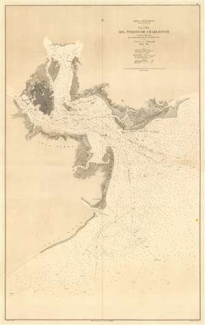
América Septentrional Carolina del Sur. Plano del Puerto de Charleston.
sold
- Digital Map Information
- Suitable for large format printing
- File Size: 38.38 MB
- File Type: ZIP / TIFF
- ICC color profile embedded
- Delivered instantly via download link
An utterly stunning 1864 Civil War Era Spanish Direccion de Hidrografia nautical chart or maritime map of Charleston Harbor, South Carolina. Probably issued for use by Spanish blockade runners during the American Civil War. The map covers the South Carolina coast from Sullivan Island to Folly Island, with a focus on Charleston Harbor. Charleston itself is beautiful engraved and situated between the Ashley and Cooper Rivers. The street grid is detailed, including piers, parks, individual buildings, and more. Similar attention has been given to the Charleston Harbor town of Mount Pleasant and Moultrieville, both of which have since been folded into greater Charleston. (more details)
Eyeing the Outer Banks.
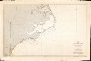
América Septentrional, Costa Este. Hoja IV. Carolina del Norte desde el Cabo Fear hasta el lago de Albemarle.
sold
- Digital Map Information
- Suitable for large format printing
- File Size: 75.2 MB
- File Type: ZIP / TIFF
- ICC color profile embedded
- Delivered instantly via download link
A curious nautical map or chart of the North Carolina coast, produced in 1868 by Spain's Dirección de Hidrografía. Surveyed before the U.S. Civil War but published afterwards, the chart reflects both Spain's investment in naval modernization in the preceding decades and a continued interest in the Americas, despite having lost most of its colonial empire earlier in the century. (more details)
South China Sea - then as now, an important and strategic artery.
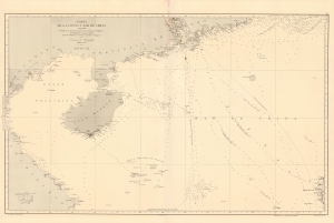
Carta de la Costa y Mar de China comprendida entre el Cabo Batangan y el Canal de Formosa con parte de la Isla de Luzon, segun los trabajos mas recientes macionales y estrangeros.
sold
- Digital Map Information
- Suitable for large format printing
- File Size: 48.36 MB
- File Type: ZIP / TIFF
- ICC color profile embedded
- Delivered instantly via download link
A rare 1869 Direccion Hidrografía nautical map detailing the China coast and the South China Sea from, roughly, Hong Kong and Macao south to Hue (Vietnam) and Luzon (the Philippines), thus embracing a highly-trafficked and critical trade and strategic channel in the 19th century (as today). The map focuses heavily on coastal maritime routes, but pushes inland along major river arteries, including a detailed mapping of the Pearl River Delta as far as Canton (Guangzhou). In Vietnam, several factorias antiguas are noted, underscoring early European trade activity. (more details)
Includes the city of Iloilo, the third most active port in the Philippines.
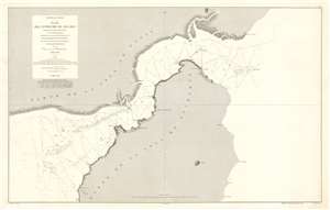
Archipiélago Filipino. Plano del Estrecho de Ilo - Ilo.
sold
- Digital Map Information
- Suitable for large format printing
- File Size: 53.29 MB
- File Type: ZIP / TIFF
- ICC color profile embedded
- Delivered instantly via download link
This is an 1875 Direccion de Hidrografia and D. Claudio Montero nautical chart or maritime map of the Iloilo Strait in the Philippines. The Iloilo Strait separates Panay Island from Guimaras Island and connects the Panay Gulf with the Guimaras Strait. Depth soundings are indicated throughout, as are banks and shoals. Points along the coast are labeled, as is the port city of Iloilo, which is today the third busiest port in the Philippines with regard to number of ships. A manuscript anchor in drawn near Iloilo, indicating the presence of a safe harbor. (more details)
Out of the Sulu Sea.
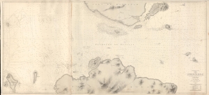
Archipiélago Filipino. Carta del Estrecho de Basilan.
sold
- Digital Map Information
- Suitable for large format printing
- File Size: 174.45 MB
- File Type: ZIP / TIFF
- ICC color profile embedded
- Delivered instantly via download link
A rare 1886 nautical map of the Basilan Strait, Sulu Sea, Mindanano, Philippines. The strait was (and remains) a critical passage through the Sulu Archipelago and major access point to the Moro Gulf, southern Mindanano, and the trans-Pacific passage. (more details)
Philippine-American War reissue of a Spanish Map of the Philippines.
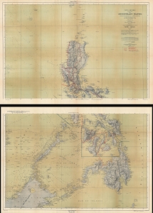
Carta General (en dos hojas) del Archipiélago Filipino.
sold
- Digital Map Information
- Suitable for large format printing
- Full resolution TIFF file
- ICC color profile embedded
- Delivered instantly via download link
This is a 1901 U.S. War Department map of the Philippines. Published during the Philippine-American War (1899 - 1902), the War Department repurposed a Spanish Direccion Hidrografia map originally published in 1870. (more details)