
Münster, Sebastian (sold)
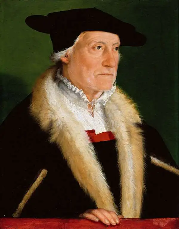
Sebastian Münster (January 20, 1488 - May 26, 1552), was a German cartographer, cosmographer, Hebrew scholar and humanist. He was born at Ingelheim near Mainz, the son of Andreas Munster. He completed his studies at the Eberhard-Karls-Universität Tübingen in 1518, after which he was appointed to the University of Basel in 1527. As Professor of Hebrew, he edited the Hebrew Bible, accompanied by a Latin translation. In 1540 he published a Latin edition of Ptolemy's Geographia, which presented the ancient cartographer's 2nd century geographical data supplemented systematically with maps of the modern world. This was followed by what can be considered his principal work, the Cosmographia. First issued in 1544, this was the earliest German description of the modern world. It would become the go-to book for any literate layperson who wished to know about anywhere that was further than a day's journey from home. In preparation for his work on Cosmographia, Münster reached out to humanists around Europe and especially within the Holy Roman Empire, enlisting colleagues to provide him with up-to-date maps and views of their countries and cities, with the result that the book contains a disproportionate number of maps providing the first modern depictions of the areas they depict. Münster, as a religious man, was not producing a travel guide. Just as his work in ancient languages was intended to provide his students with as direct a connection as possible to scriptural revelation, his object in producing Cosmographia was to provide the reader with a description of all of creation: a further means of gaining revelation. The book, unsurprisingly, proved popular and was reissued in numerous editions and languages including Latin, French, Italian, and Czech. The last German edition was published in 1628, long after Münster's death of the plague in 1552. Cosmographia was one of the most successful and popular books of the 16th century, passing through 24 editions between 1544 and 1628. This success was due in part to its fascinating woodcuts (some by Hans Holbein the Younger, Urs Graf, Hans Rudolph Manuel Deutsch, and David Kandel). Münster's work was highly influential in reviving classical geography in 16th century Europe, and providing the intellectual foundations for the production of later compilations of cartographic work, such as Ortelius' Theatrum Orbis Terrarum Münster's output includes a small format 1536 map of Europe; the 1532 Grynaeus map of the world is also attributed to him. His non-geographical output includes Dictionarium trilingue in Latin, Greek, and Hebrew, and his 1537 Hebrew Gospel of Matthew. Most of Munster's work was published by his stepson, Heinrich Petri (Henricus Petrus), and his son Sebastian Henric Petri.
Discovery Era World Map.
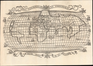
Typus Cosmographicus Universalis.
sold
- Digital Map Information
- Suitable for large format printing
- Full resolution TIFF file
- ICC color profile embedded
- Delivered instantly via download link
This is Joachim Vadian's rare 1534 woodcut map of the world, combining a largely Ptolemaic formulation of Europe and Asia with what was a modern depiction of Africa and the New World. It is one of the earliest maps to name America. While largely derived from the map Sebastian Münster prepared for Simon Grynaeus in 1532, it is in many ways a better representation of Münster's source, the 1507 map of Martin Waldseemüller. (more details)
First printed map to show the American Pacific Northwest.
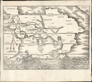
[Africa / Asia Maior / Terra incognita].
sold
- Digital Map Information
- Suitable for large format printing
- DPI: 600
- File Size: 8.5 MB
- File Type: ZIP / TIFF
- ICC color profile embedded
- Delivered instantly via download link
This is the rare 1538 Sebastian Münster map of Asia created for inclusion in his edition of Solinus' Polyhistor. This map preceded the map of Asia in Münster's 1540 Geographia by two years. Although it is not entirely a modern work, it is the earliest printed map to focus on the continent of Asia. It also contains the first printed representation of the Pacific Northwest, more than 30 years before the Ortelius map generally granted that laurel. (more details)
The first printed map of the Pacific Northwest.
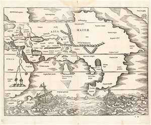
[Africa/ Asia Maior/ Terra incognita]
sold
- Digital Map Information
- Suitable for large format printing
- Full resolution TIFF file
- ICC color profile embedded
- Delivered instantly via download link
This is a rare 1538 map of Asia, executed by Sebastian Münster for inclusion in his edition of Solinus' Polyhistor. It predates by two years the map of Asia in Münster's 1540Geographia. Although it is not entirely a modern work, it is the earliest printed map focusing on the continent of Asia. It also contains the first printed representation of the Pacific Northwest, more than thirty years prior to the Ortelius map generally granted that laurel. (more details)
Attractive, southern-oriented map of Germany.
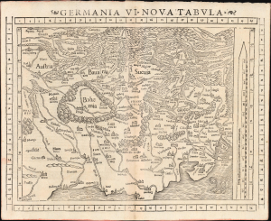
Germania VI. Nova Tabula.
sold
- Digital Map Information
- Suitable for large format printing
- Full resolution TIFF file
- ICC color profile embedded
- Delivered instantly via download link
This is a superb example of Sebastian Münster's modern map of Germany and Central Europe, in a desirable 1552 Geographia edition. It is one of the earliest acquirable modern maps of the heart of Europe. (more details)
Desirable Edition of an Early Holy Land Map.
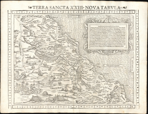
Terra Sancta XXIII Nova Tabula.
sold
- Digital Map Information
- Suitable for large format printing
- Full resolution TIFF file
- ICC color profile embedded
- Delivered instantly via download link
This is Sebastian Münster's 1540 map of the Holy Land, here in the distinctive 1552 state (with coordinate bars) appearing in the last edition of Münster's Ptolemy. This attractive and evocative map was broadly influential. While predated by its source, Jacob Ziegler's 1532 Holy Land, Münster improved both on the aesthetics and content of the map. Moreover, the inclusion of this map both in Münster's Geographia and in his Cosmographia extended this geography far beyond the reach of Ziegler's scholarly works. Among the earliest printed maps of this part of the world, Münster's is the most decorative. (more details)
First printed map of the Western Hemisphere.
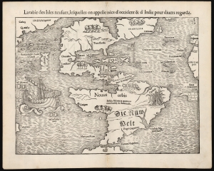
La table des Isles neufues, lesquelles on appelle isles d'occident et d Indie pour divers regardz.
sold
- Digital Map Information
- Suitable for large format printing
- Full resolution TIFF file
- ICC color profile embedded
- Delivered instantly via download link
This is an excellent 1552 French-text edition of Sebastian Münster's 1540 map of America, the first printed map of the Western Hemisphere. From 1544, this map was included in Münster's Cosmographia. The 1552 editions are the last published in Münster's lifetime - after which production quality significantly declined. Cosmographia long outlasted Münster, remaining the best source for over 40 years for anyone who wished to know about the world. Consequently, this map had a disproportionate impact, providing the first glimpse of the New World to Europeans for nearly half a century. (more details)
Earliest obtainable modern map of Poland and Hungary.
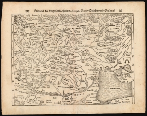
Landftafel des Ungerlands / Polands / Reüssen / Littaw / Walachei unnd Bulgarei.
sold
- Digital Map Information
- Suitable for large format printing
- Full resolution TIFF file
- ICC color profile embedded
- Delivered instantly via download link
This is the 1564 German edition of Sebastian Münster's map of Poland and Hungary, the first acquirable map to focus on the region using contemporary place names and geographical knowledge. (more details)
Habitable world as known to the ancients.
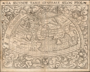
La Seconde Table Generale Selon Ptol.
sold
- Digital Map Information
- Suitable for large format printing
- Full resolution TIFF file
- ICC color profile embedded
- Delivered instantly via download link
An attractive example of Sebastian Münster's 1540 map of the world, according to Claudius Ptolemy, in a 1568 French text edition. The map details the Oikumene, the inhabited world as it was known to the Roman Empire of the second century, well before the Age of Discovery. It covers only the 'Old World' from the Atlantic (Pillars of Hercules) to Indochina, and from the Arctic to the Tropic of Capricorn. The map is surrounded by aeoli and clouds. (more details)
Earliest acquirable map of Europe based on contemporaneous knowledge.
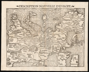
Description Nouvelle D'Europe.
sold
- Digital Map Information
- Suitable for large format printing
- Full resolution TIFF file
- ICC color profile embedded
- Delivered instantly via download link
This is a 1568 edition of Sebastian Münster's 1540, southern-oriented map of Europe: the first acquirable map of Europe based on contemporary geographical information and the only acquirable derivative of Martin Waldseemüller's unobtainable 1511 map of Europe. Münster's Geographia and Cosmographia provided for many years the literate European's only glimpses of the world, and these two works contained a number of maps with previously unseen, contemporaneous knowledge of the areas they depicted. For Münster's readership, this map was almost certainly the first depiction of their home continent, not based on the 2nd-century work of Claudius Ptolemy. (more details)
India-Beyond-The-Ganges as known to Ancient Rome.
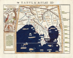
Tabulas Asiae XI.
sold
- Digital Map Information
- Suitable for large format printing
- Full resolution TIFF file
- ICC color profile embedded
- Delivered instantly via download link
This is a 1540, first edition first state example of Sebastian Münster's Ptolemaic map of Southeast Asia and the Malay Peninsula. The region was known to ancient geographers as 'India Extra Gangem,' or 'India Beyond the Ganges.' (more details)
First Edition, First State.
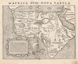
Africa XVIII. Nova Tabula.
sold
- Digital Map Information
- Suitable for large format printing
- Full resolution TIFF file
- ICC color profile embedded
- Delivered instantly via download link
This is the rare 1540 first edition of Sebastian Münster's map of Africa, the earliest detailed map of the continent available to the collector, here in its earliest state. As is to be expected for an early printing strike, the image is bold, sharp and clear. This attractive and evocative map was broadly influential: for more than thirty years during the age of discovery, this map would be the predominant representation of Africa available to the European reader. (more details)
First Edition, First State.
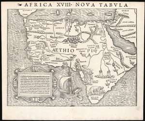
Africa XVIII. Nova Tabula.
sold
- Digital Map Information
- Suitable for large format printing
- Full resolution TIFF file
- ICC color profile embedded
- Delivered instantly via download link
This is the rare 1540 first edition of Sebastian Münster's map of Africa, the earliest detailed map of the continent available to the collector, here in its earliest state. As is to be expected for an early printing strike, the image is bold, sharp and clear. This attractive and evocative map was broadly influential: for more than thirty years during the age of discovery, this map would be the predominant representation of Africa available to the European reader. (more details)
First Edition, First State.
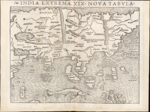
India Extrema, XIX Nova Tabula.
sold
- Digital Map Information
- Suitable for large format printing
- Full resolution TIFF file
- ICC color profile embedded
- Delivered instantly via download link
This is the rare 1540 first-edition first-state of Sebastian Münster's map of Asia, the first printed map of that continent based on contemporary data and the earliest obtainable map of the continent overall. This attractive and evocative map was broadly influential: for more than 30 years during the age of discovery, this map was the predominant representation of Asia available to Europeans. (more details)
The earliest modern map to clearly depict Poland and Hungary.
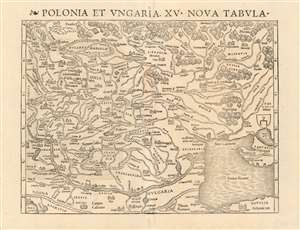
Polonia et Ungaria, XV. Nova Tabula.
sold
- Digital Map Information
- Suitable for large format printing
- DPI: 600
- File Size: 37.24 MB
- File Type: ZIP / TIFF
- ICC color profile embedded
- Delivered instantly via download link
This is the scarce 1540 first state of Sebastian Münster's map of Poland and Hungary, the first map to focus on the region using contemporary place names and geographical knowledge. The only earlier printed maps to focus at all on the region were iterations of Ptolemy's maps of Sarmatia in Europe; the nearest contender for an earlier modern map of the region is Waldseemüller's 1513 Tabula moderna Sarmatie which was of broader scope (reaching as far west as Germany and the Bavarian Alps) and whose geography for the region is far more primitive. Münster's map is the first of this region to present the reader with a largely recognizable depiction of Poland and Hungary. (more details)
Earliest modern map to clearly depict Poland and Hungary.
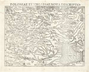
Polonia et Ungariae Nova Descriptio.
sold
- Digital Map Information
- Suitable for large format printing
- Full resolution TIFF file
- ICC color profile embedded
- Delivered instantly via download link
This is the 1559 Latin edition of Sebastian Münster's map of Poland and Hungary, the first acquirable map to focus on the region using contemporary place names and geographical knowledge. The only earlier printed maps to focus at all on the region were iterations of Ptolemy's maps of Sarmatia in Europe; the nearest surviving contender for an earlier modern map of the region is Waldseemüller's 1513 Tabula moderna Sarmatie which was of broader scope (reaching as far west as Germany and the Bavarian Alps) and whose geography for the region is far more primitive. Bernard Wapowski's c. 1526 map of Sarmatia informed Münster's ma, but only fragments of it have survived. Münster's map is thus the first of this region available to the collector with a largely recognizable depiction of Poland and Hungary. (more details)
Quintessential Discovery Era World.
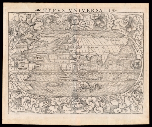
Typus Universalis.
sold
- Digital Map Information
- Suitable for large format printing
- Full resolution TIFF file
- ICC color profile embedded
- Delivered instantly via download link
This is a superb example of the scarce first block of Sebastian Münster's 1540 map of the world, one of the most distinctive maps of the Age of Discovery. It is a remarkable work of synthesis, providing the best summation of the rapidly expanding known world. Although this first block only appeared in the few editions of Münster's Geographia and Cosmographia that were printed prior to 1550, its content was largely preserved in the second block which replaced it. Thus, it was able to provide a broad audience their first image of the post-Magellanic world, unchallenged until the 1570 publication of Ortelius' Theatrum Orbis Terrarum. The present example is the 1545 third state of the map. (more details)
Earliest map of Greece based on contemporaneous knowledge, in a desirable issue.
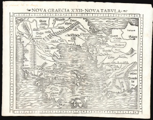
Nova Graecia XXII Nova Tabula.
sold
- Digital Map Information
- Suitable for large format printing
- Full resolution TIFF file
- ICC color profile embedded
- Delivered instantly via download link
This is a superb example of Sebastian Münster's modern map of Greece, in the desirable 1552 Geographia edition, the only one to include the distinctive coordinate borders. It is the first detailed map specifically of Greece based on contemporary geographical information. (more details)
First printed map of the Western Hemisphere in one of its earliest printings.
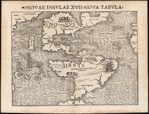
Novae Insulae XVII Nova Tabula.
sold
- Digital Map Information
- Suitable for large format printing
- Full resolution TIFF file
- ICC color profile embedded
- Delivered instantly via download link
This is a superb example of Sebastian Münster's map of America, the first printed map of the Western Hemisphere. This map appeared in the second, 1542 printing of Münster's edition of Ptolemy's Geographia, preceded only by the 1540. As is to be expected for an early printing strike, the image is bold, sharp, and clear. This attractive and evocative map was broadly influential. Münster's Geographia was one of the earliest versions of Ptolemy's work to systematically include maps showing contemporary geographical knowledge, but the map's 1544 inclusion in Münster's magnum opus, Cosmographia Universalis would insure that for more than thirty years during the age of discovery, this map would provide the first glimpse of the New World to the literate European. (more details)
2nd Century Persian Empire.
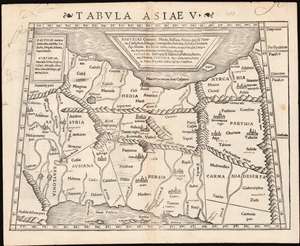
Tabula Asiae V.
sold
- Digital Map Information
- Suitable for large format printing
- Full resolution TIFF file
- ICC color profile embedded
- Delivered instantly via download link
This is a 1542 example of Sebastian Münster's Ptolemaic map of Persia, the fifth of Ptolemy's Asia maps. The map covers modern-day Iraq and Iran, extending from the Fertile Crescent to the desert south of the Caspian Sea. In the 1st and 2nd centuries CE, these territories were occupied by the Persian Empire, and its vassal kingdoms Carmania, Hyrcania, Parthia, Media, Assyria, Susiana (Elam), and Babylonia. The western limit of the map is marked by the Tigris and Euphrates Rivers; and the eastern by the Masdoranus Mountains (roughly corresponding to the Eastern Iranian Range). The map is bordered on the south by the Persian Gulf, and on the north by the southern shores of the Caspian Sea (then conceived as a wide and oval). (more details)
Scarce, early, Scandinavia.
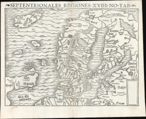
Septentrionales Regiones. XVIII. No. Tab.
sold
- Digital Map Information
- Suitable for large format printing
- Full resolution TIFF file
- ICC color profile embedded
- Delivered instantly via download link
This is Sebastian Münster's scarce woodcut map of Scandinavia and the northern parts of the European world, first added to his Cosmographia in 1544; this example is of its second, 1545 printing. It is one of the few examples of this map printed during its author's lifetime. It is an important work, being the earliest acquirable derivative of the 1539 milestone Olaus Magnus Carta Marina, then the most correct and detailed depiction of Scandinavia. The present work is, moreover, one of the scarcest of Münster's maps. Of more than 30 editions of Cosmographia, this map only appeared in nine, and in only two editions of his Ptolemy. (more details)
Earliest map of Czech, earliest map with a key!
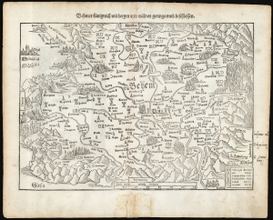
Behmer kunigreich mit bergen und waelden gerings umb beschlossen.
sold
- Digital Map Information
- Suitable for large format printing
- Full resolution TIFF file
- ICC color profile embedded
- Delivered instantly via download link
This is Munster's 1545 map of Bohemia, the earliest acquirable printed map of what is now the Czech Republic. This map appeared in the 1572 Latin edition Munster’s Cosmographia Universalis, a work notable for presenting to a broad lay audience many of the first printed maps based on contemporaneous surveys and toponymy, rather than data from classical sources. Munster’s source for this map was Nicolaus Claudianus’ 1518 map of Bohemia, which now exists in only one known surviving example. Munster's map is the only version of Claudianus' map available to the collector. (more details)
Earliest map of Czech, earliest map with a key!
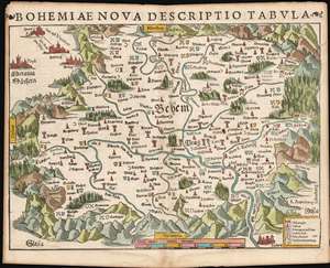
Bohemiae Nova Descriptio Tabula.
sold
- Digital Map Information
- Suitable for large format printing
- Full resolution TIFF file
- ICC color profile embedded
- Delivered instantly via download link
This is Munster's 1545 map of Bohemia, the earliest acquirable printed map of what is now the Czech Republic. This map appeared in the 1572 Latin edition Munster’s Cosmographia Universalis, a work notable for presenting to a broad lay audience many of the first printed maps based on contemporaneous surveys and toponymy, rather than data from classical sources. Munster’s source for this map was Nicolaus Claudianus’ 1518 map of Bohemia, which now exists in only one known surviving example. Munster's map is the only version of Claudianus' map available to the collector. (more details)
Earliest map of Czechia, earliest map with a key!
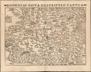
Bohemiae Nova Descriptio Tabula.
sold
- Digital Map Information
- Suitable for large format printing
- Full resolution TIFF file
- ICC color profile embedded
- Delivered instantly via download link
This is Sebastian Münster's 1545 map of Bohemia, the earliest acquirable printed map of what is now the Czech Republic. This example appeared in the 1572 Latin edition of Münster's Cosmographia Universalis, a work notable for presenting to a broad lay audience many of the first printed maps based on contemporaneous surveys and toponymy, rather than data from classical sources. Munster's source for this map was Nicolaus Claudianus' 1518 map of Bohemia, which now exists in only one known surviving example. Munster's map is the only version of Claudianus' map available to the collector. (more details)
The Earliest Acquirable Map of Bohemia, and the First Acquirable Map to Use a Key
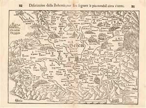
Discrizzion della Bohemia, oue son segnate le piu notabil citta é terre.
sold
- Digital Map Information
- Suitable for large format printing
- DPI: 600
- File Size: 10.23 MB
- File Type: ZIP / TIFF
- ICC color profile embedded
- Delivered instantly via download link
This is Munster's 1545 map of Bohemia, the earliest acquirable printed map of what is now the Czech Republic. The map appeared in an Italian edition of Munster’s Cosmographia Universalis, a work notable for presenting to a broad lay audience many of the first printed maps to rely on recent surveys and toponymy, rather than data from classical sources. Munster’s source for this map was Nicolaus Claudianus’ 1518 map of Bohemia, which now exists in only one known copy. Munster's map is the only version of Claudianus' map available to the collector. (more details)
Munster's Monsters!
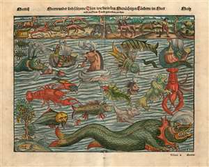
Meerwunder und seltzame Their/ wie die in den Mitnachigen Landern im Meer.
sold
- Digital Map Information
- Suitable for large format printing
- DPI: 600
- File Size: 22.62 MB
- File Type: ZIP / TIFF
- ICC color profile embedded
- Delivered instantly via download link
Often euphemistically referred to as Munster's Monsters, this is Sebastian Munster's bestiary of sea serpents and other terrifying monsters, some fictional, some real, that was included in the 1545 Cosmographia. Most of the beasts here are derived from a 1539 map of Scandinavia drawn by Olaus Magnus. Although Munster's Monsters may initially seam fabulous and scary, many are based upon or outright depictions the factual creatures that Scandinavian sailors and whalemen actually encountered. This woodcut was composed by the Swiss artist Hans Rudolf Manuel Deutsch, who produced many of Munster's woodcuts. The actual Formschneider is unknown beyond his initials, M-F, which appear along with 'Deutsch's HR-MD.'
Among the more recognizable beasts are various forms of whales with obvious blowholes, at least two enormous lobsters, a sea serpent (probably an oarfish), the whale fish (white fish at center, an Orca), and something that might very well be a walrus. Of course, there are fictional sea monsters too, including a pig faced sea beast, apparently seen by sailors in 1537, and the Sea Buffalo, something that looks like a cross between a bull and a fish.
Although much is made of Munster's sea creatures, it should be noted that his map also illustrates land based fauna, most of which is far more realistic. These include reindeer, beavers, sables, bears, a wolverine, snakes, and what might be some sort of large cat. In the lower left, there is a tree populated by 'duckbirds,' a curious kind of avian that Munster claims 'grows on trees' but which, in his lifetime, had not been seen for some 400 years.
Although not properly a map, Munster included this catalog of beasts in his Cosmographia to illustrate the natural world. Today we might look at a book like the Cosmographia and consider it an atlas for its many maps, but the work itself is more accurately an attempt to describe, as the name suggests, the entire cosmos. It included descriptions of flora, fauna, geological and astronomical observations, historical notes, and cultural (some might even say anthropological) commentary. (more details)
Among the more recognizable beasts are various forms of whales with obvious blowholes, at least two enormous lobsters, a sea serpent (probably an oarfish), the whale fish (white fish at center, an Orca), and something that might very well be a walrus. Of course, there are fictional sea monsters too, including a pig faced sea beast, apparently seen by sailors in 1537, and the Sea Buffalo, something that looks like a cross between a bull and a fish.
Although much is made of Munster's sea creatures, it should be noted that his map also illustrates land based fauna, most of which is far more realistic. These include reindeer, beavers, sables, bears, a wolverine, snakes, and what might be some sort of large cat. In the lower left, there is a tree populated by 'duckbirds,' a curious kind of avian that Munster claims 'grows on trees' but which, in his lifetime, had not been seen for some 400 years.
Although not properly a map, Munster included this catalog of beasts in his Cosmographia to illustrate the natural world. Today we might look at a book like the Cosmographia and consider it an atlas for its many maps, but the work itself is more accurately an attempt to describe, as the name suggests, the entire cosmos. It included descriptions of flora, fauna, geological and astronomical observations, historical notes, and cultural (some might even say anthropological) commentary. (more details)
Munster's Monsters!
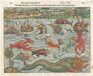
Monstra Marina et Terrestria, quae Passim in partibus aquilonis inueniuntur.
sold
- Digital Map Information
- Suitable for large format printing
- DPI: 300
- File Size: 5.93 MB
- File Type: ZIP / TIFF
- ICC color profile embedded
- Delivered instantly via download link
Often euphemistically referred to as Munster's Monsters , this is Sebastian Munster's bestiary of sea serpents and other terrifying monsters, some fictional, some real, that was included in the 1545 Cosmographia . Most of the beasts here are derived from a 1539 ... (more details)
Earliest map of Europe based on contemporaneous knowledge.
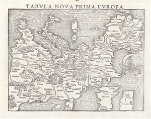
Tabula Nova Prima Europa.
sold
- Digital Map Information
- Suitable for large format printing
- Full resolution TIFF file
- ICC color profile embedded
- Delivered instantly via download link
This is a rare 1545 example of Sebastian Münster's southern-oriented map of Europe: an early imprint of the first acquirable map of Europe based on contemporary geographical information, and the only generally acquirable derivative of Martin Waldseemüller's unobtainable 1511 map of Europe. Münster's Geographia and Cosmographia provided for many years the literate European's only glimpses of the world, and these two works contained a number of maps with previously unseen contemporaneous knowledge of the areas they depicted. For Münster's readership, this map was almost certainly the first depiction of their home continent not based upon the 2nd century work of Claudius Ptolemy. (more details)
Earliest map of Greece based on contemporaneous knowledge, in a very early issue.
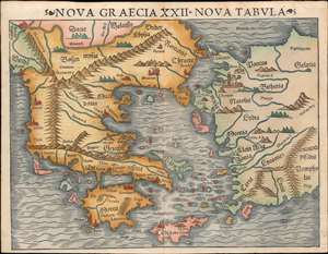
Nova Graecia XXII Nova Tabula.
sold
- Digital Map Information
- Suitable for large format printing
- File Size: 9.2 MB
- File Type: ZIP / TIFF
- ICC color profile embedded
- Delivered instantly via download link
This is a scarce 1545 example of Sebastian Münster's modern map of Greece: the second imprint of the first detailed map specifically of Greece and the Greek Islands based on contemporary geographical information. Münster's Geographia and Cosmographia provided for many years the literate European's only glimpses of the world, and these two works contained several maps with previously unseen contemporaneous knowledge of the areas they depicted. For Münster's readership, this map was the first depiction of Greece not based upon the 2nd century work of Claudius Ptolemy. This map appeared in Geographia as a somewhat late addition: the 1540 and 1542 editions of the work did not include this map. It would appear again in the 1552 Ptolemy (with the added coordinate bars characteristic of that edition.) It first appeared in the 1544 debut edition of Münster's Cosmographia and would appear in all editions of that work until 1578. In that 1544 German edition, the title of the map explicitly states Münster's intent: 'Neüw Griechen land mit andern anstoffenden in lendern/ wie es zu unsern zeiten beschreiben ist' - 'New Greece... as it is described in our era.' (more details)
Most beautifully executed woodcut map of Europe.
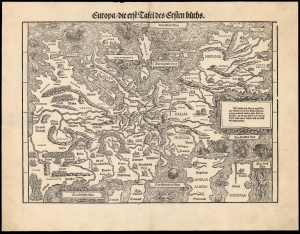
Europa die erst Tafel des Ersten Buchs.
sold
- Digital Map Information
- Suitable for large format printing
- DPI: 600
- File Size: 36.82 MB
- File Type: ZIP / TIFF
- ICC color profile embedded
- Delivered instantly via download link
This is a rare, 1548 example of Johann Stumpf's southern oriented map of Europe. It is the only map derived from Sebastian Münster's map of the continent, and thus is the last derivative of Martin Waldseemüller's unobtainable 1511 map of Europe. While Münster's map went to many editions and is readily acquirable, Stumpf's work was produced in significantly smaller numbers and consequently is a much rarer work. It is moreover larger and more beautifully executed, and is consequently more desirable. (more details)
Italian Edition of the Earliest Acquirable Plan of Paris.
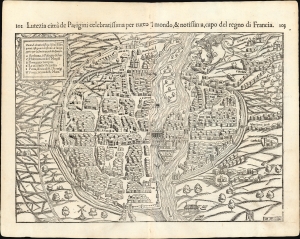
Lutetia Parisiorum urbs, toto orbe celeberrima notissimaque, caput regni Franciæ.
sold
- Digital Map Information
- Suitable for large format printing
- Full resolution TIFF file
- ICC color profile embedded
- Delivered instantly via download link
This attractive 1550 woodcut map of Paris is the earliest acquirable plan of the city, here from the 1558 Italian edition of Sebastian Münster's Cosmographia. (more details)
French Edition of the Earliest Acquirable Plan of Paris, including the earliest printed view of Poitiers.
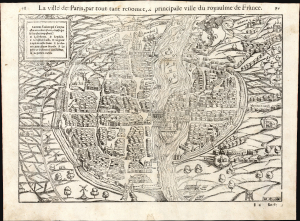
La Ville de Paris.
sold
- Digital Map Information
- Suitable for large format printing
- Full resolution TIFF file
- ICC color profile embedded
- Delivered instantly via download link
This attractive 1568 woodcut map of Paris is the earliest acquirable plan of the city, here from a French edition of Sebastian Münster's Cosmographia. (more details)
Sebastian Münster's Home City.
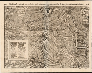
Basiliensis civitatis contrafactura, adumbrata ad genuinum eius situm, quem anno 1549, habuit.
sold
- Digital Map Information
- Suitable for large format printing
- Full resolution TIFF file
- ICC color profile embedded
- Delivered instantly via download link
Sebastian Münster's lively and remarkably accurate woodcut bird's-eye view of Basel, Switzerland's old town as it stood in 1549, is the earliest acquirable map of that city. It is preceded only by the view appearing in the 1493 Nuremberg Chronicle. Münster's work is particularly significant, as it is a representation of the mapmaker's home city. (more details)
One of the Earliest Acquirable Views of Venice.
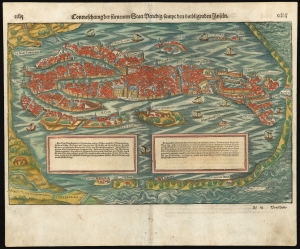
Contrafehtung der fürnemen Statt Venedig sampt den umbligenden Inseln.
sold
- Digital Map Information
- Suitable for large format printing
- Full resolution TIFF file
- ICC color profile embedded
- Delivered instantly via download link
This is Sebastian Munster's attractive 1592 woodcut view of Venice. It displays the famous city, emphasizing the turbulent waters beyond the sand banks and the calm shallows in which the city lies protected. Many of the city's famous buildings and churches are labeled, including the iconic Piazza San Marco. (more details)
One of Bavaria's Oldest Towns.
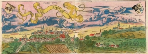
Die Bischoffliche Statt Freisingen im Bayerlandt zwischen Landtshût und Muenchen gelegen.
sold
- Digital Map Information
- Suitable for large format printing
- DPI: 600
- File Size: 28.78 MB
- File Type: ZIP / TIFF
- ICC color profile embedded
- Delivered instantly via download link
An old-color 1592 woodcut Münster view of the medieval university town of Freising, Bavaria, as the title describes it, 'The episcopal town of Freisingen in Bavaria between Landtschut and Munich'. One of the oldest settlements of Bavaria, the view presents the city from the north, upon its two prominent hills. Freising was an important diocese, and the view highlights the city's cathedral and churches.
The view is embellished with the arms of the Prince-Bishop of Freising (who had supplied the view to Münster) and the arms of the city itself, featuring the saddled bear of Saint Corbinian. (In the saint's hagiography, whilst en route to Rome, a bear killed his packhorse. The saint successfully commanded the bear to carry the load the rest of the way to Rome.) A church dedicated to the Saint can be seen atop the hill overlooking the town. (more details)
The view is embellished with the arms of the Prince-Bishop of Freising (who had supplied the view to Münster) and the arms of the city itself, featuring the saddled bear of Saint Corbinian. (In the saint's hagiography, whilst en route to Rome, a bear killed his packhorse. The saint successfully commanded the bear to carry the load the rest of the way to Rome.) A church dedicated to the Saint can be seen atop the hill overlooking the town. (more details)
One of the Earliest Acquirable Views of Istanbul.
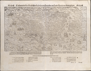
Constantinopel, des griechischen Keyserthumbs Hauptstatt im Landt Thracia am Meere gelegen.
sold
- Digital Map Information
- Suitable for large format printing
- Full resolution TIFF file
- ICC color profile embedded
- Delivered instantly via download link
This is Sebastian Münster's attractive, 1550 woodcut bird's-eye view map of Constantinople (Istanbul), one of the earliest acquirable. It displays the famous city in detail viewed from the east, emphasizing both its ancient ruins and its contemporary monuments, including the Hagia Sophia, the palace of Constantine, the Gynoecium, and the Ottoman Imperial Arsenal. The city's suburbs of Pera can be seen to the north on the right side of the view. The waters of the Bosporus are teeming with ships of every description. (more details)
First edition of the earliest printed map of Amsterdam available to the collector.
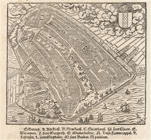
[Untitled Bird's Eye View of Amsterdam].
sold
- Digital Map Information
- Suitable for large format printing
- Full resolution TIFF file
- ICC color profile embedded
- Delivered instantly via download link
This is Sebastian Münster's 1550 view / map of Amsterdam, the earliest acquirable printed map of that city. It was preceded only by the 1544 wall map of Cornelis Anthonisz, Münster's source for this view. Anthonisz's wall map - which survives in fewer than ten examples - represented the best (and only) firsthand depiction of Amsterdam of its time. Its depiction in 1550 by Münster and in 1572 by Braun and Hogenberg established as the dominant 16th century image f what would become the chief economic engine of the seventeenth century. (more details)
An Old-Colored Example of the Earliest Acquirable Printed Map of the African Continent.
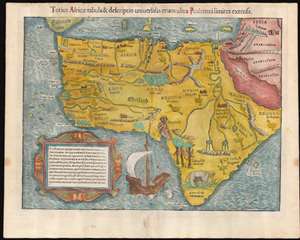
Totius Africae tabula et descriptio universalis etiam ultra Ptolemaei limites extensa.
sold
- Digital Map Information
- Suitable for large format printing
- Full resolution TIFF file
- ICC color profile embedded
- Delivered instantly via download link
This is a 1550 Latin Cosmographia edition of Sebastian Münster's 1540 map of Africa, the earliest map of the continent available to the collector. For more than thirty years during the age of discovery, this map would be the predominant representation of Africa for the European reader. The purpose of the map was to reveal, to a lay readership, the still-momentous discoveries that the waters around Africa represented a navigable route to the Indian Ocean, a reality not known to classical geographers. The Latin title of the map emphasizes this:
The map and description of the whole of Africa extended even beyond the limits of Ptolemy.Within its generally-recognizable depiction of the shape of the continent, Münster's work presents an amalgam of sources. Most of the general detail of North Africa is derived from Ptolemaic geography, as is the depiction of the Nile with its sources in the lakes of the Mountains of the Moon (Ptolemy's assumptions about the sources of that river would remain unchallenged on maps of Africa until the end of the 17th century.) Many place names in North Africa were likely drawn from Leo Africanus' 1526 Descrittione dell 'Africa, though many - for example, Garamantes - are drawn from classical historians such as Herodotus. Münster draws on Portuguese sources for west Africa. (Cadamosto's 15th century journeys there would reveal the Cape Verde Islands, which appear here.) Numerous kingdoms are noted throughout the continent and are marked by a crown and scepter. Some of these include the Arab kingdoms of Melinde and Quiola, Meroë, where the Nubian kings are said to be buried, and Hamarichthe capital of the kingdom of the mythical Christian king Prester John. In an elegant frame, Münster includes a descriptive text describing the route taken by the Portuguese around the African coast to arrive at Calicut, modern Kozhikode on the western coast of India:
From Portugal to the Eastern Empire of Calicut, we arrive by this sea route. On the western side of Mauritania and Getulia, we arrive at Cape Verde, formerly called Experias, where the Hesperides Islands are seen. After having passed Ethiopia we find the southern cape, which is the Cape of Good Hope, which reaches nine degrees below the Tropic. Soon the region bends to to Cape Prassum, which Ptolemy placed at his southernmost limits and called an unknown land. Thence the road is open to the Troglodites, where the gold mines of Zaphala were known even to the ancients. From thence, having crossed the kingdom of Melinde, we pass through the Barbarian Gulf, into the Indian Ocean, and at length to the city of Calicut.(The text is typeset, and changes typographically from edition to edition - but in all editions it appears to adhere to this same topic.) (more details)
Earliest Acquirable Derivative of the First Map of France made in France.
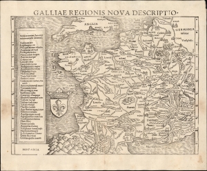
Galliae Regionis Nova Descriptio.
sold
- Digital Map Information
- Suitable for large format printing
- Full resolution TIFF file
- ICC color profile embedded
- Delivered instantly via download link
This elegant 1550 woodcut map by Sebastian Münster is one of the earliest acquirable true modern maps of France, being based on the unacquirable 1525 Oronce Finé Nova Totius Galliae descriptio, the first map of France produced in France based on contemporaneous observations. Münster's work is the earliest acquirable derivative of that groundbreaking map. (more details)
First Issue of the Earliest Acquirable Plan of Paris.
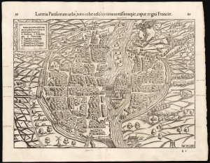
Lutetia Parisiorum urbs, toto orbe celeberrima notissimaque, caput regni Franciæ.
sold
- Digital Map Information
- Suitable for large format printing
- Full resolution TIFF file
- ICC color profile embedded
- Delivered instantly via download link
This attractive 1550 woodcut map of Paris is the earliest acquirable plan of the city, here in its first printing in Sebastian Münster's Cosmographia. (more details)
An Early Woodcut Map of the Holy Land.
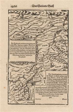
[Woodcut map of the Eastern Mediterranean Sea, Cyprus and the Holy Land.
sold
- Digital Map Information
- Suitable for large format printing
- DPI: 600
- File Size: 14.68 MB
- File Type: ZIP / TIFF
- ICC color profile embedded
- Delivered instantly via download link
This is a Sebastian Münster's woodcut map of the Holy Land and Cyprus, from a German edition of his masterwork, Cosmographia. The map contextualizes the Holy Land with the whole Levant, from Egypt to the coast of Asia Minor. The map includes the track of the Israelites from Egypt to Canaan. The Arabian city of Medina appears at the southernmost extent of the map.
The image first appeared in the expanded 1550 editions of Munster's Cosmographia, a work which for more than half a century provided the European literate layperson their best source of information about the world. The map's detail may have been largely drawn from Waldseemüller's Ptolemaic map of the Holy Land and the Fertile Crescent but focusing specifically on the Biblical lands and narrowing the selection of place names to reflect the Biblical era. It is interesting the Münster retains the northern orientation of the Ptolemaic Quarta Asia Tabula rather than adopting the eastern orientation of the medieval Sanuto-Vesconte, which would dominate the mapping of these lands well into the eighteenth century. That orientation allows for the inclusion of the island of Cyprus, set amongst the waves of the Mediterranean Sea. There is also a sea monster and a sailboat. (more details)
The image first appeared in the expanded 1550 editions of Munster's Cosmographia, a work which for more than half a century provided the European literate layperson their best source of information about the world. The map's detail may have been largely drawn from Waldseemüller's Ptolemaic map of the Holy Land and the Fertile Crescent but focusing specifically on the Biblical lands and narrowing the selection of place names to reflect the Biblical era. It is interesting the Münster retains the northern orientation of the Ptolemaic Quarta Asia Tabula rather than adopting the eastern orientation of the medieval Sanuto-Vesconte, which would dominate the mapping of these lands well into the eighteenth century. That orientation allows for the inclusion of the island of Cyprus, set amongst the waves of the Mediterranean Sea. There is also a sea monster and a sailboat. (more details)
Discovery Era World Revealed.
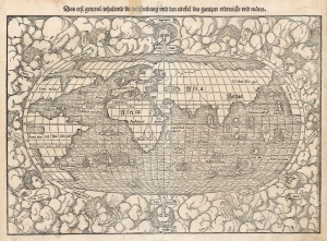
Das erst general inhaltend die beschreibung und den circkel des gantzen erdereichs und moeres.
sold
- Digital Map Information
- Suitable for large format printing
- DPI: 600
- File Size: 27.09 MB
- File Type: ZIP / TIFF
- ICC color profile embedded
- Delivered instantly via download link
This is Sebastian Münster's 1550 map of the world, one of the most distinctive maps produced during the Age of Discovery. In the mid-16th century, it was the best generally available summation of the rapidly expanding known world. The map was included in Münster’s magnum opus, Cosmographia Universalis, which for over 40 years was the go-to volume for the literate European seeking knowledge of the world. Consequently, this map had a disproportionate impact, providing a broad audience their first image of the post-Magellanic world. It was not challenged until the 1570 publication of Ortelius' Theatrum Orbis Terrarum. As important as its geographical revelations were, the map is also rich in the imagery of its era: it is bordered with billowing clouds and wind-heads marking the cardinal directions, puffing their breezes over the waters. The oceans are prowled by eight sea monsters and a sailing ship is shown crossing the Pacific and proudly firing its cannons. (more details)
A Circumnavigable Globe Revealed.
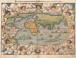
Das erst general, inhaltend die beschreibung und den circkel des gantzen erdtreichs und môres.
sold
- Digital Map Information
- Suitable for large format printing
- Full resolution TIFF file
- ICC color profile embedded
- Delivered instantly via download link
This is the first, 1550 German edition of the second block of Sebastian Münster's map of the world, one of the most distinctive to be produced during the Age of Discovery. In the mid-sixteenth century, it was the best summation of the rapidly-expanding known world available to the literate European. The map was included in Münster's magnum opus, Cosmographia Universalis, for over forty years was the primary source for anyone who wished knowledge of the world. Consequently, this map would have had a disproportionate impact, providing the first presentation of a circumnavigable world for nearly half a century. It would not be challenged until the 1570 publication of Ortelius' Theatrum Orbis Terrarum. As important as its geographical revelations were, the map is also rich in the imagery of its era: it is bordered with billowing clouds, with wind-heads marking the cardinal directions, puffing their breezes over the waters. The oceans are prowled by eight sea monsters; a sailing ship is shown crossing the Pacific and proudly firing its cannons. (more details)
Discovery Era World Revealed.
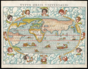
Typus Orbis Universalis.
sold
- Digital Map Information
- Suitable for large format printing
- Full resolution TIFF file
- ICC color profile embedded
- Delivered instantly via download link
This is Sebastian Münster's 1550 map of the world, one of the most distinctive maps produced during the Age of Discovery. In the mid-16th century, it was the best generally available summation of the rapidly expanding known world. The map was included in Münster's magnum opus, Cosmographia Universalis, which for over 40 years was the go-to volume for the literate European seeking knowledge of the world. Consequently, this map had a disproportionate impact, providing a broad audience with their first image of the post-Magellanic world. It was not challenged until the 1570 publication of Ortelius' Theatrum Orbis Terrarum. As important as its geographical revelations were, the map is also rich in the imagery of its era: it is bordered with billowing clouds and wind-heads marking the cardinal directions, puffing their breezes over the waters. Eight sea monsters prowl the oceans, and a sailing ship appears, crossing the Pacific and proudly firing its cannon. (more details)
First edition of the earliest acquirable view Frankfurt an der Oder.
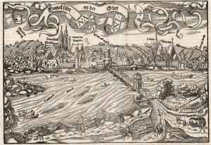
Frankfurt an der Oder Anno Dni. 1548 RMD.
sold
- Digital Map Information
- Suitable for large format printing
- DPI: 600
- File Size: 28.46 MB
- File Type: ZIP / TIFF
- ICC color profile embedded
- Delivered instantly via download link
This Sebastian Münster's lively 1550 view of Frankfurt an der Oder, in Germany near the border of Poland, one of the earliest acquirable printed images of that city. This example is of the first edition of Munster's Cosmographia in which it appeared, the much-expanded German edition of 1550. (more details)
The first map of the entire continent of Africa.
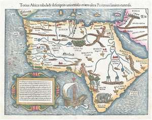
Totius Africae tabula et descriptio universalis etiam ultra Ptolemaeilimites extensa.
sold
- Digital Map Information
- Suitable for large format printing
- DPI: 300
- File Size: 5.71 MB
- File Type: ZIP / TIFF
- ICC color profile embedded
- Delivered instantly via download link
This is a historically groundbreaking c. 1550 Sebastian Münster map of Africa. Recognized as the first map to depict the entire continent, the map stretches from the Iberian Peninsula to the Cape of Good Hope and from the Cape Verde Islands to the Red Sea and ... (more details)
The first printed map of Asia.
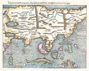
Tabula orientalis regionis, Asiae scilicet extremas complectens terras et regna.
sold
- Digital Map Information
- Suitable for large format printing
- DPI: 300
- File Size: 5 MB
- File Type: ZIP / TIFF
- ICC color profile embedded
- Delivered instantly via download link
This is a c. 1550 Sebastian Munster map of Asia, the first specific printed map of Asia and the earliest obtainable map of the continent. The map depicts the Asian continent from the Caspian Sea and the Persian Gulf to the Pacific Ocean and from the Arctic ... (more details)
Munster's second world map.
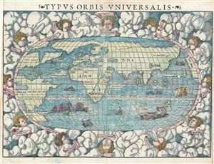
Typus Orbis Universalis.
sold
- Digital Map Information
- Suitable for large format printing
- DPI: 300
- File Size: 8.05 MB
- File Type: ZIP / TIFF
- ICC color profile embedded
- Delivered instantly via download link
One of the most recognizable maps of the 16th century, this is a fine colored example of Sebastian Munster's 1550 map of the world - considered the first map to identify the Pacific Ocean or, as here, 'Mare Pacificum.' This is the world of the educated ... (more details)
The Ptolemaic World.
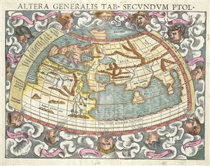
Altera generalis tab. Secundum Ptol.
sold
- Digital Map Information
- Suitable for large format printing
- DPI: 300
- File Size: 6.61 MB
- File Type: ZIP / TIFF
- ICC color profile embedded
- Delivered instantly via download link
An attractive c. 1550 example of Sebastian Munster's map of the world according to Claudius Ptolemy. The map details the world prior to the great age of discovery. As such, it covers only the 'Old World' from the Atlantic (Pillars of Hercules) to ... (more details)
The Ptolemaic World.

Altera generalis tab. Secundum Ptol.
sold
- Digital Map Information
- Suitable for large format printing
- DPI: 300
- File Size: 4.78 MB
- File Type: ZIP / TIFF
- ICC color profile embedded
- Delivered instantly via download link
An attractive c. 1550 example of Sebastian Munster's map of the world according to Claudius Ptolemy. The map details the world prior to the great age of discovery. As such, it covers only the 'Old World' from the Atlantic (Pillars of Hercules) to ... (more details)
Remarkable example, exhibiting Catholic censorship.
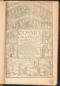
A superb, fascinating example of Sebastian Münster's masterpiece: his Cosmographia, in its much-expanded, first, Latin edition of 1550. Münster's work had between 1544 and 1548 been only published in German. With this edition, opening the work to an international audience, Münster added a wealth of larger and more elaborate images that would seal its popularity. This compendium would for more than half a century provide the European literate layperson their best source of information about the world, via its lively descriptions, engaging woodcut illustrations, and its array of maps. It was also one of the most copiously illustrated, early books, containing nearly 1000 woodcuts as well as the first separate maps of America and Asia, and the first detailed contemporaneous maps of Europe and Africa. Its regional maps present their respective areas in what were often the earliest modern depictions available to the reader.
That the book retained an audience long after its publication is attested to by the present example: almost two hundred and fifty years after its publication, it fell under the scrutiny of a Catholic censor, expurgating passages deemed harmful to the Church, the Papacy, and the modesty of the presumably Catholic reader. (more details)
That the book retained an audience long after its publication is attested to by the present example: almost two hundred and fifty years after its publication, it fell under the scrutiny of a Catholic censor, expurgating passages deemed harmful to the Church, the Papacy, and the modesty of the presumably Catholic reader. (more details)