Authenticity Guaranteed — We sell only original antique maps.
Geographicus Rare Antique Maps
Authenticity Guaranteed — We sell only original antique maps.
Navigation
Shopping Cart
Sort By Price: highest first

Spencer D. Hunt

A storyteller at heart, focused on 19th- and 20th-century conflict — with an eye for pictorial and allegorical maps.


I came to Geographicus through my passion for history. I believe in knowing our collective past and the surprising nuances that come with it — because in the end, history isn't about names and dates, it's about stories. Many of the stories I've found through Geographicus I'd never have encountered otherwise, and sharing them with clients is my favorite part of the work.

That passion started with an interest in WWII aircraft, which grew into a broader focus on 19th- and 20th-century conflict — the lens I bring to my work here. I'm also drawn to pictorial and allegorical maps, and editorial cartoons.

Monthly Digest of Spencer's Picks

Portrait of Spencer D. Hunt
Sort by
View 12 / 24 / All
< 1 2 >
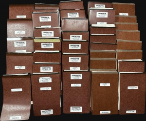
Most comprehensive record of the My Lai Massacre in private hands.

U.S. v. Henderson.

1971 (dated)
17 x 12 in (43.18 x 30.48 cm)
MyLaiArchive-hunt-1971

$250,000.00

Acquire
A Closer Look
This is a 37-volume archive of documents from the 1971 My Lai Massacre court-martial of Colonel Oran K. Henderson. Henderson was the highest-ranking officer tried in connection with My Lai, one of the most horrific events in American military history, and the last soldier to face a court-martial. The court-martial lasted 62 days and on December 17, 1971, Henderson was found not guilty. Henderson's court-martial ties for the longest court-martial in U.S. Army history with that of Lieutenant William Calley, the only member of the U.S. Army found guilty in connection with My Lai. (more details)
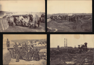
Unprecedented collection of 55 Mathew Brady photos capturing the Eastern Theater of the Civil War.

[Mathew Brady American Civil War Photo Archive (1861 - 1865)].

1865 (undated)
10 x 14 in (25.40 x 35.56 cm)
BradyArchive-bradyco-1865

$90,000.00

Acquire
A Closer Look
  • Digital Map Information
  • Suitable for large format printing
  • Full resolution TIFF file
  • ICC color profile embedded
  • Delivered instantly via download link
An extraordinary opportunity, this is a collection of 55 original Mathew Brady / Brady and Company albumen photographs covering the span of the American Civil War (1861 - 1865). The documentation of the Civil War by Brady and his colleagues marks the first instance in which the brutal realities of war were communicated to the general public via a medium as immediate and visceral as photography - an achievement that has led Brady to be called the 'First Photojournalist'. While individual Brady photos occasionally appear at auction and on the market, a collection of this magnitude is unprecedented. (more details)
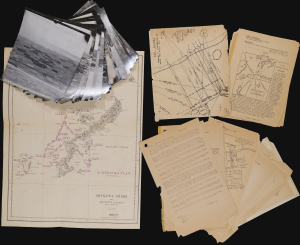
Operational archive documenting the final preparations for the invasion of Okinawa, the last great amphibious campaign of World War II.

Okinawa Shima and Adjacent Islands. Screen Plan Okinawa--1. / U.S.S. Monrovia (APA-31) Amphibious Assault on Okinawa.

1945 (dated)
21 x 16.5 in (53.34 x 41.91 cm)
MonroviaOkinawaInvasion-unknown-1945

$18,000.00

Acquire
A Closer Look
An extraordinary discovery and an even more improbable survival, this archive from the U.S.S. Monrovia preserves the operational record of the April 1, 1945, Invasion of Okinawa, the final great amphibious campaign of World War II (1939 - 1945). Comprising aerial reconnaissance photographs, operational maps, and briefing papers prepared as late as March 31, 1945, the collection captures the tense final hours before the assault. Few surviving archives so vividly illustrate the intelligence, planning, and meticulous coordination behind one of the most consequential military landings of the twentieth century. (more details)
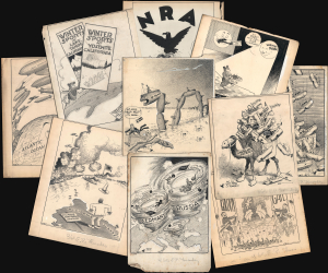
Unique historical record.

[Kettlewell Cartoons].

1935 (undated)
18 x 14 in (45.72 x 35.56 cm)
WWICartoons-kettlewell-1935

$6,500.00

Acquire
A Closer Look
A collection of 30 manuscript political cartoons, many with cartographic content, drawn by Frank 'Ket' Kettlewell for the Oakland Tribune. As a group, they constitute a unique comic record of world events c. 1916 - 1935. Each hand-drawn cartoon is a visually striking San Francisco-centric commentary on domestic or international affairs. 'Ket' has signed each, with many most featuring his signature tiny bird (which occasionally comments). (more details)
Unique record of D-Day.

Operations Overlay. Annex No. 1 to F.O. No. 1. HQ-357th Inf. 28 May 1944. / ADM. OVERLAY. France 1:25000 GSGS-4250. NEPTUNE ANNEX#2 TO FO#1 HQ 357th INF, May 28, 1944. / Annex 3a. Overlay to Accompany Intelligence Annex to FO #1 HQ 357th INF. 28 May 1944.

1944 (dated)
24 x 19 in (60.96 x 48.26 cm)
319thInfNeptuneOverlays-unknown-1944

$6,000.00

Acquire
A Closer Look
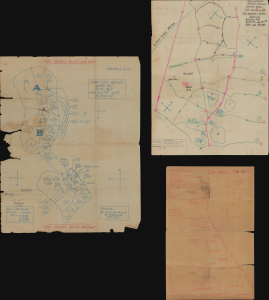
This is a collection of three 1944 World War II manuscript map overlays created nine days before the D-Day invasion in Normandy (May 28, 1944), all of which bear the classification BIGOT - TOP SECRET. All three were drawn for the 357th Infantry Regiment, which landed on Utah Beach on June 8, 1944, two days after D-Day. The overlays provide insight into how infantry soldiers prepared and the details these men valued enough to carry into the field. These overlays were found sewn into the collar of a uniform jacket a soldier received in the field. (more details)
Manuscript record of the voyage that nearly transformed the American Civil War into a global conflict.

[Voyage of the HMS Rinaldo, 1861-1863]

1863 (undated)
17.5 x 30.75 in (44.45 x 78.10 cm)
CivilWarVoyage-rinaldo-1863

$5,000.00

Acquire
A Closer Look
  • Digital Map Information
  • Suitable for large format printing
  • Full resolution TIFF file
  • ICC color profile embedded
  • Delivered instantly via download link
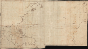
A unique c. 1863 manuscript map documenting one of the most consequential British naval voyages of the early American Civil War (1861 - 1865): the 1861-63 Atlantic cruise of HMS Rinaldo. Operating along the North American and West Indian Station, the British warship visited Union and Confederate ports, protected British commercial and diplomatic interests, and carried the released Confederate commissioners James Murray Mason and John Slidell- central figures in the Trent Affair - from Provincetown, Massachusetts, to St. Thomas in the Danish West Indies. This manuscript unites two important episodes in Anglo-American Civil War diplomacy: the resolution of the Trent Affair and the confrontation between General Butler and British acting consul George Coppell. (more details)
Planning Operation Hailstone - the World War II U.S. Navy attack on Truk Atoll.

Truk Atoll. Major Fortifications. / Truk - Air Target Folder II. Truk Islands. Target Area Map - Truk Islands. / [Untitled Aviation Chart of the East Caroline Islands.]

1944 (dated)
17 x 16 in (43.18 x 40.64 cm)
TrukIslandsTrukAtoll-jicpoa-1944

$3,500.00

Acquire
A Closer Look
  • Digital Map Information
  • Suitable for large format printing
  • Full resolution TIFF file
  • ICC color profile embedded
  • Delivered instantly via download link
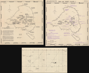
This important archive, compiled days after the World War II Battle of Kwajalein and weeks before Operation Hailstone, includes three 1944 U.S Navy maps of Truk Atoll (Chuuk Lagoon, Micronesia): two 1944 Joint Intelligence Center Pacific Ocean Areas (JICPOA) maps of Truk Atoll, and an aviation chart of the same. The map archive offers unique insights into the U.S. Navy's preparations to assault one of Japan's most formidable bases in the South Pacific. Truk Atoll was Imperial Japan's main naval base in the South Pacific, considered the 'Gibraltar of the Pacific'. (more details)
A glimpse into how WWII aviators were briefed before missions.

[Kwajalein Atoll Aerial Attack Archive.]

1944 (dated)
10.5 x 8 in (26.67 x 20.32 cm)
KwajaleinArchive-unknown-1944

$2,500.00

Acquire
A Closer Look
  • Digital Map Information
  • Suitable for large format printing
  • Full resolution TIFF file
  • ICC color profile embedded
  • Delivered instantly via download link
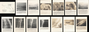
This is a 1943-1944 intelligence archive prepared for the aerial campaign preceding the invasion of Kwajalein Atoll, offering unique insights into how American World War II aircrews were briefed for combat missions. Strategically located, Kwajalein was occupied and fortified by Imperial Japan early in the war and became a principal American objective in the Central Pacific. U.S. forces landed on Kwajalein and Roi-Namur on January 31, 1944, following months of reconnaissance and preparatory bombing. Comprising annotated aerial photographs, target maps, a manuscript planning overlay, and a regional aviation chart, this archive reveals how pilots moved from broad theater geography to the identification of individual airfields, warehouses, gun positions, and other tactical targets. (more details)
Bringing aerial destruction to Nazi-dominated Europe.

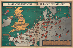
La Grande-Bretagne - Fer de Lance de l'Attaque.

1943 (undated)
19 x 29 in (48.26 x 73.66 cm)
FerdeLance-blake-1943

$2,500.00

Acquire
A Closer Look
  • Digital Map Information
  • Suitable for large format printing
  • Full resolution TIFF file
  • ICC color profile embedded
  • Delivered instantly via download link
This is a 1943 F. Donald Blake French-language pictorial propaganda map of Great Britain and continental Europe at the height of World War II (1939 - 1945). The map's message is clear: the tide of war has turned, and British RAF forces are taking a heavy toll on Nazi-dominated Europe. (more details)
A complete set of 79th Infantry Division route maps from World War II - maps created by the soldiers for the soldiers.

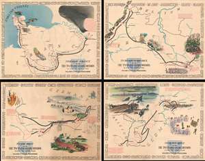
Through France with the 79th Infantry Division 14 June to 29 Aug, 1944. Maj Gen I.T. Wyche, Commanding. / To Belgium and Back wit the 79th Infantry Division 31 Aug to 25 Oct, 1944 Maj. Gen. I. T. Wyche, Commanding. / To the Rhine with the 79th Infantry Division 25 Oct to 14 Feb. 1945 Maj Gen I.T. Wyche, Commanding. / Over the Rhine with the 79th Infantry Division 17 Feb to 9 May 1945 Maj. Gen. I. T. Wyche, Commanding.

1945 (undated)
26 x 33 in (66.04 x 83.82 cm)
79thInfantrySet-kaliherwhite-1945-2

$2,200.00

Acquire
A Closer Look
  • Digital Map Information
  • Suitable for large format printing
  • Full resolution TIFF file
  • ICC color profile embedded
  • Delivered instantly via download link
This is a set of four Steve Kaliher and Harry D. White pictorial World War II route maps of the 79th Infantry's advance from Normandy to Germany. Presented on four separate sheets, a detailed summary of the division's progress across northern Europe from Utah Beach (one of the four Normandy beaches assaulted by Allied troops only eight days on what has become known as D-Day) to Mulheim, Germany. Each map traces a sequence of a few months in the combat history of the 79th with red lines labeled with dates marking the advance week by week and sometimes day to day. Text blocks narrate parts of the advance, providing insight into what the division accomplished during their over 300 days of combat. Cities and towns are identified throughout all four maps, as are rivers. Each map is framed by the names of cities and towns that the division passed through on their advance, fought for, and liberated, adding yet another level of memory to each piece. (more details)
Battle of the Ironclads.

The First Naval Conflict between Iron Clad Vessels. In Hampton Roads, March 9th 1862.

1862 (dated)
13.5 x 21 in (34.29 x 53.34 cm)
MonitorMerrimac-endicott-1862

$1,500.00

Acquire
A Closer Look
  • Digital Map Information
  • Suitable for large format printing
  • Full resolution TIFF file
  • ICC color profile embedded
  • Delivered instantly via download link
This is Charles Parsons' 1862 view of the American Civil War (1861 - 1865) naval battle between the USS Monitor and the CSS Virginia, a captured Union ship formerly called Merrimac. Although the battle was inconclusive, this first confrontation between ironclads ushered in a new era of naval warfare. (more details)
Informing and inspiring the Navy in WWII.

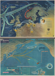
NavWarMap No. 3 World War 2 in the North Sea Area. / NavWarMap No. 4 The North Pacific Area.

1944 (dated)
39.5 x 58.5 in (100.33 x 148.59 cm)
NavWar3and4-usn-1944-2

$1,250.00

Acquire
A Closer Look
  • Digital Map Information
  • Suitable for large format printing
  • Full resolution TIFF file
  • ICC color profile embedded
  • Delivered instantly via download link
This is a 1944 double-sided Navy Education Services pictorial map, with northwestern Europe and the North Atlantic on one side and the northern Pacific Ocean on the other. These maps were issued for distribution to American naval personnel with the intent to both inform and inspire. (more details)
One the earliest obtainable maps of Yosemite!

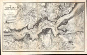
Map of the Yosemite Valley from Surveys made by order of the Commissioners to manage the Yosemite Valley and Mariposa Big Tree Grove.

1870 (dated)
17 x 26.75 in (43.18 x 67.94 cm)
YosemiteValley-gardner-1870

$1,200.00

Acquire
A Closer Look
  • Digital Map Information
  • Suitable for large format printing
  • Full resolution TIFF file
  • ICC color profile embedded
  • Delivered instantly via download link
This is Clarence King and James Terry Gardiner's detailed map of the Yosemite Valley, California. Published in 1870, it is considered one of the earliest obtainable maps of that region. This map represents early government efforts under Frederick Law Olmsted and Josiah Dwight Whitney to map Yosemite as America's first reserved parkland. It offers superb detail, noting the Merced River, Virgin Tears, Yosemite Falls, Sentinel Rock and Dome, Bridal Veil Falls and Creek, Mariposa Trail, and much more. Important buildings on the valley floor also appear - including Yosemite's first two tourist hotels! (more details)
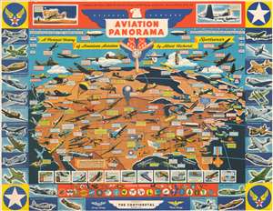
Promotes American aviation advancements and accomplishments in both the military and civilian spheres at the height of World War II.

Aviation Panorama. A Pictorial History of American Aviation. A Tribute to the Pioneer Spirit, the Inventive Genius, and the Courage of American Men and Women of the Air.

1943 (undated)
17 x 22 in (43.18 x 55.88 cm)
AviationPanorama-cheeseman-1943

$1,200.00

Acquire
A Closer Look
  • Digital Map Information
  • Suitable for large format printing
  • File Size: 29.23 MB
  • File Type: ZIP / TIFF
  • ICC color profile embedded
  • Delivered instantly via download link
Published in November 1943 at the height of World War II, this F.E. Cheeseman advertising broadside map of the United States promotes achievements and advances in American aviation. Dozens of different airplanes, varying from early biplanes to the most modern military bombers, fighters, and transport aircraft, are illustrated flying over the United States. (more details)
Ephemeral WWII mimeograph Route Map following the 318th Infantry Regiment.

Map Route CT 318.

1945 (dated)
23.75 x 16.125 in (60.32 x 40.96 cm)
318thInfReg-unknown-1945-2

$1,000.00

Acquire
A Closer Look
  • Digital Map Information
  • Suitable for large format printing
  • Full resolution TIFF file
  • ICC color profile embedded
  • Delivered instantly via download link
This is a 1945 mimeographed World War II unit route map of the 318th Infantry Regiment in Europe. It records the regiment's fight across Europe, noting milestones, and includes an operational report of the last days of combat in the European theatre, May 6-7, 1945, on the verso. As a mimeograph, this route map is unusual for the genre and limited by the medium, making it exceptionally ephemeral. (more details)
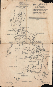
WWII Philippine Campaign - planning and prep.

Philippine Islands.

1944 (dated)
12.875 x 8 in (32.70 x 20.32 cm)
PhilippineIslands-ags-1944

$950.00

Acquire
A Closer Look
  • Digital Map Information
  • Suitable for large format printing
  • Full resolution TIFF file
  • ICC color profile embedded
  • Delivered instantly via download link
A unique survivor, this is a 1944 World War II Allied Geographical Section mimeographed map of the Philippines, issued for planning and preparation for the Philippine Campaign. Reproduced by Battalion Landing Team 184-2 less than a month before the invasion of Leyte, it captures the moment when Allied plans for returning to the Philippines were becoming battlefield reality. Its stark presentation and utilitarian mimeograph printing reflect its purpose as a working military document, prepared for troops about to enter one of the Pacific War's decisive campaigns. (more details)
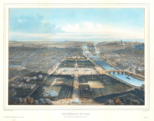
A moment of change.

Vue Générale de Paris prise du Rond-Point des Champs-Elysées, Nord-Ouest.

1897 (undated)
18.25 x 23 in (46.36 x 58.42 cm)
VueGeneraleParis-fichot-1897

$950.00

Acquire
A Closer Look
  • Digital Map Information
  • Suitable for large format printing
  • Full resolution TIFF file
  • ICC color profile embedded
  • Delivered instantly via download link
This is an exceptional c. 1896 Michel Charles Fichot chromolithograph bird's-eye view map of Paris, France. The view looks southeast down the Champs-Élysées towards the Place de la Concorde, the Jardin des Tuileries, and the Louvre. The Seine, with its iconic bridges, curves through the heart of the city. Pedestrians, carriages, and a battalion of soldiers ply the streets, emphasizing the bustling French capital. (more details)
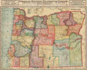
A 'most unblushing fraud upon the government'.

Oregon. Oregon and Western Colonization Company.

1911 (dated)
28 x 35.25 in (71.12 x 89.54 cm)
OregonColonization-cram-1911

$950.00

Acquire
A Closer Look
  • Digital Map Information
  • Suitable for large format printing
  • Full resolution TIFF file
  • ICC color profile embedded
  • Delivered instantly via download link
This is a 1911 George Cram map of Oregon published for the Oregon and Western Colonization Company (OWC). The grant lands offered for sale here were the fruit of a 'most unblushing fraud upon the government' perpetrated in the late 19th century by the Willamette Valley and Cascade Mountain Wagon Road Company. (more details)
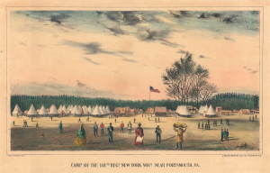
Active Civil War encampment.

Camp of the 148th Regt. New York Vols. Portsmouth, VA.

1863 (undated)
10 x 15.75 in (25.40 x 40.00 cm)
Camp148thNYPortsmouth-laidlaw-1863

$950.00

Acquire
A Closer Look
  • Digital Map Information
  • Suitable for large format printing
  • Full resolution TIFF file
  • ICC color profile embedded
  • Delivered instantly via download link
This is a c. 1863 James S. Laidlaw view of the 148th Regiment, New York Infantry's camp at Portsmouth, Virginia, during the American Civil War (1861 - 1865). Unlike most Civil War images, this view was published contemporaneously with the war. (more details)
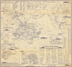
Tracking the Pacific War from Pearl Harbor to V-J Day.

U.S. Naval Operations Pacific Ocean Areas World War II.

1966 (dated)
37.5 x 40.5 in (95.25 x 102.87 cm)
PacificWar-metzler-1966

$900.00

Acquire
A Closer Look
This is a rare first-edition 1966 Marvin E. Metzler infographic map of the Pacific War battles of World War II (1939 - 1945). It is a unique tribute to the Pacific War prepared by a veteran who experienced it firsthand. (more details)
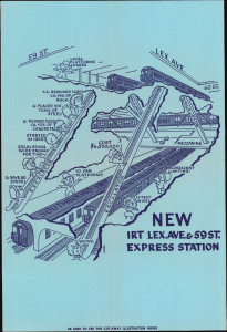
Inaugural celebrations of the new 59th Street Lexington Avenue express subway station.

NEW IRT LEX. AVE AND 59 ST. EXPRESS STATION.

1962 (dated)
18 x 12 in (45.72 x 30.48 cm)
59thExpressStation-irt-1962

$850.00

Acquire
A Closer Look
This is a 1962 New York City Transit Authority cutaway map of the newly opened 59th Street Express subway station, part of the original program for the station's inaugural ceremonies. One of the most frequented stations on the Lexington Avenue line, the illustration encompasses three levels, 'express' escalators, transfer ramps, and a whole world of newer, faster transit. (more details)
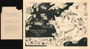
Personal insights into the 301st Field Artillery during World War I.

Over There' and Back with the 301st First Field Artillery.

1933 (undated)
13.5 x 19 in (34.29 x 48.26 cm)
OverThereAndBack-rothegibbs-1933

$800.00

Acquire
A Closer Look
  • Digital Map Information
  • Suitable for large format printing
  • Full resolution TIFF file
  • ICC color profile embedded
  • Delivered instantly via download link
This rare 1933 Lewis Rothe and Warren Gibbs pictorial map of Europe playfully commemorates the peregrinations of the 301st Field Artillery during World War I (1914 - 1918). The map traces the 301st's movements from Boston through Nova Scotia and England to France, then back across the Atlantic to New York City after the war ended. Lewis Rothe drew the map in collaboration with Warren R. Gibbs, a veteran of the 301st. A series of 'close-ups' in the lower left offers interesting personal insights into the unit: Lieutenant Dowd's luck at gambling and Colonel Brooke's habit of buying souvenirs. (more details)
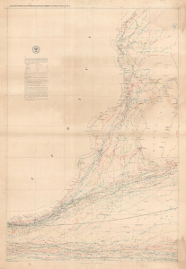
Groundbreaking infographic chart of the East African Coast / Western Indian Ocean.

Maury's Wind and Current Chart Series A, Indian Ocean No. 4.

1854 (dated)
35 x 24 in (88.90 x 60.96 cm)
EastAfricaChart-maury-1854

$800.00

Acquire
A Closer Look
  • Digital Map Information
  • Suitable for large format printing
  • Full resolution TIFF file
  • ICC color profile embedded
  • Delivered instantly via download link
A colorful 1854 Matthew Fontaine Maury nautical map of the eastern coast of Africa, from Kenya to South Africa. Matthew Fontaine Maury, the greatest American hydrographer of his time, produced it, and like all his wind and current charts, it is a marvel of infographic mapping. (more details)
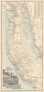
Tourism from Chilkat, Alaska, to San Diego, California.

Map Showing Routes of the Pacific Coast Steamship Company.

1894 (dated)
27 x 12.75 in (68.58 x 32.38 cm)
PacificCoast-randmcnally-1894

$800.00

Acquire
A Closer Look
  • Digital Map Information
  • Suitable for large format printing
  • Full resolution TIFF file
  • ICC color profile embedded
  • Delivered instantly via download link
This is a scarce 1894 Rand McNally map of the Pacific Coast of North America, produced to promote tourism and travel with the Pacific Coast Steamship Company just a few years before the Klondike Gold Rush (1896 - 1898). The map illustrates the Pacific Coast from the Mexican border to British Columbia and Vancouver Island; an inset details the route north to 'Mousouah Lake' (Mosquito Lake) in Alaska. (more details)
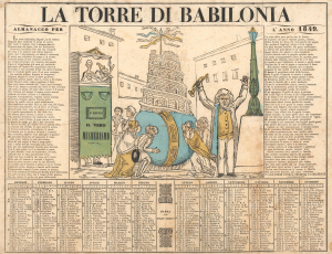
Decrying the Revolutions of 1848 in Italy. Or Just The Disorganization?

La Torre di Babilonia. Almanacco per l'Anno 1849.

1848 (undated)
16.25 x 21 in (41.28 x 53.34 cm)
TorreBabilonia-unknown-1848

$750.00

Acquire
A Closer Look
  • Digital Map Information
  • Suitable for large format printing
  • Full resolution TIFF file
  • ICC color profile embedded
  • Delivered instantly via download link
This is a c. 1848 Italian satirical broadside decrying the chaos of the 1848 People's Revolutions in Italy. The evocative political propaganda piece combines a woodcut image, a poetic description of said image, and an almanac for 1849. It is an excellent example of 19th-century Italian political ephemera. (more details)
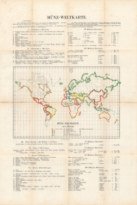
Gold Standard.

Münz-Weltkarte : Ein Schlüssel zu den Preisen der Weltausstellung.

1873 (dated)
21 x 13 in (53.34 x 33.02 cm)
MunzWeltkarte-eggers-1873

$750.00

Acquire
A Closer Look
  • Digital Map Information
  • Suitable for large format printing
  • Full resolution TIFF file
  • ICC color profile embedded
  • Delivered instantly via download link
A numismatic world map prepared in 1873 by August Eggers. Its production corresponded with the 1873 adoption of an international gold standard, a key event in modern economic history. The map was exhibited at the 1873 Vienna World's Fair. (more details)
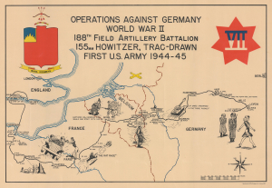
The 188th from England to victory in Germany.

Operations Against Germany World War II 188th Field Artillery Battalion 155mm Howitzer, Trac-Drawn First U.S. Army 1944 - 45.

1945 (dated)
15 x 21.5 in (38.10 x 54.61 cm)
188thFieldArtillery-unknown-1945-2

$750.00

Acquire
A Closer Look
  • Digital Map Information
  • Suitable for large format printing
  • Full resolution TIFF file
  • ICC color profile embedded
  • Delivered instantly via download link
This is a 1945 188th Field Artillery Battalion World War II Route Map of Europe. The map traces the battalion's movements during the war, marking important events and providing comedic commentary on the experience. (more details)
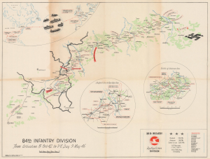
84th Infantry Division's during World War II.

84th Infantry Division From Activation 15 Oct 42 to V-E Day 9 May 45.

1945 (dated)
21.75 x 28 in (55.24 x 71.12 cm)
84thInfantryDiv-harney-1945-2

$550.00

Acquire
A Closer Look
  • Digital Map Information
  • Suitable for large format printing
  • Full resolution TIFF file
  • ICC color profile embedded
  • Delivered instantly via download link
This is a 1945 George D. Harney World War II campaign route map chronicling the movements of the U.S. Army's 84th Infantry Division across Europe. This map is distinct within the genre as Harney eschews extraneous geographical detail, focusing attention on the places where he and his comrades traveled and fought. The central map traces the division's principal campaign route, while three insets document its deployment and actions in key combat zones. (more details)
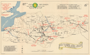
87th Infantry Division during World War II.

87th Infantry Division. Route of the Golden Acorn Division France, Luxembourg, Belgium, Germany, and Czechoslovakia.

1945 (undated)
16.25 x 26.75 in (41.28 x 67.94 cm)
87thInfDiv-unknown-1945

$425.00

Acquire
A Closer Look
  • Digital Map Information
  • Suitable for large format printing
  • Full resolution TIFF file
  • ICC color profile embedded
  • Delivered instantly via download link
This is a 1945 campaign route map for the 87th Infantry Division in western and central Europe during World War II. The map was issued as a souvenir campaign map in the immediate wake of WWII to chronicle the Division's movements and battles from its arrival at Le Havre, France, until V-E Day near the Czechoslovak border. (more details)
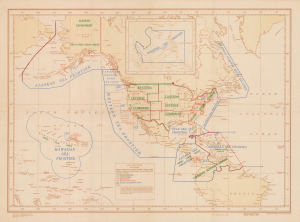
Defending America's Maritime Frontiers.

(Special COMINCH) H.O. Misc. 10,194.

1945 (dated)
21.75 x 29.5 in (55.24 x 74.93 cm)
SeaFrontiersWWII-cominch-1945

$400.00

Acquire
A Closer Look
  • Digital Map Information
  • Suitable for large format printing
  • Full resolution TIFF file
  • ICC color profile embedded
  • Delivered instantly via download link
This is an unrecorded 1945 U.S. Navy Hydrographic Office map of the Americas, delineating the territory of different U.S. Navy Sea Frontiers. These zones were critical components of the U.S. war effort, securing America's coastline and shipping lanes throughout the Atlantic and Pacific Oceans. (more details)
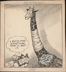
Financing Victory in WWII.

Pain in the Neck.

1943 (undated)
11.25 x 9.5 in (28.58 x 24.13 cm)
PainInTheNeck-white-1943

$400.00

Acquire
A Closer Look
  • Digital Map Information
  • Suitable for large format printing
  • Full resolution TIFF file
  • ICC color profile embedded
  • Delivered instantly via download link
This is a 1943 George White manuscript political cartoon that was the basis for a published version that appeared in The Tampa Tribune. It deals with the difficulties faced by the U.S. Congress in paying for the high and mounting costs of fighting World War II (1939 - 1945). (more details)
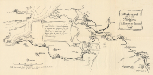
WWII 13th Armored Division: from Le Havre, France, to Austria.

13th Armored (Black Cat) Division. A History in Pictures Jan-May 1945.

1945 (dated)
13.75 x 28 in (34.92 x 71.12 cm)
13thArmoredDiv-lovett-1945

$400.00

Acquire
A Closer Look
  • Digital Map Information
  • Suitable for large format printing
  • Full resolution TIFF file
  • ICC color profile embedded
  • Delivered instantly via download link
This is a 1945 World War II (1939 - 1945) pictorial unit route map drawn by Technician Fourth Grade Wendell Lovett, a member of the 13th Armored Division. The map highlights the division's deployment in Europe from January 1945 until the end of the war in May 1945. Small illustrations of tanks are scattered throughout, underlining the division's role as an armored unit. It was published in June 1945 in Europe before the 13th Armored Division returned to the United States. (more details)
< 1 2 >

Stay Informed

First Look at New Acquisitions

New inventory updates delivered directly to your inbox.