
Bellin, Jacques-Nicolas (sold)

Jacques-Nicolas Bellin (1703 - March 21, 1772) was one of the most important cartographers of the 18th century. With a career spanning some 50 years, Bellin is best understood as geographe de cabinet and transitional mapmaker spanning the gap between 18th and early-19th century cartographic styles. His long career as Hydrographer and Ingénieur Hydrographe at the French Dépôt des cartes et plans de la Marine resulted in hundreds of high quality nautical charts of practically everywhere in the world. A true child of the Enlightenment Era, Bellin's work focuses on function and accuracy tending in the process to be less decorative than the earlier 17th and 18th century cartographic work. Unlike many of his contemporaries, Bellin was always careful to cite his references and his scholarly corpus consists of over 1400 articles on geography prepared for Diderot's Encyclopedie. Bellin, despite his extraordinary success, may not have enjoyed his work, which is described as "long, unpleasant, and hard." In addition to numerous maps and charts published during his lifetime, many of Bellin's maps were updated (or not) and published posthumously. He was succeeded as Ingénieur Hydrographe by his student, also a prolific and influential cartographer, Rigobert Bonne.
Deciphering the 'Locked Country'.
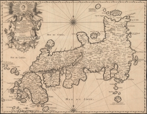
Carte de l'empire du Japon, dressée sur les auteurs japonois, sur les mémoires des portugais et des hollandois et en particulier sur ceux des RRPP. de la comp. de Jesus.
sold
- Digital Map Information
- Suitable for large format printing
- DPI: 600
- File Size: 17.77 MB
- File Type: ZIP / TIFF
- ICC color profile embedded
- Delivered instantly via download link
This is Jacques-Nicolas Bellin's 1735 / 1754 map of Japan, published in Pierre François Xavier de Charlevoix's Histoire et description générale du Japon, an influential work throughout the 18th century. (more details)
A beautifully engraved 18th century map of the Arabian Peninsula - labels both Mecca and Medina.
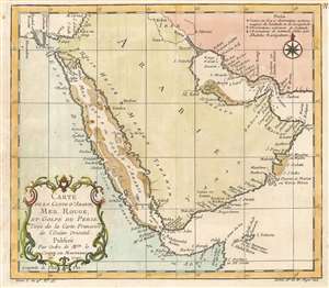
Carte de la Coste d'Arabie, Mer Rouge, et Golfe de Perse. Tirée de la Carte Françoise de l'Océan Oriental.
sold
- Digital Map Information
- Suitable for large format printing
- DPI: 600
- File Size: 5.29 MB
- File Type: ZIP / TIFF
- ICC color profile embedded
- Delivered instantly via download link
This is a 1740 Jacques-Nicolas Bellin Bellin map of the Arabian Peninsula. The map depicts the region from Alexandria, Egypt to the Gulf of Oman and from the Mediterranean Sea and Iraq to the Horn of Africa. Beautifully engraved, numerous coastal locations are ... (more details)
Forgotten French influence in India.
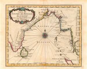
Carte du Golphe de Bengale.
sold
- Digital Map Information
- Suitable for large format printing
- Full resolution TIFF file
- ICC color profile embedded
- Delivered instantly via download link
This is Jacques-Nicolas Bellin's lovely 1740 map of the Bay of Bengal. It illustrates the region at the height of French influence in India, when they nearly surpassed the British as the dominant European power on the subcontinent. (more details)
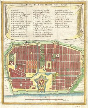
Plan de Pondicheri en 1741.
sold
- Digital Map Information
- Suitable for large format printing
- DPI: 300
- File Size: 2.18 MB
- File Type: ZIP / TIFF
- ICC color profile embedded
- Delivered instantly via download link
This beautifully hand colored map of Pondicherry (now 'Puducherry'), India was drawn by Nicholas Bellin and dates to the 1750s. The site of Pondicherry had been a trading post for at least 1600 years, as evidenced by 1st Century AD Roman goods unearthed ... (more details)
Important early map illustrating the explorations of La Verendrye and the River of the West.
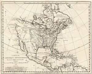
Carte de L'Amerique Septentrionale Pour servir a L'Histoire de la Nouvelle France.
sold
- Digital Map Information
- Suitable for large format printing
- DPI: 300
- File Size: 5.1 MB
- File Type: ZIP / TIFF
- ICC color profile embedded
- Delivered instantly via download link
An important and influential first edition first state 1743 map of the North America by the French cartographer Jacques-Nicholas Bellin. Bellin's map covers all of North America from the Arctic to the Spanish Main, including modern day Canada, the ... (more details)
Important early map illustrating the explorations of La Verendrye and the River of the West.
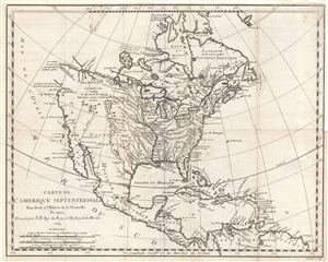
Carte de L'Amerique Septentrionale Pour servir a L'Histoire de la Nouvelle France.
sold
- Digital Map Information
- Suitable for large format printing
- Full resolution TIFF file
- ICC color profile embedded
- Delivered instantly via download link
An important and influential first edition first state 1743 map of the North America by the French cartographer Jacques-Nicholas Bellin. Bellin's map covers all of North America from the Arctic to the Spanish Main, including modern day Canada, the ... (more details)
Speculative rivers based on American Indian maps.
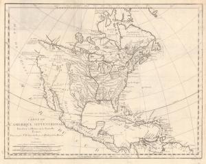
Carte de L'Amerique Septentrionale Pour servir a L'Histoire de la Nouvelle France.
sold
- Digital Map Information
- Suitable for large format printing
- File Size: 6.77 MB
- File Type: ZIP / TIFF
- ICC color profile embedded
- Delivered instantly via download link
An important and influential first edition first state 1743 map of North America by the French cartographer Jacques-Nicholas Bellin. The map is a profoundly French production, illustrating that nation's plans and ambitions for America in the decades preceding the French and Indian War (1754 - 1763). It includes speculative river systems and hopeful cities of gold and suggests broad, if ambiguous, territorial claims. (more details)
The earliest obtainable example of the first map to introduce four fictional islands in Lake Superior. Islands later used to draw the post-Revolutionary War US-Canada border.
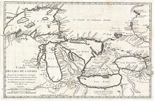
Carte des Lacs du Canada Dresse sur les Manuscrits du Depost des Carts, Plans et Journaux de la Marine et sur le Journal de RP. De Charlevoix.
sold
- Digital Map Information
- Suitable for large format printing
- DPI: 300
- File Size: 6.99 MB
- File Type: ZIP / TIFF
- ICC color profile embedded
- Delivered instantly via download link
An iconic and historically influential 1744 map of the Great Lakes by Jacques-Nicholas Bellin. Possibly Bellin's most important production, this is the earliest obtainable map, preceded only by a 1742 proof noted by Kershaw, to depict the four ... (more details)
The earliest obtainable example of the first map to introduce four fictional islands in Lake Superior. Islands later used to draw the post-Revolutionary War US-Canada border.
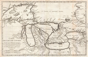
Carte des Lacs du Canada Dresse sur les Manuscrits du Depost des Carts, Plans et Journaux de la Marine et sur le Journal de RP. De Charlevoix.
sold
- Digital Map Information
- Suitable for large format printing
- DPI: 300
- File Size: 5.74 MB
- File Type: ZIP / TIFF
- ICC color profile embedded
- Delivered instantly via download link
An iconic and historically influential 1744 map of the Great Lakes by Jacques-Nicholas Bellin. Possibly Bellin's most important production, this is the earliest obtainable map, preceded only by a 1742 proof noted by Kershaw, to depict the four ... (more details)
Bellin's illustration of 18th century French claims to the American Southeast.
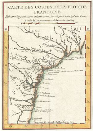
Carte des Costes de la Floride Francoise Suivant les premieres decouvertes.
sold
- Digital Map Information
- Suitable for large format printing
- DPI: 300
- File Size: 1.74 MB
- File Type: ZIP / TIFF
- ICC color profile embedded
- Delivered instantly via download link
A beautiful example of Bellin's unusual an interesting 1744 map of the American Southeast. The map covers the southeastern coast of the modern day United States roughly from St. Augustine, Florida to Cape Fear, North Carolina. As the title ... (more details)
Bellin's illustration of 18th century French claims to the American Southeast.
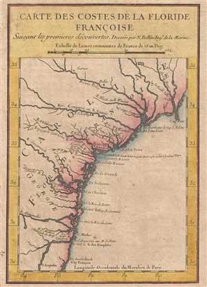
Carte des Costes de la Floride Francoise Suivant les premieres decouvertes.
sold
- Digital Map Information
- Suitable for large format printing
- DPI: 300
- File Size: 1.31 MB
- File Type: ZIP / TIFF
- ICC color profile embedded
- Delivered instantly via download link
A beautiful hand colored example of Jaques Nicholas Bellin's unusual and interesting 1744 map of the American Southeast. The map depicts the southeastern coast of the modern day United States roughly from St. Augustine, Florida to Cape ... (more details)
The earliest obtainable map or plan of New Orleans, Louisiana.
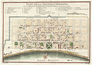
Plan de la Nouvelle-Orleans sur les Manuscrits du Depot des Cartes de la Marine.
sold
- Digital Map Information
- Suitable for large format printing
- DPI: 300
- File Size: 3.15 MB
- File Type: ZIP / TIFF
- ICC color profile embedded
- Delivered instantly via download link
This scarce 1744 map by J. N. Bellin is the earliest obtainable map of New Orleans, Louisiana. Oriented to the northwest, Bellin's map covers the original settlement of New Orleans along the Mississippi River and inland as far the ... (more details)
The earliest obtainable map or plan of New Orleans, Louisiana.
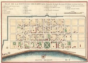
Plan de la Nouvelle-Orleans sur les Manuscrits du Depot des Cartes de la Marine.
sold
- Digital Map Information
- Suitable for large format printing
- DPI: 300
- File Size: 3.36 MB
- File Type: ZIP / TIFF
- ICC color profile embedded
- Delivered instantly via download link
This scarce 1744 map by J. N. Bellin is the first edition first state of earliest obtainable map of New Orleans, Louisiana. Oriented to the northwest, Bellin's map covers the original settlement of New Orleans along the ... (more details)
The earliest obtainable map or plan of New Orleans, Louisiana.
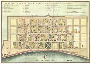
Plan de la Nouvelle-Orleans sur les Manuscrits du Depot des Cartes de la Marine.
sold
- Digital Map Information
- Suitable for large format printing
- DPI: 300
- File Size: 2.81 MB
- File Type: ZIP / TIFF
- ICC color profile embedded
- Delivered instantly via download link
This scarce 1744 map by J. N. Bellin is the first edition first state of earliest obtainable map of New Orleans, Louisiana. Oriented to the northwest, Bellin's map covers the original settlement of New Orleans along the ... (more details)
An important and often under appreciated 1744 map of French, English and Spanish claims in North America.
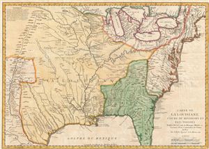
Carte de La Louisiane Cours du Mississipi et Pais Voisins.
sold
- Digital Map Information
- Suitable for large format printing
- Full resolution TIFF file
- ICC color profile embedded
- Delivered instantly via download link
An important and influential 1744 map of the settled portions of North America by the French cartographer Jacques-Nicholas Bellin. Centered on the Mississippi Valley, Bellin's map covers from the Riviere de Nord (Rio ... (more details)
First state first edition of an iconic map of Quebec City.
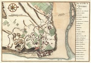
Plan de la Ville de Quebec.
sold
- Digital Map Information
- Suitable for large format printing
- DPI: 300
- File Size: 3.68 MB
- File Type: ZIP / TIFF
- ICC color profile embedded
- Delivered instantly via download link
A scarce 1744 first state first edition of Bellin's important map of Quebec City, Canada. Oriented to the west, Bellin's map covers the fortified center of Quebec City at the conjunction of the St. Laurence River and ... (more details)
First state first edition of an iconic map of Quebec City.
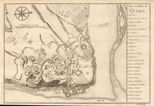
Plan de la Ville de Quebec.
sold
- Digital Map Information
- Suitable for large format printing
- DPI: 600
- File Size: 5.83 MB
- File Type: ZIP / TIFF
- ICC color profile embedded
- Delivered instantly via download link
A scarce 1744 first state first edition of Bellin's important map of Quebec City, Canada. Oriented to the west, Bellin's map covers the fortified center of Quebec City at the conjunction of the St. Laurence River and the St. Charles estuary. The map illustrates various fortifications as well as some 24 individual buildings including churches, schools, batteries and government buildings. Some of the surrounding farmland is also illustrated. On the east side of the city the port and is identified.
When Bellin drew this map Quebec City was a major center for the French Colony of Quebec with its strategic location dominating trade on the vital St. Lawrence artery. After the French and Indian War control of Quebec fell to the British. British rule proved both beneficial and magnanimous to the predominantly French population. (more details)
When Bellin drew this map Quebec City was a major center for the French Colony of Quebec with its strategic location dominating trade on the vital St. Lawrence artery. After the French and Indian War control of Quebec fell to the British. British rule proved both beneficial and magnanimous to the predominantly French population. (more details)
Elegant Map of the Atlantic, Showing Charlevoix' Voyage to and from North America.
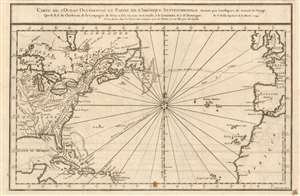
Carte De L'Ocean Occidental et Partie De L'Amerique Septentrionale Dressee pour l'intelligence du Journal du V oyage.
sold
- Digital Map Information
- Suitable for large format printing
- DPI: 600
- File Size: 8.7 MB
- File Type: ZIP / TIFF
- ICC color profile embedded
- Delivered instantly via download link
This is a 1744 Bellin map of the colonized regions of North America and the Caribbean Islands shown in relation to the coasts of Europe and Africa. It appeared in Pierre Francois Xavier de Charlevoix's 1744 Histoire et description generale de la Nouvelle France, one of the most comprehensive works on North America predating the French and Indian War. Charlevoix was a Jesuit missionary and traveler commissioned by the French Crown and the Duke of Orleans to explore French holdings in the Americas, particularly with a view towards finding a profitable route to the Pacific. Many hoped this in the network of rivers and lakes to the west of the Great Lakes, as suggested by earlier explorers and mapmakers such as Lahontan and De l'Isle. (more details)
One of the earliest obtainable plan of the Harbor of Pensacola, Florida.
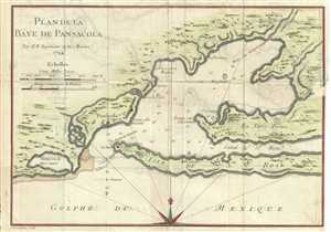
Plan de la Baye de Pensacola.
sold
- Digital Map Information
- Suitable for large format printing
- DPI: 300
- File Size: 2.65 MB
- File Type: ZIP / TIFF
- ICC color profile embedded
- Delivered instantly via download link
This is a beautiful early 1744 map or chart of Pensacola Harbor in Florida by Bellin. Among the earliest available charts of the bay and harbor, the map identifies the locations of Fort St. Charles and fort St. Rose. ... (more details)
The earliest obtainable example of the first map to introduce four fictional islands in Lake Superior. Islands later used to draw post-Revolutionary War US-Canada border.
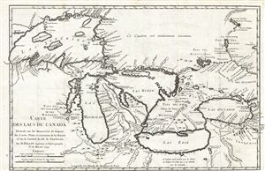
Carte des Lacs du Canada Dresse sur les Manuscrits du Depost des Carts, Plans et Journaux de la Marine et sur le Journal de RP. De Charlevoix.
sold
- Digital Map Information
- Suitable for large format printing
- Full resolution TIFF file
- ICC color profile embedded
- Delivered instantly via download link
An iconic and historically influential 1744 map of the Great Lakes by Jacques-Nicholas Bellin. Possibly Bellin's most important production, this is the earliest obtainable map, preceded only by a 1742 proof noted by ... (more details)
Among the earliest obtainable specific maps of the Louisiana, Mississippi, Florida coasts.
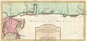
Partie de La Coste de la Louisiane et de La Floride depuis le Mississipi Jusqua St. Marc d'Apalache. Dressee sur les Manuscrits du Depost des Plans de la Marine.
sold
- Digital Map Information
- Suitable for large format printing
- Full resolution TIFF file
- ICC color profile embedded
- Delivered instantly via download link
The extremely scarce first edition first state of Bellin's important 1744 map of the Gulf Coast from New Orleans past Mobile Bay, as far east as Apalachicola Bay and the St. Marks River. Though still quite ... (more details)
Among the earliest obtainable specific maps of the Louisiana, Mississippi, Florida coasts.
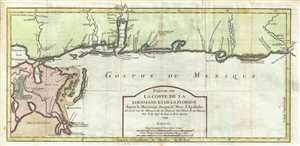
Partie de La Coste de la Louisiane et de La Floride depuis le Mississipi Jusqua St. Marc d'Apalache. Dressee sur les Manuscrits du Depost des Plans de la Marine.
sold
- Digital Map Information
- Suitable for large format printing
- DPI: 300
- File Size: 4.5 MB
- File Type: ZIP / TIFF
- ICC color profile embedded
- Delivered instantly via download link
The extremely scarce first edition first state of Bellin's important 1744 map of the Gulf Coast from New Orleans past Mobile Bay, as far east as Apalachicola Bay and the St. Marks River. Though still quite ... (more details)
An Attractively Engraved Map of the 'Île-d'Orléans
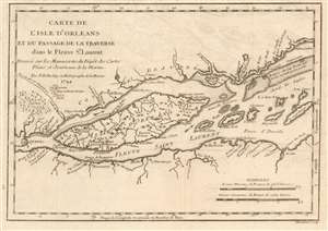
Carte de l'Isle d'Orleans et du Passage de la Traverse ans le Fleuve St.Laurent.
sold
- Digital Map Information
- Suitable for large format printing
- DPI: 600
- File Size: 4.63 MB
- File Type: ZIP / TIFF
- ICC color profile embedded
- Delivered instantly via download link
This is a beautiful example of Bellin's scarce 1744 map of the Île d'Orléans in the Saint Lawrence River. The map covers from Quebec City downstream to the Batures de Cap Brule.
Bellin originally prepared this map to illustrate Pierre François Xavier de Charlevoix's Histoire et description generale de la Nouvelle France, one of the most comprehensive works on North America predating the French and Indian War. Charlevoix was a Jesuit missionary and traveler commissioned by the French Crown and the Duke of Orleans to explore French holdings in the Americas, particularly with a view towards finding a profitable route to the Pacific. Many hoped this in the network of rivers and lakes to the west of the Great Lakes, as suggested by earlier explorers and mapmakers such as Lahontan and De l'Isle. It was engraved by Desbruslins Fils of Paris. Charlevoix's history thus proved exceptionally influential as one of the most comprehensive works on North America predating the French and Indian War. (more details)
Bellin originally prepared this map to illustrate Pierre François Xavier de Charlevoix's Histoire et description generale de la Nouvelle France, one of the most comprehensive works on North America predating the French and Indian War. Charlevoix was a Jesuit missionary and traveler commissioned by the French Crown and the Duke of Orleans to explore French holdings in the Americas, particularly with a view towards finding a profitable route to the Pacific. Many hoped this in the network of rivers and lakes to the west of the Great Lakes, as suggested by earlier explorers and mapmakers such as Lahontan and De l'Isle. It was engraved by Desbruslins Fils of Paris. Charlevoix's history thus proved exceptionally influential as one of the most comprehensive works on North America predating the French and Indian War. (more details)
Early map showing the mouth of the Mississippi River.
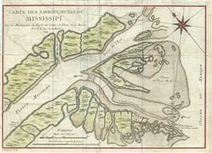
Carte des Embouchures du Mississipi.
sold
- Digital Map Information
- Suitable for large format printing
- DPI: 300
- File Size: 3.56 MB
- File Type: ZIP / TIFF
- ICC color profile embedded
- Delivered instantly via download link
This is a scarce 1744 map by Bellin depicting the mouth of the Mississippi River as it empties into the Gulf of Mexico. The map identifies Fort Balize, the first French fort and settlement in the region. ... (more details)
Beautifully engraved chart of the Pacific Coast with fascinating Tierra del Fuego cartography
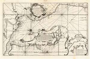
Carte nouvelle et exacte de la mer Pacifique autrement Mer du Sud / dressée sur les memoires et les avis des meilleurs pilotes et routiers de cette mer, ainsi que sur les observations les plus exactes de l'Astronomie et de la navigation en 1744
sold
- Digital Map Information
- Suitable for large format printing
- Full resolution TIFF file
- ICC color profile embedded
- Delivered instantly via download link
This is a 1744 Bellin map of the Pacific coast of Mexico, Central and South America. This beautifully engraved, eastern-oriented chart illustrates the coast line from Acapulco, Mexico to Valparaiso, Chile. The map is continued via inset at bottom center from Valparaiso to Tierra del Fuego. A text annotation along the Chilean coastline identifies the site where Captain David Cheap, one of Anson's sub-commanders, lost his freighter, the Wager, in 1741. (more details)
First issue of an early depiction of Quebec.
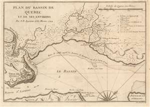
Plan du Bassin de Quebec et de ses Environs.
sold
- Digital Map Information
- Suitable for large format printing
- DPI: 600
- File Size: 5.06 MB
- File Type: ZIP / TIFF
- ICC color profile embedded
- Delivered instantly via download link
A scarce 1744 first state first issue of Bellin's map of the vicinity of Quebec City, Canada, illustrating the shallows of the St. Lawrence River. When this map was issued, Quebec dominated the French fur trade with its strategic position on a vital St. Lawrence artery. (more details)
An important Great Lakes Map showing the straits between Lake Superior, Lake Huron, and Lake Michigan.
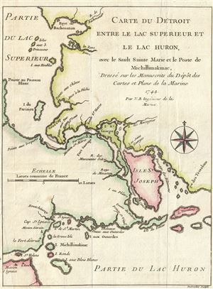
Carte du Detroit entre le Lac Superieur et le Lac Huron, ave le Sault Sainte Marie et la Poste de Michillimakinac, Dresse sur les Manuscrits du Depot des Cartes et Plans de la Marine.
sold
- Digital Map Information
- Suitable for large format printing
- DPI: 300
- File Size: 1.7 MB
- File Type: ZIP / TIFF
- ICC color profile embedded
- Delivered instantly via download link
This is a fine example of Bellin's scarce 1744 map illustrating the straits between Lake Superior, Lake Huron, and Lake Michigan. The map covers from Batchawana Bay (Baye de Bachouanan) south to ... (more details)
An important Great Lakes Map showing the straits between Lake Superior, Lake Huron, and Lake Michigan.
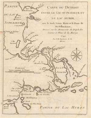
Carte du Detroit entre le Lac Superieur et le Lac Huron, ave le Sault Sainte Marie et la Poste de Michillimakinac, Dresse sur les Manuscrits du Depot des Cartes et Plans de la Marine.
sold
- Digital Map Information
- Suitable for large format printing
- DPI: 600
- File Size: 2.79 MB
- File Type: ZIP / TIFF
- ICC color profile embedded
- Delivered instantly via download link
This is a handsome example of Bellin's scarce 1744 map illustrating the straits between Lake Superior, Lake Huron, and Lake Michigan. The map covers from Batchawana Bay (Baye de Bachouanan) south to Whitefish Bay past Ille Parisienne to the St. Mary's River, which it follows inland, passing the Mission of St. Marie, Fort Sauvage, and Surgar Island (I. St. Georges) to the Isle St. Joseph and Lake Huron. It then follows westward as far as Bois Blanc Island and Point St. Ignace and the entrance to Lake Michigan. This is the same passage through which the United States-Canada border now runs.
Bellin originally prepared this map to illustrate Pierre François Xavier de Charlevoix's Histoire et description generale de la Nouvelle France, one of the most comprehensive works on North America predating the French and Indian War. Charlevoix was a Jesuit missionary and traveler commissioned by the French Crown and the Duke of Orleans to explore French holdings in the Americas, particularly with a view towards finding a profitable route to the Pacific. Many hoped this in the network of rivers and lakes to the west of the Great Lakes, as suggested by earlier explorers and mapmakers such as Lahontan and De l'Isle. It was engraved by Desbruslins Fils of Paris. Charlevoix's history thus proved exceptionally influential as one of the most comprehensive works on North America predating the French and Indian War. (more details)
Bellin originally prepared this map to illustrate Pierre François Xavier de Charlevoix's Histoire et description generale de la Nouvelle France, one of the most comprehensive works on North America predating the French and Indian War. Charlevoix was a Jesuit missionary and traveler commissioned by the French Crown and the Duke of Orleans to explore French holdings in the Americas, particularly with a view towards finding a profitable route to the Pacific. Many hoped this in the network of rivers and lakes to the west of the Great Lakes, as suggested by earlier explorers and mapmakers such as Lahontan and De l'Isle. It was engraved by Desbruslins Fils of Paris. Charlevoix's history thus proved exceptionally influential as one of the most comprehensive works on North America predating the French and Indian War. (more details)
Earliest obtainable map of New Orleans.
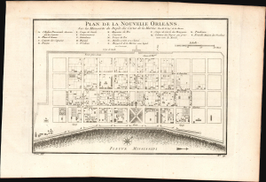
Plan de la Nouvelle Orleans. Sur les Manuscrits du Depôt des Cartes de la Marine.
sold
- Digital Map Information
- Suitable for large format printing
- File Size: 5.95 MB
- File Type: ZIP / TIFF
- ICC color profile embedded
- Delivered instantly via download link
This scarce 1744 map by J. N. Bellin is the earliest obtainable map of New Orleans, Louisiana. It was issued for Pierre François Xavier de Charlevoix's Histoire et Description Generale de la Nouvelle France, one of the earliest published accounts of the city. (more details)
Earliest obtainable map of New Orleans.
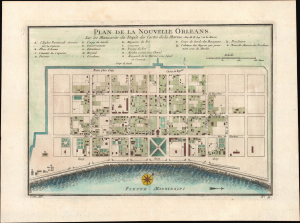
Plan de la Nouvelle Orleans. Sur les Manuscrits du Depôt des Cartes de la Marine.
sold
- Digital Map Information
- Suitable for large format printing
- Full resolution TIFF file
- ICC color profile embedded
- Delivered instantly via download link
This scarce 1744 map by J. N. Bellin is the earliest obtainable map of New Orleans, Louisiana. It was issued for Pierre François Xavier de Charlevoix's Histoire et Description Generale de la Nouvelle France, one of the earliest published accounts of the city. (more details)
The earliest obtainable map or plan of New Orleans, Louisiana.
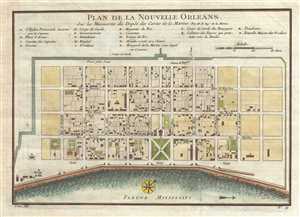
Plan de la Nouvelle-Orleans sur les Manuscrits du Depot des Cartes de la Marine.
sold
- Digital Map Information
- Suitable for large format printing
- Full resolution TIFF file
- ICC color profile embedded
- Delivered instantly via download link
This scarce 1744 map by J. N. Bellin is the earliest obtainable map of New Orleans, Louisiana. Oriented to the northwest, Bellin's map covers the original settlement of New Orleans along the ... (more details)
The earliest obtainable map or plan of New Orleans, Louisiana.
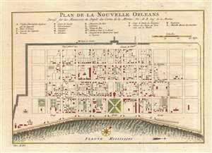
Plan de la Nouvelle Orleans Dresse sur les Manuscrits du Depot des Cartes de la Marine.
sold
- Digital Map Information
- Suitable for large format printing
- DPI: 300
- File Size: 3.41 MB
- File Type: ZIP / TIFF
- ICC color profile embedded
- Delivered instantly via download link
This scarce 1744 map by J. N. Bellin is the earliest obtainable map of New Orleans, Louisiana. Oriented to the northwest, Bellin's map covers the original settlement of New Orleans along the ... (more details)
The earliest obtainable map or plan of New Orleans, Louisiana.
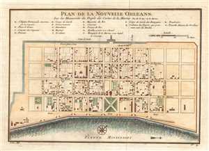
Plan de la Nouvelle Orleans Dresse sur les Manuscrits du Depot des Cartes de la Marine.
sold
- Digital Map Information
- Suitable for large format printing
- Full resolution TIFF file
- ICC color profile embedded
- Delivered instantly via download link
This scarce 1744 map by J. N. Bellin is the earliest obtainable map of New Orleans, Louisiana. Oriented to the northwest, Bellin's map covers the original settlement of New Orleans along the ... (more details)
The earliest obtainable map or plan of New Orleans, Louisiana.
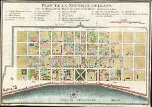
Plan de la Nouvelle Orleans. Sur les Manuscrits du Depôt des Cartes de la Marine.
sold
- Digital Map Information
- Suitable for large format printing
- Full resolution TIFF file
- ICC color profile embedded
- Delivered instantly via download link
This scarce 1744 map by J. N. Bellin is the earliest obtainable map of New Orleans, Louisiana. Oriented to the northwest, Bellin's map covers the original settlement of New Orleans along the ... (more details)
The earliest obtainable map or plan of New Orleans, Louisiana.
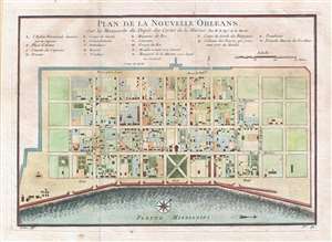
Plan de la Nouvelle Orleans. Sur les Manuscrits du Depôt des Cartes de la Marine.
sold
- Digital Map Information
- Suitable for large format printing
- Full resolution TIFF file
- ICC color profile embedded
- Delivered instantly via download link
This scarce 1744 map by J. N. Bellin is the earliest obtainable map of New Orleans, Louisiana. Oriented to the northwest, Bellin's map covers the original settlement of New Orleans along the ... (more details)
The earliest obtainable map of New Orleans.
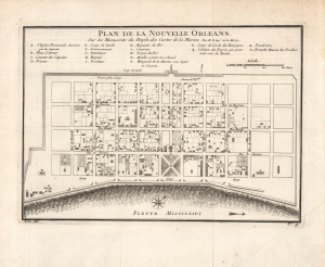
Plan de la Nouvelle Orleans. Sur les Manuscrits du Depôt des Cartes de la Marine.
sold
- Digital Map Information
- Suitable for large format printing
- Full resolution TIFF file
- ICC color profile embedded
- Delivered instantly via download link
This scarce 1744 map by J. N. Bellin is the earliest obtainable map of New Orleans, Louisiana. It was issued for Pierre François Xavier de Charlevoix's Histoire et description generale de la Nouvelle France, one of the earliest published accounts of the city. (more details)
The earliest obtainable example of the first map to introduce four fictional islands in Lake Superior. Islands later used to draw the post-Revolutionary War US-Canada border.
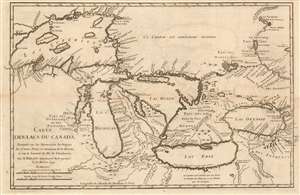
Carte des Lacs du Canada Dresse sur les Manuscrits du Depost des Carts, Plans et Journaux de la Marine et sur le Journal de RP. De Charlevoix.
sold
- Digital Map Information
- Suitable for large format printing
- Full resolution TIFF file
- ICC color profile embedded
- Delivered instantly via download link
This is the 1744 Bellin/ Charlevoix map of the Great Lakes, the most accurate map of the Great Lakes to date and the best to be produced since the De l'Isle map of 1718. It is also the earliest obtainable map, preceded only by a 1742 proof noted by Kershaw, to depict the four fictive islands in Lake Superior (Philippeux, Pontchartrain, Maurepas, and St. Anne) - islands that nonetheless significantly influenced the structuring of post-Revolutionary War borders between British Canada and the fledgling United States. It is also notable for being among the earliest maps to identify Detroit and the Port of Chicago. Bellin's map covers all five Great Lakes and their adjacent drainage systems in considerable detail, noting known fortifications, American Indian villages, missions, and some speculative topography (particularly in Michigan). (more details)
Imaginary (but important!) Islands of Lake Superior.
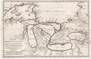
Carte des Lacs du Canada Dresse sur les Manuscrits du Depost des Carts, Plans et Journaux de la Marine et sur le Journal de RP. De Charlevoix.
sold
- Digital Map Information
- Suitable for large format printing
- Full resolution TIFF file
- ICC color profile embedded
- Delivered instantly via download link
This is the 1744 Bellin / Charlevoix map of the Great Lakes, the most accurate map of the Great Lakes to date and the best produced since the De l'Isle map of 1718. It is also the earliest obtainable map, preceded only by a 1742 proof noted by Kershaw, to depict the four fictive islands in Lake Superior (Philippeux, Pontchartrain, Maurepas, and St. Anne) - islands that nonetheless significantly influenced the structuring of post-Revolutionary War borders between British Canada and the fledgling United States. It is also notable for being among the earliest maps to identify Detroit and the Port of Chicago. Bellin's map covers all five Great Lakes and their adjacent drainage systems in considerable detail, noting known fortifications, American Indian villages, missions, and some speculative topography (particularly in Michigan). (more details)
Imaginary (but important!) Islands of Lake Superior.
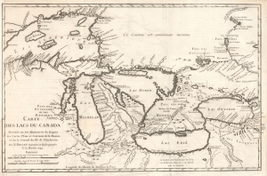
Carte des Lacs du Canada Dresse sur les Manuscrits du Depost des Carts, Plans et Journaux de la Marine et sur le Journal de RP. De Charlevoix.
sold
- Digital Map Information
- Suitable for large format printing
- File Size: 8.57 MB
- File Type: ZIP / TIFF
- ICC color profile embedded
- Delivered instantly via download link
This is the 1744 Bellin / Charlevoix map of the Great Lakes, the most accurate map of the Great Lakes to date and the best produced since the De l'Isle map of 1718. It is also the earliest obtainable map, preceded only by a 1742 proof noted by Kershaw, to depict the four fictive islands in Lake Superior (Philippeux, Pontchartrain, Maurepas, and St. Anne) - islands that nonetheless significantly influenced the structuring of post-Revolutionary War borders between British Canada and the fledgling United States. It is also notable for being among the earliest maps to identify Detroit and the Port of Chicago. Bellin's map covers all five Great Lakes and their adjacent drainage systems in considerable detail, noting known fortifications, American Indian villages, missions, and some speculative topography (particularly in Michigan). (more details)
An Attracive Map of Quebec in the Vicinity of the Saguenay River
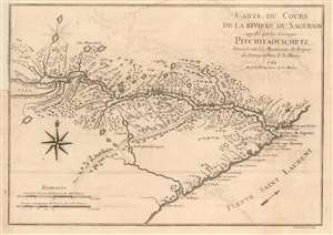
Carte Du Cours de la Riviere Saguenay appellee par les Sauvages Pitchitaouichetz
sold
- Digital Map Information
- Suitable for large format printing
- DPI: 600
- File Size: 5.15 MB
- File Type: ZIP / TIFF
- ICC color profile embedded
- Delivered instantly via download link
This is a 1744 Bellin map of the region of Quebec surrounding the course of the Saguenay River, reaching just short of Lake Saint-Jean. It shows the settlement of Chicoutimi (Chekoutimi on the map) in the location of present-day Saguenay. A track, running southwest, leads to Lac St. Charles near Quebec City.
This map appeared in Pierre Francois Xavier de Charlevoix's 1744 Histoire et description generale de la Nouvelle France, one of the most comprehensive works on North America predating the French and Indian War. Charlevoix was a Jesuit missionary and traveler commissioned by the French Crown and the Duke of Orleans to explore French holdings in the Americas, particularly with a view towards finding a profitable route to the Pacific. Many hoped this in the network of rivers and lakes to the west of the Great Lakes, as suggested by earlier explorers and mapmakers such as Lahontan and De l'Isle. (more details)
This map appeared in Pierre Francois Xavier de Charlevoix's 1744 Histoire et description generale de la Nouvelle France, one of the most comprehensive works on North America predating the French and Indian War. Charlevoix was a Jesuit missionary and traveler commissioned by the French Crown and the Duke of Orleans to explore French holdings in the Americas, particularly with a view towards finding a profitable route to the Pacific. Many hoped this in the network of rivers and lakes to the west of the Great Lakes, as suggested by earlier explorers and mapmakers such as Lahontan and De l'Isle. (more details)
Depicts the 'First Meridian', established by French King Louis XIII in 1634.
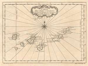
Carte des Isles Canaries.
sold
- Digital Map Information
- Suitable for large format printing
- DPI: 600
- File Size: 4.92 MB
- File Type: ZIP / TIFF
- ICC color profile embedded
- Delivered instantly via download link
This is a 1746 Jacques-Nicolas Bellin map of the Canary Islands. The map depicts the seven Canary Islands, including Tenerife (Isle de Teneriffe), Fuerteventura (I. de Fortaventure), Gran Canaria (I. Canarie), Lanzarote (I. Lancerotte), La Palma (I. de Palme), La Gomera (I. Gomere), and El Hierro (I. de Fer). The Canary Islands are a major tourist destination, welcoming over 12 million tourists every year. Numerous cities are labeled on each of the islands. A meridian, the 'first meridian' is included on the map and runs through El Hierro (I. de Fer). This meridian was created and fixed to El Hierro by declaration of French King Louis XIII in 1634. (more details)
Attractive map of Madeira and Porto Santo - known for their New Year's Eve Fireworks!
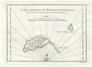
Carte des Isles de Madere et Portosanto. Dressée sur les Journaux des plus habiles Navigateurs.
sold
- Digital Map Information
- Suitable for large format printing
- DPI: 300
- File Size: 1.41 MB
- File Type: ZIP / TIFF
- ICC color profile embedded
- Delivered instantly via download link
This is a 1746 Jacques-Nicolas Bellin map of Madeira and Porto Santo, Portugal. The map depicts the islands of Madeira, Porto Santo, and the Desertas Islands, an archipelago 250 miles south ... (more details)
A charming map of the Cape Verde Islands.
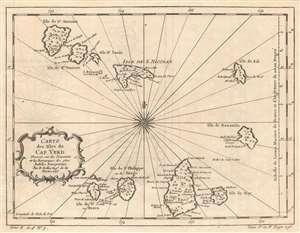
Carte des Isles du Cap Verd.
sold
- Digital Map Information
- Suitable for large format printing
- DPI: 600
- File Size: 5.77 MB
- File Type: ZIP / TIFF
- ICC color profile embedded
- Delivered instantly via download link
This is a 1746 Jacques-Nicolas Bellin map of the Cape Verde Islands. The map depicts all ten islands in the archipelago, which is located 350 miles off the northwest coast of Africa. ... (more details)
A unusual Anglocentric perspective illustrating the vast potential of British colonial expansionism in North America.
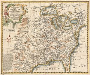
A new & accurate map of Louisiana, with part of Florida and Canada, and the adjacent countries.
sold
- Digital Map Information
- Suitable for large format printing
- Full resolution TIFF file
- ICC color profile embedded
- Delivered instantly via download link
A fascinating 1747 map of North America drawn by the British cartographer Emanuel Bowen shortly before the outbreak of the French and Indian War. Bowen's map covers most of the ... (more details)
Uncommon map naming the Sea of Korea.
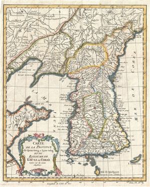
Carte de la Province de Quan-tong ou Lyau-tong et du Royaume de Kau-Li ou Coree.
sold
- Digital Map Information
- Suitable for large format printing
- Full resolution TIFF file
- ICC color profile embedded
- Delivered instantly via download link
An uncommon c. 1748 map of Korea by Jacques Nicholas Bellin. Centered on the west coast of Korea (Corea), this map covers all of peninsular Korea as well as adjacent parts of ... (more details)
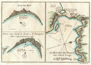
Isle De May, Veue De L'Isle S. Jago ou St. Jacques, Le Havre de Praya dans l'Isle de St. Jago.
sold
- Digital Map Information
- Suitable for large format printing
- Full resolution TIFF file
- ICC color profile embedded
- Delivered instantly via download link
Bellin's uniquely drawn half-view, half-maps of the Portuguese held Cape Verde Islands, from Prevost's influential Histoire Des Voyages , 1750. essentially three coastal ... (more details)
Identifies the Sea of Korea.
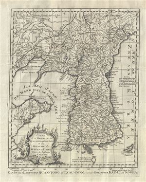
Carte de la Province de Quan-tong, ou Lyau-tong et du Royaume de Kau-li ou Coree .
sold
- Digital Map Information
- Suitable for large format printing
- Full resolution TIFF file
- ICC color profile embedded
- Delivered instantly via download link
This is an uncommon 1749 map of Korea by Jacques Nicholas Bellin. Centered on the west coast of Korea (Corea), this map covers all of peninsular Korea as well as ... (more details)
Identifies the Sea of Korea.
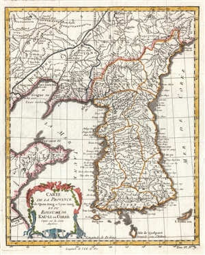
Carte de la Province de Quan-tong, ou Lyau-tong et du Royaume de Kau-li ou Coree .
sold
- Digital Map Information
- Suitable for large format printing
- DPI: 300
- File Size: 2.45 MB
- File Type: ZIP / TIFF
- ICC color profile embedded
- Delivered instantly via download link
This is an uncommon 1749 map of Korea by Jacques Nicholas Bellin. Centered on the west coast of Korea (Corea), this map covers all of peninsular Korea as well as ... (more details)
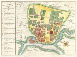
Plan de la Ville De Luovo Deineure ordinarie des Rois du Siam.
sold
- Digital Map Information
- Suitable for large format printing
- DPI: 300
- File Size: 3.46 MB
- File Type: ZIP / TIFF
- ICC color profile embedded
- Delivered instantly via download link
A beautifully detailed and engraved c. 1750 plan of the city of Louvo (Lopburi), the 'ordinary abode' of the kings of Siam (Thailand) on the Menam (Chao Phraya) ... (more details)
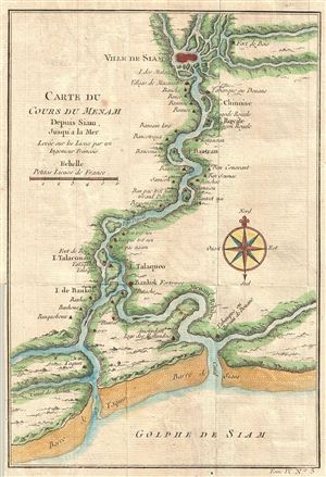
Carte du Cours Du Menam Depuis Siam Jusqu'a La Mer Levee sur los Lieux par un Ingenieur Francois
sold
- Digital Map Information
- Suitable for large format printing
- DPI: 300
- File Size: 1.84 MB
- File Type: ZIP / TIFF
- ICC color profile embedded
- Delivered instantly via download link
A beautifully hand-colored, copper engraving from the mid-1700s detailing the course of the Chao Phraya River from the former Thai royal capital Ayutthaya ... (more details)