
Wit, Frederik de (sold)

Frederik de Wit (1629 - 1706) was a Dutch Golden Age cartographer active in the second half of the 17th and the early 18th centuries. De Wit was born of middle class Protestant stock in the western Netherlandish town of Gouda. He relocated to Amsterdam sometime before 1648, where he worked under Willem Blaeu. His first attributed engraved map, a plan of Haarlem for Antonius Sanderus' Flandria Illustrata, was issued around this time. He struck out on his own in 1654. The first chart that De Wit personally both drew and engraved was most likely his 1659 map of Denmark, REGNI DANIÆ Accuratissima delineatio Perfeckte Kaerte van ‘t CONJNCKRYCK DENEMARCKEN. His great wall map of the world and most famous work, Nova Totius Terrarum Orbis Tabula appeared one year later. Following the publication of his wall map De Wit quickly rose in prominence as a both cartographer and engraver. He married Maria van der Way in 1661 and through her became a citizen of Amsterdam in 1662. Around this time he also published his first major atlas, a composite production ranging in size from 17 to over 150 maps and charts. Other atlases and individual maps followed. In 1689 De Wit was granted a 15 year Privilege by the Dutch States General. (An early copyright that protected the recipient's rights to print and publish.) He was recognized with the honorific 'Good Citizen' in 1694. De Wit died in 1706 after which his wife Maria continued publishing his maps until about 1710. De Wit's son, Franciscus, had no interest in the map trade, instead choosing to prosper as a stockfish merchant. On her own retirement, Maria sold most De Wit maps and plates at a public auction. Most were acquired by Pieter Mortier and laid the groundwork for the 1721 rise of Covens and Mortier, the largest Dutch cartographic publishing house of the 18th century.
Rare Imprint of a Beautiful Map of the Middle East.
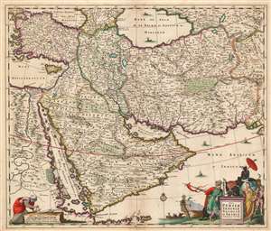
Nova Persiae Armeniae Natoliae et Arabiae Descriptio per F. de Wit.
sold
- Digital Map Information
- Suitable for large format printing
- DPI: 600
- File Size: 32.92 MB
- File Type: ZIP / TIFF
- ICC color profile embedded
- Delivered instantly via download link
This beautifully engraved and colored map is Frederick de Wit's 1659 map of the Middle East. Tibbets described this map as 'the largest scale map of the area until 1700' and 'the most useful until D’Anville’s map of 1751'. Coverage extends from Constantinople and the Nile River Valley in the west, to the mouth of the Indus River in the east, and from the Black Sea and the Caspian Sea in the north to the southern tip of the Arabian Peninsula. It is centered on the Persian Empire but includes the whole of the Arabian Peninsula and Asia Minor. The Caspian Sea appears in a distorted, elongated shape which may have been a conflation of both the Caspian and the neighboring Aral Sea. (more details)
Richly-Detailed Southeast Asia.
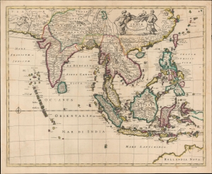
Tabula Indiae Orientalis Emendata a F. de Wit.
sold
- Digital Map Information
- Suitable for large format printing
- File Size: 20.83 MB
- File Type: ZIP / TIFF
- ICC color profile embedded
- Delivered instantly via download link
This is Frederick de Wit's map of India, Southeast Asia, southern China, and the East Indies, including an early mapping of the north coast of Australia. (more details)
'Most Attractive of its Time' -Shirley
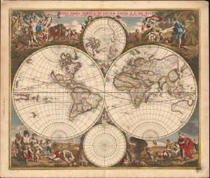
Nova Orbis Tabula In Lucem Edita, A. F. de Wit.
sold
- Digital Map Information
- Suitable for large format printing
- DPI: 600
- File Size: 64.85 MB
- File Type: ZIP / TIFF
- ICC color profile embedded
- Delivered instantly via download link
This is a striking c. 1689 example, in original color, of Frederick De Wit's classic double hemisphere map of the world. Shirley praised it as 'one of the most attractive of its time'. It features many of the tropes of 17th-century Dutch mapmaking: Isular California, imaginary islands, etc., as well as new discoveries, such as Western Australia, and cartographic reconsiderations, among them the removal of the imaginaryTerra Australis. (more details)
'Most Attractive of its Time' ~ Shirley
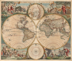
Nova Orbis Tabula In Lucem Edita, A.F.de Wit.
sold
- Digital Map Information
- Suitable for large format printing
- DPI: 600
- File Size: 61.1 MB
- File Type: ZIP / TIFF
- ICC color profile embedded
- Delivered instantly via download link
This is a first-plate, first-state example in original color of Frederick De Wit's classic double hemisphere map of the world. Shirley praised it as 'one of the most attractive of its time'. De Wit's map presents the state of the art of Dutch mapmaking as was expressed in Nicolas Visscher's 1658 map of the world, its detail drawn primarily from Joan Blaeu's Nova et Accuratissima Totius Terrarum Orbis Tabula. In both its geographical detail and the composition of its primary and subordinate hemispheres, it is a faithful copy of the Visscher. (more details)
Theatre of the Eighty Years' War.
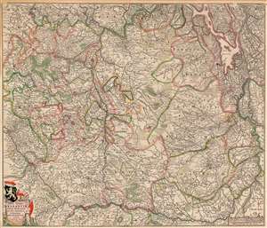
Tabula Ducatus Brabantiae continens Marchionatum Sacri Imperii et Dominium Mechliniense.
sold
- Digital Map Information
- Suitable for large format printing
- Full resolution TIFF file
- ICC color profile embedded
- Delivered instantly via download link
This is Frederic De Wit's 1666 map of the Duchy of Brabant, in present-day Netherlands and Belgium. Oriented to the west-north-west, the map embraces the lands from Rotterdam to Namur, extending to include part of western Germany. The Meuse River provides the limits for the bottom and right-hand portions. The map is exceedingly well detailed, including the cities of Antwerp, Rotterdam, Liege, Brussels, Bergen op Zoom, Venlo, and Maastricht along with countless smaller towns. It includes rich topographical detail showing forests and wetlands, with a great many roads included. There is an attractive cartouche featuring the Lion of Brabant; the scale cartouche is embellished with putto playing with a surveyor's compass. (more details)
Features an inset map of the Temple of Solomon.
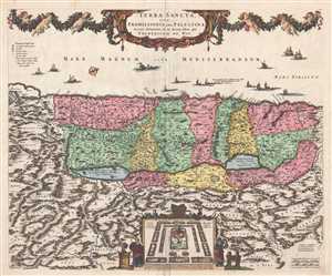
Terra Sancta, sive Promissionis, olim Palestina.
sold
- Digital Map Information
- Suitable for large format printing
- DPI: 300
- File Size: 11.73 MB
- File Type: ZIP / TIFF
- ICC color profile embedded
- Delivered instantly via download link
This is a c. 1670 Frederick de Wit map of the Holy Land, Israel, or Palestine. The map depicts the region from 'Arabia' to 'Syria' and from the Mediterranean Sea to Ammon, modern day Jordan. The Holy Land itself is divided into the regions occupied by the Twelve ... (more details)
Roads and Shipping in the Holy Roman Empire.
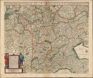
Carta Noua accurata del Passagio et strada dalli Paesi Bassi per via de Allemagna per Italia et per via di Paesi svizeri à Geneva, Lione et Roma per servizio delli Marchanti et viagianti in Genāle ad instanza delli Ss. scherer et sdi Momforti speditori delli Marchantie in Bregens. Dato in luce da Frederico de Wit di Amsterdam l'anno 1671.
sold
- Digital Map Information
- Suitable for large format printing
- DPI: 600
- File Size: 57.46 MB
- File Type: ZIP / TIFF
- ICC color profile embedded
- Delivered instantly via download link
This is a scarce road map engraved by Cornelis Danckerts in 1651, embellished and completed by Frederic De Wit for its most attractive edition, printed in 1671. It illustrates the land routes throughout the Holy Roman Empire connecting the Netherlands, France, Germany, Italy, Switzerland, Austria and Bohemia. It is a remarkable instance of a map commissioned by a specific mercantile concern, in this case the shippers Scherer and Montefort of Bregenz, on the Boden Zee in modern-day Austria. Maps depicting roads, particularly at this level of detail and at this scale, are unusual for this period; this one provides a unique glimpse on the business of transporting goods, and of travel in general, in the seventeenth century. (more details)
Exceedingly rare first edition of De Wit's masterful sea chart of the West Indies during the Golden Age of Caribbean Piracy.
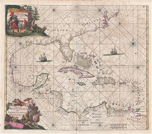
Indiarum Occidentalium Tractus Littorales cum Insulis Caribicis. / Pascaert van Westindien ende Caribise Eylanden.
sold
- Digital Map Information
- Suitable for large format printing
- DPI: 300
- File Size: 15.36 MB
- File Type: ZIP / TIFF
- ICC color profile embedded
- Delivered instantly via download link
A fine and rare old color example of the first edition of Frederick de Wit's 1675 nautical chart or maritime map of the West Indies, Central America, Gulf of Mexico, and Florida. Printed during the Golden Age of Caribbean Piracy, this sea chart covers the ... (more details)
Stunning example of DeWit's early map of Tartary predating European exploration.
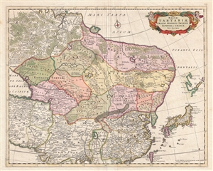
Magnae Tartariae Magni Mogolis Imperii Iaponiae et Chinae Nova Descriptio
sold
- Digital Map Information
- Suitable for large format printing
- Full resolution TIFF file
- ICC color profile embedded
- Delivered instantly via download link
A beautiful example of Frederick de Wit's c. 1680 map of Tartary. The map covers from just north of the Arctic Circle to Formosa south to the the Bay of Bengal and Formosa, and from the Caspian Sea to Hokkaido or Yedso. Although parts of China, Japan, ... (more details)
Created after the Ottomans conquered Crete, removing it from Venice's overseas empire.
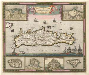
Insula Candia Ejusque Fortificatio.
sold
- Digital Map Information
- Suitable for large format printing
- DPI: 600
- File Size: 29.76 MB
- File Type: ZIP / TIFF
- ICC color profile embedded
- Delivered instantly via download link
This is a c. 1680 Frederik de Wit map of Crete only years after the end of the Cretan War, which is also known as the Fifth Ottoman-Venetian War. Based on a map created by Sébastien Pontault de Beaulieu, the map depicts the entire island after the end of the Siege of Candia, a 24-year long siege of a fortress on Crete. Candia, along with myriad other cities, towns, and villages are labeled all across Crete, and roads, rivers, and mountain ranges are also illustrated. Six inset maps are placed along the borders that focus on Crete's fortresses at Canea, Candia, Spina Longa, Retimo, Thine, and Suda, a natural inclusion since Pontault de Beaulieu is known for his work illustrating Mediterranean fortifications. (more details)
Impressive original color with fine gilt work.
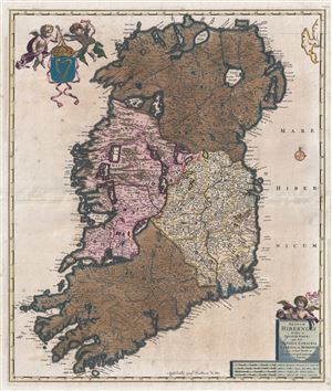
Regnum Hiberniae divisum in Quatuor Partes quae sunt Ultonia Conachia Lagenia et Momonia quae et sunt Divisae in Omnes Suos Comitatus.
sold
- Digital Map Information
- Suitable for large format printing
- Full resolution TIFF file
- ICC color profile embedded
- Delivered instantly via download link
This is a rare large format map of Ireland by Frederik de Witt. Issued in 1680, the map covers the entirety of insular Ireland in considerable detail. Counties, roadways, rivers, swamps, forests, and mountain rangers are noted. Topography is rendered ... (more details)
The Russo-Swedish Deluge.
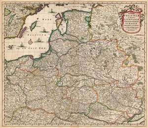
Regni Poloniae et Ducatus Lithuaniae Voliniae, Podoliae, Ucraniae, Prussiae, Livoniae, et Curlandiae descriptio emendata per F. de Wit Amstelodami.
sold
- Digital Map Information
- Suitable for large format printing
- DPI: 600
- File Size: 62.52 MB
- File Type: ZIP / TIFF
- ICC color profile embedded
- Delivered instantly via download link
This is a striking example of Frederik de Wit's 1680 map of the Kingdom of Poland and the Grand Duchy of Lithuania. The map spans from the Baltic Sea to the Black Sea, and from Latvia to Moldova, including much of modern-day Poland and Lithuania. (more details)
Extremely rare and early oversized double hemisphere constellation map, or celestial, by Frederik de Wit.
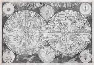
Planisphaerium Coeleste.
sold
- Digital Map Information
- Suitable for large format printing
- DPI: 300
- File Size: 84.78 MB
- File Type: ZIP / TIFF
- ICC color profile embedded
- Delivered instantly via download link
A remarkable and very rare example of Frederic de Wit's c. 1680 oversized and beautifully engraved double hemisphere celestial map. The map consists of two hemispheres surrounded by six supplementary diagrams. These illustrated the Copernican ... (more details)
Extremely rare and early oversized double hemisphere constellation map, or celestial, by Frederik de Wit.
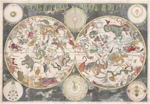
Planisphaerium Coeleste.
sold
- Digital Map Information
- Suitable for large format printing
- DPI: 300
- File Size: 18.1 MB
- File Type: ZIP / TIFF
- ICC color profile embedded
- Delivered instantly via download link
A remarkable and very rare example of Frederic de Wit's c. 1680 oversized and beautifully engraved double hemisphere celestial map. The map consists of two hemispheres surrounded by six supplementary diagrams. These illustrated the Copernican ... (more details)
De Wit's masterful sea chart of the West Indies during the Golden Age of Caribbean Piracy.
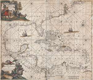
Indiarum Occidentalium Tractus Littorales cum Insulis Caribicis. / Pascaert van Westindien ende Caribise Eylanden.
sold
- Digital Map Information
- Suitable for large format printing
- DPI: 300
- File Size: 12.56 MB
- File Type: ZIP / TIFF
- ICC color profile embedded
- Delivered instantly via download link
A fine and rare old color example of the second edition of Frederick de Wit's 1680 nautical chart or maritime map of the West Indies, Central America, Gulf of Mexico, and Florida. Printed during the Golden Age of Caribbean Piracy, this sea ... (more details)
Striking decorative map of Poland and Lithuania!
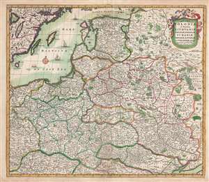
Regni Poloniae et Ducatus Lithuaniae Voliniae, Podoliae, Ucraniae, Prussiae, Lovoniae, et Curlandiae descriptio.
sold
- Digital Map Information
- Suitable for large format printing
- DPI: 300
- File Size: 13.24 MB
- File Type: ZIP / TIFF
- ICC color profile embedded
- Delivered instantly via download link
This is a striking and highly decorative c. 1682 Frederik de Wit map of Poland and Lithuania. The map covers from the Baltic Sea to the Black Sea and from Latvia to Moldova, including much of modern day Poland and Lithuania. The map was ... (more details)
Slowly improving European cartography of Africa.
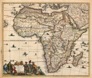
Totius Africae Accuratissima Tabula.
sold
- Digital Map Information
- Suitable for large format printing
- DPI: 600
- File Size: 25.13 MB
- File Type: ZIP / TIFF
- ICC color profile embedded
- Delivered instantly via download link
A beautiful example of Frederick De Wit's 1685 map of Africa. The map covers all of Africa and parts of Arabia, as well as the adjacent portions of the Atlantic and Indian oceans and Mediterranean Sea. Cartographically, it is a composite of earlier maps, including Jodocus Hondius's map of 1623, Willem Blaeu's map of 1617, and Visscher's map of 1658. In the lower-left corner, the decorative cartouche features three Moors and a child on the left, as well as several Africans with two children on the right. (more details)
The frontier between the Habsburg Empire and the Ottoman Empire.
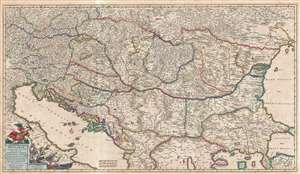
Regni Hungariae et regionum, quae ei quondam fuere unitae, ut Transilvaniae, Valachiae, Moldaviae, Serviae, Romaniae, Bulgariae, Bessarabiae, Croatiae, Bosniae, Dalmatiae, Sclavoniae, Morlachiae, Ragusanae Reipublicae, maximaeq[ue] partis Danubii Fluminis, novissima delineatio.
sold
- Digital Map Information
- Suitable for large format printing
- DPI: 300
- File Size: 24.01 MB
- File Type: ZIP / TIFF
- ICC color profile embedded
- Delivered instantly via download link
A sprawling 1688 decorative map of the Balkans by Fredrik de Wit. The map depicts from the Adriatic to the Black Sea and from Poland to Macedonia, focusing on the multiethnic, multilingual, and multinational Hungarian empire. It includes ... (more details)
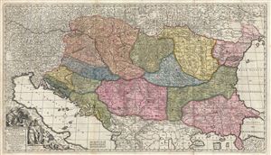
Regni Hungariae et regionum, quae ei quondam fuere unitae, ut Transilvaniae, Valachiae, Moldaviae, Serviae, Romaniae, Bulgariae, Bessarabiae, Croatiae, Bosniae, Dalmatiae, Sclavoniae, Morlachiae, Ragusanae Reipublicae, maximaeq[ue] partis Danubii Fluminis, novissima delineatio.
sold
- Digital Map Information
- Suitable for large format printing
- Full resolution TIFF file
- ICC color profile embedded
- Delivered instantly via download link
A sprawling 1688 decorative map of the Balkans by Fredrick de Wit. Covering from the Adriatic to the Black Sea and from Poland to Macedonia, this large map focuses on the multiethnic, multilingual, and multinational Hungarian Empire. It ... (more details)
Extremely Rare Imprint of a Beautiful Map of the Middle East.
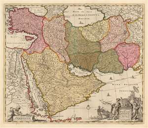
Nova Persiae Armeniae Natoliae et Arabiae Descriptio per F. de Wit.
sold
- Digital Map Information
- Suitable for large format printing
- Full resolution TIFF file
- ICC color profile embedded
- Delivered instantly via download link
This beautifully engraved and colored map is Frederick de Wit's 1666 map of the Middle East, in a rare c. 1690 edition published in London by Christopher Browne. The map spans from Constantinople and the Nile River Valley in the west, to the mouth of the Indus River in the east; it stretches from the Black Sea and the Caspian Sea in the north to the southern tip of the Arabian Peninsula. Tibbets described this map as 'the largest scale map of the area until 1700' and 'the most useful until D’Anville’s map of 1751' which would explain much of its popularity: the map was added to many atlases, with few changes, well into the late eighteenth century. The map is centered on the Persian Empire but includes the whole of the Arabian Peninsula and Asia Minor. The Caspian Sea appears in a distorted, elongated shape which may have been a conflation of both the Caspian and the neighboring Aral Sea. (more details)
Dutch Golden Age map of the British Isles.
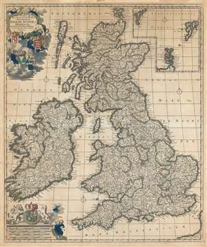
Novissima prae caeteris aliis accuratissima regnorum Angliae, Scotiae, Hiberniae.
sold
- Digital Map Information
- Suitable for large format printing
- DPI: 600
- File Size: 44.67 MB
- File Type: ZIP / TIFF
- ICC color profile embedded
- Delivered instantly via download link
An impressive c. 1690 Dutch Golden Age map of the British Isles by Frederick de Wit. The map including England, Scotland, Wales, and Ireland, as well as an inset of the Faro, Shetland and Orkney Islands. The title cartouche, appearing in the upper left, is surrounded by clouds in which putti display the coats of arms of England, Scotland and Ireland. The scale of miles, appearing in the lower left, is further embellished with the royal joint-sovereignty coat of arms of William and Mary (1689-94). (more details)
Superb Original Color.
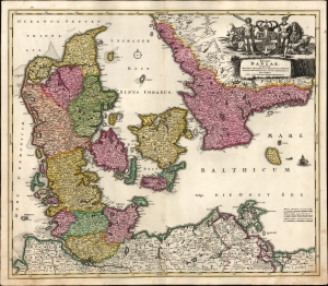
Regni Daniae in quo sunt Ducatus Holsatia et Slesvicum, Insulae Danicae Provinciae Iutia Scania Blekingia etc. Nova Tabula edita á Io. Baptista Homanno Noribergae.
sold
- Digital Map Information
- Suitable for large format printing
- File Size: 24.05 MB
- File Type: ZIP / TIFF
- ICC color profile embedded
- Delivered instantly via download link
A beautiful, original color example of Johann Baptist Homann's 1702 map of Denmark. One of Homann's earliest works, this was probably engraved by the Johann Baptist Homann himself during his brief apprenticeship under David Funcke. It is a bold and elegant engraving typical of the elder Homann. (more details)
Engraved at the Height of the Golden Age of Dutch Cartography
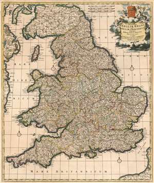
Accuratissima Angliae Regnum et Walliae Principatus Descriptio Distincté Divisa in Omnes Suas Provincias.
sold
- Digital Map Information
- Suitable for large format printing
- DPI: 600
- File Size: 37.19 MB
- File Type: ZIP / TIFF
- ICC color profile embedded
- Delivered instantly via download link
This is Frederic De Wit's superbly engraved 1662 map of England and Wales, in one of its most complete states. De Wit's last, fifth state of the map (coinciding with his being granted his privilege, in 1689) exhibits the totality of its maker's aesthetic changes. De Wit completely re-engraved the cartouche and the scales at that time, with its four splendid putti and the crowned Royal Arms of England. The maps produced in Amsterdam in the latter part of the 17th century enjoyed both technological advances both in printing technology (resulting in larger presses, hence larger plates and larger maps) and in the art of engraving (resulting in finer and more dense geographical detail and toponymy.) Hence both as geographical documents and works of art, they represent great steps forward. (more details)
Everything about America of interest to the Dutchman.
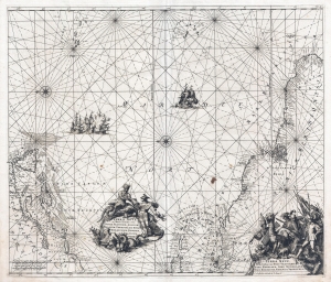
Terra Nova ac Maris Tractus circa Novam Franciam, Angliam, Belgium, Venezuelam Novam Andalusium, Guianam, Brasiliam. / Terra Neuf en de Custen van Nieu Vranckryck, Nieu Engeland, Nieu Nederland, Nieu Andalusia, Guiana en Venezuela.
sold
- Digital Map Information
- Suitable for large format printing
- DPI: 300
- File Size: 14.9 MB
- File Type: ZIP / TIFF
- ICC color profile embedded
- Delivered instantly via download link
A stunning example of the 1715 L. Renard edition of Frederick de Wit's map of the western Atlantic. The map illustrates the full scope of Dutch interest in the Americans, covering from Newfoundland to Brazil, including New York, New England, the eastern West Indies, and northeastern South America. By the time Renard reissued the map in 1715, the Dutch had long since surrendered control of New York to the British. Nonetheless, the longevity and popularity of this map among Dutch publisher is ample evidence of lingering ambitions to regain their American colonies. (more details)
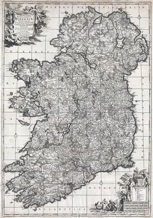
Novissima ac prae caeteris alus accuratissima Regni et Insulae Hiberniae delineatio in qua sunt Lagenia, Ultonia, Connachia et Momonia Provinciae divisae in triginta duos Comitatus qui et sunt divisi in omnes subjacentes Baronnatus.
sold
- Digital Map Information
- Suitable for large format printing
- DPI: 300
- File Size: 24.73 MB
- File Type: ZIP / TIFF
- ICC color profile embedded
- Delivered instantly via download link
An uncommon large format map of Ireland by Frederik de Witt. This is the c. 1721 Covens and Mortier edition of a map originally issued in 1690. The map covers the entirety of insular Ireland in considerable detail. Counties, roadways, ... (more details)
The Dominant Mapping of Italy of the 17th Century, Updated and Amended.
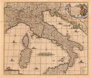
Novissima et Accuratissima totius Italiae, Corsicae et Sardiniae Descriptio Correcta, multis auct Locis et Viis editaque.
sold
- Digital Map Information
- Suitable for large format printing
- Full resolution TIFF file
- ICC color profile embedded
- Delivered instantly via download link
This is an attractive and scarce map of Italy, engraved c. 1680 by Frederik De Wit, but updated in 1721 by the Amsterdam publishers Covens and Mortier. Covens and Mortier added many place names and included the post road system first introduced on a 1695 map of Italy by Giacomo Cantelli da Vignola. The map covers the Italian Peninsula in its entirety including the Dalmatian coast, at the time controlled by the Republic of Venice, as well as the islands of Corsica, Sardinia, and part of Sicily. As with virtually every map of Italy produced in the seventeenth century, De Wit follows the model established by Magini's monumental 1608 Italia Nuova. Magini's map was justifiably influential, rendering the whole of Italy and its islands in magnificent detail with their river systems clearly presented and mountains shown pictorially. (more details)
Beautiful map of Brabant, part of modern day Belgium and the Netherlands.
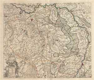
Brabantiae pars Orientalis.
sold
- Digital Map Information
- Suitable for large format printing
- Full resolution TIFF file
- ICC color profile embedded
- Delivered instantly via download link
This is an attractive c.1721 map of the Duchy of Brabant by Frederik De Wit. The map depicts part of modern day Belgium and the Netherlands, which were at the time this map was made, part of the Duchy of Brabant. It extends from ... (more details)
Scarce early map of Tuscany and the Papal States.
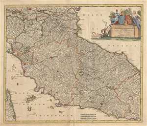
Status Ecclesiasticus et Magnus Ducatus Thoscanae.
sold
- Digital Map Information
- Suitable for large format printing
- Full resolution TIFF file
- ICC color profile embedded
- Delivered instantly via download link
This is an attractive c.1721 map of depicting central Italy and the regions of Tuscany and the States of the Church or the Papal States by Frederik De Wit. It covers from the Isle of Ariano south as far as Gaeta. The Island of ... (more details)
Early 18th century map of the Hesse-Kassel region of Germany.
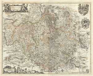
Hassia Landgraviatus.
sold
- Digital Map Information
- Suitable for large format printing
- Full resolution TIFF file
- ICC color profile embedded
- Delivered instantly via download link
This is a beautiful c.1721 map of the Hesse-Kassel region in Germany by Frederik De Wit. The map depicts the Landgraviate of Hesse with its capital Kassel (here noted Cassel), which forms the northern parts of the modern day ... (more details)
Early decorative map of Italy.
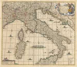
Novissima et Accuratissima totius Italiae, Corsicae et Sardiniae Descriptio Correcta, multis auct Locis et Viis editaque.
sold
- Digital Map Information
- Suitable for large format printing
- Full resolution TIFF file
- ICC color profile embedded
- Delivered instantly via download link
This is an attractive c.1721 map of Italy by Frederik De Wit. It covers Italian Peninsula in its entirety including the Dalmatian coast, at the time controlled by the Republic of Venice. Also includes the islands of Corsica ... (more details)
Detailed map of southern Netherlands dating to the early 18th century.
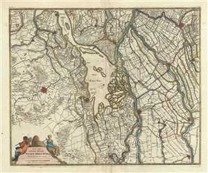
Nova atque emendata descriptio Suydt Hollandiae.
sold
- Digital Map Information
- Suitable for large format printing
- Full resolution TIFF file
- ICC color profile embedded
- Delivered instantly via download link
This is a beautiful c.1721 map of southern Holland or the Netherlands by Frederik De Wit. Oriented with north facing northwest, it extends from Gouda south to Breda and from Willemstad east as far as Culemborg. Important ... (more details)
Beatifull map of the central and eastern provinces of the Netherlands.
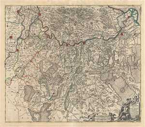
Comitatus Zutphaniae sive Geldriae Tetrachiae Zutphaniensis Isalae Fluvii.
sold
- Digital Map Information
- Suitable for large format printing
- Full resolution TIFF file
- ICC color profile embedded
- Delivered instantly via download link
This is a scarce c.1721 map of the provinces of Overijssel and Gelderland in Holland or the Netherlands by Frederik De Wit. Oriented with north in the east, it covers from Kampen south to Kleve in Germany and Arnhem ... (more details)
Early map representing the County of Moers, Germany.
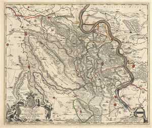
Illustrissimo Celsissmo Principi Guilielmo Henrico D.G. Arausionum Principi Domino suo Clementissimo Hanc Comitatus Meursensis et Annexarum Dinastiarum.
sold
- Digital Map Information
- Suitable for large format printing
- Full resolution TIFF file
- ICC color profile embedded
- Delivered instantly via download link
This is an attractive c.1721 map of the county of Moers, Germany by Frederik De Wit. The map depicts what was then the County of Moers, on the western bank of the Rhine River. The entire map is depicted in ... (more details)
Scarce map of the Electorate of Trier, Germany.
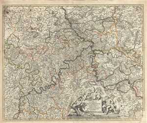
Archiepiscopatus et Electoratus Trevirensis Novissima delineatio Exacte divisa in omnes Suas Praefecturas
sold
- Digital Map Information
- Suitable for large format printing
- Full resolution TIFF file
- ICC color profile embedded
- Delivered instantly via download link
This is a beautiful c.1721 map of the Electorate of Trier, in Germany by Frederik De Wit. It covers from Duren to Trier and includes the important cities of Bonn, Mainz, Trier and Kolbenz. The entire ... (more details)
Detailed map of Netherlands dating to the early 18th century.
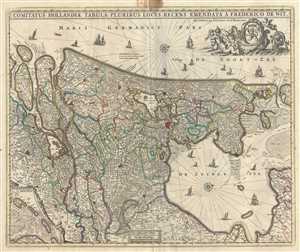
Comitatus Hollandiae tabula Pluribus Locis Recens.
sold
- Digital Map Information
- Suitable for large format printing
- Full resolution TIFF file
- ICC color profile embedded
- Delivered instantly via download link
A beautiful c.1721 map of Holland or the Netherlands by Frederik De Wit. Oriented with north on the right, the map extends from modern day Goeree-Overflakkee north to Texel and inland as far as ... (more details)
Beautiful map depicting the flow of the Northern Dwina River in Russia.
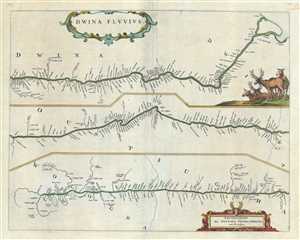
Dwina Fluvius.
sold
- Digital Map Information
- Suitable for large format printing
- Full resolution TIFF file
- ICC color profile embedded
- Delivered instantly via download link
This is a beautiful 1721 map of the Northern Dvina River in northern Russia by Frederik De Wit. The map is divided into three sections to follow the course of the river from its source in the ... (more details)