
Walker, John (J. and C. Walker)

John Walker (1787 - April 19, 1873) was a British map seller, engraver, lithographer, hydrographer, geographer, draughtsman, and publisher active in London during the 19th century. Walker published both nautical charts and geographical maps. His nautical work is particularly distinguished as he was an official hydrographer for the British East India Company, a position, incidentally, also held by his father of the same name. Walker's maps, mostly published after 1827, were primarily produced with his brothers Charles Walker and Alexander Walker under the imprint J. and C. Walker. Among their joint projects are more than 200 maps for the influential Society for the Diffusion of Useful Knowledge Atlas (SDUK). In addition they published numerous charts for James Horsburgh and the British Admiralty Hydrographic Office, including Belcher's important map of Hong Kong and Carless' exploratory map of Karachi. The J. and C. Walker firm continued to publish after both Walkers died in the 1870s.
AKA: J. and C. Walker
Largest and Best Map of Lower Canada after the War of 1812.
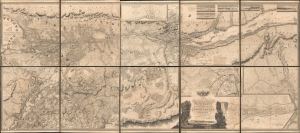
To His Royal Highness George Augustus Frederick, Prince of Wales, Duke of Cornwall ... and Prince Regent of the United Kingdom of Great Britain and Ireland; this Topographical map of the Province of Lower Canada, shewing its division into Districts, Counties, Seigniories, and Townships with all the Lands reserved both for the Crown and the Clergy ... Is with his Royal Hyghnes's Special Permission, Most gratefully dedicated by a Faithful and Zealous Canadian Subject, and His Royal Highnes's Most Obedient and Devoted Servant, Joseph Bouchette, His Majesty's Surveyor General of the Province and Lieutt. Colonel C.M.
$25,000.00
Acquire
- Digital Map Information
- Suitable for large format printing
- File Size: 317.57 MB
- File Type: ZIP / TIFF
- ICC color profile embedded
- Delivered instantly via download link
This is Joseph Bouchette's monumental 10-sheet map of Lower Canada. Appearing at the end of the War of 1812, this is the largest, best, and most influential map of Canada issued in the 19th century. David Rumsey correctly praises it, saying that the 'graphic elegance of the large map is the equal (or perhaps the superior) of any of the contemporary maps that I have seen'. In its pre-publication manuscript form, it played a significant role in the Treaty of Ghent, which ended the War of 1812 and began the establishment of formal U.S.-Canada borders. Due to its extreme rarity, the significance of this map is often overlooked, and it is poorly represented in scholarly literature. (more details)
First accurate map of Thailand.
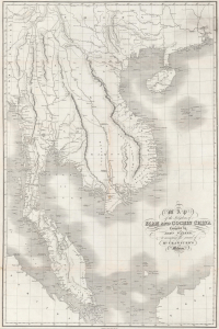
Map of the Kingdoms of Siam and Cochin China.
$2,800.00
Acquire
- Digital Map Information
- Suitable for large format printing
- DPI: 600
- File Size: 101.92 MB
- File Type: ZIP / TIFF
- ICC color profile embedded
- Delivered instantly via download link
This rare large-format 1828 map of Southeast Asia, compiled by John Walker to illustrate John Crawfurd's mission to Siam (Thailand), is the first accurate survey of the coasts of Siam. Coverage extends from China to Singapore and from the Gulf of Martaban (Burma) to Vietnam and Hainan. Siam at the time was inaccessible to European merchants and even diplomats, with its coasts and interior largely unknown. This map is an amalgam of European sources, but with regard to Siam, it was derived primarily from secretly acquired early 19th-century Siamese surveys previously unknown to Europeans and, for all intents and purposes, still lost. (more details)
First scientific penetration of Burma.
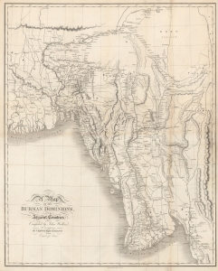
Map of the Burman Dominions, and Adjacent Countries.
$1,000.00
Acquire
- Digital Map Information
- Suitable for large format printing
- DPI: 600
- File Size: 44.31 MB
- File Type: ZIP / TIFF
- ICC color profile embedded
- Delivered instantly via download link
This is an 1829 John Crawfurd and John Walker map of Burma (Myanmar). The map, considered the first accurate map of this region, was prepared to illustrate John Crawfurd's Embassy to Ava to negotiate with Burmese King Bagyidaw following the First Anglo-Burmese War (1824 - 1826). (more details)
Most important Canadian immigration and settlement initiative.
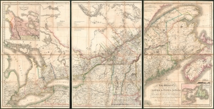
To His Most Excellent Majesty King William IVth This Map of the Provinces of Lower and Upper Canada, Nova Scotia, New Brunswick, Newfoundland and Prince Edwards Island, with a Large Section of the United States...
$19,500.00
Acquire
- Digital Map Information
- Suitable for large format printing
- Full resolution TIFF file
- ICC color profile embedded
- Delivered instantly via download link
This is Joseph-Francis Bouchette's rare large-scale 1831 map of Canada - a seminal map relating to Canadian development, immigration, and land usage. The map details the provinces of Upper and Lower Canada (Ontario and Quebec), which were established in 1791. Most significantly, the map focuses on lands, towns, roads, and districts designated to the Canada Company - the most important immigration and settlement initiative in Canadian history. The Canada Company’s copious settlements are indicated on the map by an asterisk or a cross next to each name. Bouchette notes land disputes between the United States and British North America in Maine and Oregon, but predictably advocates exclusively for British positions. (more details)
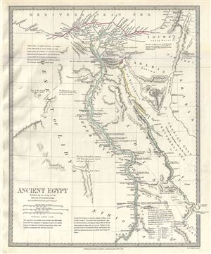
Ancient Egypt.
$150.00
Acquire
- Digital Map Information
- Suitable for large format printing
- DPI: 300
- File Size: 5.1 MB
- File Type: ZIP / TIFF
- ICC color profile embedded
- Delivered instantly via download link
This is a fascinating and beautiful 1831 example of the Society for the Diffusion of Useful Knowledge or S.D.U.K. map of ancient Egypt. Centered on the Nile River Delta, the map covers Egypt and the Sinai Peninsula and part of Arabia and the Red Sea. Several ... (more details)
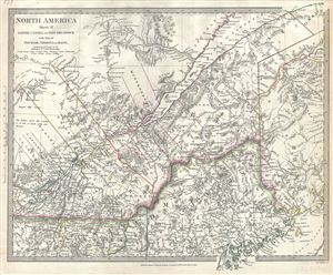
North America Sheet II Lower Canada and New Brunswick with Part of New York, Vermont and Maine.
$100.00
Acquire
- Digital Map Information
- Suitable for large format printing
- DPI: 300
- File Size: 7.65 MB
- File Type: ZIP / TIFF
- ICC color profile embedded
- Delivered instantly via download link
A beautiful 1832 map of Lower Canada with parts of Maine and New Brunswick by the Society for the Diffusion of Useful Knowledge or S.D.U.K. Centered on the St. Lawrence River, it covers part of Quebec or Lower Canada from Vaudreuil to the Chaleur Bay and ... (more details)
Early map of German Confederate states including Czech Republic, Hungary and Austria.
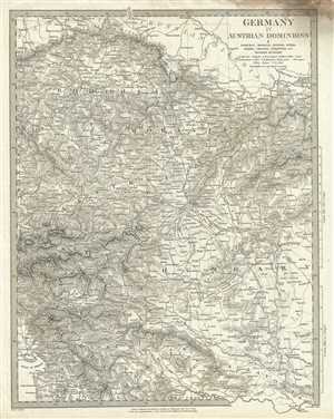
Germany IV Austrian Dominions I Bohemia, Moravia, Austria, Styria, Illyria, Croatia, Sclavonia and Western Hungary.
$75.00
Acquire
- Digital Map Information
- Suitable for large format printing
- DPI: 300
- File Size: 9.24 MB
- File Type: ZIP / TIFF
- ICC color profile embedded
- Delivered instantly via download link
This is a beautiful 1832 first edition S.D.U.K. map of Central Europe and the German States including Eastern Austria, Western Hungary, Czech Republic and parts of the Balkan states. Throughout, the map identifies various cities, towns, rivers and ... (more details)
Attractive map showing Indian tribes in Mississippi.
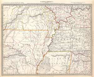
North America Sheet X Parts of Missouri, Illinois, Kentucky, Tennessee, Alabama, Mississippi and Arkansas.
$125.00
Acquire
- Digital Map Information
- Suitable for large format printing
- Full resolution TIFF file
- ICC color profile embedded
- Delivered instantly via download link
This is an 1833 Society for the Diffusion of Useful Knowledge or S.D.U.K. map of Arkansas, Missouri, Mississippi, Kentucky, Tennessee, Alabama and Illinois. The map depicts the region from the Ozark Mountains to Rome, Indiana and Huntsville, Alabama and from Mount Leansboro, Illinois to Columbus, Mississippi. The states are outlined in different colors to allow for easy differentiation, along with individual counties within each state, which are also labeled. Cities, towns, and villages are identified throughout, including Little Rock, Arkansas. Rivers, mountains, Indian villages, and topographical features are also noted throughout, with relief shown by hachure. (more details)
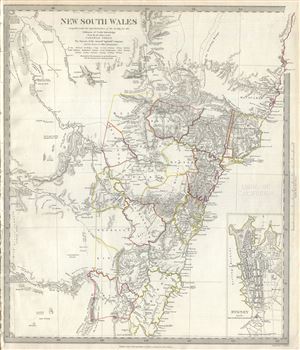
New South Wales.
$200.00
Acquire
- Digital Map Information
- Suitable for large format printing
- DPI: 300
- File Size: 6.57 MB
- File Type: ZIP / TIFF
- ICC color profile embedded
- Delivered instantly via download link
This is a fascinating 1833 map of New South Wales, Australia, by the Society for the Diffusion of Useful Knowledge or S.D.U.K. It covers eastern Australia from Solitary Island to Bateman Bay. Although the coastlines are accurately mapped, much of ... (more details)
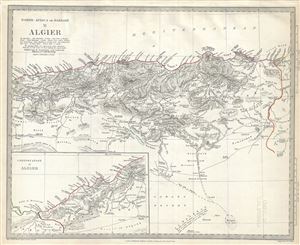
North Africa or Barbary II Algier.
$100.00
Acquire
- Digital Map Information
- Suitable for large format printing
- DPI: 300
- File Size: 6.17 MB
- File Type: ZIP / TIFF
- ICC color profile embedded
- Delivered instantly via download link
This is a scarce and beautiful 1834 Society for the Diffusion of Useful Knowledge or S.D.U.K. map of Algeria on the Barbary Coast of northern Africa. It covers from the Mediterranean Sea south to the Sahara Desert and the Melgig Salt Marsh and ... (more details)
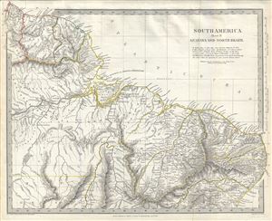
South America Sheet II Guayana and North Brazil.
$125.00
Acquire
- Digital Map Information
- Suitable for large format printing
- DPI: 300
- File Size: 6.93 MB
- File Type: ZIP / TIFF
- ICC color profile embedded
- Delivered instantly via download link
This is a fine example of the 1837 Society for the Diffusion of Useful Knowledge or S.D.U.K. map of Guyana and northern Brazil. It covers from British Guyana south to Bahia. Dutch and French Guyana are also included. Throughout, the map ... (more details)
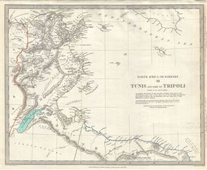
North Africa or Barbary III Tunis and part of Tripoli
$175.00
Acquire
- Digital Map Information
- Suitable for large format printing
- DPI: 300
- File Size: 6.27 MB
- File Type: ZIP / TIFF
- ICC color profile embedded
- Delivered instantly via download link
This is a scarce and beautiful 1836 Society for the Diffusion of Useful Knowledge or S.D.U.K. map of Tunisia and Tripoli on the Barbary Coast of northern Africa. It covers from the Annaba in Algeria east including all of Tunisia to ... (more details)
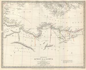
Ancient Africa or Libya Part II.
$100.00
Acquire
- Digital Map Information
- Suitable for large format printing
- DPI: 300
- File Size: 5.14 MB
- File Type: ZIP / TIFF
- ICC color profile embedded
- Delivered instantly via download link
This is a fine example of the 1840 Society for the Diffusion of Useful Knowledge or S.D.U.K. map of northern Africa in ancient times. It depicts the various ancient kingdoms and offers a good detail in the deserts - some of which ... (more details)
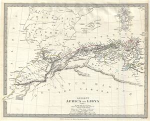
Ancient Africa or Libya Part I.
$125.00
Acquire
- Digital Map Information
- Suitable for large format printing
- DPI: 300
- File Size: 5.54 MB
- File Type: ZIP / TIFF
- ICC color profile embedded
- Delivered instantly via download link
This is a fine example of the 1840 Society for the Diffusion of Useful Knowledge or S.D.U.K. map of northern Africa in ancient times. It depicts the various ancient kingdoms and offers a good detail in the deserts - some of which ... (more details)
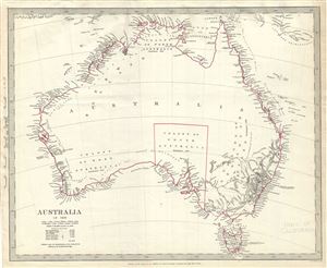
Australia in 1839.
$200.00
Acquire
- Digital Map Information
- Suitable for large format printing
- DPI: 300
- File Size: 4.57 MB
- File Type: ZIP / TIFF
- ICC color profile embedded
- Delivered instantly via download link
This is a fine example of the Society for the Diffusion of Useful Knowledge or S.D.U.K. map of Australia. It covers the entire continent of Australia along with Van Diemen's Land or Tasmania in 1839. An interesting map issued ... (more details)
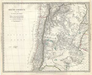
South America Sheet IV La Plata and Chile.
$125.00
Acquire
- Digital Map Information
- Suitable for large format printing
- DPI: 300
- File Size: 6.48 MB
- File Type: ZIP / TIFF
- ICC color profile embedded
- Delivered instantly via download link
This is a fine example of the 1840 Society for the Diffusion of Useful Knowledge or S.D.U.K. map of Chile and Argentina. It covers Chile and Argentina along with parts of Bolivia, Uruguay. Throughout, the map identifies ... (more details)
Texas as a Republic!
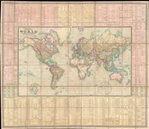
To Her Most Gracious Majesty Queen Victoria, This Map of the World on Mercator's Projection, is most respectfully dedicated, by Her devoted Subjects J. and C. Walker.
$7,500.00
Acquire
- Digital Map Information
- Suitable for large format printing
- File Size: 175.51 MB
- File Type: ZIP / TIFF
- ICC color profile embedded
- Delivered instantly via download link
A dramatic first edition of J. and C. Walker's 1840 highly decorative wall map of the world on Mercator's Projection - notable here for its bold inclusion of the Republic of Texas. It also rather neutrally addresses the ambiguity of the Oregon Question - an ongoing dispute between the United States and British Canada over claims to British Columbia that would not be resolved until 1846. This deluxe edition of the map is enhanced by extensive tables offering statistics and data on all parts of the world. (more details)
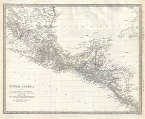
Central America 1. Including Yucatan, Belize, Guatemala, Salvador, Honduras, Nicaragua and the Southern States of Mexico.
$150.00
Acquire
- Digital Map Information
- Suitable for large format printing
- DPI: 300
- File Size: 6.7 MB
- File Type: ZIP / TIFF
- ICC color profile embedded
- Delivered instantly via download link
This is a scarce 1842 example of the Society for the Diffusion of Useful Knowledge or S.D.U.K. map of Central America, including southern Mexico, Guatemala, Belize, Yucatan, Honduras, El Salvador, Nicaragua and Costa Rica. ... (more details)
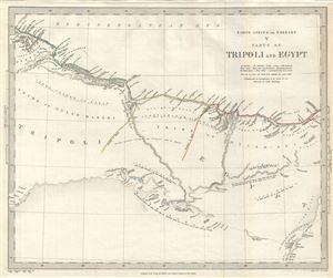
North Africa or Barbary V parts of Tripoli and Egypt.
$100.00
Acquire
- Digital Map Information
- Suitable for large format printing
- DPI: 300
- File Size: 4.78 MB
- File Type: ZIP / TIFF
- ICC color profile embedded
- Delivered instantly via download link
This is a scarce and beautiful 1837 Society for the Diffusion of Useful Knowledge or S.D.U.K. map of parts of Egypt and Tripoli, Libya on the Barbary Coast of Northern Africa. It covers from Al Bayda in Libya east as far ... (more details)
New treaty port mapped.
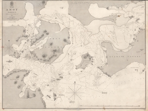
Amoy Harbour.
$950.00
Acquire
- Digital Map Information
- Suitable for large format printing
- DPI: 600
- File Size: 54.59 MB
- File Type: ZIP / TIFF
- ICC color profile embedded
- Delivered instantly via download link
This is an 1846 British Admiralty nautical chart or maritime map of Amoy (Xiamen / 厦门市), China, one of the treaty ports created by the Treaty of Nanking. It was published shortly after the First Opium War (1839 - 1842) and the signing of the Treaty of Nanking. This chart is the result of the important survey work that followed in the wake of the Opium Wars and the opening of wide-scale trade with China. It provided the bases of British maritime trade in and around Amoy for the subsequent 2 decades. (more details)
Treaty Ports in China.
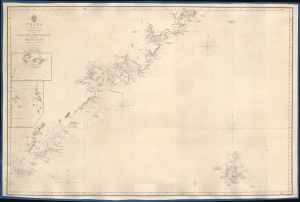
China Sheet IV. Eastern Coast from Chauan Bay to Port Matheson Including the Pescadore Islands.
$1,200.00
Acquire
- Digital Map Information
- Suitable for large format printing
- DPI: 600
- File Size: 24.79 MB
- File Type: ZIP / TIFF
- ICC color profile embedded
- Delivered instantly via download link
This is an 1849 British Admiralty Hydrographic Office nautical map of the Fujian coast of China. First published in 1844, only two years after the end of the First Opium War (1839 - 1842), Xiamen (Amoy) was the first of five treaty ports opened to the Europeans after the signing of the Treaty of Nanking, officially opening China to European traders. Before this treaty, only one port, Guangzhou, was open to European traders. Thus, this chart provided necessary details for mariners and traders taking advantage of this new market. (more details)
Charting the Chinese Coast, in War and Peace.
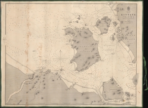
Kintang Channel.
$900.00
Acquire
- Digital Map Information
- Suitable for large format printing
- DPI: 600
- File Size: 633.74 MB
- File Type: ZIP / TIFF
- ICC color profile embedded
- Delivered instantly via download link
A remarkable 1849 first edition example of Richard Collinson's important blueback nautical chart or map of the coasts off Ningbo (Ning-po), between the Chinese mainland and Zhoushan (Chusan). These waters had long been important for China's interactions with the outside world and formed a strategic point of control during the First Opium War (1839 - 1842). (more details)
Most comprehensive and detailed mid-19th century map of Arabia.

A Map of Arabia and Syria Laid down chiefly from original Surveys Under the Supervision of Leiut. Colonel Chesney, R.A. F.R.S. and drawn by W. H. Plate, L.L.D.
$22,000.00
Acquire
- Digital Map Information
- Suitable for large format printing
- Full resolution TIFF file
- ICC color profile embedded
- Delivered instantly via download link
This is William Henry F. Plate's important 1849 map of Arabia, the Persian Gulf, Syria, and Mesopotamia. The product of a wave of new exploration and surveys in the first half of the 19th century, this map is the most significant and detailed map of Arabia and the Persian Gulf to appear in the mid-19th century. (more details)
Best general mapping of Arabia in Persia - drawn from first hand reports and exploration.
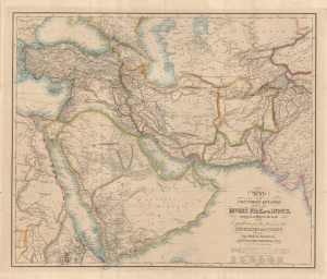
Map of the Counties Situated between the Rivers Nile and Indus; serving as an Inex to the work on the Expedition for hte Survey of the Euphrates and Tigris Drawn from Materials furinished by Lieut. Colonel Chesney R. S. F.R.S.
$12,000.00
Acquire
- Digital Map Information
- Suitable for large format printing
- Full resolution TIFF file
- ICC color profile embedded
- Delivered instantly via download link
This is a 1850 general map of Arabia and Persia, illustrating the route of Rawdon Chesney's Euphrates Expedition (1835 - 1837). Decades before the Suez Canal, Chesney proposed the Euphrates as a viable route for steamers to reach the Persian Gulf and, thus, India, avoiding the dangerous months-long voyage around Africa. The cartography presented is the most advanced general mapping of Arabia and Persia then available, being either directly derived from the 1830s Euphrates Expedition or collected from local sources en route. (more details)
First and largest chart of Karachi as an EIC Port.
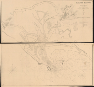
Karachi Harbour, surveyed by Lieut. A. M. Grieve, I.N. Assisted by Lieuts. Constable and Barker.
$6,000.00
Acquire
- Digital Map Information
- Suitable for large format printing
- DPI: 600
- File Size: 112.65 MB
- File Type: ZIP / TIFF
- ICC color profile embedded
- Delivered instantly via download link
A seminal 1854 large-scale Indian Navy Albany M. Grieve nautical map of Karachi Harbor, in the Sindh region of what is today Pakistan. This is the second and certainly the largest map of Karachi, and the first as an East India Company port. It was issued in the same year that marked Karachi Harbor's opening to EIC traders and the completion of the connecting Napier Mole causeway - illustrated here. (more details)
Map of the Ganjam District, part of British India's Madras Presidency.
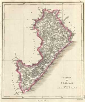
District of Ganjam.
$250.00
Acquire
- Digital Map Information
- Suitable for large format printing
- DPI: 300
- File Size: 2.95 MB
- File Type: ZIP / TIFF
- ICC color profile embedded
- Delivered instantly via download link
This is an unusual 1854 map of the Ganjam District (modern day Ganjam District and Srikakulam District in Odisha and Andhra Pradesh), India. It extends from the Chilika Lake south to Srikakulam or Chicacole. The map ... (more details)
Map of the North-Arcot district notes the town of Tirupati, one of the holiest sites in the Hindu religion.
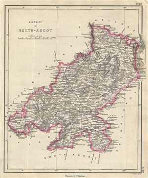
District of North-Arcot.
$250.00
Acquire
- Digital Map Information
- Suitable for large format printing
- DPI: 300
- File Size: 2.97 MB
- File Type: ZIP / TIFF
- ICC color profile embedded
- Delivered instantly via download link
This is an 1854 map of the district of North Arcot in Tamil Nadu, India. Issued by Pharoah and Company, it covers from Vandavasi north to Mettu and the Swarnamukhi River in the modern day state of Andhra Pradesh. ... (more details)
Map of the Trichinopoly district in British India.
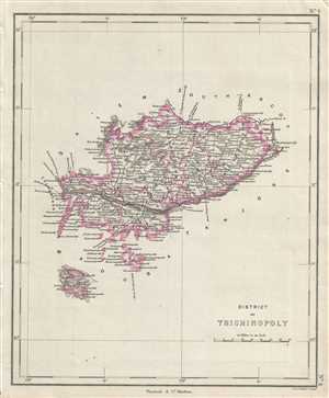
District of Trichinopoly.
$250.00
Acquire
- Digital Map Information
- Suitable for large format printing
- DPI: 300
- File Size: 2.3 MB
- File Type: ZIP / TIFF
- ICC color profile embedded
- Delivered instantly via download link
This is a nice example of the 1854 map of the District of Trichinopoly in the modern day state of Tamil Nadu, India, issued by Pharoah and Company. It covers from Karur east to Chidambaram. Includes important ... (more details)
Map of the Khammam province of the princely state of Hyderabad, India.
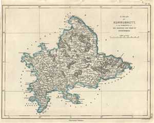
Circar of Kummummett in the Dominions of His Highness The Nizam of Hyderabad.
$250.00
Acquire
- Digital Map Information
- Suitable for large format printing
- DPI: 300
- File Size: 2.57 MB
- File Type: ZIP / TIFF
- ICC color profile embedded
- Delivered instantly via download link
This is an uncommon 1854 map of the Kummummet or Khammam Circar of the Nizam of Hyderabad. The map covers what is today the modern district of Khammam in the Indian state of Telangana from Kondapalli, Andhra ... (more details)
Pharoah and company map of the Kurnool district in the Indian state of Andhra Pradesh.
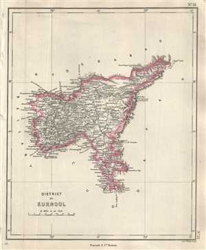
District of Kurnool.
$250.00
Acquire
- Digital Map Information
- Suitable for large format printing
- DPI: 300
- File Size: 2.24 MB
- File Type: ZIP / TIFF
- ICC color profile embedded
- Delivered instantly via download link
This is a lovely 1854 Pharoah and Company map of the Kurnool District of Andhra Pradesh, India. It extends from the Krishna River south to the Lankamalla reserved forest. Kurnool city is identified. The map ... (more details)
Map of part of the Amravati division of Maharashtra, India under the rule of the Nizam of Hyderabad.
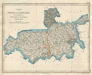
Circars of Nurnulla and Gawilghuk in the Dominions of His Highness the Nizam of Hyderabad.
$250.00
Acquire
- Digital Map Information
- Suitable for large format printing
- DPI: 300
- File Size: 2.71 MB
- File Type: ZIP / TIFF
- ICC color profile embedded
- Delivered instantly via download link
This is a good example of the 1854 Pharoah and Company map of part of the Amravati Division or the districts of Akola, Buldhana and Amravati in the Indian state of Maharashtra. It covers the circars or ... (more details)
Map of the dominions of the Nizam of Hyderabad when India was under British control.
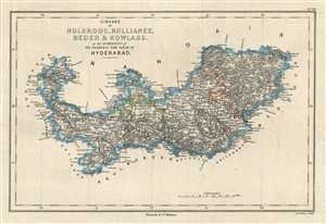
Circars of Nuldroog, Kullianee, Beder and Kowlass in the Dominions of His Highness the Nizam of Hyderabad.
$250.00
Acquire
- Digital Map Information
- Suitable for large format printing
- DPI: 300
- File Size: 3.09 MB
- File Type: ZIP / TIFF
- ICC color profile embedded
- Delivered instantly via download link
This is an attractive 1854 Pharoah and Company map of the Circars of Naldurg, Kalyani, Bidar and Kowlass under the Nizam of Hyderabad. The map extends from Dhoki Town in the modern day Osmanabad ... (more details)
19th century map of the divisions of the princely state of Hyderabad during British rule.
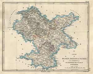
Circars of Maiker, Bassim & Patree in the Dominions of His Highness the Nizam of Hyderabad.
$250.00
Acquire
- Digital Map Information
- Suitable for large format printing
- DPI: 300
- File Size: 2.69 MB
- File Type: ZIP / TIFF
- ICC color profile embedded
- Delivered instantly via download link
This is an uncommon 1854 map of the Buldhana, Washim and Parbhani districts in the Indian state of Maharashtra. The map was issued by Pharoah and Company in 1854 and depicts the region when it ... (more details)
Map depicting the dominions of the Nizam of Hyderabad in parts of Maharashtra and Telangana, India.
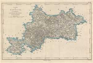
Circar of Nandair in the Dominions of His Highness the Nizam of Hyderabad.
$250.00
Acquire
- Digital Map Information
- Suitable for large format printing
- DPI: 300
- File Size: 3.72 MB
- File Type: ZIP / TIFF
- ICC color profile embedded
- Delivered instantly via download link
This is a lovely map depicting the circar of Nanded under the Nizam of Hyderabad corresponding to parts of the modern day districts of Nanded, Latur in Maharashtra and Nizamabad and Adilabad ... (more details)
19th century map of the princely state of Hyderabad during British rule.
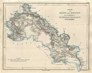
Circars of Mahoor and Ramgheer in the Dominions of His Highness the Nizam of Hyderabad.
$250.00
Acquire
- Digital Map Information
- Suitable for large format printing
- DPI: 300
- File Size: 2.58 MB
- File Type: ZIP / TIFF
- ICC color profile embedded
- Delivered instantly via download link
This is a lovely 1854 Pharoah and Company map of part of the Yavatmal and Adilabad districts in the Indian states of Maharashtra and Telangana. It covers the circars of Mahoor and Ramgheer ... (more details)
Pharoah map depicting part of the state of Tamil Nadu, India.
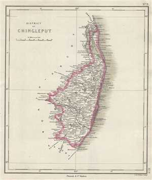
District of Chingleput.
$250.00
Acquire
- Digital Map Information
- Suitable for large format printing
- DPI: 300
- File Size: 2.3 MB
- File Type: ZIP / TIFF
- ICC color profile embedded
- Delivered instantly via download link
This is an interesting 1854 map of the District of Chingleput in the modern day state of Tamil Nadu, India, issued by Pharoah and Company. It depicts the district from the Pulicat Lake ... (more details)
Beautiful map depicting the Bellari District of Karnataka, India.
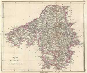
District of Bellary.
$250.00
Acquire
- Digital Map Information
- Suitable for large format printing
- DPI: 300
- File Size: 4.45 MB
- File Type: ZIP / TIFF
- ICC color profile embedded
- Delivered instantly via download link
This is an uncommon 1854 Pharoah and Company map of the district of Bellary in Karnataka, India. The map covers the district from Hyderabad south to Bangalore and from Dharwar east to ... (more details)
Beautiful map of the Tajore district in Tamil Nadu, India, home of the Tanjore paintings.
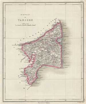
District of Tanjore.
$250.00
Acquire
- Digital Map Information
- Suitable for large format printing
- DPI: 300
- File Size: 2.55 MB
- File Type: ZIP / TIFF
- ICC color profile embedded
- Delivered instantly via download link
This is a nice example of the 1854 map of the District of Tanjore in the modern day state of Tamil Nadu, India, issued by Pharoah and Company. It covers from Mimbesel (Mimisal) north ... (more details)
19th century map of the princely state of Hyderabad during British rule.
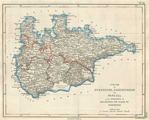
Circars of Ghunapoor, Davercondah and Pangull in the Dominion of His Highness the Nizam of Hyderabad.
$250.00
Acquire
- Digital Map Information
- Suitable for large format printing
- DPI: 300
- File Size: 2.67 MB
- File Type: ZIP / TIFF
- ICC color profile embedded
- Delivered instantly via download link
This is an uncommon 1854 Pharoah and Company map of the Circars or Sarkars of Ghunapoor, Davercondah and Pangull under the Nizam of Hyderabad. The map covers what is today part of ... (more details)
19th century map of the princely state of Hyderabad during British rule.
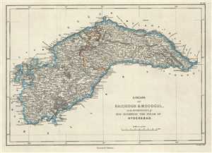
Circars of Raichoor and Moodgul in the Dominions of His Highness The Nizam of Hyderabad.
$250.00
Acquire
- Digital Map Information
- Suitable for large format printing
- DPI: 300
- File Size: 3.22 MB
- File Type: ZIP / TIFF
- ICC color profile embedded
- Delivered instantly via download link
This is a nice 1854 map of the Circars or Sarkars of Raichur and Mudgul under the Nizam of Hyderabad issued by Pharoah and Company. It covers what are today the Raichur and Koppal ... (more details)
Town plan of Samalkota in the Indian state of Andhra Pradesh.
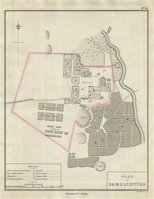
Plan of Samulcottah.
$175.00
Acquire
- Digital Map Information
- Suitable for large format printing
- DPI: 300
- File Size: 2.22 MB
- File Type: ZIP / TIFF
- ICC color profile embedded
- Delivered instantly via download link
This is a nice 1854 Pharoah and Company map of the town of Samalkota located in the East Godavari district of Andhra Pradesh, India. The map notes rivers, important roads, ... (more details)
Lovely depiction of the town of Eluru, India under British control.
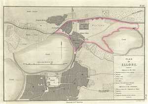
Plan of Ellore.
$200.00
Acquire
- Digital Map Information
- Suitable for large format printing
- DPI: 300
- File Size: 4.08 MB
- File Type: ZIP / TIFF
- ICC color profile embedded
- Delivered instantly via download link
This is a nice example of the 1854 Pharoah and Company map of the town of Eluru in the Indian State of Andhra Pradesh. It covers the town at the time it was a military ... (more details)
Hong Kong issued shortly after the acquisition of Kowloon.
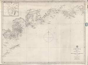
China Sheet II Eastern Coast from Hong Kong to Chelang Pt.
$2,200.00
Acquire
- Digital Map Information
- Suitable for large format printing
- File Size: 21.93 MB
- File Type: ZIP / TIFF
- ICC color profile embedded
- Delivered instantly via download link
A rare 1861 British Admiralty / Richard Collinson nautical map covering the coast of China around Hong Kong. It was issued shortly after the Second Opium War (1856 - 1860) and the British acquisition of Kowloon (which is labeled). (more details)
One of only 4 known examples of this rare early chart of Australia's coast.
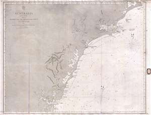
Australia East Coast Sheet IV Broken Bay to Sugarloaf Point.
$1,200.00
Acquire
- Digital Map Information
- Suitable for large format printing
- File Size: 16.08 MB
- File Type: ZIP / TIFF
- ICC color profile embedded
- Delivered instantly via download link
This is an extremely rare 1862 map of eastern Australia covering from Sugarloaf Point to Broken Bay, just north of Syndey. This is one of the earliest large scale ... (more details)
Charting British Control of Burma.
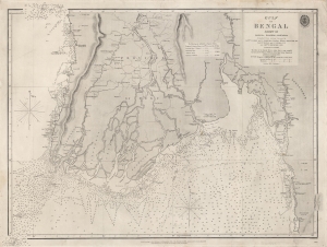
Gulf of Bengal Sheet VII Bassein, Rangoon, Martaban Compiled from various Surveys...
$550.00
Acquire
- Digital Map Information
- Suitable for large format printing
- File Size: 28.43 MB
- File Type: ZIP / TIFF
- ICC color profile embedded
- Delivered instantly via download link
A scarce 1863 British Admiralty chart of the waters off the coast of Burma (now Myanmar), focusing on the Irrawaddy River Delta, the Andaman Sea, and the Gulf of Martaban. It was produced following the Second Anglo-Burmese War (1852 - 1853), when the British took control of the region. (more details)
Just after the Second Opium War.
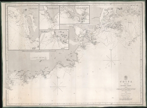
China Sheet III. Eastern Coast from Chelang Pt. to Chauan Bay.
$950.00
Acquire
- Digital Map Information
- Suitable for large format printing
- File Size: 22.28 MB
- File Type: ZIP / TIFF
- ICC color profile embedded
- Delivered instantly via download link
This is a rare 1863 British Admiralty nautical map of Guangdong, China, by Sir Richard Collinson. It was issued in the wake of the Second Opium War (1856 - 1860) and the signing of the 1860 Convention of Peking - an event that led to an explosion of foreign trade with China. (more details)
Laying the French-Atlantic Cable.
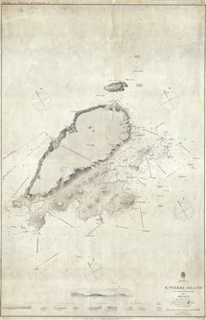
St. Pierre Island.
$750.00
Acquire
- Digital Map Information
- Suitable for large format printing
- File Size: 18.89 MB
- File Type: ZIP / TIFF
- ICC color profile embedded
- Delivered instantly via download link
A rare 1861 map of France's last colony in North America, the tiny island of St. Pierre of the coast of Newfoundland, with manuscript additions related to the French Atlantic Telegraph Company. This chart covers all of St. Pierre Island as well as the adjacent islands and the surrounding seas. The harbor community of St. Pierre is detailed with individual streets and buildings recognizable. This map is noteworthy not only for its rarity but also for the manuscript addition of the course of the French Atlantic Telegraph. (more details)
Important early Stokes nautical chart of Australia inlcuding Sydney, Port Jackson, and Botany Bay.
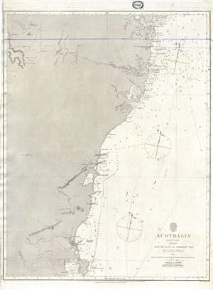
Australia East Coast Sheet III Jervis Bay to Broken Bay.
$1,200.00
Acquire
- Digital Map Information
- Suitable for large format printing
- File Size: 14.58 MB
- File Type: ZIP / TIFF
- ICC color profile embedded
- Delivered instantly via download link
This is an extremely rare 1865 map of eastern Australia covering from Broken Bay to Jervis Bay, including Sydney Port Jackson, and Botany Bay. This is one of the ... (more details)
Exceptional early nautical chart of southeastern Australia including inland topography.
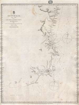
Australia East Coast Sheet I Cape Howe to Barriga Point.
$1,000.00
Acquire
- Digital Map Information
- Suitable for large format printing
- File Size: 8.96 MB
- File Type: ZIP / TIFF
- ICC color profile embedded
- Delivered instantly via download link
This is an extremely rare 1865 map of eastern Australia covering from Cape Howe to Barriga Point. It extends north as far as Mount Townsend and south to Bass ... (more details)
Exceptional early nautical chart of southeastern Australia including inland topography.
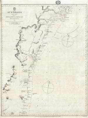
Australia East Coast Sheet II Barriga Point to Jervis Bay.
$1,000.00
Acquire
- Digital Map Information
- Suitable for large format printing
- File Size: 9.07 MB
- File Type: ZIP / TIFF
- ICC color profile embedded
- Delivered instantly via download link
This is an extremely rare 1865 map of eastern Australia covering from Jervis Bay to Barriga Point, including Ulladulla Harbor (then under construction) and ... (more details)