
Florida's Suburb of Hills and Lakes.
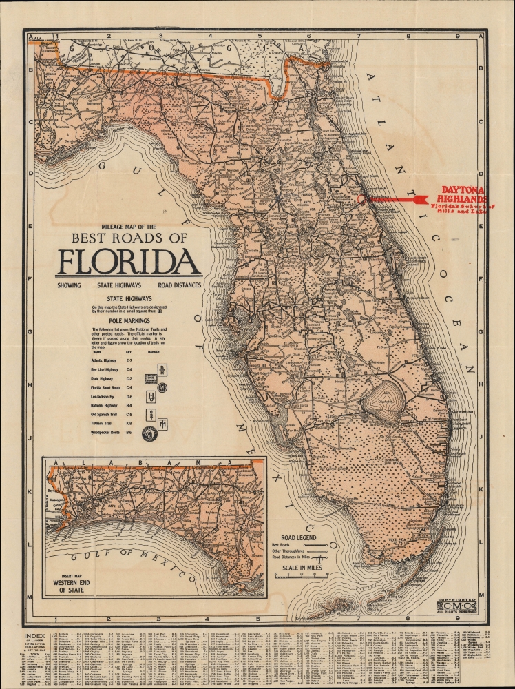
Milage Map of the Best Roads of Florida.
sold
- Digital Map Information
- Suitable for large format printing
- File Size: 12.3 MB
- File Type: ZIP / TIFF
- ICC color profile embedded
- Delivered instantly via download link
This is the c. 1922 Clason folding road map of Florida. It corresponds with the Florida Land Boom of the 1920s and was issued to promote real estate development in the Daytona Highlands neighborhood of Daytona Beach. (more details)
First edition.
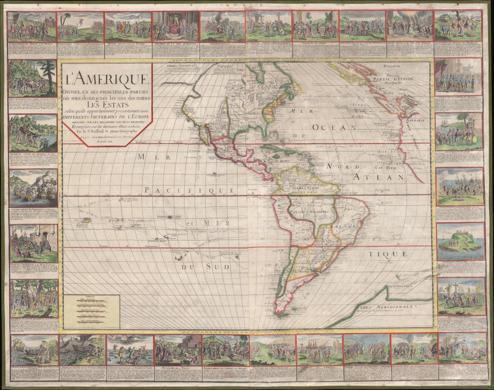
L'Amerique divisée en ses principales parties où sont distingués les uns des autres les estats : selon quils appartiennent presentement aux differents souverains de l'Europe : dressée sur les relations les plus recentes et rectifiées sur les dernieres observations.
sold
- Digital Map Information
- Suitable for large format printing
- Full resolution TIFF file
- ICC color profile embedded
- Delivered instantly via download link
A stunning 1752 wall map of the Americas by Nicolas Baillieul 'le jeune.' Aside from its aesthetic qualities, including elaborate border vignettes, it is also notable for reflecting developing notions of American geography, including tentative mapping of the northwest coast. (more details)
Qing map of Beijing.

北京全圖 / [Complete Map of Beijing].
sold
- Digital Map Information
- Suitable for large format printing
- File Size: 31.98 MB
- File Type: ZIP / TIFF
- ICC color profile embedded
- Delivered instantly via download link
This is a rare and meticulously composed manuscript map of Beijing from the 1860s, showing the inner and outer cities and noting a handful of sites outside the city walls. It notes important bureaucratic offices, temples, and other locations throughout the city, and is especially detailed in its cataloging of gates and structures inside the Forbidden City, as well as religious sites in and around Beijing. (more details)
Best and largest pictorial map of San Francisco.
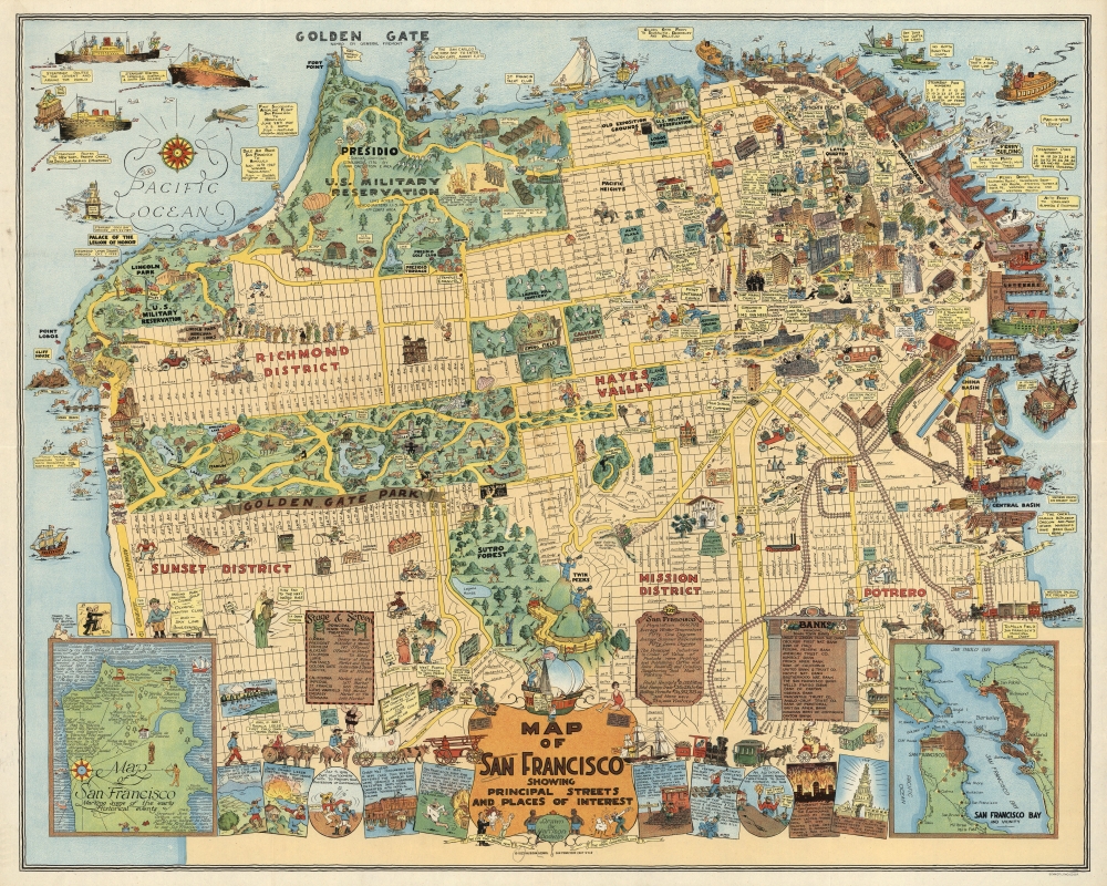
Map of San Francisco Showing Principal Streets and Places of Interest.
sold
- Digital Map Information
- Suitable for large format printing
- File Size: 48.96 MB
- File Type: ZIP / TIFF
- ICC color profile embedded
- Delivered instantly via download link
This is a 1927 Harrison Godwin pictorial map of San Francisco, California - considered the best genre illustration of that city. Comic illustrations appear alongside depictions of San Francisco landmarks, including the Fine Arts Palace, the Twin Peaks, and Fisherman's Wharf. Golden Gate Park appears in detail, with the many animal enclosures, lakes, and buildings all illustrated. The city's schools, churches, hospitals, post offices, and even the U.S. Mint (complete with workers shoveling gold coins into the back of a van) are marked. A surprising number of golfers and golf courses populate the map, with one fellow holding a sign that reads, 'San Francisco has 365 golfing days in the year'. Placards near the bottom border bear facts about the city and list its banks and theaters. Comic panels line the bottom border and present events in San Francisco's history, from its founding to its many fires. An inset in the lower left marks important events, while the inset in the lower right depicts the Greater Bay Area. (more details)
Photograph of the Battlefield of Gettysburg.
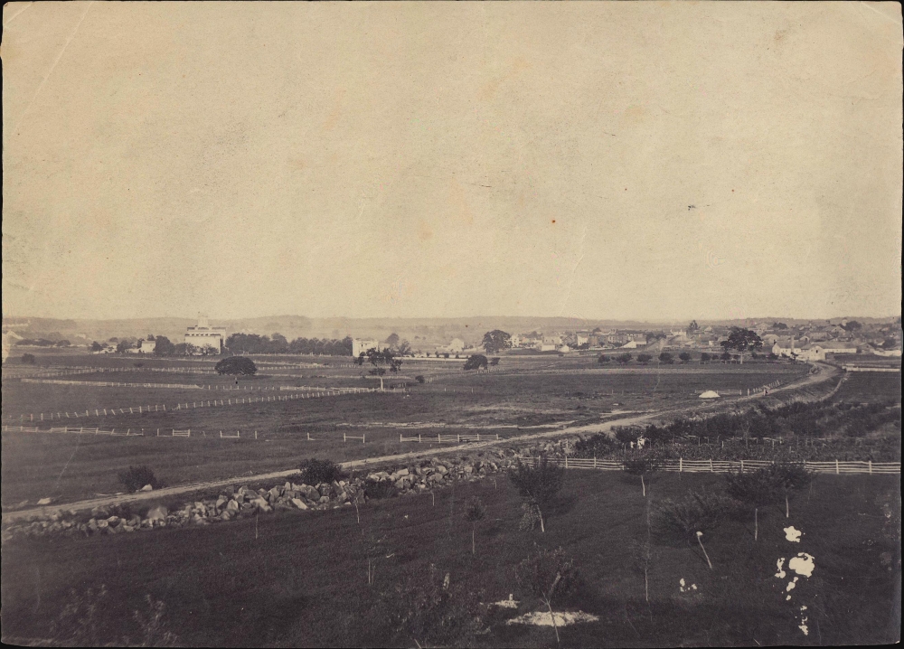
View of Gettysburg from Seminary Ridge.
sold
This is an 1863 albumen print of a Timothy O'Sullivan photograph of the Battlefield of Gettysburg. Brady's photo-documentation of the Civil War is significant and played a role much like television journalism did during the Vietnam War - it brought the horrors and violence of the war to the home front, informing public opinion. (more details)
Dutch merchant activity in the Amazon.
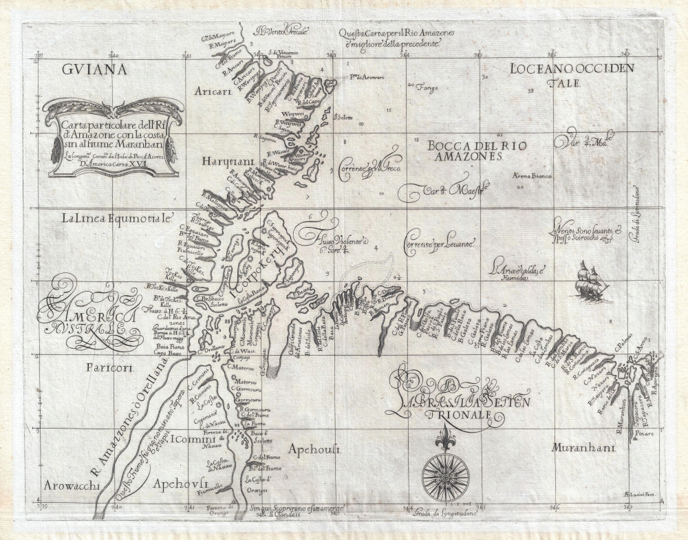
Carta Particolare dell'Rio d'Amazone con la costa sin al fiume Maranhan.
sold
- Digital Map Information
- Suitable for large format printing
- DPI: 600
- File Size: 39.65 MB
- File Type: ZIP / TIFF
- ICC color profile embedded
- Delivered instantly via download link
This is a beautiful, first edition example of Robert Dudley's rare 1647 nautical chart of the mouth of the Amazon River, Brazil. It appeared in Dudley's Dell'Arcano del Mare, first nautical atlas to cover the whole world, and the first to be produced by an Englishman. It was also the first sea atlas to consistently employ the Mercator projection, making the work useful in actual navigation. (more details)
First published map of Jaffrey, New Hampshire.
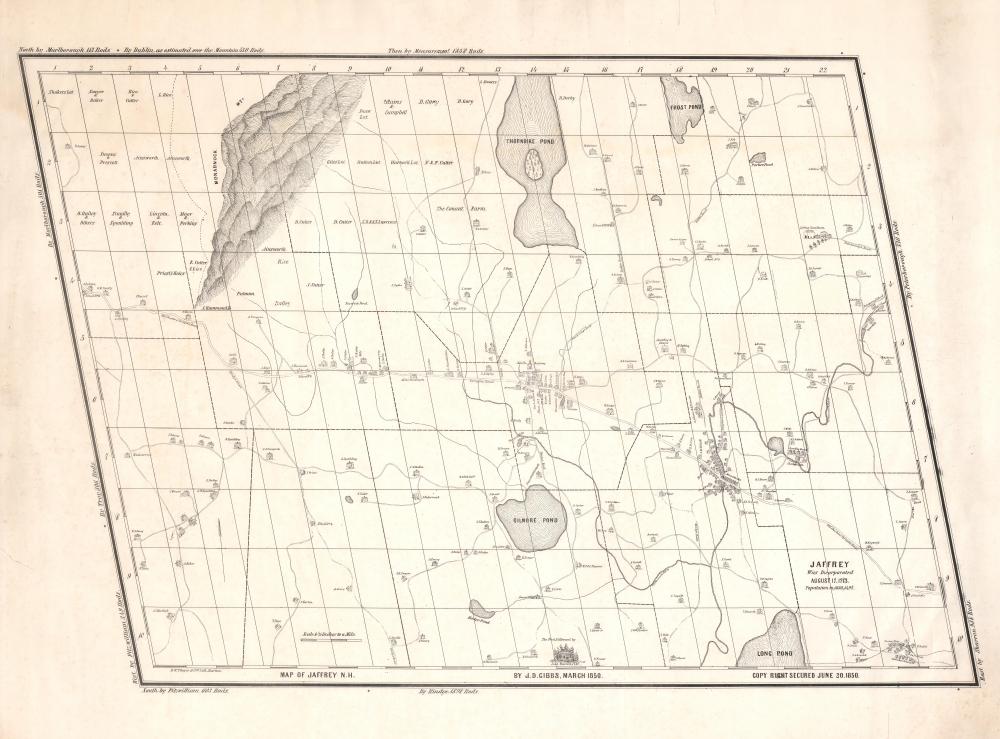
Map of Jaffrey N.H. by J. D. Gibbs, March 1850.
sold
- Digital Map Information
- Suitable for large format printing
- DPI: 600
- File Size: 31.48 MB
- File Type: ZIP / TIFF
- ICC color profile embedded
- Delivered instantly via download link
This is the 1850 Jonathan Danforth Gibbs large-scale map of Jaffrey, New Hampshire, considered the first separately issued map of that region. Mount Monadnock, one of the highest points in southern New Hampshire and at the time the stomping ground of the transcendentalists, appears prominently yet idiosyncratically illustrated in the upper left. (more details)
Long Island American Indian Heritage.
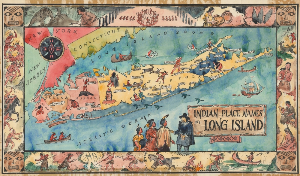
Indian Place Names on Long Island.
sold
This is the original 'Kash' watercolor artwork for a c. 1957 pictorial map of Long Island celebrating the island's American Indian heritage. (more details)
One of the Earliest American Maps to Extend to the Mississippi.
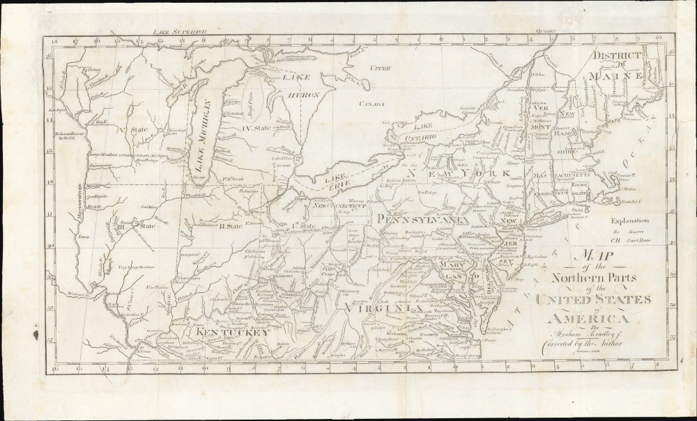
Map of the Northern Parts of the United States of America.
sold
- Digital Map Information
- Suitable for large format printing
- File Size: 196.32 MB
- File Type: ZIP / TIFF
- ICC color profile embedded
- Delivered instantly via download link
This is a significant 1802 map of the northern parts of the United States illustrating postal routes and the five Jeffersonian states proposed by the Ordinance of 1789. The present example is the Jedidiah Morse issue of the northern part of Abraham Bradley's 1797 postal map of the United States - one of the most important maps in American history. It is one of the first American maps to extend west to the Mississippi River, and one of the first to address early colonization of the lands west of Pennsylvania, including Ohio. (more details)
Made by one of the great female pioneers of pictorial cartography.
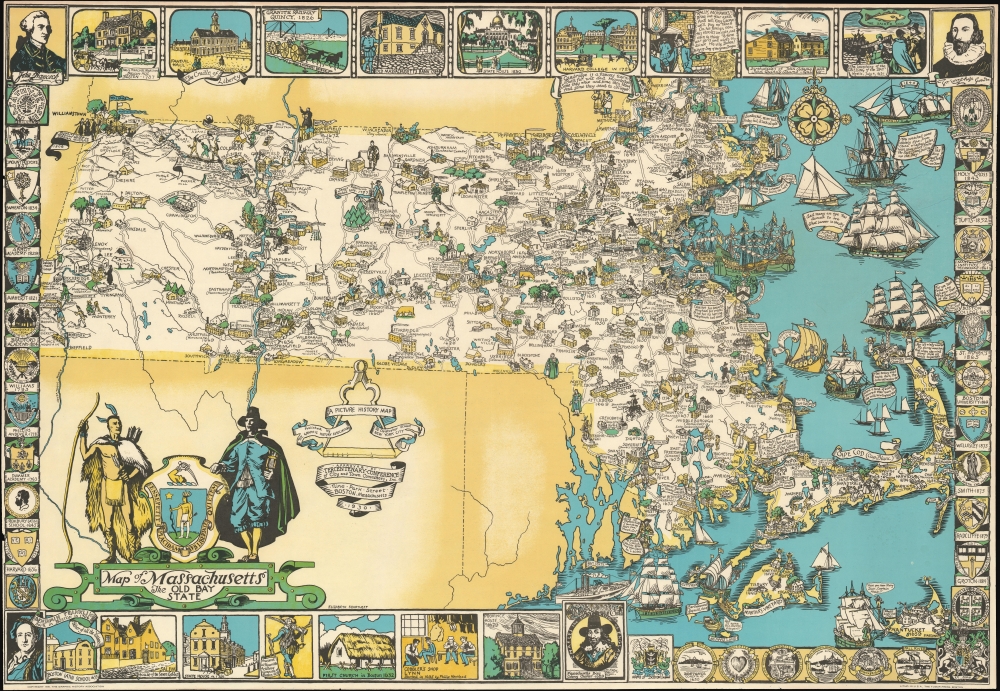
Map of Massachusetts The Old Bay State.
sold
- Digital Map Information
- Suitable for large format printing
- File Size: 57.37 MB
- File Type: ZIP / TIFF
- ICC color profile embedded
- Delivered instantly via download link
An uncommon 1930 pictorial map of Massachusetts issued by Tudor Press and Elizabeth Shurtleff, one of the most prominent female pictorial mapmakers. The map covers all of Massachusetts with vignette cartoon illustrations of various towns. Considerable focus is placed on industry, and many towns are highlighted with factory and/or mill illustrations. Indications of the merchandise produced there are also noted, including knit goods, shoes, jewelry, optical goods, textiles, etc. Other illustrations reference events of the American Revolutionary War. Surrounding the map are decorative armorial crests celebrating the many distinguished institutions of learning located throughout Massachusetts. Among them are Harvard, the Roxbury Latin School, Williams, Phillips Andover, the Bradford Academy, Amherst, Wheaton, the Abbot Academy, Mount Holyoke, Holy Cross, Tufts, MIT, Boston College, St. Marks, and Boston University. (more details)
Earliest Atlas Map of Vermont Published in the United States.

Vermont From Actual Survey.
sold
- Digital Map Information
- Suitable for large format printing
- DPI: 600
- File Size: 18.24 MB
- File Type: ZIP / TIFF
- ICC color profile embedded
- Delivered instantly via download link
The first map of Vermont published in the United States. This 1795 work was drawn and engraved by Amos Doolittle for Matthew Carey's Carey's American Edition of Guthrie's Geography Improved, the first atlas published in the United States. (more details)
Earliest Acquirable Printed Representation of Lyon.
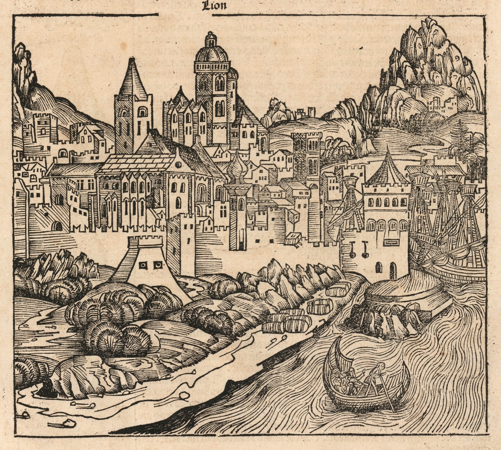
Lion.
sold
- Digital Map Information
- Suitable for large format printing
- Full resolution TIFF file
- ICC color profile embedded
- Delivered instantly via download link
This is the earliest acquirable printed depiction of Lyon, France. It appeared in Hartmann Schedel's 1493 Liber Chronicarum, also known as the Nuremberg Chronicle. (more details)
Follow the 1st U.S. Army from D-Day to V-E Day.
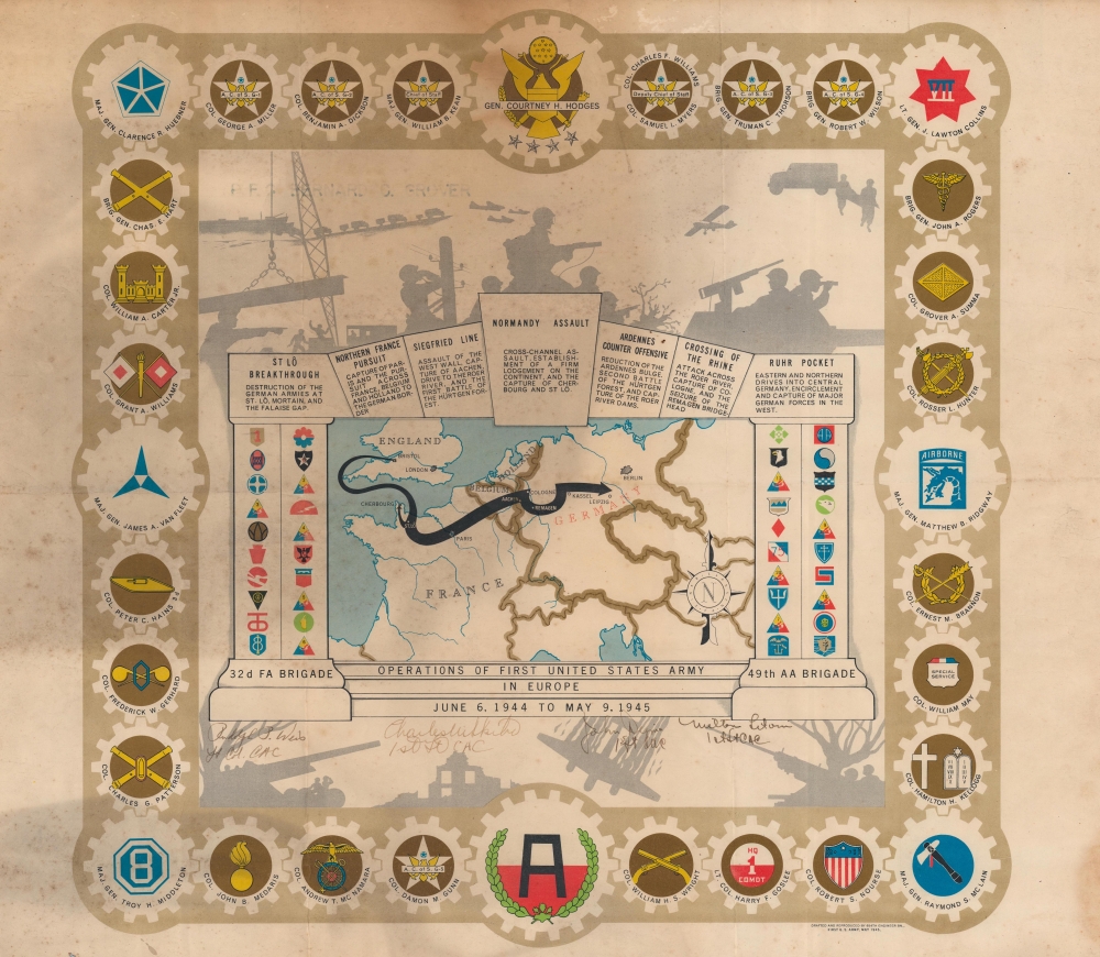
Operations of the First United States Army in Europe June 6, 1944 to May 9, 1945.
sold
- Digital Map Information
- Suitable for large format printing
- File Size: 22.76 MB
- File Type: ZIP / TIFF
- ICC color profile embedded
- Delivered instantly via download link
One of the more overtly decorative pieces in the genre, this is a 1945 Einar Larssen pictorial World War II route map of the First United States Army in Europe. The map traces the path of the First Army as it traveled throughout Europe. (more details)
Presumed invasion of continental Europe?
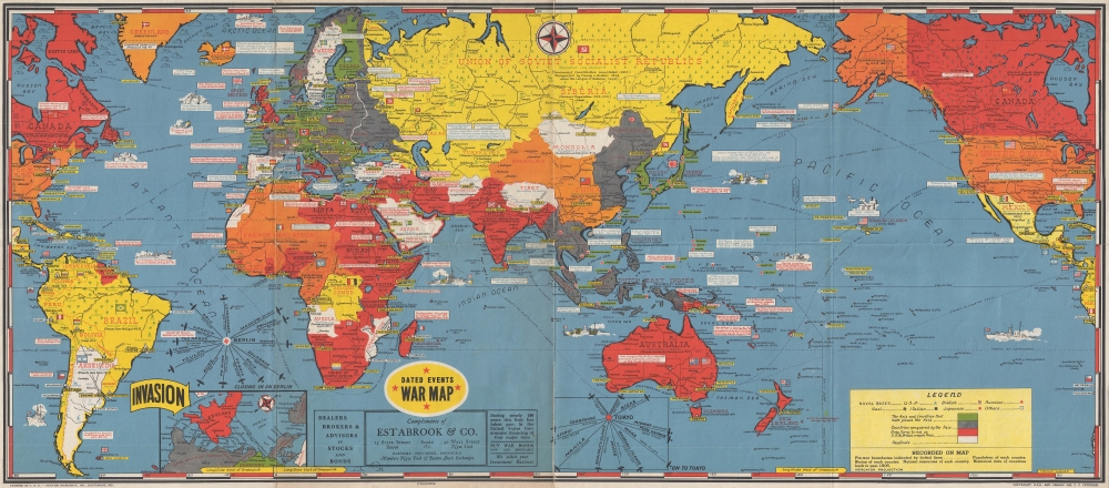
Dated Events War Map.
sold
- Digital Map Information
- Suitable for large format printing
- File Size: 15.31 MB
- File Type: ZIP / TIFF
- ICC color profile embedded
- Delivered instantly via download link
This is a 1944 Stanley Francis Turner world map detailing the events of World War II until mid-1944. This map, part of a series encompassing more than 25 editions, was meticulously and regularly updated, allowing the home front to digest the complex tides of war. (more details)
Travel by radio.

RCA Radio Tours - America's Latest Game.
sold
- Digital Map Information
- Suitable for large format printing
- Full resolution TIFF file
- ICC color profile embedded
- Delivered instantly via download link
This is a 1934 RCA Radiotron map of the United States. Presented as a game, radio stations, with their call signs and frequencies, are labeled throughout the U.S., Canada, Cuba, and Mexico. (more details)
Holy grail of Siam map collecting.
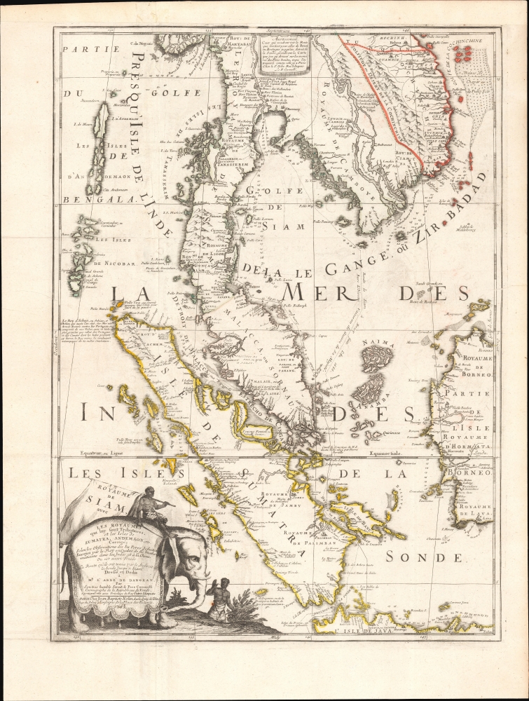
Royaume De Siam, avec Les Royaumes qui luy sont-Tributaries, et les Isles de Sumatra, Andemaon, etc.
$10,000.00
Acquire
- Digital Map Information
- Suitable for large format printing
- Full resolution TIFF file
- ICC color profile embedded
- Delivered instantly via download link
This is the important and influential Coronelli-Nolin map of Southeast Asia, considered one of the Holy Grails of Siam-related map collecting. Here in its 1742 edition, the map was first issued in 1687, following the 1685 first French embassy to Siam, led by Alexandre, Chevalier de Chaumont (1640 - 1710). Most Europeans were expelled from Siam a year later in 1688, making this the definitive model of all subsequent maps of Siam, and Southeast Asia in general until the 1821 John Crawfurd Embassy. (more details)
Pre-Смутное время plan of Moscow.
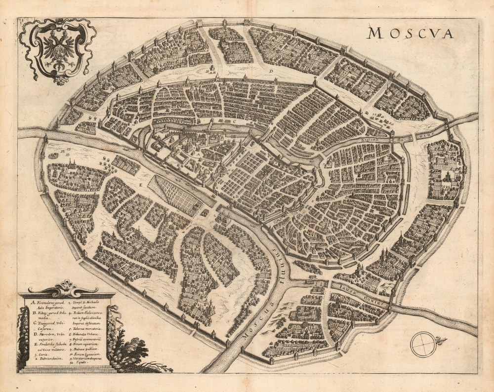
Moscva.
$1,900.00
Acquire
- Digital Map Information
- Suitable for large format printing
- DPI: 600
- File Size: 12.97 MB
- File Type: ZIP / TIFF
- ICC color profile embedded
- Delivered instantly via download link
This is a scarce 1638 Matthais Merian city plan or map of Moscow. Apart from the Braun and Hogenberg, this is the earliest full-sheet edition of the plan, which pre-dates by more than 20 years the version included by Joan Blaeu in his Atlas Maior. (more details)
Sacred places of Islam.

[Islamic Pilgrimage Sites].
sold
- Digital Map Information
- Suitable for large format printing
- File Size: 10.05 MB
- File Type: ZIP / TIFF
- ICC color profile embedded
- Delivered instantly via download link
This is a rare c. 1900 Raja Ravi Varma chromolithograph view of the primary Islamic pilgrimage sites: Mecca, Medina, and Jerusalem, as well as 6 secondary sites, and 24 tertiary sites. The view was printed in Lonavala, India, by a Raja Ravi Varma Press, one the first Indian owned and operated presses on the Subcontinent. (more details)
VIII Corps from Normandy to the German-Czech border.
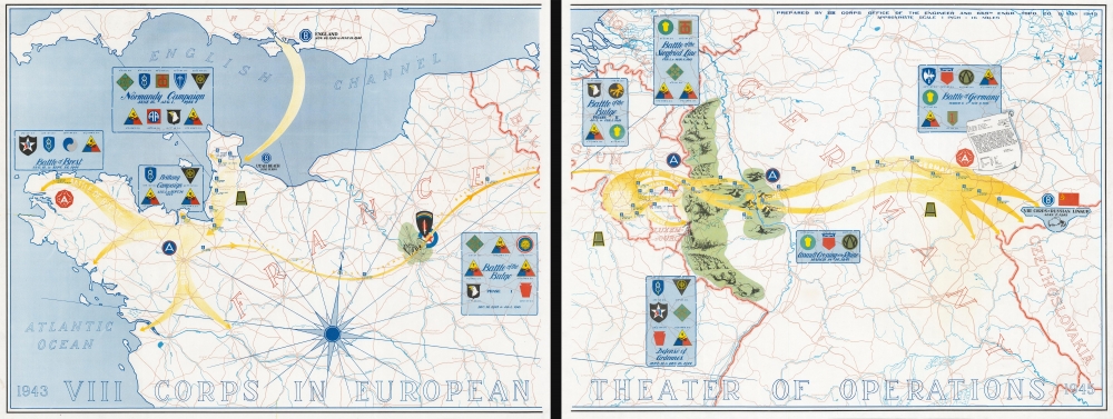
1943 VIII Corps in the European Theater of Operations 1945.
sold
- Digital Map Information
- Suitable for large format printing
- File Size: 80.76 MB
- File Type: ZIP / TIFF
- ICC color profile embedded
- Delivered instantly via download link
On two sheets, this is the 1945 VIII Corps route map of the VIII Corps in the European Theater during World War II (1939 - 1945). It is one of the largest, most impressive, and rarest of the route-map genre. (more details)
Acme of Human Invention.

March of Intellect. No. 2.
sold
- Digital Map Information
- Suitable for large format printing
- Full resolution TIFF file
- ICC color profile embedded
- Delivered instantly via download link
A rare and highly imaginative satirical work, this print was produced by William Heath and published by Thomas McLean around the year 1829. It is the rarest of three prints issued Heath and McLean that both ridicule and revel in the deluge of new inventions that accompanied the Industrial Revolution. (more details)