
Scarce and Elegantly-Engraved Map of the Far East.

Il Regno Della China detto presentemente Catay e Mangin diviso sopra le Carte piú esatte sue Principali Provincie.
sold
- Digital Map Information
- Suitable for large format printing
- Full resolution TIFF file
- ICC color profile embedded
- Delivered instantly via download link
This is a rare 1682 Cantelli da Vignola map of China, Japan and Korea, presenting a striking and up-to-date view of the Far East benefitting from Jesuit and Dutch reports. Its framework and outline are derived from the 1552 Martino Martini map produced by Blaeu, but this map is significantly updated, at least in part, from the reports of the Jesuits Bento de Góis and Johann Grueber. (more details)
History of Oakland and San Francisco Bay.

Cartographer's Impressions of Early Days in Eastbay.
sold
- Digital Map Information
- Suitable for large format printing
- File Size: 112.47 MB
- File Type: ZIP / TIFF
- ICC color profile embedded
- Delivered instantly via download link
This is a 1934 Fred Lundy pictorial map of Oakland and San Francisco Bay, California. Pictorial vignettes highlight historical moments from the arrival of Spanish explorers in the 1770s. Among these are turf wars between rival Chinese factions over shrimp fishing rights, and Californians diving off the compass rose. A bull fighting ring appears in Oakland near the bottom border, where fights were held every Sunday until 1854. Two stagecoaches race near the left border. Short texts note the founding of the University of California, the development of wharves along the bay, and provide a sparse history of ferries between Oakland and San Francisco. (more details)
Japanese and American bases after Pearl Harbor Attack.

Flat-Globe of the World.
sold
- Digital Map Information
- Suitable for large format printing
- File Size: 53.23 MB
- File Type: ZIP / TIFF
- ICC color profile embedded
- Delivered instantly via download link
This is a 1941 William H. Wise and Company and Admiral Robert E. Peary round double-sided globe map of the world as of December 8, 1941, the day after the Japanese attack on Pearl Harbor. Each side depicts one of the Earth's hemispheres, with the nations of the world labeled and delineated by black dotted and dashed lines. Red overprinting highlights air routes between the world's major cities. Clock faces along the Equator mark time zones, an essential detail in the age of air travel and world war. An inscription, 'All Data as of Dec. 8, 1941', suggests this map is updated to that point. There are overprinted US, British, and Japanese flags highlighting the global naval and air bases of these world powers. Oil fields, copper, rubber, and tin (essential raw materials for the war effort) are also noted by red overprinting. Interestingly, world geography does not reflect territorial gains won by Nazi Germany in Europe, or the fighting in North Africa, but Manchukuo, the Japanese puppet-state in northeastern China, is illustrated and labeled. Korea is labeled as Chosen, the name used by the Japanese following their annexation of the region in 1910. (more details)
Estes Park, Boulder, and Loveland.
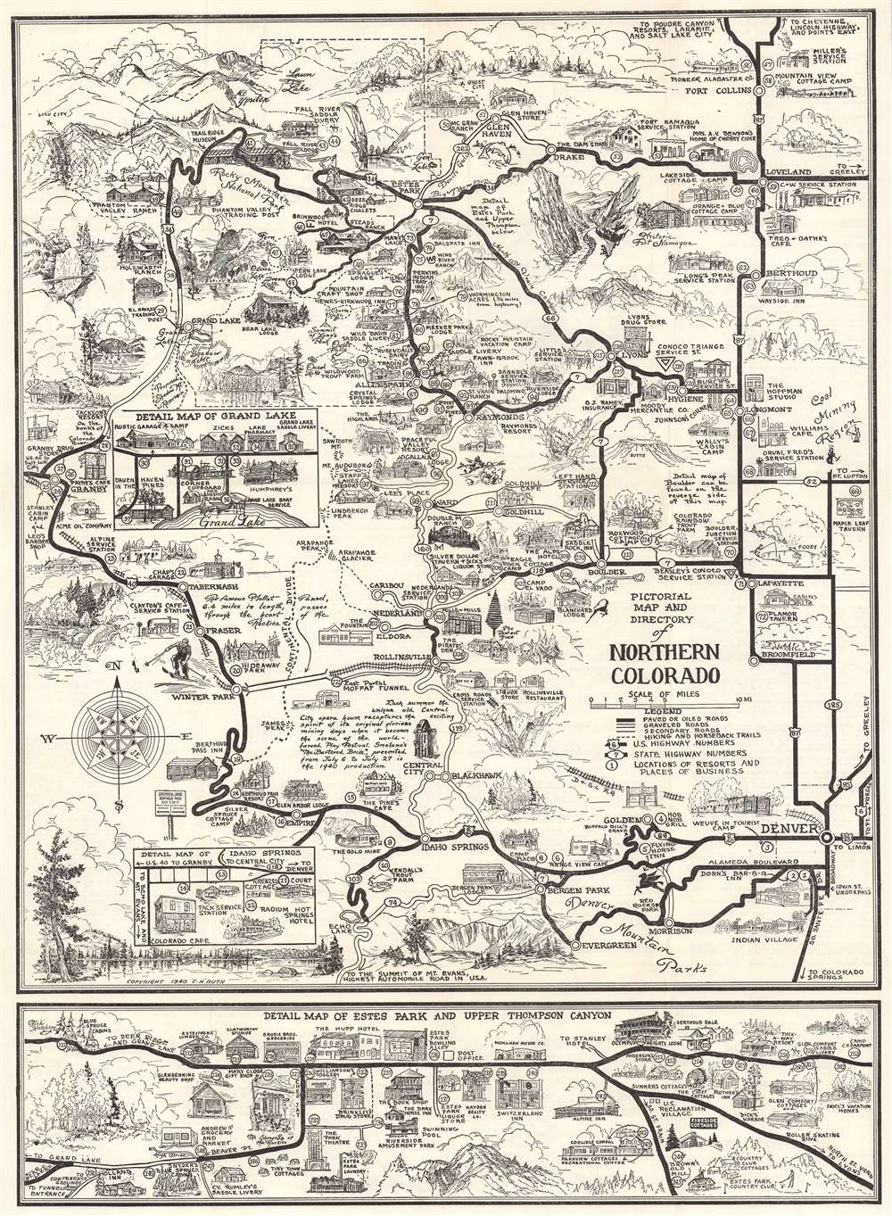
Pictorial Map of the Rocky Mountain National Park Area and Northern Colorado.
sold
- Digital Map Information
- Suitable for large format printing
- Full resolution TIFF file
- ICC color profile embedded
- Delivered instantly via download link
This is a 1940 C. H. Ruth pictorial map of northern Colorado and Rocky Mountain National Park. The map depicts the region from north of Fort Collins to Conifer and from Hot Sulphur Springs and Granby to Denver. Thick black lines mark U.S. and state highways, and bold black lettering labels cities and towns. Rocky Mountain National Park appears in the upper left and is delineated by a dotted and dashed line. Lodges, motels, service stations, stores, cabins, and myriad other businesses are illustrated in profile. 223 locations are numerically identified and indexed along the left side and on the verso. Inset maps detail business districts in Loveland, Grand Lake, Boulder, and Idaho Springs. (more details)
One of the rarest maps of the American southeast
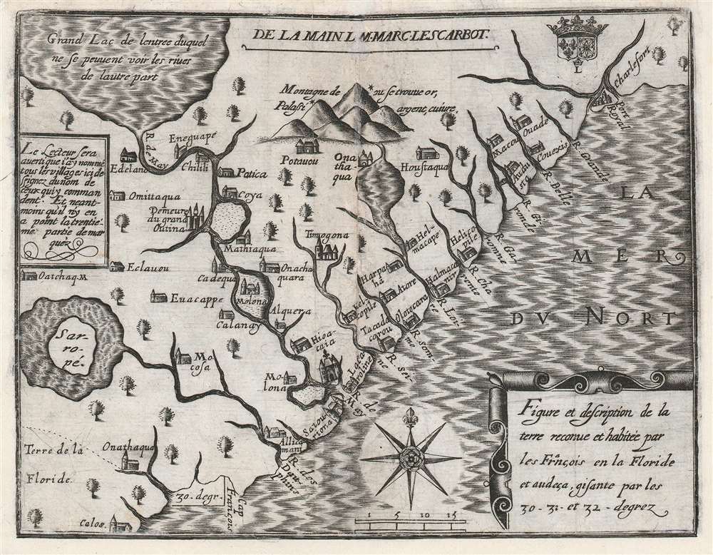
Figure et description de la terre reconue et habitée par les François en la Floride et audeça, gisante par les 30-31 - et 32 - degrez.
sold
- Digital Map Information
- Suitable for large format printing
- DPI: 600
- File Size: 10.61 MB
- File Type: ZIP / TIFF
- ICC color profile embedded
- Delivered instantly via download link
One of the great unobtainable maps of early attempts to settle North America. This is Marc Lescarbot's 1612 map of the American Southeast, one of the earliest specific maps detailing modern-day Florida, Georgia, and South Carolina. It chronicles 1562-1565 French attempts to establish a Huguenot colony in the region. Coverage extends roughly from 30° to 33° N, covering parts of modern-day Florida, Georgia, and South Carolina. (more details)
First Edition, First State.
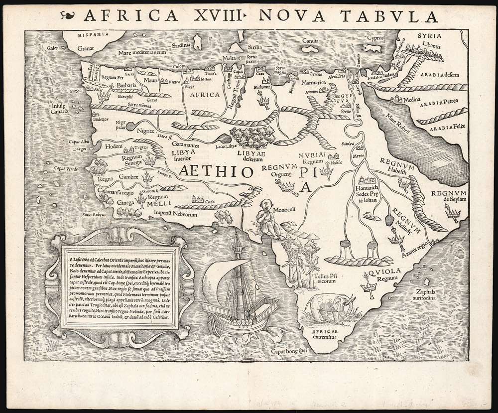
Africa XVIII. Nova Tabula.
sold
- Digital Map Information
- Suitable for large format printing
- Full resolution TIFF file
- ICC color profile embedded
- Delivered instantly via download link
This is the rare 1540 first edition of Sebastian Münster's map of Africa, the earliest detailed map of the continent available to the collector, here in its earliest state. As is to be expected for an early printing strike, the image is bold, sharp and clear. This attractive and evocative map was broadly influential: for more than thirty years during the age of discovery, this map would be the predominant representation of Africa available to the European reader. (more details)
A land of plenty.
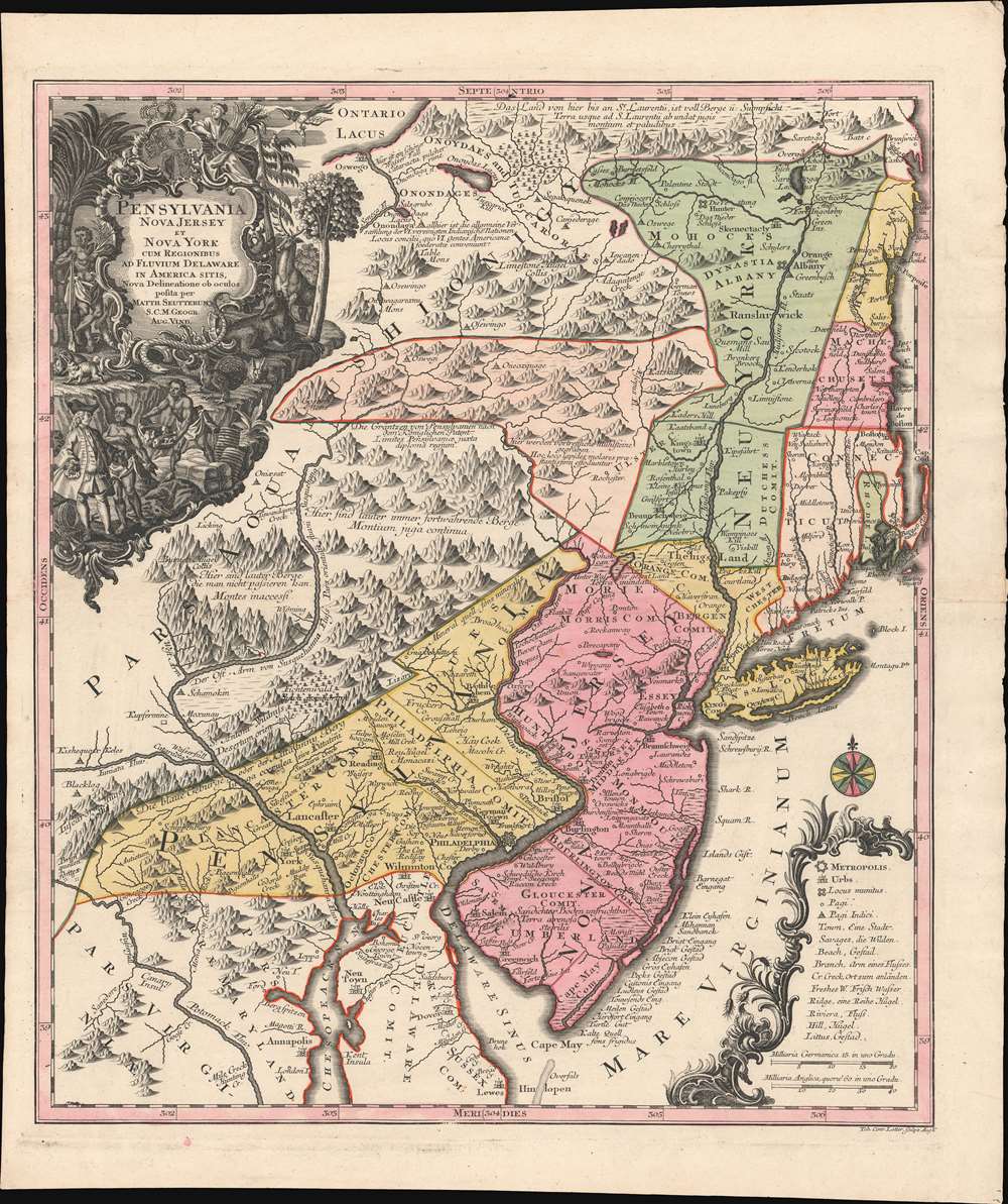
Pensylvania Nova Jersey et Nova York cum Regionibus Ad Fluvium Delaware In America Sitis, Nova Delinatione ob oculos posita ...
sold
- Digital Map Information
- Suitable for large format printing
- DPI: 600
- File Size: 40.3 MB
- File Type: ZIP / TIFF
- ICC color profile embedded
- Delivered instantly via download link
A c. 1750 example of Matthäus Seutter's map of the Middle Atlantic and New England regions during the British colonial period. It encompasses the Middle English Colonies, particularly New York, New Jersey, and Pennsylvania, capturing a period of rapid westward expansion and encouraging German emigration and settlement. (more details)
Superb example of a classic map.

Insulae Americanae in Oceano Septentrionali cum Terris adiacentibus.
sold
- Digital Map Information
- Suitable for large format printing
- DPI: 600
- File Size: 49.15 MB
- File Type: ZIP / TIFF
- ICC color profile embedded
- Delivered instantly via download link
This is a beautiful 1640 example of Willem Blaeu's 1634 map of the Caribbean Islands and the adjacent coastlines of North and South America. Both geographically and aesthetically this map set the standard for the mapping of this region: more than a dozen maps of the region produced later in the 17th century would copy this map, some to the extent of reproducing the title. Blaeu based this work both on his own West Indische Paskaert and Hessel Gerritsz' unacquirably rare and unassailably authoritative De Eylanden Ende Vastelanden Van Westindien op de Noordzee of 1631. The map thus reflects those geographers' commanding knowledge of the Caribbean and the Gulf Coast. (more details)
History in the flow of time.
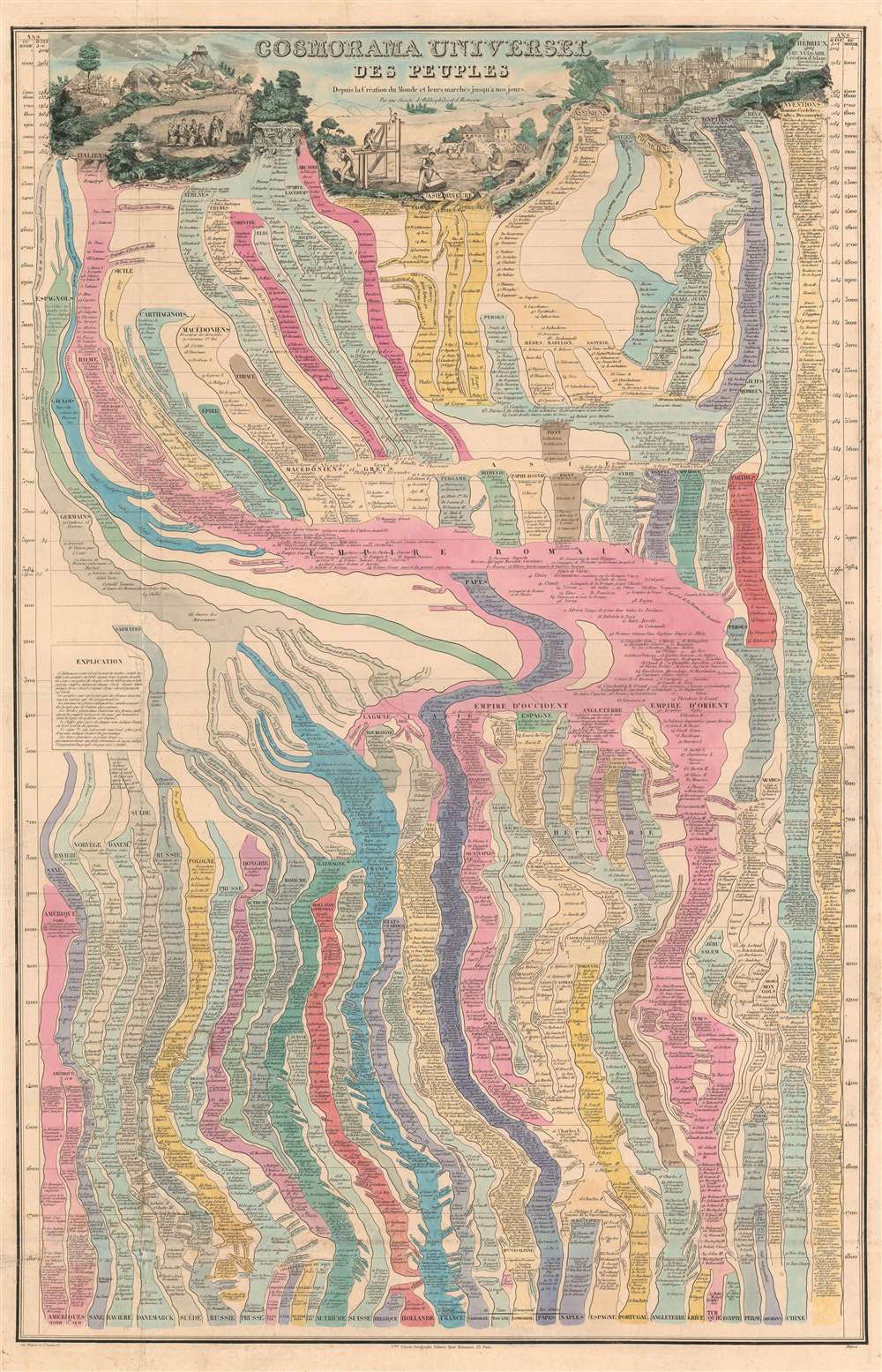
Cosmorama Universel des Peuples depuis la Création du Monde, et leurs Marches jusqu'à nos jour.
sold
- Digital Map Information
- Suitable for large format printing
- DPI: 600
- File Size: 68.45 MB
- File Type: ZIP / TIFF
- ICC color profile embedded
- Delivered instantly via download link
A marvelously complex c. 1852 universal timeline chart by the French cartographer Victor Clérot. The chart traces human history from creation, roughly, to the founding of the Roman Empire. The cartographer follows the Usher Chronology, placing the date of Creation at 4004 BC with the Biblical Deluge at about 2300 BC. The chart then proceeds to break down history in 100-year increments. After 3984 years, Jesus Christ is born, and standard BC/AD dating system is adopted to 1800. (more details)
Early nautical chart of Western Australia.
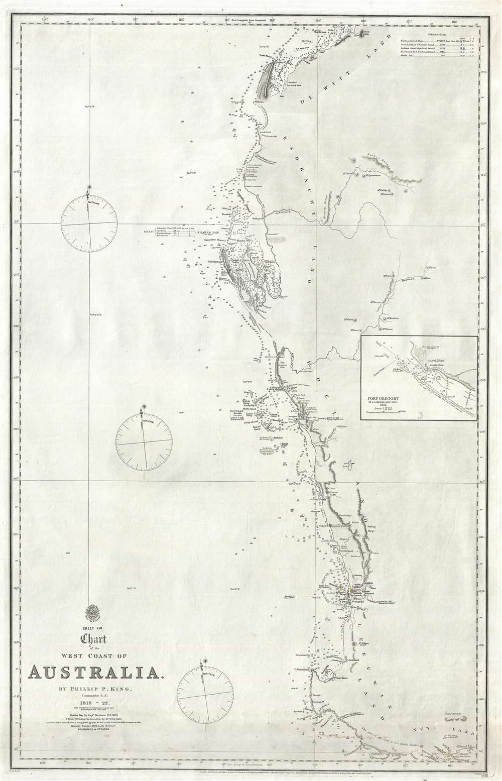
Sheet VIII Chart of the West Coast of Australia.
sold
- Digital Map Information
- Suitable for large format printing
- File Size: 13.28 MB
- File Type: ZIP / TIFF
- ICC color profile embedded
- Delivered instantly via download link
An extremely rare 1872 British Admiralty nautical map of western Australia by Phillip Parker King. The map covers southwestern Australia roughly from Exmouth Gulf to modern-day Albany and the Point King Light, including the city of Perth. This chart constitutes a major chapter in the mapping of western Australia. It was originally surveyed by King between 1818 and 1822. King's mission was to fill in the gaps in explorations of Matthew Flinders. The present edition features updates by Commander John Lort Stokes (1842), John Septimus Roe (1855), and Captain Henry Mangles Denham (1859). The chart includes De Witt Land, Endracht Land, Edel land, Leeuwin Land, and Nuyt Land. The coasts of Nuyt and Leeuwin Lands are drawn from the work of Flinders with few updates. This edition of the map is notable for its inclusion of the 1859 mapping of Sharks Bay by Captain Henry Mangles Denham. Today Sharks Bay is a World Heritage site known for its Stromatolites, considered the oldest lifeforms on Earth. Despite many improvements, much of the coast, particularly north of Shark's Bay, remains only ghosted in and remained only tenuously known. Updates subsequent to 1859 are limited to magnetic variation. (more details)
Details the railroad networks of the Boston and Maine Railroad and the Maine Central Railroad.
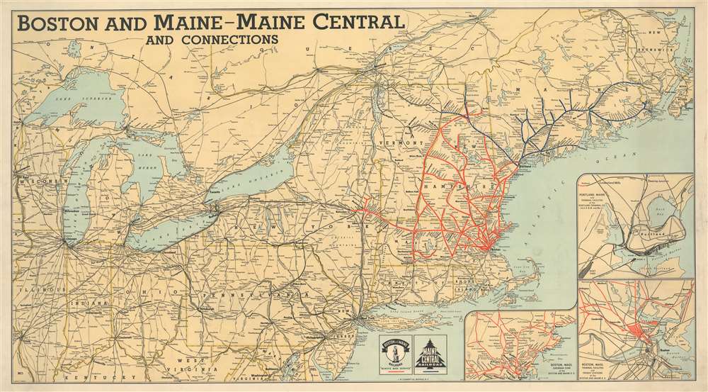
Boston and Maine - Maine Central and Connections.
sold
- Digital Map Information
- Suitable for large format printing
- File Size: 43.62 MB
- File Type: ZIP / TIFF
- ICC color profile embedded
- Delivered instantly via download link
This is a 1945 Crawford C. Anderson and J. W. Clement railroad map of the northeastern United States. Created for the Boston and Maine Railroad and the Maine Central Railroad, the map boldly highlights both networks. Red lines follow the routes of the Boston and Maine, while dark blue traces the Maine Central. White dots mark stops along both networks, and all stops are labeled. Connecting rail networks, including the Bangor and Aroostook Railroad, New York Central, and Pennsylvania Railroad, are illustrated by black lines and identified using abbreviations. Insets situated in the lower right corner focus on the Boston and Maine Railroad's network in Boston and the Boston region, along with the rail network in Portland, Maine. (more details)
Scarce of San Francisco's Golden Gate Park including the Avenue and Buena Vista Park.

Map showing the Golden Gate Park The Avenue and Buena Vista Park.
$1,000.00
Acquire
- Digital Map Information
- Suitable for large format printing
- File Size: 20.12 MB
- File Type: ZIP / TIFF
- ICC color profile embedded
- Delivered instantly via download link
A rare sprawling map of San Francisco's Golden Gate Park issued in 1903. The map Golden Gate Park in full as well as The Avenue, today called 'The Panhandle' and nearby Buena Vista Park. San Franciscans began to recognize the need for a public recreation area to rival New York City's Central Park in the late 1860s. However, plans for Golden Gate Park did not get underway until the early 1870s. This is the earliest map we are aware of to illustrate the full park. (more details)
First atlas map of Switzerland.

Helvetiae Descriptio Aegidio Tschudo Auct.
sold
- Digital Map Information
- Suitable for large format printing
- DPI: 600
- File Size: 53.28 MB
- File Type: ZIP / TIFF
- ICC color profile embedded
- Delivered instantly via download link
This is Abraham Ortelius' 1570 map of Switzerland, the first to appear in a modern atlas. This richly detailed, southern-oriented map provided the best delineation of the Swiss Confederation of the sixteenth century. (more details)
Scarce Danish blueback chart of the Öresund Strait (The Sound).
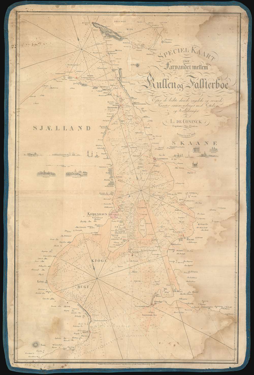
Speciel Kaart over Farvandet mellem Kullen og Falsterboe.
sold
- Digital Map Information
- Suitable for large format printing
- DPI: 600
- File Size: 61.42 MB
- File Type: ZIP / TIFF
- ICC color profile embedded
- Delivered instantly via download link
A very attractive 1830 blueback nautical chart or maritime map illustrating the waters around Copenhagen, and the Öresund Strait (The Sound) between Denmark and Sweden. Along the coastline Danish towns and villages are illustrated using tiny vignettes, presumably somewhat accurate to fact. There are several additional vignettes illustrating prominent castles, churches, villages, and estates. Unlike most early blueback charts, the present chart exhibits old color to distinguish between land and sea. This is a working sea chart and bears signs of use, including pen annotations relating to shipboard triangulation work. (more details)
Sacramento, from 'New Switzerland' to state capital.

Vue de Sacramento.
sold
- Digital Map Information
- Suitable for large format printing
- DPI: 600
- File Size: 28.76 MB
- File Type: ZIP / TIFF
- ICC color profile embedded
- Delivered instantly via download link
This is a rare c. 1854 Louis Le Breton view of Sacramento in its early days as an American city - a latter printing around the turn of the century. It depicts the settlement in the immediate wake of the California Gold Rush, as its population was rapidly increasing, attracting migrants from throughout the United States and the across the world. (more details)
A rare map of Wichita on the recto of a piece of stationery.
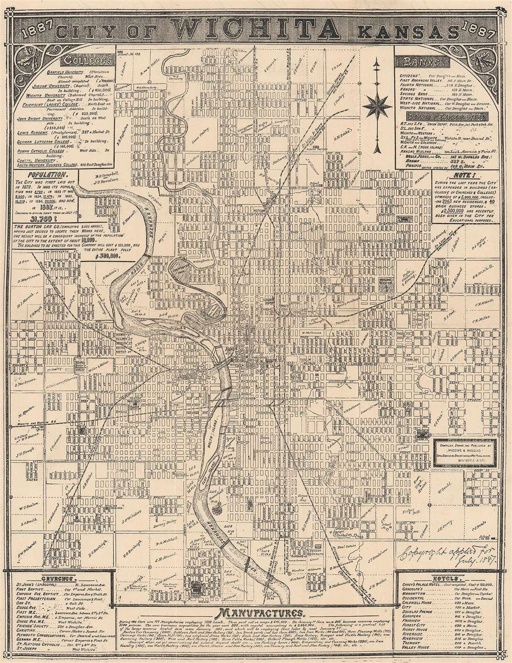
City of Wichita Kansas.
sold
- Digital Map Information
- Suitable for large format printing
- Full resolution TIFF file
- ICC color profile embedded
- Delivered instantly via download link
This is an 1887 Wiggins and Wiggins city plan or map of Wichita, Kansas. Large private landholdings around town are illustrated and identified by the owner's first initial and last name, with most of these situated on the outskirts of town. However, some, such as 'W. Mathewson' and Ford and Firebaugh's tracts, appear within the city's planned street grid. Parks, hotels, schools, Garfield College, and Fairmount College are illustrated and labeled. Seven railroads, including the 'St. Louis and San Francisco Railroad', the 'St. Louis, Ft. Scott, and Wichita Railroad', the 'Chicago, Kansas, and Nebraska Railroad', and the 'Atchison, Topeka, and Santa Fe Railroad' service Wichita, making the town a transportation hub in the late 19th century. Textboxes along the top and bottom borders list Wichita's banks, colleges, churches, hotels, and factories. (more details)
Historic sites across Luxembourg.

[Luxembourg].
sold
- Digital Map Information
- Suitable for large format printing
- Full resolution TIFF file
- ICC color profile embedded
- Delivered instantly via download link
This is a c. 1935 Union des villes et centres touristiques du Grand-Duché de Luxembourg pictorial map of Luxembourg. Pictorial illustrations highlight historic buildings throughout, including the Denzelt in Echternach (the oldest town in Luxembourg), Notre-Dame Cathedral in Luxembourg City, and Schoenfels Castle. Vibrant red lines define eight proposed itineraries. (more details)
The only known example.
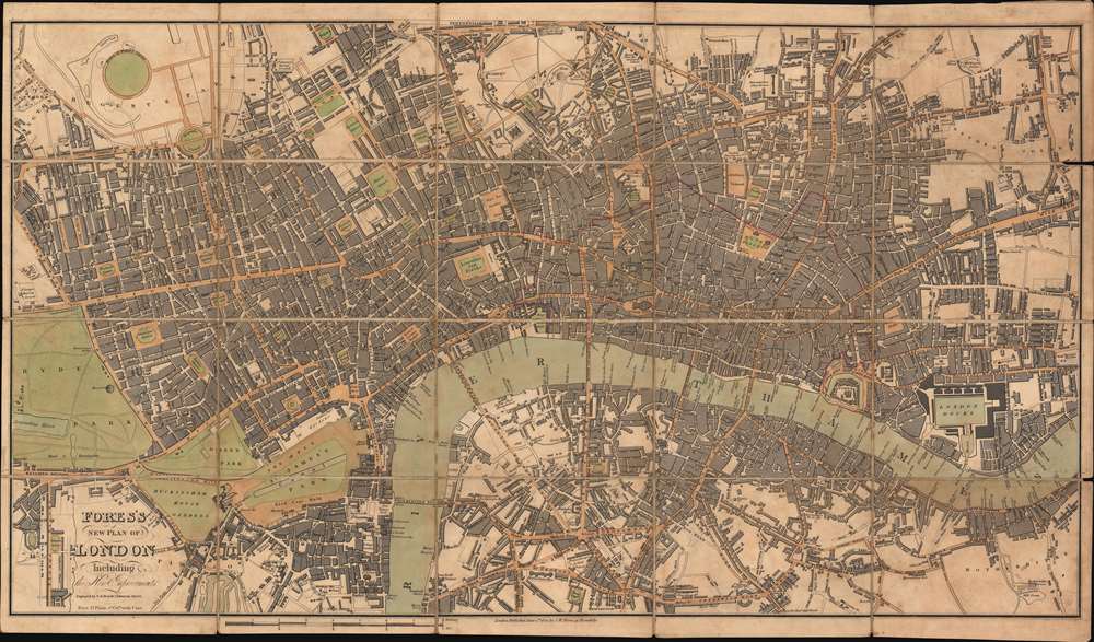
Fores's New Plan of London Including the New Improvements.
sold
- Digital Map Information
- Suitable for large format printing
- Full resolution TIFF file
- ICC color profile embedded
- Delivered instantly via download link
This is an 1822 Samuel William Fores city plan or map of London, England. Focusing on central London in the vicinity of the Thames River, the map depicts from Hyde Park to Bethnal Green and from Regent's Park to Rotherhithe. Numerous landmarks, including the Tower of London, London Bridge, St. Paul's Cathedral, the British Museum, and Buckingham Palace (labeled here as Buckingham House), all appear. Streets, squares, and other buildings are identified. (more details)
Crete and the Greek Islands, as known to the Ancients.
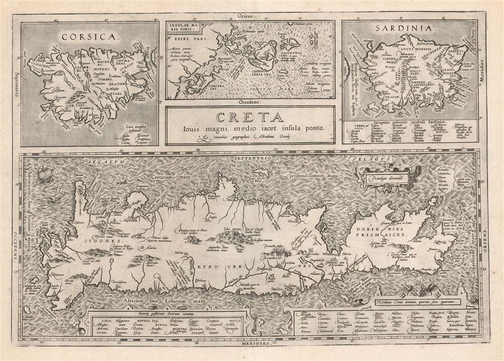
Creta Jovis Magni Medio Iacet Insula Ponto.
sold
- Digital Map Information
- Suitable for large format printing
- DPI: 600
- File Size: 56.85 MB
- File Type: ZIP / TIFF
- ICC color profile embedded
- Delivered instantly via download link
This is Abraham Ortelius' 1595 map of Crete and other Mediterranean islands as they were understood in antiquity and Greek mythology. The engraving is comprised of four separate maps of Corsica, Sardinia, Crete, and the Ionian Islands. (more details)
Seattle on the eve of the great fire.
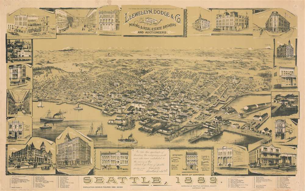
Seattle, 1889.
sold
- Digital Map Information
- Suitable for large format printing
- File Size: 148.1 MB
- File Type: ZIP / TIFF
- ICC color profile embedded
- Delivered instantly via download link
This is an intriguing 1946 bird's-eye view map of Seattle, Washington, published by the Seattle Historical Society based on an earlier view published in 1889 by Llewellyn, Dodge and Co. It illustrates the city as it stood in 1889, the same year a great fire destroyed many of the structures seen here (also the same year Washington entered the Union). (more details)