
Striking old-color example.

Novissima et exactissima Totius Regni Neapolis Tabula Praesentis Belli Statui Accomodata et Exhibita.
sold
- Digital Map Information
- Suitable for large format printing
- Full resolution TIFF file
- ICC color profile embedded
- Delivered instantly via download link
This is a beautiful, old-color example of Johann Baptist Homann's 1716 map of the Kingdom of Naples, which comprises southern Italy. The map depicts the region from Terracina to the Adriatic Sea, and from the Adriatic Sea to northern Sicily. Countless towns and villages are shown and named, including major cities such as Naples, Messina, and Capua. (more details)
One of the earliest obtainable maps of Kentucky.
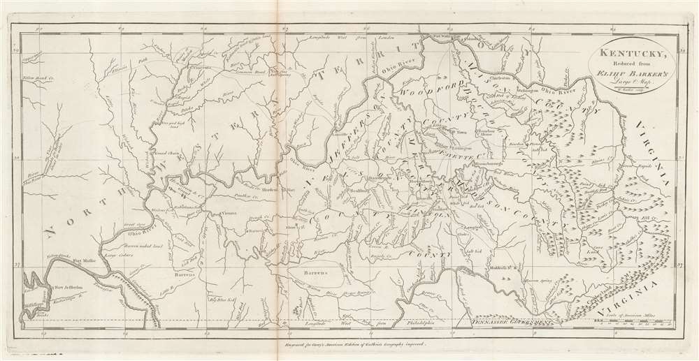
Kentucky, Reduced from Elihu Barker's Large Map.
sold
- Digital Map Information
- Suitable for large format printing
- Full resolution TIFF file
- ICC color profile embedded
- Delivered instantly via download link
An example of Matthew Carey's 1795 reduction of Elihu Barker's map of Kentucky - one of the earliest obtainable specific maps of Kentucky based upon actual observation and settlement. It also follows closely on Kentucky's admission to the Union. The map is a reduced version of the unobtainable Elihu Barker map of 1793, entitled A Map of Kentucky from Actual Survey, by Elihu Barker, also published by Carey in Philadelphia. The present map has less detail, given the reduced size, but closely adheres to Barker's important map, described as 'so well done it cold be used today with satisfaction'. Throughout, settlements, stations, salt licks, courthouses, furnaces, springs, planned settlements, and forts are noted - providing an invaluable insight into life in Kentucky when it was still the 'frontier'. (more details)
Coal baby, coal!
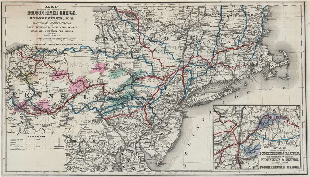
Map Showing the Location of the Hudson River Bridge at Poughkeepsie, N.Y. and its Various Railroad Connections with New England and the West, the Coal, Oil, and Iron Ore Fields, and with Tide Water.
sold
- Digital Map Information
- Suitable for large format printing
- File Size: 26.83 MB
- File Type: ZIP / TIFF
- ICC color profile embedded
- Delivered instantly via download link
This is an 1870 George Woolworth and Charles B. Colton map of the northeast United States created to promote the construction of a Hudson River railroad bridge at Poughkeepsie, New York. Depicting the region from Erie, Pennsylvania to the Atlantic Ocean and from Oswego, New York to Washington, D.C., with a focus on the railroad network. Numerous regional railroad lines are illustrated, including the Hudson River Railroad, the Lackawanna and Bloomsburg Railroad, and the New Haven, Hartfield, and Springfield Railroad. Cities and towns along the routes are labeled, and distances provided. Proposed railroads are also included as dashed lines. An inset in the lower right focuses on the area immediately surrounding Poughkeepsie and the proposed bridge. The whole emphasizes the point that a bridge at Poughkeepsie would create a relatively straight journey from the coal fields in Pennsylvania to the urban centers of the East Coast. Here, the bituminous coal fields are shaded pink, the anthracite fields green. The oil region in western Pennsylvania is yellow and the iron ore regions around Poughkeepsie are purple. (more details)
An early example of d'Anville's influential map of China.
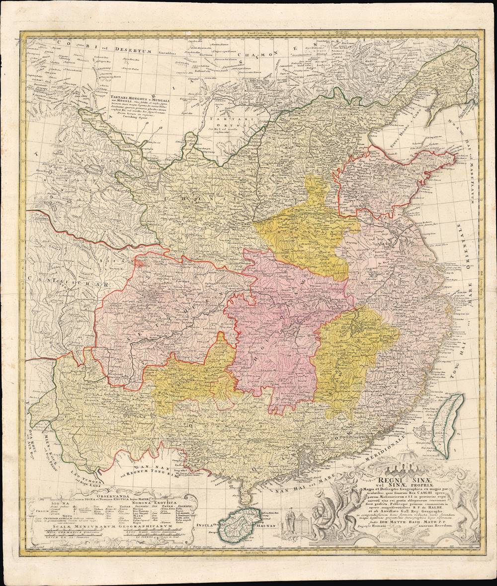
Regni Sinae Vel Sinae Propriae Mappa et Descriptio Geographica.
sold
- Digital Map Information
- Suitable for large format printing
- Full resolution TIFF file
- ICC color profile embedded
- Delivered instantly via download link
This is a rare and early example of d'Anville's famous map of China, printed in c. 1738 by Johann Hase of the Homann Heirs publishing house. It shows the geography and provinces of 'China proper,' as well as surrounding regions, as it stood in the early 18th century. (more details)
Stunning map of Lake Erie, Lake Ontario, and the Niagara Falls region.
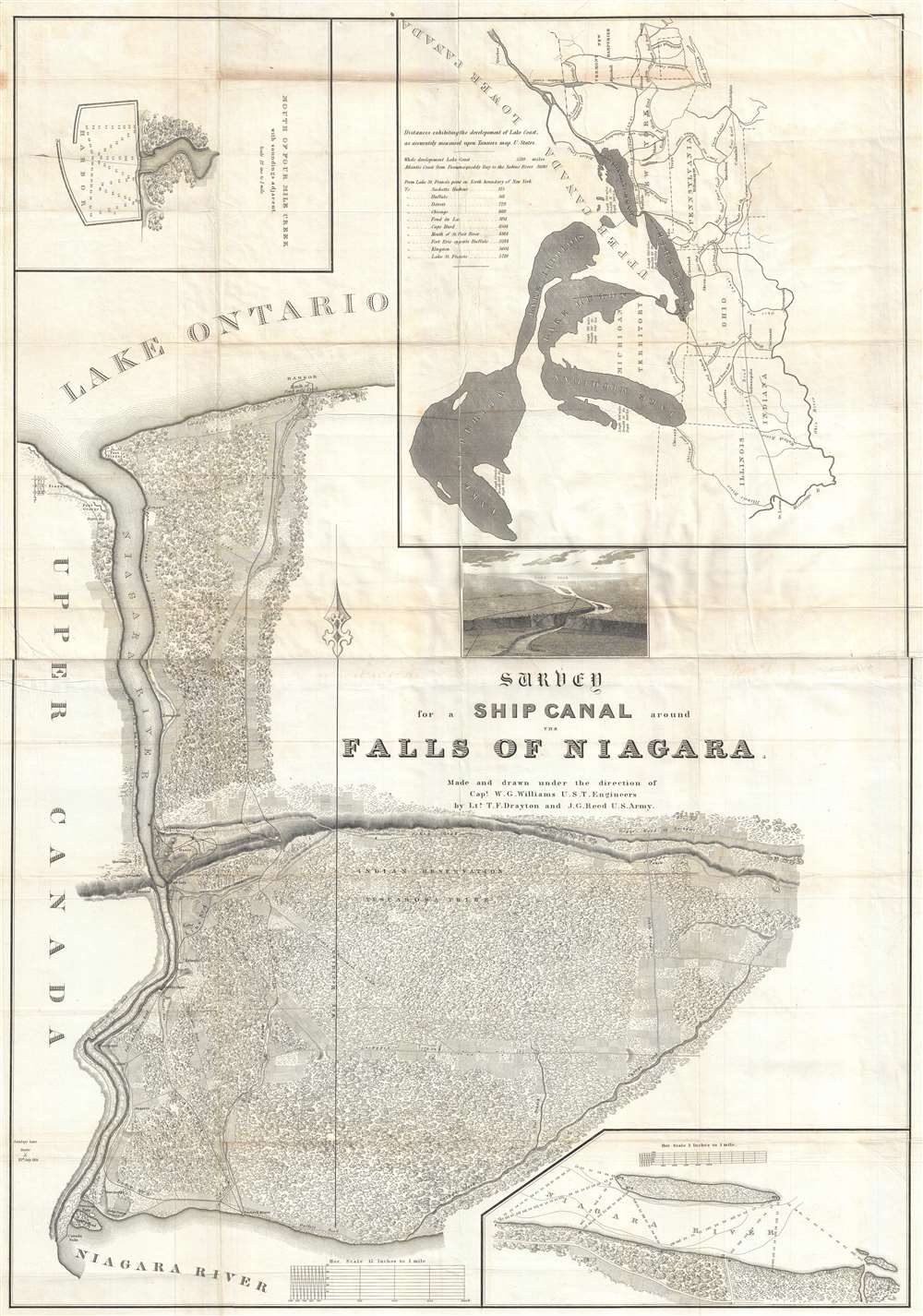
Survey for a Ship Canal around the Falls of Niagara.
sold
- Digital Map Information
- Suitable for large format printing
- DPI: 300
- File Size: 30.47 MB
- File Type: ZIP / TIFF
- ICC color profile embedded
- Delivered instantly via download link
This is a stunning and important 1835 William G. Williams map of the proposed routes of a canal linking Lake Erie and Lake Ontario around Niagara Falls. The map depicts the region from the Niagara River just above Niagara Falls to Lake Ontario. Four different routes, or lines, for the proposed canal are depicted on the map. Captain Williams conducted a survey of the region to propose these four lines and included this map in his report to Congress. (more details)
Indigenous American nations.

Tribal and Linguistic Groupings o Native North America.
sold
A fascinating 1955 map of North America loosely illustrating the locations of more than 112 American Indian groups. The map is based upon the studies of the renowned anthropologist and ethnologist George Peter 'Pete' Murdock (1897 - 1985). The map has here been updated and revised with the studies of the linguist George L. Trager (1906 - 1992), and new information by University of Chicago anthropologist Norman A. McQuown (1914 - 2005). (more details)
Comic vignettes map every humor by the 'world's fastest cartoonist'.

A MAD Pictorial Map of the United States.
sold
This is a 1981 Sergio Aragonés pictorial map of the United States created for Mad Magazine. Comical illustrations of people populate the map. Many of our favorites are comic scenes, including a hunter sneaking up on a herd of bison wearing a bison costume only to be spotted and confronted by one of the bison, or a ship captain yelling at someone who unplugged the lighthouse blaming him for his ship sinking. Another is a McDonald's fan proposing a second arch in St. Louis! A rocket launches from Cape Canaveral and the Wright Flyer appears over Kitty Hawk. Famous landmarks also make appearances, including the Golden Gate Bridge and San Francisco's legendary fog, the Space Needle in Seattle, and Mount Rushmore. Aragonés included himself in the piece. He is illustrated standing next to the title banner holding a pen. With all the detail present here, every look will provide the opportunity to create a new story! (more details)
India on the eve of the Mutiny.
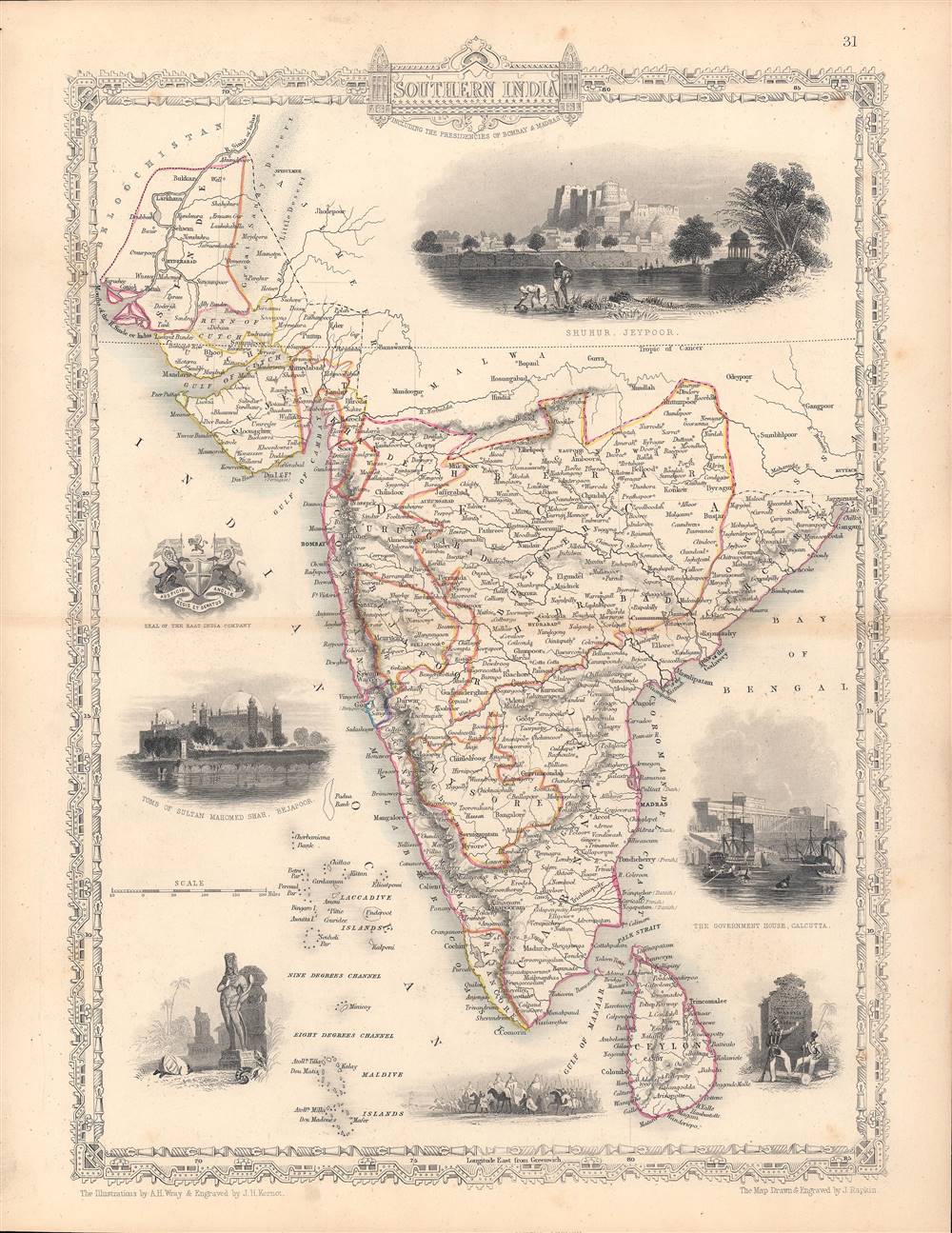
Southern India - including the Presidencies of Bombay and Madras.
$200.00
Acquire
- Digital Map Information
- Suitable for large format printing
- Full resolution TIFF file
- ICC color profile embedded
- Delivered instantly via download link
This is a rare 1851 map of India drawn and engraved by John Rapkin that appeared in Tallis's Illustrated Atlas and Modern History of the World. The map and illustrations reflect the recent Anglo-Sikh War (1845 - 1846) and show the divisions of the Indian subcontinent soon before the 1857 Mutiny and the inception of the Raj. (more details)
Travel from West Palm Beach to Miami.
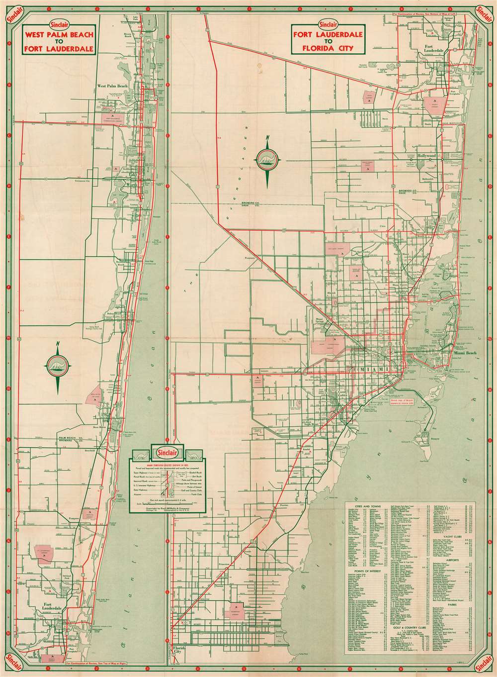
West Palm Beach to Fort Lauderdale. Fort Lauderdale to Florida City.
sold
- Digital Map Information
- Suitable for large format printing
- Full resolution TIFF file
- ICC color profile embedded
- Delivered instantly via download link
This is a c. 1951 Rand McNally and Sinclair Oil road map of West Palm Beach and Fort Lauderdale, Florida. Divided into two sections, the left section highlights Highway 1 in red and other major roads between West Palm Beach and Fort Lauderdale in green. Country clubs, parks, golf courses, and airports are labeled in West Palm Beach, Boca Raton, and northern Fort Lauderdale. The right section depicts from Fort Lauderdale to Florida City in much the same manner, labeling cities, towns, and suburbs along the way. Both Highway 1 and the Tamiami Trail (Highway 41) are illustrated in red. An index situated in the lower right corner lists cities and towns, points of interest, golf and country clubs, yacht clubs, airports, and parks. (more details)
Gigantic geological map of Kentucky.
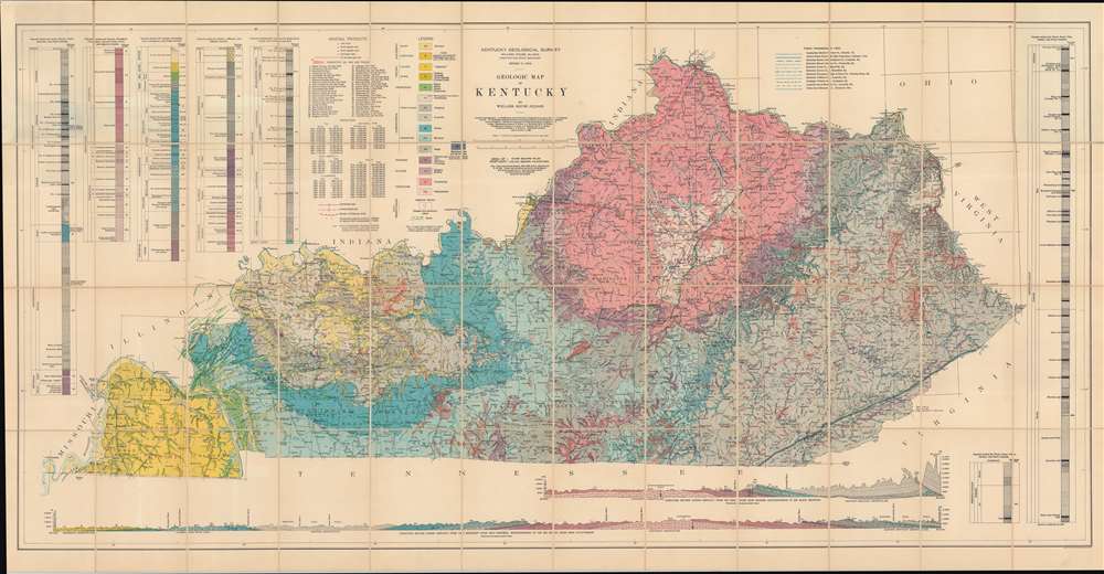
Geologic Map of Kentucky.
sold
- Digital Map Information
- Suitable for large format printing
- File Size: 83.35 MB
- File Type: ZIP / TIFF
- ICC color profile embedded
- Delivered instantly via download link
This is a gigantic 1929 Willard Rouse Jillson geological map of Kentucky. The map locates seventeen geological zones with distinct colors and patterns, each defined in the legend in the upper right. Fault lines are also noted and traced in green. As are resources: coal mines, rock asphalt mines, and oil and gas fields. Oil and gas fields are numerically identified and correspond with an index in the upper left. Five different geologic cores are also included in the upper left and right. Two profile sections illustrating layered geological formations are included along the bottom border. (more details)
Rare Italian edition of an important French nautical chart.
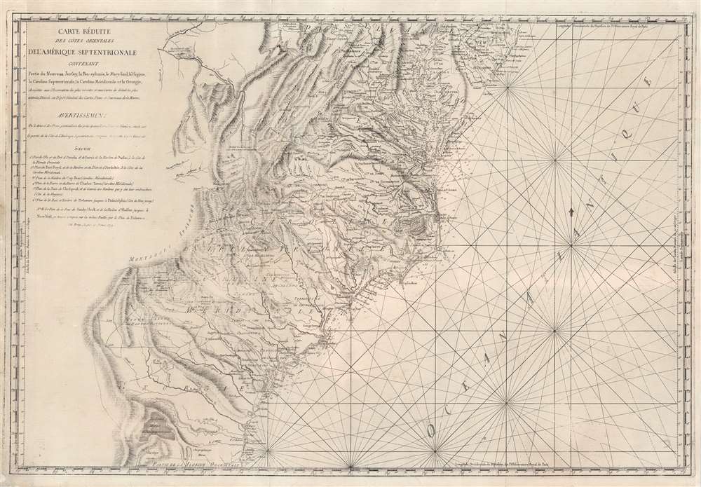
Carte Réduite Des Côtes Orientales Del'Amérique Septentrionale Contenant Partie du Nouveau Jersey, la Pen-sylvanie, le Mary-land, la Virginie, la Caroline Septentrionale, la Caroline Méridionale et la Géorgie.
sold
- Digital Map Information
- Suitable for large format printing
- Full resolution TIFF file
- ICC color profile embedded
- Delivered instantly via download link
A most unusual 1799 Rome imprint of the important 1788 Sartine / Dépôt des Cartes et Plans de la Marine map of the American Mid-Atlantic seaboard. Coverage extends from New Jersey and Pennsylvania southward through Maryland and Virginia, then along the Carolina coast to Georgia and Florida. While this map was originally by the French 'Dépôt General de la Marine' in 1778, the present example bears a 1799 Rome imprint. Although a nautical chart, this map features a magnificent wealth of inland detail as far west as the Appalachian Mountains and the Ohio River. (more details)
Cartouche to the doomed Emperor Charles XII.
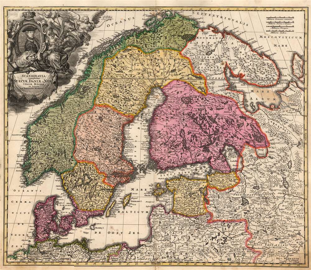
Scandinavia complectens Sueciae, Daniae et Norvegiae Regna ex tabula Joh Bapistae Homanni.
sold
- Digital Map Information
- Suitable for large format printing
- Full resolution TIFF file
- ICC color profile embedded
- Delivered instantly via download link
This is Johann Baptist Homann's 1716 map of Scandinavia, bringing the dominant 17th century mapping of the northern parts of Europe up-to-date with the events of the Great Northern War (1700 - 1721). The map is based primarily on Anders Bure's 1626 mapping of the region, which became the state of the art of the mapping of Scandinavia and was replaced as an authority for more than a century. In this regard, Bure is hailed as the Father of Swedish Cartography. The scope of the map includes Denmark, Norway, the greater Swedish Empire, the Baltic coasts of Germany, Poland and Livonia, and the Russian Empire - including 'Lapponia Moscovitica,' the portions of Lapland occupied by Russia. (more details)
Anticipating the 1976 Montreal Olympics.

Montréal.
sold
This is a large-scale loosely cartographical 'city character print' 1974 Swaena Lavelle pictorial map of Montréal, Canada, published two years before the Montréal hosted the 1976 Summer Olympics. The view overlooks the city from the west from across the Saint Lawrence River. Buildings throughout are illustrated, including several department stores, banks, hotels, and the headquarters of the Montreal Star. Two Olympic venues, the Olympic Stadium and Arena Maurice Richard, appear near the right border. Wonderful artistic illustrations of sites around Montreal create a fantastic pictorial border. (more details)
The Magnificent Mile.

Michigan Avenue and Jackson Street in the Year 1889.
sold
- Digital Map Information
- Suitable for large format printing
- File Size: 12.8 MB
- File Type: ZIP / TIFF
- ICC color profile embedded
- Delivered instantly via download link
This is a 1929 Raoul Varin aquatint view of the Leland Hotel at the corner of Michigan Avenue and Jackson Street, on the Magnificent Mile. Trees line Michigan Avenue and pedestrians walk along the sidewalks. Horse-drawn carriages make their way up and down Michigan Avenue transporting Chicago's elite. The Leland Hotel appears prominently at right. (more details)
The Swedish Empire, Crumbling.
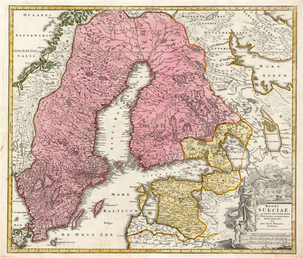
Regni Sueciae in omnes suas Subjacentes Provincias accurate divisi Tabula Generalis edita à Ioh. Bapt. Homanno Noribergae.
sold
- Digital Map Information
- Suitable for large format printing
- Full resolution TIFF file
- ICC color profile embedded
- Delivered instantly via download link
This is Johan Baptist Homann's map of the Kingdom of Sweden, bringing what was the dominant mapping of Sweden and its neighbors up-to-date with the events of the Great Northern War. Homann starts - almost certainly - with Frederic de Wit's 1680 Regni Sueciae but adds detail and placenames that did not exist prior to the 1700–1721 Great Northern War between Sweden and Russia, and particularly before the 1703 capture of the island of Kotlin by Russia from Sweden, the 1703 Russian capture of Nyenskans, and the foundation of the city of St. Petersburg. Also marked is the town of Schlisselburg, formerly Oreshek, which was captured by Russia in 1702 and renamed by Peter the Great during his administrative reforms. An earlier iteration of this map appearing in a 1716 example of the Atlas Novus includes Petersburg and Kronschloss (formerly Kotlin) but does not name Schlüsselburg. That placename would be included in Ingermanland Governorate in 1710 and would in 1727 become part of Sankt-Petersburgsky Uyezd. Many city names have been underlined in an old hand, and, in some cases, placenames have been added. For example, the Finnish city of Wekelax (Veckelax) has had inscribed above it the name 'Fridrichsham.' The city, as originally named on the map, had been burned by the Russians in 1712. Following the peace of 1721, the city was rebuilt, and renamed after Sweden's new King Frederick I. (more details)
A Bay in the Nicobars.
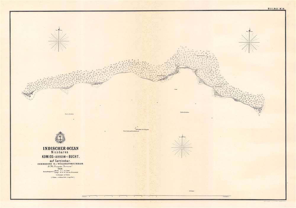
Komios (Arrow) Bucht auf Carnicobar / [Komios (Arrow) Bay at Car Nicobar].
$500.00
Acquire
- Digital Map Information
- Suitable for large format printing
- File Size: 13.7 MB
- File Type: ZIP / TIFF
- ICC color profile embedded
- Delivered instantly via download link
This is a rare 1858 Baron Bernhard von Wüllerstorf-Urbair map of Kimois Bay and the southern part of the island of Car, one of several maps the Indian Ocean drawn by the 1857 - 1859 Novara Expedition. This map includes a brief legend noting longitude, latitude, units of measurement, and conversion. (more details)
A Harbor in the Nicobars.
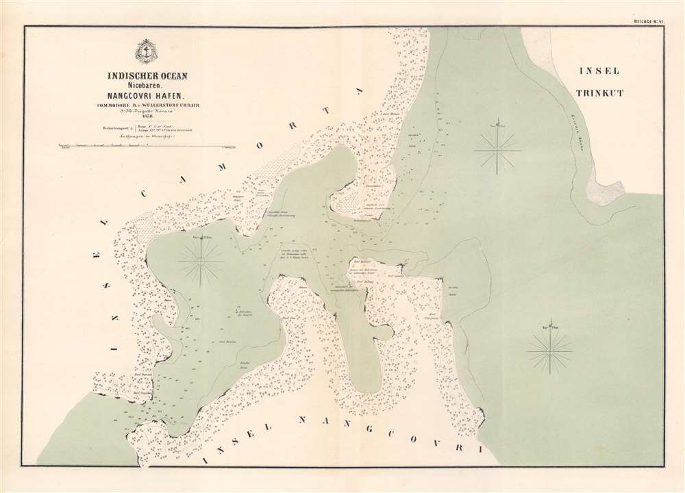
Nangcovri Hafen / [Nangcovri Harbor].
$500.00
Acquire
- Digital Map Information
- Suitable for large format printing
- File Size: 17.37 MB
- File Type: ZIP / TIFF
- ICC color profile embedded
- Delivered instantly via download link
This is a rare 1858 Baron Bernhard von Wüllerstorf-Urbair map of Nancowry Harbor, one of several maps the Indian Ocean drawn by the 1857 - 1859 Novara Expedition. This map includes a brief legend noting longitude, latitude, and units of measurement ('Viennese feet'), as well as common elements of maps in this series, such as numbers on the map indicating the hourly speed of the current in stagnant or falling water. (more details)
Island in the Nicobars.

Indischer Ocean Nicobaren. Insel Tillangschong. / [Tillangchong Island, Nicobar Islands, Indian Ocean].
sold
- Digital Map Information
- Suitable for large format printing
- File Size: 11.42 MB
- File Type: ZIP / TIFF
- ICC color profile embedded
- Delivered instantly via download link
This is a rare 1858 Baron Bernhard von Wüllerstorf-Urbair map of Tillangchong Island, one of several maps the Indian Ocean drawn by the 1857 - 1859 Novara Expedition. This map includes a brief legend noting longitude, latitude, units of measurement, and conversion. (more details)
View of Kealakekua and Kealakekua Bay, important sites in Native Hawaiian culture.

Village De Kearakekoua / [Kealakekua Village].
sold
- Digital Map Information
- Suitable for large format printing
- Full resolution TIFF file
- ICC color profile embedded
- Delivered instantly via download link
This is a c. 1845 lithograph view of the village of Kealakekua, Hawaii (Sandwich Islands) showing two groups of indigenous inhabitants in canoes with the village in the background. The view was sketched by Barthélémy Lauvergne, one of the resident artists on the Bonite expedition, a French scientific and diplomatic voyage around the world in 1836 - 1837. (more details)
Follow New York City's most famous authors around Manhattan.

The Literary Map of N.Y.
sold
This is a 1988 Linda Ayriss and Brian Ladner pictorial literary map of New York City. Focusing on the borough of Manhattan, 141 locations around Manhattan associated with famous authors and poets are numerically identified. The vast majority of these are residences, but other identified locales include the San Remo Café, the Cedar Street Tavern, the Algonquin Hotel, and The New Yorker and Vanity Fair offices. An alphabetical index lists the authors and poets in question, with their most recognizable works noted in italics (especially if one was written at a particular location). Among these are F. Scott Fitzgerald, Joseph Heller, Allen Ginsberg, William S. Burroughs, Langston Hughes, Edith Wharton, and Willa Cather. The entire map is drawn as if it is the façade of the Algonquin Hotel and the top section of the index appears within the awning over the hotel's front doors. A series of portraits beneath the façade of the Algonquin Hotel celebrate New York City authors, including Norman Mailer, James Baldwin, Dylan Thomas, and Dorothy Parker. (more details)