
Lincoln Road, 'the most beautiful shopping street in the world'.
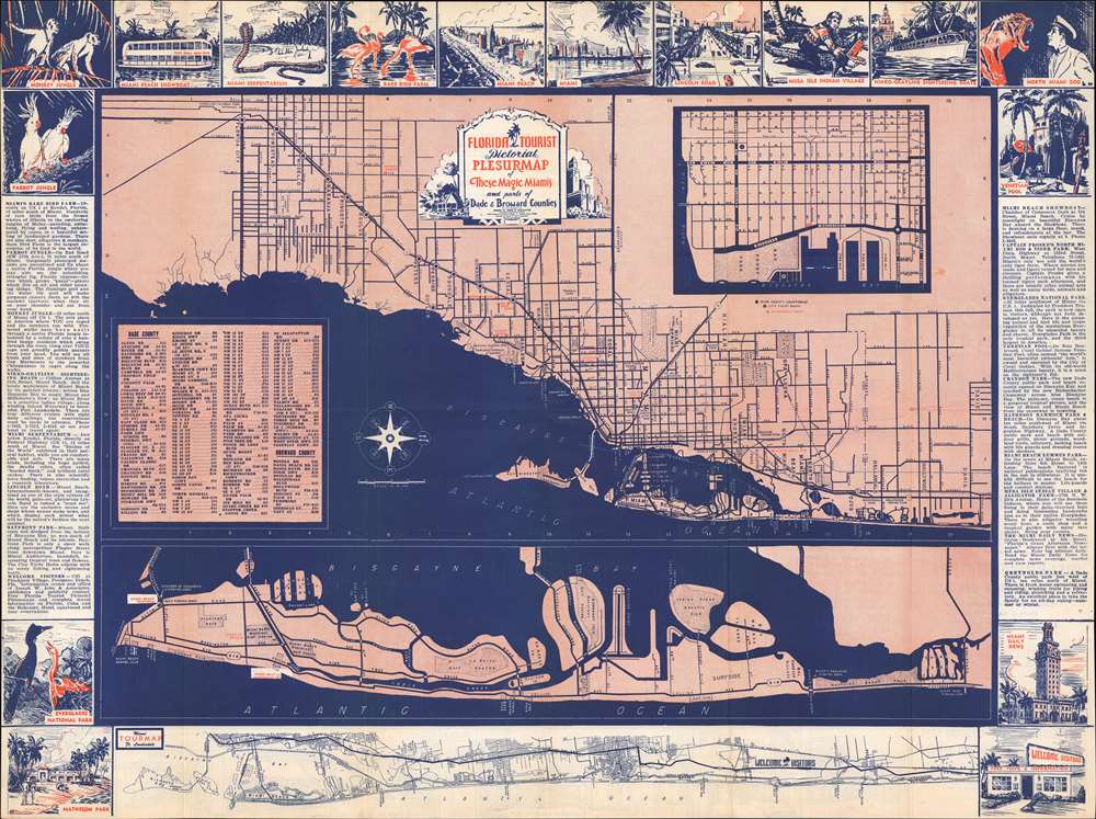
Florida Tourist Pictorial Plesurmap of These Magic Miamis and parts of Dade and Broward Counties.
sold
- Digital Map Information
- Suitable for large format printing
- Full resolution TIFF file
- ICC color profile embedded
- Delivered instantly via download link
This is a c. 1948 'Joseph W. John and Associates' pictorial city plan or map of Miami, Florida. Oriented towards the west, the map depicts the Florida coast from Florida City north to Davie. Wonderful sketches promoting tourist attractions and local businesses create the border on both the recto and verso. Red text marks many of the promoted attractions, including the Parrot Jungle, the Rare Bird Farm, the Serpentarium, the Monkey Jungle, and Lincoln Road. A Dade County and Broward County road index appears on the lower left. A map of the Florida Coast from Miami to Boca Raton creates most of the bottom border. (more details)
The 'Old Northwest' remembered.

The Old Northwest Territory.
sold
- Digital Map Information
- Suitable for large format printing
- Full resolution TIFF file
- ICC color profile embedded
- Delivered instantly via download link
An uncommon 1937 pictorial map of the old Northwest Territory by Fred Rentschler. The map includes all five of the Great Lakes and the modern-day states of Minnesota, Wisconsin, Illinois, Indiana, Michigan, and Ohio. It includes numerous vignettes referencing historic events, American Indian peoples, and folklore. The main map is surrounded by historical maps illustrating various plans for the Northwest Territory ranging from the 'Thomas Jefferson Conception' to specific illustrations of the individual states in different configurations. The verso of the map features a transcript of the Ordinance of 1787 as well as additional historical text. (more details)
Pictorial history of New Mexico.
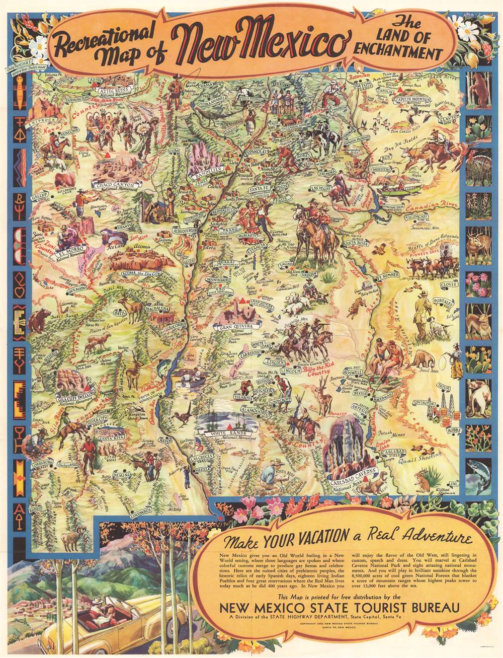
Recreational Map of New Mexico. The Land of Enchantment.
sold
- Digital Map Information
- Suitable for large format printing
- Full resolution TIFF file
- ICC color profile embedded
- Delivered instantly via download link
This is a 1952 Wilfred Stedman pictorial map of New Mexico. Vignettes highlight New Mexico's history and culture, including dancing Native Americans, a Spanish conquistador hiding behind a boulder, a covered wagon, and a group of outlaws on horseback in 'Billy the Kid Country'. Other vignettes promote modern life in New Mexico, such as ranching, while also emphasizing recreational activities, like fishing, skiing, and swimming. Important sites around the state, including Carlsbad Caverns National Park, Chaco Canyon National Monument, Aztec Ruins National Monument, and White Sands Nationals Monument have their own vignettes. Banners label cities and towns, including Santa Fe, Albuquerque, and Taos. (more details)
Depression-era Minnesota.

Minnesota invites you to Live Work Play in the Playground of 10,000 Lakes.
sold
- Digital Map Information
- Suitable for large format printing
- Full resolution TIFF file
- ICC color profile embedded
- Delivered instantly via download link
This c. 1935 Minnesota Tourist Bureau pictorial tourist map of Minnesota presents an intriguing mix of economic facts and tourist sites. Minnesota's fishing, while not expressly touted, takes center stage. Illustrations of fourteen different fish species 'swim' along the right border and facts about the piscine population are scattered throughout. Red lines trace state highways, and white banners proclaim everything from the 'largest freshwater inland lake in the U.S.' and the '11,007 lakes in Minnesota' to the state's annual dairy, barley, and raspberries production. The University of Minnesota and the Mayo Clinic both make an appearance. State parks and an Indian reservation are illustrated next to references to resort hotels, tourist cabins, and '36 holes of golf'. (more details)
Visit wonderful Silver Springs, Florida!

America's Finest Highways Lead to Silver Springs.
sold
This is a 1955 Automobile Association of America map of Florida. Created as a promotional for Silver Springs, a tourist destination outside Ocala, Florida, a large red 'arrow' points the way. U.S. highways are illustrated in red. Four highways pass through Ocala, highlighting the destination's easy access. Five inset maps, each focused on a different part of the United States, trace highway routes from numerous major cities in the U.S. and Canada to Silver Springs. (more details)
'Hail Fredonia!'
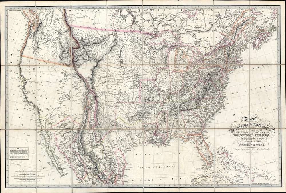
Fredonia, or the United States of North America; including also Cabotia, or the Canadian Provinces; the Western Territory to the Pacific Ocean; and the Northern Part of the Mexican States.
sold
- Digital Map Information
- Suitable for large format printing
- Full resolution TIFF file
- ICC color profile embedded
- Delivered instantly via download link
A fine example of the rare 1830 first obtainable edition of the famous Richard Holmes Laurie 'Fredonia' map of the United States. The map is best known for its advocation of a new name for the United States - Fredonia, which it is argued would build national pride and solidarity, as well as better distinguish it from Canada (Cabotia) and Mexico. Aside from the map's 'Fredish' qualities, this is considered one of the best early 'Manifest Destiny' maps issued in the wake of Lewis and Clark (1804 - 1806), thus illustrating the United States spreading coast-to-coast. It is derived from the most up-to-date sources and includes much of interest throughout. In Florida, it is one of the earliest maps to note the Cape Florida Settlement, a squatter community that was the precursor of modern-day Miami. (more details)
Controversial pre-discovery 'Australia;' Religious argument for Spanish imperialism.
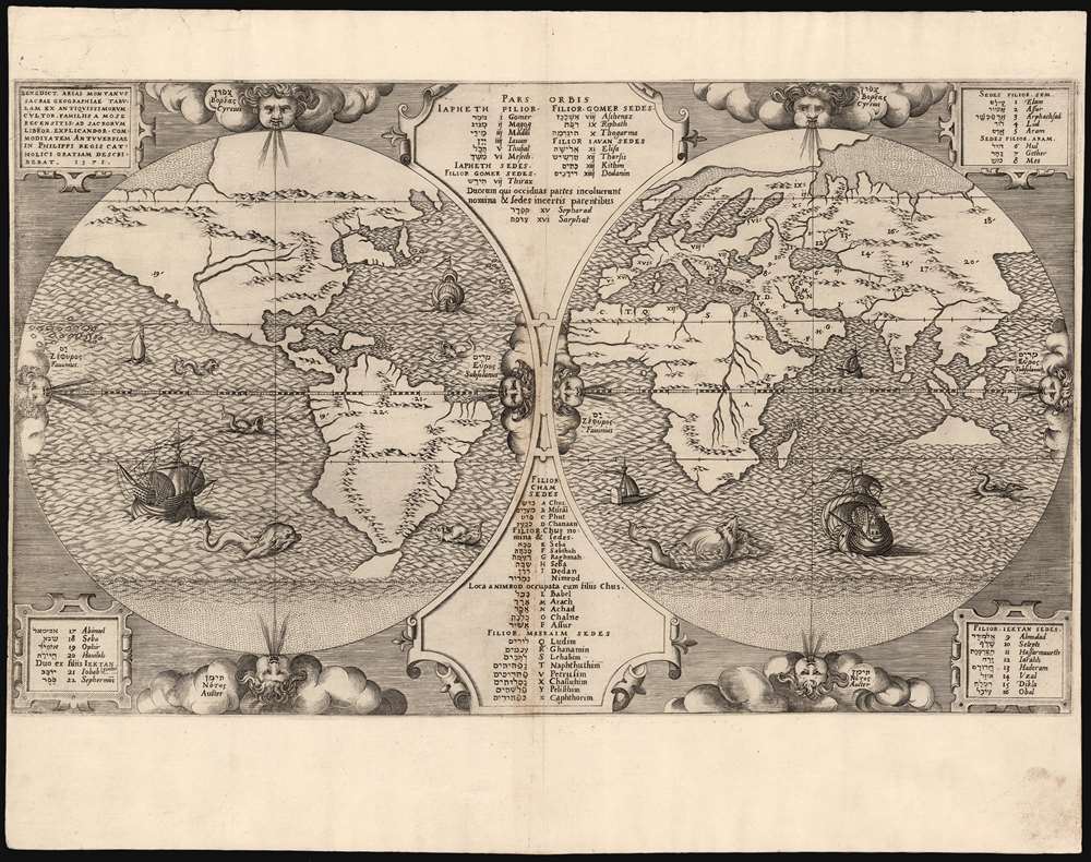
Benedict Arias Montanus Sacrae Geographiae Tabulam Ex Antiquissimorum Cultor.
sold
- Digital Map Information
- Suitable for large format printing
- Full resolution TIFF file
- ICC color profile embedded
- Delivered instantly via download link
This is a scarce and important 1571 map of the world by Benedict Arias Montanus. Finely engraved and prepared for the eight-volume Plantin Polyglot Bible, this elegant map was intended to bring the new discoveries of the Americas into a coherent religious context. It further established the Native American population as Hebrew descendants of Noah, and thus Children of God whom the dedicatee of the Polyglot, Philip II of Spain, was obliged to convert. Although its alleged revelations of Australian geography have long been the map's cause celebre, these are overshadowed by the map's actual significance as a cartographic justification of Spanish Imperialism. (more details)
Old color.
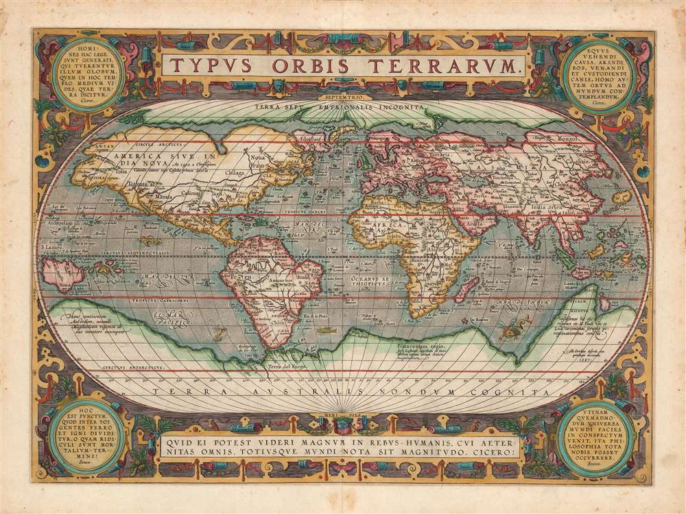
Typus Orbis Terrarum.
sold
- Digital Map Information
- Suitable for large format printing
- Full resolution TIFF file
- ICC color profile embedded
- Delivered instantly via download link
One of the most iconic maps of all time, this is Abraham Ortelius's 1589 map of the world, Typus Orbis Terrarum, here in the first state of the 3rd plate. This map was published in Ortelius' Theatrum Orbis Terrarum, the first modern published atlas. The map embraces the entirety of the known world and represented the most widely-disseminated and eagerly-copied image of the world available to the European reader at the end of the 16th century. In compiling this map Ortelius drew on the best cartography available, including Gerard Mercator's map of 1569, Giacomo Gastaldi's 1561 World Map, Diego Gutierrez's portolan of the Atlantic, as well as other works by Sebastian Cabot, Jodocus Hondius, Orontius Finaeus, Petrus Plancius, Gemma Frisius, Laurent Fries, and more. (more details)
The Circumnavigable Globe Revealed.
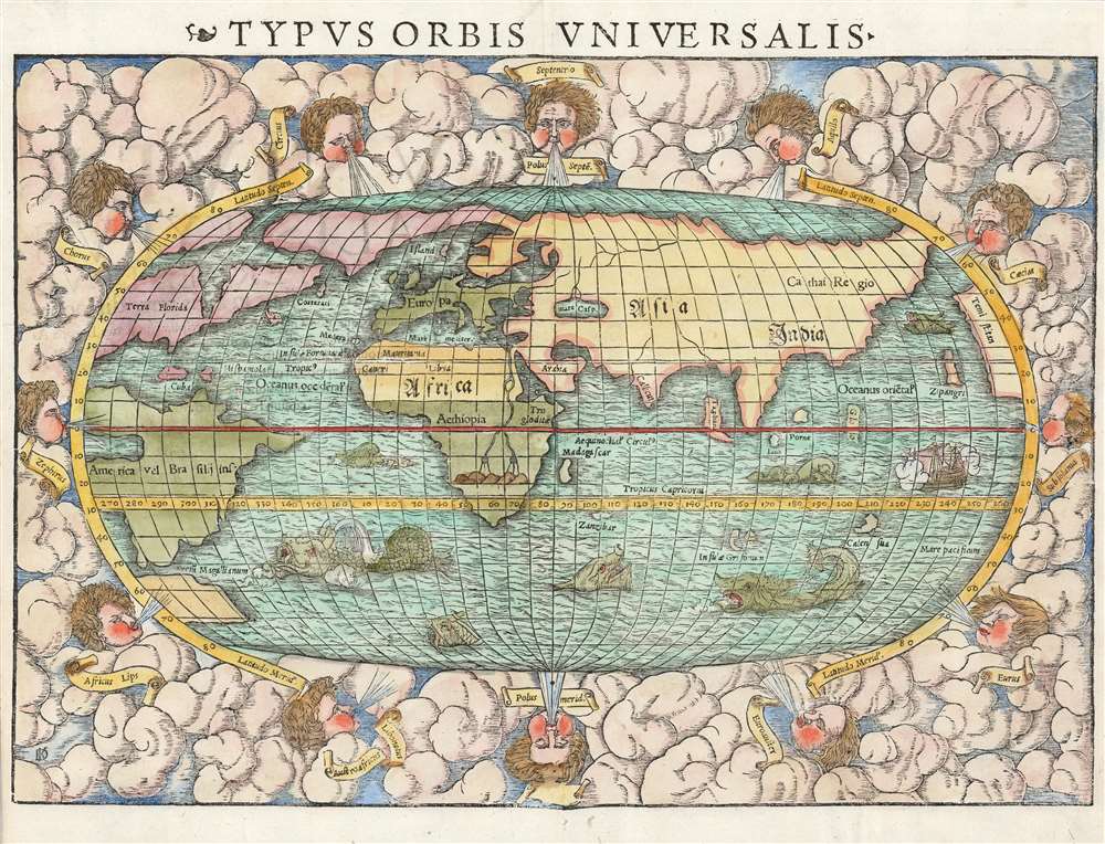
Typus Orbis Universalis.
sold
- Digital Map Information
- Suitable for large format printing
- Full resolution TIFF file
- ICC color profile embedded
- Delivered instantly via download link
This is Sebastian Münster's 1550 map of the world, one of the most distinctive produced during the Age of Discovery. In the mid-sixteenth century, it was the best summation of the rapidly expanding known world available to the literate European. The map was included in Münster’s magnum opus, Cosmographia Universalis, for over forty years was the primary source for anyone who wished knowledge of the world. Consequently, this map would have had a disproportionate impact, providing the first presentation of a circumnavigable world for nearly half a century. It would not be challenged until the 1570 publication of Ortelius' Theatrum Orbis Terrarum. As important as its geographical revelations were, the map is also rich in the imagery of its era: it is bordered with billowing clouds and wind-heads marking the cardinal directions, puffing their breezes over the waters. The oceans are prowled by eight sea monsters and a sailing ship is shown crossing the Pacific and proudly firing its cannons. (more details)
First Atlas Map of the Caribbean, and Northwestern Mexico.
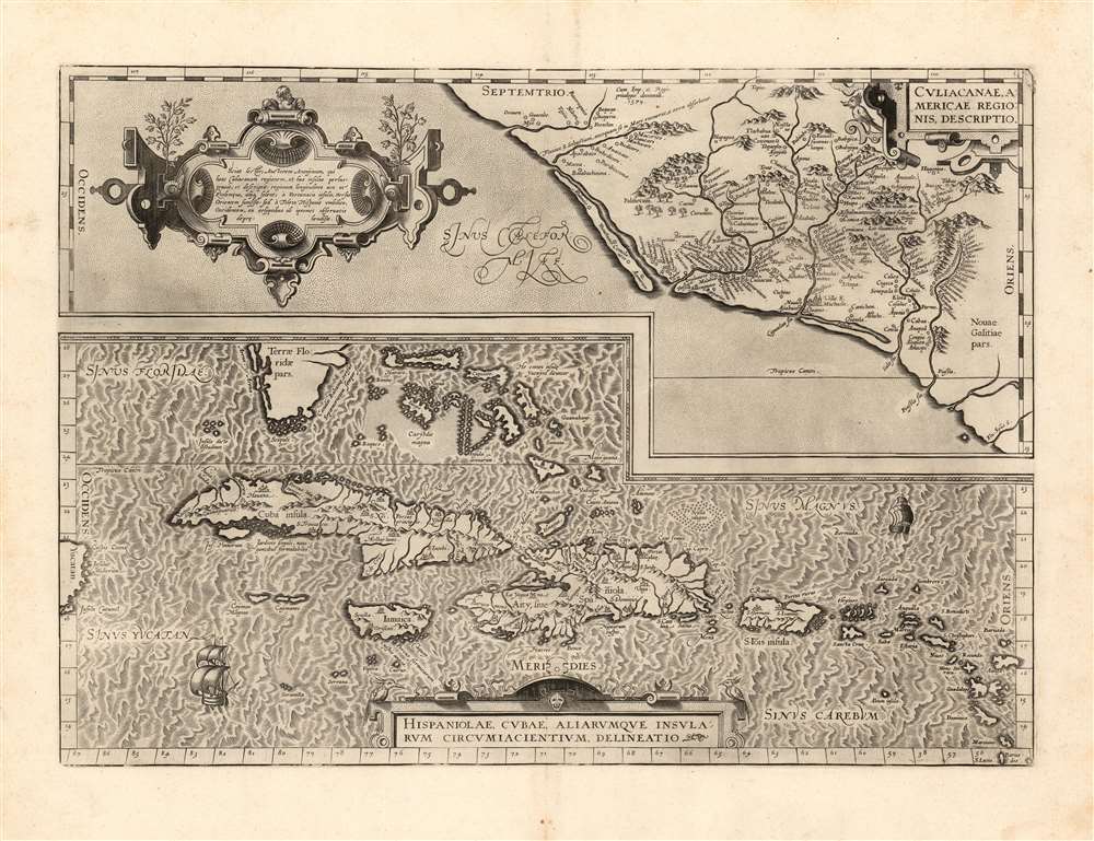
Culiacanae, America Regionis Descriptio./ Hispaniolae, Cubae, Aliarumque Insularum Circumiacentium, Delineatio./ Cum Imp. et Regio./ privilegio decennali 1579.
sold
- Digital Map Information
- Suitable for large format printing
- Full resolution TIFF file
- ICC color profile embedded
- Delivered instantly via download link
This is a beautiful, sharp example of Ortelius' 1579 map of the Viceroyalty of Culiacan in Northwestern Mexico, and Ortelius' map of Cuba and the Caribbean. While Ortelius is generally most esteemed as an editor and compiler of maps, he was an accomplished mapmaker in his own right, and this map is among those of his Theatrum of his own composition, synthesizing data drawn from Mercator's 1569 world map, Gutierrez's 1562 America map and Alonso de Santa Cruz's 1560 Isolario (sources now unobtainable by the collector). These maps, both of essential areas of recent exploration in the New World, exemplify Ortelius' trail-blazing cartographic work. (more details)
The golden age of rail...
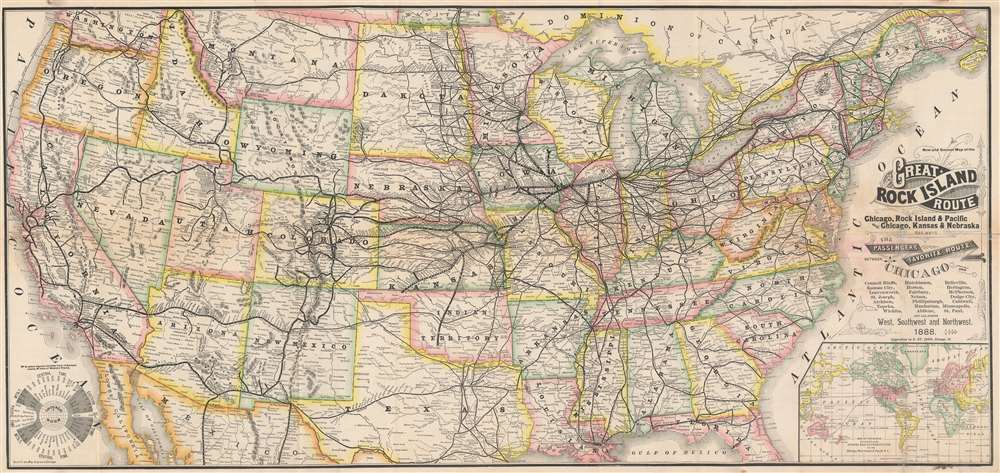
New and Correct Map of the Great Rock Island Route Chicago, Rock Island and Pacific and Chicago, Kansas and Nebraska Railways.
sold
- Digital Map Information
- Suitable for large format printing
- File Size: 52.84 MB
- File Type: ZIP / TIFF
- ICC color profile embedded
- Delivered instantly via download link
This is an 1888 George F. Cram and Rock Island Railroad map of the United States. Centered on the railroad network of the 'Chicago, Rock Island, and Pacific Railroad', every stop from Chicago to Omaha is labeled. The same detail is present along the lines of the 'Chicago, Kansas, and Nebraska Railway'. The rest of the transcontinental railroad network is illustrated as well, with the Union Pacific, Northern Pacific, Southern Pacific, and the Denver and Rio Grande noted. An inset map situated in the lower right details the global trade network operated 'via the Chicago, Rock Island, and Pacific Railway'. (more details)
Dominant map of Persia and Afghanistan at the beginning of the 18th century

[Persia]
sold
- Digital Map Information
- Suitable for large format printing
- Full resolution TIFF file
- ICC color profile embedded
- Delivered instantly via download link
This is a rare 1726 map of Persia by Francois Valentijn. It covers from the Gulf of Suez eastward to Ahmedabad (Amadabad) in modern-day western India. This map, centered on Persia, includes the Caspian Sea and part of the Arabian Peninsula. The map is highly detailed, noting numerous rivers, towns, islands and mountains. Stippling along the coastlines indicates shallows. The detail of this elegant and scarce map, alas, reflects the cartography of the previous centuries: place names are largely consistent with those found on the 16th century maps of Giacomo Gastaldi, which were largely passed along wholesale to Blaeu, whose labors this map's maker appears to have mined. (more details)
Angkor Wat!

Carte du Groupe et du Parc d'Angkor.
sold
- Digital Map Information
- Suitable for large format printing
- File Size: 14.98 MB
- File Type: ZIP / TIFF
- ICC color profile embedded
- Delivered instantly via download link
This is a 1953 'Service Géographique des Forces Armées Royales Khmères' map of Angkor, Cambodia. Angkor, home to the world-famous temples of Angkor Wat and Angkor Thom, among others, was the capital of the Khmer Empire which flourished between the 9th and 15th centuries. Both Angkor Wat and Angkor Thom are illustrated and labeled, their moats making them instantly recognizable. Angkor Wat, while the smaller of the two sites, is said to be the world's largest single religious monument and is Cambodia's most popular tourist attraction. Both temples, along with the surrounding area, are collectively a UNESCO World Heritage Site. Using satellite photography and other modern techniques, an international team of researchers determined that Angkor was the largest pre-industrial city in the world in 2007. They realized that an interconnected community that covered at least 390 square miles, with Angkor Wat and Angkor Thom at its center. Today, over two million people visit the site annually. (more details)
A Fifth Avenue candy store.

Map of the City of New York Shewing Surrounding Villages, Farms, Estates, etc. in 1839. Prepared by Dean's Who Were Established in That Year.
sold
- Digital Map Information
- Suitable for large format printing
- File Size: 20.13 MB
- File Type: ZIP / TIFF
- ICC color profile embedded
- Delivered instantly via download link
This is a c. 1920 Guy Reed pictorial map of New York City as it appeared in 1839. Coverage includes Manhattan from 106th Street to the Battery and from Jersey City to Brooklyn. New York's high society populate the map, with a well-dressed couple promenading up 2nd Avenue and two coaches taking the wealthy to their estates outside the city. Many of these estates, including the Schuyler, Astor, Dykman, and Woolsey residences, are labeled. Manhattan's iconic street grid, then emerging, appears as dashed lines. Bloomingdale Road (now part of Broadway) and the Post Road are illustrated. (more details)
Religious and secular sites around Jerusalem,
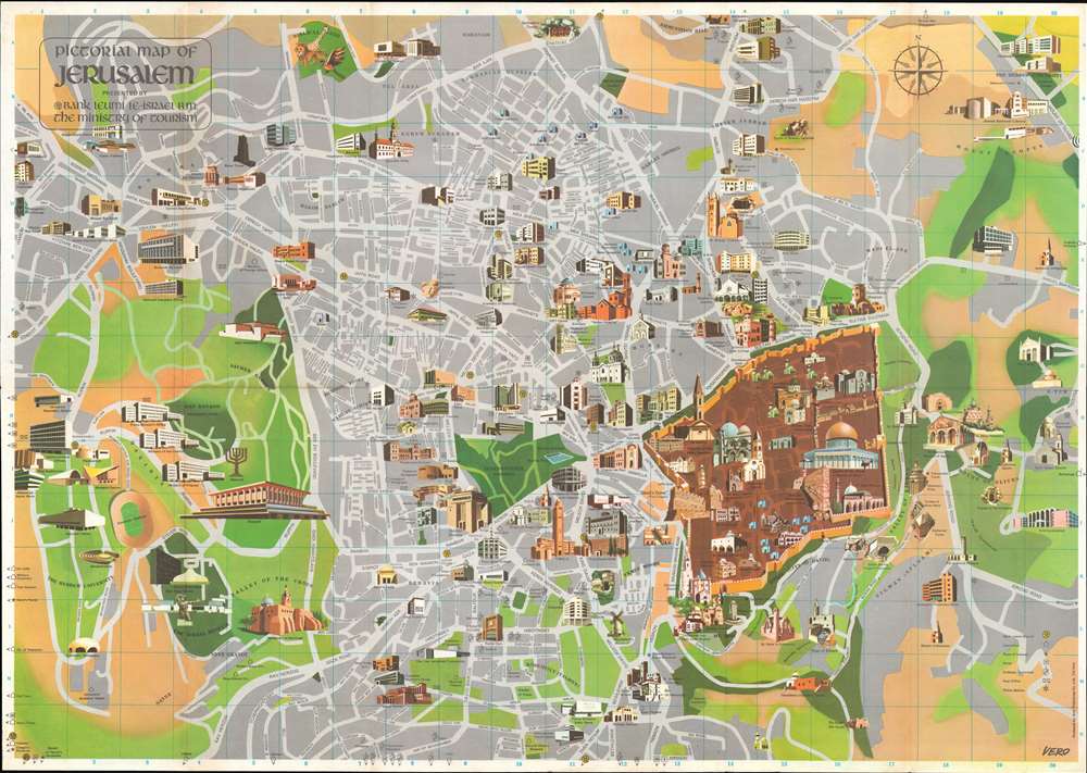
Pictorial Map of Jerusalem.
sold
This is a 1971 Radu Vero pictorial map of Jerusalem. Centered on the Old City, illustrations of Jerusalem's many sites dominate the piece. Shaded brown, the Old City stands in stark contrast to the rest of the city, which appears in gray with green highlighting the city's gardens and parks. The Dome of the Rock, the Western Wall, Al-Aqsa Mosque, 'David's Tower', and the Church of the Holy Sepulcher are among the notable sites named. Numerous additional locations are illustrated outside the Old City and range from government ministries, hotels, schools, convents, and synagogues to famous sites, such as the Hebrew University, The Israel Museum, and the Knesset. Religious sites including the Tombs of the Prophets, David's Tomb, the Sanhedrin Tombs, and the Tomb of the Kings are illustrated and labeled as well. (more details)
Early study on manmade climate change.
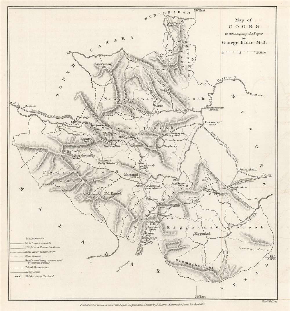
Map of Coorg to accompany the Paper by George Bidie, M.B.
sold
- Digital Map Information
- Suitable for large format printing
- File Size: 2.88 MB
- File Type: ZIP / TIFF
- ICC color profile embedded
- Delivered instantly via download link
This is an 1869 John Murray map of Kodagu (formerly Coorg) District in Karnataka, India. This is one of the earliest maps we are aware of to deal with manmade climate change. Created to accompany a paper published in The Journal of the Royal Geographical Society. The paper's author, George Bidie, described Coorg to his readers:
Coorg lies near the centre of the Western Ghâts, and chiefly in the eastern aspect of the range. On its western margin the crests of the chain rise up in bold peaked mountain masses, some of which attain the height of 5000 feet above the sea, and to the east of these the country consists of a series of low, long-backed hills, with intersecting deep-set valleys, running out towards, and gradually subsiding in, the table-land of Mysore.(more details)
Highlights the Dead Sea and the Sea of Galilee.
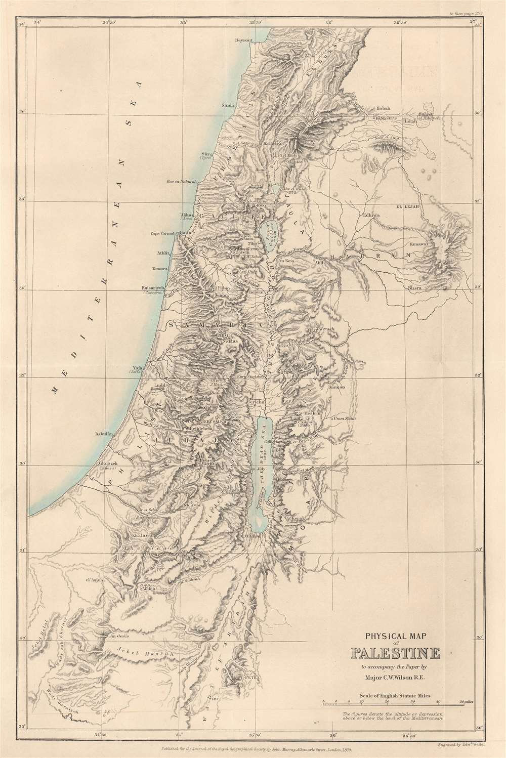
Physical Map of Palestine to accompany the Paper by Major C.W. Wilson R.E.
sold
- Digital Map Information
- Suitable for large format printing
- File Size: 6.77 MB
- File Type: ZIP / TIFF
- ICC color profile embedded
- Delivered instantly via download link
This is an 1873 John Murray map of Palestine, Israel, and the Holy Land highlighting the region's physical features. Depicting from Beirut south to Petra, the region's striking topography becomes immediately apparent. Many peaks are identified, including the Mount of Olives near Jerusalem, and their elevations provided. Both the Dead Sea and the Sea of Galilee are illustrated and labeled. The region's river network is detailed as well. Haifa, Jaffa, Tyre, Bethlehem, Hebron, Jericho, and Gaza are among the identified cities. (more details)
Published in a 1905 time table booklet for the Chicago and Eastern Illinois Railroad.
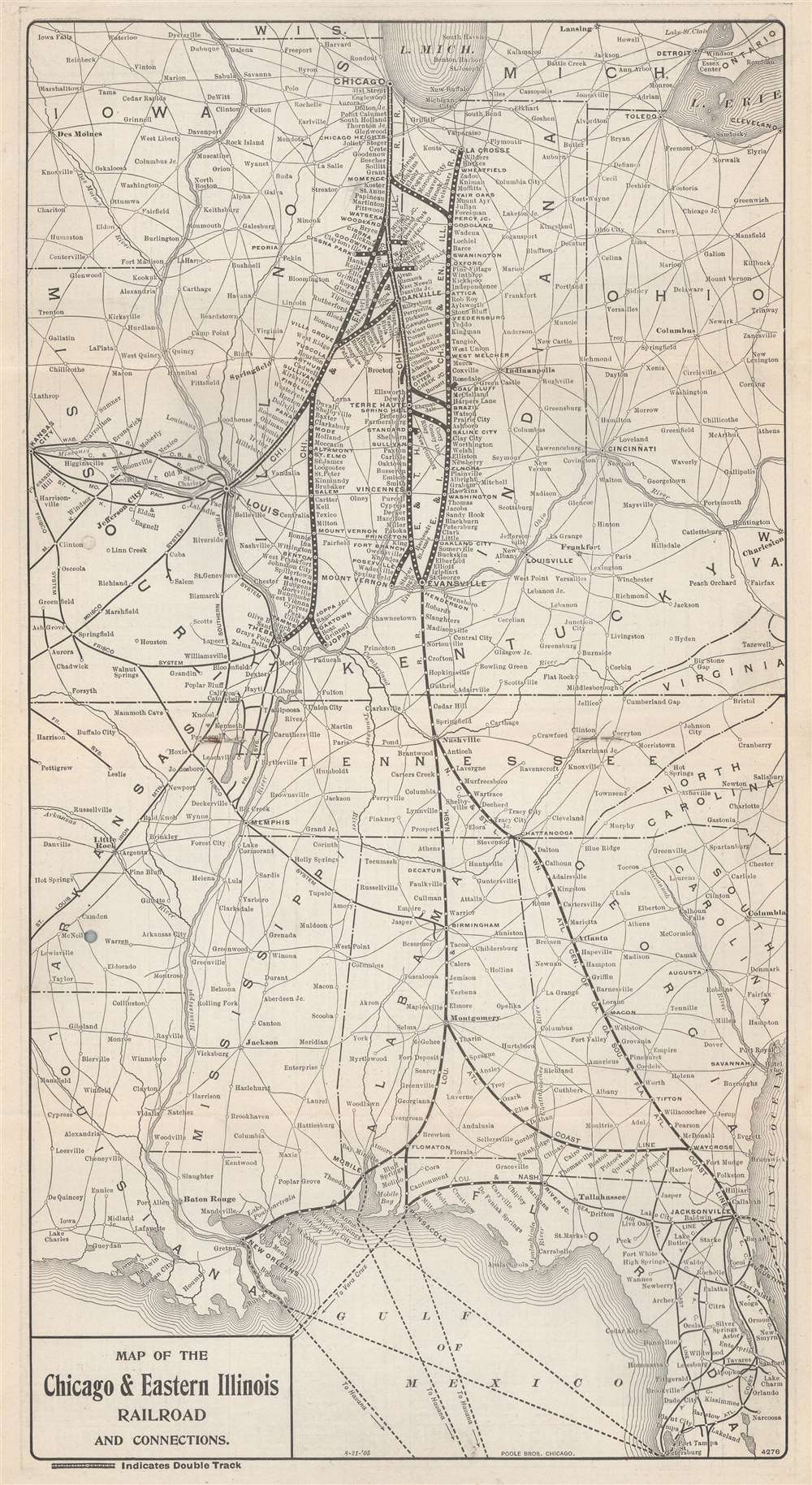
Map of the Chicago and Eastern Illinois Railroad and Connections.
sold
- Digital Map Information
- Suitable for large format printing
- File Size: 6.66 MB
- File Type: ZIP / TIFF
- ICC color profile embedded
- Delivered instantly via download link
This is a 1901 Poole Brothers and Chicago and Eastern Railroad map of the central United States. Focused on the Chicago and Eastern Railroad's network in Illinois and Indiana, the map depicts from Lake Michigan south to Tampa, Florida and from Kansas City, Missouri to Cleveland, Ohio, and Charleston, West Virginia. Thick black lines highlight the Chicago and Eastern's rail lines and every stop along their routes. As would be expected from a railroad map, connecting railroads are illustrated as well. (more details)
China's terrain.
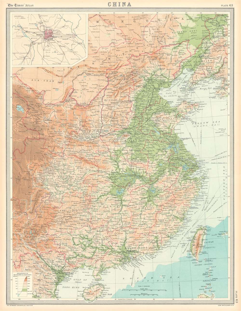
China.
$100.00
Acquire
- Digital Map Information
- Suitable for large format printing
- File Size: 25.48 MB
- File Type: ZIP / TIFF
- ICC color profile embedded
- Delivered instantly via download link
This is a 1922 J.G. Bartholomew terrain map of China. Depicting eastern China from Mongolia to Hainan, Bartholomew employs color to differentiate between six ranges in elevation from sea level to 12,000 feet and above. He also uses color to illustrate ocean depth. Chinese provinces are illustrated and labeled, and cities, town, and villages are identified. An inset map in the upper left corner details Beijing (Peking) and its environs. (more details)
One of only a few English maps to recognize the Republic of Texas. / The first map to show a fully explored Northwest Passage.
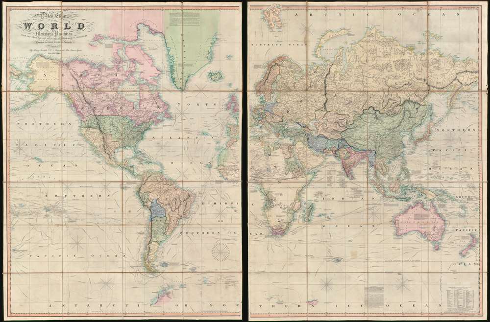
A New Chart of the World On Mercator's Projection With The Tracks Of The Most Celebrated and Recent Navigators.
sold
- Digital Map Information
- Suitable for large format printing
- Full resolution TIFF file
- ICC color profile embedded
- Delivered instantly via download link
This is an impressive 1845 large format map of the world by Henry Teesdale. The map covers the entire world on a Mercator projection with copious notes and annotations throughout. It is significant for many reasons, but chief among them is that it is one of the few English maps to recognize the Republic of Texas (as England itself did not) - and depict its most ambitious boundary configuration. It is also the first map to show a complete northwest passage following the Deese-Simpson Expedition. The map is thorough, including the most up to date political events and discoveries, but also tends to be biased, although not always towards Anglo-centric interests. For example, the map agrees with British claims to British Columbia relating to the 54/40 Oregon Question, and ignores the discoveries of Charles Wilkes (1798 - 1877) and the U.S. Exploring Expedition (1838 - 1842), no doubt to bolster the competing exploratory claims of Englishman John Ross (1777 - 1856). Teesdale's map is beautifully presented in two sections, each of which have been dissected into sixteen panels and laid on linen. The whole folds into a beautifully tooled leather binder with marbled endpapers. (more details)