
Marks 141 shipwrecks over the last 400+ years.
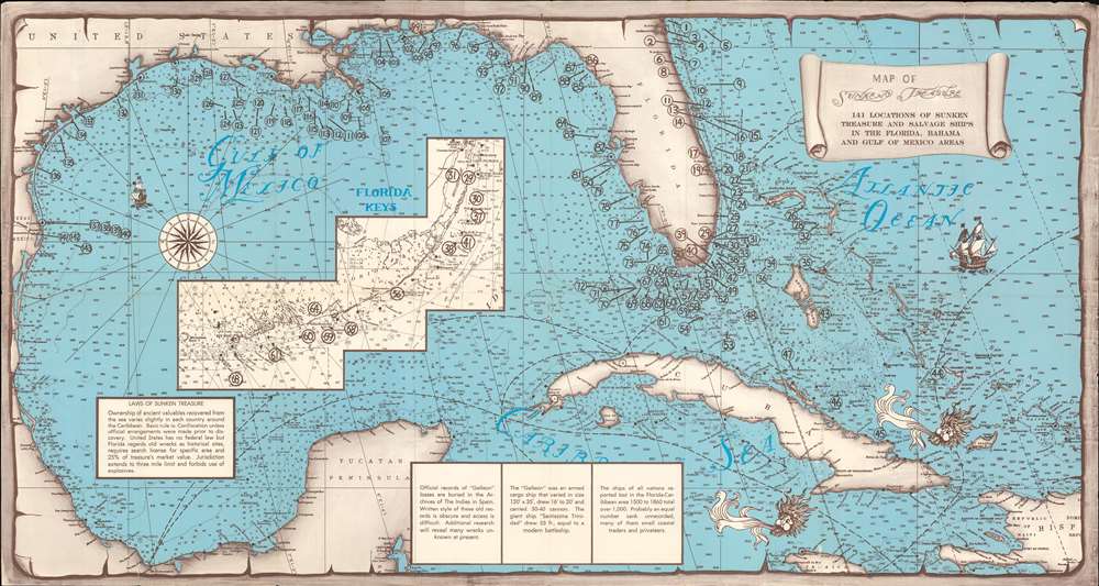
Map of Sunken Treasure. 141 Locations of Sunken Treasure and Salvage Ships in the Florida, Bahama, and Gulf of Mexico Areas.
sold
- Digital Map Information
- Suitable for large format printing
- Full resolution TIFF file
- ICC color profile embedded
- Delivered instantly via download link
This is a c. 1950 sunken treasure map of Florida, the Bahamas, and the Gulf of Mexico. The map covers from Tampico, Mexico to Hispaniola and the Turks and Caicos Islands, and from Jacksonville and Pensacola to Jamaica. It highlights 141 shipwrecks from the late 1500s to the 1940s. Circles containing numbers indicate each wreck, with a large concentration appearing along the Florida coast. Depth soundings are noted throughout, helping to estimate just how deep each wreak rests. An inset of the Florida Keys, from Miami to the Marquesas Keys, occupies the Gulf of Mexico, implying that no wrecks would be found in this area. An index of the 141 wrecks provides some information concerning each, including the type of vessel, Latitude and Longitude, and, in some cases, the date and the circumstances of its sinking. Text boxes along the bottom border provide a crash course in the 'Laws of Sunken Treasure' and a short, suggestive history of Spanish Galleon losses in the Caribbean. The whole is drawn as if on a large sheet of aged paper, with the artist using effects to make it look old, torn, and as if it had been rolled for years - like a stereotypical treasure map. (more details)
A wonderful map of South America.
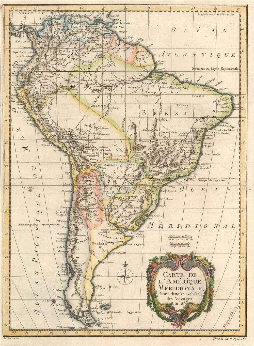
Carte de l'Amérique Méridionale.
sold
- Digital Map Information
- Suitable for large format printing
- DPI: 600
- File Size: 12.55 MB
- File Type: ZIP / TIFF
- ICC color profile embedded
- Delivered instantly via download link
This is a 1780 Jacques-Nicolas Bellin map of South America. Concentrations of detail, particularly along the west coast in Peru, Chile, and throughout northern South America, indicate where most of the era's interest and knowledge was concentrated. Most of Brazil, however, is a blank wasteland occupied by the Amazon rainforest. The Amazon River, on the other hand, and its tributaries, appear in surprising detail. Fort Negro, modern-day Manaus, is labeled near the confluence of the Negro and Solomoes rivers, where it was founded in 1669. Other major cities throughout the continent are identified as well, including Buenos Aires, Montevideo, Cuzco, Cartagena, and Rio de Janeiro. The Rio de la Plata, the Paraguay River, and their tributaries occupy a large portion of south-central South America and include the mythical Laguna de Xarayes. (more details)
The first edition of an impressively detailed map of Cape Ann.
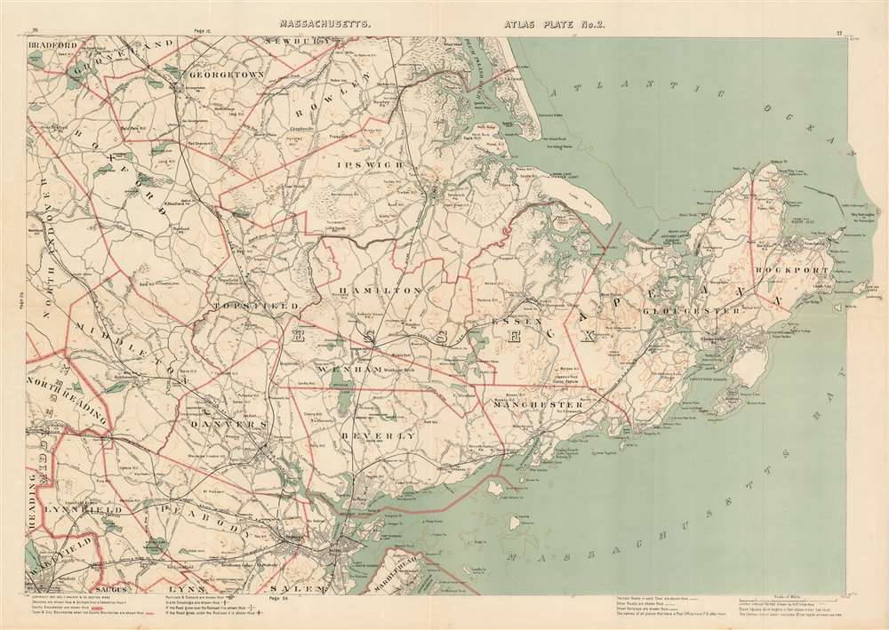
[Cape Ann.] Massachusetts Atlas Plate No. 2.
sold
- Digital Map Information
- Suitable for large format printing
- File Size: 25.06 MB
- File Type: ZIP / TIFF
- ICC color profile embedded
- Delivered instantly via download link
This is a first edition 1891 Oscar W. Walker map of Cape Ann / Gloucester, Massachusetts. Depicting the region from Woodchuck Hill to the Dry Salvages and from South Byfield to Marblehead Neck, the map provides a clear and, more importantly, usable, overview of the area. Cities and towns are labeled throughout, including Salem, Danvers, Marblehead, Ipswich, Beverly, Gloucester, and Rockport. Plum Island and the Plum Island River occupy the top center. Major roads wind across the map, and differentiation between three different road grades allows travelers unfamiliar with the area to know the best roads to take. Stark black lines mark several branches of the Boston and Maine Railroad and railroad stations are identified. (more details)
An Early Masterpiece of Harrison's Cartographic Presentation of Data.
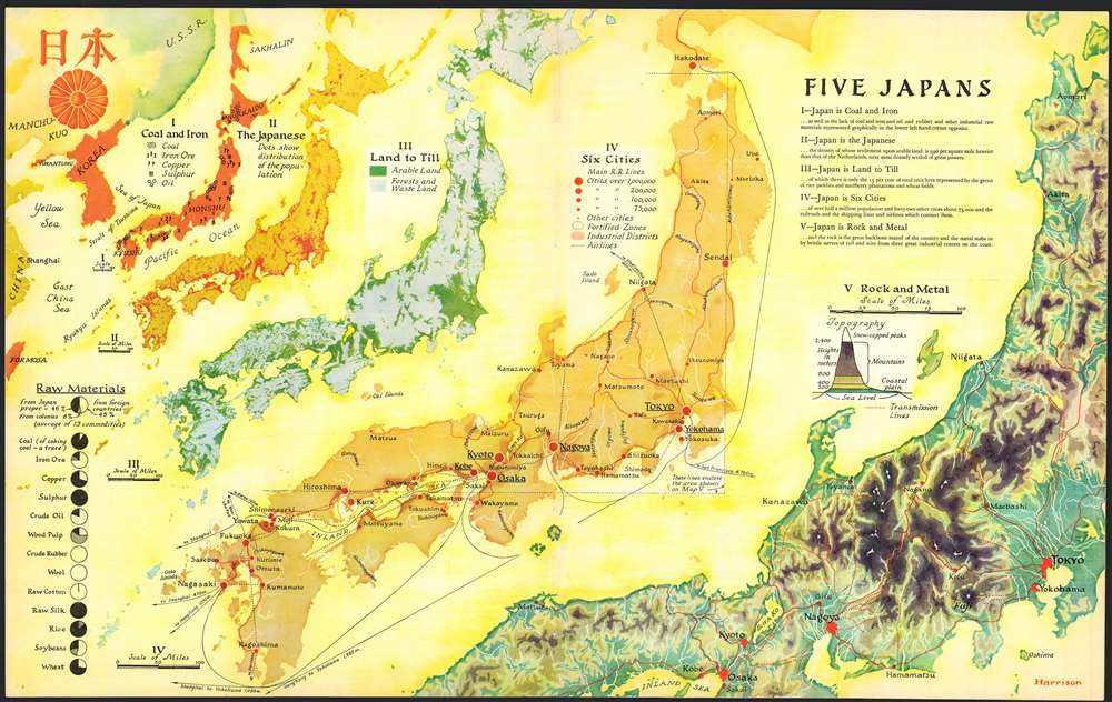
Five Japans.
sold
- Digital Map Information
- Suitable for large format printing
- File Size: 15.46 MB
- File Type: ZIP / TIFF
- ICC color profile embedded
- Delivered instantly via download link
This 1936 Richard Edes Harrison map of Japan - really, five separate maps of Japan on a single sheet – is one of the graphic artist Harrison's first published forays in cartography, and is a superb representation of his skill at the visual display of quantitative information. Accompanying an article describing Japan's pre-war industrial powerhouse, this combination of maps uses bright color in Harrison's inimitable style to clearly present a layered picture of Japan, her people, and her industries. The five maps fan out across the page in a visually arresting composition. (more details)
Saugerties Village in Granular Detail
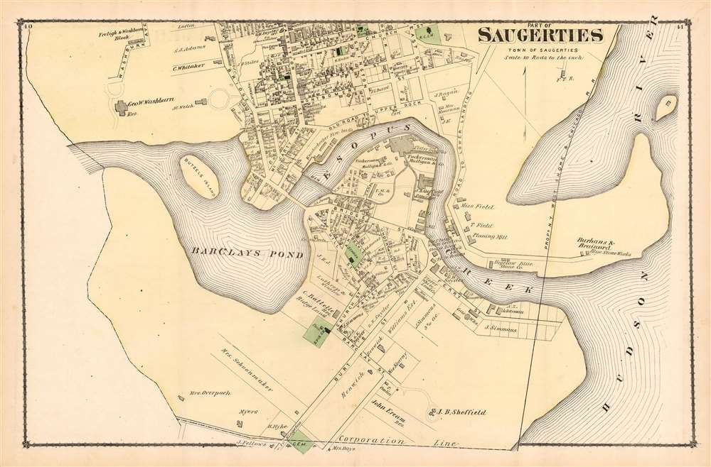
Part of Saugerties: Town of Saugerties.
sold
- Digital Map Information
- Suitable for large format printing
- File Size: 15.16 MB
- File Type: ZIP / TIFF
- ICC color profile embedded
- Delivered instantly via download link
An attractive and interesting F. W. Beers plan or map of Part of Saugerties, from his 1875 County Atlas of Ulster, New York. The close scale of the plan reveals not only streets and plots of land, but also individual structures, many of which still exist. Municipal structures and the town's industries are shown as well. The Saugerties Lighthouse is marked and named. The plan focuses specifically on the southern part of the village, on the shores of Barclays Pond and Esopus Creek. It extends as far north as Church Street (now Post Street) and Russell Street. The proposed route of the New York, West Shore and Chicago Railroad is shown - cutting off the waterfront - although the Railroad only existed between 1870 and 1877 and does not appear to have been actually constructed. (more details)
Rarest and most poignant Russo-Japanese War serio-comic map!

New Funny Map Asia Europa. / 亞細亞歐羅巴嶄新滑稽地圖
sold
- Digital Map Information
- Suitable for large format printing
- File Size: 31.38 MB
- File Type: ZIP / TIFF
- ICC color profile embedded
- Delivered instantly via download link
The holy grail of Japanese Russo-Japanese War (1904 - 1905) chromolithograph serio-comic maps, this is Haru EiDō's July 1904 map lionizing Japanese victories and staging Japan as a major world power and the 'protector' of Asia. This is one of four serio-comic style maps issued sequentially from April through July, 1904, to illustrate and propagandize Japan's near-continuous victories over Russian forces. Unlike some of the others, which also included English content, and therefore were presumably intended for distribution both within and without Japan, this map was intended exclusively for Japanese audiences. (more details)
Eldridge's most important chart.
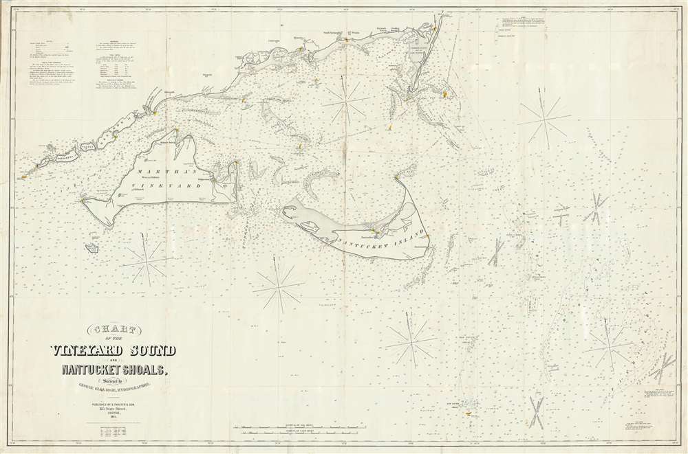
Chart of the Vineyard Sound and Nantucket Shoals, Surveyed by George Eldrdige, Hydrographer.
sold
- Digital Map Information
- Suitable for large format printing
- File Size: 25.23 MB
- File Type: ZIP / TIFF
- ICC color profile embedded
- Delivered instantly via download link
This is George Eldridge’s enormous and important large-format 1864 blueback nautical chart of the waters around Nantucket and Martha’s Vineyard, including Vineyard Sound and the Nantucket Shoals. Most likely Eldridge's most important and useful publication, this chart offers hundreds of depth soundings, along with notations about shoals and other hazards, lighthouses and other aids to navigation, tides, currents and compass variations, sailing directions, and other information pertinent to the mariner. The staggering size of this map as well as its extraordinary overall detail underscore the importance of these waters not only as an international shipping channel, but also for the vibrant local maritime community, of which included Eldridge. The present chart is one of Eldridge’s most important charts with an active period of more than 40 years. (more details)
The updated world and continents maps from the dominant geographical source for its day.
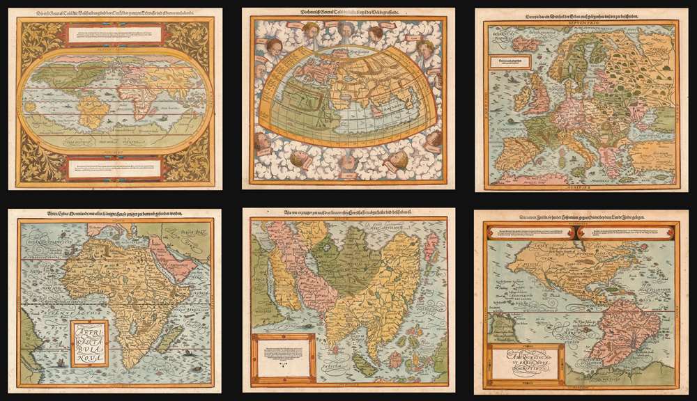
Die erst General Tafel... Ptolemeisch General Tafel... Europa... Asia... Africa... Die newen Inseln.
sold
- Digital Map Information
- Suitable for large format printing
- DPI: 600
- File Size: 76.61 MB
- File Type: ZIP / TIFF
- ICC color profile embedded
- Delivered instantly via download link
This is a beautiful, 6-map set of maps of the world and continents executed for 1588 and later editions of Sebastian Münster's magnum opus, Cosmographia Universalis, entitled in these later editions Cosmographey: das ist, Beschreibung Aller Länder, Herrschafften vnd fürnemesten Stetten des gantzen Erdbodens, sampt ihren Gelegenheiten, Eygenschafften, Religion, Gebräuchen, Geschichten vnd Handtierungen, [et]c. Beginning in 1544, this work would be the primary source of information for anyone who wished to know about the rest of the world: consequently its maps would have had a disproportionate impact, providing the first glimpse of remote and newly-discovered parts World to literate laypeople in Europe for more than half a century. (more details)
A previously undiscovered Japanese Serio-Comic Map! Possibly the first!

New Commemorative Print of Various Countries Sympathies in the Russo Japanese War. / 崭新纪念画 日露戰爭列國义同情
sold
- Digital Map Information
- Suitable for large format printing
- Full resolution TIFF file
- ICC color profile embedded
- Delivered instantly via download link
The only known example of a 1904 (Meiji 37) Japanese serio-comic style map of Asia illustrating foreign perspectives on the Russo-Japanese War (1904 - 1905). Although previously unknown, if the May 3rd 1904 date is to be believed, this is the second Japanese serio-comic map in the Russo-Japanese War series. The map covers all of Asia and although it does not include Europe, illustrates several western European powers, including France, England, and Germany. (more details)
The 'high water mark' of the Confederacy and turning point of the Battle of Gettysburg.

Gettysburg. Repulse of Longstreet's Assault.
sold
- Digital Map Information
- Suitable for large format printing
- File Size: 55.2 MB
- File Type: ZIP / TIFF
- ICC color profile embedded
- Delivered instantly via download link
A fine example of John Badger Bachelder and James Walker's 1876 steel-engraved view of the American Civil War Battle of Gettysburg, here in the rare 1905 edition issued by Bachelder's widow, Lizzie B. Bachelder. The view is derived from James Walker's incredible 20-foot-wide painting of Pickett's Charge, identified here as Longstreet's Assault, considered the 'high water mark' of the Confederacy and the turning point not only of the battle, but of the American Civil War (1861 - 1865). (more details)
A rare, Italian Map of the East Indies, Philippines, and Australia.
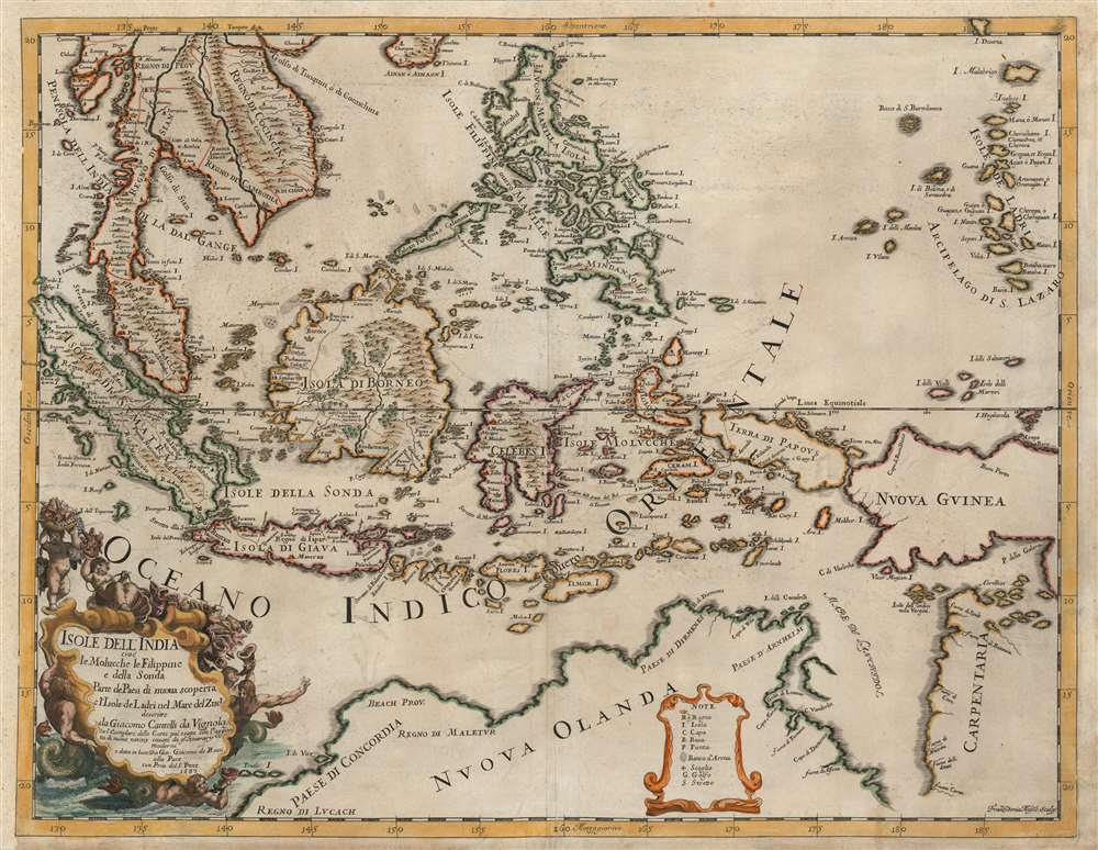
Isole dell'India cio è le Molucche, le Filippine e della Sonda, parte de paesi di nuova scoperta e l'isole de Ladri nel mare del zud / descritte da Giacomo Cantelli de Vignola ; Fran. Donia Messis sculp.
sold
- Digital Map Information
- Suitable for large format printing
- Full resolution TIFF file
- ICC color profile embedded
- Delivered instantly via download link
A rare, highly decorative 1683 map of Southeast Asia by Giacomo Cantelli da Vignola and Giacomo de Rossi. The map shows the Malay Peninsula, Cochinchina, and the kingdom of Siam; Sumatra, Java, Borneo, and the Spice Islands appear to be based primarily on the Dutch maps of the period, as is also the case with the Philippines. Singapore Island is named. The island 'Terfra di Papous' is shown as a separate landmass from 'Nuova Guinea,' an error preserved from Nicolosi's large map of Asia, whose geography this map otherwise improves upon. The southern portion of the map is dominated by Nuova Olanda, that is to say, New Holland aka Australia: much of the detail here appears to be drawn from Thevenot's map based on Tazman, but there are some place names retained from Marco Polo, such as the hypothetical provinces of Lucach and Maletur.
There is a lush cartouche in the lower left-hand quadrant that is surrounded by putti and Mer-men, bearing a wealth of sea-shells and cornucopia filled with spice-pods. (more details)
There is a lush cartouche in the lower left-hand quadrant that is surrounded by putti and Mer-men, bearing a wealth of sea-shells and cornucopia filled with spice-pods. (more details)
European colonial exoticism at its finest.

Congo Nova Descriptio.
sold
- Digital Map Information
- Suitable for large format printing
- File Size: 77.88 MB
- File Type: ZIP / TIFF
- ICC color profile embedded
- Delivered instantly via download link
This is a c. 1950 James Thiriar pictorial map of the Democratic Republic of the Congo, then known as the Belgian Congo. Meant to capitalize on Belgian interest in the Congo, the map exoticizes the Congo and reinforces the then-positive view of Belgium's role there. Native tribes appear throughout the colony, with red capital letters marking each name. Caricatures of native Congolese in traditional dress create an aesthetic that undoubtedly appealed to schoolchildren across Belgium, many of whom were taught by former Belgian missionaries. These missionaries likely had an extremely positive view of Belgium's presence in the Congo, which they would have passed along to their pupils. Illustrations of traditional Congolese costumes and art, all of which are numbered, are situated along the bottom and right borders and correspond with a bilingual Belgian French and Dutch legend. Thirty-three portraits of different ethnic groups (many of which are likely highly stereotypical) create the border along the top, left, and right sides, and, although unnumbered, correspond with another section of the legend. (more details)
Depicts Texas at its fullest and traces the advance of the U.S.-Mexico border.

The United States and The Relative Position of The Oregon and Texas.
sold
- Digital Map Information
- Suitable for large format printing
- DPI: 600
- File Size: 18.58 MB
- File Type: ZIP / TIFF
- ICC color profile embedded
- Delivered instantly via download link
This is a c. 1850 James Wyld map of the United States featuring Texas at its fullest before the Compromise of 1850. Wyld identifies three different borders between the United States and Mexico, only two of which existed. The Oregon Trail is also referenced, along with Astoria, Washington, and numerous forts throughout the American West. (more details)
Massive apocryphal Sea of the West!
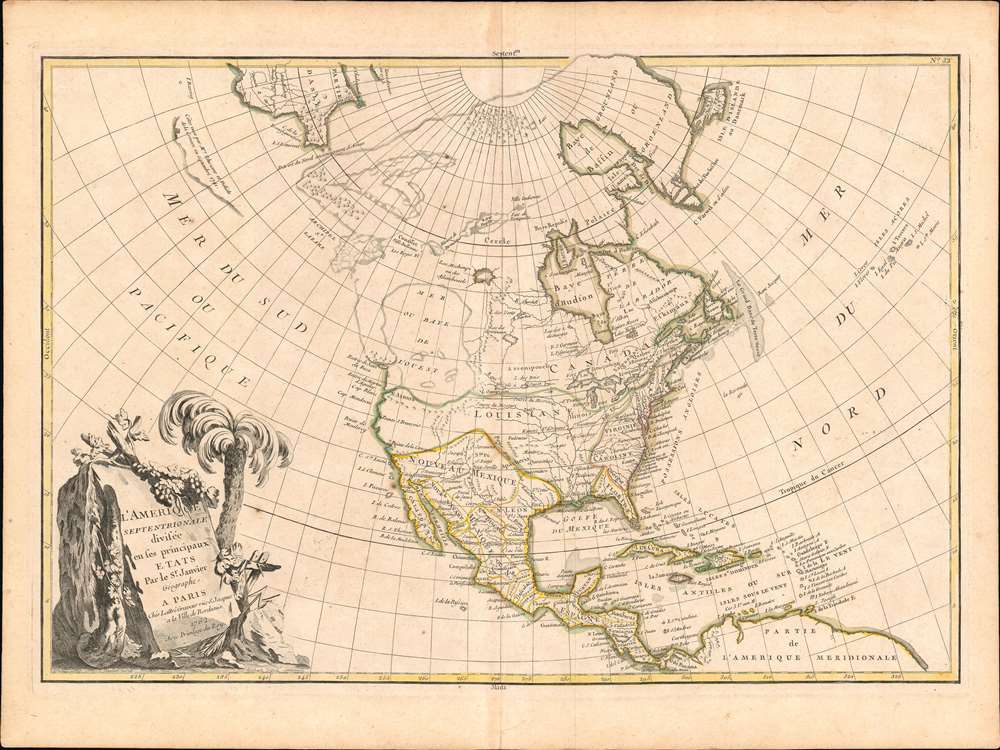
L'Amerique Septentrionale Divisee en ses Principaux Etats.
sold
- Digital Map Information
- Suitable for large format printing
- DPI: 600
- File Size: 14.77 MB
- File Type: ZIP / TIFF
- ICC color profile embedded
- Delivered instantly via download link
An altogether fascinating first edition example of Jean Janvier 1762 map of North America, including one of the most ambitious depictions of the Sea of the West ever published. Depicting the continent from Panama to the Arctic Circle, it also extends westward to include parts of Asia and eastward as far as Iceland. This map, which is heavily influenced by the theoretical mappings of Guillaume de l'Isle and Philippe Buache, went through several states of which this is the first and possibly the most interesting. Javier divides the continent according to the three colonial powers that controlled it, with England controlling its colonies along the east coast, France occupying Canada and Louisiana, and Spain dominating Mexico, Florida, Cuba and Central America. (more details)
Penguins and whales!

Nr. 570 Südpolargebiet Landtierleben und Forschung.
sold
- Digital Map Information
- Suitable for large format printing
- Full resolution TIFF file
- ICC color profile embedded
- Delivered instantly via download link
This is a c. 1957 Westermann Verlag pictorial wall map of Antarctica. Many species of penguins, whales, and seals populate the continent, and icebergs drift out to sea. Seabirds, including albatross and skuas, soar in the skies over the Antarctic ocean. Sailing ships spanning centuries of exploration ply the surrounding waters, including a vessel resembling those used by Sir Francis Drake or Jacob Le Maire rounding Cape Horn. International flags stake claims and chronicle Antarctic exploration, heralding the successes of Norway's Roald Amundsen, Britain's Robert Falcon Scott, and the U.S.'s Richard Byrd. French flags surround the French Dumont d'Urville Station, a scientific station in southeastern Antarctica. Established on January 12, 1956, the station remains in active use today and can accommodate 120 people during the summer and thirty over the winter months. (more details)
The United States at the turn of the 20th century.
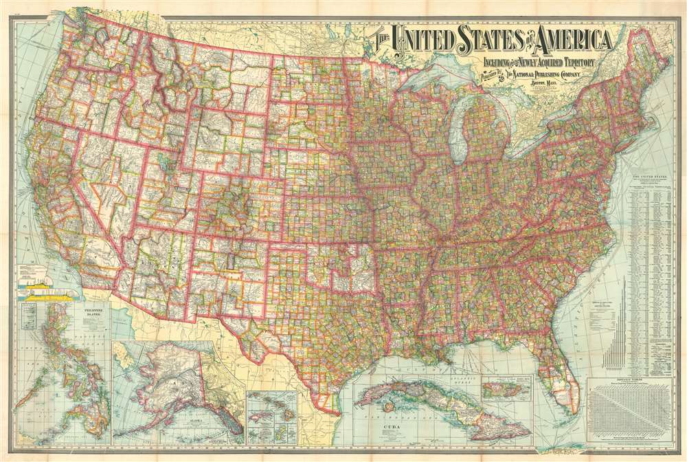
The United States of America Including All Its Newly Acquired Territory.
sold
- Digital Map Information
- Suitable for large format printing
- File Size: 190.01 MB
- File Type: ZIP / TIFF
- ICC color profile embedded
- Delivered instantly via download link
This is a 1902 National Publishing Company map of the United States with a typographically elaborate title. The map depicts the continental United States from the Pacific Ocean to the Atlantic Ocean and the Bahamas and from Canada to Mexico and the Gulf of Mexico. Each of the states and territories are divided into counties, with myriad cities, towns, and villages labeled. The distinction between the developing western states, with enormous scarcely populated counties and the eastern states is made stark by the map's rich coloring. The road network spreads across the country like a web, with major cities functioning as hubs. Shipping lanes are noted in the Atlantic and Pacific, with their destination and the company which operates on that route provided. Several inset maps are situated along the lower border, including Puerto Rico, Cuba, Hawaii, Wake Island, Guam, Samoa, Tutuila Island, Howland Island and Baker Island, Alaska (with a smaller inset of the western portion of the Aleutian Islands), and the Philippines. (more details)
One of the earliest maps of Florida as a state. Second Interbellum.
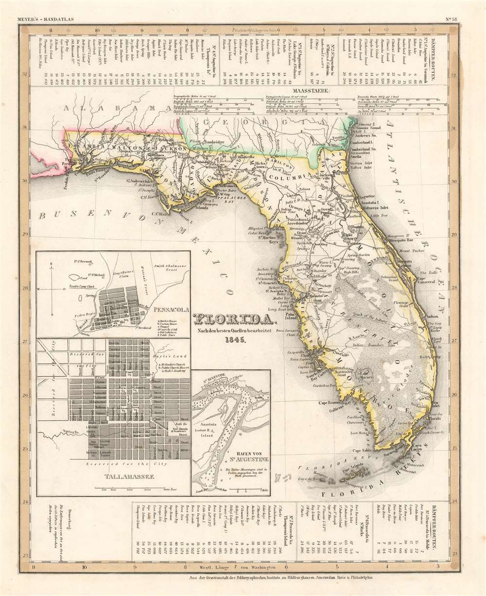
Florida. Nach en besten Quellen bearbeitet 1845.
sold
- Digital Map Information
- Suitable for large format printing
- DPI: 600
- File Size: 11.37 MB
- File Type: ZIP / TIFF
- ICC color profile embedded
- Delivered instantly via download link
This is a first edition 1845 Joseph Meyer map of Florida. Granted statehood on March 3, 1845, this map likely ranks among the first published maps of Florida as a state. Derived from maps by David Tanner, this map illustrates Florida early in its statehood during the Second Interbellum, a period of relative peace between the Second and Third Seminole Wars. Cities and counties throughout are labeled, along with both the Arredondo and Miranda land grants. In addition to Arredondo's famous large grant in central Florida, a secondary Arredondo holding is noted near modern day Fort Meyers. Tables along the top border chronicle four steamship routes, and another three are included along the bottom border. Inset maps in the lower left quadrant detail Saint Augustine, Tallahassee, and Pensacola. (more details)
Chronicles a botany expedition through the Tsangpo Gorge and southern Tibet.
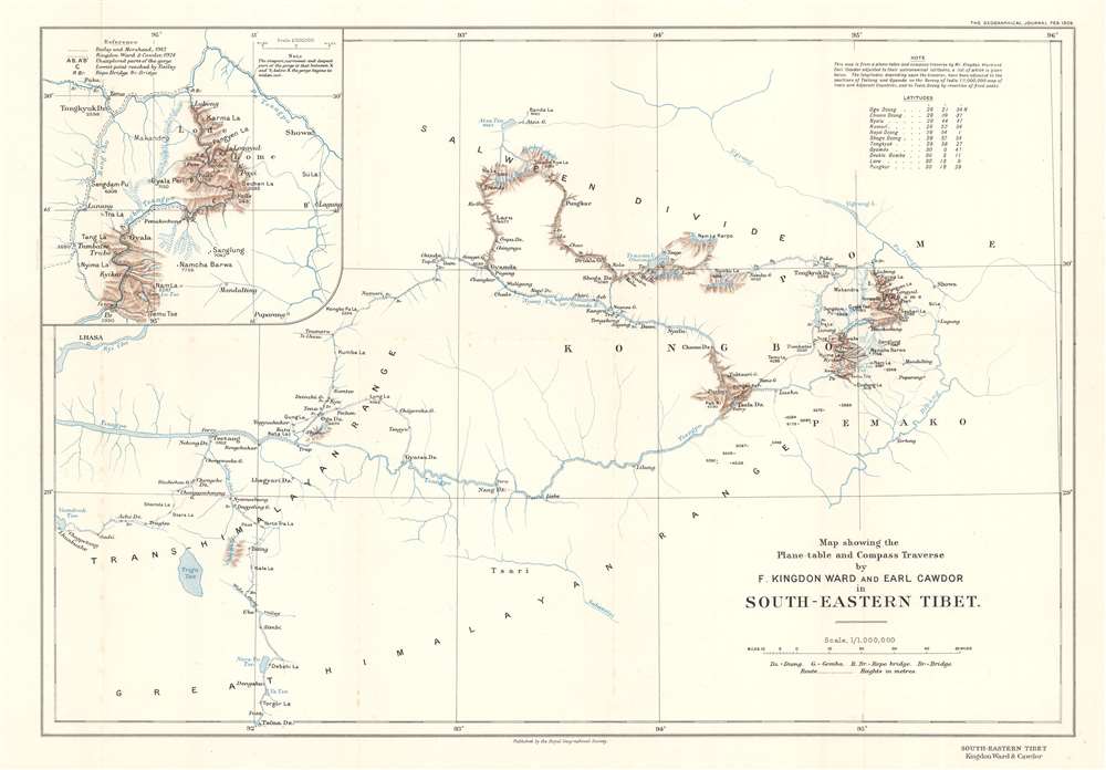
Map showing the Plane-table and Compass Traverse by F. Kingdon Ward and Earl Cawdor in South-Eastern Tibet.
sold
- Digital Map Information
- Suitable for large format printing
- File Size: 7.69 MB
- File Type: ZIP / TIFF
- ICC color profile embedded
- Delivered instantly via download link
This is a 1926 Frank Kingdon-Ward and John Duncan Vaughan Campbell, Earl Cawdor, map of southeastern Tibet tracing their botany expedition of 1924 - 1925. Published in the Geographical Journal, the map depicts the region from Lhasa to Showa, and from Atsa Tso to Tsöna Dzong. (more details)
Highlights historic houses throughout the county.
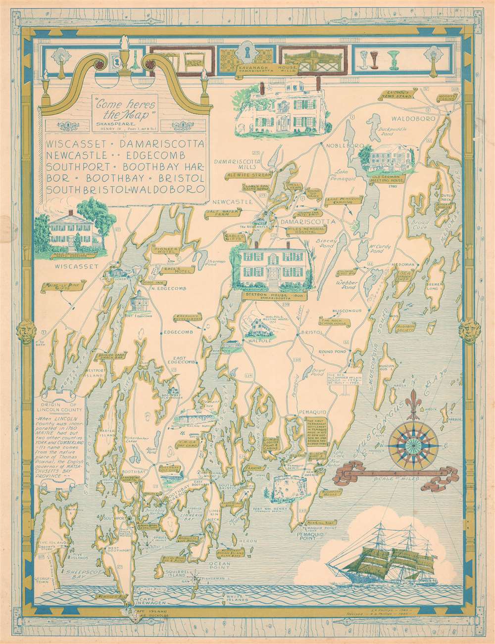
Wiscasset. Damariscotta. Newcastle. Edgecomb. Southport. Boothbay Harbor. Boothbay. Bristol. South Bristol. Waldoboro.
sold
This is a 1966 Augustus Dewey Phillips pictorial map of Lincoln, County, Maine. Depicting from Montsweag Bay to Muscongus Bay and from Waldoboro to Cape Island, Dewey highlights local history, the county's historic whaling towns, and identifies many local businesses. The towns of Damariscotta, Waldoboro, Wiscasset, Boothbay Harbor, Newcastle, Boothbay, and others all appear. Vignettes illustrate important historic structures, including the Marie Antoinette House in North Edgecomb, Castle Tucker, the Stetson House in Damariscotta, the Boothbay Railway Museum, and the Kavanagh House in Damariscotta Mills. The Round Top Dairy, Cable's Gifts, the Rock Schoolhouse, Emerson's Smorgasbord, the Boothbay Golf Club, and the Bayside Oaks Snack Bar represent a sampling of the local establishments from across the county promoted by Phillips. A text along the left border provides a short history of Lincoln County's founding. (more details)
An early comparative mountains chart originally commissioned by Alexander von Humboldt.

Physical Geography.
sold
- Digital Map Information
- Suitable for large format printing
- DPI: 600
- File Size: 13.59 MB
- File Type: ZIP / TIFF
- ICC color profile embedded
- Delivered instantly via download link
This is Adam and Charles Black's rare 1853 profile view of the Andes Mountains, particularly Ecuador's Mt. Chimborazo, based upon an influential 1805 illustration by the renowned German explorer and scientist Alexander von Humboldt. Among the first scientists to take Kant’s philosophy of Transcendental Idealism into the scientific field, Alexander von Humboldt illustrates discoveries made on his ascent (the first) of Mt. Chimborazo. (more details)