
The African Continent on the Eve of the Scramble for Africa
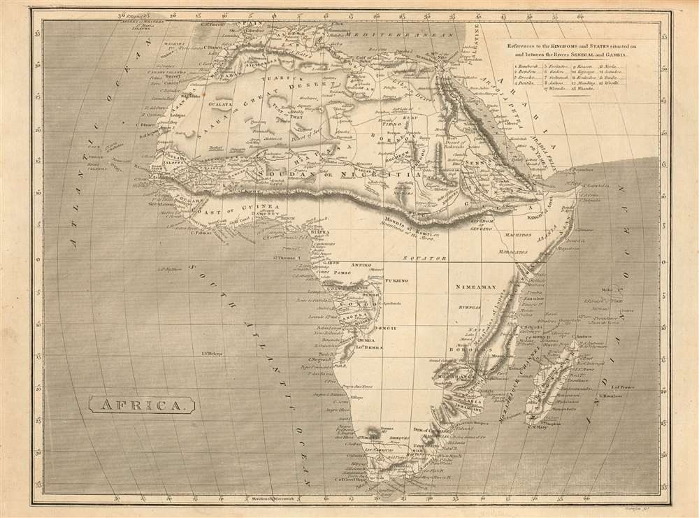
Africa.
sold
- Digital Map Information
- Suitable for large format printing
- DPI: 600
- File Size: 13.19 MB
- File Type: ZIP / TIFF
- ICC color profile embedded
- Delivered instantly via download link
This fascinating 1802 Arrowsmith map of Africa shows the results of first African expeditions of Scottish explorer Mungo Park, contrasting these with the vast expanses of Africa of which Europeans remained utterly ignorant. Virtually all of the information in this map pertaining to Western Africa reflects Park's 1795-97 exploration up the Gambia, into the interior, and along the Niger River. Park hard presumed the Niger to have its headwaters in a mountain range separating the Gold, Ivory and Slave coasts from north Africa: this mythical range, the Mountains of Kong, are shown here prominently; they extend eastward and connect with the equally mythical Mountains of the Moon, which were presumed by Ptolemy, and virtually every cartographer until well into the 19th century, to be the location of the source of the Nile. (more details)
Highlights the Allied losses after the German Spring Offensive and their gains during the Hundred Days Offensive.
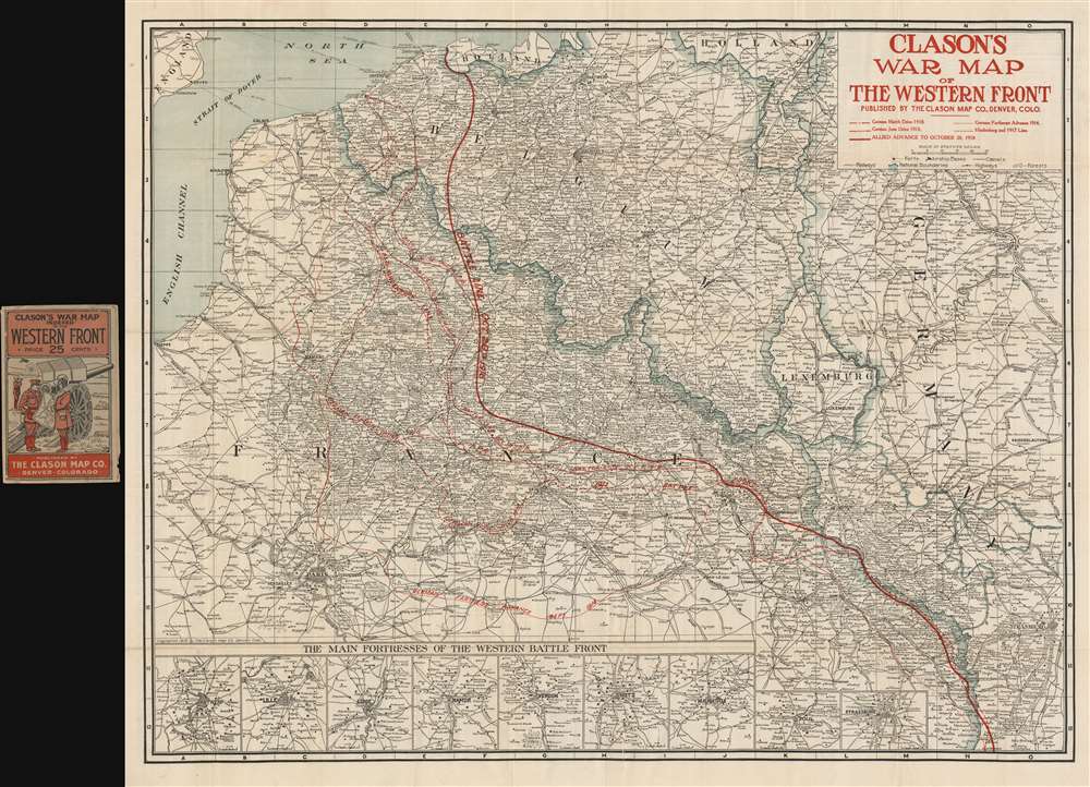
Clason's War Map of the Western Front.
sold
- Digital Map Information
- Suitable for large format printing
- File Size: 60.23 MB
- File Type: ZIP / TIFF
- ICC color profile embedded
- Delivered instantly via download link
This is a 1918 Clason Map Company map of northern France illustrating the movements of the front line in World War I through late October 1918. Unlike World War II, World War I was fought along mostly static lines of trenches in northern France and Belgium from 1914 through 1918. The map depicts the region from the English Channel and Dieppe to Strasburg (Strassburg) in Alsace, then part of Germany, and from Holland and the North Sea to Colmar. Red overprinting is used to illustrate the battle line at seven different times during the four-year slaughter. The furthest line depicts the farthest advance of the German army, when they reached within thirty kilometers of the center of Paris before their advance was stopped by the French at the First Battle of the Marne. This is the battle that includes the fabled taxis of Paris ferrying soldiers to the battlefield. Dashed lines also trace the German offensives of March and June 1918, collectively known as the Spring Offensive. The two thin solid lines mark the battle lines of October 7, 1918 and October 14, 1918, which were part of the Hundred Days Offensive, a campaign that began in August 1918 with the Battle of Amiens. Following the Allied success in the Battle of Amiens, the Germans fell back to the Hindenburg Line, a well-fortified defensive line that was established in 1917 and is illustrated and labeled here. The Hundred Days Offensive, in fact a series of battles that pushed back the Central Powers, eventually led to the end of the war. The final, bold battle line reinforces how far the Germans and other Central Powers had been pushed back since the beginning of the Hundred Days Offensive. (more details)
The Gulag Archipelago, Revealed
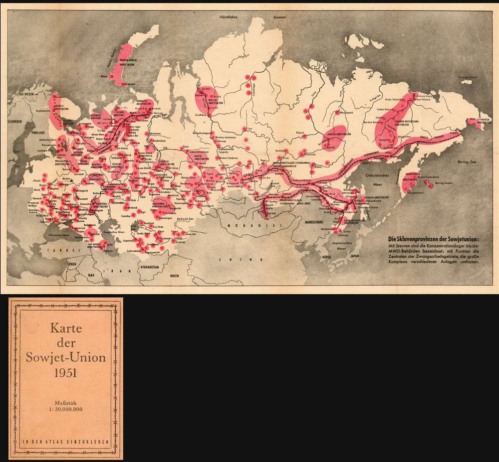
Die Sklavenprovinzen der Sowjetunion: Mit Sternen die Konzentrationdlager lokaler MWD-Behörden bezeichnet; mit Punkten die Zentralen der Zwangsarbeitsgebiete, die grosse Komplexe verschiedener Anlagen umfassen.
sold
- Digital Map Information
- Suitable for large format printing
- File Size: 22.49 MB
- File Type: ZIP / TIFF
- ICC color profile embedded
- Delivered instantly via download link
This is a rare Cold War artifact: a U.S. Information Service persuasive map published in Vienna showing what Russian writer and historian Aleksandr Solzhenitsyn would later call The Gulag Archipelago. This folding, two-color map shows the Soviet Union from the Baltic Sea to the Bering Strait, highlighting in red 'the location and extent of the Soviet Russian forced labor camps...' The German text on the inside cover explains, 'Taken together, these areas would make up a space the size of Western Europe.' Though the first 'corrective labor camps' were established as early as 1918, the full extent of the Gulag's massive prison and forced labor system - as displayed here on the map - was not realized until Stalin's rise to power. The map marks with stars the locations of concentration camps run by the MWD (Ministry of the Interior.) Broader forced labor regions are shaded a light red, with their headquarters locations marked with points. Several such 'forced labor areas' are shown to be linked together by railways, reflecting a high degree of organization and mechanization. (more details)
The first battle of General Ulysses S. Grant's 1864 Overland Campaign against General Robert E. Lee's Army of Northern Virginia.
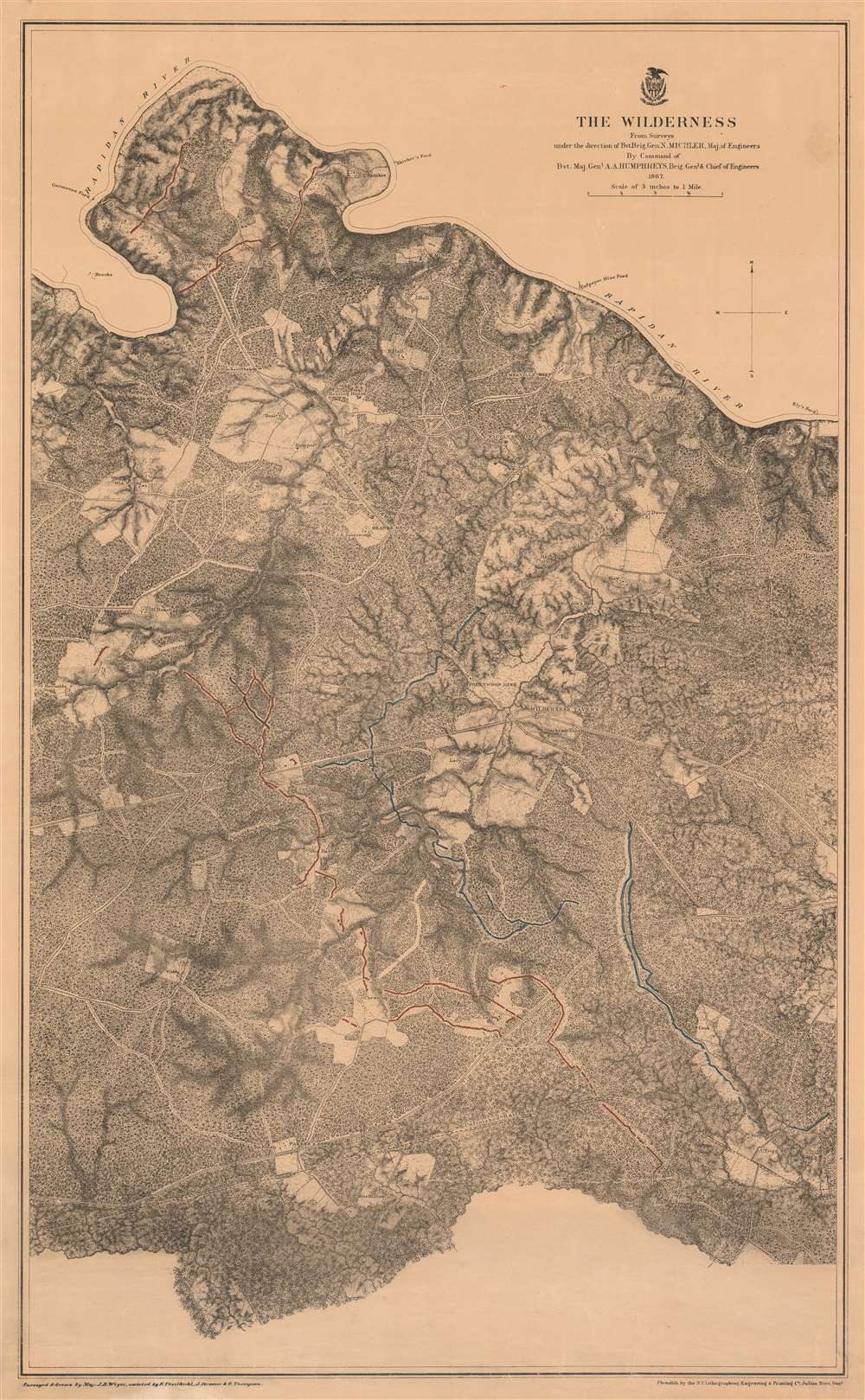
The Wilderness.
sold
- Digital Map Information
- Suitable for large format printing
- File Size: 55.14 MB
- File Type: ZIP / TIFF
- ICC color profile embedded
- Delivered instantly via download link
This is an 1867 John Weyss and Nathaniel Michler map of the battlefield of the Wilderness in Virginia. The map depicts the region from Brook's Ford on the Rapidan River to the Carpenter homestead and from Rapidan River to Miss Billion's homestead. The first battle in General Ulysses S. Grant's Overland Campaign against Robert E. Lee's Army of Northern Virginia, the Battle of the Wilderness ended in a strategic stalemate. Nonetheless, Grant was undeterred and did something no other Union commander had up to that point in the war: he continued on the offensive instead of retreating. By continuing his push deeper into Virginia, even though the Army of the Potomac had suffered catastrophic casualties, Grant won the admiration and support of his soldiers, as they were convinced that the commander of the Army of the Potomac would finally lead them to victory. (more details)
A large and highly detailed topographic map of the Philippines.
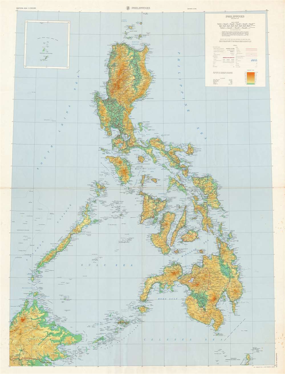
Philippines.
sold
- Digital Map Information
- Suitable for large format printing
- File Size: 142.44 MB
- File Type: ZIP / TIFF
- ICC color profile embedded
- Delivered instantly via download link
This is a large 1971 U.S. Army Topographic Command topographic map of the Philippines. Depicting from the Babuyen Islands south to Borneo and Sulawesi, an incredible level of detail is present. Myriad cities, towns, and villages throughout the archipelago are labeled, along with innumerable coastal bays, gulfs, and points. The number of islands identified here is astounding, with each of the major islands, such as Luzon, Mindoro, Leyte, Samar, Panay, Mindanao, Negros, and Cebu all labeled, as well as hundreds of smaller islands. Seas and channels within the archipelago are labeled as well. Roads are illustrated in red and are differentiated between primary, secondary, and tracks or trails, as well as those under construction. Topography is indicated by gradient lines and colors. (more details)
Traces bus routes in central Charleston and outside of downtown during World War II.

Map of Charleston and Vicinity.
sold
- Digital Map Information
- Suitable for large format printing
- File Size: 14.57 MB
- File Type: ZIP / TIFF
- ICC color profile embedded
- Delivered instantly via download link
Two maps on a single sheet, this 1942 South Carolina Power Company city map or plan of Charleston, South Carolina details the city's bus routes. The nine bus routes, all illustrated by thick red lines, are identified alphabetically. An index of the bus routes is situated along the bottom border. Central Charleston is depicted in detail on the right, with all major city streets labeled, along with Marion Square, railroad piers, and the Cooper River Bridge. Twenty locations in Charleston are numerically labeled and correspond with an index printed on the verso, including the Porter Military Academy, the Y.M.C.A., and the Charleston Free Library. Several bus routes in central Charleston proceed along the same streets. The map on the left follows the bus routes from central Charleston northwest along the Cooper River toward the Navy Yard, the Port of Embarkation, the U.S. Army Ordnance Depot, and North Charleston. Other lines cross the Ashley River to the south and connect Riverland Terrace, Woodland Shores, Pleasant Grove, and Pinecrest with downtown Charleston. (more details)
Locations throughout the city are identified and an arrow points the way to Chichen Itza.
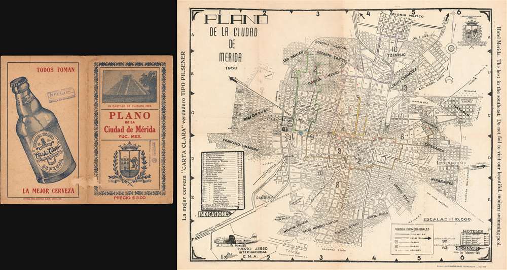
Plano de la Ciudad de Merida.
sold
- Digital Map Information
- Suitable for large format printing
- File Size: 22.66 MB
- File Type: ZIP / TIFF
- ICC color profile embedded
- Delivered instantly via download link
This is a 1953 Luis Gutierrez Gonzales city plan or map of Mérida, Yucatán, Mexico, the capital and largest city in Yucatán. In central Mérida, the streets are numbered, much like streets and avenues in major cities throughout the world. Neighborhoods are labeled and districts are numbered. Very few locations are labeled around the city, but those that are include the Cerveceria Yucateca, the Centro Social Turistico Los Tulipanes, and the cementerio general. Thirty-three locations are numerically identified, including numerous parks, the university, the archaeological museum, and the prison. Thirty of these locations are listed in a table situated along the left border, which also provides their grid location on the map, while a handful of hotels and three other locations are identified in the lower right corner. An arrow along the right border points the way to the Mayan ruins at Chichen Itza. (more details)
A Chart of Pitcairn Island as Carteret Found It
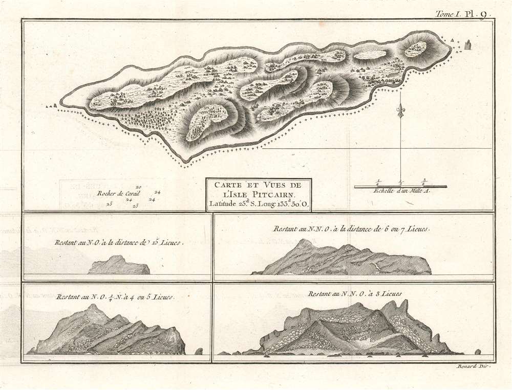
Carte et Vues de l'Isle Pitcairn.
sold
- Digital Map Information
- Suitable for large format printing
- DPI: 600
- File Size: 4.66 MB
- File Type: ZIP / TIFF
- ICC color profile embedded
- Delivered instantly via download link
This is a 1774 map of Pitcairn Island, encountered first by Europeans on Captain Carteret's circumnavigation of 1767. HMS Swallow having been separated from the other ship of the expedition and gripped with scurvy, the opportunity for resupply would have been tantalizing. It was not, however, to be:
We continued our course westward till the evening of Thursday the 2d of July when we discovered land to the northward of us. Upon approaching it the next day, it appeared like a great rock rising out of the sea: it was not more than five miles in circumference, and seemed to be uninhabited; it was, however, covered with trees, and we saw a small stream of fresh water running down one side of it. I would have landed upon it, but the surf, which at this season broke upon it with great violence, rendered it impossible.The island was first spotted by fifteen-year-old midshipman Robert Pitcairn, and so named after him. (The unfortunate middie would die at sea three years later.) As Carteret was unable to survey the island by foot, the interior topography must be construed as speculative, based on the analysis of the views of the island taken from sea. The breakers along the souther shore of the island and the rough coastline that so discouraged the explorer are discernible in the views. (more details)
Labels Trelawny and Accompougs Town, two settlements of descendants of escaped African slaves.
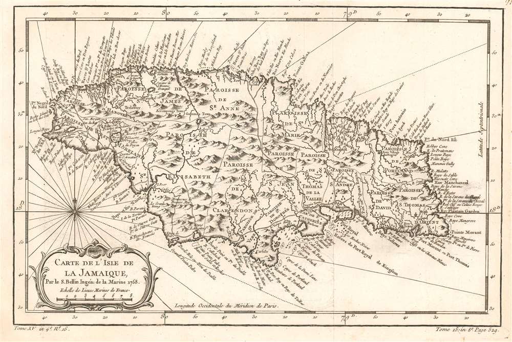
Carte de l'Isle de la Jamaique.
sold
- Digital Map Information
- Suitable for large format printing
- DPI: 600
- File Size: 5.37 MB
- File Type: ZIP / TIFF
- ICC color profile embedded
- Delivered instantly via download link
This is a 1758 Jacques Nicolas Bellin map of Jamaica. Incredibly detailed and beautifully engraved, each of the island's parishes is labeled. Roads are illustrated and the towns and villages are labeled, including Kingston. Myriad coastal locations are also identified, along with descriptions of the island, including a burned savannah, the 'Savannah of the Tranquil Man' ('Savane de l'Homme Tranquil'), and the Black Swamp ('Le Marai Noir'). (more details)
The Kingdoms of Herod the Great
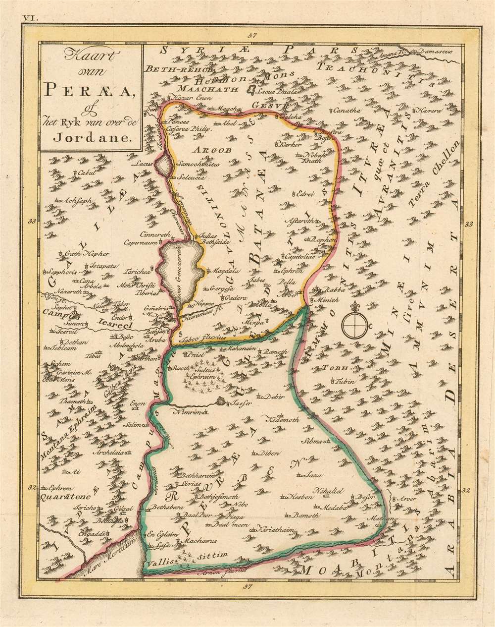
Kaart van Peraea, of het Ryk van over de Jordane.
sold
- Digital Map Information
- Suitable for large format printing
- DPI: 600
- File Size: 5.17 MB
- File Type: ZIP / TIFF
- ICC color profile embedded
- Delivered instantly via download link
This rare 1780 map of the Kingdom of Peraea presents the region of modern-day Israel, Jordan and Syria. the map is centered on the course of the River Jordan, from its sources north of the Sea of Galilee to the Dead Sea. The map includes Galilaea and Samaria to the west but focuses on Peraea and Batanaea. These were both the domains of Herod the Great in the first century C.E. The map's topography is based on contemporary cartographic data, but it was not intended to depict the 18th century Near East: rather, the place names are drawn from Biblical sources, reinforced with geographical data of ancient geographers - in particular Pliny the Elder, and Josephus. (more details)
Canaan Before the Arrival of the Israelites

Kaart van het Land Kanaan zo als het van de oudste Inwooners bewoond werd.
sold
- Digital Map Information
- Suitable for large format printing
- DPI: 600
- File Size: 5.31 MB
- File Type: ZIP / TIFF
- ICC color profile embedded
- Delivered instantly via download link
This rare 1780 map of Canaan presents the region of modern-day Israel, Lebanon, Jordan and Syria. The map shows Canaan prior to the arrival of the Israelites. It shows the kingdoms of the Philistines, Canaanites, Amelekites, Ammonites, and the Kingdom of Bashan. The Jordan River, the sea of Galilee and the Dead Sea are all shown. The doomed cities of Zeboim, Adama, Sodom and Gomorrah are all shown - unusually, for a holy land map of this period - on the shores of the Dead Sea, rather than in the middle of it. The map's topography i+K225:K22s based on contemporary cartographic data, but it was not intended to depict the 18th century Near East: rather, the place names are drawn from Biblical sources, reinforced with geographical data of ancient geographers. (more details)
Contians 'On Federal Government No. 1' a pre-Federalist Papers argument for the U.S. Constitution issued during the Constitutional Convention.

The New-York Packet. Friday, October 5, 1787.
sold
- Digital Map Information
- Suitable for large format printing
- DPI: 600
- File Size: 60.07 MB
- File Type: ZIP / TIFF
- ICC color profile embedded
- Delivered instantly via download link
A rare example of the October 5, 1787 edition of The New-York Packet containing 'On the Federal Government. No. 1,' an anonymous precursor to the Federalist Papers published during the Constitutional Convention. The subsequent Federalist Papers h would begin appearing in the The New-York Packet on October 27th, later in the same month. This essay, leading to the Federalist Papers, is considered one of the first published defenses of the proposed U. S. Constitution and as such is a cornerstone of American political thought. (more details)
An extremely rare pictorial map commemorating the Cuban Revolution created by one of the revolutionaries.
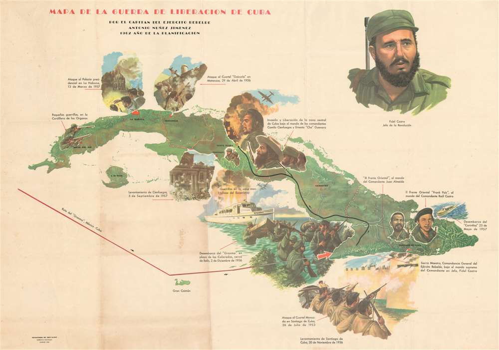
Mapa de la Guerra de Liberacion de Cuba.
sold
- Digital Map Information
- Suitable for large format printing
- File Size: 76.45 MB
- File Type: ZIP / TIFF
- ICC color profile embedded
- Delivered instantly via download link
This is a 1962 Antonio Núñez Jiménez pictorial map of the Cuban Revolution. Pictorial vignettes capture key events that were part of this critical event in world history. A large portrait of Fidel Castro looms over the island from the upper-right corner, while other members of the Rebel Army immortalized here include Camilo Cienfuegos, Ernesto 'Che' Guevara and Fidel's brother Raúl Castro. Events of the Cuban Revolution, including the landing of the Castro brothers and their guerillas on the 'Granma', the student assault on the Presidential Palace, and the attack on the Moncada Barracks in Santiago de Cuba, which started all these events in motion, are illustrated in vignettes. (more details)
One of the first accurate maps of the interior of Thailand (Siam).
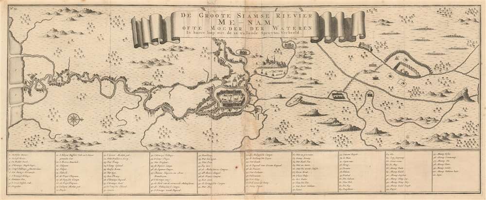
De Groote Siamse Rievier Me-Nam ofte Moeder der Wateren inharen loop met de in vallende Spruyten Verbeeld.
sold
- Digital Map Information
- Suitable for large format printing
- DPI: 600
- File Size: 19.24 MB
- File Type: ZIP / TIFF
- ICC color profile embedded
- Delivered instantly via download link
This is a rare 1726 Francois Valentijn map of the Chao Phraya River, Thailand. Roughly translated, the title reads, 'The Great Siamese River Me-Nam, or Mother of Waters, its course and its tributaries displayed.' Centered on the Siamese capital of Ayutthaya and oriented to the west, the map extends inland several hundred miles from the Gulf of Thailand to central Thailand. Bangkok, identified as 'Fortres Banckok' appears on the left side of the map as no. 12. At the mouth of the Chao Phraya, described here as the Me-nam, a Dutch flag flies from a building (no. 5), no doubt the VOC (Dutch East India Company) storehouse. This is one of the first published maps to offer accurate first-hand information on the interior of Siam. In total some 101 locations are referenced in the table below the map. The wonderful research below can be attributed to the superb research compiled by Barend J Terwiel and published as François Valentijn’s Map of 'The Great Siamese River Me-Nam'. (more details)
Japan reimages itself on the world stage!
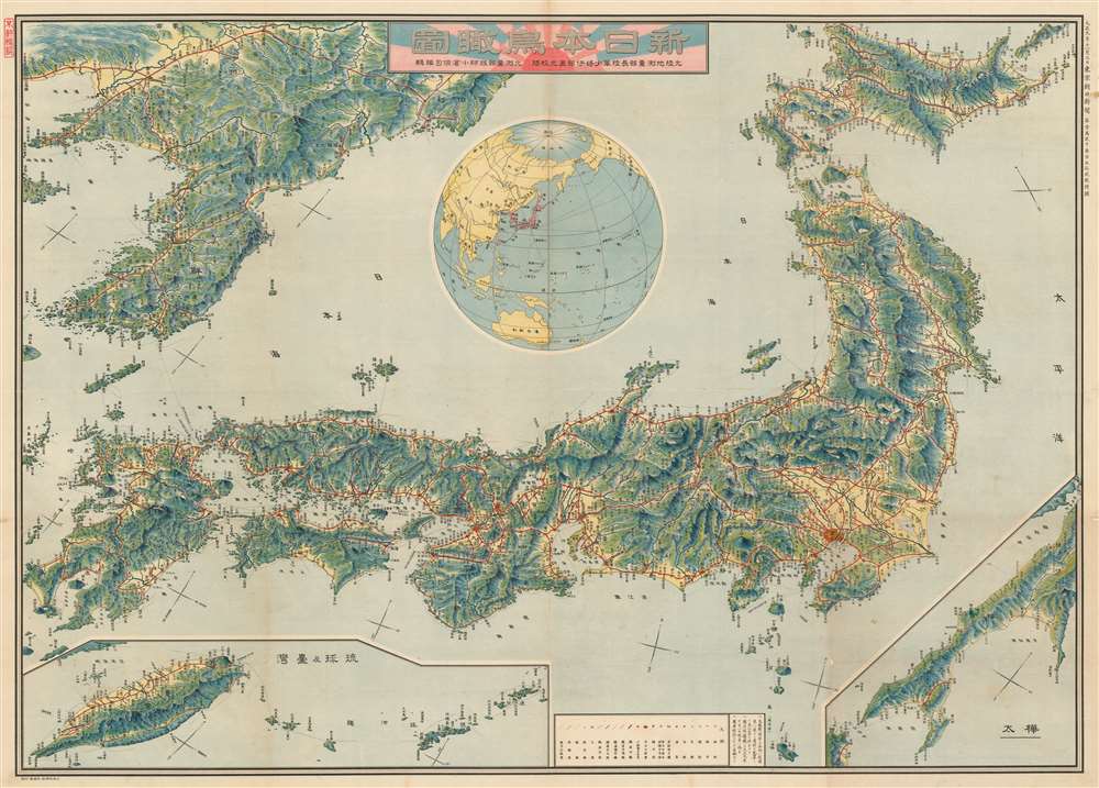
Bird's eye view of the New Japan. / 新日本鳥瞰圖
sold
- Digital Map Information
- Suitable for large format printing
- File Size: 143.63 MB
- File Type: ZIP / TIFF
- ICC color profile embedded
- Delivered instantly via download link
This is a rare and stunningly produced Taisho 10 or 1921 map of the Japanese Empire, including Taiwan and Korea, issued by the daily Tokyo Asahi Shimbun. The map uses a bird's-eye view model to illustrate the Japanese islands as well as Japanese imperial claims in Korea, Taiwan, The Ryukyu's, and Karafuto (Sakhalin). A globe appears a center, situating Japan in a global context. Red lines illustrate the empire-wide railroad network, with stops and connections identified throughout. (more details)
A map of Southeast Asia during the Vietnam War that was created for schoolchildren and clearly separates the communist countries from the capitalist countries in the region.
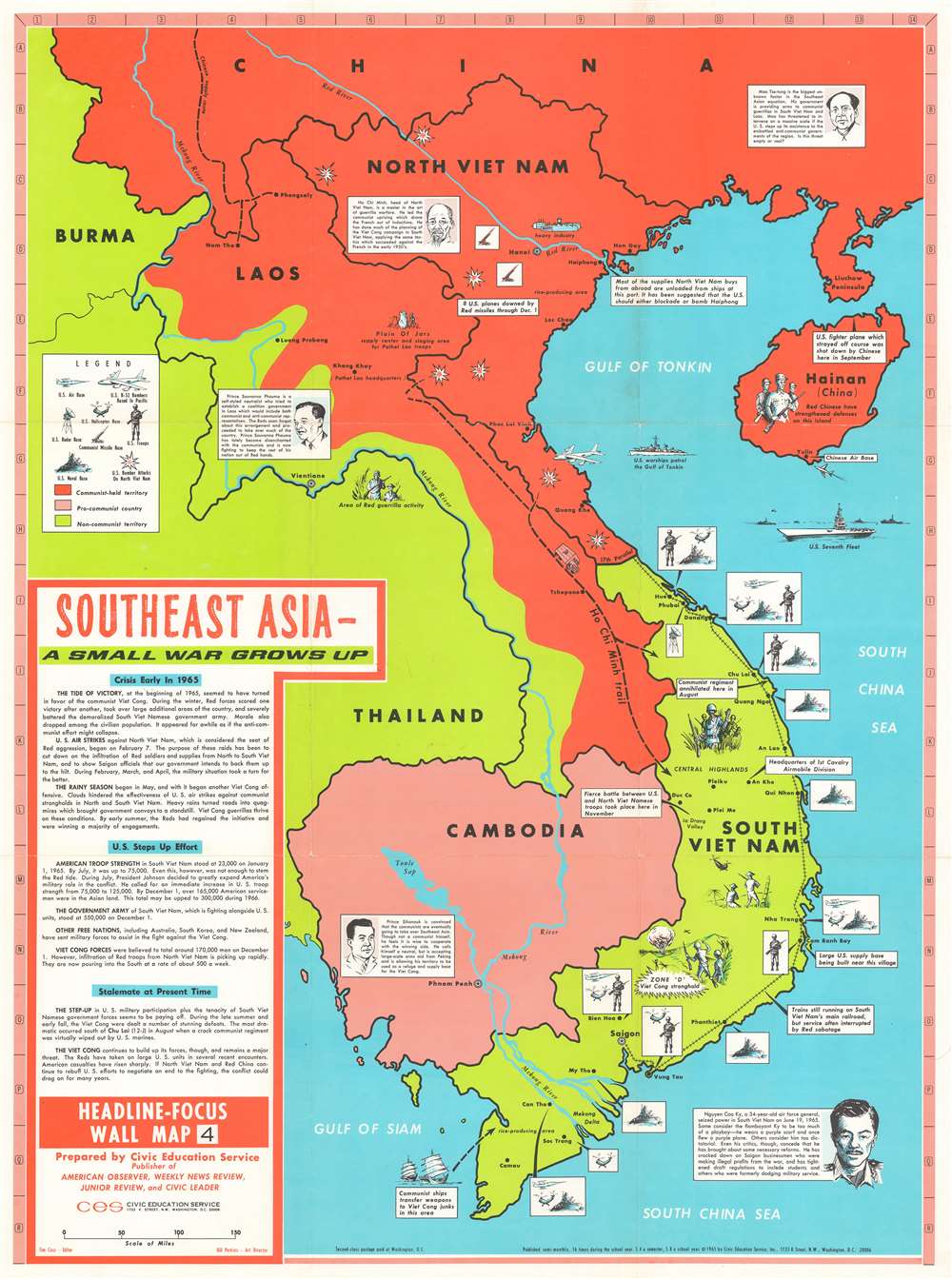
Southeast Asia - A Small War Grows Up. Headline-Focus Wall Map 4.
sold
- Digital Map Information
- Suitable for large format printing
- File Size: 54.33 MB
- File Type: ZIP / TIFF
- ICC color profile embedded
- Delivered instantly via download link
This is a 1965 Civil Education Service pictorial map of Southeast Asia. The map depicts the region from Burma and Thailand to the South China Sea and from China to the Gulf of Siam and the Ca Mau Peninsula. A product of the Cold War and the Vietnam War, the ideological fight between communism and capitalism is immediately apparent, with communist countries shaded red and capitalist countries shaded an almost neon green – ‘the color of money’, ironically. China and North Vietnam are colored red, while Laos is half red and half green, a vivid illustration of the fight between the Pathet Lao forces and the anti-communist government backed forces in that country. Thailand, Burma, and South Vietnam are all green, while Cambodia is a dull red, indicating its pro-communist stance but its officially neutral stance. Icons along the South Vietnamese coast indicate the locations of American naval, helicopter, and air bases situated throughout the country, as well as troop concentrations. Text boxes provide some context, highlighting for example the headquarters of the 1st Cavalry Airmobile Division and locations of important battles between communist and American forces. Other vignettes highlight the now famous Ho Chi Minh Trail, the North Vietnamese supply route from North Vietnam, through Laos, into South Vietnam, areas of guerrilla activity, and the U.S. Seventh Fleet stationed over the Vietnamese Coast. Short biographies of important leaders, including Ho Chi Minh, Nguyen Cao Ky, a South Vietnamese air force general who seized power in June 1965, Prince Sihanouk of Cambodia, and Prince Souvanna Phouma of Laos are included as well, and are accompanied by portraits. A text box in the lower left corner provides context and information concerning America’s escalating role in the region and an assessment of the current state of affairs there. (more details)
An extremely rare Spanish language reduction of Ernest Dudley Chase's map of the history of flight published in Mexico.

Mapa Historico de la Aviacion o Cronica de la Conquista del Aire por el Hombre.
sold
- Digital Map Information
- Suitable for large format printing
- File Size: 19.2 MB
- File Type: ZIP / TIFF
- ICC color profile embedded
- Delivered instantly via download link
This is a 1945 Spanish translation of an Ernest Dudley Chase pictorial map of the history of aviation that was published in Mexico. A reduced version of Chase's map entitled 'The Story Map of Flying', small vignettes highlighting landmark achievements in aviation encircle a map of the world drawn on a polar projection. Planes, both real and imaginary, are illustrated flying across the world. Some of these include flying boats, early airliners, and bombers flown during World War II, including the Consolidated B-24 Liberator and the Boeing B-17 Flying Fortress. Humanity's earliest attempts at flight are chronicled beginning at the top left and proceeding clockwise, from the unsuccessful attempts to fly with wings strapped to one's arms, to hot air balloons, and then several unsuccessful attempts to create powered flying machines. The Wright Flyer, recognized as the first successful heavier-than-air powered aircraft, is illustrated just below the title, next to Charles Lindbergh's Spirit of St. Louis, in which Lindbergh completed the first successful solo flight across the Atlantic Ocean. Other aviation pioneers referenced here include Glenn Curtis, Richard Byrd, Amelia Earhart, Wiley Post, and Howard Hughes. (more details)
A Spanish language reduction of Ernest Dudley Chase's map of North America published by a Mexican magazine.

Mapa Pictórico de Norte America.
sold
- Digital Map Information
- Suitable for large format printing
- File Size: 22.32 MB
- File Type: ZIP / TIFF
- ICC color profile embedded
- Delivered instantly via download link
This is a 1945 Spanish translation of an Ernest Dudley Chase pictorial map of North America. Cities throughout the continent, from Anchorage, Alaska, to Panama City, Panama, are labeled in black lettering, with the capitals identified by block letters. Profile views of famous buildings enhance these labels, some of which include the White House, numerous state capital buildings, Guadalajara Cathedral, and the Mexico City Metropolitan Cathedral. Similar views also mark important cultural and natural sites, including Arches National Park, Yellowstone National Park (Old Faithful), Hoover Dam, Mesa Verde National Park, and Chichen Itza. Vignette views of other sites around the region, such as Rockefeller Center, the Capitol Building in Washington, D.C., Niagara Falls, the French Quarter in New Orleans, and the Capitol Building in Havana. (more details)
With Delightful Manuscript Notation Describing a Family's Bermuda Vacation in August 1921
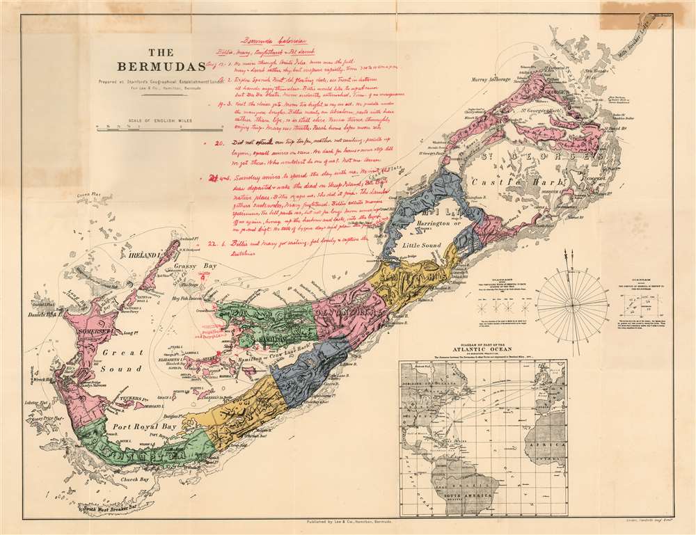
The Bermudas Prepared at Stanford's Geographical Establishment, London for Lee and Co., Hamilton, Bermuda.
$500.00
Acquire
- Digital Map Information
- Suitable for large format printing
- File Size: 16.73 MB
- File Type: ZIP / TIFF
- ICC color profile embedded
- Delivered instantly via download link
This is Stanford's map of Bermuda, printed in London on behalf of Bermuda publisher Donald M. Lee. (more details)
Highlights different floral areas throughout the state.
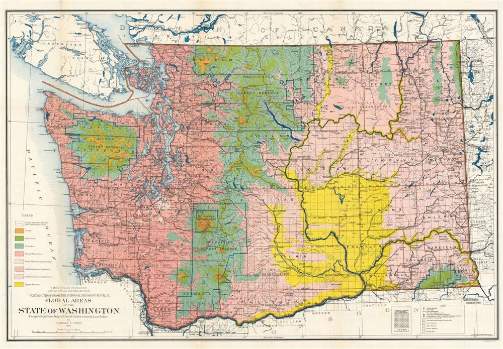
Floral Areas of the State of Washington.
sold
- Digital Map Information
- Suitable for large format printing
- File Size: 53.45 MB
- File Type: ZIP / TIFF
- ICC color profile embedded
- Delivered instantly via download link
This is a 1906 Charles Vancouver Piper map of Washington State highlighting the state's different floral areas. Piper created this map to accompany his book Flora of the State of Washington in which he expounds on the various characteristics inherent to different parts of the state and the unique flora that grow there. Different colors are used to differentiate between the eight different floral areas delineated by Piper. The largest contrast lies between the humid transition areas and the arid transition areas, which occur on the western and eastern halves of the state, respectively. They are separated by the Cascade Mountains, which play host to at least three different floral areas. One of Piper's stated goals was to highlight the variety and stark contrast between the floral areas of Washington after spending over twenty years of his life studying the flora of the region. (more details)