
One of the few 18th century specific maps of the Virgin Islands.
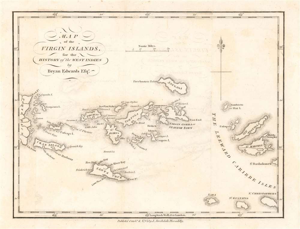
Map of the Virgin Islands, for the History of the West Indies.
sold
- Digital Map Information
- Suitable for large format printing
- DPI: 600
- File Size: 2.22 MB
- File Type: ZIP / TIFF
- ICC color profile embedded
- Delivered instantly via download link
A rare 1794 map of the West Indies by John Stockdale and Bryan Edwards. This is one of the few 18th century specific maps of the Virgin Islands. The map covers from the eastern shores of Porto Rico to Saint Martin and Anguilla, covering all of the Virgin Islands, including St. Thomas, St. Johns, Tortola, Virgin Gorda, an Anagada (Anugada). The eccentric billionaire Sir Richard Branson's, private haven, Necker Islands, appears and is labeled just north of Virgin Gorda. At the northwest tip of Anegada Island, Freebooter's Point is noted - this is the only place on the island free of barrier reefs and a famous rendezvous point for 18th century pirates and buccaneers. (more details)
Highlights Yellowstone, Yosemite, and Grand Canyon National Park among numerous others.
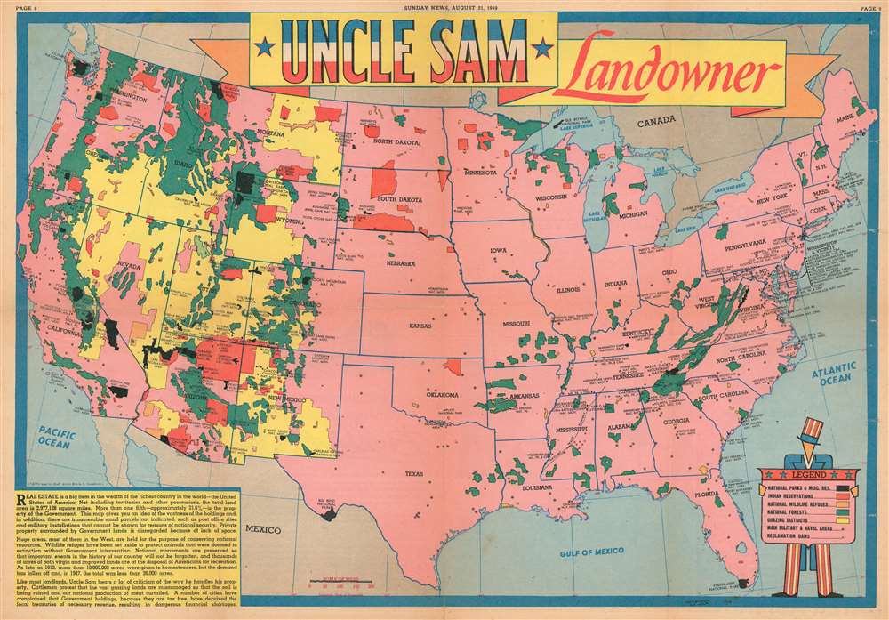
Uncle Sam Landowner.
sold
- Digital Map Information
- Suitable for large format printing
- File Size: 23.4 MB
- File Type: ZIP / TIFF
- ICC color profile embedded
- Delivered instantly via download link
This is a 1949 Edwin Sundberg map of the United States marking national parks, forests, monuments, and Indian reservations. The map depicts the continental United States from the Pacific Ocean to the Atlantic Ocean and from Canada to Mexico and the Gulf of Mexico. With the U.S. shaded in pink, the federal lands, highlighted in various different colors, are clearly apparent. National parks, including Yellowstone, Acadia, Grand Canyon, Sequoia, and Yosemite, are shaded black, giving them the most prominent place visually. Red areas are Indian reservations. The green areas are, naturally, national forests, while the orange areas denote national wildlife refuges and the yellow grazing districts. All of the states are labeled, and the national parks are prominently identified by block lettering. Smaller block lettering labels national monuments, while national forests, grazing districts, and Indian reservations remain unidentified by name. The only city referenced, even indirectly, is Washington, D.C. since the District is outlined. The stars that dot the U.S. from coast to coast denote 'military and naval areas'. A legend, held by a caricature of Uncle Sam, is situated in the lower right corner. (more details)
Vividly Entertaining Map of the Sailing Clubs of Long Island Sound

A Map of Western Long Island Sound: Showing Yacht Clubs, Aids to Navigation and Principal Larchmont Race Courses.
sold
- Digital Map Information
- Suitable for large format printing
- Full resolution TIFF file
- ICC color profile embedded
- Delivered instantly via download link
This is a delightful 1939 Rolf Klep pictorial map of western Long Island Sound. It covers the waters off Westchester County, Fairfield County, and the ‘Gold Coast’ of Long Island, specifically those frequented by the members of the Larchmont Yacht Club. A note on the verso describes this as ‘a Yachting Paradise’ and ‘the most populous yachting center in the world, with about fifty clubs lining some seventeen miles of Long Island Sound.’ The locations of indeed fifty yachting clubs are marked with flags on the map, as are lighthouses, buoys, and radio beacons. The routes of seven Larchmont Regatta race courses are shown in white overlapping triangles throughout the Sound. Though soundings are not numbered, depths are indicated by varying shades, the darkest showing the deepest water, over 120 feet. Ebb and flood tides are marked on the map with arrows, as are key landmarks used by yachtsmen to take compass bearings - chimneys, domes, water towers and even specific houses. Despite the map’s richness of detail, the author of the article it accompanied was at pains to explain that ‘though accurate, this map should not be used for navigation’ directing the reader instead to consult the U.S. Coast and Geodetic Survey and Texaco cruising charts from which the map’s data was drawn. (more details)
Propaganda map supporting the Beiyang government.

最新北京全圖 / Latest Full Map of Beijing. / 中華民國全圖 / Republic of China Map.
sold
- Digital Map Information
- Suitable for large format printing
- File Size: 37.88 MB
- File Type: ZIP / TIFF
- ICC color profile embedded
- Delivered instantly via download link
A rare 1925 propaganda map of Beijing, China issued by the ROC Mapping Office to commemorate the 15th year of the Beiyang Government / Republic of China. The map is large an impressive. At top, it is surmounted by the Five-Colored Flag of the Republic of China, used from 1911/12 to 1928, when it was replaced the Kuomintang flag. Below the flags there is a large map of China, flanked on either side by maps of the Western and Eastern and eastern hemisphere, underscoring China's culturally central position as the 'Mandarin Zhongguo' or 'Middle Kingdom.' Below is a detailed map of Beijing, with keys to either site highlighting important sites and buildings. (more details)
Uncommon map of Asia illustrating the geographical confusions of the early 18th century.
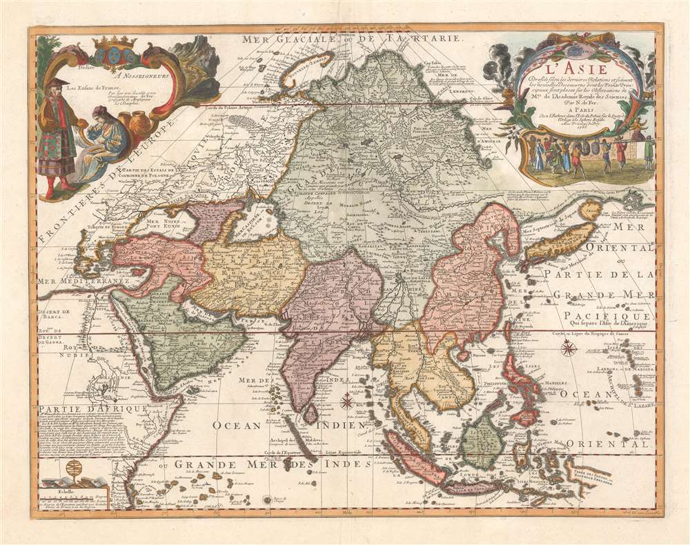
L'Asie dressée selon les dernières relations et suivant les nouvelles découvertes dont les points principaux sont placés sur les observations de Mrs. de l'Académie Royale des Sciences par N. de Fer.
sold
- Digital Map Information
- Suitable for large format printing
- Full resolution TIFF file
- ICC color profile embedded
- Delivered instantly via download link
A scarce 1705 separate issue Nicolas De Fer map of Asia dedicated to the children of France. The map features two decorative cartouches engraved by N. Guerard. Coverage on an unusual conical projection extends from the Mediterranean to the Philippine Archipelago (Archipel de St. Lazare), and from Nova Zembla to Java. The map embraces many of the confusions and misconceptions regarding the geography of Asia prevalent during the late 17th and late 18th centuries, among them a mismapping of the Caspian Sea, the apocryphal lake of Chiamay, and confusion regarding the seas north of Japan and the Siberian Arctic. (more details)
Rare pictorial map by famous French illustrator!
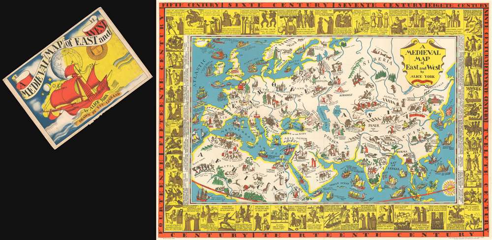
A Medieval Map of East and West by Alice York.
sold
- Digital Map Information
- Suitable for large format printing
- File Size: 61.04 MB
- File Type: ZIP / TIFF
- ICC color profile embedded
- Delivered instantly via download link
A rare 1930 pictorial map of Europe, Asia, and North Africa in the Middle Ages by Alice York and Eduourd Léon Edy-Legrand, accompanied by its original envelope. Although romanticizing a difficult historical period, the map is quite beautiful and inclusive in its scope, addressing not just European, but also Chinese, Japanese, Indian, Persian, and Arabian history. On the verso of the map's original envelope, there is a description of the map that exceeds anything we could write,
Here is a new map by Alice York - a delightful presentation of that colorful and romantic pageant of the Medieval World, characterizing civilization in Europe, Africa and Asia from the 5th to the 15th Century.The map is the 2nd of two maps issued by Alice York, both intended for educational work. (more details)
A glance at Spain shows us the Famous Alhambra and the Tower of Seville; in France we find Joan of Arc riding bravely to her fate; two Minnesingers wander about Germany while a member of the House of Hapsburg sits stoically upon his stronghold; a horde of Mongols is invading Russia and still further East Tamerlane the Great goes about his business of conquest. The Crusaders, too, are graphically pictured on their valorous arch to Jerusalem. And sea commerce, with all the hazards and adventures of the day, discovers new trade routes for the precious oriental cargoes which must be brought thousands of miles to enrich the centers of Europe.
Around the map is a border portraying, in chronological fashion, the more important figures and single outstanding events of the medieval centuries. We learn, for instance, that games of polo and chess were played in 531; that the Koran was introduced by Mohammed in 622; that Marco Polo described the wonders of China in 1275; that Robert Bruce won independence for Scotland in 1314 and that Chaucer wrote his famous Canterbury Tales in 1380.
There is rich historical treasure in this pictorial drama of Conquests and Discovers, Crusaders and Troubadours, beginning with the Fall of the Roman Empire in the West in the 5th Century and ending in the new Age of Discovery with the voyage of Columbus in the 15th Century. The map is stimulating, and provokes a desire to know more of this fascinating period. It is also, by virtue of its interesting cartography, especially adapted for use as a decoration, either in the home or in the school.
An Exquisite Hand-Tinted Photogtraphic Panorama of Quebec City

[Panorama of Quebec City]
sold
- Digital Map Information
- Suitable for large format printing
- File Size: 2.84 MB
- File Type: ZIP / TIFF
- ICC color profile embedded
- Delivered instantly via download link
This is a beautiful 1930s panorama view of Quebec City as seen from the St. Lawrence. This delicately hand-tinted photograph shows the waterfront of the city, with the Citadelle atop the natural palisades, the skyline dominated by the exquisite Chateau Frontenac. The only structure rivaling the Chateau in height is the Edefice Price, Quebec’s first skyscraper. Indeed, it is the presence of this building, completed in 1931, that dates the picture. (more details)
A child's game propagandizing the might of the Imperial Japanese army on the even of World War II.

[Japanese Army Sugoroku]
sold
- Digital Map Information
- Suitable for large format printing
- File Size: 52.38 MB
- File Type: ZIP / TIFF
- ICC color profile embedded
- Delivered instantly via download link
A rare 1938 or Showa 13 Japanese sugoroku game board and propaganda map with a martial theme. Although depicting no physical location, the game takes the form of a map, with rivers, seas, and land. Although predating World War II by one year, and Pearl Harbor by 2 years, this map highlights the rising nationalism and militarism in Pre-War Japan. The map is geared towards children and features Japanese youth involved in a host of military victories as well as doing good deeds in the home islands - like helping an old man bathe. (more details)
A beautiful city map of Paris after Haussmannization.

Nouveau Plan de Paris Divisé en Vingt Arrondissements.
sold
- Digital Map Information
- Suitable for large format printing
- File Size: 58.84 MB
- File Type: ZIP / TIFF
- ICC color profile embedded
- Delivered instantly via download link
This is a beautiful 1870 Alexandre Vuillemin folding plan or map of Paris, France. Centered on the Seine River, the map depicts embastilled Paris as contained in the Thiers Wall, from the Bois de Boulogne to the Porte de Montreuil and from Clichy to Montrouge. Divided according to 20 arrondissements, each arrondissement is labeled with a Roman numeral and shaded a different color, to allow for easy differentiation. Streets, monuments, gardens, and churches are labeled throughout the city, with the Louvre, the Jardin des Tuileries, Notre Dame de Paris, and the Jardin du Luxembourg among them. Another of the major changes to Paris reflected here were the annexations of eleven communes outside the ring of fortifications surrounding the city, including Montmartre, Passy, La Villette, and Belleville, which expanded the city's system of arrondissements from twelve to twenty. A table in the lower left corner details these new arrondissements. (more details)
One of the most celebrated miniature maps of California as an island.
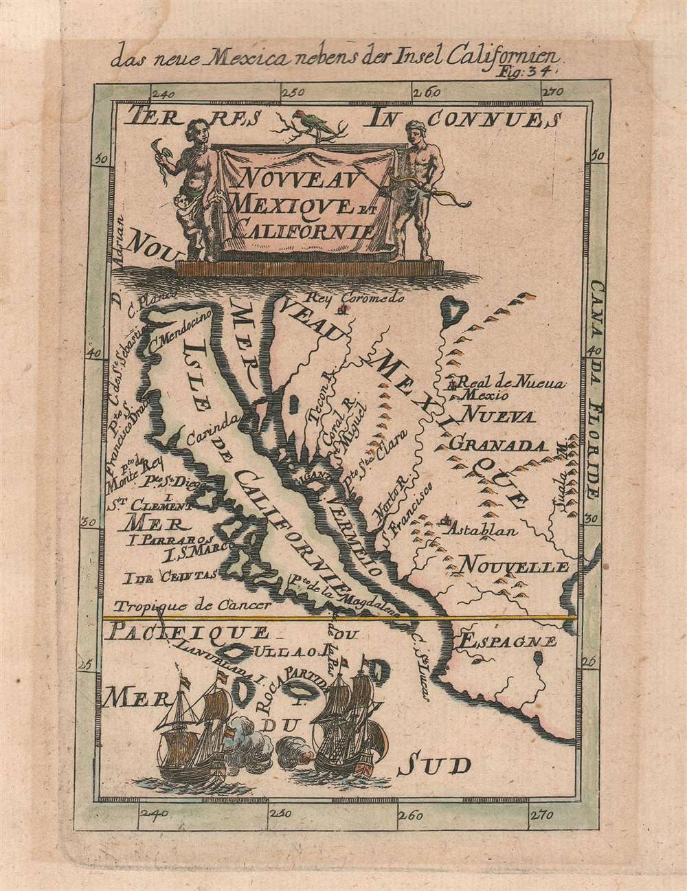
das neue Mexica nebens der Insel Californien. / Nouveau Mexique et Californie.
sold
- Digital Map Information
- Suitable for large format printing
- DPI: 600
- File Size: 2 MB
- File Type: ZIP / TIFF
- ICC color profile embedded
- Delivered instantly via download link
This is a 1683 Alain Manesson Mallet map of California as an island in its much scarcer German edition. The map depicts the region from the Pacific Ocean to Santa Fe (Real de Nueva Mexico) and the Suala Mountains and from Rey Coromedo to Mexico (Nouvelle Espagne). One of the most celebrated miniature maps of California as an island, Mallet employs a unique projection, making this an essential piece for any collector of maps illustrating California as an island. Most maps that include California as an island depict the entirety of North America, making a map of this scope a rare find, and this is one of the earliest. (more details)
A colorful and detailed city map of Bangkok published by the government railway department.

Plan of Bangkok.
sold
- Digital Map Information
- Suitable for large format printing
- File Size: 20.18 MB
- File Type: ZIP / TIFF
- ICC color profile embedded
- Delivered instantly via download link
This is a c. 1920 Thai issue Royal State Railway Department of Siam city map or plan of Bangkok, Thailand. The map depicts the city from the Bangkok Noi Station to the Royal Bangkok Sports Club and from Tejavanij Road to the Chao Phraya River. Created by the government railway department, four different railways are illustrated here. The Paknam Railway, Thailand's first railway, was established in 1893 and runs southeast from the main train station. The Northern and Eastern Railways run to the north from the same railway station, before the eastern line turns east. The Ta Chin Railway, today known as the Maeklong Railway, leaves the city from the Ta Chin Railway Station on the west side of the Chao Phraya and heads southwest. The Southern Railway leaves the city from Bangkok Noi Station on the west side of the river from the city center and heads due west. Numerous locations throughout the city are labeled, including the grand palace, the Pasteur Institute, Chulalongkorn University, and the Phyathai Palace. One hundred and three other locations are identified numerically and correspond with two different indexes included along the borders. The first, along the left border, lists these locations numerically, making it easier to find a location after locating a number on the map. The other index, split between the left and right borders, lists streets and klongs (waterways) alphabetically, and the numerically identified locations by category, such as banks, hotels, consulates and legations, post offices, and railway stations. (more details)
The first map of any parkway, anywhere - in this case Brookln's Eastern Parkway.

City of Brooklyn. Plan of a Portion of Park Way as Proposed to be Laid out From the Eastern Part of the City to The Plaza.
sold
- Digital Map Information
- Suitable for large format printing
- File Size: 2.9 MB
- File Type: ZIP / TIFF
- ICC color profile embedded
- Delivered instantly via download link
A rare 1868 example Vaux and Olmsted's preliminary plan for Eastern Parkway, Brooklyn. This may well be the first published plan of Eastern Parkway, and indeed any parkway anywhere, which began construction about 2 years after this initial layout was published. (more details)
A great city map of Madrid from the early 20th century.
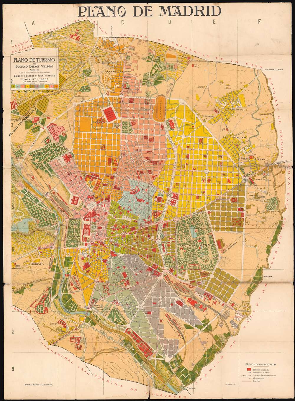
Plano de Madrid: Plano de Turismo.
sold
- Digital Map Information
- Suitable for large format printing
- File Size: 56.06 MB
- File Type: ZIP / TIFF
- ICC color profile embedded
- Delivered instantly via download link
This is a 1910 Eugenio Bisbal and Juan Vassallo city plan or map of Madrid, Spain. The map depicts the city from the Lago de Patinar to the Colonia Oriental and from the Asilo de la Paloma to Termino de Villaverde. Highly detailed, the city is divided into ten districts, each of which is shaded a different color to allow for easy differentiation. Buildings throughout the city are illustrated and colored red, making them stand out against the rest of the color. Schools, hospitals, government buildings, churches, and train stations are all identified. Myriad streets are illustrated and labeled as well, as are the city's many parks and the Rio Manzanares. (more details)
A charming pictorial map tracing the life of George Washington from the French and Indian War through his years as President of the United States.

Principal Events in the life of George Washington in this States that lie between the Hudson and Savannah.
sold
- Digital Map Information
- Suitable for large format printing
- File Size: 24.92 MB
- File Type: ZIP / TIFF
- ICC color profile embedded
- Delivered instantly via download link
This is a c. 1932 General Drafting Company pictorial map of principal events and important sites in the life of George Washington, the First President of the United States and the Commander-in-Chief of the Continental Armies during the American Revolutionary War. ... (more details)
Farming in Africa.
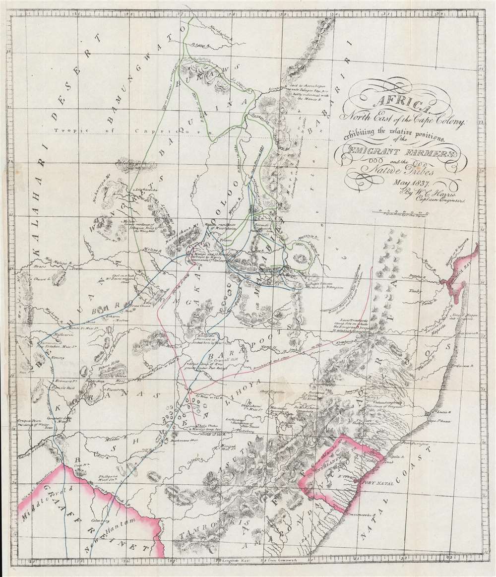
Africa, North East of the Cape Colony exhibiting the relative positions of the Emigrant Farmers and the Native Tribes.
sold
- Digital Map Information
- Suitable for large format printing
- File Size: 17.53 MB
- File Type: ZIP / TIFF
- ICC color profile embedded
- Delivered instantly via download link
This is a c. 1900 William Cornwallis Harris map of southeastern Africa. The map depicts the region from Graaff Reinet to Delagoa Bay and from the Kalahari Desert to Graaf Reinet. Originally published in Harris's book The Wild Sports of Southern Africa, the map traces the route Harris followed during his 1837 - 1838 hunting trip in the area using a line highlighted in blue. The green line follows the peregrinations of David Hume, a Scottish explorer and big game hunter. Noteworthy for its level of detail, Harris references numerous tribes by name, making it abundantly clear that the territory was not 'deserted' as some would have had you believe at the time of this map's original publication. Harris's geography also is not perfect, but he created this piece by basing it on a map published by Arrowsmith in 1834 and then adding, as Norman Etherington puts it, 'many details obtained during his travels in the interior'. (more details)
Rare Lee Corporation advertisement featuring heroes and villains of the American Old West.

The Lee Pictorial Map of the Old West.
sold
This c. 1970 Lee Pictorial Map of the Old West depicts the entire United States. This map is apparently an advertisement for the Lee Corporation drawn by graphic artist Charles Varner. The map of the United States is framed by photographs and sketches of the most ... (more details)
An entertaining pictorial map of the Philippines.
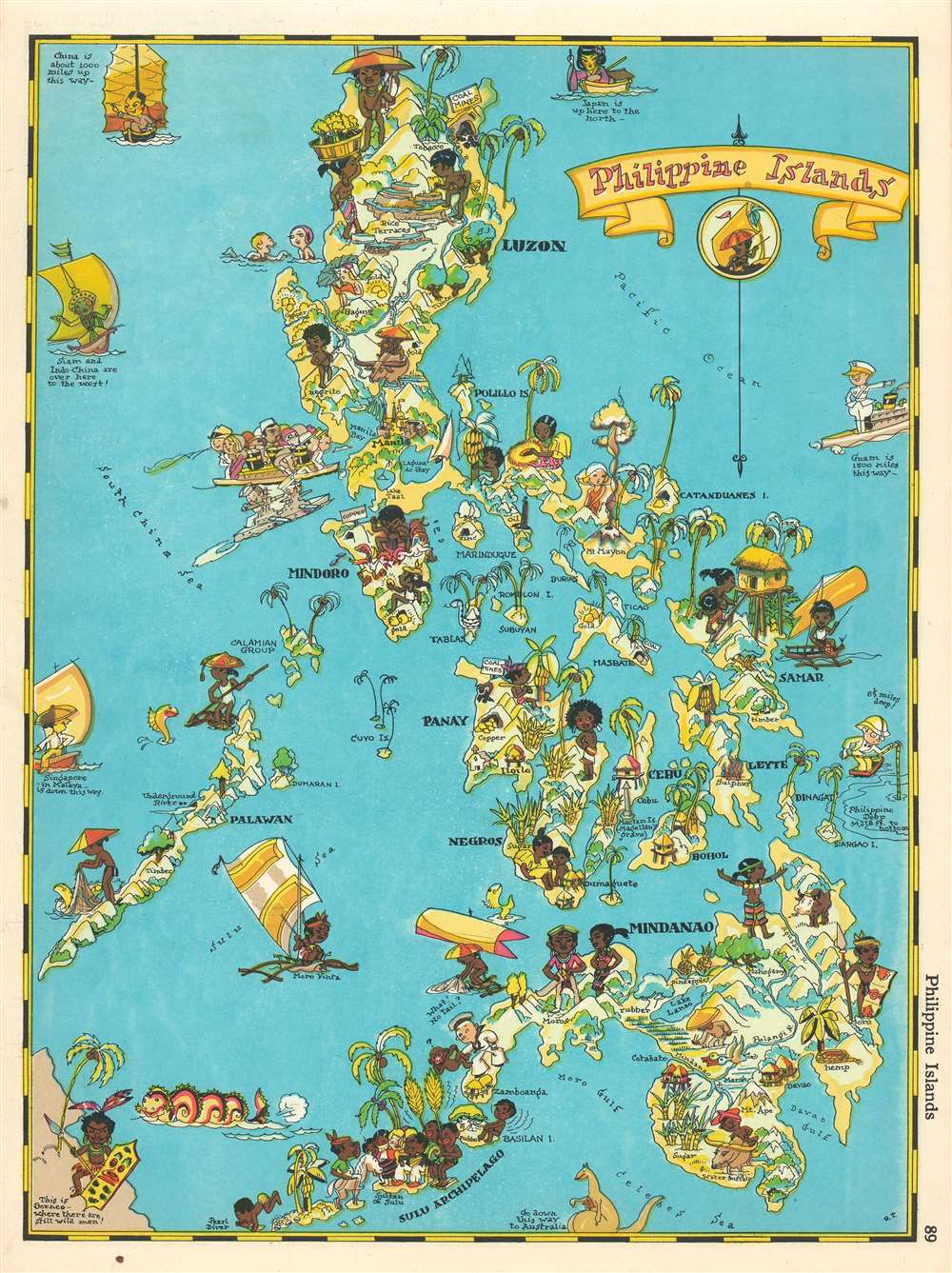
Philippine Islands.
sold
- Digital Map Information
- Suitable for large format printing
- File Size: 6.55 MB
- File Type: ZIP / TIFF
- ICC color profile embedded
- Delivered instantly via download link
This is a 1935 Ruth Taylor White pictorial map or 'cartograph' of the Philippines. The map depicts the archipelago from the South China. Sea to the Pacific Ocean and from Luzon to the Celebes Sea and Borneo. This 'cartograph' epitomizes the style and aesthetic of Ruth Taylor White, in that it is not meant to be geographically accurate but to entertain. In the 1930s, Manila was known as 'The Pearl of the Orient' and was an incredibly popular tourist destination. Here, White depicts a steamer full of tourists heading into Manila Bay right alongside and American battleship, complete with oversize guns. Native Filipinos, most of whom are barely clothed, are illustrated going about their lives beside white tourists frolicking in the ocean and reading in the sun. Many of the islands in the archipelago are labeled, and resources, such as copper, sulfur, gold, rubber, timber, and tobacco, are referenced. White also uses stereotypical caricatures of regional neighbors to globally situate the Philippines, including using a kangaroo and its joey to indicate the direction to Australia. (more details)
Gangland Style! The greatest pictorial map of all time! Addressing socially, politically, and legally volitile issues!
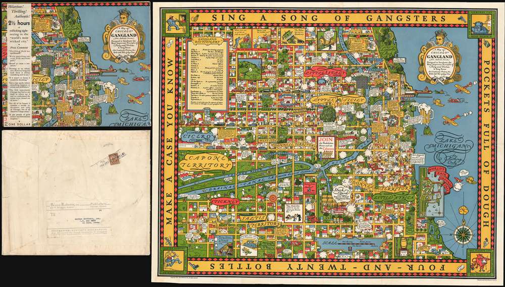
A Map of Chicago's Gangland from Authentic Sources. Designed to Inculcate the Most Important Principles of Piety and Virtue in Young Persons and Graphically Portray the Evils and Sin and Large Cities.
sold
- Digital Map Information
- Suitable for large format printing
- File Size: 52.39 MB
- File Type: ZIP / TIFF
- ICC color profile embedded
- Delivered instantly via download link
Perhaps the greatest pictorial map of all time, this is the legendary 1931 Bruce-Roberts cartoon map of Gangland Chicago, accompanied by its original mailer. Although not drawn to scale, the map covers downtown Chicago from Lincoln Park to Jackson Park and west as far as Cicero and Stickney. When this map was issued, Chicago's Prohibition Era gang wars were winding down. Al Capone, Chicago's criminal king-pin, was convicted of tax evasion and sentenced to 11 years in federal prison in October of this same year. Nonetheless, as this went to press, probably in August or September of 1931, all of Chicago was reeling from years of violent gang warfare. Unlike any previous pictorial map, the revolutionary unknown artist that drew this map is embracing politically, socially, and legally complex issues at the moment of their highest volatility. It comes thus as no surprise that the artist chose to remain anonymous. Despite its violent if cartoonish content, the map was issued with the noble intent, 'to inculcate the most important principles of Piety and virtue in young persons and graphically portray the evils and sin of large cities.' (more details)
Rare persuasive map made to promote the constrution of the U.S. Highway System!
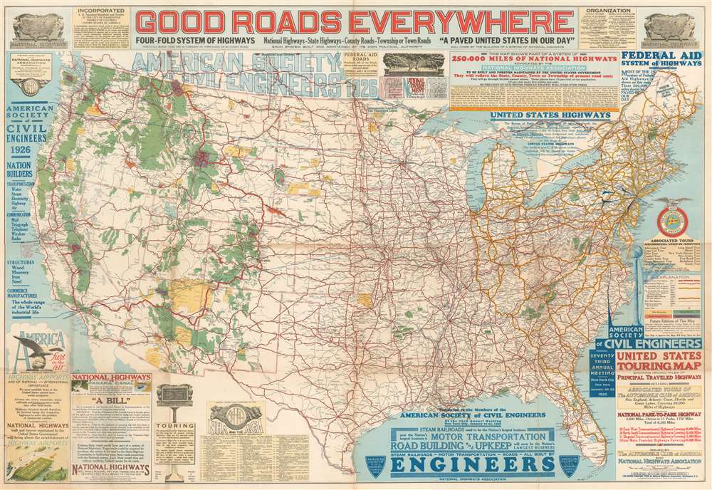
Good Roads Everywhere.
sold
- Digital Map Information
- Suitable for large format printing
- File Size: 98.5 MB
- File Type: ZIP / TIFF
- ICC color profile embedded
- Delivered instantly via download link
A scarce, large, and strikingly dense 1926 persuasive map of the United States prepared to promote federal investment in a national highway system. The map covers the United States from Coast to Coast and from Canada to Mexico. Highways are illustrated with color coding defining the 250,000 miles of national highways advocated for by the National Highway Association. These include the NHA's darling project, the National Park-to-Park Highway connecting the National Parks in the western United States. The map also includes arguments for the construction of 'Highway Airports.' (more details)
Only known example! Shows the development of the French Concession!
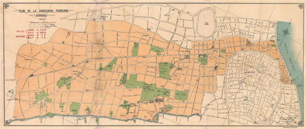
Plan de la Concession Francaise Changhai.
sold
- Digital Map Information
- Suitable for large format printing
- File Size: 15.6 MB
- File Type: ZIP / TIFF
- ICC color profile embedded
- Delivered instantly via download link
Here in its only known example, this is a c. 1920 map of the Shanghai French Concession. Published in Shangahi by the T'ou-sè-wè Orphanage and Mission Press, this map's coverage extends form the Hunagpu River and the French Bund, westward to Huashan Lu (Haig Avenue), and from the British Concession to the northern part of the Chinese City (Old Shanghai). The map illustrates street development, important building, docs, and more. A red over stamp in the upper right features day and night phone numbers for the police and fire department. Parks are highlighted in green. (more details)