
Celestial - Lunar
Quod est superius est sicut quod est inferius, et quod inferius est sicut quod est superius.
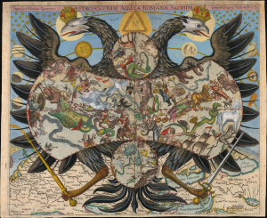
Speculum Uranico-Romanum S. Astroscopium Aquilae Romanae Sacrum Erhardi Weigelis Mathem. Prof. P. Jena.
$20,000.00
Acquire
- Digital Map Information
- Suitable for large format printing
- Full resolution TIFF file
- ICC color profile embedded
- Delivered instantly via download link
This is Erhard Weigel's rare and striking 1661 astroscopium, or allegorical chart of the constellations, framed by the janiform eagle of the Holy Roman Empire. The map is titled 'Speculum Uranico-Romanum', which translates to 'Roman Celestial Mirror', underscoring the mirroring of the celestial and political realms. As-above-so-below, the map presents Weigel's cosmographical framework, in which astronomy (mathematics) and politics were divinely sanctioned and mutually reinforcing: astronomy revealed God's mathematically ordered universe, while the Holy Roman Empire embodied His ordained Christian order. This fascinating image underwent several changes during its printing history: the present example is likely a proof state. (more details)
First Modern Chart of the Solar System.
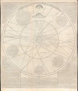
A scheme of the Solar System with the orbits of the planets and comets belonging thereto.
$6,500.00
Acquire
- Digital Map Information
- Suitable for large format printing
- File Size: 28.05 MB
- File Type: ZIP / TIFF
- ICC color profile embedded
- Delivered instantly via download link
This rare broadsheet engraving is a c.1763 Bowles edition of William Whiston's influential 1713 chart of the Solar System, including the orbits of known comets. It is the first modern chart of the Solar System, incorporating the observations of Newton, Halley, and Flamsteed. (more details)
Copernicus Centers the Sun.
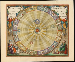
Planisphaerium Copernicanum Sive Systema Universi Totius Creati Ex Hypothesi Copernicana in Plano Exhibitum.
$4,500.00
Acquire
- Digital Map Information
- Suitable for large format printing
- File Size: 27.24 MB
- File Type: ZIP / TIFF
- ICC color profile embedded
- Delivered instantly via download link
This beautiful work is Andreas Cellarius' celestial chart, in its 1708 Valk and Schenk edition, illustrating the solar system theorized by Nicolaus Copernicus in the 16th century. It is among the most vivid and unambiguous depictions of the heliocentric solar system produced in the 17th century. (more details)
Comets Color Coded in Mansucript w/Marginalia.
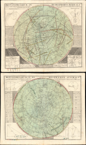
Motus Cometarum in Hemisphaerio Boreali... / Motus Cometarum in Hemisphaerio Australi...
$3,500.00
Acquire
- Digital Map Information
- Suitable for large format printing
- File Size: 53.6 MB
- File Type: ZIP / TIFF
- ICC color profile embedded
- Delivered instantly via download link
This is a striking pair of 1742 Doppelmayr celestial maps illustrating comets recorded over 210 years between 1530 and 1740. We are aware of no earlier cartographic work that attempts to synthesize all known comet sightings, marking this map as a significant step forward in the study of astronomy. The present example offers additional manuscript annotation of considerable interest, including color coding in each hemisphere that associates the depicted comets with the dates on which they were recorded. (more details)
Finely engraved double hemisphere celestial chart.
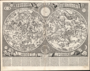
Planisfero del Globo Celeste Artico Antartico.
$3,000.00
Acquire
- Digital Map Information
- Suitable for large format printing
- File Size: 29.82 MB
- File Type: ZIP / TIFF
- ICC color profile embedded
- Delivered instantly via download link
An intricately engraved 1687 double hemisphere celestial chart prepared by Francesco Brunacci for inclusion in Giacomo Giovanni Rossi's atlas Mercurio Geografico, overo Guida Geografica in tutte le parti del Mondo, one of the most beautiful Italian atlases of the 17th century.. (more details)
Separately-issued Celestial Charts.
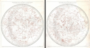
Hémisphère Céleste Arctique ou Septentrional calculé et construit pour l’année 1763 ... / Hémisphère Céleste Antarctique ou Austral calculé et construit pour l’année 1763 ...
$2,500.00
Acquire
- Digital Map Information
- Suitable for large format printing
- File Size: 66.13 MB
- File Type: ZIP / TIFF
- ICC color profile embedded
- Delivered instantly via download link
This is a stunning c. 1787 pair of separately issued celestial maps by Didier Robert de Vaugondy and Charles-François Delamarche. The maps employ a two-plate engraving system to highlight constellations in red - a unique feature not replicated elsewhere in Robert de Vaugondy's corpus. (more details)
Luminous comet in Draco.
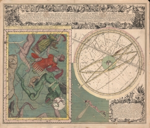
Cometa qui Anno Christi 1742. Apparuit, Ex Observationibus, a die 13 Marty usque ad 15 Aprilis, plusquam Vigesies quinquies institutis ...
$2,500.00
Acquire
- Digital Map Information
- Suitable for large format printing
- File Size: 29.01 MB
- File Type: ZIP / TIFF
- ICC color profile embedded
- Delivered instantly via download link
A striking 1743 Seutter illustration of the Comet of 1742, an exceptionally bright comet whose appearance inspired a wave of intellectual thought and scientific study. (more details)
Virgo.
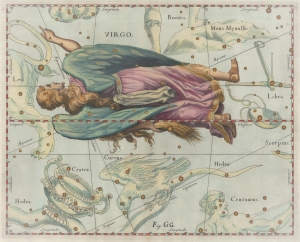
[Virgo.]
$2,000.00
Acquire
- Digital Map Information
- Suitable for large format printing
- File Size: 8.21 MB
- File Type: ZIP / TIFF
- ICC color profile embedded
- Delivered instantly via download link
This is a 1690 Johannes Hevelius celestial chart or star map of the Virgo constellation from his influential work Firmamentum Sobiescianum, sive Uranographia. Virgo dominates the sheet, which also includes adjacent Bootes, Mons Menalus, Libra, Scorpius, Centaurus, Hydra, Corvus, Crader, and Leo. (more details)
Visualizing the Celestial Sphere.

Situs Terrae Circulis Coelestibus Circundatae.
$1,800.00
Acquire
- Digital Map Information
- Suitable for large format printing
- DPI: 600
- File Size: 62.91 MB
- File Type: ZIP / TIFF
- ICC color profile embedded
- Delivered instantly via download link
This beautiful work is Andreas Cellarius' celestial chart, in its 1708 Valk and Schenk edition, illustrating the position of the Earth within the celestial sphere divided into its circles. Its lush, baroque presentation - filled with clouds, putti, and muses - frames a useful visual glossary illustrating terminology important both to the astronomer and to the geographer. (more details)
Pegasus Constellation.
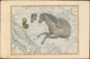
[Pegasus].
$1,800.00
Acquire
- Digital Map Information
- Suitable for large format printing
- Full resolution TIFF file
- ICC color profile embedded
- Delivered instantly via download link
An exceptional example of the 1801 Johann Elbert Bode elephant folio celestial, constellation, or star map of Pegasus, Equuleus, and Delphinus. Considered the largest and most dramatic celestial maps of their era, possibly ever published, Bode's gigantic star charts detail thousands of stars, nebulae, and clusters. Constellations are dramatically represented in pictorial form, as was the convention of the previous century. Many of the newly discovered nebulae, double stars, star clusters discovered by European astronomers in the late 18th century, such as Lacaille, Lalande, Messier, and Herschel, are identified. Bode presents this map on a conic geocentric projection in which most constellations are seen as from Earth. The current example is spectacularly colored gold highlighting of important stars. (more details)
Surrealist embodiment of the golden age of air travel.
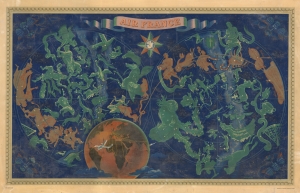
Air France.
$1,800.00
Acquire
- Digital Map Information
- Suitable for large format printing
- File Size: 57.67 MB
- File Type: ZIP / TIFF
- ICC color profile embedded
- Delivered instantly via download link
This is Lucien Boucher's iconic c. 1950 double hemisphere celestial map drawn to promote Air France, here in a scarce large format edition. Boucher's work for Air France is considered an embodiment of the golden age of air travel. In a surrealistic style, Boucher illustrates the constellations as seen from the northern and southern hemispheres. The constellations of the Zodiac are highlighted in gold and orange. Taurus is missing from this group, as it is obscured by the Earth. Rendered in tones of burnt orange, a spider work of Air France routes appears over the Earth. Wind heads decorate each corner. Here the airplane is master not just of the sky, but the whole universe, connecting the passenger not merely to earthly destinations, but to the heavenly spheres themselves. (more details)
Detailing a Projected Annular Solar Eclipse.
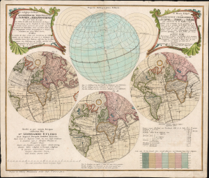
Die verfinsterte Erdkugel d. i. Geographische Vorstellung der Sonnen- od. Erd-Finsternis den 25ten Iulii Ao. 1748/ Le Monde Eclipse ou Representation Geographique de l'Eclipse De La Terre Ou Du Soleil qui arrivera le 25. Iuillet 1748.
$1,650.00
Acquire
- Digital Map Information
- Suitable for large format printing
- File Size: 25.93 MB
- File Type: ZIP / TIFF
- ICC color profile embedded
- Delivered instantly via download link
This is Georg Moritz Lowitz's 1747 celestial chart, projecting the annular solar eclipse of July 25, 1748. Published by the Nuremberg map printing house of Homann Heirs, this bilingual chart detailed the parts of the world from which the event would be visible, using a series of stereographic projections of the world to illustrate the track of the eclipse. An additional hemisphere illustrates the path of the center of the eclipse around the globe. (more details)
Unpublished game by one of the early Pioneers of Science Fiction.
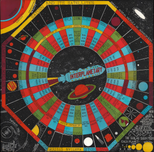
Interplanetary.
$1,500.00
Acquire
- Digital Map Information
- Suitable for large format printing
- Full resolution TIFF file
- ICC color profile embedded
- Delivered instantly via download link
This is a 1946 board for 'Interplanetary', an unpublished board game by pioneering science fiction writer Neil Ronald Jones. Although lesser known, Jones was one of the great early pioneers of science fiction, ranking with Arthur C. Clarke, Robert A. Heinlein, and Ray Bradbury. Jones was a lifelong devotee of board games and spent his spare time developing this game, although it appears not to have been published; this being one of only 5 known proof examples (all others are in private hands). (more details)
Detailing a Projected Lunar Eclipse.
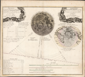
Vorstellung der in der Nacht zwischen den 8. u. 9. Aug. 1748 vorfallenden partialen Mond-Finsternis/ Représentation de l'Eclipse partiale de la Lune, qui arrivera la nuit du 8 au 9 d'Août, 1748.
$1,500.00
Acquire
- Digital Map Information
- Suitable for large format printing
- File Size: 25.94 MB
- File Type: ZIP / TIFF
- ICC color profile embedded
- Delivered instantly via download link
This is Tobias Mayer's 1748 celestial chart projecting the partial lunar eclipse of August 8 and 9, 1748. Published by the Nuremberg map printing house of Homann Heirs, this bilingual chart detailed the phases of the eclipse and the parts of the world from which the event would be visible. (more details)
Teaching astronomy.
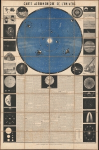
Carte Astronomique de L'Univers.
$1,250.00
Acquire
- Digital Map Information
- Suitable for large format printing
- Full resolution TIFF file
- ICC color profile embedded
- Delivered instantly via download link
This is a dramatic astronomical chart issued in Paris in 1878 by Etienne Laporte. Laporte believed that astronomy was best taught visually, via large charts and diagrams, rather than through more traditional text-only schoolbooks. This chart was thus published for used in schools and by private tutors to teach astronomy. (more details)
Aquarius from the most important 17th century celestial atlas.
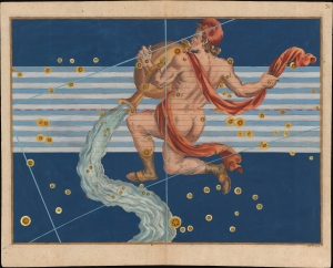
[Aquarius].
$1,200.00
Acquire
- Digital Map Information
- Suitable for large format printing
- File Size: 9.04 MB
- File Type: ZIP / TIFF
- ICC color profile embedded
- Delivered instantly via download link
This is a beautiful Johann Bayer's celestial chart of the zodiacal constellation Aquarius. It was engraved for Bayer's seminal 1603 celestial atlas, Uranometria: omnium asterismorum content schemata, nova methodo delineata, aereis laminis expressa. As the forerunner of all later celestial atlases, the importance and relevance of this work are emphasized by its continued publication throughout the mid-17th century. (more details)
Auriga from the most important 17th century celestial atlas.
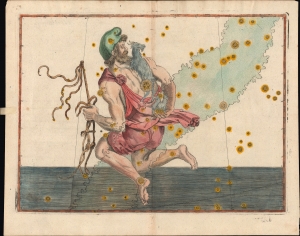
[Auriga]. / Tabula Duodecima Auriga et Erichthonius [handwritten on verso].
$1,200.00
Acquire
- Digital Map Information
- Suitable for large format printing
- Full resolution TIFF file
- ICC color profile embedded
- Delivered instantly via download link
A charming c. 1640 example of Johannes Bayer's celestial chart of the zodiacal constellation Auriga ('the charioteer'), published in his seminal Uranometria, one of the most important celestial atlases of the early modern period. As the forerunner of all later celestial atlases, the significance and relevance of this work are emphasized by its continued publication throughout the mid-17th century. (more details)
Boötes from the most important 17th century celestial atlas.
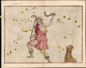
[Boötes]. / Tabula. Quinta Bootes. [handwritten on verso]
$1,200.00
Acquire
- Digital Map Information
- Suitable for large format printing
- Full resolution TIFF file
- ICC color profile embedded
- Delivered instantly via download link
A lovely c. 1640 example of Johannes Bayer's celestial chart of the zodiacal constellation Boötes (the 'herdsman' or 'ploughman'), published in his seminal Uranometria, one of the most important celestial atlases of the early modern period. As the forerunner of all later celestial atlases, the significance and relevance of this work are emphasized by its continued publication throughout the mid-17th century. (more details)
Predicts a Solar Eclipse and reveals Arctic Explorations.
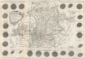
The geography of the great solar eclipse of July 14 MDCCXLVIII. : exhibiting an accurate map of all parts of the Earth in which it will be visible with the North Pole according to the latest discoveries.
$950.00
Acquire
- Digital Map Information
- Suitable for large format printing
- File Size: 12.65 MB
- File Type: ZIP / TIFF
- ICC color profile embedded
- Delivered instantly via download link
This elegant 1748 north polar projection map was drawn by the English astronomer and writer George Smith and engraved by the great English mapmaker Thomas Jefferys. It was produced for inclusion in Smith's pamphlet describing and predicting the path of the July 14, 1748, solar eclipse. (more details)
Manuscript record of the Great Comet of 1811.
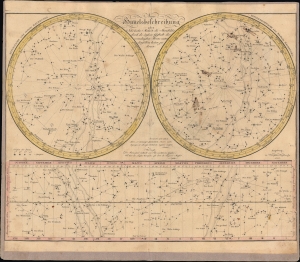
Neue Himmelsbeschreibung oder sehr leichte Methode die Sternbilder durch die äußere Gestalt der vornehmsten Sterne unter denselben kennen zu lernen.
$950.00
Acquire
- Digital Map Information
- Suitable for large format printing
- File Size: 20.95 MB
- File Type: ZIP / TIFF
- ICC color profile embedded
- Delivered instantly via download link
This is an 1804 celestial map, with extensive manuscript annotations, prepared by Johannes Walch. Aside from its aesthetic qualities, the chart is noteworthy for its manuscript annotations recording the Great Comet of 1811. Overall, the chart captures the state of astronomical knowledge at the time, including the discovery of Uranus by astronomer William Herschel (1738-1822). (more details)
Lovecraft inspiration!
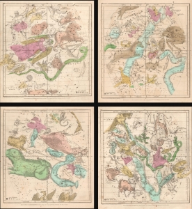
January February March. / April May June. / July August September. / October November December.
$900.00
Acquire
- Digital Map Information
- Suitable for large format printing
- Full resolution TIFF file
- ICC color profile embedded
- Delivered instantly via download link
This is an 1835 set of maps by Elijah Burritt depicting the night sky throughout the year. Each sheet features the stars and constellations in the night sky over a quarter of the year. On each of the charts, the constellations are drawn in detail and include depictions of the Zodiacal figures the stars were believed to represent. (more details)
Apparent Retrograde Motion Explained.
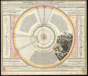
Ephemerides Motuum Coelestium Geometricae.
$750.00
Acquire
- Digital Map Information
- Suitable for large format printing
- DPI: 600
- File Size: 54.09 MB
- File Type: ZIP / TIFF
- ICC color profile embedded
- Delivered instantly via download link
This fascinating 1710 celestial chart is a collaboration between mathematician and astronomer Johan Gabriel Doppelmayr and Johann Baptist Homann. It was produced to explain Copernicus' theories of planetary motion and apparent retrograde motion using data from observations in 1708 and 1709. (more details)
The Papal Crown.
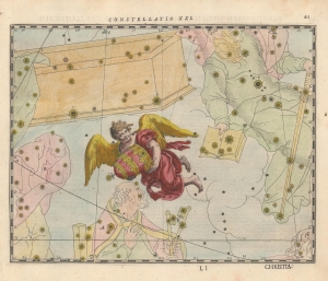
Contellatio XIX. [Mitrae Pontificalis S. Petri].
$750.00
Acquire
- Digital Map Information
- Suitable for large format printing
- Full resolution TIFF file
- ICC color profile embedded
- Delivered instantly via download link
A beautiful 1627 celestial chart of the Triangulum constellation, reimagined as an angel holding the Papal tiara, with surrounding constellations similarly replaced by Biblical imagery. It appeared in Julius Schiller's rare 1627 star atlas Coelum Stellatum Christianum, which aimed, but failed, to have fellow astronomers exchange the classical zodiac and Greco-Roman figures for Christian ones. (more details)
The Heavens without a Telescope, The Only Practical Combination Star, Planet, and Sun and Moon Map. - Barritt
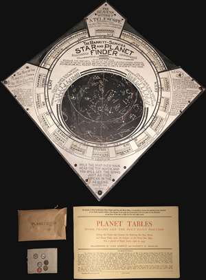
An unusual tool for the amateur astronomer, this is Leon Barritt and Garrett Serviss's 1906 star and planet finder. The tool consists of a celestial map set into a frame. The map can be rotated to reveal the night sky of the Northern Hemisphere on each day of the month. The chart is surrounded by a wealth of additional astronomical information associated with Ellipses, the Elliptic, the sun, and more. The tool is further accompanied by a book of planetary Tables as well as six pushpin planet disks covering the Sun, Mercury, Mars, Venus, Jupiter, and Saturn. It is promoted as 'The Heavens without a Telescope, The Only Practical Combination Star, Planet, and Sun and Moon Map.' (more details)
Constellations from the Golden Age of Air Travel.
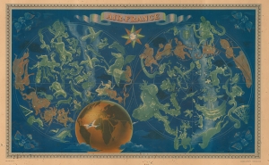
The finest of Lucien Boucher's iconic maps drawn for Air France, this is a 1951 medium-format edition of his beautiful double hemisphere pictorial map of the constellations. Boucher's work for Air France is considered an embodiment of the golden age of air travel. (more details)
Father of the Israelites.
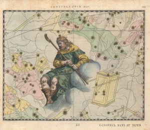
Constellatio XLV. [Sancti Israelis Sive Jacobi Patriarchæ].
$500.00
Acquire
- Digital Map Information
- Suitable for large format printing
- Full resolution TIFF file
- ICC color profile embedded
- Delivered instantly via download link
A hand-colored example of Julius Schiller's 1627 depiction of the Lupus Constellation, represented by the Biblical figure Jacob. It appeared in Schiller's rare star atlas Coelum Stellatum Christianum, which aimed but failed to have fellow astronomers exchange the classical zodiac and Greco-Roman figures for Christian icons. (more details)
Lovecraft inspiration!
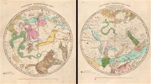
Northern Circumpolar Map for each Month in the Year. Southern Circumpolar Map for each Month in the Year.
$500.00
Acquire
- Digital Map Information
- Suitable for large format printing
- Full resolution TIFF file
- ICC color profile embedded
- Delivered instantly via download link
This is a beautiful hand-colored set of the 1835 Elijah Burritt northern and southern circumpolar celestial maps. This pair illustrates the night sky and constellations of both the northern hemisphere and southern hemisphere respectively. Constellations are drawn in detail and include depictions of the zodiacal figures (more details)
Christianizing Celestial Nomenclature.
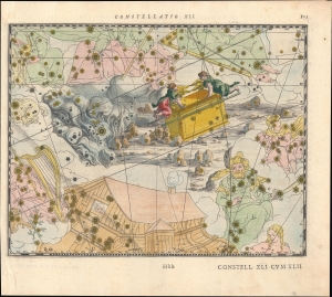
Contellatio XLI. [Iordanis Fluvii.]
$500.00
Acquire
- Digital Map Information
- Suitable for large format printing
- Full resolution TIFF file
- ICC color profile embedded
- Delivered instantly via download link
A lovely hand-colored 1627 celestial chart of the Hydra constellation, reimagined as the River Jordan, with surrounding constellations similarly replaced by Biblical imagery. It appeared in Julius Schiller's rare 1627 star atlas Coelum Stellatum Christianum, which aimed, but failed, to supplement classical zodiac Greco-Roman celestial nomenclature for Christian-themed naming conventions. (more details)
Failed Effort to Rename the Heavens.
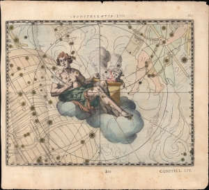
Constellatio LIII. [Abelis Iusti].
$500.00
Acquire
- Digital Map Information
- Suitable for large format printing
- Full resolution TIFF file
- ICC color profile embedded
- Delivered instantly via download link
A hand-colored 1627 celestial map of the Volans and Dorado constellations as the Biblical figure Abel. It appeared in Julius Schiller's rare 1627 star atlas Coelum stellatum Christianum. Schiller's atlas aimed, but failed, to have fellow astronomers replace the classical zodiac and Greco-Roman figures with Christian ones. (more details)
A set of four incredible views of the moon in four different phases.
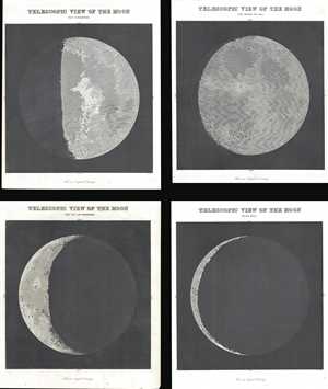
Telescopic View of the Moon Just Before the Full. / Telescopic View of the Moon Past Quadrature. / Telescopic View of the Moon Past the Last Quadrature. / Telescopic View of the Moon The Old Moon.
$500.00
Acquire
- Digital Map Information
- Suitable for large format printing
- DPI: 300
- File Size: 12.49 MB
- File Type: ZIP / TIFF
- ICC color profile embedded
- Delivered instantly via download link
This is a set of four (4) 1845 Duncan Bradford views of the moon. Each view illustrates the moon in a different phase, with the visible portion of the pale-gray of the moon contrasting beautifully with the blackness of space. Each view bears a caption stating that ... (more details)
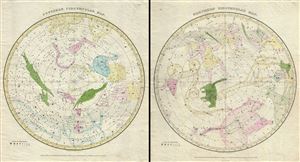
Northern Circumpolar Map. Southern Circumpolar Map.
$500.00
Acquire
- Digital Map Information
- Suitable for large format printing
- Full resolution TIFF file
- ICC color profile embedded
- Delivered instantly via download link
This is a beautiful hand colored set of the northern and southern circumpolar maps by Elijah Burritt. This pair of maps illustrates the night sky and constellations of both the northern hemisphere and southern hemisphere respectively. Constellations are drawn in ... (more details)
Landing site of Luna 21 and Apollo 17.
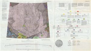
Geologic Map of the Mare Serentatis Region of the Moon by M. H. Carr.
$400.00
Acquire
- Digital Map Information
- Suitable for large format printing
- File Size: 50.71 MB
- File Type: ZIP / TIFF
- ICC color profile embedded
- Delivered instantly via download link
A stunning full color geologic map of the Moon's Mare Serenitatis, or ‘Sea of Serenity' - better known to us as the ‘right eye' of the Man in the Moon. The map's ghostly purple, punctuated by small, regular impact craters lends the map an eerily alien, ... (more details)