
Celestial - Lunar (sold)
A Monument of Renaissance Astronomy
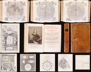
Selenographia: sive lunae descriptio; atque Accurata, Tam Macularum eius, addita est, lentes expoliendi nova ratio (with) Observatio eclipseos solaris Gedani, anno aerae Christianae 1652, die 8. Aprilis (and) Eclipsis Solis observata Gedani Anno á nato Christo 1649, die 4, Novembris, st. Greg. Johanne Hevelio.
sold
A masterpiece of 17th-century scientific engraving and publishing: This is the first edition of Johannes Hevelius' magnificent 1647 Selenographia. This is the first lunar atlas and one of the finest scientific books of the 17th century, in a beautiful example bound with two rare, printed letters regarding Hevelius' observations of the eclipses of November 4, 1649, and April 8, 1652. (more details)
Pardies' star atlas is stylistically one of the most attractive ever published.
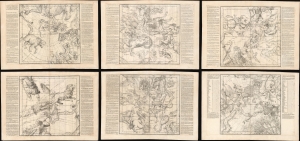
Globi coelestis in tabulas planas redacti descriptio auctore R.P. Ignatio Gastone Pardies Societatis Jesu mathematico opus postumum.
sold
- Digital Map Information
- Suitable for large format printing
- Full resolution TIFF file
- ICC color profile embedded
- Delivered instantly via download link
This is a stunning example of Ignace-Gaston Pardies' innovative 1693 celestial maps on 6-part gnomonic projection - here in fine, uncolored loose sheets with an exceptionally strong, crisp impression. Pardies' charts were both revolutionary and influential, emerging as eager scholars and private researchers, aided by ever more sophisticated telescopes, advanced knowledge of astronomy by leaps and bounds. (more details)
Spectacular 15 inch Celestial Globe.

Cary's New Celestial Globe, on which are carefully laid down the whole of the Stars and Nebulae contained in the Catalogues of Wollaston, Herschel, Bode, Piazzi, Zach and c. calculated to the year 1820.
sold
A fine 15-inch example of Cary's New Celestial Globe . The stars and constellations depicted are derived from the astronomical catalogues of Wollaston, Herschel, Bode, Piazzi, Zach and others, calculated to the Year 1820. This globe was made and sold by J. and ... (more details)
A complete set of Cassini's globe gores.
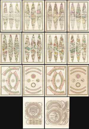
Globo Terrestre Delineato Sulle Ultime Osservazioni Con I Viaggi e nuove scoperte del Cap. Cook Inglese./ Globo Celeste Calolato per il corrente anno sulle Osservazioni de' Sigg. Flamsteed, e de la Caille. / Circolo per formare La Sfera Aremilare.
sold
- Digital Map Information
- Suitable for large format printing
- Full resolution TIFF file
- ICC color profile embedded
- Delivered instantly via download link
A beautiful, complete set of gores for the construction of Giovanni Maria Cassini's 1792 terrestrial and celestial globe pair, including the calottes and printed matter for the horizon and meridian rings. The gores are paired in four bordered sheets for each globe, plus two sheets containing each globe's calottes and labels for meridians. The set also includes the labels, printed to two sheets dated 1795, for the armillary sphere intended to accompany the globes. All are superbly engraved and beautifully colored, and are evocative artifacts of the world and its place in the universe as understood at the end of the eighteenth century. (more details)
Rare, High Baroque Double Hemisphere World Map, with Allegorical Vignettes.
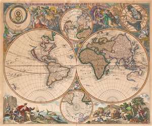
Haemisphaeriorum Tabula Carthesiana P. Schenkii.
sold
- Digital Map Information
- Suitable for large format printing
- Full resolution TIFF file
- ICC color profile embedded
- Delivered instantly via download link
Rare. This is a c. 1700 Pieter Schenk map of the world in a double hemisphere projection. The map draws on a number of 17th century sources - the insular California and the tentative coastline of the Pacific Northwest derive from Sanson; the depiction of Abel Tazman's discoveries in Australia and the South Pacific resembles that of Blaeu and De Wit; there is considerable influence from Carel Allard's map of 1696 as well, particularly in the inclusion of the Great Lakes in North America, and a Hennepin-type Mississippi River with its outlet in the vicinity of Galveston Bay. The map includes the La Salle expedition Fort Prudhomme on the Mississippi, the first French settlement in what would become Tennessee. Unlike Allard's map (and Schenk's own 1706 world map), the present composition contains considerable decorative flourish. There are putti nestled in the cruxes of the two hemispheres: the southern one puffing a flowery wind, and the northern one brandishing a star, which may be the North Star. Above and below the cruxes of the main hemispheres are a pair of polar projections illustrating the parts of the globe least understood until well into the 19th century. (more details)
Presenting the obsolete, geocentric, model of the universe
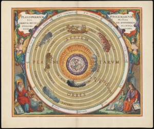
Planisphaerium Ptolemaicum, sive Machina Orbium Mundi Ex Hypothesi Ptolemaica in Plano Disposita.
sold
- Digital Map Information
- Suitable for large format printing
- File Size: 28.06 MB
- File Type: ZIP / TIFF
- ICC color profile embedded
- Delivered instantly via download link
This beautiful work is Andreas Cellarius' celestial chart, in its 1708 Valk and Schenk edition, illustrating the geocentric solar system imagined by Claudius Ptolemy in the 2nd century, and which remained the standard model of the universe until the 16th century and the discoveries of Nicolas Copernicus. It is among the most beautiful depictions of the Earth-centered solar system produced in the 17th century. (more details)
Extremely rare and early oversized double hemisphere constellation map, or celestial, by Frederik de Wit.
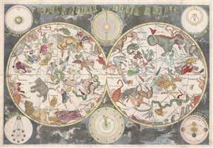
Planisphaerium Coeleste.
sold
- Digital Map Information
- Suitable for large format printing
- DPI: 300
- File Size: 18.1 MB
- File Type: ZIP / TIFF
- ICC color profile embedded
- Delivered instantly via download link
A remarkable and very rare example of Frederic de Wit's c. 1680 oversized and beautifully engraved double hemisphere celestial map. The map consists of two hemispheres surrounded by six supplementary diagrams. These illustrated the Copernican hypothesis, the ... (more details)
Extremely rare and early oversized double hemisphere constellation map, or celestial, by Frederik de Wit.
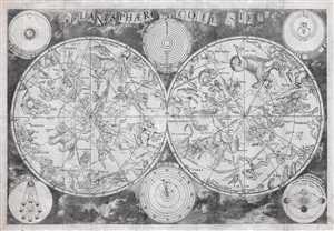
Planisphaerium Coeleste.
sold
- Digital Map Information
- Suitable for large format printing
- DPI: 300
- File Size: 84.78 MB
- File Type: ZIP / TIFF
- ICC color profile embedded
- Delivered instantly via download link
A remarkable and very rare example of Frederic de Wit's c. 1680 oversized and beautifully engraved double hemisphere celestial map. The map consists of two hemispheres surrounded by six supplementary diagrams. These illustrated the Copernican hypothesis, the ... (more details)
The first, largest, and finest star maps of the 19th century.
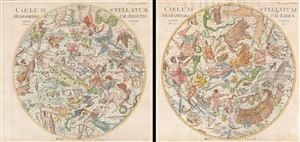
Coelum Stellatum Hemisphaerium Librae / Coelum Stellatum Hemisphaerium Arietis.
sold
- Digital Map Information
- Suitable for large format printing
- DPI: 300
- File Size: 51.59 MB
- File Type: ZIP / TIFF
- ICC color profile embedded
- Delivered instantly via download link
A rare and extraordinary pair of elephant folio celestial hemisphere charts or star maps issued in 1801 by Johann Elert Bode. Considered the largest and most dramatic celestial map of its era, possibly ever published, these gigantic star charts detail ... (more details)
Bringing the Baroque into the Scientific Age: Precursor to Zurner's famous map.
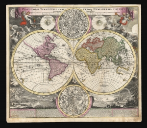
Planiglobii Terrestris Cum Utroq. Hemisphaerio Caelesti Generalis Exhibitio.
sold
- Digital Map Information
- Suitable for large format printing
- DPI: 600
- File Size: 77.87 MB
- File Type: ZIP / TIFF
- ICC color profile embedded
- Delivered instantly via download link
This is the scarce first plate of Johann Baptist Homann's 1707 map of the world in a double hemisphere projection. It is both long misunderstood and mis-identified: it was a novel and influential adaptation of up-to-date cartographic information (including the explorations of Dampier and the studies of Edmund Halley). Moreover, the present example is the first plate, engraved by or for the elder Homann in 1707. Most examples of the map of this title appearing on the market are a different plate, engraved by Homann's son no earlier than 1724 (identified by the Imperial privilege.) Thus the present example is the most desirable of Homann's world maps. (more details)
Early manuscript star chart integrating Korean, Chinese, and western astronomical / astrological science.
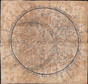
[Chinese Celestial]
sold
- Digital Map Information
- Suitable for large format printing
- DPI: 300
- File Size: 33.22 MB
- File Type: ZIP / TIFF
- ICC color profile embedded
- Delivered instantly via download link
A rare c. 1800 Korean celestial and zodiacal constellation chart in manuscript. This chart illustrates the traditional Chinese zodiacal system, generally following the Korean Cheonsang Yeolcha Bunyajido (which shows the night sky as seen from Seoul ... (more details)
Stunning set of full color celestial globe gores from the 18th century!
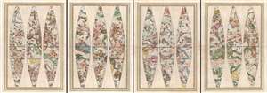
Globo Celeste.
sold
- Digital Map Information
- Suitable for large format printing
- DPI: 300
- File Size: 31.25 MB
- File Type: ZIP / TIFF
- ICC color profile embedded
- Delivered instantly via download link
A stunning set of globe gores for Giovanni Maria Cassini's 1792 Globo Celeste or Celestial Globe. The gores are presented in four bordered sheets, each containing three gores, for a total of 12 gores. Each individual gore represents 30° of the ... (more details)
Ptolemy's Earth-Centered Universe.
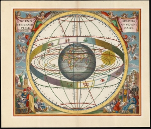
Scenographia Systematis Mundani Ptolemaici.
sold
- Digital Map Information
- Suitable for large format printing
- File Size: 22.18 MB
- File Type: ZIP / TIFF
- ICC color profile embedded
- Delivered instantly via download link
This beautiful work is Andreas Cellarius' celestial chart, in its 1708 Valk and Schenk edition, illustrating the geocentric solar system theorized by the 2nd-century astronomer Claudius Ptolemy. One of Cellarius' most visually engaging celestial charts, it centers on a beautifully engraved hemisphere and depicts the orbits around it of the Moon, Mercury, Venus, the Sun, Mars, Jupiter, and Saturn. Surrounding the orbiting planets is the celestial sphere, divided into circles. Cellarius' lush, baroque presentation frames the chart with a sky filled with putti while on the ground, scholars, astronomers, and their students measure the sky and confer over books and globes. (more details)
From the most important celestial atlas of the 18th Century.
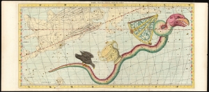
Hydra Crater Corvus Sextans Virgo.
sold
- Digital Map Information
- Suitable for large format printing
- File Size: 48.82 MB
- File Type: ZIP / TIFF
- ICC color profile embedded
- Delivered instantly via download link
This grand and beautiful celestial chart depicts the constellations of Hydra, Crater, Corvus, Sextans, and Virgo. It was issued in the first two editions of John Flamsteed's 1729 Atlas Coelestis. In the present example, the constellation Hydra and the contiguous constellations of Crater, Corvis, and Sextans have been illuminated with attractive hand color. Parts of Cancer, Leo, Lupus, and Centaurus are visible at the edges of the engraving. (more details)
First Edition of a Richly Detailed Map of the Visible Face of the Moon
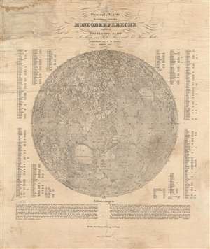
General-Karte der sichtbaren Seite der Mond-oberflaeche zugleich als Übersichts-Blatt zur grössern Mondkarte von Wilh. Beer und Joh: Heinr.: Mädler.
sold
- Digital Map Information
- Suitable for large format printing
- DPI: 600
- File Size: 28.73 MB
- File Type: ZIP / TIFF
- ICC color profile embedded
- Delivered instantly via download link
A groundbreaking lunar map of considerable rarity and great significance. Sharply detailed, separately-issued map of the moon, produced in 1837 by the German astronomer Johann Heinrich Mädler. It is a reduced version of his 1834-6 four-sheet map of the moon, and represents just the second accurate, printed map of the lunar surface visible from Earth. It is abundantly detailed, naming 351 individual mountains and craters and using a number key to mark their locations on the map. The tables are broken into quarters, corresponding to the four parts of the original map. Where Mädler has been able to calculate them, the tables also provide the height and depth of the noted features. (more details)
Summation of 19th century astronomical knowledge.
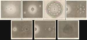
Précis du Système Planétaire.
sold
- Digital Map Information
- Suitable for large format printing
- DPI: 600
- File Size: 359.94 MB
- File Type: ZIP / TIFF
- ICC color profile embedded
- Delivered instantly via download link
A stunning 1839 - 1859 set of 7 Sigismond Visconti astronomical charts issued by Auguste-Henri Dufour and Charles Simonneau. The charts represent the summation of astronomical knowledge regarding the Solar System and the orbits of the earth and moon, as understood in the early 19th century. The set consist of seven plates, which are as follows:
- The Solar System - Centered on the sun, displays the entire solar system as far as Neptune. Includes the asteroid belt objects Vesta, Junon, Ceres and Pallas. Identifies moos surrounding Earth, Jupiter, Saturn, Uranus, and Neptune. A comet, possibly Halley's, is also identified. Dated 1859. Revised by Dufour to reflect the 1846 discovery of Neptune.
- Orbit of the Earth - Details the orbit of the Earth around the sun, showing the axis of the Earth and the solar effects on the seasons. Equinox and solstice points are noted.
- Planisphere - Added to the Visconti set by Dufour in 1830. Illustrates the position of the Earth relative to the Sun in each month of the year. Four seasons are futher identified in each corner. So too are the signs of the zodiac. Dated 1839.
- Phases of the Moon - This chart illustrates the phases of the moon relative to the Earth and Sun. Dated 1839.
- Flux and Reflux - Attempts to illustrate the effect of the Sun and moon on the Tides relative to the rotation of the Earth and Moon. Dated 1839.
- Eclipses of the Sun and Moon - Illustrates the positions of the Sun and moon during full and partial solar and lunar eclipses. Dated 1839.
- Cross-section of the Earth - Illustrates the earth and its atmosphere as a cross-section. Radiating bands of shading illustrate the layers of the Earth. The volcanoes Pichincha in Columbia and Mount Ophir in Sumatra are noted. Also noted are the Galapagos Islands, South America, Africa, San Tome, the Maluku Islands, and the Isle of Dundas (British Columbia).
The first comparative chart of the Moon.
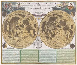
Tabula Selenographica in qua Lunarium Macularum exacta Descriptio secundum Nomenclaturam Praestantissimorum Astronomorum tam Hevelii quam Riccioli Curiosis Rei Sidereae Cultoribus exhibetur Joh. Babr. Doppelmajero Math. P.P. upera Joh. Baptistae Homanni Norinbergae.
sold
- Digital Map Information
- Suitable for large format printing
- DPI: 300
- File Size: 20.87 MB
- File Type: ZIP / TIFF
- ICC color profile embedded
- Delivered instantly via download link
A stunning full color example of J. B. Homann and Johann Gabriel Doppelmayr's important c. 1742 map of the Moon. Essentially a comparative chart, Doppelmayer constructed this map to illustrate the lunar mapping of Johannes Hevelius (left) and ... (more details)
The first comparative chart of the Moon from which the names of many lunar features have been derived.
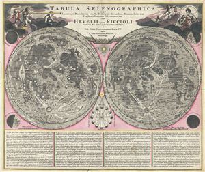
Tabula Selenographica in qua Lunarium Macularum exacta Descriptio secundum Nomenclaturam Praestantissimorum Astronomorum tam Hevelii quam Riccioli Curiosis Rei Sidereae Cultoribus exhibetur Joh. Babr. Doppelmajero Math. P.P. upera Joh. Baptistae Homanni Norinbergae.
sold
- Digital Map Information
- Suitable for large format printing
- Full resolution TIFF file
- ICC color profile embedded
- Delivered instantly via download link
A stunning full color example of J. B. Homann and Johann Gabriel Doppelmayr's important c. 1742 map of the Moon. Essentially a comparative chart, Doppelmayer constructed this map to illustrate the lunar mapping of Johannes Hevelius (left) and ... (more details)
Visualizing the Celestial Sphere.
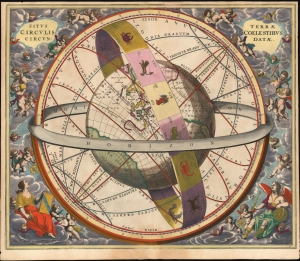
Situs Terrae Circulis Coelestibus Circundatae.
sold
- Digital Map Information
- Suitable for large format printing
- File Size: 24.78 MB
- File Type: ZIP / TIFF
- ICC color profile embedded
- Delivered instantly via download link
This beautiful work is Andreas Cellarius' celestial chart, in its 1661 second state with sumptuous original color, illustrating the position of the Earth within the celestial sphere divided into its circles. Its lush, baroque presentation - filled with clouds, putti, and muses - frames a useful visual glossary illustrating terminology important to the astronomer and the geographer. (more details)
The wheel of the Zodiac in a beautiful example.
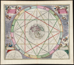
Typus Aspectuum Oppositionum et Conjunctionum Etz In Planetis.
sold
- Digital Map Information
- Suitable for large format printing
- Full resolution TIFF file
- ICC color profile embedded
- Delivered instantly via download link
This beautiful work is Andreas Cellarius' 1660 astrological chart, in its second 1661 edition with beautiful original color. The work illustrates how planetary positions affect the 'humors', and thus human behavior. (more details)
The first, largest, and finest star maps of the 19th century.
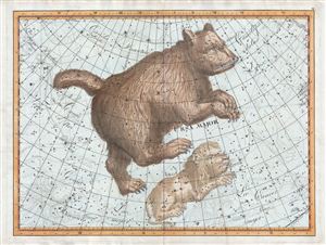
Ursa Major.
sold
- Digital Map Information
- Suitable for large format printing
- Full resolution TIFF file
- ICC color profile embedded
- Delivered instantly via download link
A rare and extraordinary 1801 Johann Elbert Bode elephant folio celestial, constellation, or star map of Ursa Major (the Great Bear or Big Dipper) and Leo Minor. Considered the largest and most dramatic celestial maps of their era, possibly ever ... (more details)
Set of landmark maps of the Moon made for the Apollo 11 Lunar Landing.
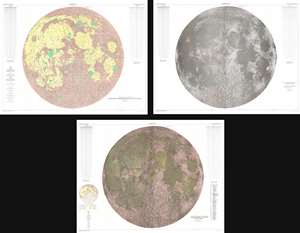
Engineer Special Study of the Surface of the Moon Generalized Photogeologic Map of the Moon. / Lunar Rays. / Physiographic Divisions of the Moon.
sold
- Digital Map Information
- Suitable for large format printing
- File Size: 358.37 MB
- File Type: ZIP / TIFF
- ICC color profile embedded
- Delivered instantly via download link
This is a set of three 1961 landmark maps of the Moon made by the U.S. Geological Survey in preparation for the Apollo 11 Lunar Landing Mission. All three represent the near side of the Moon on a scale of 1:3,800,000. Each map illustrates the Moon in a different spectacular monumentally proportioned manner and illustrates the physical geography of the moon, noting craters, seas, mountains, and other formations. (more details)
First Earthside lunar stereographic map - prepping for Apollo.
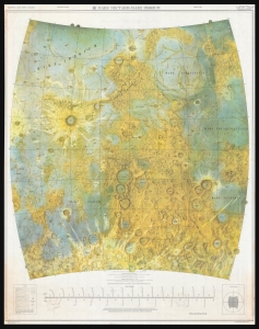
A seminal cartographic achievement, this is the first Earthside Stereographic map of the Moon produced by the Army Map Service in anticipation of the lunar landing missions of the late 1960s. The map was produced by the Army Map Service, Corps of Engineers, in March 1962 and incorporates the 6 landing sites of the forthcoming Apollo Missions. (more details)
Describing the moon.
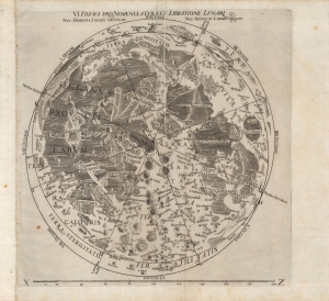
Figura Pro Nomenclatura, Et Libratione Lunari Nec Homines Lunam incolunt. Nec Anime in Lunam migrant.
sold
- Digital Map Information
- Suitable for large format printing
- Full resolution TIFF file
- ICC color profile embedded
- Delivered instantly via download link
An important work in the development of lunar geography (selenography) and astronomy more broadly, this 1665 map of the near side of the moon was drawn by Francesco Maria Grimaldi and appeared in Giovanni Battista Riccioli's work Astronomia Reformata. Building on his paradigm-setting 1651 work Almagestum Novum, Riccioli used the Astronomia Reformata to correct errors, summarize findings, and include updated information. (more details)
An iconic surrealist embodiment of the golden age of air travel by Lucian Boucher.
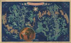
Air France.
sold
- Digital Map Information
- Suitable for large format printing
- File Size: 95.27 MB
- File Type: ZIP / TIFF
- ICC color profile embedded
- Delivered instantly via download link
The finest of Lucien Bucher's iconic comic maps drawn for Air France, here in a scarce large format edition. Boucher's work for Air France is considered an embodiment of the golden age of air travel. This map, presented as a double hemisphere ... (more details)
An iconic surrealist embodiment of the golden age of air travel by Lucien Boucher.
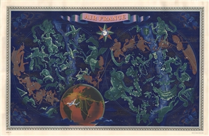
Air France.
sold
- Digital Map Information
- Suitable for large format printing
- File Size: 24.1 MB
- File Type: ZIP / TIFF
- ICC color profile embedded
- Delivered instantly via download link
The finest of Lucien Bucher's iconic comic maps drawn for Air France, here in a scarce large format edition. Boucher's work for Air France is considered an embodiment of the golden age of air travel. This map, presented as a double hemisphere ... (more details)
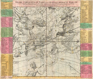
Globi Coelestis in Tabulas Planas Redacti Pars IV.
sold
- Digital Map Information
- Suitable for large format printing
- DPI: 300
- File Size: 18.46 MB
- File Type: ZIP / TIFF
- ICC color profile embedded
- Delivered instantly via download link
Published by J. B. Homann, this is a very nice example of DoppelmayerÂ's map of the constellations. Focuses on the Zodiac constellations of Leo and Virgo, though Bootes, Ursa Major, Chara, Hydra, Libra, and others and also visible. Each ... (more details)
Pegasus.
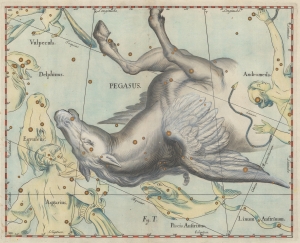
[Pegasus].
sold
- Digital Map Information
- Suitable for large format printing
- DPI: 600
- File Size: 8.34 MB
- File Type: ZIP / TIFF
- ICC color profile embedded
- Delivered instantly via download link
This is a 1690 Johannes Hevelius celestial chart or star map of the Pegasus constellation from his influential work Firmamentum Sobiescianum, sive Uranographia. Pegasus dominates the sheet, which also includes adjacent Piscis Austrinus, Aquarius, Equuleus, Delphius, Andromeda, and Vulpecula. (more details)
Unpublished game by one of the early Pioneers of Science Fiction.
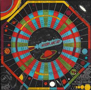
Interplanetary.
sold
- Digital Map Information
- Suitable for large format printing
- File Size: 14.24 MB
- File Type: ZIP / TIFF
- ICC color profile embedded
- Delivered instantly via download link
This is a 1946 board for 'Interplanetary', an unpublished board game by pioneering science fiction writer Neil Ronald Jones. Although lesser known, Jones was one of the great early pioneers in the genre of science fiction, ranking with Arthur C. Clarke, Robert A. Heinlein, and Ray Bradbury. Jones was a lifelong devotee of board games and spent his spare time developing this game - although it appears not to have been published, this being one of only 5 known proof examples (all others are in private hands). (more details)
The Big Dipper.
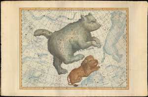
[Ursa Major].
sold
- Digital Map Information
- Suitable for large format printing
- Full resolution TIFF file
- ICC color profile embedded
- Delivered instantly via download link
An exceptional example of the 1801 Johann Elbert Bode elephant folio celestial, constellation, or star map of Ursa Major (the Great Bear or Big Dipper) and Leo Minor. Considered the largest and most dramatic celestial maps of their era, possibly ever published, Bode's gigantic star charts detail thousands of stars, nebulae, and clusters. Constellations are dramatically represented in pictorial form, as was the convention of the previous century. Many of the newly discovered nebulae, double stars, star clusters discovered by European astronomers in the late 18th century, such as Lacaille, Lalande, Messier, and Herschel, are identified. Bode presents this map on a conic geocentric projection in which most constellations are seen as from Earth. The current example is spectacularly colored gold highlighting of important stars. (more details)
The first, largest, and finest star maps of the 19th century.
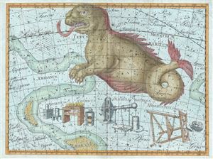
[Cetus Monstrum Marinum]
sold
- Digital Map Information
- Suitable for large format printing
- DPI: 300
- File Size: 33.29 MB
- File Type: ZIP / TIFF
- ICC color profile embedded
- Delivered instantly via download link
A rare and extraordinary 1801 Johann Elbert Bode elephant folio celestial, constellation, or star map of Cetus (the Sea Monster) or as it is more commonly known, the Whale. Cetus was originally been associated with a whale, which would ... (more details)
Homann Presents the Revelations of Christiaan Huygens.
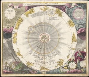
Systema Solare Et Planetarium ex hypothesi Copernicana secundum elegantissimas Illustrissimi quondam Hugenij deductiones novissime collectum et exhibitum.
sold
- Digital Map Information
- Suitable for large format printing
- DPI: 600
- File Size: 68.12 MB
- File Type: ZIP / TIFF
- ICC color profile embedded
- Delivered instantly via download link
This is a scarce, early example of Johann Baptist Homann's 1707 celestial chart displaying the solar system following the Copernican, sun-centered model - using the calculations appearing in Dutch astronomer and mathematician Christiaan Huygens' Cosmotheros, published posthumously in 1698. (more details)