
Europe (whole)
Iranian reaction to Russian Imperialism.
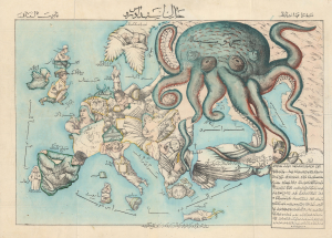
New Map of Europe. / خارطه جديده اوروپا
$24,000.00
Acquire
- Digital Map Information
- Suitable for large format printing
- Full resolution TIFF file
- ICC color profile embedded
- Delivered instantly via download link
A rare c. 1880 Iranian-issued Ottoman Turkish / Farsi version of Englishman Fred Rose's iconic 1877 Serio Comic War Map, in which expansionist Imperial Russia is analogized as a menacing, grasping octopus. The map was issued in Qajar Iran (Persia), but for an Ottoman Turkish audience (there is also a Farsi variant). Both countries were then being menaced by Russia, Turkey in the recent Russo-Turkish War of 1877-1878, and Iran as a field of contention in the Great Game - so the work would have proved widely resonant with a possible hope of fostering mutual support. Text is partially in Turkish, partially in Farsi. (more details)
Most beautifully executed woodcut map of Europe.
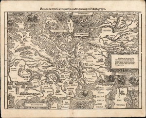
Europa / die erste Tafel diser Chronicken / so im ersten Buech begrissen.
$4,000.00
Acquire
- Digital Map Information
- Suitable for large format printing
- File Size: 14.99 MB
- File Type: ZIP / TIFF
- ICC color profile embedded
- Delivered instantly via download link
This is a bold, attractive 1606 edition of Johann Stumpf's 1548 south-oriented map of Europe. It is the only map derived from Sebastian Münster's Europe and is thus the last derivative of Martin Waldseemüller's unobtainable 1511 map of Europe. While Münster's map went to many editions and is readily acquirable, Stumpf's work was produced in smaller numbers and is a rarer work: larger, more beautifully executed, and more desirable. (more details)
Earliest acquirable map of Europe based on contemporaneous knowledge.
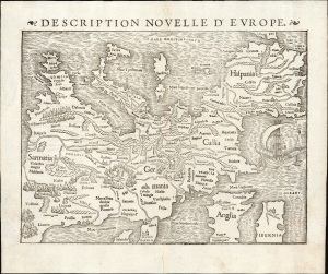
Description Nouvelle D'Europe.
$2,750.00
Acquire
- Digital Map Information
- Suitable for large format printing
- Full resolution TIFF file
- ICC color profile embedded
- Delivered instantly via download link
This is a 1556 edition of Sebastian Münster's 1540, southern-oriented map of Europe: the first acquirable map of Europe based on contemporary geographical information and the earliest acquirable derivative of Martin Waldseemüller's unobtainable 1511 map of Europe. Münster's Geographia and Cosmographia provided for many years the literate European's only glimpses of the world, and these two works contained a number of maps with previously unseen, contemporaneous knowledge of the areas they depicted. For Münster's readership, this map was almost certainly the first depiction of their home continent, not based on the 2nd-century work of Claudius Ptolemy. (more details)
Bringing aerial destruction to Nazi-dominated Europe.
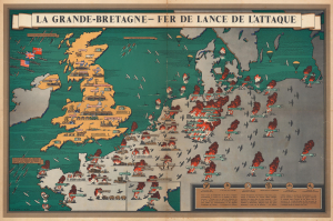
La Grande-Bretagne - Fer de Lance de l'Attaque.
$2,500.00
Acquire
- Digital Map Information
- Suitable for large format printing
- Full resolution TIFF file
- ICC color profile embedded
- Delivered instantly via download link
This is a 1943 F. Donald Blake French-language pictorial propaganda map of Great Britain and continental Europe at the height of World War II (1939 - 1945). The map's message is clear: the tide of war has turned, and British RAF forces are taking a heavy toll on Nazi-dominated Europe. (more details)
Cyanotype World War II route map!
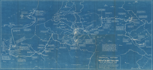
Graphical History of the 987th F.A. Battalion 155 MM Self Propelled Guns. Lt. Col. Wm. C. Smith, BN CO.
$2,500.00
Acquire
- Digital Map Information
- Suitable for large format printing
- DPI: 600
- File Size: 42.67 MB
- File Type: ZIP / TIFF
- ICC color profile embedded
- Delivered instantly via download link
This is a rare 1946 cyanotype World War II route map of the 987th Field Artillery Battalion in Europe, drawn by the battalion's commanding officer, Lieutenant Colonel William C. Smith. The map highlights moments throughout the 987th's campaign across Europe and provides snippets of the battalion's experiences in the war. This map is the only cyanotype route map we have encountered. Due to restrictions imposed by the cyanotyping process, this map was likely produced in a very small print run. (more details)
An economic infographic masterwork.
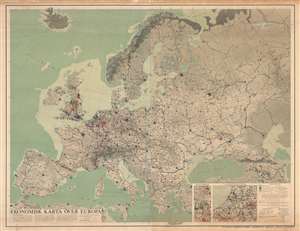
Ekonomisk Karta Över Europa.
$2,500.00
Acquire
- Digital Map Information
- Suitable for large format printing
- DPI: 600
- File Size: 208.81 MB
- File Type: ZIP / TIFF
- ICC color profile embedded
- Delivered instantly via download link
A striking and fascinating 1953 infographic wall map of Europe drawn by the Swedish economic geographer William Frits William-Olsson. Working in the wake of World War II (1939 - 1945), William-Olsson was striving to develop a new symbolic vocabulary for assessing economic growth and development patterns. This expansive pedogeological map covers the entire continent of Europe. Insets in the lower right focus on the dense and highly industrialized Netherlands and English midlands. The map is necessarily large to cover its immense detail and complex iconography. The whole is covered with a complex array of symbols, intended to present a full picture of the European economic situation, as well as illustrate how urban centers inter-related and evolve. (more details)
A complete set of 79th Infantry Division route maps from World War II - maps created by the soldiers for the soldiers.
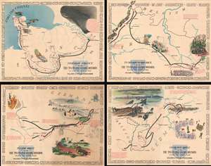
Through France with the 79th Infantry Division 14 June to 29 Aug, 1944. Maj Gen I.T. Wyche, Commanding. / To Belgium and Back wit the 79th Infantry Division 31 Aug to 25 Oct, 1944 Maj. Gen. I. T. Wyche, Commanding. / To the Rhine with the 79th Infantry Division 25 Oct to 14 Feb. 1945 Maj Gen I.T. Wyche, Commanding. / Over the Rhine with the 79th Infantry Division 17 Feb to 9 May 1945 Maj. Gen. I. T. Wyche, Commanding.
$2,200.00
Acquire
- Digital Map Information
- Suitable for large format printing
- Full resolution TIFF file
- ICC color profile embedded
- Delivered instantly via download link
This is a set of four Steve Kaliher and Harry D. White pictorial World War II route maps of the 79th Infantry's advance from Normandy to Germany. Presented on four separate sheets, a detailed summary of the division's progress across northern Europe from Utah Beach (one of the four Normandy beaches assaulted by Allied troops only eight days on what has become known as D-Day) to Mulheim, Germany. Each map traces a sequence of a few months in the combat history of the 79th with red lines labeled with dates marking the advance week by week and sometimes day to day. Text blocks narrate parts of the advance, providing insight into what the division accomplished during their over 300 days of combat. Cities and towns are identified throughout all four maps, as are rivers. Each map is framed by the names of cities and towns that the division passed through on their advance, fought for, and liberated, adding yet another level of memory to each piece. (more details)
Promoting German Wine Production.
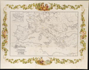
Weinkarte von Europa mit besonderer Berücksichtigung der Weinorte Deutschlands.
$2,000.00
Acquire
- Digital Map Information
- Suitable for large format printing
- File Size: 281.48 MB
- File Type: ZIP / TIFF
- ICC color profile embedded
- Delivered instantly via download link
This is an attractive and scarce 1875 Johann Ferdinand Rubens map of Europe, noting wine production regions, specifically those of Germany. The map is framed with a beautiful chromolithograph grapevine border, with allegorical medallions on a classical theme. (more details)
Manuscript map related to German U-Boat Commander in World War II.
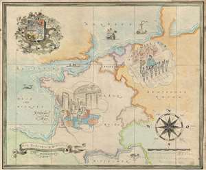
Kapitanleutnat Bitter gewindmet vom Soldatenheim Rochefort November 1943. / Zur Beförderung Gratulirf Der Schwesterntisch.
$2,000.00
Acquire
- Digital Map Information
- Suitable for large format printing
- File Size: 7.07 MB
- File Type: ZIP / TIFF
- ICC color profile embedded
- Delivered instantly via download link
This is a charming 1943 manuscript map of Europe was drawn to celebrate the promotion of the German World War II Kriegsmarine officer Kapitänleutnant Georg von Bitter to U-Boat Commander. Drawn in a whimsical manuscript style, with stylistic elements drawn from ... (more details)
Romanticizing African travel in the Era of the 'Africa Queen'.
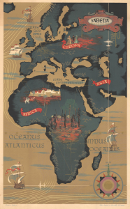
Sabena Belgian World Airlines.
$1,800.00
Acquire
- Digital Map Information
- Suitable for large format printing
- File Size: 42.09 MB
- File Type: ZIP / TIFF
- ICC color profile embedded
- Delivered instantly via download link
An attractive c. 1950 Claude Dohet art deco map of Africa and Europe advertising Sabena Airlines, the Belgian national carrier. The map features striking gold highlighting of air routes connecting Africa with Europe. It captures the mystique of Africa and the Congo, specifically, at the height of the 'African Queen' era. (more details)
Hunting the Enemy in the Early Days of World War I.
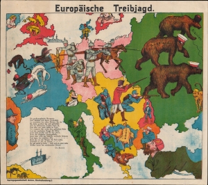
Europäische Treibjagd.
$1,800.00
Acquire
- Digital Map Information
- Suitable for large format printing
- File Size: 42.09 MB
- File Type: ZIP / TIFF
- ICC color profile embedded
- Delivered instantly via download link
Scarce, attractive decorative map.

Nova Europae descriptio Auct. F. de Wit.
$1,700.00
Acquire
- Digital Map Information
- Suitable for large format printing
- DPI: 600
- File Size: 23.75 MB
- File Type: ZIP / TIFF
- ICC color profile embedded
- Delivered instantly via download link
This is a scarce 1660 Dutch carte à figures map of Europe, engraved by Frederick de Wit. This beautifully engraved work was one of a handful of maps that De Wit would have considered his showcase works as he struck out on his own as a mapmaker, after having worked for many years with the Blaeu family. Although in general terms the style is reminiscent of his former teachers', it differs both from the corresponding map in Blaeu's atlases and those of Blaeu's primary competitors, Hondius and Jansson. (more details)
Bedrock of the British Empire.
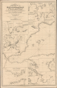
A General Chart of the Mediterranean, Adriatic and Black Seas together with the Grecian Archipelago... [First Sheet].
$1,600.00
Acquire
- Digital Map Information
- Suitable for large format printing
- File Size: 59.98 MB
- File Type: ZIP / TIFF
- ICC color profile embedded
- Delivered instantly via download link
This is John Norie's large-format 1850 nautical chart of the western Mediterranean Sea, including the Strait of Gibraltar and the Balearic Islands. Among other features, it highlights the critically important Strait of Gibraltar, the crux of British naval power in the Mediterranean. (more details)
A monumental and striking topographic map of central Europe by the greatest German cartographer of the 19th century.
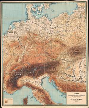
Stumme Physikalische Schul-Wandkarten der Länder Europas. Deutschland.
$1,500.00
Acquire
- Digital Map Information
- Suitable for large format printing
- File Size: 208.58 MB
- File Type: ZIP / TIFF
- ICC color profile embedded
- Delivered instantly via download link
An amazing piece created by the most celebrated 19th-century German cartographer, this is a massive and impressive 1886 Richard Kiepert topographic map of central Europe. The map depicts the region from eastern France east across the continent to the Baltic states and the Balkans and from the Baltic Sea to Corsica. Kiepert employs eight different colors to illustrate the region's topography. He details the region's river systems, lakes, and coastlines, and marks, although without identifying them by name, many of the region's cities and towns. (more details)
German Gloating in the Early Days of World War I.
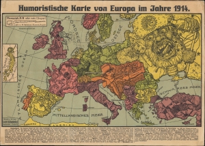
Humoristische Karte von Europa im Jahre 1914.
$1,400.00
Acquire
- Digital Map Information
- Suitable for large format printing
- File Size: 14.2 MB
- File Type: ZIP / TIFF
- ICC color profile embedded
- Delivered instantly via download link
A biting 1914 serio-comic German chromolithographic map of the belligerents in the First World War, drawn by Karl Lehmann-Dumont and published by Leutert and Schneidewind. It presents the German perspective on the conflict, mocking its main opponents (France, Britain, and Russia) and their allies, as well as neutral countries. (more details)
Informing and inspiring the Navy in WWII.
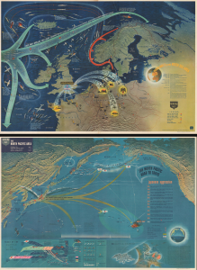
NavWarMap No. 3 World War 2 in the North Sea Area. / NavWarMap No. 4 The North Pacific Area.
$1,250.00
Acquire
- Digital Map Information
- Suitable for large format printing
- Full resolution TIFF file
- ICC color profile embedded
- Delivered instantly via download link
This is a 1944 double-sided Navy Education Services pictorial map, with northwestern Europe and the North Atlantic on one side and the northern Pacific Ocean on the other. These maps were issued for distribution to American naval personnel with the intent to both inform and inspire. (more details)
European military uniforms and more.
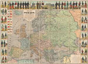
Nuevo Mapa de Europa Politico y Comercial Ilustrado con los Tipos y Uniformes Militares de los Estados de Europa.
$1,000.00
Acquire
- Digital Map Information
- Suitable for large format printing
- Full resolution TIFF file
- ICC color profile embedded
- Delivered instantly via download link
This is an 1890 Jean Dosseray wall map of Europe. A political map of Europe occupies most of the sheet, with countries, cities, towns, rivers, and more all identified. Europe's rail is highlighted, underscoring its ever-growing importance. Eighteen European flags with population statistics appear in an inset at the upper left. An inset in the lower right focuses on the Suez Canal and the Nile Delta in Egypt, underscoring the canal's strategic importance to European powers. (more details)
Direct Steam Service from France to America!

Compagnie Générale Transatlantique.
$950.00
Acquire
- Digital Map Information
- Suitable for large format printing
- Full resolution TIFF file
- ICC color profile embedded
- Delivered instantly via download link
This is an 1882 Jules Sédille map of the Atlantic Ocean highlighting the transatlantic routes between France and the Americas, primarily issued to promote the Compagnie Générale Transatlantique's service between Le Havre and New York, as well as the routes to the Caribbean and Mexico. (more details)
Comprehensive visual summary of World War II in Europe.
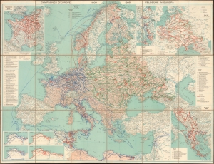
Die Feldzüge in Europa 1939 - 1945.
$950.00
Acquire
- Digital Map Information
- Suitable for large format printing
- File Size: 108.47 MB
- File Type: ZIP / TIFF
- ICC color profile embedded
- Delivered instantly via download link
This is a c. 1947 Erwin Tschudi map of Europe and North Africa offering a striking visual summary of World War II in Europe. (more details)
Fly Sabena and visit extra cities at no additional cost!
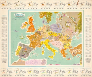
This is a c. 1961 Sabena Belgian World Airlines pictorial map of Europe. Created as a promotional tool and aimed at an American audience, this piece promotes Sabena's 'Extra City Plans' to entice Americans to travel across the Atlantic. (more details)
Earliest acquirable map of Transylvania.
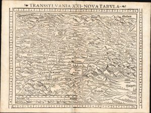
Transsylvania XXI. Nova Tabula.
$850.00
Acquire
- Digital Map Information
- Suitable for large format printing
- Full resolution TIFF file
- ICC color profile embedded
- Delivered instantly via download link
This is a superb example of Sebastian Münster's modern map of Transylvania (part of modern-day Romania) in the desirable 1552 Geographia edition, the only one to include distinctive coordinate borders. It is the earliest acquirable derivative of Johannes Honter's foundational 1532 map of his homeland, Chorographia Transylvaniae. Sybembürgen. Honter's work, a woodcut printed on two sheets, was the first printed map of Transylvania, but Honter was dissatisfied with his work and suppressed it, resulting in the survival of only a single example. Münster's single-sheet copy of Honter's map, first appearing in the 1544 edition of Cosmographia, is thus the earliest acquirable iteration of the first map of this region. (more details)
A wartime summary of World War II in the Mediterranean region.
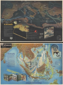
NavWarMap No. 1 The Mediterranean. / NavWarMap No. 2 The South China Sea Area
$850.00
Acquire
- Digital Map Information
- Suitable for large format printing
- Full resolution TIFF file
- ICC color profile embedded
- Delivered instantly via download link
This is a 1944 Navy Department pictorial map of the Mediterranean region with a Navy Department pictorial map of Southeast Asia on the verso. This visually stunning map summarizes Allied operations in the Mediterranean theater through the Allied invasion of Italy in September 1943 and the early months of the Pacific War on the other side. (more details)
Personal insights into the 301st Field Artillery during World War I.
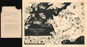
Over There' and Back with the 301st First Field Artillery.
$800.00
Acquire
- Digital Map Information
- Suitable for large format printing
- Full resolution TIFF file
- ICC color profile embedded
- Delivered instantly via download link
This rare 1933 Lewis Rothe and Warren Gibbs pictorial map of Europe playfully commemorates the peregrinations of the 301st Field Artillery during World War I (1914 - 1918). The map traces the 301st's movements from Boston through Nova Scotia and England to France, then back across the Atlantic to New York City after the war ended. Lewis Rothe drew the map in collaboration with Warren R. Gibbs, a veteran of the 301st. A series of 'close-ups' in the lower left offers interesting personal insights into the unit: Lieutenant Dowd's luck at gambling and Colonel Brooke's habit of buying souvenirs. (more details)
Hopping across 'the Pond'.
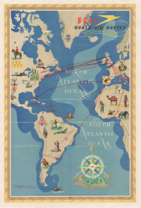
B.O.A.C. World Air Routes Western Hemisphere.
$750.00
Acquire
- Digital Map Information
- Suitable for large format printing
- Full resolution TIFF file
- ICC color profile embedded
- Delivered instantly via download link
This is a c. 1949 E. O. Seymour pictorial map of the Western Hemisphere produced for the British Overseas Air Corporation (B.O.A.C.). It was prepared during the airline's 'Golden Age,' when a Postwar commercial air travel boom was taking flight and travel between continents was becoming increasingly accessible. (more details)
Tying Together the Commonwealth.
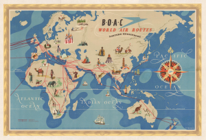
B.O.A.C. World Air Routes Eastern Hemisphere.
$750.00
Acquire
- Digital Map Information
- Suitable for large format printing
- Full resolution TIFF file
- ICC color profile embedded
- Delivered instantly via download link
This is a 1949 E. O. Seymour pictorial map of the Eastern Hemisphere produced for the British Overseas Air Corporation (B.O.A.C). It was prepared during the airline's 'Golden Age,' when a Postwar commercial air travel boom was taking flight and travel between continents was becoming increasingly accessible. (more details)
The 188th from England to victory in Germany.
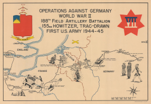
Operations Against Germany World War II 188th Field Artillery Battalion 155mm Howitzer, Trac-Drawn First U.S. Army 1944 - 45.
$750.00
Acquire
- Digital Map Information
- Suitable for large format printing
- Full resolution TIFF file
- ICC color profile embedded
- Delivered instantly via download link
This is a 1945 188th Field Artillery Battalion World War II Route Map of Europe. The map traces the battalion's movements during the war, marking important events and providing comedic commentary on the experience. (more details)
Gathering storm clouds over Europe, as seen from Japan.
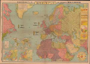
最新歐洲大地圖 (附列強國勢國防一覽) / [Latest Map of Europe (with an overview of the national strength and defenses of the major powers)].
$750.00
Acquire
- Digital Map Information
- Suitable for large format printing
- File Size: 80.15 MB
- File Type: ZIP / TIFF
- ICC color profile embedded
- Delivered instantly via download link
This is a very rare and unusual Japanese portrayal of European military power by Fuchida Tadayoshi - illustrated to support Japanese interest in the increasingly tense situation in Europe, as well as to emphasize to the Japanese public the value of European alliances. It was published as a supplement to the January 1, 1936 (Showa 11), edition of King (キング) magazine. The map, along with the included insets, charts, and graphs, describes the military and economic situation in Europe at the time and the relationship of Japan to the emerging European conflict. (more details)
A Beautiful Map of the Lower Danube and the Turkish Frontier in Europe
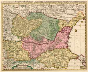
Exactissima Tabula qua tam Danubii Fluvii Pars Inferoir, a Belgrado Urbe usq ad Ejus Ostia, et Minores in eum Influentes Fluvii, quam Regiones Adjacentes, ut Transylvania, Valachia, Moldavia, Bulgaria, Bessarabia et Romonia,, aliqu Ucraniae ac Podoliae Tractus Finitimi Ostenduntur per Nicolaum Visscher.
$750.00
Acquire
- Digital Map Information
- Suitable for large format printing
- DPI: 600
- File Size: 38.38 MB
- File Type: ZIP / TIFF
- ICC color profile embedded
- Delivered instantly via download link
This is a beautiful, contemporary-color example of Nicolas Visscher's c. 1677 map of the lower Danube River, showing the Turkish administrative regions along the Black Sea coast. The map encompasses Transylvania, Serbia, Wallachia, Bulgaria and Romania. Portions of Greece and the Ukraine appear as well. Belgrade, Bucharest, and Istanbul are among the major cities appearing here. This map is notable in naming the Sanjaks, or Ottoman provinces in this contentious frontier region. These extend from the Sanjak of Ochakov (Ukraine on the Black Sea Coast) to the Sanjak of Gallipoli on the Sea of Marmora. Turkish rule in these regions was, by the time this map was produced, so established that many of the place names here are given both in approximations of the Turkish toponymy as well as European. (more details)
German Prisoner of War camps housing French POWs.
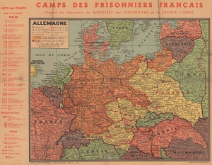
Camps des Prisonniers Français d'après des documents du Ministère des Prisonniers de la France Libérée.
$750.00
Acquire
- Digital Map Information
- Suitable for large format printing
- File Size: 32.69 MB
- File Type: ZIP / TIFF
- ICC color profile embedded
- Delivered instantly via download link
This is a 1944 Jean Baneton map of Europe identifying German camps housing French POWs. Camps throughout Germany, Austria, and Poland are noted, with an index outside the left border separating Stalag (camps for enlisted men) and Oflag (camps for officers). Each camp is identified by its alphanumeric name and its location. The ones that are struck through are camps that were dissolved by the time this map was printed. Conveying impressive historical perspective, red lines mark European borders in 1923, while black dashed lines mark those in 1944. (more details)
One of a kind comparative view of the Chateaux of France in wall map format!
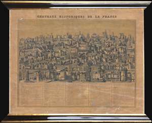
Chateaux Historiques de la France.
$750.00
Acquire
- Digital Map Information
- Suitable for large format printing
- Full resolution TIFF file
- ICC color profile embedded
- Delivered instantly via download link
This is a c. 1840 Maison Basset comparative chart of the Chateaux of France. The chart depicts 71 different French chateaux in profile, from the Château d'Isières to the Tour et Porte de Nesle, which was demolished in 1663. Each of the chateau presented is numerically identified. A table along the bottom border, organized in ascending numerical order, includes the name of each chateau, along with the department in which it is located, it's location relative to the closest city or town, and a short description. The detail renders each chateau visually recognizable. Some of the chateaux represented here have gained international renown, including Mont St. Michel, the Chateau de Tuileries (which today we know as the Louvre, since the two were connected by Louis XIII and Louis XIV), the Chateau de Vincennes, the Chateau de Fontainebleau, the Chateau de Versailles, and the Chateau de Chenonceau (in the Loire Valley). The Vieux Louvre, demolished in 1528, is also depicted. (more details)
Sanitation and Water Supply in 18th century Paris.
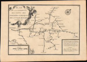
Plan de la conduite des eaües des fontaines publiques de la ville de Paris.
$650.00
Acquire
- Digital Map Information
- Suitable for large format printing
- File Size: 7.17 MB
- File Type: ZIP / TIFF
- ICC color profile embedded
- Delivered instantly via download link
This is a fascinating 1716 Nicholas de Fer schematic map of the aqueducts, fountains, and underground pipes of Paris, France. Paris was growing quickly at this time and faced a major challenge in that its water supply system was inadequate for its swelling population. The map addresses some of the immediate concerns of the period: sanitation and water supply. (more details)
Follow the 6th Paris-Dakar Rally.
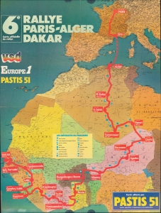
This is a 1984 map of the route of the Paris-Dakar Rally from Paris, France, to Dakar, Senegal. The map documents the 1984 edition of one of the world's most grueling long-distance motorsport rallies. (more details)