
Maine - Vermont - New Hampshire (sold)
First map to name the United States and a contemporaneous illustration of the American Revolutionary War.
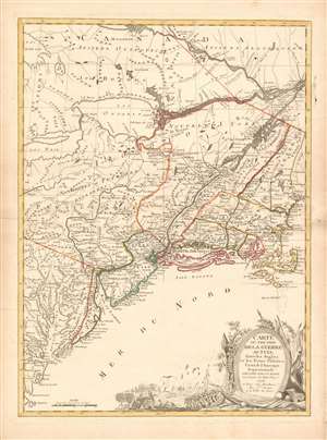
Carte du Théatre de la Guerre actuel entre les Anglais et les Trieze Colonies Unies de l'Amerique Septentrionale dressée par J. B. Eliot Ingénieurs des Etats Unis 1778.
sold
- Digital Map Information
- Suitable for large format printing
- DPI: 600
- File Size: 30.62 MB
- File Type: ZIP / TIFF
- ICC color profile embedded
- Delivered instantly via download link
A 1778 first edition American Revolutionary War era map of the northeastern United States by J. B. Elliot, considered to be of extreme significance. This is generally regarded as the earliest map to use the name 'United States', or in this case, 'Etats Unis'. Drawing on previously unused sources, Eliot's map illustrates the events of the Revolutionary War contemporaneously with the action, making it, essentially a living account of the War of Independence. Margaret Pritchard and Henry Taliaferro, published an essay on this map in Degrees of Latitude, Map 58, describing its significance in great detail, of which this is a short excerpt,
The map of the theater of war between Great Britain and America by J.B. Eliot is important because of its title, Les Treize Colonies Unies de l'Amerique Septentrionale, may include the first reference on a map to the United States. The cartographer was identified as Ingenieurs des Etats Unis. On November 15, 1777, the Continental Congress selected 'The United States of America,' as the name of the thirteen colonies that formed a government under the Articles of Confederation. One month later, French authorities learned of the victory at Saratoga and decided to recognize American independence. By January 8, French foreign minister, Charles Gravier, Comte de Vergennes, informed American envoys that France was ready to engage in an alliance. It is not surprising that the name United States was first mentioned on a map published in Paris in 1778.A decorative cartouche in the lower right incorporates a battle scene wherein British soldiers bombard a small town - possibly Valley Forge? (more details)
… It is also curious that he did not indicate on the map the general's 1777 winter headquarters at Valley Forge, misspelled Walay Forge. What Eliot did illustrate were the lines' march taken by the British and American forces during the campaign in 1777, including Lieutenant Colonel Barry St. Ledger's unsuccessful diversionary expedition down the Mohawk Valley, Burgoyne's march from Crown Point to Albany, and Howe's campaign to take Philadelphia.
… As was usually the case, Eliot appears to have borrowed from several sources in compiling the geography. Some areas were designated by French place-names while others are predominantly English, specifically in the northwestern territories that the French knew best. It is clear they were aware of the latest intelligence relating to the Revolutionary War.
First printed English Nautical Chart of the East Coast
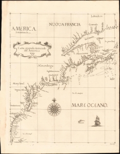
Carta Seconda Generale del' America. XXII.
sold
- Digital Map Information
- Suitable for large format printing
- File Size: 10.87 MB
- File Type: ZIP / TIFF
- ICC color profile embedded
- Delivered instantly via download link
This is the 1661 edition of Robert Dudley's general map of the east coast of North America. According to Burden, this is the 'first printed sea chart of North America by an Englishman and the first to record soundings.' It is a great rarity on the market and a keystone map for any collection of early American cartography. (more details)
Premier general chart of New England at the outbreak of the Revolutionary War.
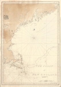
The Coast of New England.
sold
- Digital Map Information
- Suitable for large format printing
- File Size: 47.49 MB
- File Type: ZIP / TIFF
- ICC color profile embedded
- Delivered instantly via download link
This is J. F. W. Des Barres' 1776 nautical map of New England. This was the best and most accurate general chart of New England issued at the outbreak of the American Revolutionary War (1775 - 1783). (more details)
Definitive field Atlas of the Revolutionary War.
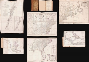
The American Military Pocket Atlas; being An approved Collection of Correct Maps, both General and Particular, of The British Colonies; Especially those which now are, or probably may be The Theatre of War.
sold
This is Sayer and Bennet's 1776 'Holster Atlas', one of the most sought-after cartographic works of the American Revolution. It was published at the beginning of the Revolution and presented as a collection of maps approved by British military authorities for use in the field. (more details)
Earliest Acquirable, Separate Issue.
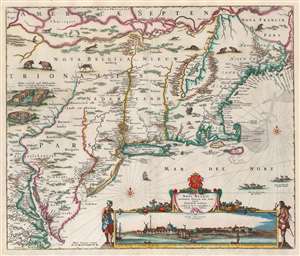
Novi Belgii Novaeque Angliae nec non Partis Virginiae Tabula multis in locis emendata a Nicolao Joannis Visschero.
sold
- Digital Map Information
- Suitable for large format printing
- Full resolution TIFF file
- ICC color profile embedded
- Delivered instantly via download link
This is the rare, c. 1656 second state of the Jansson/ Visscher map of the New Netherlands and New England. It is the earliest acquirable state of this work: the first, 'proof state', of this masterwork is an unobtainable rarity, known in only four examples in institutional and private collections. (more details)
The Earliest Acquirable, Separate Issue.

Novi Belgii Novaeque Angliae nec non Partis Virginiae Tabula multis in locis emendata a Nicolao Joannis Visschero.
sold
- Digital Map Information
- Suitable for large format printing
- Full resolution TIFF file
- ICC color profile embedded
- Delivered instantly via download link
This is the rare, c. 1656 second state of the Jansson/ Visscher map of the New Netherlands and New England. It is the earliest acquirable state of this work: the first, 'proof state', of this masterwork is an unobtainable rarity, known in only four examples in institutional and private collections. (more details)
Best map of the Hudson Valley at the outset of the American Revolution.
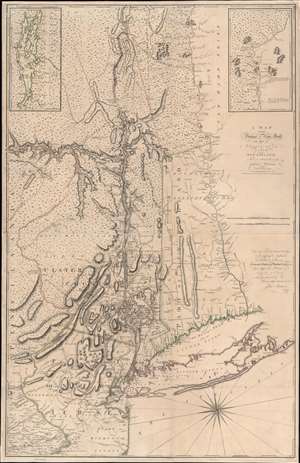
A Map of the Province of New-York, with Part of Pensilvania, and New England.
sold
- Digital Map Information
- Suitable for large format printing
- Full resolution TIFF file
- ICC color profile embedded
- Delivered instantly via download link
This is John Montresor's striking 1775 map of New York and the surrounding regions - considered the best and most authoritative map of the region at the beginning of the American Revolutionary War (1775 - 1783). (more details)
Mars, the God of War, look on as Fame proclaims the of the Birth of the United States.
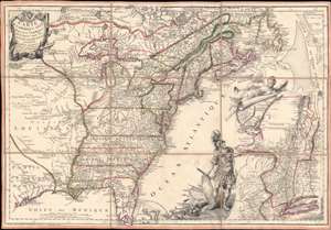
Carte de l'Amerique Septle. pour Servir a l'Intelligence de la Guerre Entre les Anglois et les Insurgents.
sold
- Digital Map Information
- Suitable for large format printing
- Full resolution TIFF file
- ICC color profile embedded
- Delivered instantly via download link
This is a rare 1777 Jean-Baptiste Jacques de Beaurain map of the United States during the American Revolutionary War, issued in anticipation of French entry into the war on the side of the revolutionaries. The map includes a bold illustration of the goddess Ossa (fame) unrolling an expansive map of the Theater of War in the Hudson corridor, proclaiming the newly formed United States. Mars, the god of War, looks on, shield and torch in hand, his arsenal ready - much like France itself. This map is thus an instrument of propaganda intended to prepare the public for French participation in the American Revolution - an event which followed in early 1778. (more details)
The most important and influential 18th century Colonial Era map of New England.
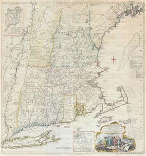
A Map of the most Inhabited part of New England containing the Provinces of Massachusets Bay and New Hampshire, with the Colonies of Connecticut and Rhode Island, divided into Counties and Townships: The whole composed form Actual Surveys and its Situation adjusted by Astronomical Observations.
sold
- Digital Map Information
- Suitable for large format printing
- Full resolution TIFF file
- ICC color profile embedded
- Delivered instantly via download link
A highly significant map, this is the 1774 'Jefferys' Map' of the Most Inhabited Part of New england . Centered on the Massachusetts Bay Colony, this map covers from Long Island to Lake Champlain and from the Hudson River to Cape Cod and Kennebec Bay, Maine. ... (more details)
The most important and influential 18th century Colonial Era map of New England.
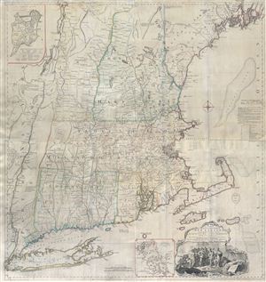
A Map of the most Inhabited part of New England containing the Provinces of Massachusets Bay and New Hampshire, with the Colonies of Connecticut and Rhode Island, divided into Counties and Townships: The whole composed form Actual Surveys and its Situation adjusted by Astronomical Observations.
sold
- Digital Map Information
- Suitable for large format printing
- Full resolution TIFF file
- ICC color profile embedded
- Delivered instantly via download link
A highly significant map, this is the 1774 'Jefferys' Map' of the Most Inhabited Part of New england . Centered on the Massachusetts Bay Colony, this map covers from Long Island to Lake Champlain and from the Hudson River to Cape Cod and Kennebec Bay, Maine. ... (more details)
Iconic early map of New England and New York with 'Visscher View' of New Amsterdam.
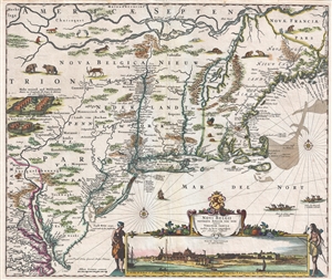
Novi Belgii Novaeque Angliae Nec Non Pennsylvaniae et Partis Virginiae Tabula multis in locis emendata.
sold
- Digital Map Information
- Suitable for large format printing
- DPI: 300
- File Size: 15.13 MB
- File Type: ZIP / TIFF
- ICC color profile embedded
- Delivered instantly via download link
A map of extreme importance, this is a fine example of Nicholaas Visscher's 1684 Novi Belgii or map of New York, New England, Pennsylvania, and Virginia. This is the first map in the Jansson-Visscher Series here presented in its 4th state (Burden, 315). Like ... (more details)
Iconic early map of New England and New York with 'Visscher View' of New Amsterdam.
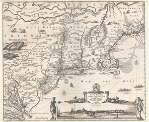
Novi Belgii Novaeque Angliae Nec Non Pennsylvaniae et Partis Virginiae Tabula multis in locis emendata.
sold
- Digital Map Information
- Suitable for large format printing
- DPI: 300
- File Size: 14.86 MB
- File Type: ZIP / TIFF
- ICC color profile embedded
- Delivered instantly via download link
A map of extreme importance, this is a fine example of Nicholaas Visscher's 1684 Novi Belgii or map of New York, New England, Pennsylvania, and Virginia. This is the first map in the Jansson-Visscher Series here presented in its 4th state (Burden, 315). Like ... (more details)
Recording the First Naval Battle of the American Revolution.
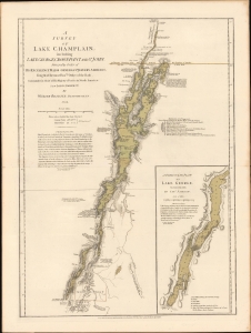
A Survey Of Lake Champlain, including Lake George, Crown Point And St. John. /A Particular Plan of Lake George.
sold
- Digital Map Information
- Suitable for large format printing
- File Size: 22.53 MB
- File Type: ZIP / TIFF
- ICC color profile embedded
- Delivered instantly via download link
This is a premier example of William Furness Brasier's 1762 map of Lakes Champlain and George, in its 1776 second state. The map overall is the first separate map of Lake Champlain and Lake George. Both this and its earlier state would certainly have been in the hands of the British officers leading the Fall 1777 campaign during the American Revolutionary War (1775 - 1783) culminating in a pivotal American victory at Saratoga. (more details)
Best and largest map of Mount Desert Island at the height of its Gilded Age.
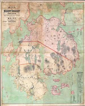
Map of Mount Desert Island, Sorrento, Portions of Lamoine, Hancock, and Frenchman's Bay, and Adjacent Islands, Maine.
sold
- Digital Map Information
- Suitable for large format printing
- File Size: 146.81 MB
- File Type: ZIP / TIFF
- ICC color profile embedded
- Delivered instantly via download link
The largest, rarest, and most important map of Mount Desert Island, Maine, to appear in the 19th century. Published by Colby and Stuart in 1887, this wall map captures Mount Desert Island and Bar Harbor at the height of its gilded age, when it rivaled Newport as a haven for the moneyed elite. The map embraces the island in exceptional detail, showing topography and roads, as well as property lots, the named estates of the wealthy, grand hotels, lodges, restaurants, and more. Today, most of Mount Desert Island is part of Acadia National Park, one of America's most beloved and beautiful national parks. (more details)
The First Map to show New York Harbor; the First Map to name Canada.
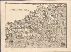
La Nuova Francia.
sold
- Digital Map Information
- Suitable for large format printing
- DPI: 600
- File Size: 14.84 MB
- File Type: ZIP / TIFF
- ICC color profile embedded
- Delivered instantly via download link
This is the seminal 1565 Giovanni Battista Ramusio map of the Northeast and Canada, 'The first printed map devoted to the New England region'(Osher) and the first map to apply a specific name to Canada. The map depicts the northeastern coast of North America from New York to the coast of Labrador, inclusive of New England and maritime Canada. In particular, it is the first map to reveal Giovanni da Verrazano's 1524 voyage to America and to depict his discoveries in what would become New York and New England. It is also among the most visually engaging early maps, being richly decorated with depictions of indigenous peoples, Europeans, flora and fauna, sailing ships, sea monsters, and demons. (more details)
The very rare second edition of the first great 19th century state map.
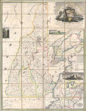
New Hampshire by Recent Survey Made Under the Supreme Authority and Published according to Law by Philip Carrigain Consellor at Law and late Secretary of the State. / New Hampshire To his Excellency Jon Taylor Gilman Esq. and to the Honourable the Legislature of the State of New Hampshire this Map commenced under their Auspices and matured by their Patronage is most respectfully inscribed by their Obliged Servant Philip Carrigain.
sold
- Digital Map Information
- Suitable for large format printing
- Full resolution TIFF file
- ICC color profile embedded
- Delivered instantly via download link
A scarce and monumental cartographic achievement, this is the scarce 1818 second edition of Philip Carrigain's wall map of New Hampshire. Carrigain's map is without a doubt the largest and most important specific map of New Hampshire ever published. This beautifully produced map covers New Hampshire as well as adjacent parts of Vermont, Massachusetts (as far as Boston), and Maine. An inset at right details the greater New York and New England region. A secondary inset in the lower right focuses on the United States east of the Mississippi River. (more details)
First Map to show New York Harbor. The First Map to name Canada.
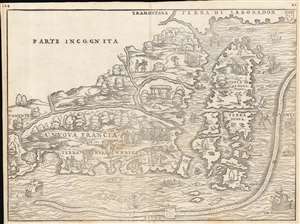
La Nuova Francia.
sold
- Digital Map Information
- Suitable for large format printing
- Full resolution TIFF file
- ICC color profile embedded
- Delivered instantly via download link
This is the seminal 1556 Giovanni Battista Ramusio map of the Northeast and Canada, 'the first printed map devoted to the New England region' (Osher), and the first map to apply a specific name to Canada. The map depicts the northeastern coast of North America from New York to the coast of Labrador, inclusive of New England and maritime Canada. It is the first map to reveal Giovanni da Verrazano's 1524 voyage to America and to depict his discoveries in what would become New York and New England. It is also among the most visually engaging early maps, being richly decorated with depictions of indigenous peoples, Europeans, flora and fauna, sailing ships, sea monsters, and demons. (more details)
First Map to detail New York Harbor; the First Map to name Canada.
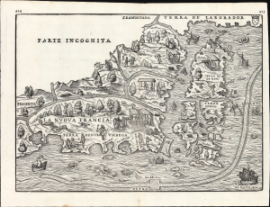
La Nuova Francia.
sold
- Digital Map Information
- Suitable for large format printing
- File Size: 13.96 MB
- File Type: ZIP / TIFF
- ICC color profile embedded
- Delivered instantly via download link
This is a superb example of the seminal 1565 Giovanni Battista Ramusio map of the Northeast and Canada, The first printed map devoted to the New England region (Osher) and the first map to apply a specific name to Canada. Significantly, it is the first map to focus specifically on Giovanni da Verrazzano's 1524 discoveries in what would become New York and New England - making it the first map to depict New York Bay and Harbor. (more details)
First printed map to show New York Harbor
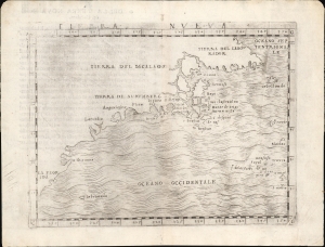
Tierra Nueva.
sold
- Digital Map Information
- Suitable for large format printing
- Full resolution TIFF file
- ICC color profile embedded
- Delivered instantly via download link
This is Giacomo Gastaldi's 1548 map of the eastern coast of North America. It is considered the first printed map specifically of the American eastern coastline and the first obtainable map to illustrate Narragansett Bay, Block Island, New York Harbor, Long Island, the Outer Banks, and Bermuda. (more details)
Heart of British Strategy in the Revolutionary War.
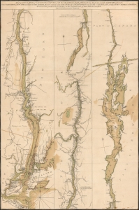
A Topographical Map of Hudsons River, with the channels depth of water, rocks, shoals etc. and the country adjacent, from Sandy-Hook, New York and bay to Fort Edward, also the communication with Canada by Lake George and Lake Champlain, as high as Fort Chambly on Sorel River.
sold
- Digital Map Information
- Suitable for large format printing
- Full resolution TIFF file
- ICC color profile embedded
- Delivered instantly via download link
This is Claude Joseph Sauthier's scarce, magnificent 1776 map of the Hudson River, Lake George, and Lake Champlain: the linchpin of Great Britain's strategy to swiftly achieve victory in the American Revolution. Control of the strategic New York - Montreal corridor would have divided the colonies effectively, allowing Britain to defeat the Revolution piecemeal. (more details)
Bar Harbor's Gilded Age.
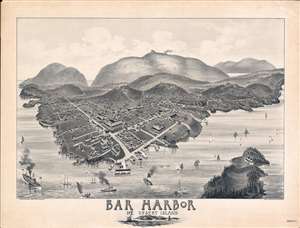
Bar Harbor Mt. Desert Island.
sold
- Digital Map Information
- Suitable for large format printing
- File Size: 60.03 MB
- File Type: ZIP / TIFF
- ICC color profile embedded
- Delivered instantly via download link
A rare and highly unusual 1886 Charles E. Jorgensen bird's-eye view of Bar Harbor, Mount Desert Island, Maine - illustrating the town at the height of Mount Desert Island's gilded age. This view was published to publicize the rebuilding of the Green Mountain Hotel (following a fire) and the inauguration of the Green Mountain Railroad - here visible at the summit of Cadillac Mountain. (more details)
A rare and important Post-Revolutionary War Era map of New England. One of the first maps to recognize Vermont as a state.
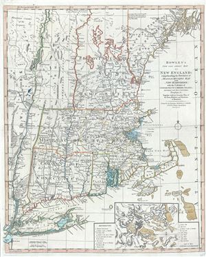
Bowles's New One-Sheet Map of New England; comprehending the Provinces of Massachusets Bay And New Hampshire; with the Colonies of Connecticut & Rhode Island; Divided into their Counties, Townships &c. Together with an Accurate Plan of the Town, Harbour and Environs of Boston.
sold
- Digital Map Information
- Suitable for large format printing
- DPI: 300
- File Size: 20.29 MB
- File Type: ZIP / TIFF
- ICC color profile embedded
- Delivered instantly via download link
A rare separately published c. 1796 map of New England by Bowles and Carver. Centered on Massachusetts, this map covers the New England coastline from Long Island, New York, to Little Kennebec Bay, Maine, and from Cape Cod and Nantucket westward to just ... (more details)
The rare propaganda-ish 'Farm Animal' variant on the Visscher-Jansson Series map of New York, Virginia, and New England.
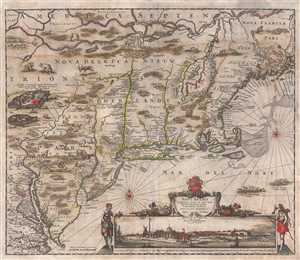
Novi Belgii Novaeque Angliae Nec Non Pennsylvaniae et Partis Virginiae Tabula multis in locis emendata.
sold
- Digital Map Information
- Suitable for large format printing
- Full resolution TIFF file
- ICC color profile embedded
- Delivered instantly via download link
An attractive old color example of Justus Danckerts' 1684 Novi Belgii or map of New York, New England, Pennsylvania, and Virginia. Some call this the 'farm animal map' for its novel incorporation of farm animals, ranging from horses and cows to chicken ... (more details)
Issued just after the Battle of Bunker Hill.
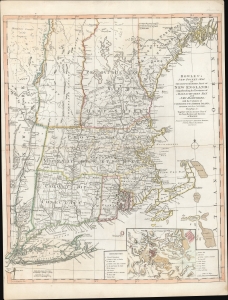
Bowles's New Pocket Map of the Most Inhabited Part of New England; comprehending the Provinces of Massachusets Bay and New Hampshire; with the Colonies of Connecticut and Rhode Island; Divided into their Counties, Townships, and c. Together with an Accurate Plan of The Town, Harbour and Environs of Boston.
sold
- Digital Map Information
- Suitable for large format printing
- DPI: 600
- File Size: 29.62 MB
- File Type: ZIP / TIFF
- ICC color profile embedded
- Delivered instantly via download link
A rare separately published 1776 American Revolutionary War map of New England by Carington Bowles - here in the scarce 4th edition that immediately followed the action at Bunker Hill. It represents one of the best and most up-to-date Revolutionary Era maps of New England. This map was initially issued by Carington Bowles in 1765 as a reduced and updated improvement upon the 1755 John Green / Braddock Mead map. The map transitioned through six known states, the present example representing the fourth state, updated with relevant content at the beginning of the American Revolutionary War (1775 - 1783). (more details)
The first great 19th century state map.
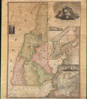
New Hampshire by Recent Survey Made Under the Supreme Authority and Published according to Law by Philip Carrigain Consellor at Law and late Secretary of the State. / New Hampshire To his Excellency Jon Taylor Gilman Esq. and to the Honourable the Legislature of the State of New Hampshire this Map commenced under their Auspices and matured by their Patronage is most respectfully inscribed by their Obliged Servant Philip Carrigain.
sold
- Digital Map Information
- Suitable for large format printing
- Full resolution TIFF file
- ICC color profile embedded
- Delivered instantly via download link
A scarce and monumental cartographic achievement, this is Philip Carrigain's 1816 map of New Hampshire. Carrigain's map is without a doubt the largest and most important specific map of New Hampshire ever published. This vast and beautifully produced map covers the entire state of New Hampshire as well as adjacent parts of Vermont, Massachusetts (as far as Boston), and Maine. An inset at right details the greater New York and New England region. A secondary inset in the lower right focuses on the United States east of the Mississippi River. (more details)
The most important and influential 18th century Colonal Era map of New England.
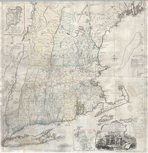
A Map of the most Inhabited part of New England containing the Provinces of Massachusets Bay and New Hampshire, with the Colonies of Connecticut and Rhode Island, divided into Counties and Townships: The whole composed form Actual Surveys and its Situation adjusted by Astronomical Observations.
sold
- Digital Map Information
- Suitable for large format printing
- Full resolution TIFF file
- ICC color profile embedded
- Delivered instantly via download link
A highly significant map, this is the 1774 'Jefferys' Map' of the Most Inhabited Part of New england . Centered on the Massachusetts Bay Colony, this map covers from Long Island to Lake Champlain and from the Hudson River to Cape Cod and Kennebec Bay, ... (more details)
Most Finely Detailed Dutch Map of the Northeast from the 17th Century.
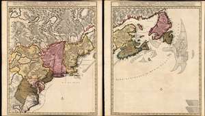
Nova Tabula Geographica Complectens Borealiorem Americae Partem: in qua Exacte Delineatae Sunt Canada sive Nova Francia, Nova Scotia, Nova Anglia, Novum Belgium, Pensylvania, Virginia, Carolina et Terra Nova, cum Omnibus Littorum. Pulvinorumque Profunditatibus. Amstelodami. à Nicolao Visscher. Cum Privilegio Ordinum Generalium Foederati Belgii./ Carte Nouvelle contenant la Partie d'Amerique la Plus Septentrionale, ou Sont Exactement Dècrites les Provinces Suivantes comme le Canada ou Nouvelle France, La Nouvelle Ecosse, la Nouvelle Angleterre, les Nouveaux Païs Bas, la Pensylvanie, la Virginie, la Caroline et l'Ile de Terre Neuve avec les profondeuis le Long des Côtes et sur les Bancs. Par Nicolas Visscher avec Privilege des Etats Géneraux.
sold
- Digital Map Information
- Suitable for large format printing
- DPI: 600
- File Size: 121.39 MB
- File Type: ZIP / TIFF
- ICC color profile embedded
- Delivered instantly via download link
This is Nicolas Visscher II's 1696 two-sheet map of the North American eastern seaboard and the Canadian Maritimes, in a beautiful example of its earliest acquirable state with rich original color. It represents the 17th century's most finely-detailed mapping of the coast from the Carolinas to Labrador. Also, it is the first Dutch map of the region to diverge from the 'Jansson-Visscher' precursor maps. (more details)
Scarce final issue of the important Holland-Jefferys Map New York, New Jersey, and the Hudson Valley on the brink of the American Revolutionary War. The best obtainable Revolutionary War Era map of this region.
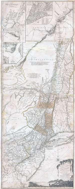
The Provinces of NEW YORK, and NEW JERSEY; with part of PENSILVANIA, and the Governments of TROIS RIVIERES, and MONTREAL: drawn by Major Holland, Surveyor General, of the Norther District in America. / A Chorographical Map of the Country between Albany, Oswego, Fort Frontenac, and Les Trois Rivieres; Exhibiting all the Grants made by the French Governors on Lake Champlain; & between that Lake & Montreal.
sold
- Digital Map Information
- Suitable for large format printing
- DPI: 300
- File Size: 26.6 MB
- File Type: ZIP / TIFF
- ICC color profile embedded
- Delivered instantly via download link
One of the most important, influential, and comprehensive American Revolutionary War Era map of New York, New Jersey, Vermont, and the Hudson Valley corridor, this is an final 1776 state of Major Samuel Holland and Thomas Jeffrey's Provinces of New ... (more details)
Very rare Bird's-Eye View of Portland, Maine. Only 4 known examples.
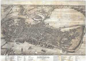
Bird's Eye View of the City of Portland Maine, 1876.
sold
- Digital Map Information
- Suitable for large format printing
- Full resolution TIFF file
- ICC color profile embedded
- Delivered instantly via download link
An exceptional 1876 Bird's-Eye View Map of Portland, Maine, by Joseph Warner. One of only three known views by Warner, this is a dramatic aerial view of Portland as seen from the east looking west. The cartographer has identified some 90 ... (more details)
The first map to depict Manhattan as an Island and the first cartographic depiction of North American fauna.
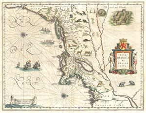
Nova Belgica et Anglia Nova.
sold
- Digital Map Information
- Suitable for large format printing
- DPI: 300
- File Size: 10.61 MB
- File Type: ZIP / TIFF
- ICC color profile embedded
- Delivered instantly via download link
A beautiful old color example of one of the most important maps in the history of America, Blaeu's c. 1635 Nova Belgica et Anglia Nova . Oriented to the west, this map covers the American coast from Virginia, past New York and Long Island ... (more details)
The first map to depict Manhattan as an Island and depict a beaver.
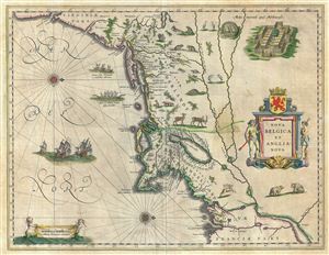
Nova Belgica et Anglia Nova.
sold
- Digital Map Information
- Suitable for large format printing
- DPI: 300
- File Size: 12.88 MB
- File Type: ZIP / TIFF
- ICC color profile embedded
- Delivered instantly via download link
A beautiful old color example of one of the most important maps in the history of America, Blaeu's 1638 Nova Belgica et Anglia Nova . Oriented to the west, this map covers the American coast from Virginia, past New York and Long Island ... (more details)
A rare proof issue of the first map to depict Manhattan as an Island and to depict a beaver.
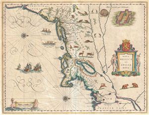
Nova Belgica et Anglia Nova.
sold
- Digital Map Information
- Suitable for large format printing
- DPI: 300
- File Size: 12.32 MB
- File Type: ZIP / TIFF
- ICC color profile embedded
- Delivered instantly via download link
A beautiful example of one of the most important maps in the history of America, Blaeu's 1635 Nova Belgica et Anglia Nova . Oriented to the west, this map covers the American coast from Virginia, past New York and Long Island to Cape ... (more details)